44A
INGELOW ROAD, LONDON, GREATER LONDON SW8 3QA
£1,551 pcm
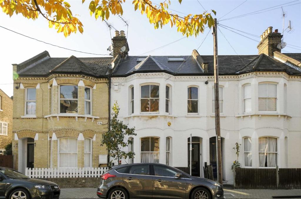
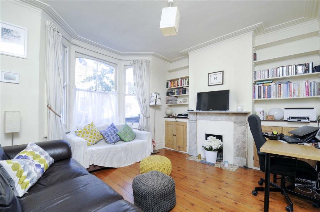
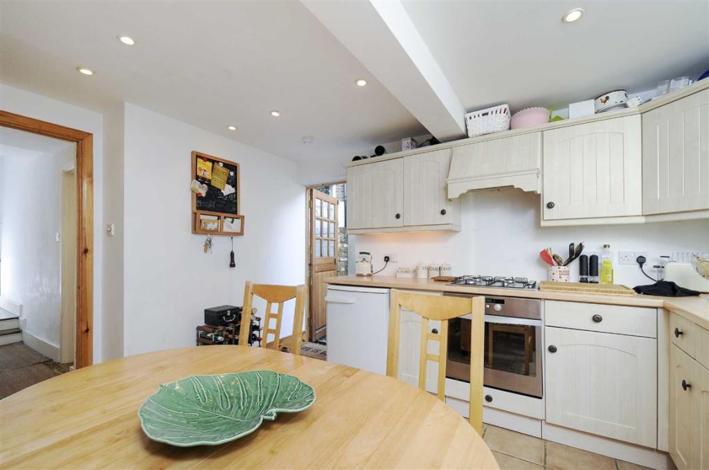
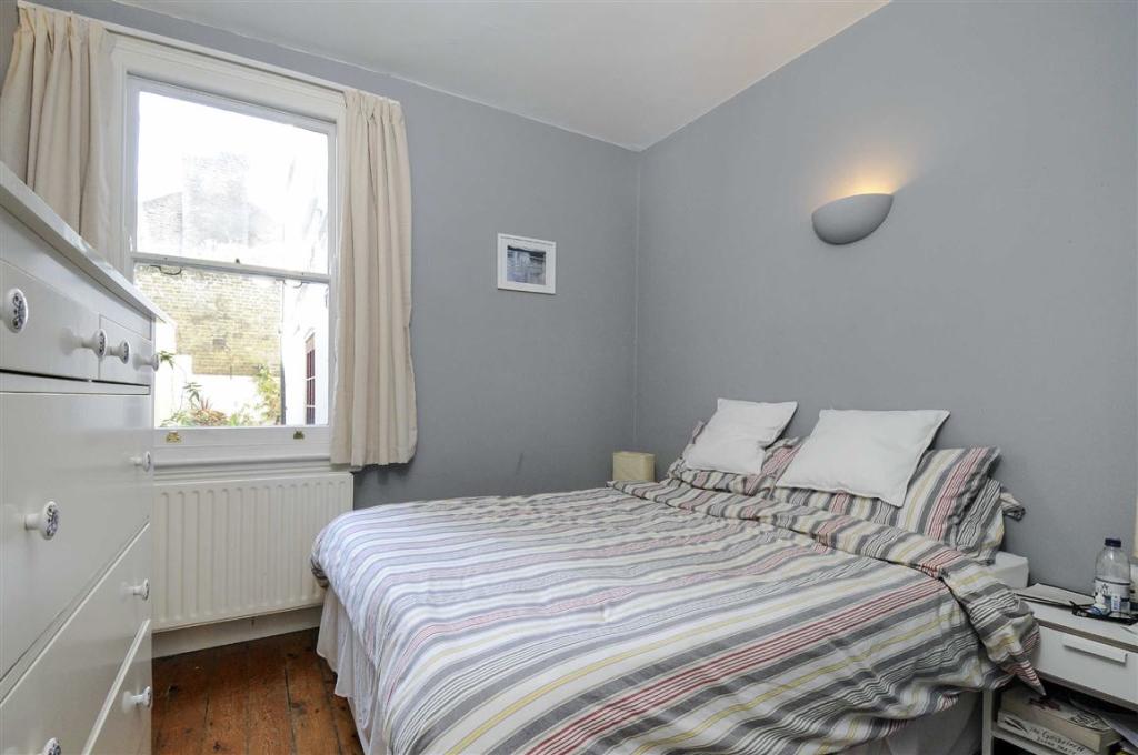
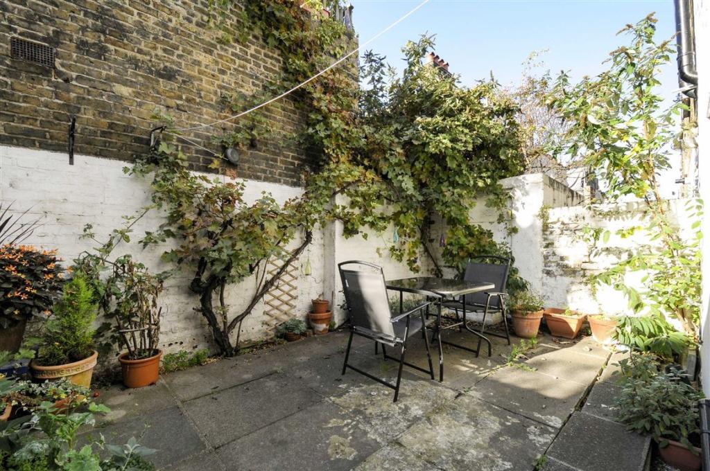
Photo 1 Photo 2 Photo 3 Photo 4 Photo 5
/ 5
Property details
Floor area
50 m²
Year built
England and Wales: 1900-1929
Deprivation
Decile 5 (15,805 of 33,755)
Street crime
1104 incidents within 1 mile (Apr 2026)
Key features
- Garden Flat
- One Bedroom
- One Bathroom
Additional details
- Garden
- Yes
Description
Directions - Situated within the Diamond Conservation Area, this highly sought after location offers excellent local amenities including shops, bars, restaurants and supermarkets. Battersea Park and Queenstown Road stations are also nearby.
You may download, store and use the material for your own personal use and research. You may not republish, retransmit, redistribute or otherwise make the material available to any party or make the same available on any website, online service or bulletin board of your own or of any other party or make the same available in hard copy or in any other media without the website owner's express prior written consent. The website owner's copyright must remain on all reproductions of material taken from this website.
Listed by
Battersea
Dexters
Reference: 67889387
Flood risk
Zone: 1
Risk: Low
Job (default Low)
Floorplans
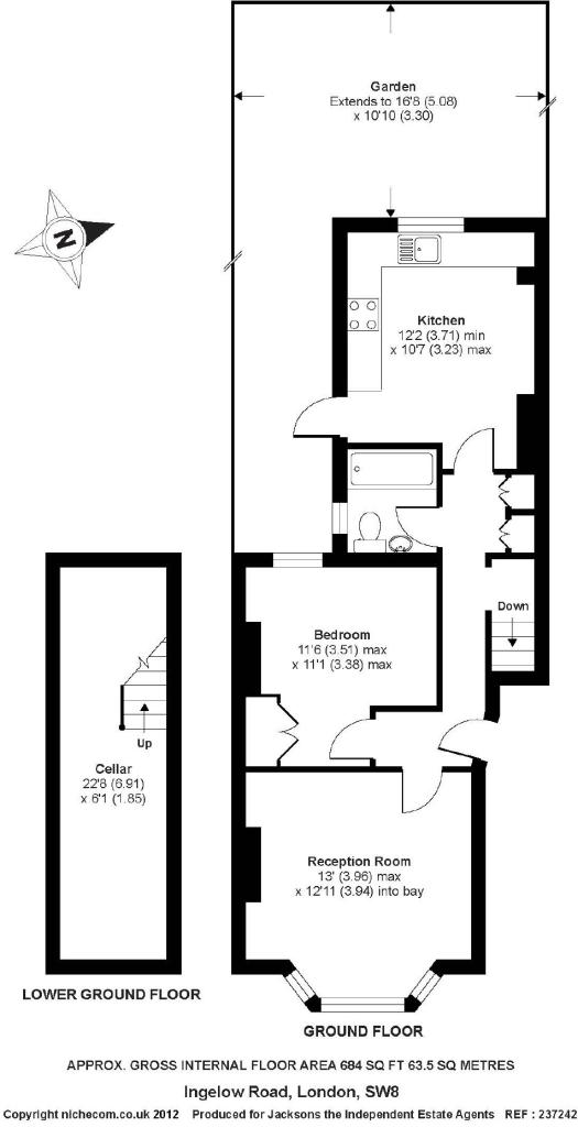
Floorplan 1
EPC Graphs
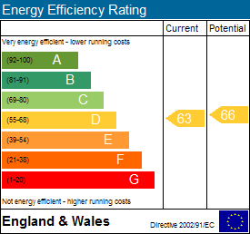
EPC 1
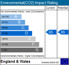
EPC 2
Rental Range
Estimated market rent for Wandsworth. Low = conservative, Realistic = average, Optimistic = best case.
Based on Local Authority from postcode lookup → Wandsworth.
LHA (30th percentile) floor for Stevenage & North Herts: £773/mo (Apr 2025 – Mar 2026)
Location
Nearby
Nearest stations, universities and amenities (distance from property).
| Type | Name | Distance |
|---|---|---|
| Bus stop | Prairie Street | 0.0 miles |
| Shop | Bowloom Limited | 0.1 miles |
| Shop | Shipton & Heneage | 0.1 miles |
| Train station | Queenstown Road | 0.4 miles |
| Train station | Battersea Park | 0.5 miles |
| Hospital | Bridge Lane Health Centre | 0.7 miles |
| University | National Heart and Lung Institute | 1.4 miles |
| University | University of Wales Trinity Saint David London Campus | 1.9 miles |
| Hospital | King's College Hospital Emergency Department | 2.5 miles |
Street-level crime
| Category | Count |
|---|---|
| Anti-social behaviour | 263 |
| Violence and sexual offences | 198 |
| Shoplifting | 118 |
| Theft from the person | 107 |
| Other theft | 90 |
| Vehicle crime | 75 |
| Burglary | 60 |
| Robbery | 42 |
| Bicycle theft | 38 |
| Public order | 37 |
| Criminal damage and arson | 34 |
| Drugs | 29 |
| Other crime | 8 |
| Possession of weapons | 5 |
| Total incidents | 1104 |
Within 1 mile during Apr 2026. Source: data.police.uk (England & Wales).
Schools nearby
Nearest open schools with Ofsted ratings (England). Closed schools are not shown. Data from Get Information about Schools and Ofsted.
| Name | Type | Distance | Ofsted |
|---|---|---|---|
| John Burns Primary School | Primary | 0.1 miles | Good — 6 Feb 2018 |
| Heathbrook Primary School | Primary | 0.3 miles | Good — 13 Jun 2016 |
| Shaftesbury Park Primary School | Primary | 0.3 miles | Good — 29 Nov 2013 |
| Chesterton Primary School | Primary | 0.4 miles | Outstanding — 6 Feb 2023 |
| Harris Academy Battersea | Secondary | 0.4 miles | Outstanding — 12 Mar 2018 |
Rental Comparables
Residential lets from OpenRent and Rightmove for the area (same bedroom count). Use to validate rent estimates. Student lets are excluded.
| Title | Rent | Beds | Distance | As seen on |
|---|---|---|---|---|
| Bondway, London | £3,683/mo | 1 | 1.45 miles | Rightmove |
Average rent: £3,683/mo (1 listing)