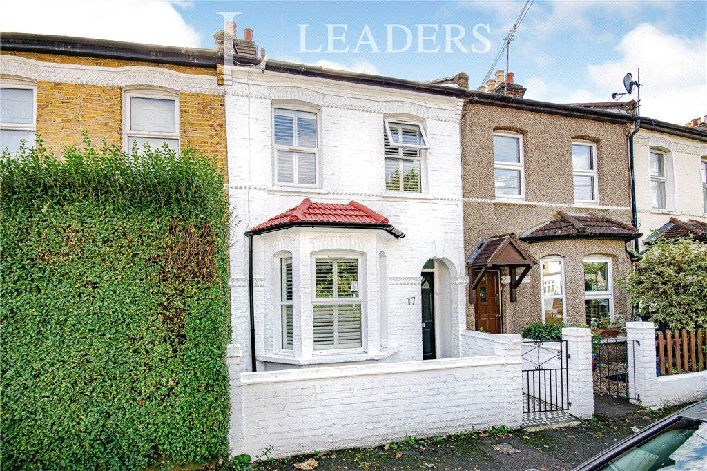
17 OVAL ROAD
CROYDON, GREATER LONDON CR0 6BG
Property details
Tenure
FREEHOLD
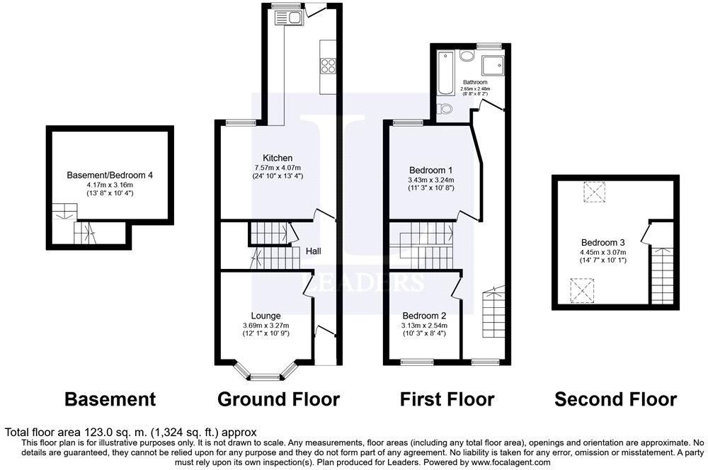
Floor area
118 m²
Last sold
£496,000 Apr 2021
Local average
£408,389 (+22.4%)
Deprivation
Decile 5 (16,505 of 33,755)
Street crime
1205 incidents within 1 mile (Apr 2026)
Additional details
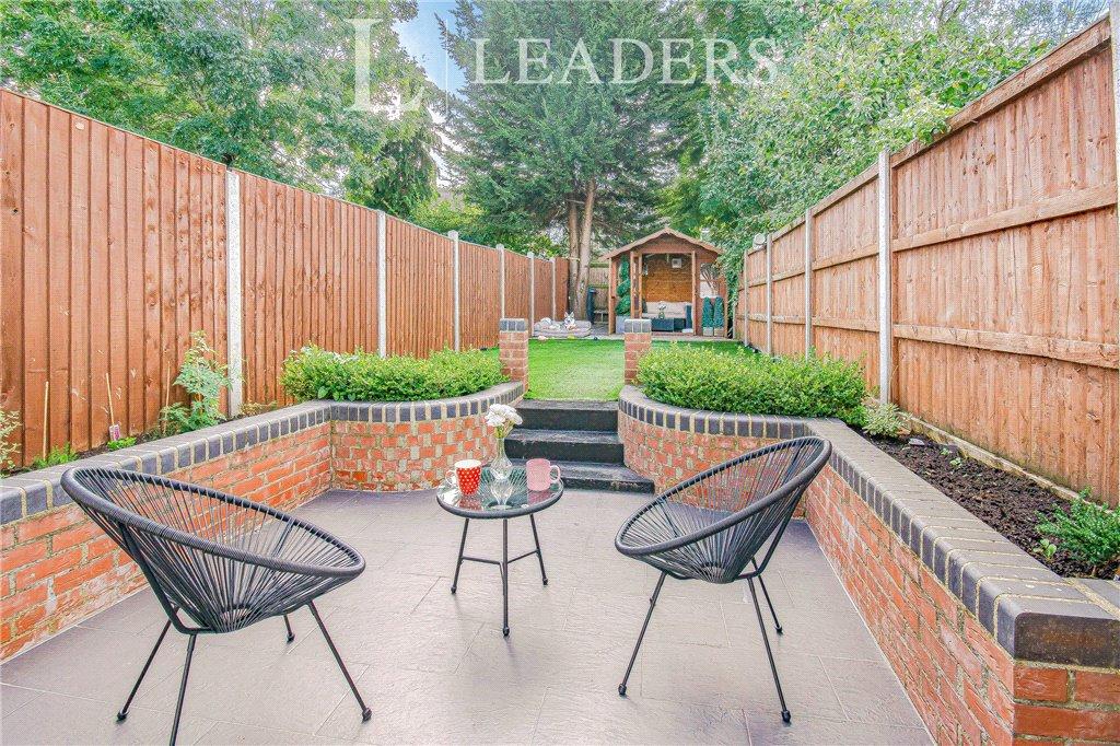
- Garden
- Yes
Description
What are you waiting for? When a house like this comes on the market, theres no time to wait around.
The four bedroom house is situated on one of the most well located roads in Croydon - youve got instant access to East Croydon Station where you can get into London in approximately 15 minutes and also Gatwick Airport. Theres also a local sainsburys just up the road, as well as being just a 10 minutes walk into Croydon High Street where youve got all of the shop you need.
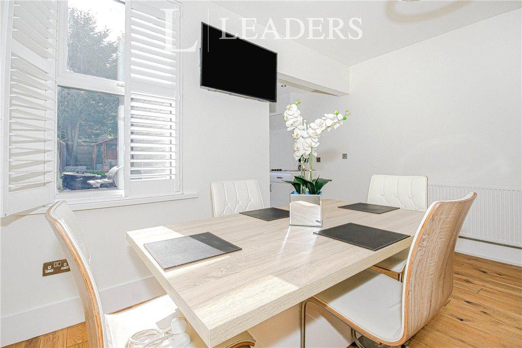
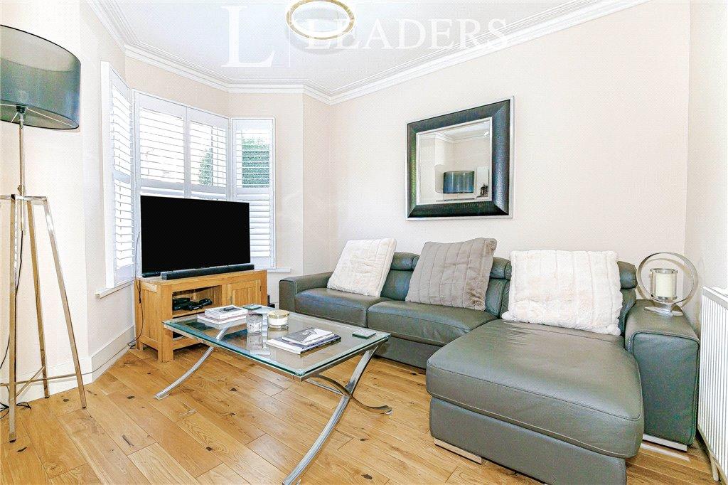
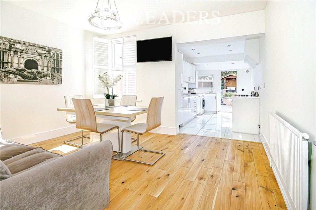
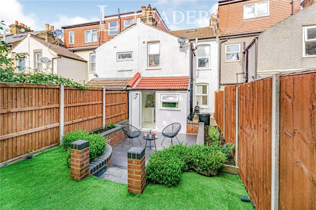
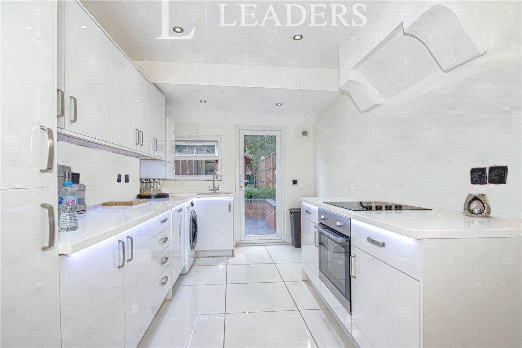
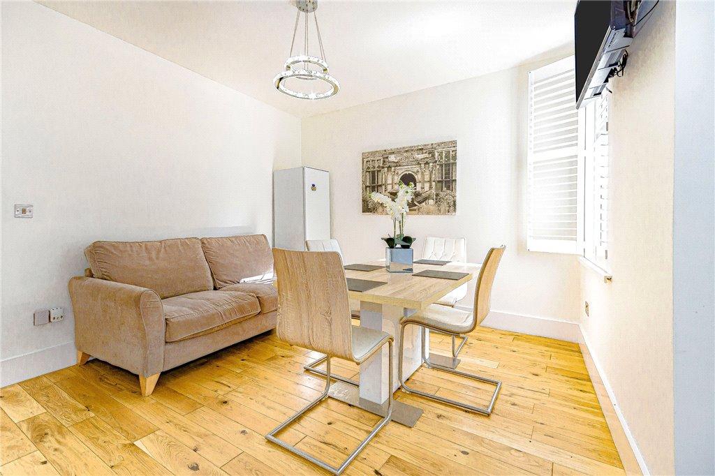
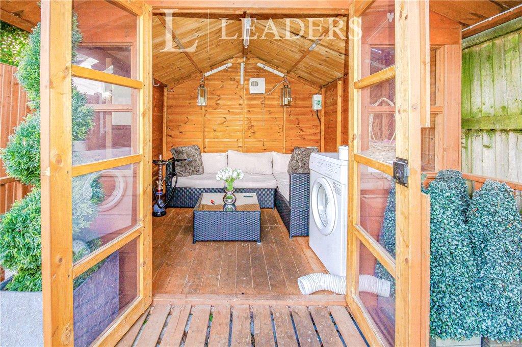
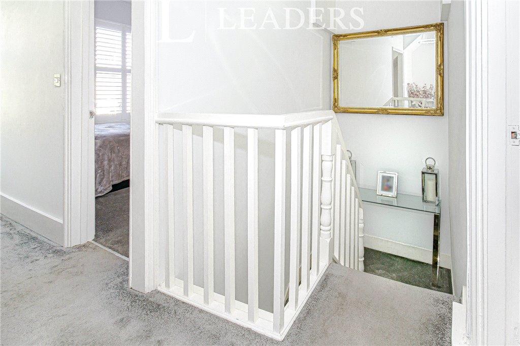
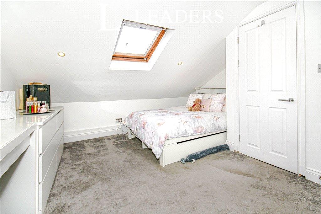
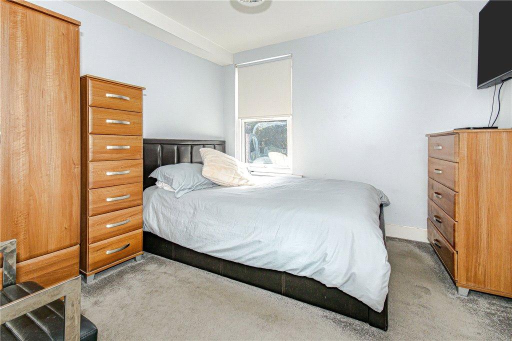
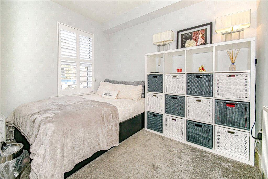
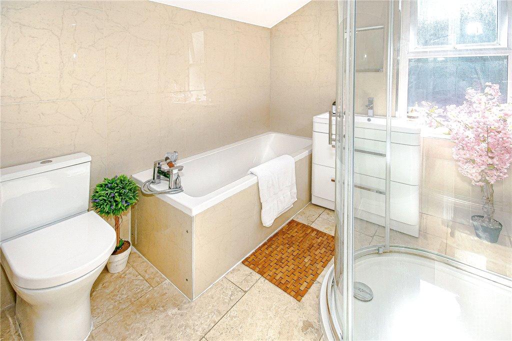
Inside, you will be amazed. The living space is stunning, and you can really imagine entertaining with the incredible kitchen diner. If you need to relax, the living room is just heaven. The south-facing garden hasnt been ignored here either; you can really imagine having a glass of wine of the patio on a summers afternoon, or having your morning coffee. Theres a lovely lawn also so if youve got green fingures you can really get stuck in. There are four good sized bedrooms to chose from, making it the perfect family home.
Listed by
Croydon
Leaders and Romans Group
Reference: 85633531
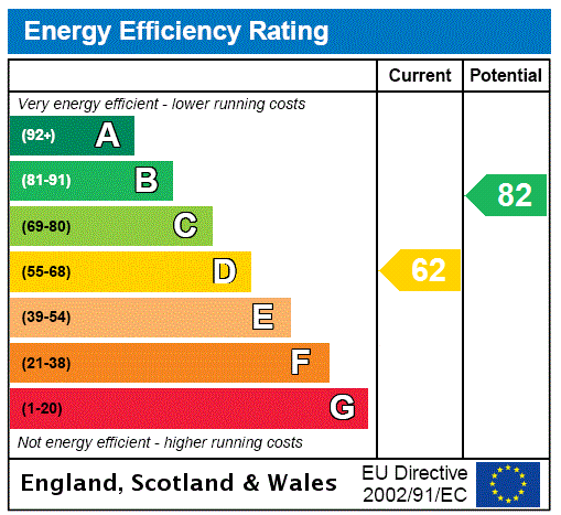
EPC Rating & Upgrade Cost
Fetching EPC data… Refresh this page in a moment.
Flood risk
Zone: 1
Risk: Low
Job (default Low)
Floorplans
Picture No. 15
EPC Graphs
EPC Rating Graph
FENSA Certificates
This property has 1 FENSA certificate(s) on record, indicating window/door installations by FENSA-approved installers.
FENSA Certificate #10024593
Property Details
Street: 17 Oval Road
Town: CROYDON
Postcode: CR0 6BG
Installation Details
Items: 9 windows and 1 door
Certificate Issued: 15/01/2014
Work Completed: 28/11/2013
This certificate data was retrieved from FENSA's database
What is FENSA? FENSA (Fenestration Self-Assessment Scheme) is a government-authorised scheme that monitors building regulation compliance for replacement windows and doors. Certificates indicate that work was completed by FENSA-approved installers.
Price history
136% since 2013
| Event | Date | Price | % change |
|---|---|---|---|
| Sold | 30/04/2021 (5 years ago) | £496,000 | +43.8% |
| Sold | 07/04/2015 (11 years ago) | £345,000 | +64.3% |
| Sold | 14/10/2013 (12 years ago) | £210,000 | — |
Source: HM Land Registry Price Paid Data. Crown copyright.
Sold Comparables
Same street and nearby sales within 0.25 miles (last 5 years). Data from Land Registry Price Paid.
| Address | Price | Date | Type |
|---|---|---|---|
| 155 CHERRY ORCHARD ROAD, CROYDON, GREATER LONDON, CR0 6BF | £375,000 | 14/01/2026 | Terraced |
| 88 LEBANON ROAD, CROYDON, GREATER LONDON, CR0 6US | £440,000 | 07/01/2026 | Terraced |
| 86 OVAL ROAD, CROYDON, GREATER LONDON, CR0 6BL | £460,000 | 17/12/2025 | Terraced |
| 4 TUNSTALL ROAD, CROYDON, GREATER LONDON, CR0 6TU | £420,000 | 26/09/2025 | Terraced |
| 50 CHISHOLM ROAD, CROYDON, GREATER LONDON, CR0 6UP | £730,000 | 07/02/2025 | Terraced |
| Same street 2 OVAL ROAD, CROYDON, GREATER LONDON, CR0 6BG | £440,000 | 11/11/2024 | Terraced |
| 38 TUNSTALL ROAD, CROYDON, GREATER LONDON, CR0 6TU | £485,500 | 07/12/2023 | Terraced |
| 14 LESLIE PARK ROAD, CROYDON, GREATER LONDON, CR0 6TN | £331,000 | 05/12/2023 | Terraced |
| 48 TUNSTALL ROAD, CROYDON, GREATER LONDON, CR0 6TU | £460,000 | 28/11/2023 | Terraced |
| 21 CEDAR ROAD, CROYDON, GREATER LONDON, CR0 6UG | £475,000 | 24/11/2023 | Terraced |
| 86 LEBANON ROAD, CROYDON, GREATER LONDON, CR0 6US | £425,000 | 21/09/2023 | Terraced |
| 86 ADDISCOMBE COURT ROAD, CROYDON, GREATER LONDON, CR0 6TS | £470,000 | 17/03/2023 | Terraced |
| 39 CEDAR ROAD, CROYDON, GREATER LONDON, CR0 6UG | £540,000 | 17/03/2023 | Terraced |
| 14B LESLIE PARK ROAD, CROYDON, GREATER LONDON, CR0 6TN | £470,000 | 21/12/2022 | Terraced |
| 61 CEDAR ROAD, CROYDON, GREATER LONDON, CR0 6UJ | £460,000 | 13/12/2022 | Terraced |
| 6 CROSS ROAD, CROYDON, GREATER LONDON, CR0 6TA | £330,000 | 25/11/2022 | Terraced |
| 123 LEBANON ROAD, CROYDON, GREATER LONDON, CR0 6UU | £577,000 | 29/09/2022 | Terraced |
| 83 LEBANON ROAD, CROYDON, GREATER LONDON, CR0 6UU | £488,000 | 22/09/2022 | Terraced |
| 128 ADDISCOMBE COURT ROAD, CROYDON, GREATER LONDON, CR0 6TS | £485,000 | 19/08/2022 | Terraced |
| 153 OVAL ROAD, CROYDON, GREATER LONDON, CR0 6BS | £427,000 | 22/07/2022 | Terraced |
| 84 LEBANON ROAD, CROYDON, GREATER LONDON, CR0 6US | £502,150 | 22/07/2022 | Terraced |
| Same street 4 OVAL ROAD, CROYDON, GREATER LONDON, CR0 6BG | £410,000 | 27/05/2022 | Semi-detached |
| Same street 5A OVAL ROAD, CROYDON, GREATER LONDON, CR0 6BG | £249,000 | 29/09/2021 | Flat |
Street average: £366,333 (3 sales)
Area average: £467,533 (20 sales)
Capital growth trend
Land Registry outcode average: last 12 months vs 5y and 10y ago (from sold prices).
House Price Index (HM Land Registry — official index, not sold-price averages): Croydon. Series: Terraced. As of March 2026.
Rental Range
Estimated market rent for Croydon. Low = conservative, Realistic = average, Optimistic = best case.
Based on Local Authority from postcode lookup → Croydon.
LHA (30th percentile) floor for Outer South London: £1,945/mo (Apr 2025 – Mar 2026)
Location
Nearby
Nearest stations, universities and amenities (distance from property).
| Type | Name | Distance |
|---|---|---|
| Shop | Chai's | 0.1 miles |
| Shop | Premier Express Varshni Convenience Store | 0.1 miles |
| Bus stop | Leslie Grove | 0.1 miles |
| Train station | East Croydon | 0.3 miles |
| Train station | West Croydon | 0.6 miles |
| Hospital | Diabetic Department | 1.2 miles |
| Hospital | Patient Advice and Liaison Service (PALS) | 1.2 miles |
| University | Horton Halls Reception | 5.6 miles |
| University | University of Wales Trinity Saint David London Campus | 7.1 miles |
Street-level crime
| Category | Count |
|---|---|
| Violence and sexual offences | 337 |
| Anti-social behaviour | 250 |
| Shoplifting | 158 |
| Vehicle crime | 77 |
| Drugs | 71 |
| Other theft | 65 |
| Public order | 61 |
| Criminal damage and arson | 53 |
| Burglary | 40 |
| Theft from the person | 28 |
| Possession of weapons | 23 |
| Robbery | 22 |
| Other crime | 11 |
| Bicycle theft | 9 |
| Total incidents | 1205 |
Within 1 mile during Apr 2026. Source: data.police.uk (England & Wales).
Schools nearby
Nearest open schools with Ofsted ratings (England). Closed schools are not shown. Data from Get Information about Schools and Ofsted.
| Name | Type | Distance | Ofsted |
|---|---|---|---|
| Ark Oval Primary Academy | Primary | 0.1 miles | Good — 11 Jan 2013 |
| Al-Khair Secondary Girls | Other | 0.1 miles | Good — 9 Jul 2024 |
| Al-Khair School | Other | 0.1 miles | Good — 24 Nov 2021 |
| Tunstall Nursery School | Nursery | 0.2 miles | Outstanding — 16 Mar 2016 |
| Ark Blake Academy | Secondary | 0.3 miles | Good — 26 Apr 2023 |
Rental Comparables
Rental listings exist nearby, but none matched the 4-bedroom count for this property.
Rent-driven metrics
Based on Area rent estimate.
- This street — Gross yield for this street only (Land Registry sales + rental comparables, same postcode + street).
- Rent ratio — Monthly rent ÷ purchase price (1% rule). 1%+ = strong, 0.8–1% = okay, <0.8% = weak for cashflow.
- Max investor price — Rent ÷ 0.8%; the price at which rent would be 0.8% of price (Stoke-style target).
- Target investor price — Rent ÷ 1%; the price at which rent would be 1% of price (strong cashflow band).
- Gross yield — Annual rent as % of purchase price (no costs).