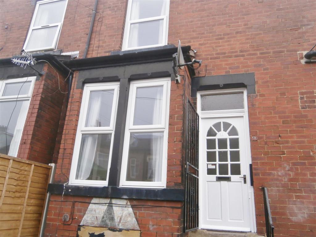
11 FLORENCE MOUNT
LEEDS, LEEDS, WEST YORKSHIRE LS9 7AU
£650 pcm
Property details
Floor area
68 m²
EPC rating
C
Year built
England and Wales: 1900-1929
Deprivation
Decile 1 (179 of 33,755)
Street crime
924 incidents within 1 mile (Apr 2026)
Key features
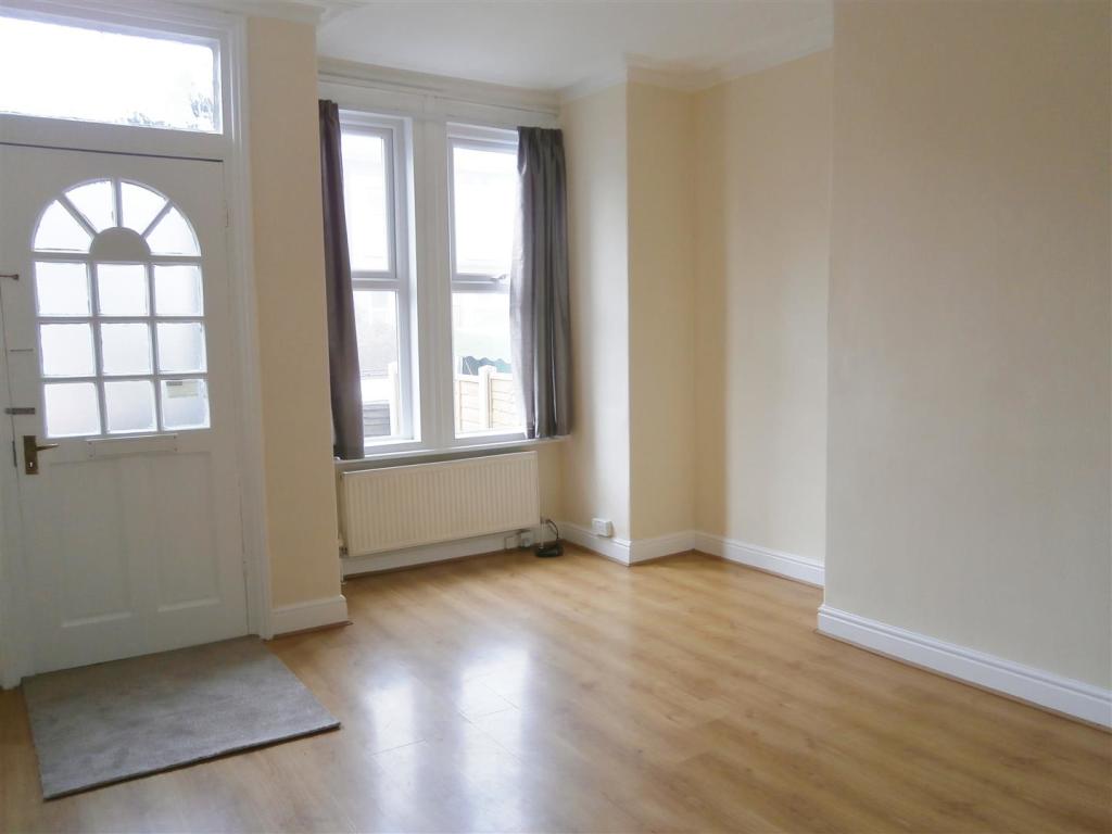
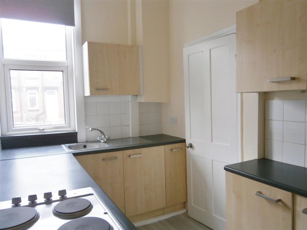
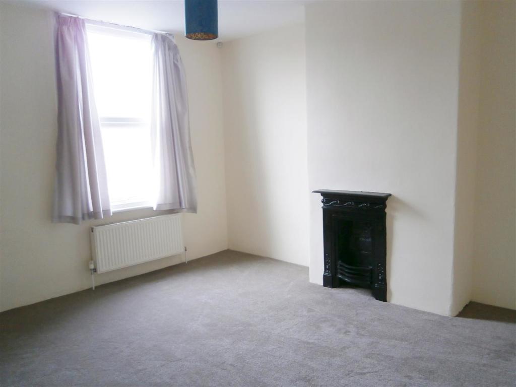
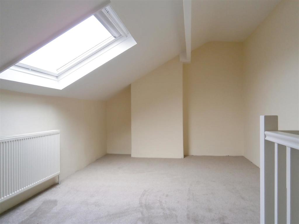
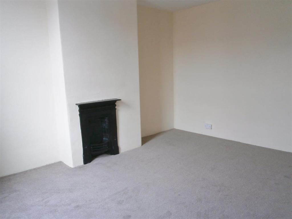
- Two Bed Back To Back Terrace
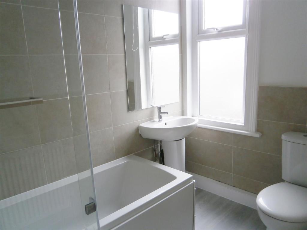
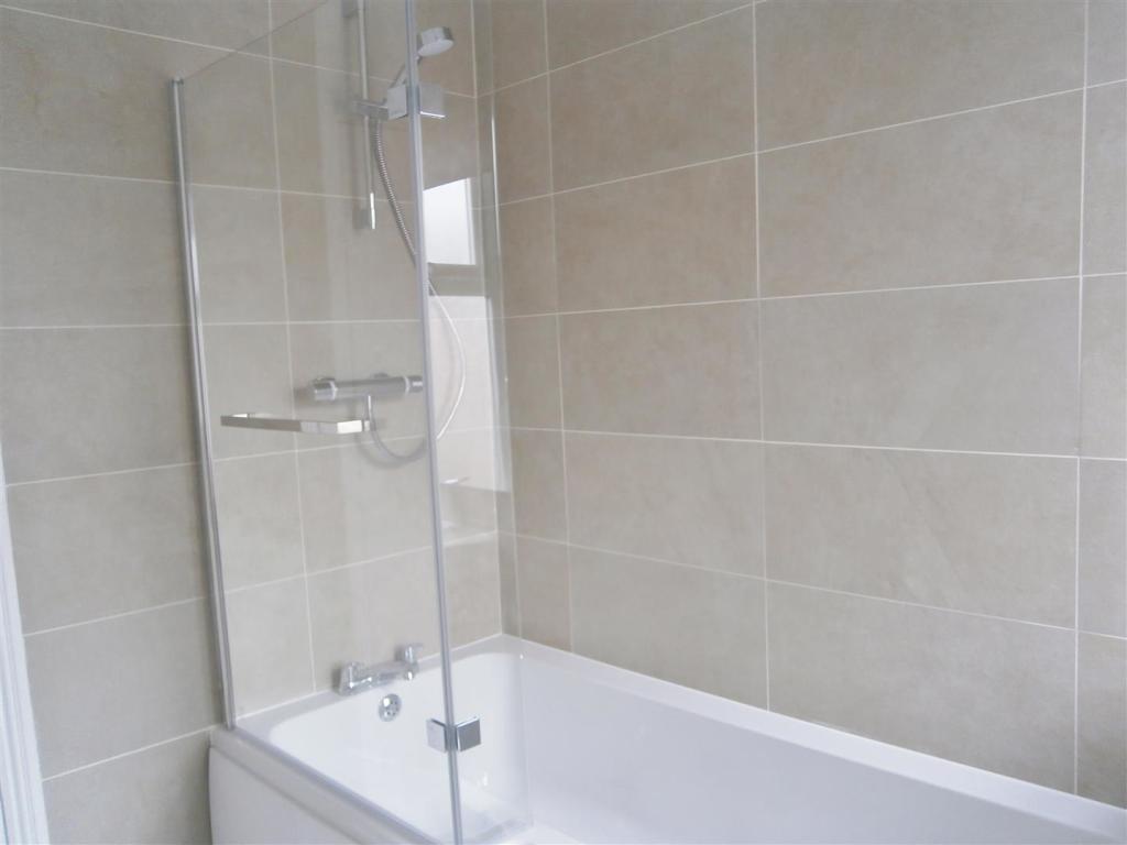
- Stunning New Bathroom
- Close To All Amenities
- Handy For Public Transport
- Unfurnished
- EPC Rating C
- Available 11th April
Description
Additional Information - Please note, a holding fee equivalent to one weeks rent is payable upon application This will form part of the first months rent.
Listed by
Horsforth
Adair Paxton
Reference: 120790862
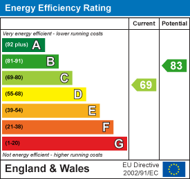
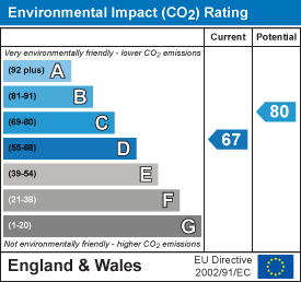
EPC Rating & Upgrade Cost
Current rating: C
Potential rating: B
Inspection date: 22/09/2017
Expiry date: 21/09/2027
Est. upgrade cost to C: £11,500
Recommendations
- Solar water heating (£4,000 - £6,000)
- Solar photovoltaic panels, 2.5 kWp (£5,000 - £8,000)
Flood risk
Zone: 1
Risk: Low
Job (default Low)
EPC Graphs
EE Rating
EI Rating
Rental Range
Estimated market rent for Leeds. Low = conservative, Realistic = average, Optimistic = best case.
Based on Local Authority from postcode lookup → Leeds.
LHA (30th percentile) floor for Leeds: £773/mo (Apr 2025 – Mar 2026)
Location
Nearby
Nearest stations, universities and amenities (distance from property).
| Type | Name | Distance |
|---|---|---|
| Shop | Ashley Road Off Licence & General Store | 0.1 miles |
| Shop | Karpaty Bakery | 0.1 miles |
| Bus stop | Harehills Lane Compton Road | 0.1 miles |
| Bus stop | Strathmore Drive Ruthven View | 0.1 miles |
| Hospital | Cancer Genetics Building | 0.3 miles |
| Hospital | Lincoln Wing - A Block Entrance | 0.4 miles |
| University | Mabgate University Centre | 0.9 miles |
| University | Northern Film School | 1.6 miles |
| Train station | Leeds | 1.8 miles |
| Train station | Cross Gates | 2.6 miles |
Street-level crime
| Category | Count |
|---|---|
| Violence and sexual offences | 424 |
| Public order | 68 |
| Criminal damage and arson | 65 |
| Other theft | 64 |
| Anti-social behaviour | 52 |
| Burglary | 48 |
| Drugs | 48 |
| Vehicle crime | 43 |
| Shoplifting | 37 |
| Other crime | 31 |
| Robbery | 22 |
| Possession of weapons | 14 |
| Theft from the person | 7 |
| Bicycle theft | 1 |
| Total incidents | 924 |
Within 1 mile during Apr 2026. Source: data.police.uk (England & Wales).
Schools nearby
Nearest open schools with Ofsted ratings (England). Closed schools are not shown. Data from Get Information about Schools and Ofsted.
| Name | Type | Distance | Ofsted |
|---|---|---|---|
| Co-op Academy Brierley | Other | 0.1 miles | — (No rating) |
| Co-op Academy Nightingale | Primary | 0.2 miles | Good — 21 Sep 2022 |
| Harehills Primary School | Primary | 0.2 miles | Good — 8 Dec 2015 |
| Co-op Academy Woodlands | Primary | 0.3 miles | Good — 16 Nov 2023 |
| St Augustine's Catholic Primary School, A Voluntary Academy | Primary | 0.4 miles | Good — 24 Oct 2013 |
Rental Comparables
Residential lets from OpenRent and Rightmove for the area (same bedroom count). Use to validate rent estimates. Student lets are excluded.
| Title | Rent | Beds | Distance | As seen on |
|---|---|---|---|---|
| 2 Bed Terraced House, Leeds, LS8 | £1,785/mo | 2 | 0.16 miles | OpenRent |
| 2 Bed Terraced House, Conway Mount, LS8 | £875/mo | 2 | 0.22 miles | OpenRent |
| 2 Bed Terraced House, Bexley Mount, LS8 | £1,685/mo | 2 | 0.32 miles | OpenRent |
Average rent: £1,448/mo (3 listings)