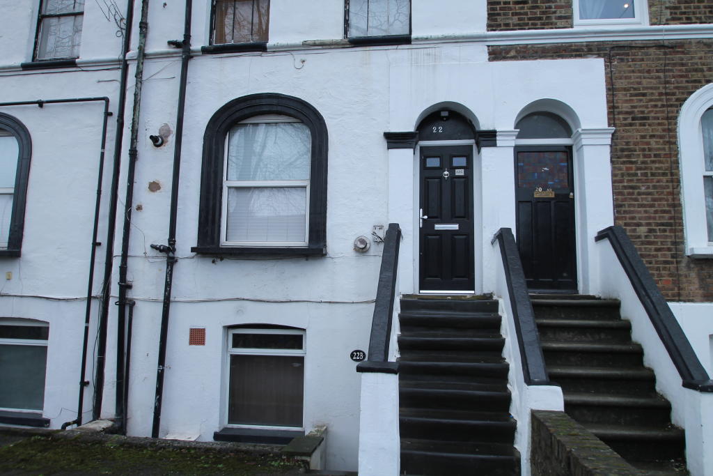
FLAT C
22 - 24, ASH GROVE, LONDON, LONDON, GREATER LONDON SE20 7RD
£950 pcm

Property details
Floor area
49 m²
Deprivation
Decile 5 (15,477 of 33,755)
Street crime
474 incidents within 1 mile (Apr 2026)
Key features
- AVAILABLE NOW
- ONE BEDROOM FLAT
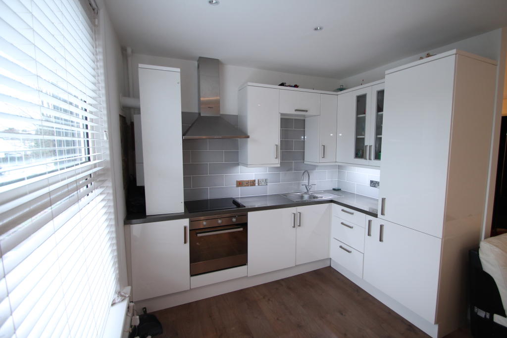
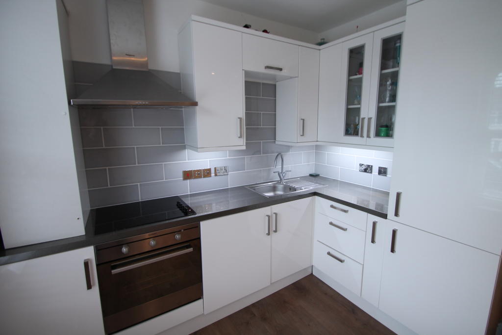
- MODERN FITTED OPEN PLAN KITCHEN
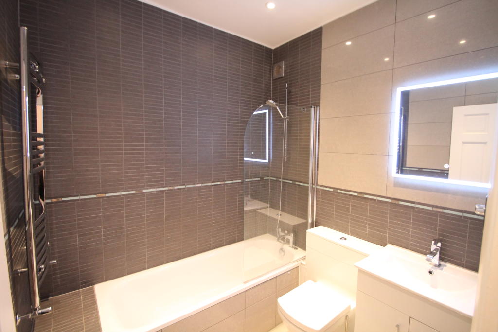
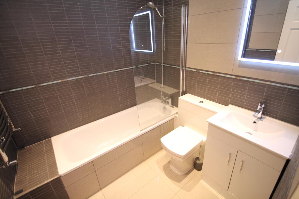
- STUNNING BATHROOM SUITE
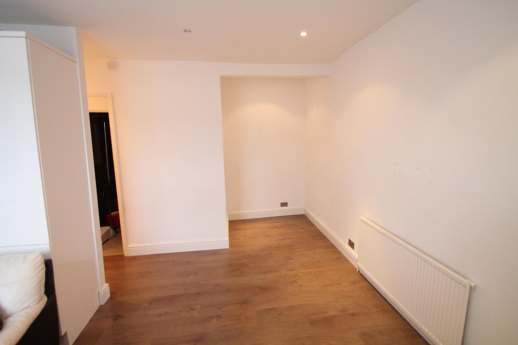
- LAMINATE FLOORING IN LOUNGE
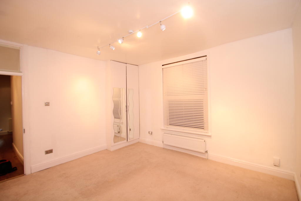
- VERY SPACIOUS BEDROOM
- 3 MINUTE WALK TO LOCAL AMENITIES
- EXCELLENT TRANSPORT LINKS
- FREE ON STREET PARKING
- SINGLE PERSON OR COUPLE WELCOME
Description
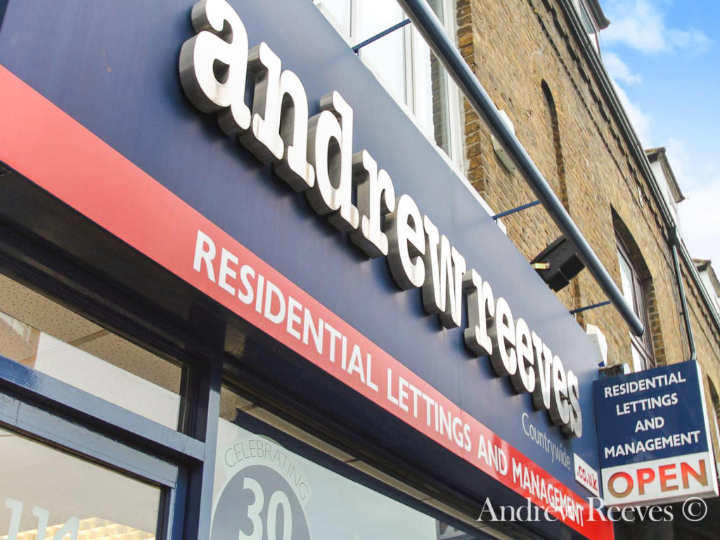
Listed by
Beckenham-Lettings
Countrywide UK Lettings - Connells
Reference: 111649406
EPC Rating & Upgrade Cost
Fetching EPC data… Refresh this page in a moment.
Flood risk
Zone: 1
Risk: Low
Job (default Low)
EPC Graphs
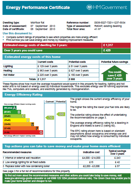
EPC
Rental Range
Estimated market rent for Bromley. Low = conservative, Realistic = average, Optimistic = best case.
Based on Local Authority from postcode lookup → Bromley.
LHA (30th percentile) floor for Cambridge: £898/mo (Apr 2025 – Mar 2026)
Location
Nearby
Nearest stations, universities and amenities (distance from property).
| Type | Name | Distance |
|---|---|---|
| Bus stop | Ash Grove | 0.0 miles |
| Shop | The Co-operative Food | 0.1 miles |
| Shop | Co-operative | 0.1 miles |
| Train station | Birkbeck | 0.2 miles |
| Train station | Anerley | 0.6 miles |
| Hospital | Sloane Hospital | 2.3 miles |
| Hospital | British Home & Hospital for Incurables | 2.4 miles |
| University | University of Wales Trinity Saint David London Campus | 5.5 miles |
| University | Horton Halls Reception | 5.6 miles |
Street-level crime
| Category | Count |
|---|---|
| Anti-social behaviour | 118 |
| Violence and sexual offences | 112 |
| Vehicle crime | 65 |
| Shoplifting | 36 |
| Criminal damage and arson | 31 |
| Other theft | 29 |
| Public order | 23 |
| Drugs | 18 |
| Burglary | 12 |
| Theft from the person | 11 |
| Robbery | 7 |
| Other crime | 5 |
| Bicycle theft | 4 |
| Possession of weapons | 3 |
| Total incidents | 474 |
Within 1 mile during Apr 2026. Source: data.police.uk (England & Wales).
Schools nearby
Nearest open schools with Ofsted ratings (England). Closed schools are not shown. Data from Get Information about Schools and Ofsted.
| Name | Type | Distance | Ofsted |
|---|---|---|---|
| Stewart Fleming Primary School | Primary | 0.2 miles | Outstanding — 7 Sep 2016 |
| St Anthony's Catholic Primary School | Primary | 0.2 miles | Good — 18 Apr 2016 |
| Churchfields Primary School | Primary | 0.5 miles | Good — 21 Nov 2023 |
| Harris Primary Academy Kent House | Primary | 0.5 miles | Outstanding — 7 Jun 2016 |
| St John's Church of England Primary School | Primary | 0.6 miles | — (Inspected (no overall grade)) |
Rental Comparables
Residential lets from OpenRent and Rightmove for the area (same bedroom count). Use to validate rent estimates. Student lets are excluded.
| Title | Rent | Beds | Distance | As seen on |
|---|---|---|---|---|
| Studio Flat, Blandford Road, BR3 | £850/mo | 1 | 0.24 miles | OpenRent |
| Bedsit, Maple Road, SE20 | £1,047/mo | 1 | 0.59 miles | OpenRent |
Average rent: £949/mo (2 listings)