School Lane
Coven, WV9 5AD
Property details
Tenure
FREEHOLD
Council tax band
B
Local average
£305,500 (-18.2%)
Deprivation
Decile 7 (20,784 of 33,755)
Street crime
5 incidents within 1 mile (Apr 2026)
Additional details
- Parking
- Yes
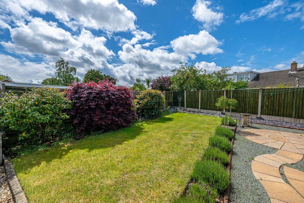
- Garden
- Yes
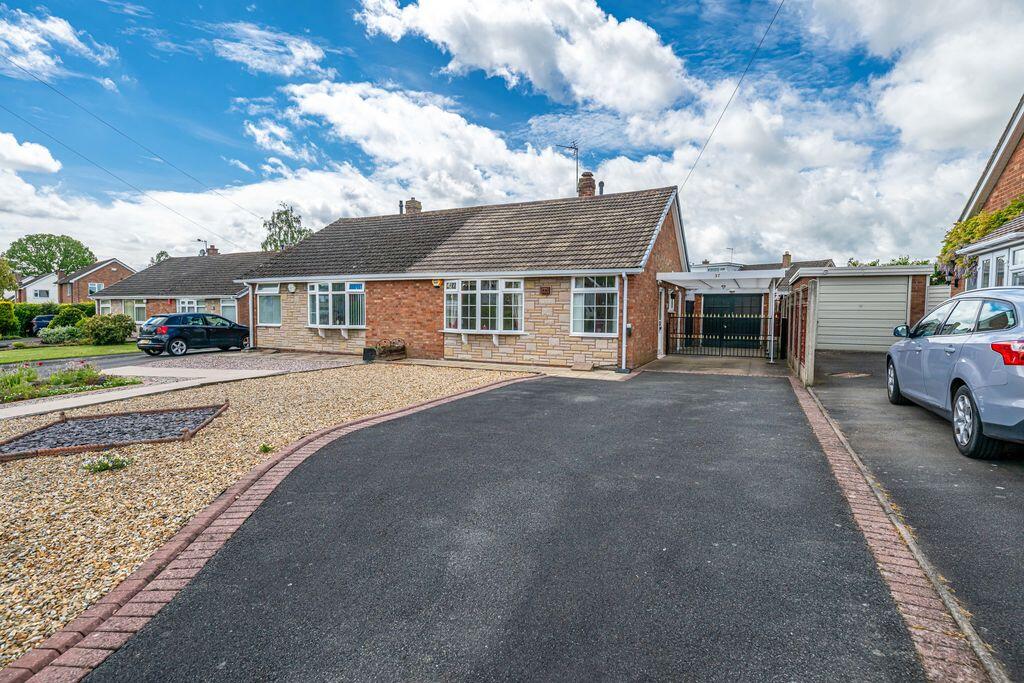
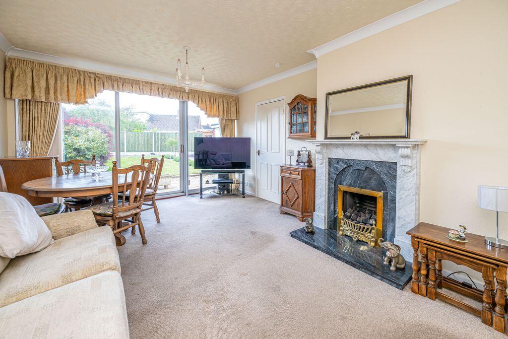
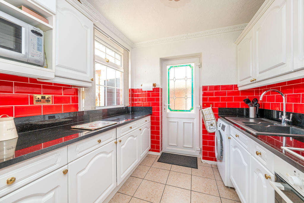
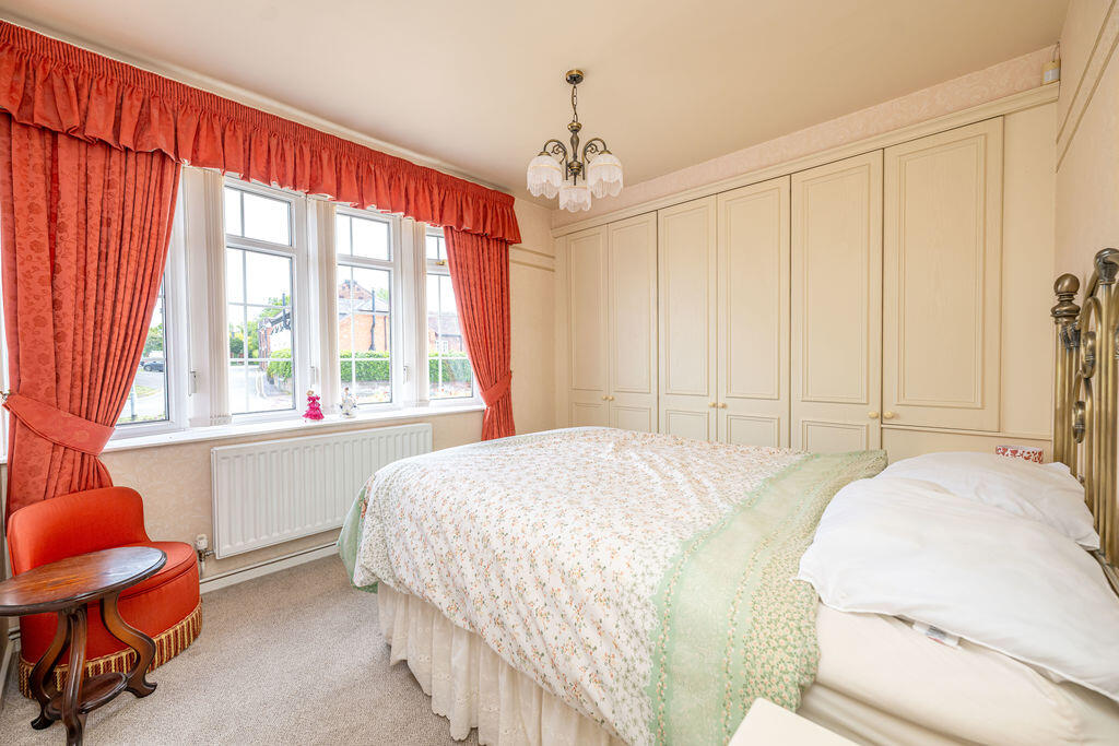
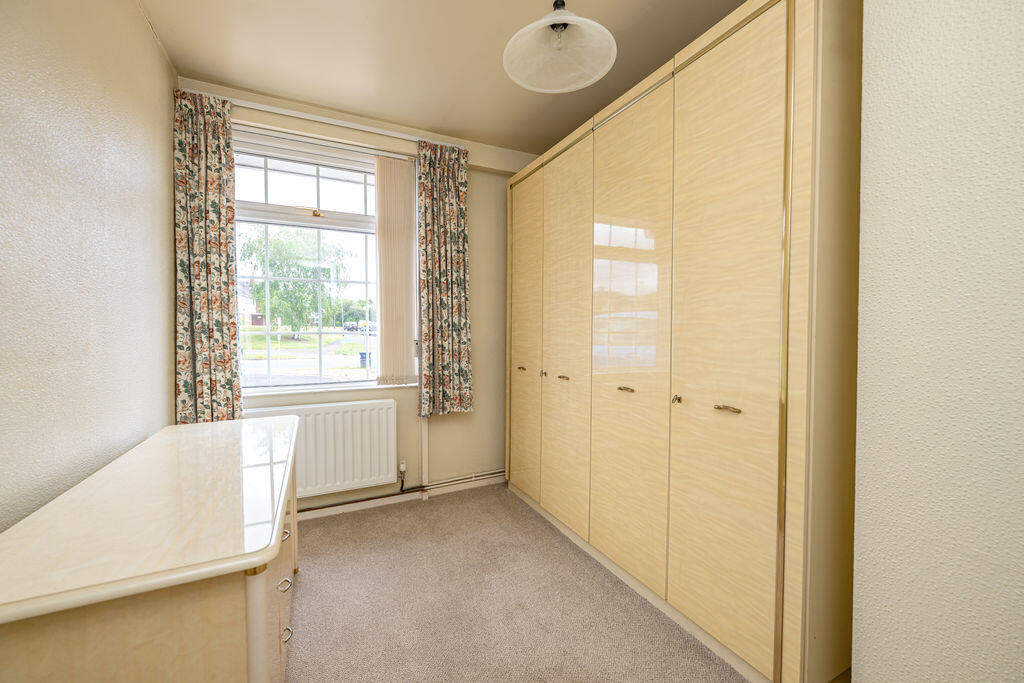
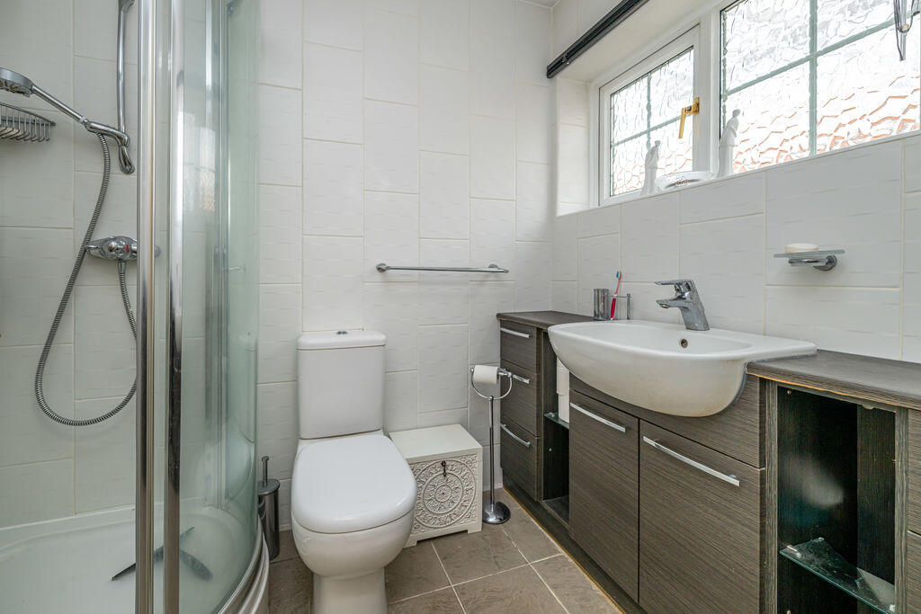
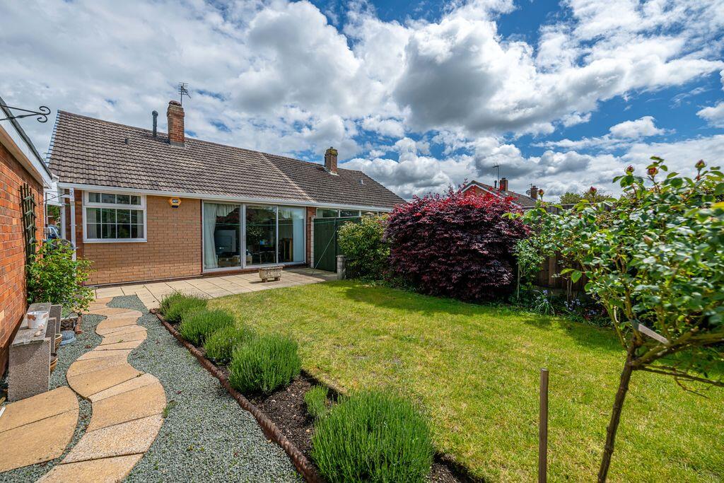
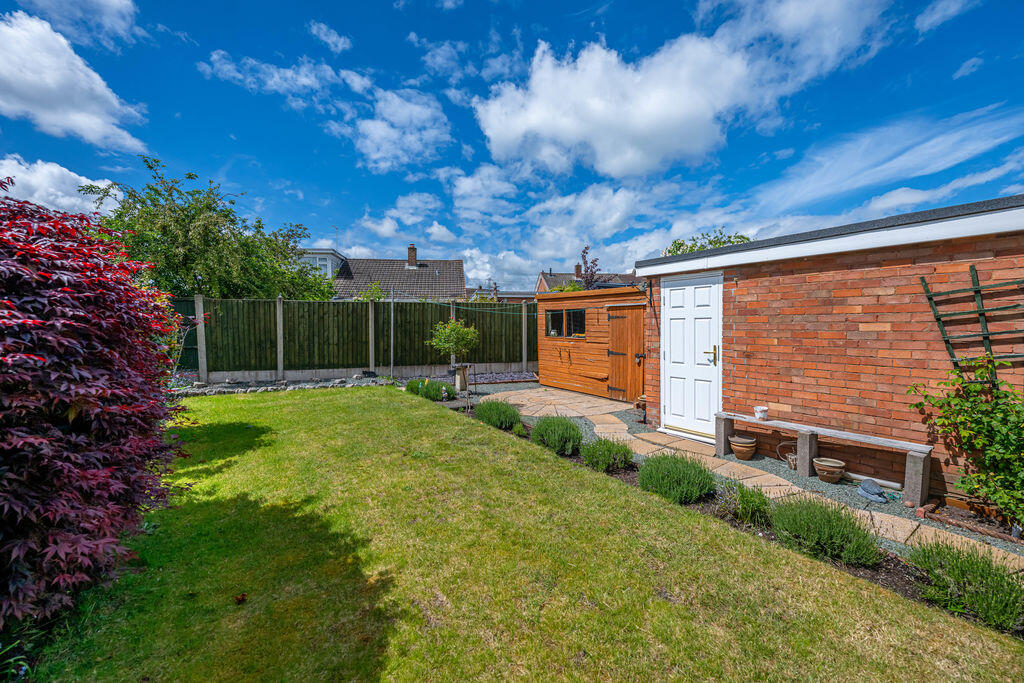
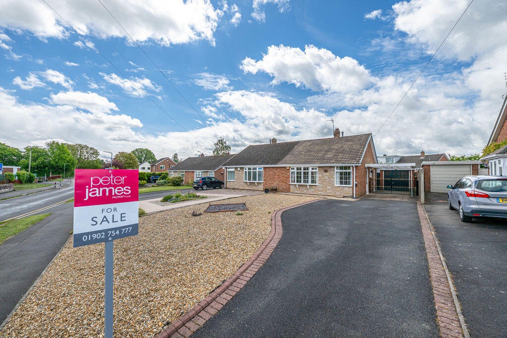
Description
Situated within the sought-after village of Coven, School Lane enjoys a pleasant semi-rural setting whilst remaining conveniently close to a wide range of everyday amenities. The village itself offers a selection of local shops, traditional pubs and useful community facilities, creating an ideal environment. Further comprehensive shopping and leisure amenities can be found in nearby Wolverhampton, Cannock and Penkridge.
This well-positioned bungalow benefits from excellent transport links, making it ideal for a range of buyers. Regular bus services operate nearby, providing convenient access to Wolverhampton, Stafford and surrounding villages, whilst local motorway connections offer straightforward commuting throughout the Midlands. Rail services can also be found at Wolverhampton and Penkridge stations, both within easy driving distance, offering direct links to Shrewsbury, Birmingham and further afield.
Property Services
Freehold
EPC - D
Council Tax Authority - South Staffordshire
Council Tax Band - B
Flood Risk - Very Low
Mobile Network Coverage
O2 - 88%
EE - 87%
Three - 81%
Vodaphone - 74%
Broadband Network Coverage
Standard - 17 Mbps
Superfast - 80 Mbps
Ultrafast - 8000 Mbps
Utilities
Mains Water
Mains Electricity
Mains Gas
Mains Drainage
WhatThreeWords - ///placed.energy.rings
Listed by
Tettenhall
Peter James Property Partnership
Reference: 89985033
EPC ratings on this postcode
We don't have a matched EPC for this property yet. Below are efficiency scores and details for other addresses on this postcode.
| Address | Current | Potential | Floor area | Age band | Type |
|---|---|---|---|---|---|
| 33, School Lane, Coven, WOLVERHAMPTON | 65 | 83 | 54 m² | England and Wales: 1950-1966 | Detached |
| 37 School Lane, Coven, WOLVERHAMPTON | 62 | 71 | 52 m² | England and Wales: 1967-1975 | Detached |
| 39, School Lane, Coven, WOLVERHAMPTON | 57 | 88 | 53 m² | England and Wales: 1967-1975 | Detached |
| 49 SCHOOL LANE, COVEN, COVEN | 76 | 88 | 106 m² | England and Wales: 1950-1966 | Detached |
| 51 School Lane, Coven, WOLVERHAMPTON | 71 | 88 | 53 m² | England and Wales: 1967-1975 | Detached |
| 51, School Lane, Coven, WOLVERHAMPTON | 60 | 81 | 66 m² | — | Detached |
| 51, School Lane, Coven, WOLVERHAMPTON | 68 | 91 | 53 m² | England and Wales: 1950-1966 | Detached |
| THE ANNEX, SCHOOL LANE, COVEN | 65 | 81 | 105 m² | England and Wales: 1900-1929 | Terraced |
Flood risk
Zone: 1
Risk: Low
Job (default Low)
Floorplans

Floor Plan
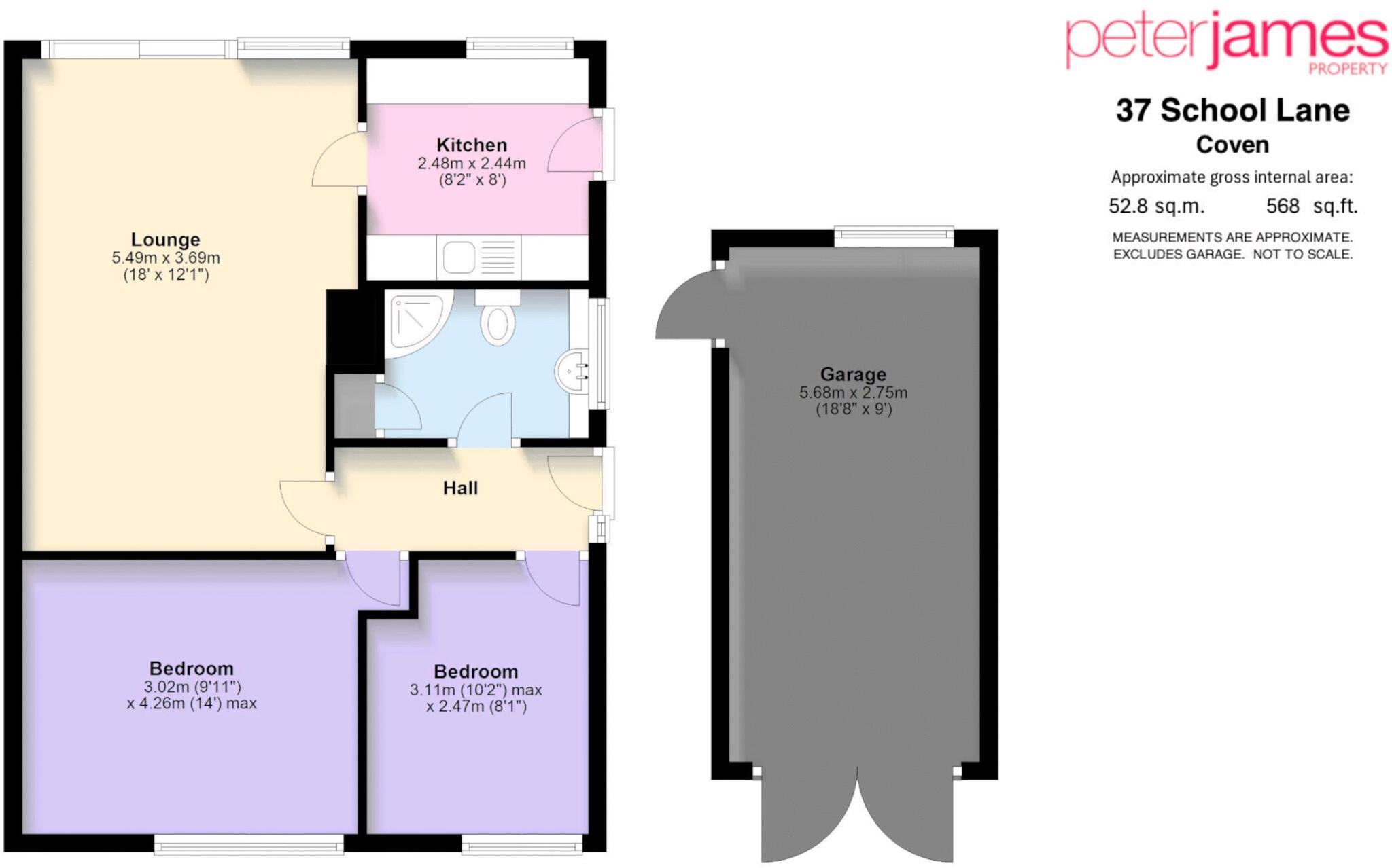
37 School Lane - Floorplan
EPC Graphs

Energy Performance Certificate
Price history
| Event | Date | Price | % change |
|---|---|---|---|
| Listed for sale | — | £249,950 | — |
Source: HM Land Registry Price Paid Data. Crown copyright.
Sold Comparables
Same street and nearby sales within 0.25 miles (last 5 years). Data from Land Registry Price Paid.
| Address | Price | Date | Type |
|---|---|---|---|
| CLAIRE HAVEN LIGHT ASH CUL DE SAC, COVEN, WOLVERHAMPTON, SOUTH STAFFORDSHIRE, STAFFORDSHIRE, WV9 5AF | £400,000 | 08/12/2023 | Detached |
| 26 CELANDINE DRIVE, COVEN, WOLVERHAMPTON, SOUTH STAFFORDSHIRE, STAFFORDSHIRE, WV9 5FD | £325,000 | 16/12/2022 | Detached |
| 5 CORNFLOWER MEADOW, COVEN, WOLVERHAMPTON, SOUTH STAFFORDSHIRE, STAFFORDSHIRE, WV9 5FB | £395,000 | 11/02/2022 | Detached |
| 5 EAST BEECHES, COVEN, WOLVERHAMPTON, SOUTH STAFFORDSHIRE, STAFFORDSHIRE, WV9 5EA | £287,000 | 21/12/2021 | Detached |
| Same street 49 SCHOOL LANE, COVEN, WOLVERHAMPTON, SOUTH STAFFORDSHIRE, STAFFORDSHIRE, WV9 5AD | £310,000 | 03/12/2021 | Semi-detached |
| CLAIRE HAVEN LIGHT ASH CUL DE SAC, COVEN, WOLVERHAMPTON, SOUTH STAFFORDSHIRE, STAFFORDSHIRE, WV9 5AF | £390,000 | 24/09/2021 | Detached |
| 3 CORNFLOWER MEADOW, COVEN, WOLVERHAMPTON, SOUTH STAFFORDSHIRE, STAFFORDSHIRE, WV9 5FB | £319,950 | 24/09/2021 | Detached |
| 20 CORNFLOWER MEADOW, COVEN, WOLVERHAMPTON, SOUTH STAFFORDSHIRE, STAFFORDSHIRE, WV9 5FB | £350,000 | 24/09/2021 | Detached |
Street average: £310,000 (1 sale)
Area average: £352,421 (7 sales)
Capital growth trend
Land Registry outcode average: last 12 months vs 5y and 10y ago (from sold prices).
House Price Index (HM Land Registry — official index, not sold-price averages): South Staffordshire. Series: Detached. As of March 2026.
Rental Range
Estimated market rent for South Staffordshire. Low = conservative, Realistic = average, Optimistic = best case.
Based on Local Authority from postcode lookup → South Staffordshire.
LHA (30th percentile) floor for Black Country: £623/mo (Apr 2025 – Mar 2026)
Location
Address
School Lane
Nearby
Nearest stations, universities and amenities (distance from property).
| Type | Name | Distance |
|---|---|---|
| Bus stop | Brewood Road | 0.1 miles |
| Shop | Unknown | 0.3 miles |
| Train station | Bilbrook | 3.4 miles |
| Train station | Codsall | 3.7 miles |
| Hospital | krishna pemmaraju | 5.0 miles |
| Hospital | Bilston Street Surgery | 8.3 miles |
| University | Staffordshire University Blackheath Lane Site | 10.8 miles |
Street-level crime
| Category | Count |
|---|---|
| Violence and sexual offences | 3 |
| Other theft | 1 |
| Vehicle crime | 1 |
| Total incidents | 5 |
Within 1 mile during Apr 2026. Source: data.police.uk (England & Wales).
Schools nearby
Nearest open schools with Ofsted ratings (England). Closed schools are not shown. Data from Get Information about Schools and Ofsted.
| Name | Type | Distance | Ofsted |
|---|---|---|---|
| St Paul's CofE First School | Primary | 0.1 miles | Good — 17 Oct 2016 |
| St Mary and St Chad CofE First School | Primary | 1.9 miles | Good — 15 Feb 2011 |
| Brewood Middle CofE Academy | Primary | 2.0 miles | Good — 29 Apr 2024 |
| St. Dominic's Grammar School | Other | 2.0 miles | — (No rating) |
| Robin's Nest School | Other | 2.2 miles | Good — 14 Jun 2023 |
Rental Comparables
Residential lets from OpenRent and Rightmove for the area (same bedroom count). Use to validate rent estimates. Student lets are excluded.
| Title | Rent | Beds | Distance | As seen on |
|---|---|---|---|---|
| 2 Bed Mobile Home, Old Stafford Road, WV10 | £695/mo | 2 | 0.39 miles | OpenRent |
| 2 Bed Mobile Home, Old Stafford Road, WV10 | £725/mo | 2 | 0.39 miles | OpenRent |
Average rent: £710/mo (2 listings)
Rent-driven metrics
Based on OpenRent comparables.
- Rent ratio — Monthly rent ÷ purchase price (1% rule). 1%+ = strong, 0.8–1% = okay, <0.8% = weak for cashflow.
- Max investor price — Rent ÷ 0.8%; the price at which rent would be 0.8% of price (Stoke-style target).
- Target investor price — Rent ÷ 1%; the price at which rent would be 1% of price (strong cashflow band).
- Gross yield — Annual rent as % of purchase price (no costs).
- Cost-to-rent — Price ÷ annual rent (from OpenRent comparables). Under 14× = strong, 14–16× = acceptable, 17×+ = compressed.
- Cashflow — Rent minus mortgage, 10% maintenance, £25/mo compliance. Assumes 75% LTV, 3.95% APR (5yr fixed), 25yr term.
- ROI — Annual profit ÷ cash in (deposit + 4% purchase costs).
Enter House Number
Enter the house number to help us retrieve more accurate pricing history and property data.
Please log in to submit or correct the house number for this listing.
Log in to continue