Sutton Drive
Stoke-On-Trent, ST4, ST4 5QA
£1,125 pcm
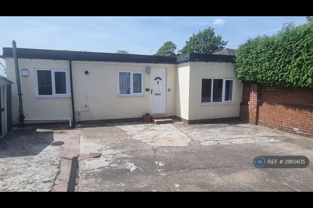
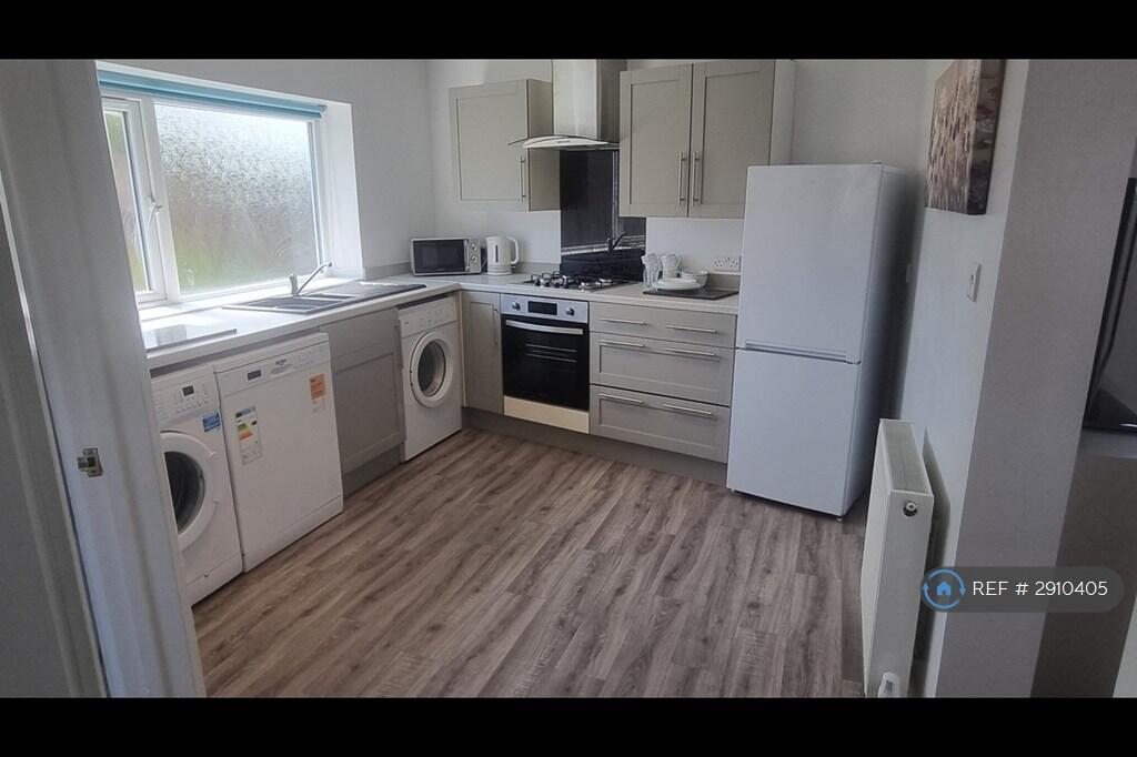
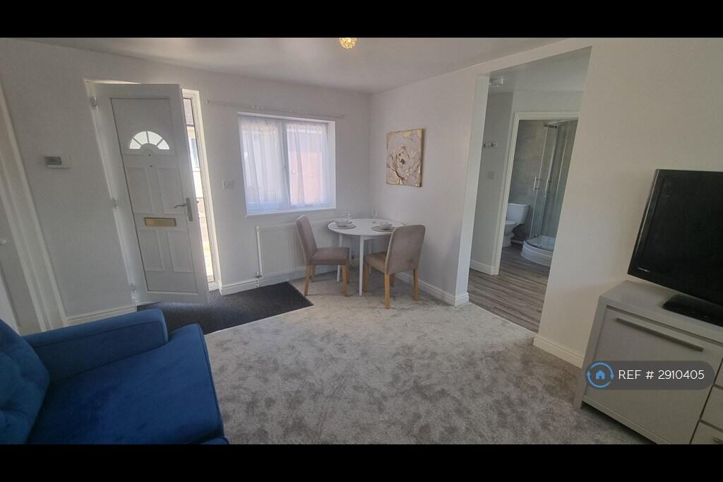
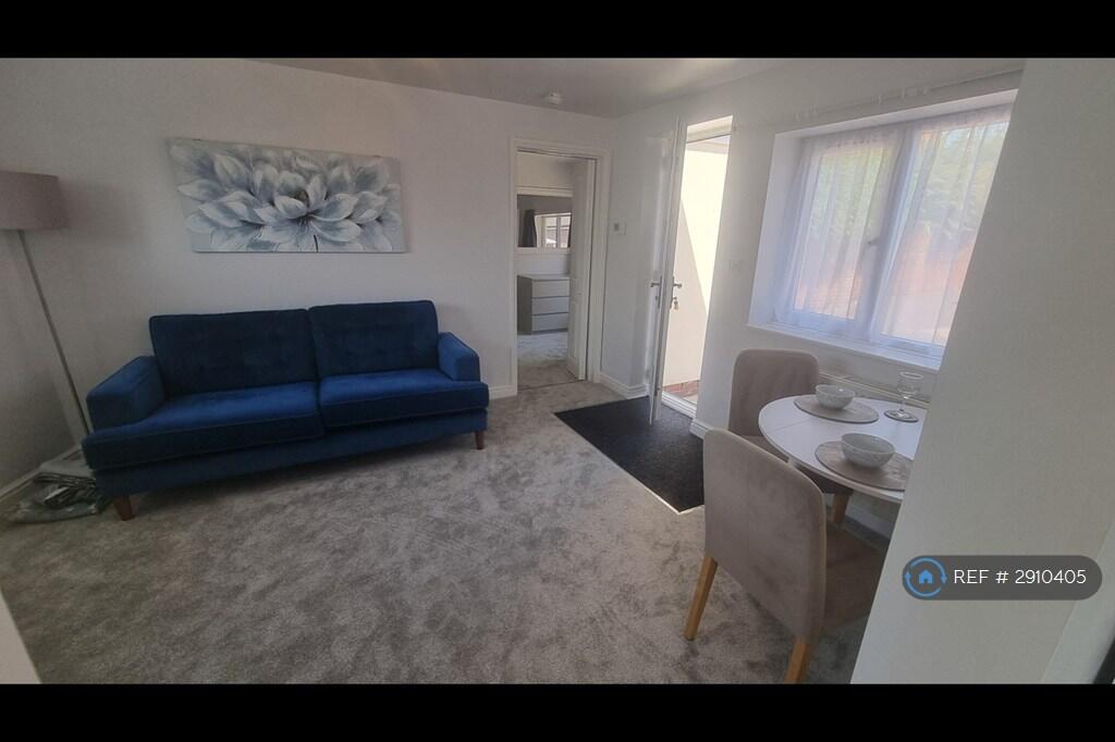
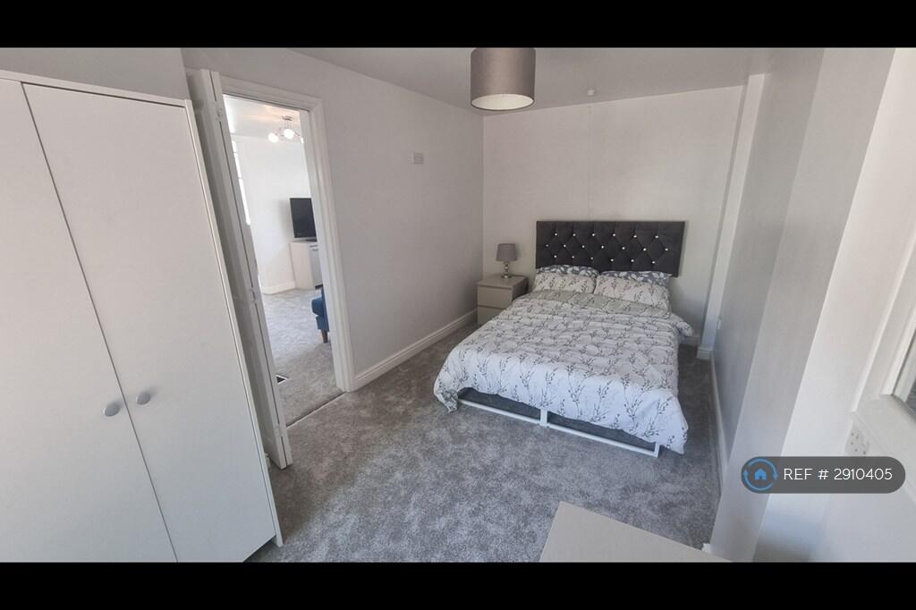
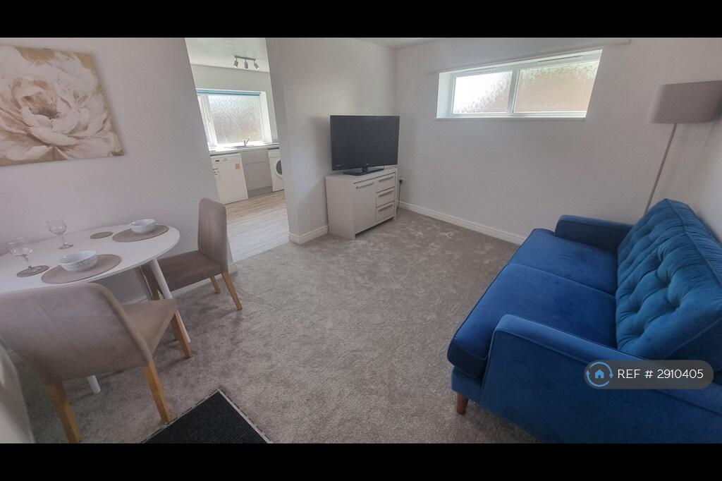
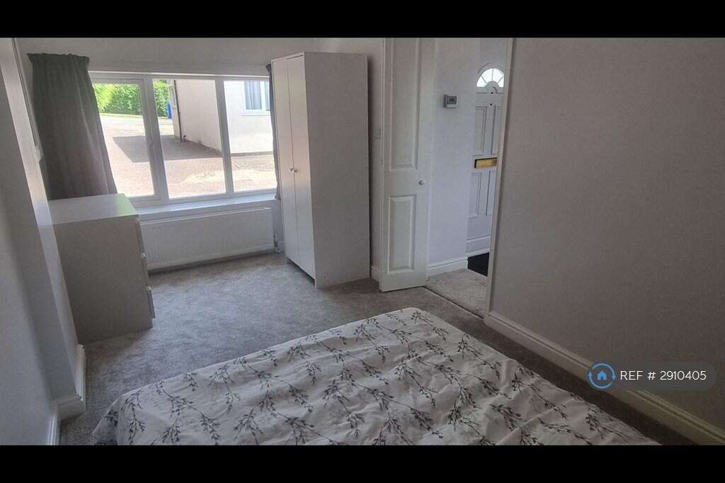
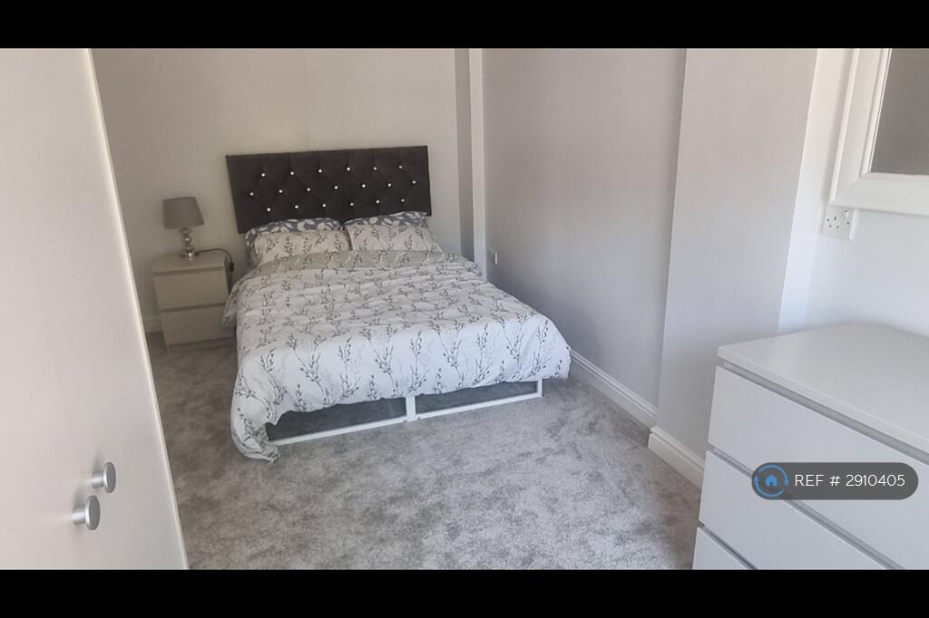
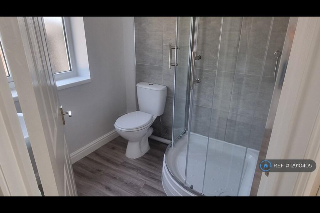
Photo 1 Photo 2 Photo 3 Photo 4 Photo 5 Photo 6 Photo 7 Photo 8 Photo 9
/ 9
Property details
Deprivation
Decile 2 (4,276 of 33,755)
Street crime
311 incidents within 1 mile (Mar 2026)
Key features
- No Agent Fees
- Students Can Enquire
- Bills Included
- Property Reference Number: 2910405
Additional details
- Parking
- Private
- Garden
- Private garden
Description
***All Bills Included*
Detached Annexe fully furnished in prime location for hospital staff.
Newly refurbished with 200mb fibre broadband and all utility bills included.
50 sq metre
Large bedroom with double bed, two wardrobes, two bedside cabinets and tv.
2 settees in lounge area and flat screen tv.
fully fitted kitchen with all appliances and utensils included.
3 piece bathroom with 900mm quadrant shower
Summary & Exclusions:
- Rent Amount: £1,125.00 per month (£259.62 per week)
- Deposit / Bond: £650.00
- 1 Bedrooms
- 1 Bathrooms
- Property comes furnished
- Available to move in from 29 May 2026
- Maximum number of tenants is 2
- Students welcome to enquire
- No Smokers
- Bills Included
- Property has parking
- Property has garden access
- EPC Rating: C
If calling, please quote reference: 2910405
Fees:
You will not be charged any admin fees.
Contact today to book a viewing and have the landlord show you round! **
Request Details form responded to 24/7, with phone bookings available 9am-9pm, 7 days a week.
Listed by
London
Techbeard Ltd
Reference: 89044149
EPC ratings on this postcode
We don't have a matched EPC for this property yet. Below are efficiency scores and details for other addresses on this postcode.
| Address | Current | Potential | Floor area | Age band | Type |
|---|---|---|---|---|---|
| 35, Sutton Drive, STOKE-ON-TRENT | 70 | 84 | 81 m² | England and Wales: 1950-1966 | Detached |
| 35, Sutton Drive, STOKE-ON-TRENT | 69 | 82 | 94 m² | England and Wales: 1900-1929 | Detached |
| 35a Sutton Drive, STOKE-ON-TRENT | 73 | 85 | 98 m² | England and Wales: 1900-1929 | Detached |
| 35a Sutton Drive, STOKE-ON-TRENT | 75 | 87 | 98 m² | — | Detached |
| 35a Sutton Drive, STOKE-ON-TRENT | 49 | 76 | 73 m² | England and Wales: 1930-1949 | Detached |
| 37 Sutton Drive, STOKE-ON-TRENT | 71 | 85 | 79 m² | England and Wales: 1950-1966 | Detached |
| 38, Sutton Drive, STOKE-ON-TRENT | 68 | 84 | 92 m² | England and Wales: 1900-1929 | Detached |
| Annex, 35a Sutton Drive, STOKE-ON-TRENT | 75 | 90 | 43 m² | England and Wales: 1967-1975 | Detached |
| Annex, 35a Sutton Drive, STOKE-ON-TRENT | 74 | 91 | 43 m² | — | Detached |
| The William Sutton Trust, Estate Office, Sutton Drive, STOKE-ON-TRENT | 54 | 85 | 89 m² | England and Wales: 1930-1949 | Detached |
Flood risk
Zone: 1
Risk: Low
Job (default Low)
Floorplans
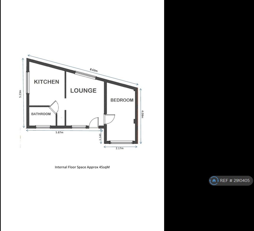
Floorplan
Rental Range
Estimated market rent for Stoke-on-Trent. Low = conservative, Realistic = average, Optimistic = best case.
Based on Local Authority from postcode lookup → Stoke-on-Trent.
LHA (30th percentile) floor for Staffordshire North: £424/mo (Apr 2025 – Mar 2026)
Location
Address
Shilton Close
Nearby
Nearest stations, universities and amenities (distance from property).
| Type | Name | Distance |
|---|---|---|
| Shop | Unknown | 0.2 miles |
| Shop | Londis | 0.2 miles |
| Bus stop | Springfields Road | 0.3 miles |
| Bus stop | James Street | 0.4 miles |
| Hospital | Royal Stoke University Hospital | 0.8 miles |
| Hospital | North Staffordshire Nuffield Hospital | 1.0 miles |
| Train station | Stoke-on-Trent | 1.3 miles |
| Train station | Trentham Leisure | 2.3 miles |
| University | Keele University | 3.0 miles |
| University | Buxton & Leek College | 10.8 miles |
Street-level crime
| Category | Count |
|---|---|
| Violence and sexual offences | 121 |
| Anti-social behaviour | 42 |
| Shoplifting | 30 |
| Public order | 28 |
| Criminal damage and arson | 25 |
| Other theft | 17 |
| Burglary | 11 |
| Vehicle crime | 10 |
| Drugs | 7 |
| Other crime | 7 |
| Bicycle theft | 6 |
| Robbery | 5 |
| Possession of weapons | 2 |
| Total incidents | 311 |
Within 1 mile during Mar 2026. Source: data.police.uk (England & Wales).
Schools nearby
Nearest open schools with Ofsted ratings (England). Closed schools are not shown. Data from Get Information about Schools and Ofsted.
| Name | Type | Distance | Ofsted |
|---|---|---|---|
| Oakhill Primary School | Primary | 0.4 miles | Good — 4 Dec 2023 |
| St Joseph's Preparatory School | Other | 0.4 miles | — (No rating) |
| St Joseph's College | Secondary | 0.4 miles | Outstanding — 6 Mar 2014 |
| Thistley Hough Academy | Secondary | 0.4 miles | Good — 26 Apr 2017 |
| St John's CofE (A) Primary School | Primary | 0.6 miles | Requires improvement — 14 Jun 2023 |
Rental Comparables
Residential lets from OpenRent and Rightmove for the area (same bedroom count). Use to validate rent estimates. Student lets are excluded.
Average rent: £604/mo (44 listings)
Enter House Number
Enter the house number to help us retrieve more accurate pricing history and property data.
Please log in to submit or correct the house number for this listing.
Log in to continue