FLAT 12
MARLBOROUGH, 61, WALTON STREET, LONDON, GREATER LONDON SW3 2JU
£6,933 pcm
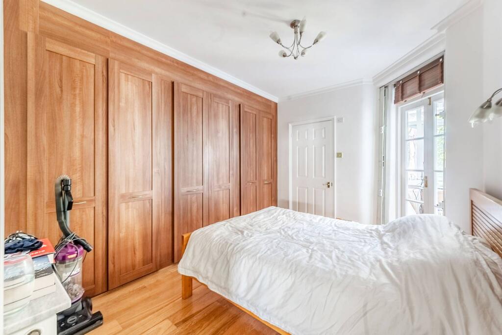
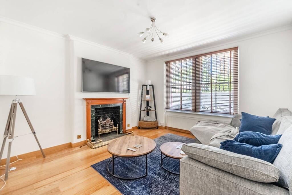
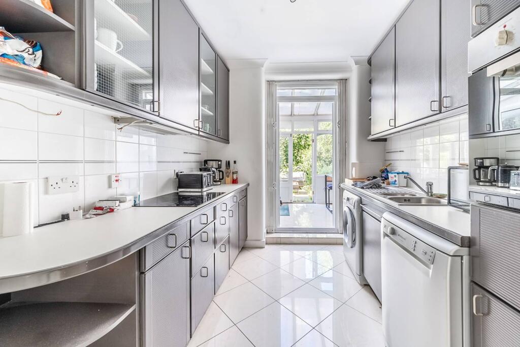
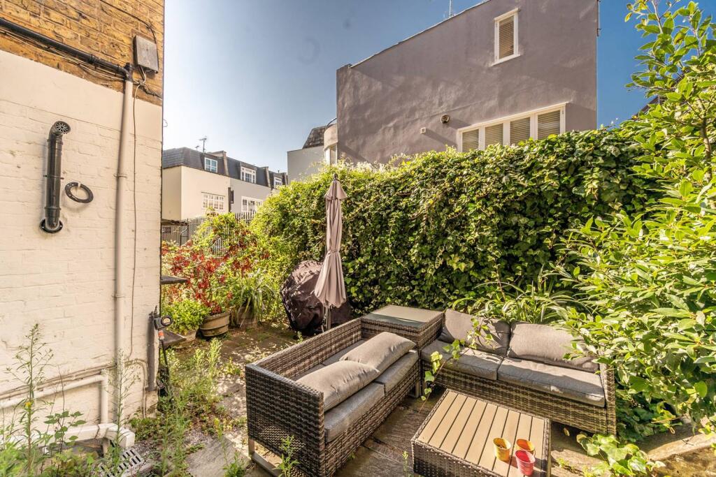
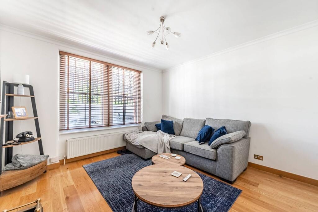
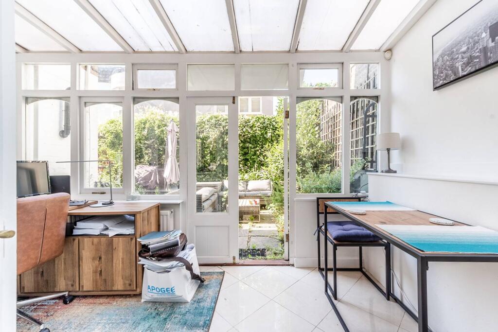
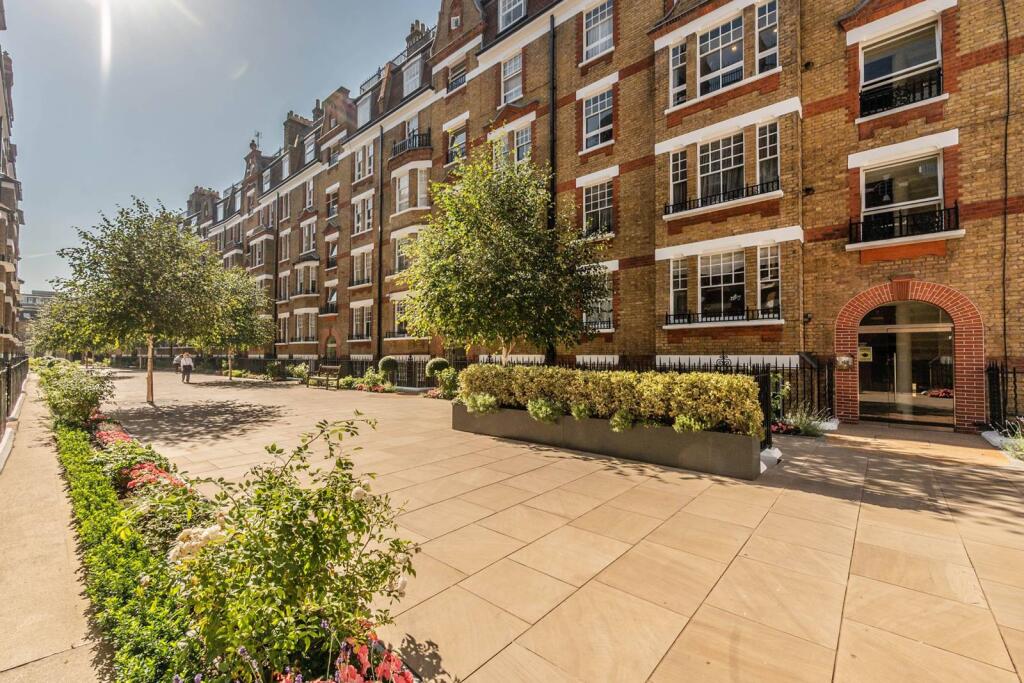
Photo 1 Photo 2 Photo 3 Photo 4 Photo 5 Photo 6 Photo 7
/ 7
Property details
Floor area
64 m²
Deprivation
Decile 7 (23,591 of 33,755)
Street crime
1006 incidents within 1 mile (Apr 2026)
Key features
- Fabulous and spacious 1 bedroom apartment
- Unique conservatory
- Patio garden
- Separate kitchen
- Portered and Gated development
- Ideal location in Chelsea
Additional details
- Garden
- Rear garden, Back garden
Description
Walton Street is ideally located close to the many amenities of South Kensington and the fashionable Sloane Square. For transport, the nearest underground station is South Kensington (Circle, District and Piccadilly lines).
Please use the reference CHPK2557462 when contacting Foxtons.
Listed by
Sloane Square
Foxtons
Reference: 172820930
EPC Rating & Upgrade Cost
Fetching EPC data… Refresh this page in a moment.
Flood risk
Zone: 1
Risk: Low
Job (default Low)
Floorplans
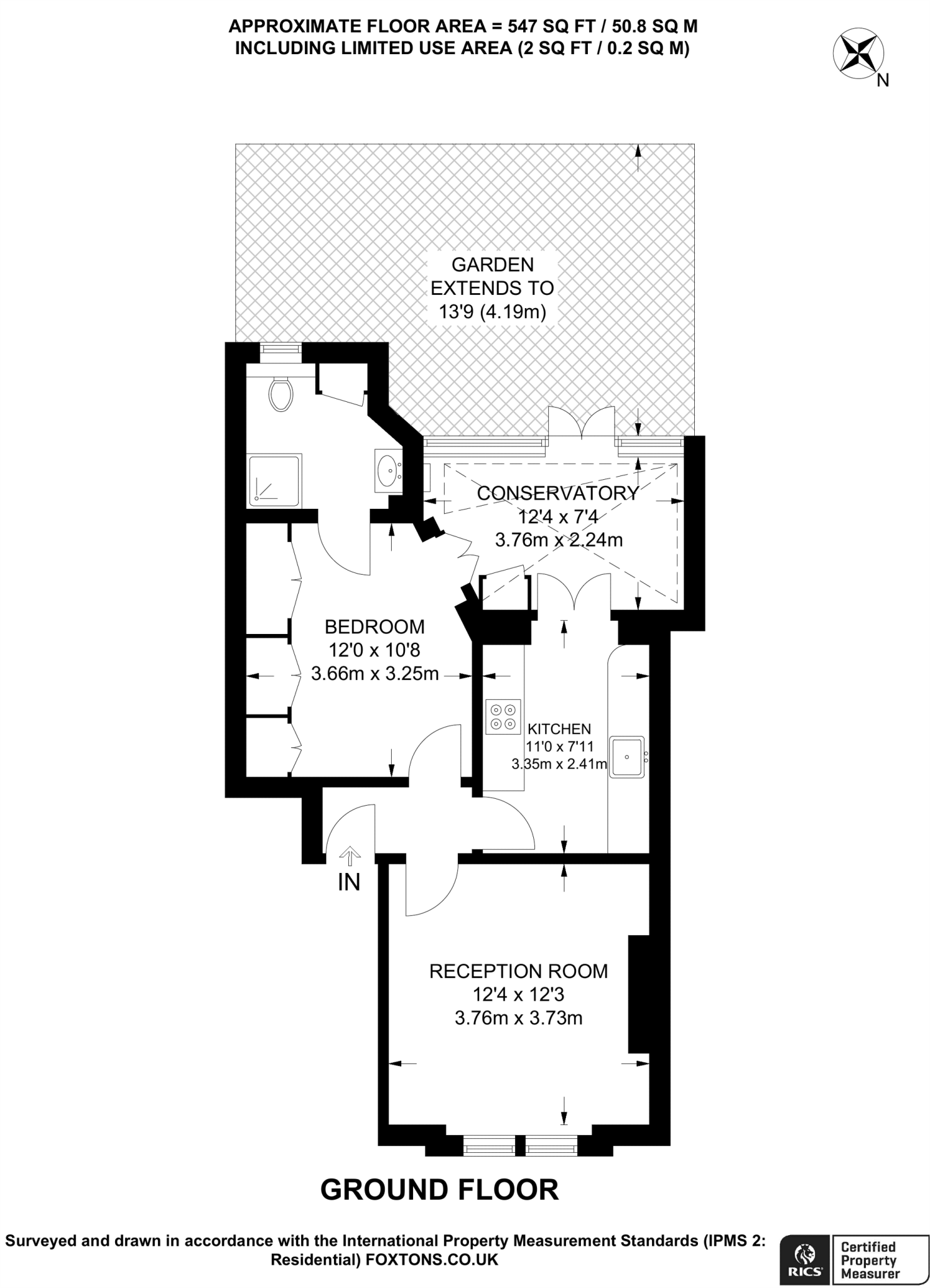
Floorplan area for info only, not for £/sq. ft valuation

Floorplan 2
Rental Range
Estimated market rent for Kensington and Chelsea. Low = conservative, Realistic = average, Optimistic = best case.
Based on Local Authority from postcode lookup → Kensington and Chelsea.
LHA (30th percentile) floor for Huntingdon: £648/mo (Apr 2025 – Mar 2026)
Location
Address
21 Donne Place
Nearby
Nearest stations, universities and amenities (distance from property).
| Type | Name | Distance |
|---|---|---|
| Shop | EH Lifestyle | 0.0 miles |
| Shop | Caz | 0.0 miles |
| Bus stop | Fulham Road | 0.1 miles |
| Train station | South Kensington | 0.3 miles |
| Train station | Sloane Square | 0.5 miles |
| University | National Heart and Lung Institute | 0.6 miles |
| Hospital | Bridge Lane Health Centre | 1.5 miles |
| University | BIMM Institute London | 1.6 miles |
| Hospital | Tunica Diagnostics | 2.1 miles |
Street-level crime
| Category | Count |
|---|---|
| Anti-social behaviour | 186 |
| Other theft | 171 |
| Violence and sexual offences | 165 |
| Theft from the person | 108 |
| Shoplifting | 101 |
| Vehicle crime | 93 |
| Public order | 49 |
| Burglary | 29 |
| Drugs | 28 |
| Criminal damage and arson | 27 |
| Robbery | 19 |
| Bicycle theft | 17 |
| Other crime | 11 |
| Possession of weapons | 2 |
| Total incidents | 1006 |
Within 1 mile during Apr 2026. Source: data.police.uk (England & Wales).
Schools nearby
Nearest open schools with Ofsted ratings (England). Closed schools are not shown. Data from Get Information about Schools and Ofsted.
| Name | Type | Distance | Ofsted |
|---|---|---|---|
| Marlborough Primary School | Primary | 0.1 miles | — (Inspected (no overall grade)) |
| Knightsbridge School | Other | 0.2 miles | — (No rating) |
| St Joseph's Catholic Primary School | Primary | 0.2 miles | Outstanding — 12 Jun 2024 |
| St. Thomas More Language College | Secondary | 0.2 miles | Good — 21 Sep 2022 |
| Sussex House School | Other | 0.2 miles | — (No rating) |
Rental Comparables
Residential lets from OpenRent and Rightmove for the area (same bedroom count). Use to validate rent estimates. Student lets are excluded.
| Title | Rent | Beds | Distance | As seen on |
|---|---|---|---|---|
| Studio Flat, Pelham Court, SW3 | £2,383/mo | 1 | 0.24 miles | OpenRent |
| 1 Bed Flat, Pelham Court, SW3 | £3,293/mo | 1 | 0.24 miles | OpenRent |
Average rent: £2,838/mo (2 listings)