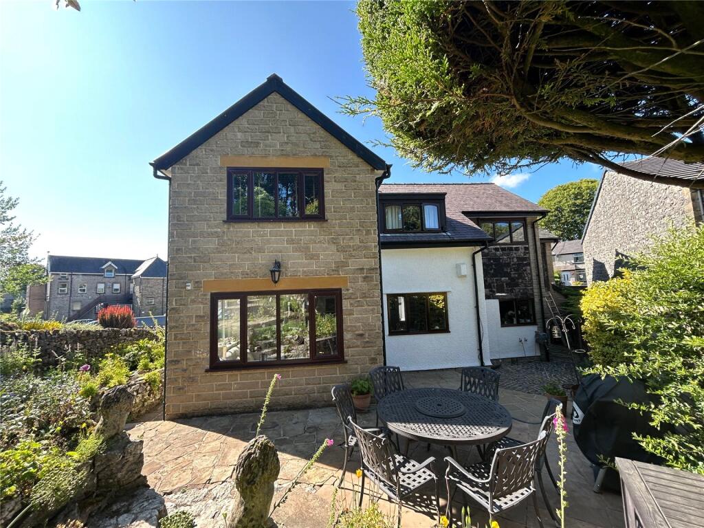
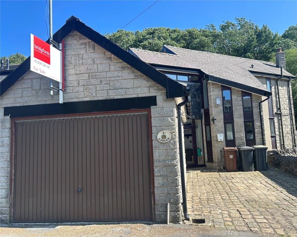
THREE GABLES
TOWN END, BUXTON, FAIRFIELD, DERBYSHIRE SK17 7EW
Property details
Tenure
FREEHOLD
Floor area
152 m²
Council tax band
D
Last sold
£165,000 Oct 2001
Local average
£464,166 (+7.7%)
Deprivation
Decile 2 (5,943 of 33,755)
Street crime
92 incidents within 1 mile (Apr 2026)
Key features
- Secluded location
- Stylish extension, impeccable design throughout.
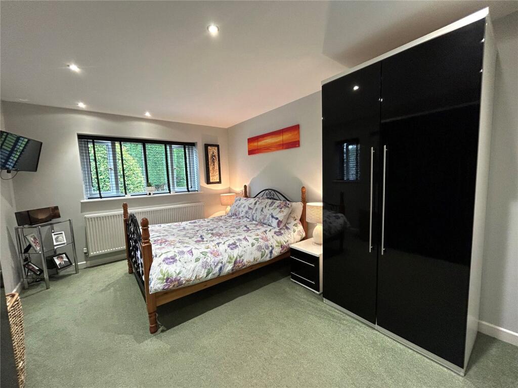
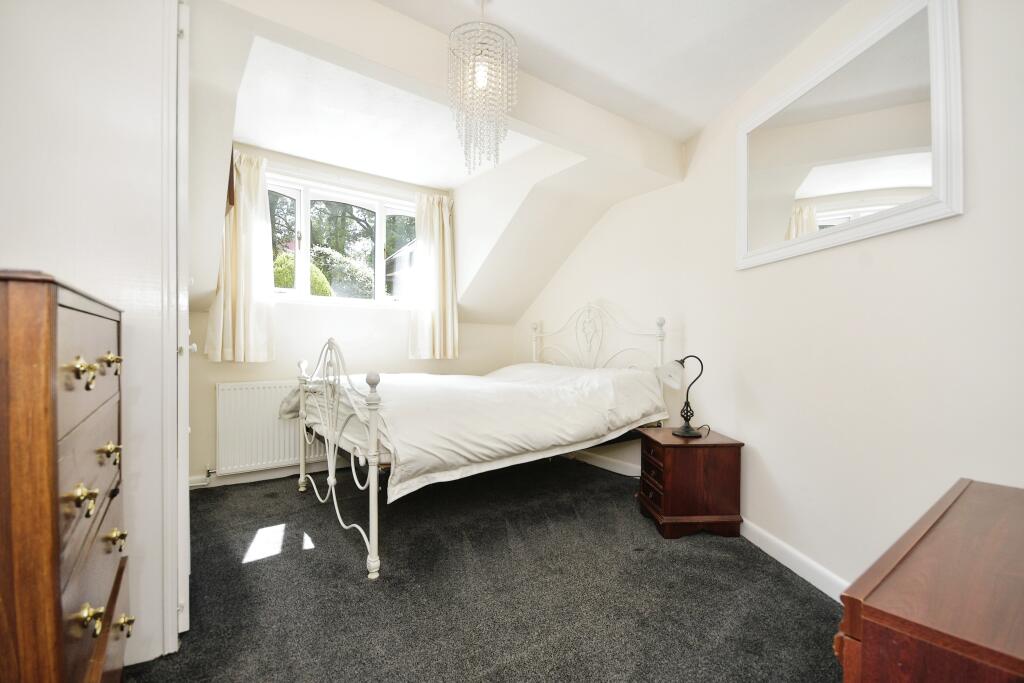
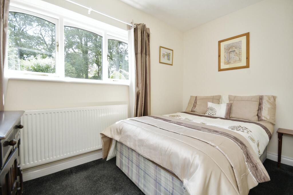
- Four spacious bedrooms for ultimate comfort.
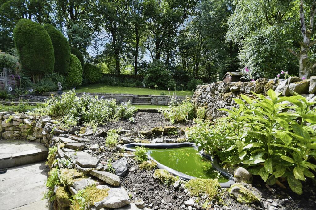
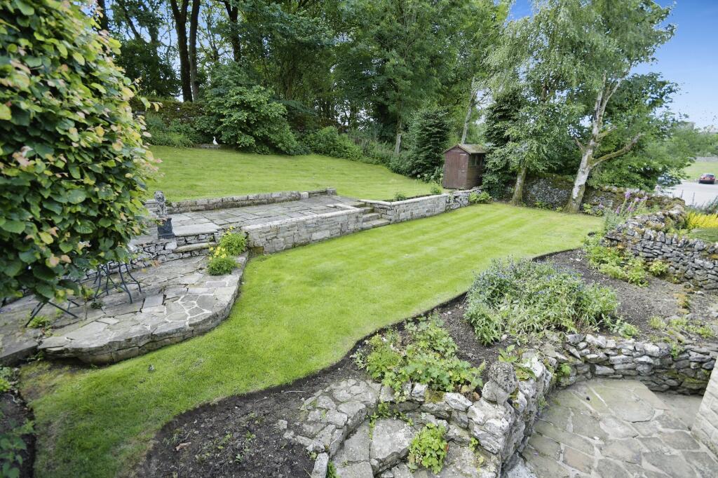
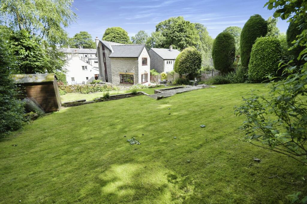
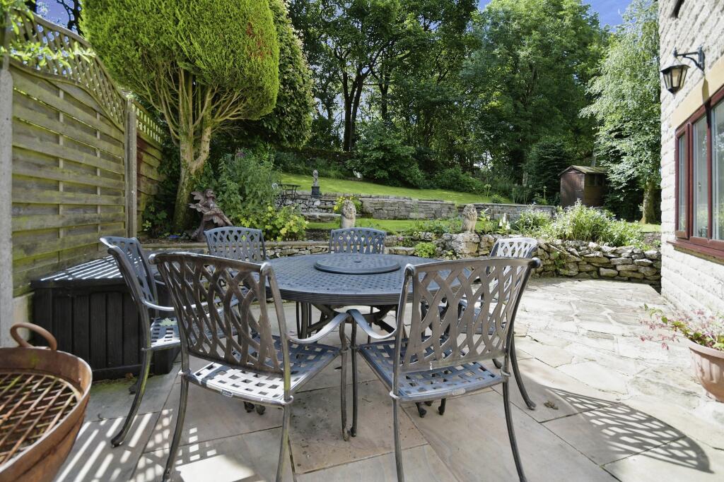
- Tranquil garden oasis, perfect for relaxation.
- Convenient parking and nearby amenities.
- Close to High Peak Golf Club.
Additional details
- Parking
- Yes
- Garden
- Yes
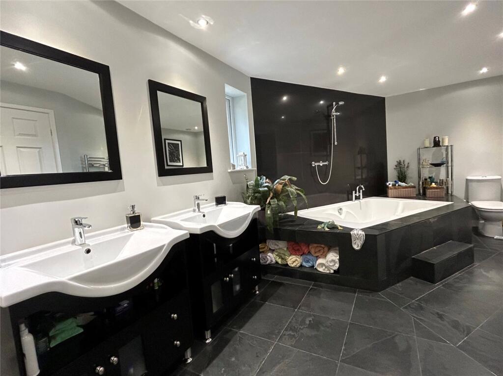
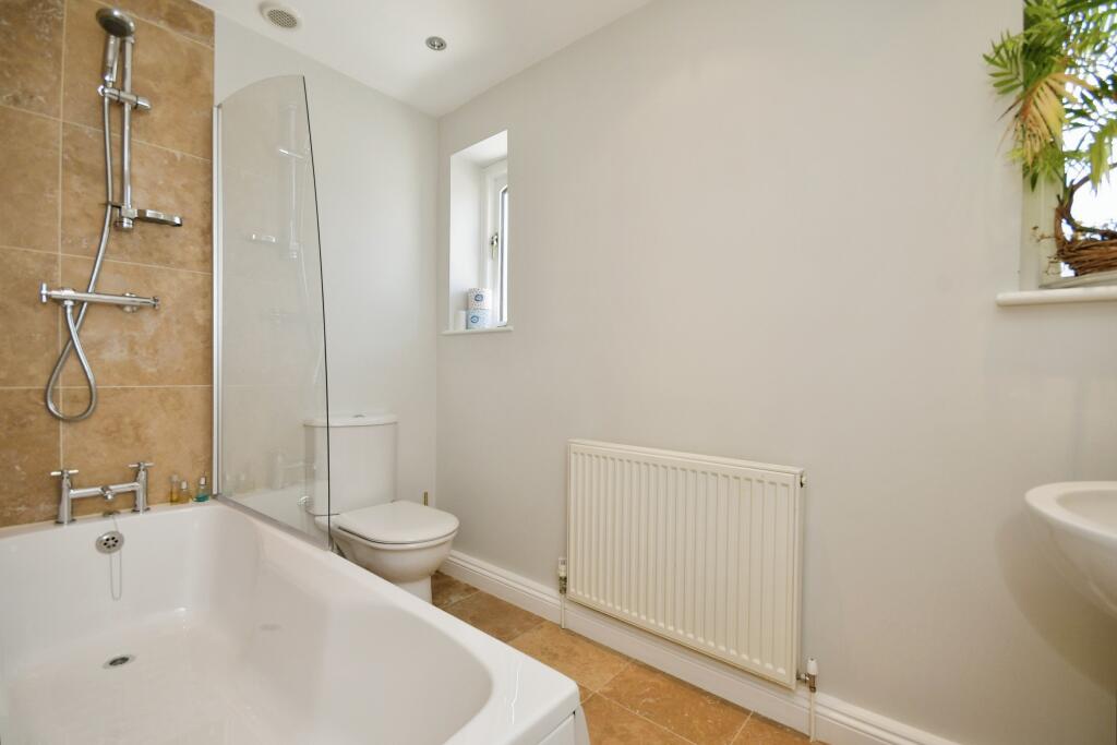
Description
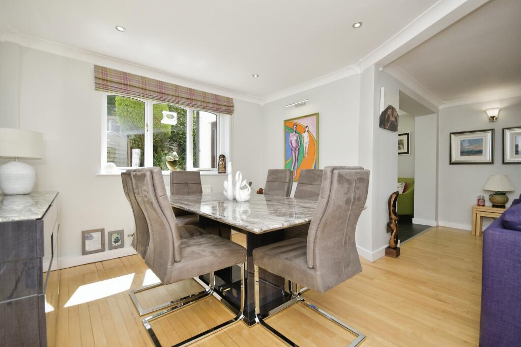
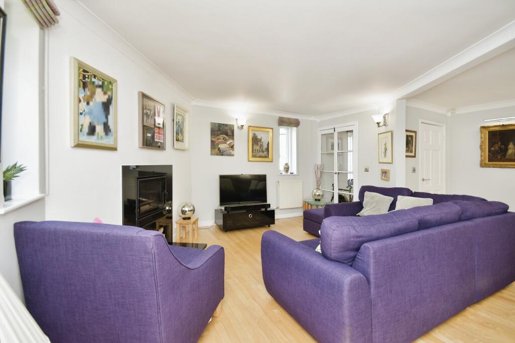
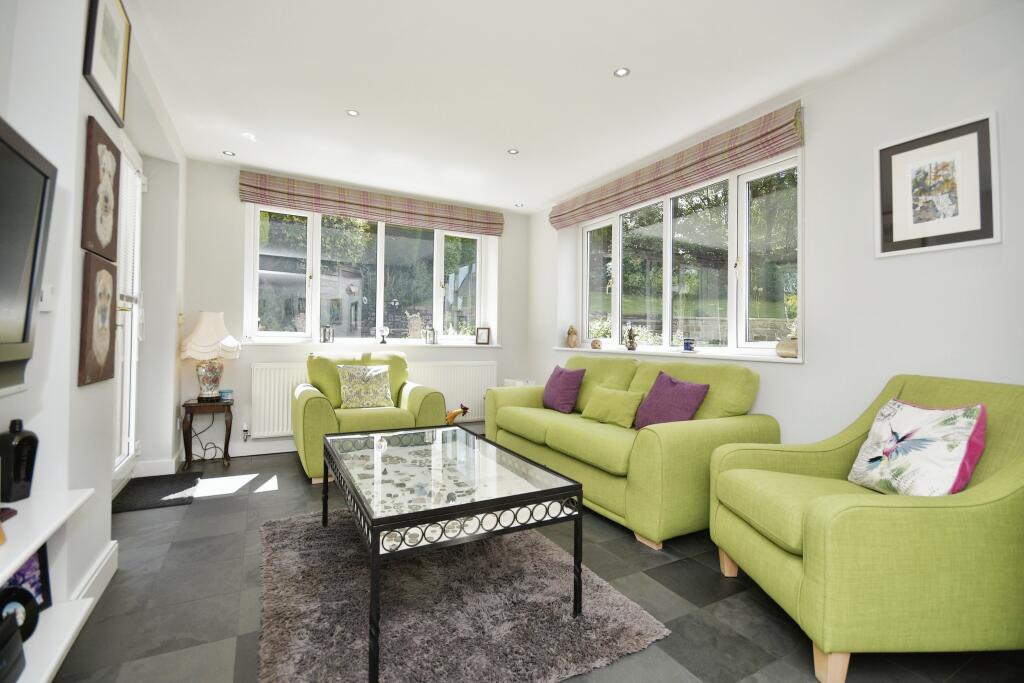
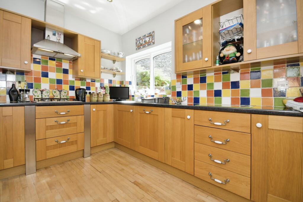
Step inside the spacious hallway and discover a well-appointed kitchen with a range of fitted appliances. The open plan lounge/dining room leads through to a sitting room, offering captivating views of the rear garden.
Benefitting from gas central heating and double glazing, this home ensures year-round warmth and comfort. Additionally, a garage/utility can be accessed from the house, providing practicality and convenience.
Outside, you'll find driveway parking and mature gardens, creating a peaceful and picturesque setting.
Conveniently located just a 20-minute walk from the town centre, as well as being a short drive away, this property offers both tranquillity and accessibility. It is also ideally situated for High Peak Golf Club, perfect for golf enthusiasts.
Viewing is highly recommended to fully appreciate the remarkable qualities and lifestyle this four-bedroom detached property offers.
Listed by
Buxton
Countrywide UK Sales - Connells
Reference: 160590785
EPC Rating & Upgrade Cost
Fetching EPC data… Refresh this page in a moment.
Flood risk
Zone: 1
Risk: Low
Job (default Low)
Floorplans
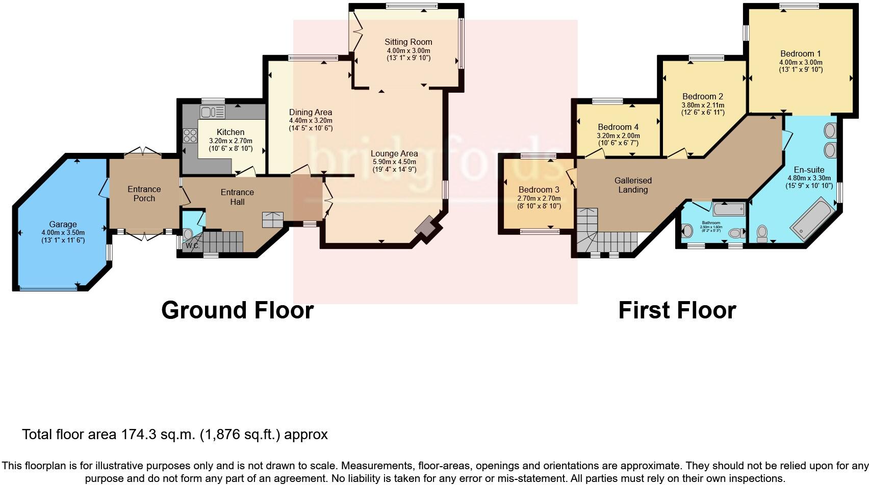
FLOOR-PLAN
EPC Graphs
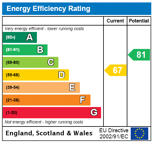
EPC Rating Graph
Price history
| Event | Date | Price | % change |
|---|---|---|---|
| Listed for sale | — | £500,000 | +203% |
| Sold | 19/10/2001 (24 years ago) | £165,000 | — |
Source: HM Land Registry Price Paid Data. Crown copyright.
Sold Comparables
Same street and nearby sales within 0.25 miles (last 5 years). Data from Land Registry Price Paid.
| Address | Price | Date | Type |
|---|---|---|---|
| THE OLD COACH HOUSE WATERSWALLOWS ROAD, FAIRFIELD, BUXTON, HIGH PEAK, DERBYSHIRE, SK17 7JJ | £183,000 | 30/03/2023 | Detached |
| LESSER LANE 1 WATERSWALLOWS ROAD, FAIRFIELD, BUXTON, HIGH PEAK, DERBYSHIRE, SK17 7JL | £310,000 | 27/07/2022 | Detached |
| DAKIN COTTAGE WATERSWALLOWS ROAD, FAIRFIELD, BUXTON, HIGH PEAK, DERBYSHIRE, SK17 7JJ | £840,000 | 22/07/2022 | Detached |
| 33 THE FRONT, BUXTON, HIGH PEAK, DERBYSHIRE, SK17 7EJ | £305,000 | 18/07/2022 | Detached |
| 2 PRINCES ROAD, BUXTON, HIGH PEAK, DERBYSHIRE, SK17 7LB | £225,000 | 25/06/2021 | Detached |
Area average: £372,600 (5 sales)
Capital growth trend
Land Registry outcode average: last 12 months vs 5y and 10y ago (from sold prices).
House Price Index (HM Land Registry — official index, not sold-price averages): High Peak. Series: Detached. As of March 2026.
Rental Range
Estimated market rent for High Peak. Low = conservative, Realistic = average, Optimistic = best case.
Based on Local Authority from postcode lookup → High Peak.
LHA (30th percentile) floor for Peaks & Dales: £898/mo (Apr 2025 – Mar 2026)
Location
Address
25 Town End
Nearby
Nearest stations, universities and amenities (distance from property).
| Type | Name | Distance |
|---|---|---|
| Bus stop | Fairfield, Fairfield Road / opposite Church | 0.3 miles |
| Bus stop | Fairfield, Fairfield Road / adjacent Church | 0.3 miles |
| Shop | One Stop | 0.5 miles |
| Shop | Morrisons Daily | 0.5 miles |
| Train station | Buxton | 0.8 miles |
| University | University of Derby, Buxton | 1.0 miles |
| Hospital | Cavendish Hospital | 1.1 miles |
| Train station | Buxton Miniature Railway | 1.2 miles |
| Hospital | Buxton Health Centre | 1.2 miles |
| University | Cliff College | 11.0 miles |
Street-level crime
| Category | Count |
|---|---|
| Violence and sexual offences | 41 |
| Anti-social behaviour | 13 |
| Shoplifting | 8 |
| Public order | 7 |
| Drugs | 6 |
| Other theft | 6 |
| Criminal damage and arson | 4 |
| Burglary | 3 |
| Other crime | 3 |
| Vehicle crime | 1 |
| Total incidents | 92 |
Within 1 mile during Apr 2026. Source: data.police.uk (England & Wales).
Schools nearby
Nearest open schools with Ofsted ratings (England). Closed schools are not shown. Data from Get Information about Schools and Ofsted.
| Name | Type | Distance | Ofsted |
|---|---|---|---|
| Fairfield Endowed CofE (C) Junior School | Primary | 0.3 miles | Good — 16 Jun 2019 |
| Fairfield Infant and Nursery School | Primary | 0.4 miles | Good — 14 Nov 2018 |
| St Anne's Catholic Voluntary Academy | Primary | 0.8 miles | Good — 7 Feb 2023 |
| St Thomas More Catholic Voluntary Academy | Secondary | 0.8 miles | Requires improvement — 9 Feb 2023 |
| Buxton Infant School | Primary | 0.9 miles | Good — 30 Jan 2024 |
Rental Comparables
Loading rental comparables for this postcode. Refresh in a few minutes.
Rent-driven metrics
Based on Area rent estimate.
- Rent ratio — Monthly rent ÷ purchase price (1% rule). 1%+ = strong, 0.8–1% = okay, <0.8% = weak for cashflow.
- Max investor price — Rent ÷ 0.8%; the price at which rent would be 0.8% of price (Stoke-style target).
- Target investor price — Rent ÷ 1%; the price at which rent would be 1% of price (strong cashflow band).
- Gross yield — Annual rent as % of purchase price (no costs).