Turner Street
Stoke-on-Trent, ST1 6LT
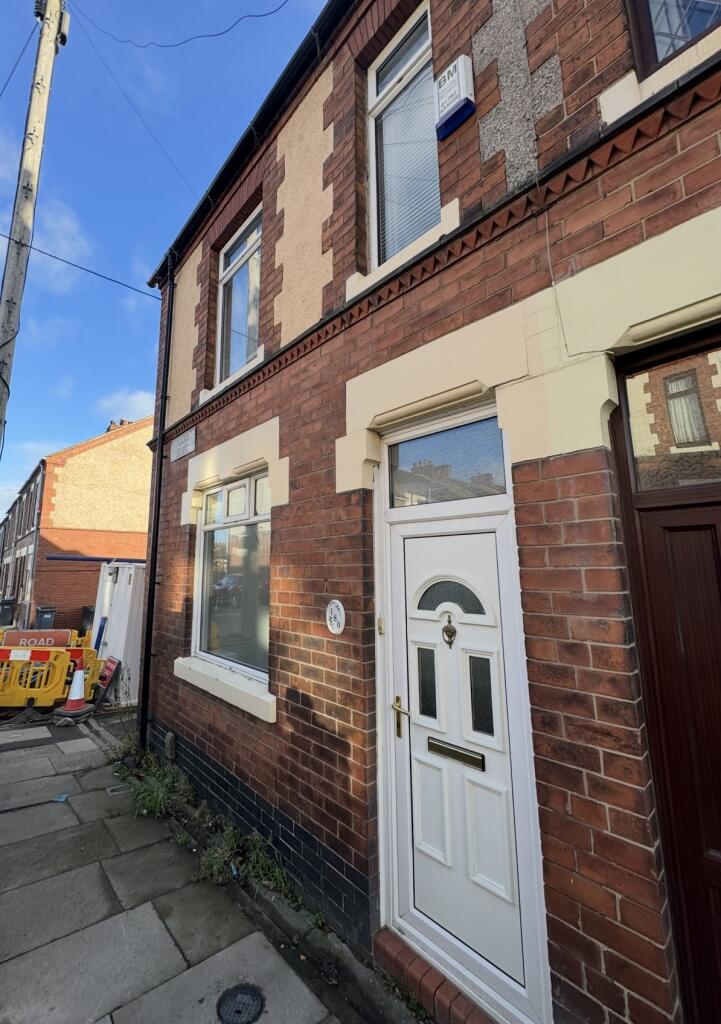
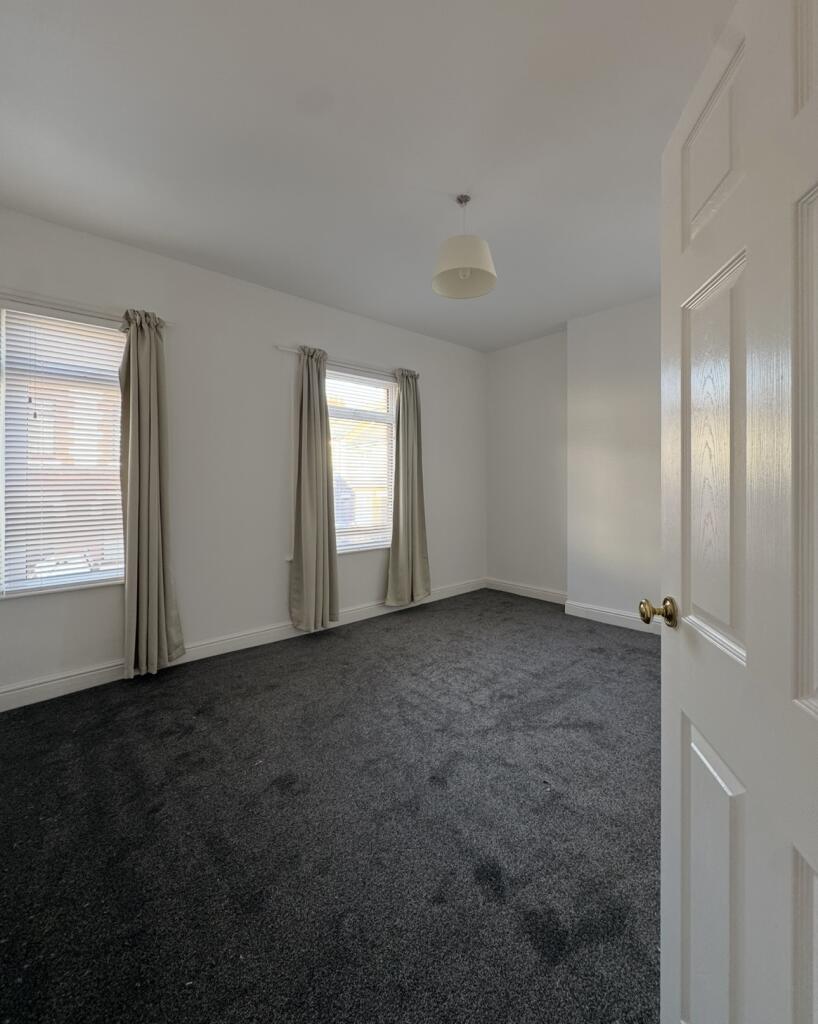
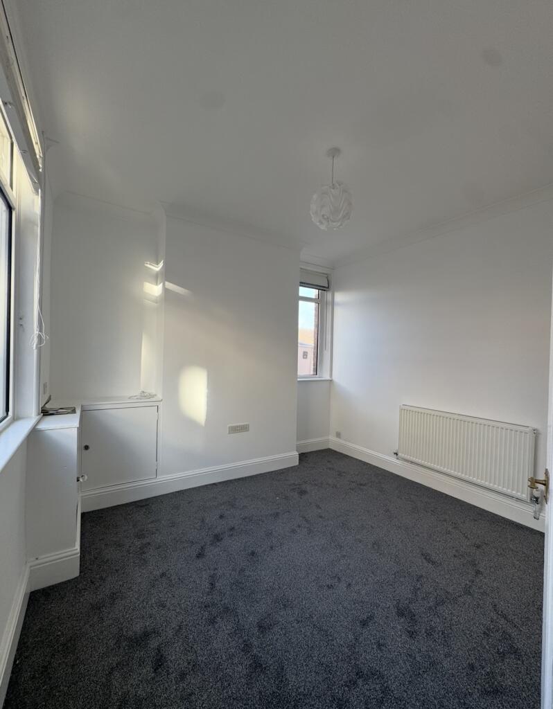
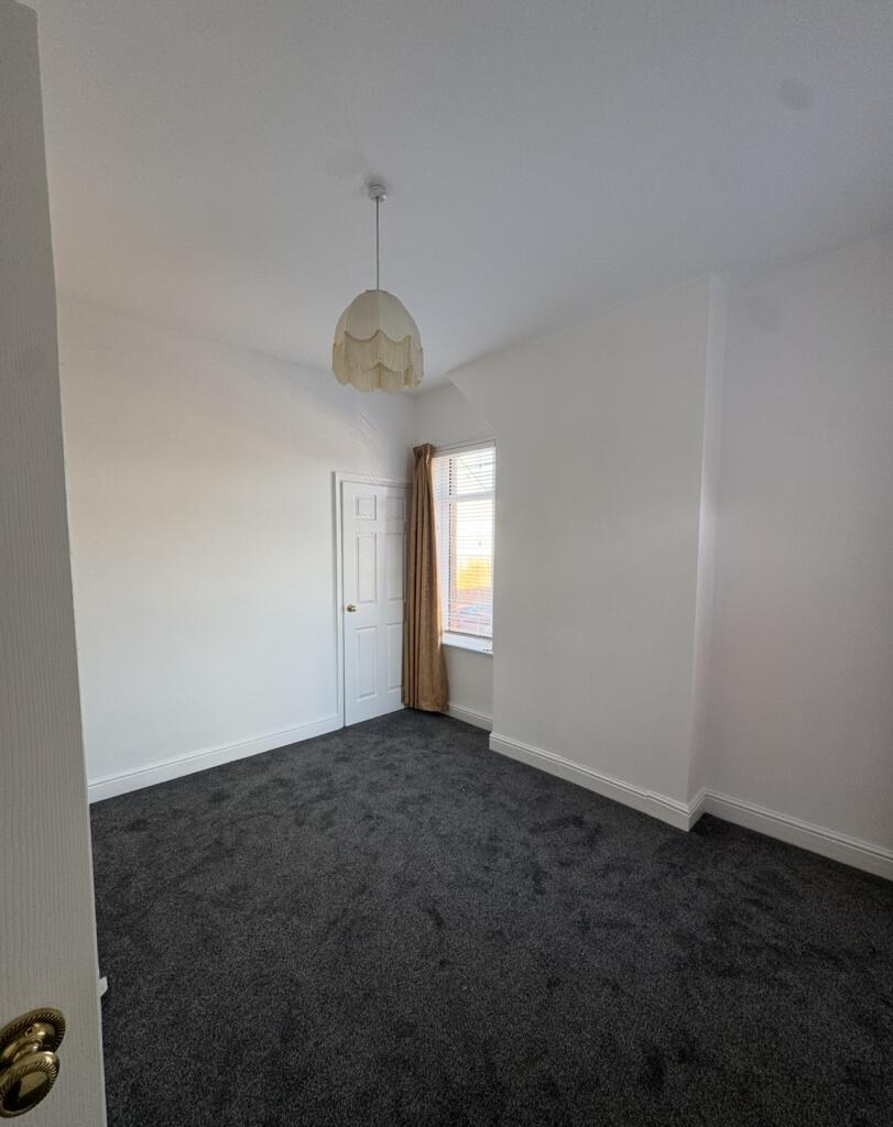
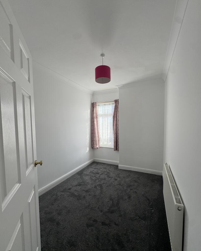
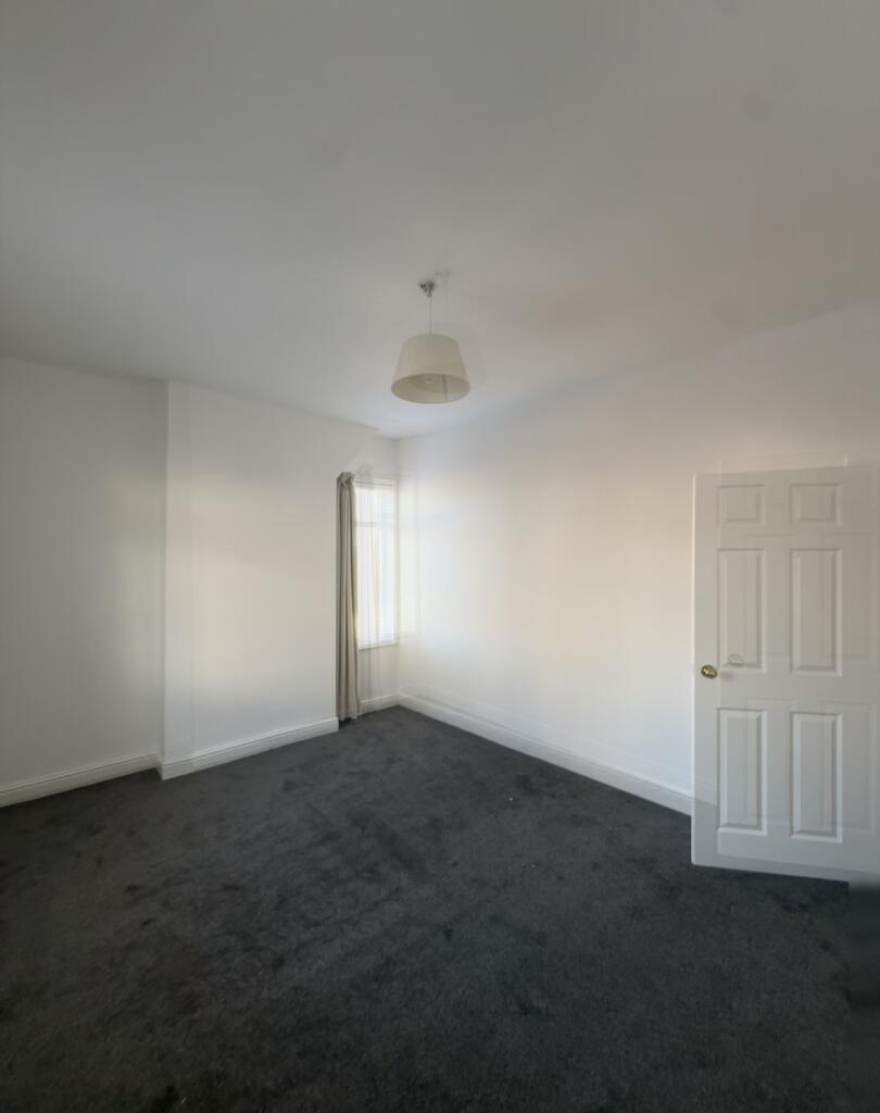
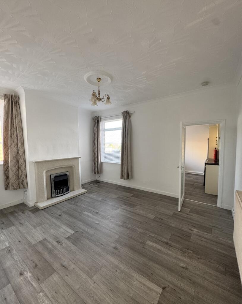
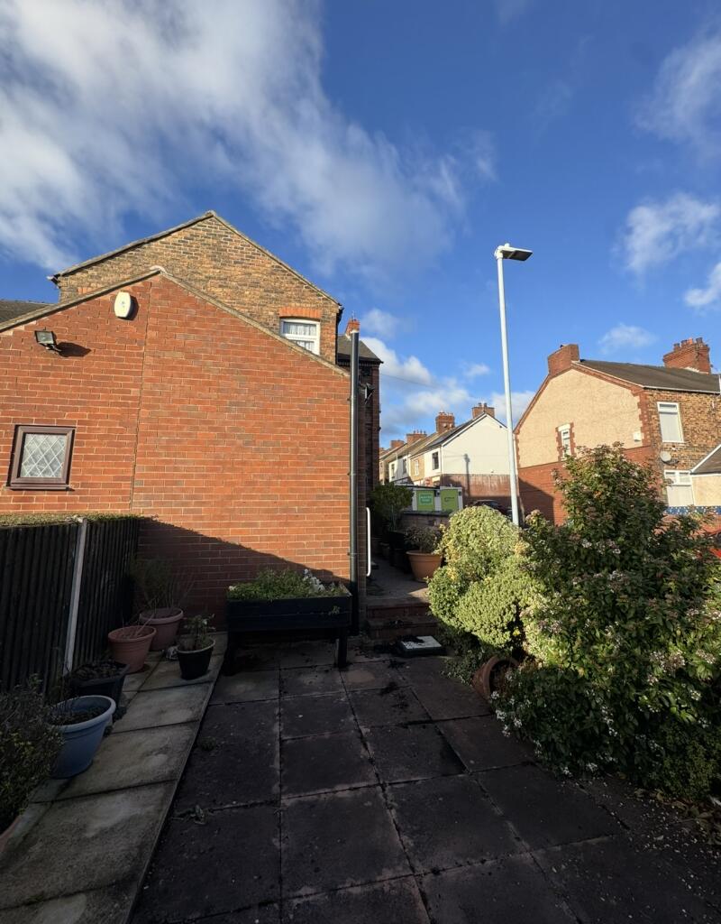
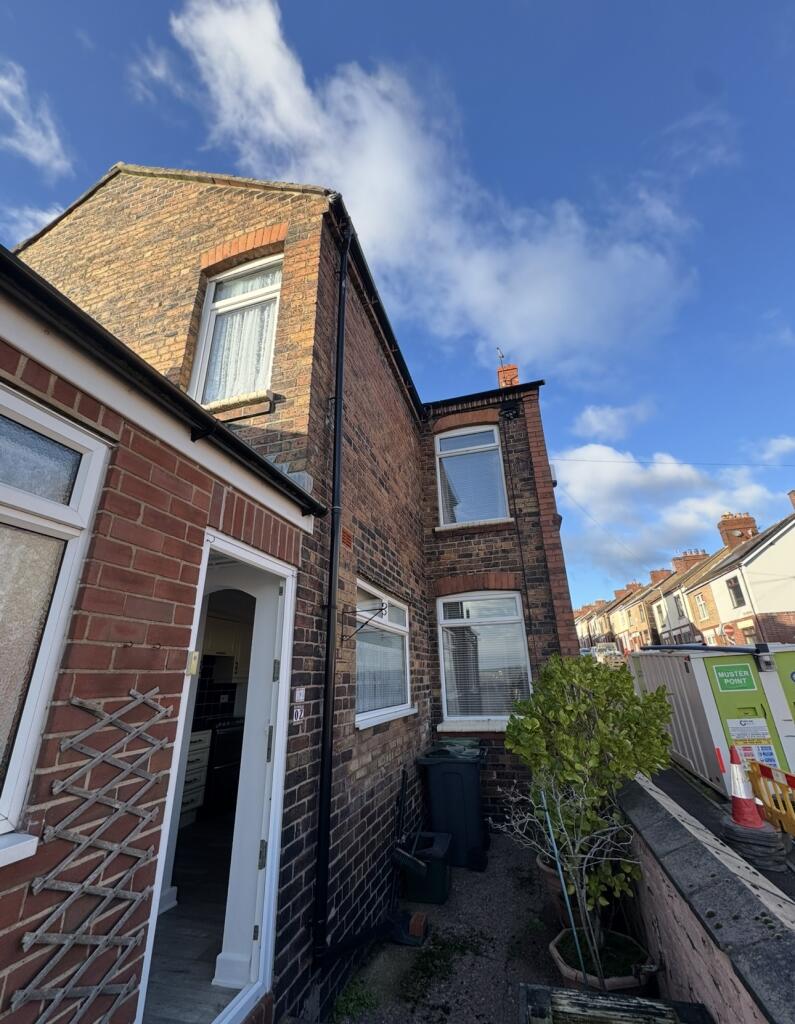
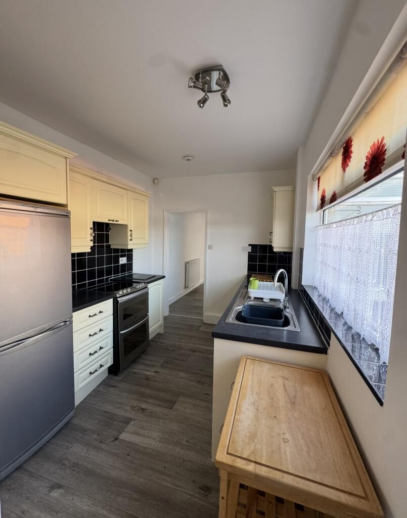
Photo 1 Photo 2 Photo 3 Photo 4 Photo 5 Photo 6 Photo 7 Photo 8 Photo 9 Photo 10 Photo 11
/ 11
Property details
Deprivation
Decile 3 (7,848 of 33,755)
Street crime
433 incidents within 1 mile (Apr 2026)
Key features
- City centre location
- Close Transport links
- newly refurbished
Additional details
- Garden
- Yes
Description
Kitchen / Dining: Open archway from the kitchen to a dining area; the kitchen is generous in size and leads to the rear of the house.
Garden: Large and low-maintenance rear garden — a paved patio provides a great outdoor space without too much upkeep
Parking: On-street parking available
EPC Rating D
Council Tax Band D
Minimum term of 12 Months
Deposit equal to 5 weeks rent
for Interest please call or text the property manager on
Listed by
covering National
Accommodation Lettings limited
Reference: 169632842
EPC ratings on this postcode
We don't have a matched EPC for this property yet. Below are efficiency scores and details for other addresses on this postcode.
| Address | Current | Potential | Floor area | Age band | Type |
|---|---|---|---|---|---|
| 132 Turner Street, STOKE-ON-TRENT | 53 | 75 | 134 m² | England and Wales: 1900-1929 | Terraced |
| 132 Turner Street, STOKE-ON-TRENT | 50 | 70 | 137 m² | England and Wales: 1900-1929 | Terraced |
| 134, Turner Street, STOKE-ON-TRENT | 66 | 88 | 65 m² | England and Wales: 1900-1929 | Terraced |
| 134, Turner Street, STOKE-ON-TRENT | 1 | 82 | 71 m² | England and Wales: 1900-1929 | Terraced |
| 136, Turner Street, STOKE-ON-TRENT | 63 | 79 | 71 m² | England and Wales: 1900-1929 | Terraced |
| 140 Turner Street, STOKE-ON-TRENT | 57 | 75 | 70 m² | England and Wales: 1900-1929 | Terraced |
| 142 TURNER STREET, STOKE-ON-TRENT | 63 | 86 | 72 m² | England and Wales: 1930-1949 | Terraced |
| 144, Turner Street, STOKE-ON-TRENT | 64 | 85 | 93 m² | England and Wales: 1900-1929 | Terraced |
| 146, Turner Street, STOKE-ON-TRENT | 49 | 83 | 97 m² | England and Wales: 1900-1929 | Terraced |
| 148, Turner Street, STOKE-ON-TRENT | 40 | 81 | 63 m² | England and Wales: before 1900 | Terraced |
| 150, Turner Street, STOKE-ON-TRENT | 59 | 90 | 65 m² | England and Wales: 1900-1929 | Terraced |
| 154 TURNER STREET, STOKE-ON-TRENT | 67 | 87 | 66 m² | England and Wales: 1900-1929 | Terraced |
| 154, Turner Street, STOKE-ON-TRENT | 63 | 91 | 65 m² | England and Wales: 1900-1929 | Terraced |
| 158 Turner Street, STOKE-ON-TRENT | 65 | 89 | 70 m² | England and Wales: 1900-1929 | Terraced |
| 162, Turner Street, STOKE-ON-TRENT | 62 | 86 | 69 m² | England and Wales: 1900-1929 | Terraced |
Flood risk
Zone: 1
Risk: Low
Job (default Low)
Rental Range
Estimated market rent for Stoke-on-Trent. Low = conservative, Realistic = average, Optimistic = best case.
Based on Local Authority from postcode lookup → Stoke-on-Trent.
LHA (30th percentile) floor for Staffordshire North: £593/mo (Apr 2025 – Mar 2026)
Location
Address
Bradford Terrace
Nearby
Nearest stations, universities and amenities (distance from property).
| Type | Name | Distance |
|---|---|---|
| Bus stop | Bradford Terrace | 0.2 miles |
| Bus stop | Donald Road | 0.2 miles |
| Shop | Exodos | 0.7 miles |
| Shop | Blinkin-ink! | 0.7 miles |
| Hospital | Haywood Hospital Walk-in Centre | 1.9 miles |
| Train station | Stoke-on-Trent | 2.0 miles |
| Train station | Longport | 2.3 miles |
| Hospital | Royal Stoke University Hospital | 3.0 miles |
| University | Keele University | 5.1 miles |
| University | Buxton & Leek College | 7.7 miles |
Street-level crime
| Category | Count |
|---|---|
| Violence and sexual offences | 130 |
| Anti-social behaviour | 90 |
| Public order | 39 |
| Criminal damage and arson | 38 |
| Shoplifting | 34 |
| Vehicle crime | 20 |
| Burglary | 19 |
| Other theft | 19 |
| Drugs | 11 |
| Robbery | 11 |
| Possession of weapons | 9 |
| Bicycle theft | 7 |
| Other crime | 4 |
| Theft from the person | 2 |
| Total incidents | 433 |
Within 1 mile during Apr 2026. Source: data.police.uk (England & Wales).
Schools nearby
Nearest open schools with Ofsted ratings (England). Closed schools are not shown. Data from Get Information about Schools and Ofsted.
| Name | Type | Distance | Ofsted |
|---|---|---|---|
| St George and St Martin's Catholic Academy | Primary | 0.2 miles | Good — 29 May 2015 |
| Grove Academy | Primary | 0.3 miles | Good — 15 Jul 2024 |
| Hamilton Academy | Primary | 0.3 miles | Good — 23 Oct 2014 |
| Northwood Broom Academy | Primary | 0.3 miles | Good — 4 Mar 2013 |
| Holden Lane Academy | Primary | 0.6 miles | Good — 23 May 2013 |
Rental Comparables
Residential lets from OpenRent and Rightmove for the area (same bedroom count). Use to validate rent estimates. Student lets are excluded.
| Title | Rent | Beds | Distance | As seen on |
|---|---|---|---|---|
| Festing Street, Stoke-on-Trent, Staffordshire, ST1 | £775/mo | 3 | 0.48 miles | Rightmove |
| Homer Street, Stoke-on-Trent, Staffordshire, ST1 | £700/mo | 3 | 0.64 miles | Rightmove |
| Tintern Street, Hanley, ST1 | £800/mo | 3 | 0.68 miles | Rightmove |
| The Webberley, Stoke-On-Trent, ST1 | £520/mo | — | 0.8 miles | Rightmove |
| The Webberley, Stoke-On-Trent, ST1 | £640/mo | — | 0.8 miles | Rightmove |
| Leek New Road, Stoke-on-trent | £1,100/mo | 3 | 0.8 miles | Rightmove |
| Moxons Island, 48 Stafford Street, Stoke-on-Trent, Staffordshire, ST1 | £525/mo | — | 0.81 miles | Rightmove |
| Trinity Point, Stoke-On-Trent, ST1 | £620/mo | — | 0.83 miles | Rightmove |
| Rosedawn Close East, STOKE-ON-TRENT | £2,250/mo | — | 0.88 miles | Rightmove |
| Denbigh Street, Hanley | £875/mo | 3 | 1.02 miles | Rightmove |
| Clayworks, Hanley | £825/mo | — | 1.09 miles | Rightmove |
| Clayworks, Hanley | £825/mo | — | 1.09 miles | Rightmove |
| Clayworks, Hanley | £895/mo | — | 1.09 miles | Rightmove |
| Clayworks, Hanley | £875/mo | — | 1.09 miles | Rightmove |
| Clayworks, Hanley | £875/mo | — | 1.09 miles | Rightmove |
| Clayworks, Hanley | £875/mo | — | 1.09 miles | Rightmove |
| Victoria Road, Stoke-On-Trent | £620/mo | — | 1.35 miles | Rightmove |
Average rent: £859/mo (17 listings)
Enter House Number
Enter the house number to help us retrieve more accurate pricing history and property data.
Please log in to submit or correct the house number for this listing.
Log in to continue