Flat 9
WINFORD COURT, FOREST WAY, SANDOWN, WINFORD, ISLE OF WIGHT PO36 0JJ
£475 pcm
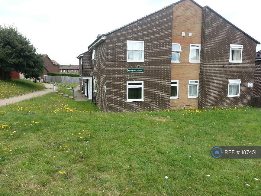
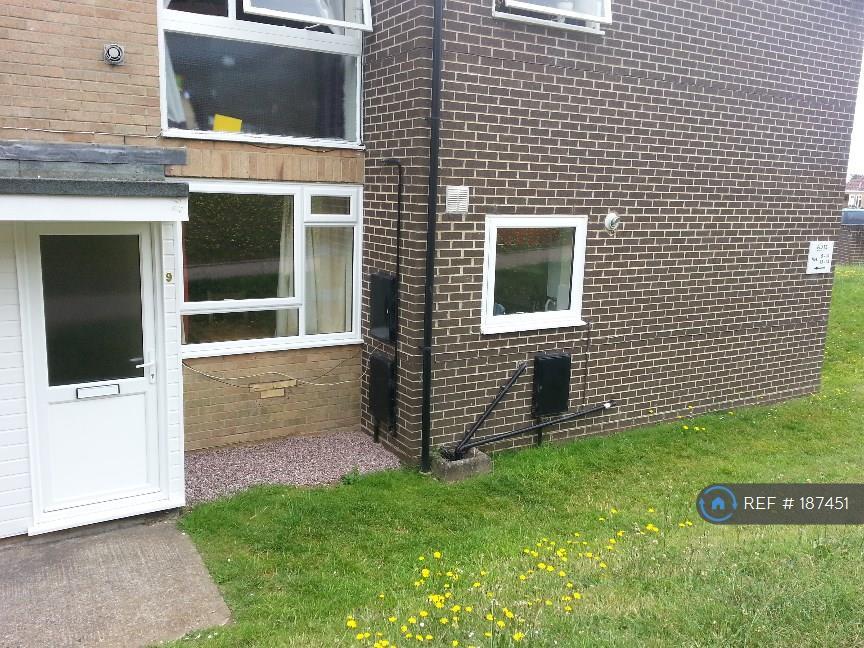
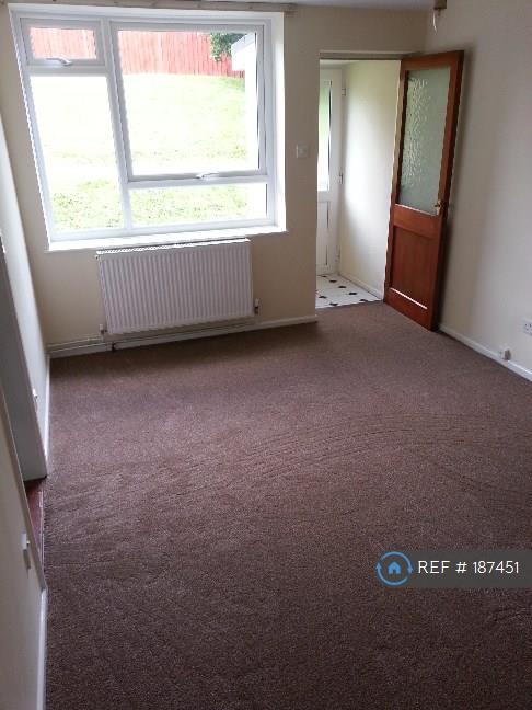
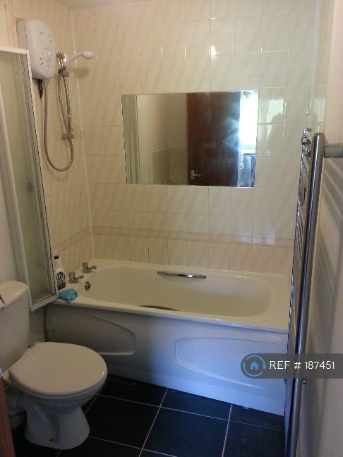
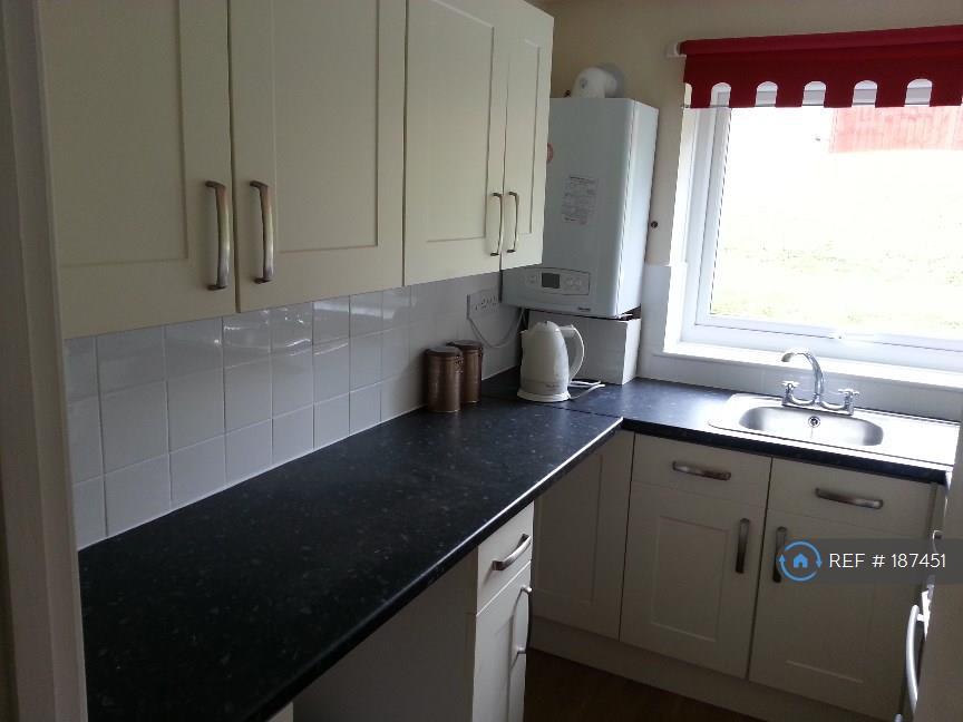
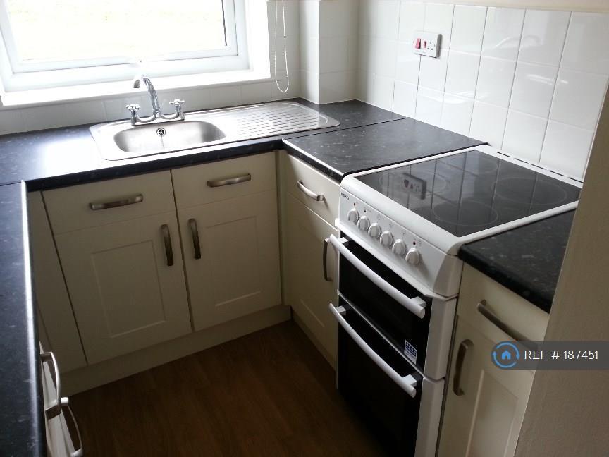
Photo 1 Photo 2 Photo 3 Photo 4 Photo 5 Photo 6
/ 6
Property details
Floor area
44 m²
Year built
England and Wales: 1976-1982
Deprivation
Decile 5 (13,795 of 33,755)
Street crime
8 incidents within 1 mile (Apr 2026)
Key features
- No Agent Fees
- Students Can Enquire
- Property Reference Number: 187451
Additional details
- Parking
- Yes
Description
This flat is situated in a lovely rural location, it benefits from it's own entrance and off road parking space.
The flat has 2 bedrooms, a living/dining room, a modern fitted kitchen, bathroom with shower over the bath, newly fitted boiler & double glazing.
Summary & Exclusions:
- Rent Amount: £475.00 per month (£109.62 per week)
- Deposit / Bond: £475.00
- 2 Bedrooms
- 1 Bathrooms
- Property comes unfurnished
- Available to move in from 23 December, 2016
- Minimum tenancy term is 6 months
- Maximum number of tenants is 4
- DSS enquiries welcome
- Students welcome to enquire
- No Pets, sorry
- Smokers considered
- Family Friendly
- Bills not included
- Property has parking
- No Garden Access
If calling, please quote reference: 187451
Fees:
You will not be charged any admin fees.
Referencing for tenants only costs £20 each, if requested by the landlord for this property.
Contact today to book a viewing and have the landlord show you round!
Request Details form responded to 24/7, with phone bookings available 9am-9pm, 7 days a week.
Listed by
London
Techbeard Ltd
Reference: 57089914
EPC ratings on this postcode
We don't have a matched EPC for this property yet. Below are efficiency scores and details for other addresses on this postcode.
| Address | Current | Potential | Floor area | Age band | Type |
|---|---|---|---|---|---|
| Flat 1 Winford Court, Forest Way, Winford, SANDOWN | 59 | 80 | 38 m² | England and Wales: 1976-1982 | Flat |
| Flat 10, Winford Court, Forest Way, SANDOWN | 72 | 77 | 39 m² | England and Wales: 1967-1975 | Flat |
| Flat 11 Winford Court, Forest Way, Winford, SANDOWN | 74 | 78 | 42 m² | England and Wales: 1983-1990 | Flat |
| Flat 11, Winford Court, Forest Way, SANDOWN | 70 | 77 | 44 m² | England and Wales: 1976-1982 | Flat |
| FLAT 12, WINFORD COURT, FOREST WAY, SANDOWN | 75 | 76 | 39 m² | England and Wales: 1983-1990 | Flat |
| Flat 13 Winford Court, Forest Way, Winford, SANDOWN | 53 | 79 | 49 m² | England and Wales: 1976-1982 | Flat |
| Flat 16 Winford Court, Forest Way, Winford, SANDOWN | 60 | 78 | 49 m² | England and Wales: 1983-1990 | Flat |
| Flat 16 Winford Court, Forest Way, Winford, SANDOWN | 70 | 79 | 48 m² | England and Wales: 1983-1990 | Flat |
| Flat 2 Winford Court, Forest Way, Winford, SANDOWN | 75 | 78 | 45 m² | England and Wales: 1983-1990 | Flat |
| Flat 2, Winford Court, Forest Way, SANDOWN | 73 | 77 | 47 m² | England and Wales: 1967-1975 | Flat |
| Flat 3, Winford Court, Forest Way, SANDOWN | 73 | 78 | 43 m² | England and Wales: 1976-1982 | Flat |
| Flat 4 Winford Court, Forest Way, Winford, SANDOWN | 73 | 77 | 42 m² | England and Wales: 1976-1982 | Flat |
| Flat 6 Winford Court, Forest Way, Winford, SANDOWN | 66 | 77 | 49 m² | England and Wales: 1983-1990 | Flat |
| FLAT 6, WINFORD COURT, FOREST WAY, NEWCHURCH | 60 | 78 | 45 m² | England and Wales: 1967-1975 | Flat |
| Flat 7 Winford Court, Forest Way, Winford, SANDOWN | 51 | 78 | 45 m² | England and Wales: 1976-1982 | Flat |
Flood risk
Zone: 1
Risk: Low
Job (default Low)
Rental Range
Estimated market rent for Isle of Wight. Low = conservative, Realistic = average, Optimistic = best case.
Based on Local Authority from postcode lookup → Isle of Wight.
Location
Address
Forest Way
Nearby
Nearest stations, universities and amenities (distance from property).
| Type | Name | Distance |
|---|---|---|
| Bus stop | Forest Road East | 0.1 miles |
| Bus stop | Winford, Parkway | 0.1 miles |
| Shop | William Hall Independent Funeral Directors | 0.3 miles |
| Shop | Isle of Wight Cheese Co | 0.4 miles |
| Train station | Shanklin | 1.7 miles |
| Train station | Lake | 1.7 miles |
| Hospital | Earl Mountbatten Hospice | 5.1 miles |
| Hospital | Orchard Private Hospital | 5.4 miles |
| University | University of Portsmouth Area | 10.9 miles |
| University | 36-40 Middle Street | 10.9 miles |
Street-level crime
| Category | Count |
|---|---|
| Violence and sexual offences | 7 |
| Criminal damage and arson | 1 |
| Total incidents | 8 |
Within 1 mile during Apr 2026. Source: data.police.uk (England & Wales).
Schools nearby
Nearest open schools with Ofsted ratings (England). Closed schools are not shown. Data from Get Information about Schools and Ofsted.
| Name | Type | Distance | Ofsted |
|---|---|---|---|
| Newchurch Primary School | Primary | 0.9 miles | Good — 8 Sep 2024 |
| Broadlea Primary School | Primary | 1.3 miles | Good — 15 Nov 2021 |
| Gatten and Lake Primary School | Primary | 1.6 miles | Good — 12 Jan 2023 |
| St Blasius Shanklin CofE Primary Academy | Primary | 1.8 miles | Good — 20 Jul 2017 |
| The Bay Church of England School | Other | 1.9 miles | Good — 26 Apr 2023 |
Rental Comparables
Rental listings exist nearby, but none matched the 2-bedroom count for this property.
Enter House Number
Enter the house number to help us retrieve more accurate pricing history and property data.
Please log in to submit or correct the house number for this listing.
Log in to continue