Hatton Mill Farm
Lower Hatton, Cranberry, ST21 6SH
£1,795 pcm
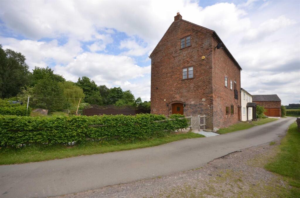
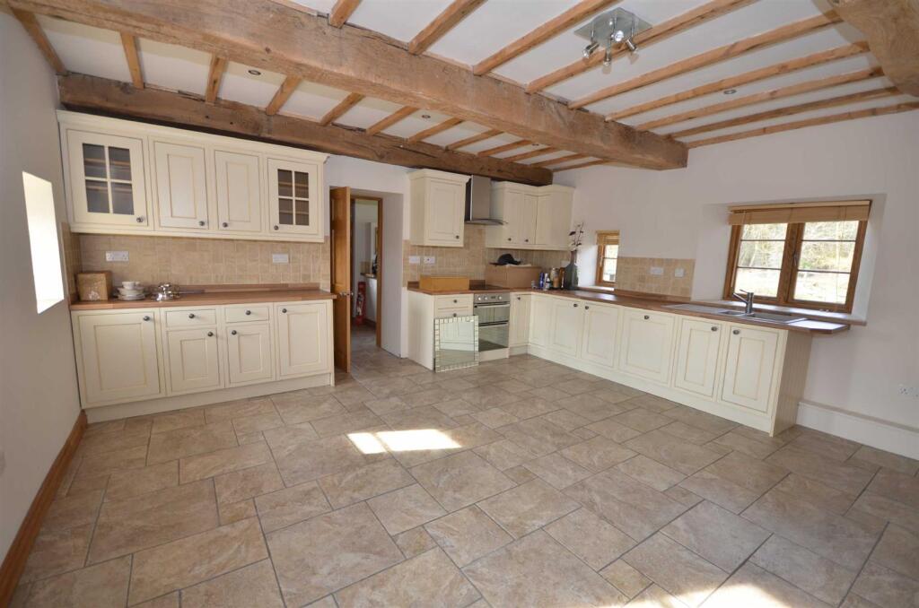
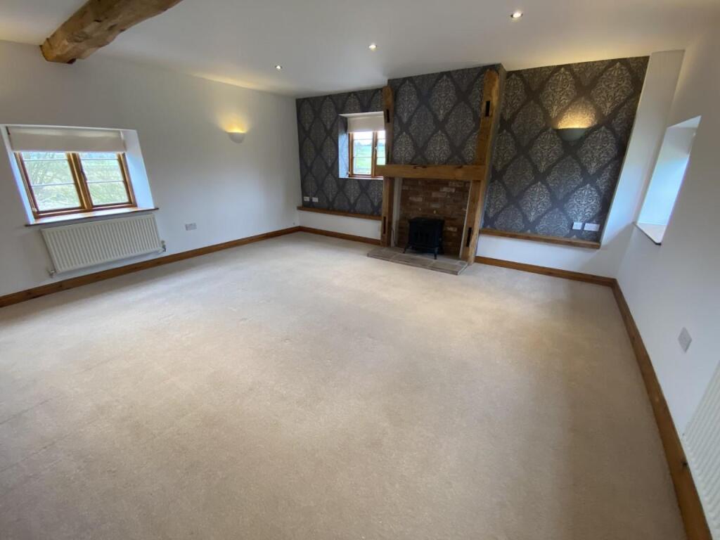
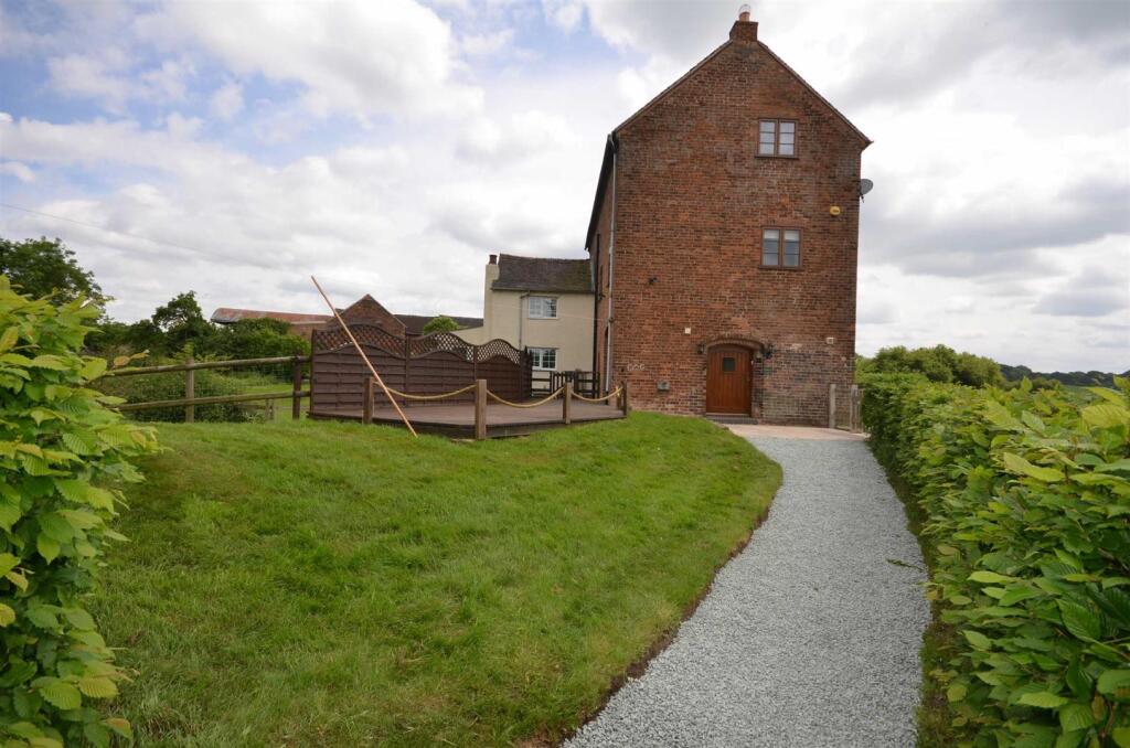
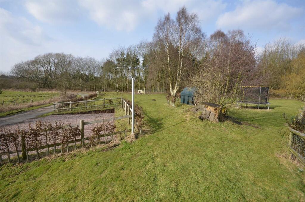
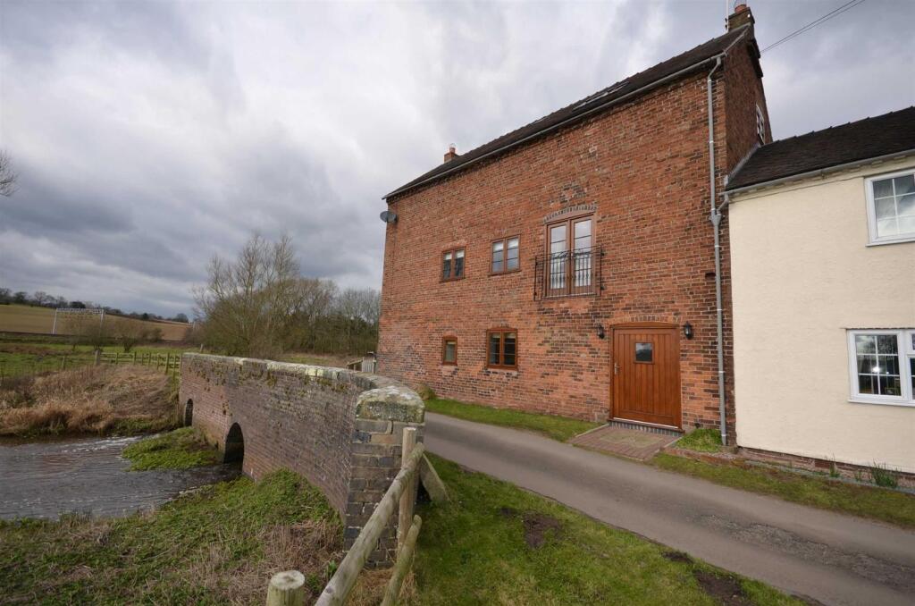
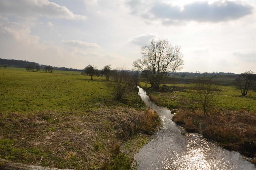
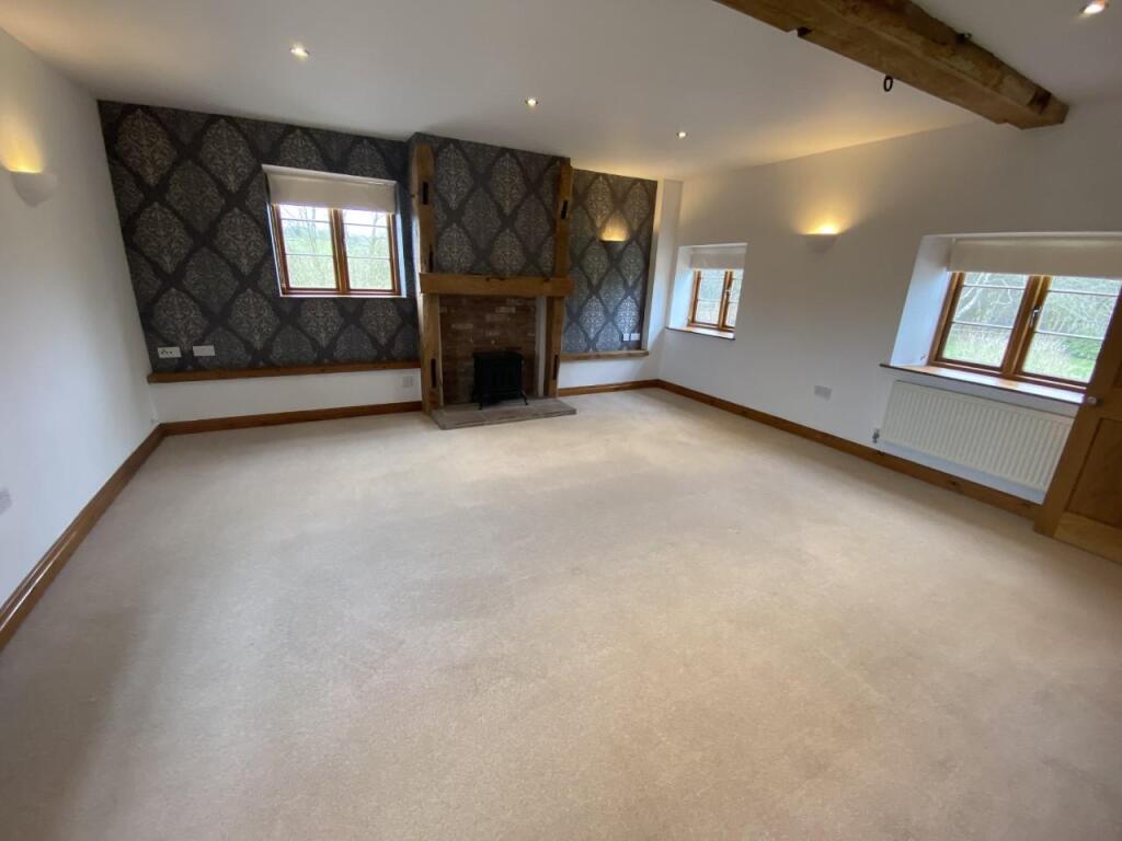
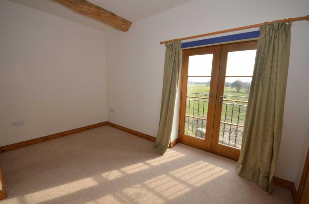
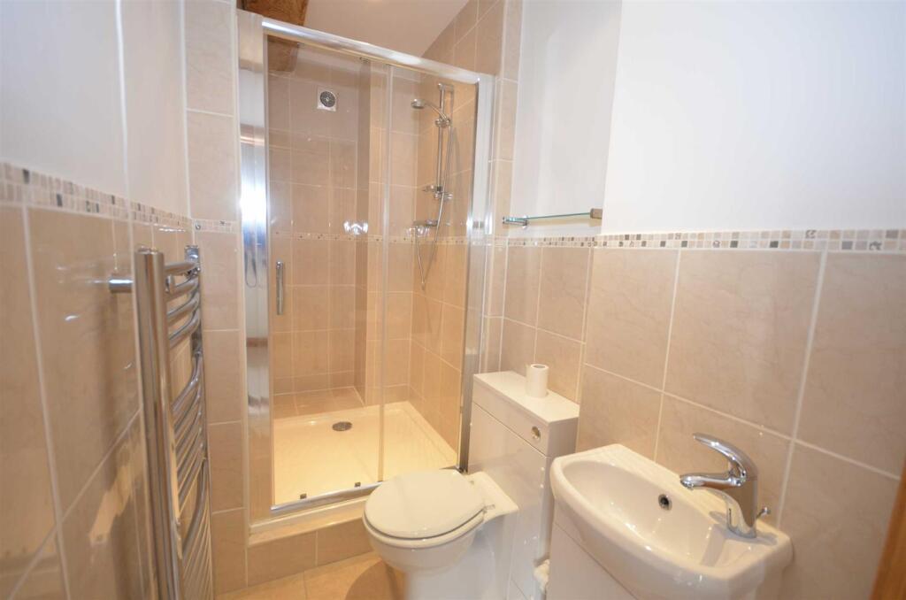
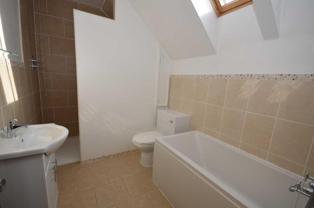
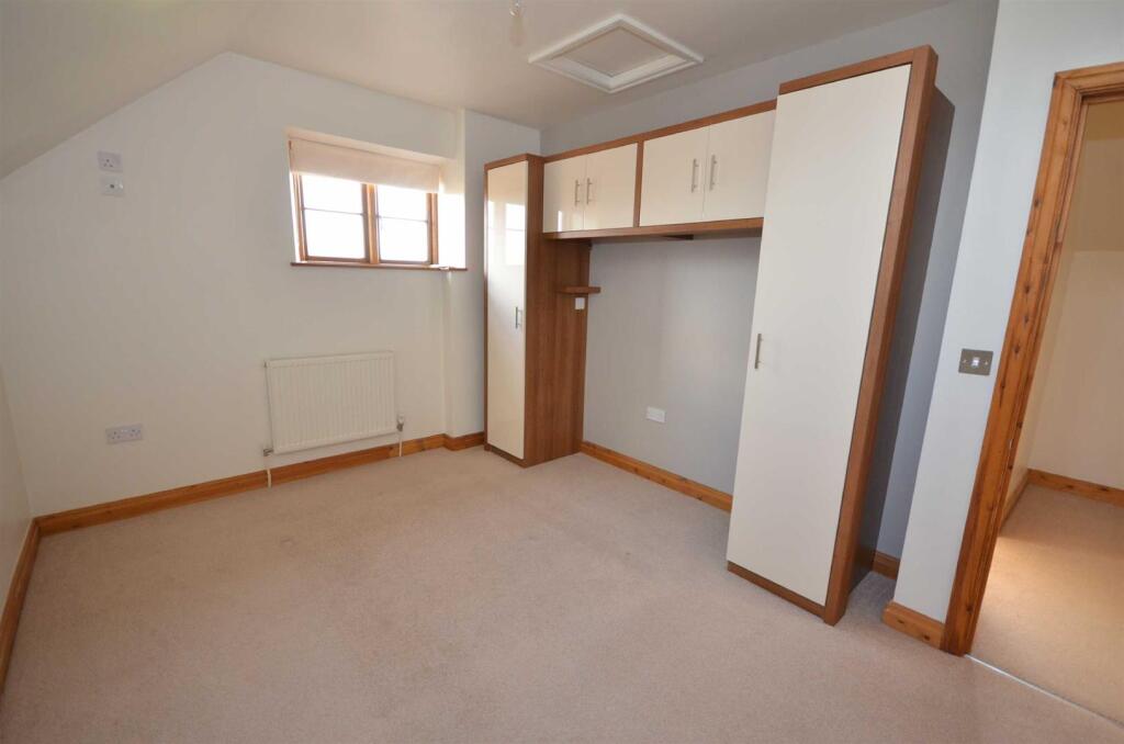
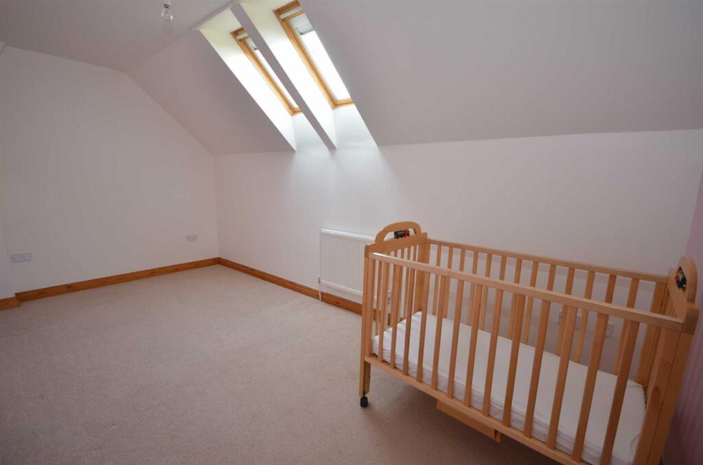
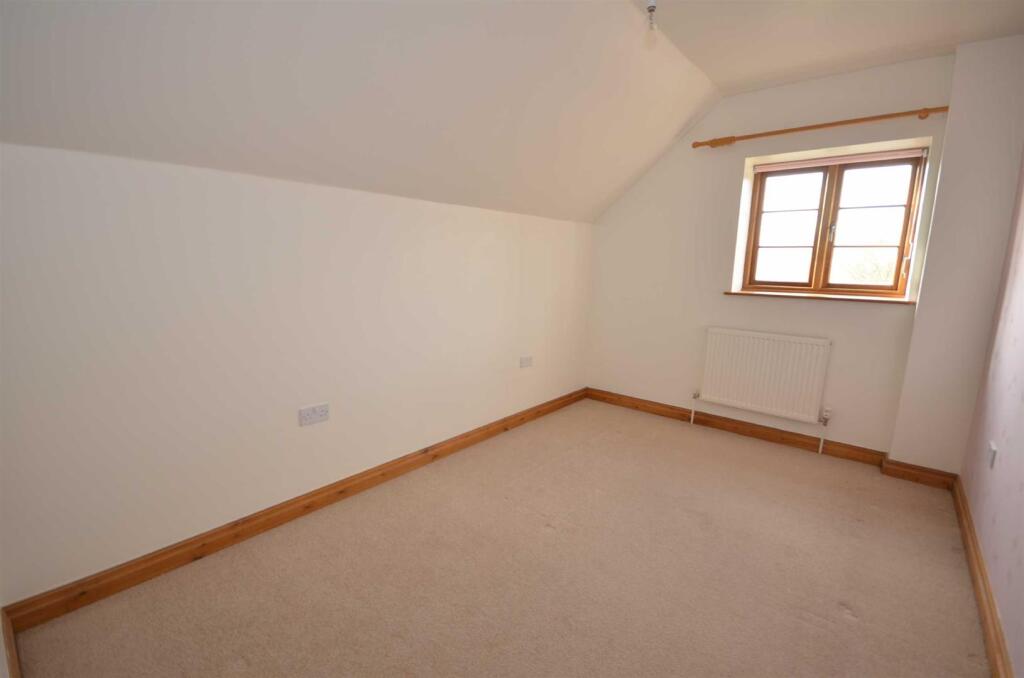
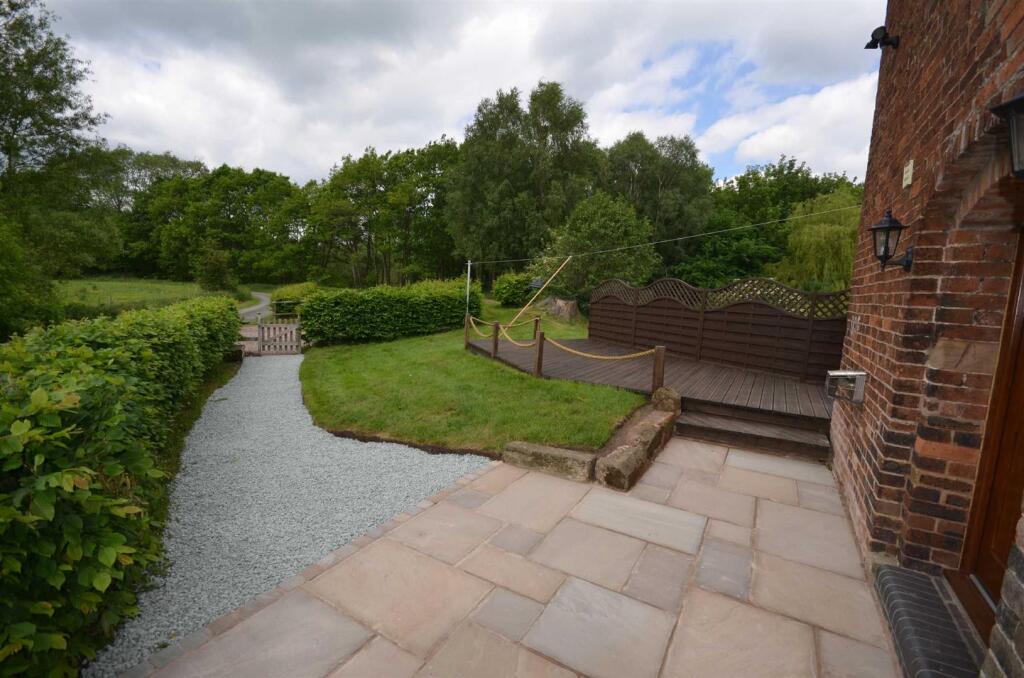
Photo 1 Photo 2 Photo 3 Photo 4 Photo 5 Photo 6 Photo 7 Photo 8 Photo 9 Photo 10 Photo 11 Photo 12 Photo 13 Photo 14 Photo 15
/ 15
Property details
Council tax band
A
Deprivation
Decile 7 (21,872 of 33,755)
Street crime
1 incident within 1 mile (Apr 2026)
Additional details
- Parking
- Yes
- Garden
- Yes
Description
Listed by
Stone
Tinsley-Garner Independent Estate Agents
Reference: 171581294
EPC ratings on this postcode
We don't have a matched EPC for this property yet. Below are efficiency scores and details for other addresses on this postcode.
| Address | Current | Potential | Floor area | Age band | Type |
|---|---|---|---|---|---|
| 1 Hatton Waterworks Cottages, Hatton, Cotes Heath, STAFFORD | 50 | 81 | 70 m² | England and Wales: 1900-1929 | Detached |
| 3 Hatton Waterworks Cottages, Hatton, Cotes Heath, STAFFORD | 64 | 81 | 76 m² | England and Wales: 1900-1929 | Detached |
| 4 Hatton Waterworks Cottages, Hatton, Cotes Heath, STAFFORD | 54 | 74 | 66 m² | England and Wales: 1900-1929 | Detached |
| 6 Hatton Waterworks Cottages, Hatton, Cotes Heath, STAFFORD | 1 | 62 | 68 m² | England and Wales: before 1900 | Detached |
| 6 Hatton Waterworks Cottages, Hatton, STAFFORD | 43 | 79 | 82 m² | England and Wales: 1930-1949 | Detached |
| 8 Hatton Waterworks Cottages, Hatton, Cotes Heath, STAFFORD | 25 | 35 | 163 m² | England and Wales: 1900-1929 | Detached |
| Gorsey Lane Cottage, Hatton, Cotes Heath, STAFFORD | 48 | 74 | 144 m² | England and Wales: before 1900 | Detached |
| Gorsey Lane Cottage, Hatton, STAFFORD | 48 | 75 | 145 m² | England and Wales: before 1900 | Detached |
| Hatton Mill, Hatton, Cotes Heath, STAFFORD | 18 | 84 | 226 m² | England and Wales: before 1900 | Detached |
| Lodge Barn Cottage, Hatton, Cotes Heath, STAFFORD | 30 | 102 | 74 m² | England and Wales: before 1900 | Detached |
| LODGE BARN COTTAGE, STONE ROAD, COTES HEATH, STAFFORD | 49 | 76 | 73 m² | England and Wales: before 1900 | Detached |
| Lodge Barn, Hatton, Cotes Heath, STAFFORD | 42 | 76 | 163 m² | England and Wales: 1996-2002 | Detached |
| Lower Hatton Farm, Hatton, Cotes Heath, STAFFORD | 41 | 74 | 219 m² | England and Wales: before 1900 | Detached |
| Lower Hatton Farm, Hatton, Cotes Heath, STAFFORD | 31 | 81 | 225 m² | England and Wales: before 1900 | Detached |
| The Mill, Hatton Mill Farm, Hatton, Cotes Heath, STAFFORD | 72 | 79 | 159 m² | England and Wales: 1900-1929 | Detached |
Flood risk
Zone: 1
Risk: Low
Job (default Low)
Floorplans
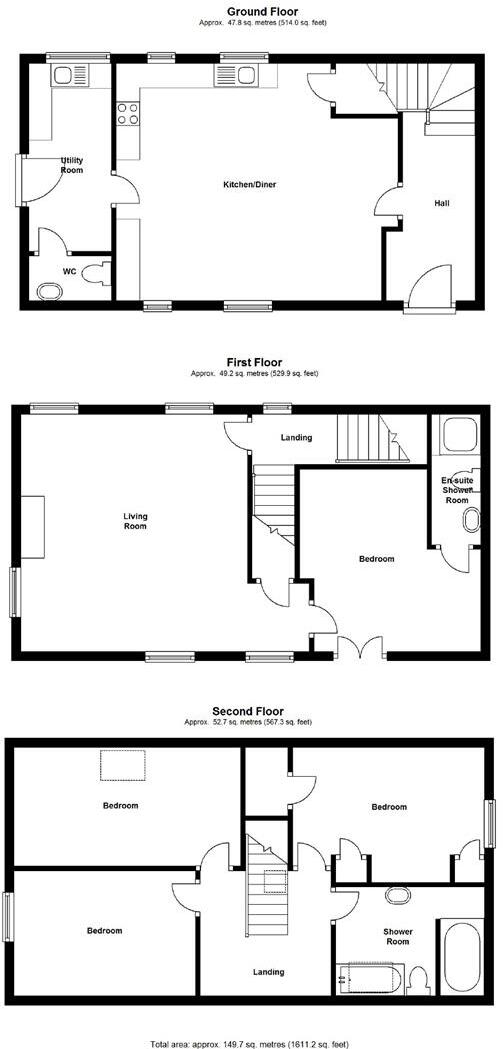
Floorplan 1
EPC Graphs
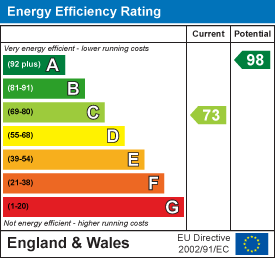
EE Rating
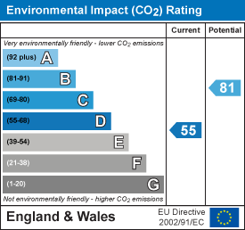
EI Rating
Rental Range
Estimated market rent for Stafford. Low = conservative, Realistic = average, Optimistic = best case.
Based on Local Authority from postcode lookup → Stafford.
LHA (30th percentile) floor for Mid Staffs: £992/mo (Apr 2025 – Mar 2026)
Location
Address
Mill Lane
Nearby
Nearest stations, universities and amenities (distance from property).
| Type | Name | Distance |
|---|---|---|
| Bus stop | Bent Lane | 0.2 miles |
| Bus stop | Lower Hatton Farm | 0.3 miles |
| Shop | Unknown | 1.9 miles |
| Shop | Jungle Shop | 3.0 miles |
| Train station | Unknown | 3.3 miles |
| Train station | Trentham Leisure | 3.4 miles |
| Hospital | North Staffordshire Nuffield Hospital | 4.3 miles |
| University | Keele University | 4.9 miles |
| Hospital | Royal Stoke University Hospital | 5.5 miles |
| University | University of Staffordshire Stoke Campus | 6.5 miles |
Street-level crime
| Category | Count |
|---|---|
| Other theft | 1 |
| Total incidents | 1 |
Within 1 mile during Apr 2026. Source: data.police.uk (England & Wales).
Schools nearby
Nearest open schools with Ofsted ratings (England). Closed schools are not shown. Data from Get Information about Schools and Ofsted.
| Name | Type | Distance | Ofsted |
|---|---|---|---|
| All Saints CofE (C) First School | Primary | 1.2 miles | Good — 19 Jan 2020 |
| Baldwins Gate CofE(VC) Primary School | Primary | 2.7 miles | Good — 7 Nov 2012 |
| Tittensor CofE (C) First School | Primary | 3.0 miles | Good — 20 Sep 2023 |
| Springfields First School | Primary | 3.7 miles | Good — 21 May 2023 |
| Trentham Academy | Secondary | 4.0 miles | Good — 30 Nov 2021 |
Rental Comparables
Loading rental comparables for this postcode. Refresh in a few minutes.
Enter House Number
Enter the house number to help us retrieve more accurate pricing history and property data.
Please log in to submit or correct the house number for this listing.
Log in to continue