FLAT 1
78 OAKLEIGH ROAD NORTH, LONDON, GREATER LONDON N20 9FH
£2,300 pcm
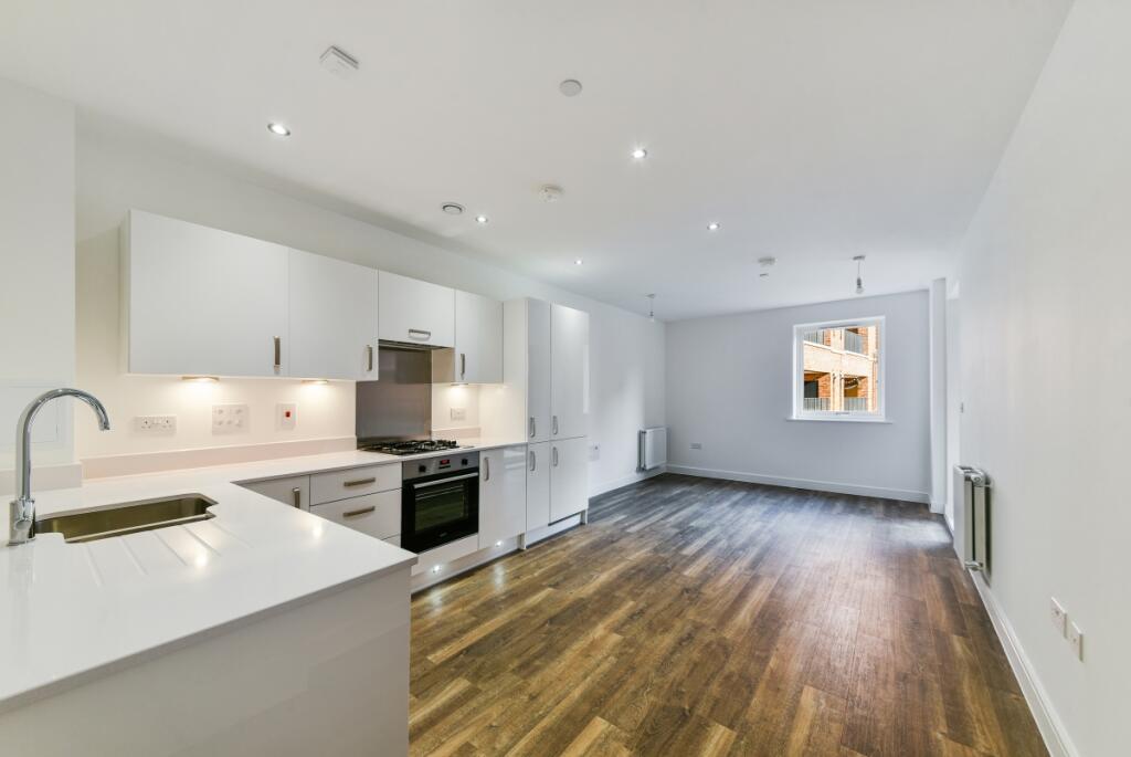
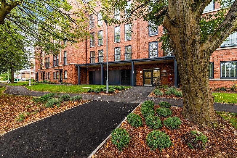
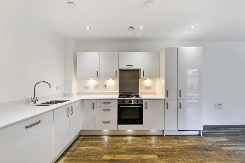
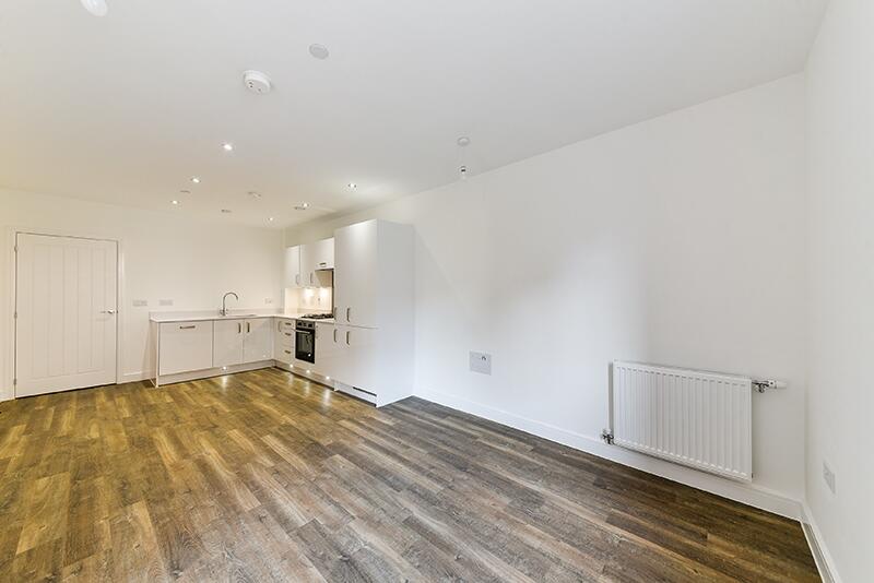
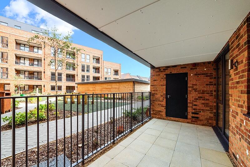
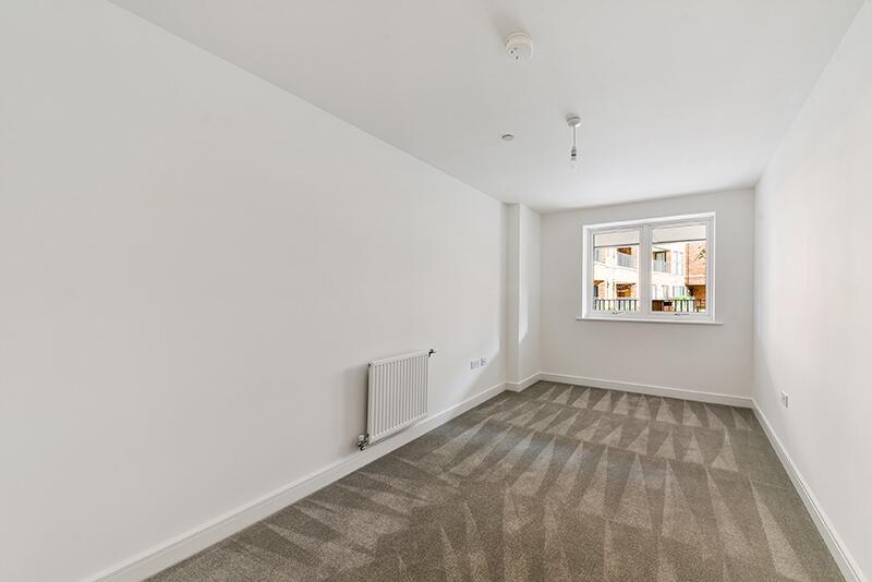
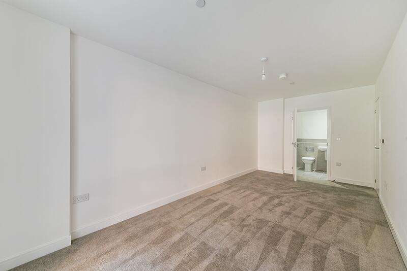
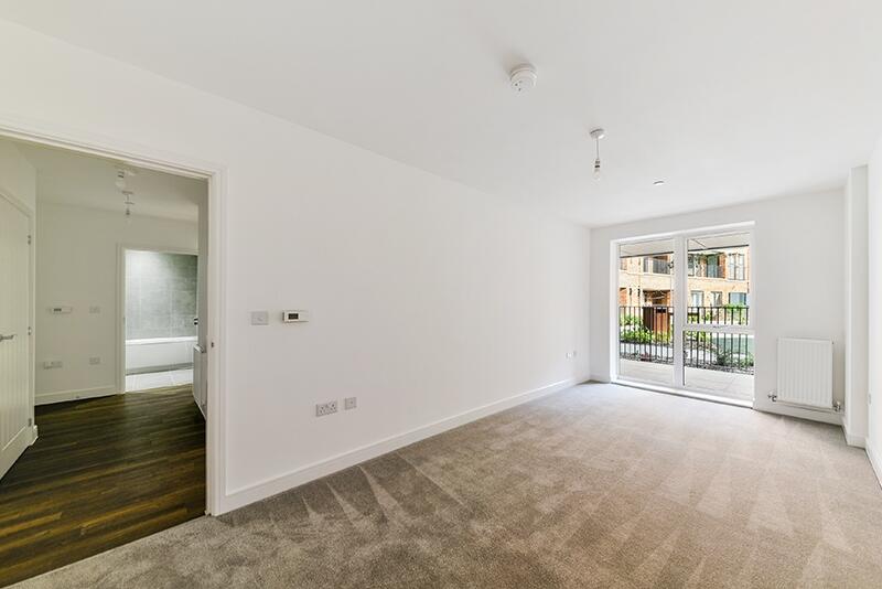
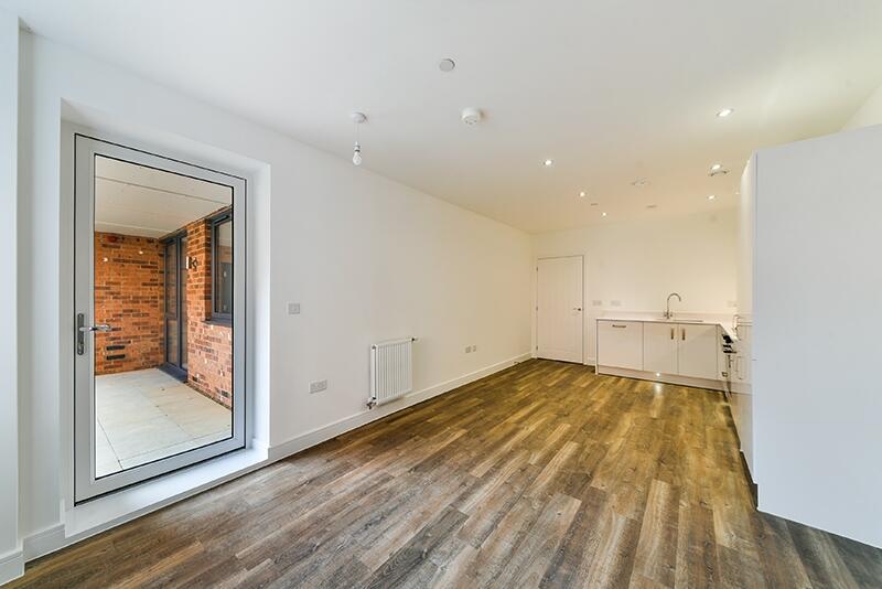
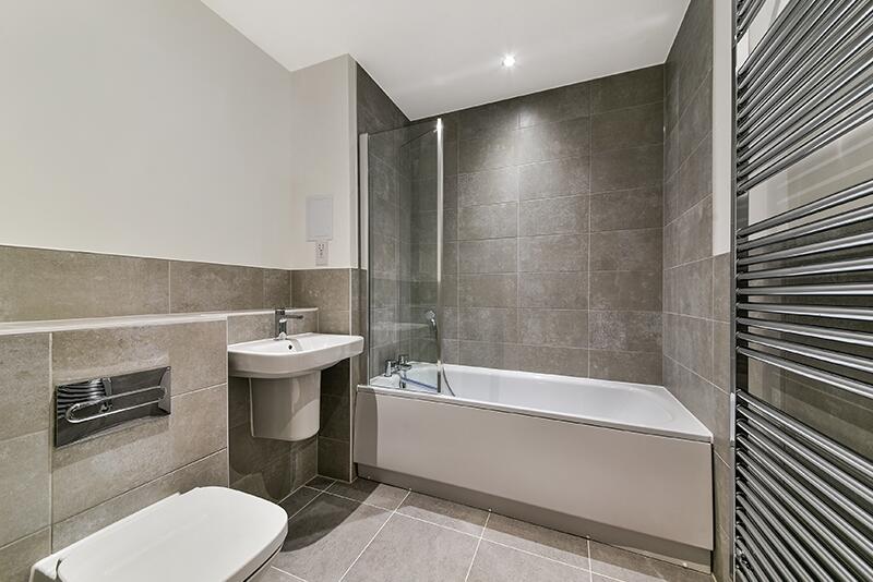
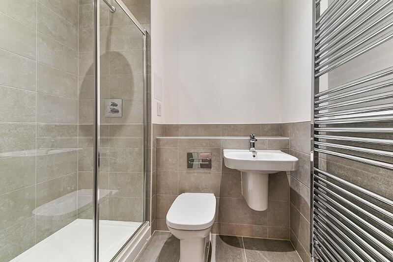
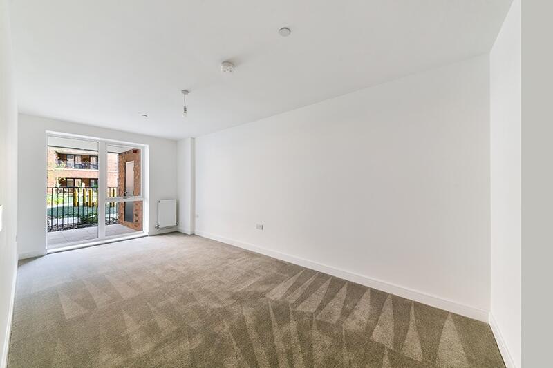
Photo 1 Photo 2 Photo 3 Photo 4 Photo 5 Photo 6 Photo 7 Photo 8 Photo 9 Photo 10 Photo 11 Photo 12
/ 12
Property details
Floor area
72 m²
Council tax band
E
Street crime
226 incidents within 1 mile (Mar 2026)
Key features
- Two Bedrooms plus One ensuit
- Unfurnished
- Available 14th December 2024
- Allocated Parking
- Council Tax Band E
Additional details
- Parking
- Communal
Description
Listed by
Totteridge & Whetstone
Countrywide Hamptons Lettings - Connells
Reference: 154055828
EPC Rating & Upgrade Cost
Fetching EPC data… Refresh this page in a moment.
Flood risk
Zone: 1
Risk: Low
Job (default Low)
Floorplans
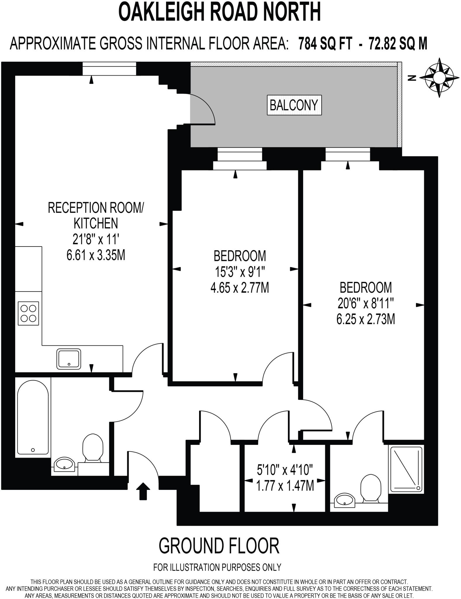
Floorplan 1
EPC Graphs
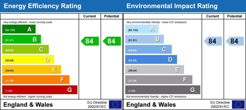
Energy Performanc...
Rental Range
Estimated market rent for London. Low = conservative, Realistic = average, Optimistic = best case.
Based on Postcode area N → London.
LHA (30th percentile) floor for Peterborough: £698/mo (Apr 2025 – Mar 2026)
Location
Nearby
Nearest stations, universities and amenities (distance from property).
| Type | Name | Distance |
|---|---|---|
| Bus stop | Oakleigh Park North | 0.1 miles |
| Bus stop | Whetstone / The Griffin | 0.1 miles |
| Shop | Barrington Jewellers | 0.1 miles |
| Shop | Unknown | 0.1 miles |
| Train station | Totteridge & Whetstone | 0.3 miles |
| Hospital | Springdene Nursing Home | 0.3 miles |
| Train station | Oakleigh Park | 0.6 miles |
| Hospital | Finchley Memorial Hospital | 1.7 miles |
| University | UCL Observatory | 3.3 miles |
| University | Scholars Courtyard | 3.7 miles |
Street-level crime
| Category | Count |
|---|---|
| Anti-social behaviour | 49 |
| Violence and sexual offences | 44 |
| Vehicle crime | 38 |
| Other theft | 21 |
| Burglary | 19 |
| Criminal damage and arson | 15 |
| Public order | 9 |
| Theft from the person | 9 |
| Shoplifting | 8 |
| Robbery | 7 |
| Drugs | 3 |
| Possession of weapons | 3 |
| Other crime | 1 |
| Total incidents | 226 |
Within 1 mile during Mar 2026. Source: data.police.uk (England & Wales).
Schools nearby
Nearest open schools with Ofsted ratings (England). Closed schools are not shown. Data from Get Information about Schools and Ofsted.
| Name | Type | Distance | Ofsted |
|---|---|---|---|
| All Saints' CofE Nursery and Primary School N20 | Primary | 0.2 miles | Good — 17 Oct 2014 |
| Alma Primary | Primary | 0.2 miles | Good — 5 Oct 2023 |
| Queenswell Infant & Nursery School | Primary | 0.2 miles | Good — 27 Jul 2023 |
| Queenswell Junior School | Primary | 0.2 miles | Good — 26 Feb 2014 |
| Pavilion Study Centre | Other | 0.3 miles | Good — 9 Oct 2017 |
Rental Comparables
Residential lets from OpenRent and Rightmove for the area (same bedroom count). Use to validate rent estimates. Student lets are excluded.
| Title | Rent | Beds | Distance | As seen on |
|---|---|---|---|---|
| 2 Bed Flat, High Road, N20 | £1,950/mo | 2 | 0.25 miles | OpenRent |
| 2 Bed Flat, High Road, N20 | £1,950/mo | 2 | 0.29 miles | OpenRent |
| 2 Bed Maisonette, Oakleigh Crescent, N20 | £1,750/mo | 2 | 0.48 miles | OpenRent |
| 2 Bed Flat, Whittington Mews, N12 | £1,900/mo | 2 | 0.77 miles | OpenRent |
| 2 Bed Flat, Welbeck Road, EN4 | £1,850/mo | 2 | 0.86 miles | OpenRent |
| 2 Bed Flat, Welbeck Road, EN4 | £2,000/mo | 2 | 0.88 miles | OpenRent |
| 2 Bed Maisonette, Welbeck Road, EN4 | £2,000/mo | 2 | 0.91 miles | OpenRent |
Average rent: £1,914/mo (7 listings)