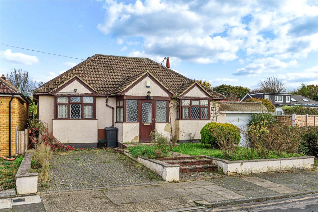
19 AXTAINE ROAD
ORPINGTON, GREATER LONDON BR5 4HX

Property details
Tenure
FREEHOLD
Floor area
105 m²
Council tax band
TBC
Last sold
£450,000 May 2023
Local average
£804,231 (-40.9%)
Deprivation
Decile 9 (29,264 of 33,755)
Street crime
153 incidents within 1 mile (Apr 2026)
Additional details
- Parking
- Yes
- Garden
- Yes
Description
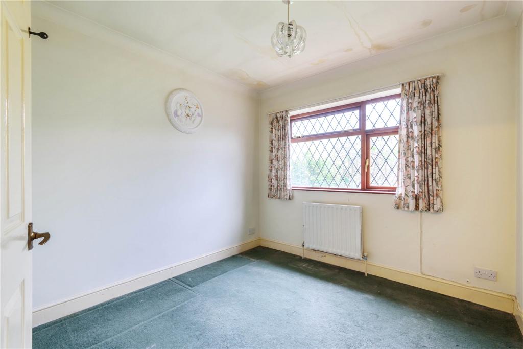
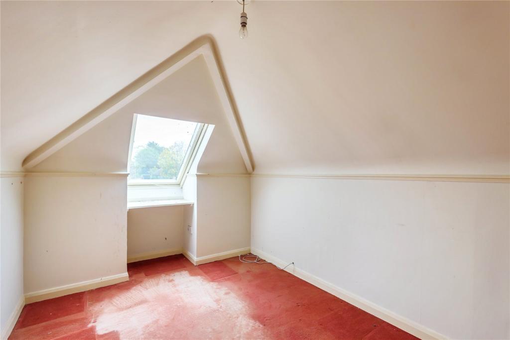
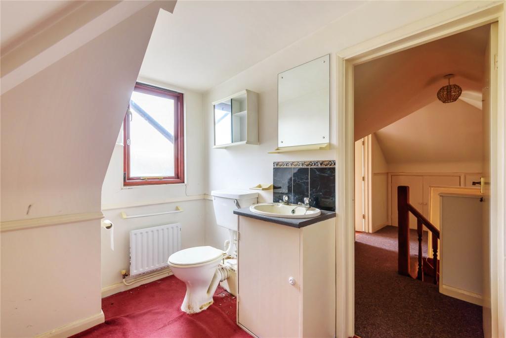
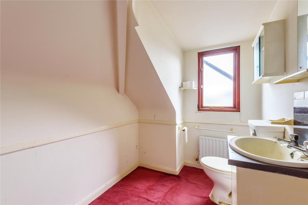
The accommodation is over two floors with two of the bedrooms on the ground level and a further bedroom and WC upstairs.
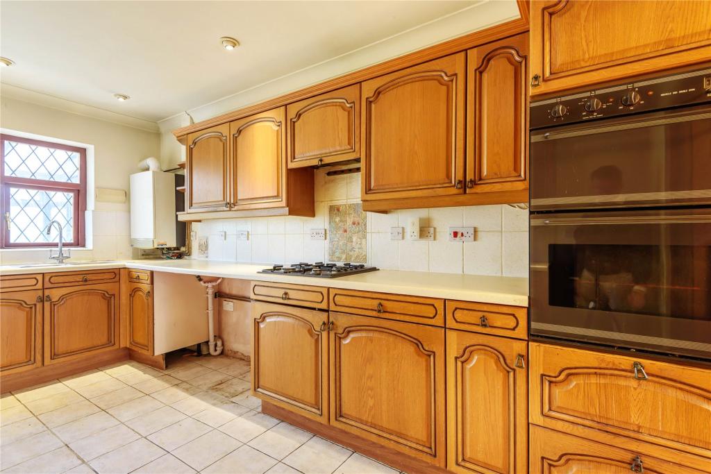
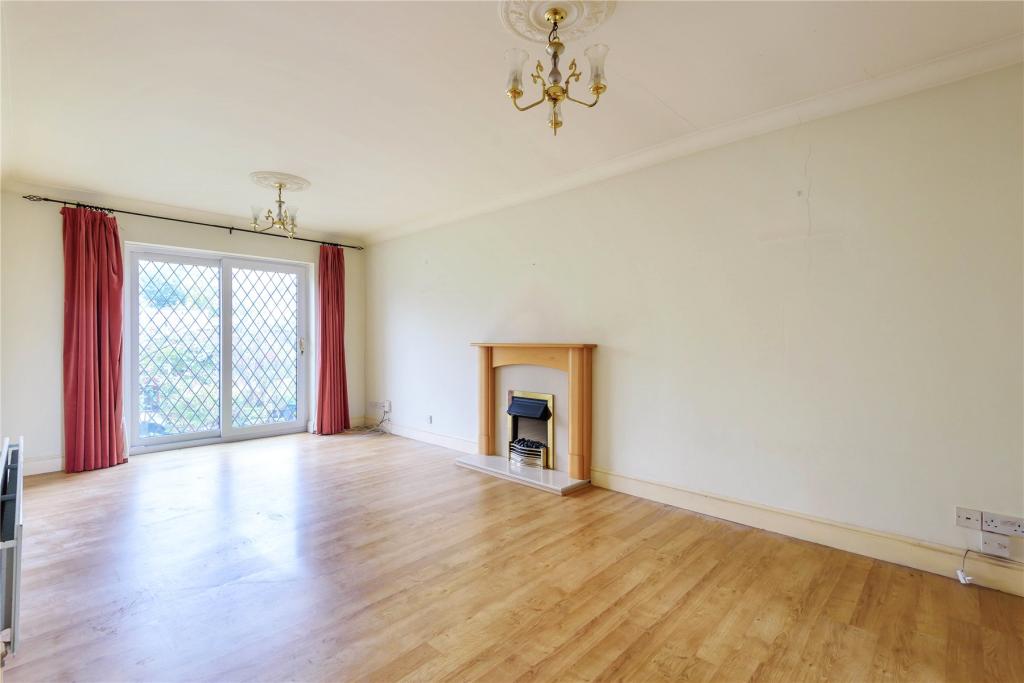
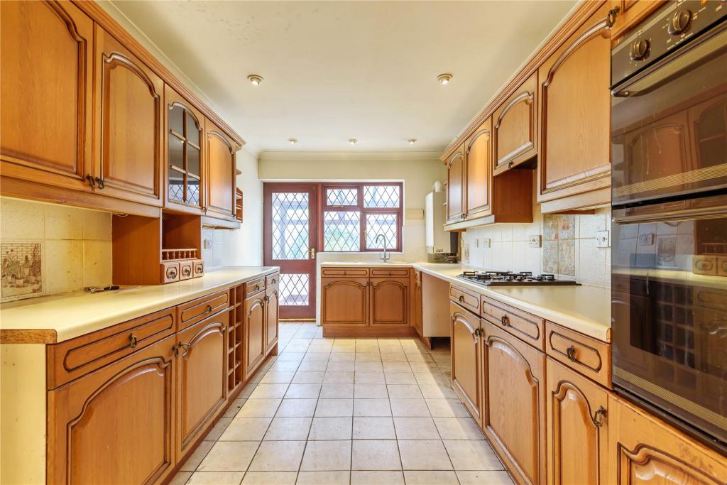
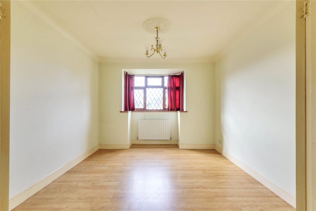
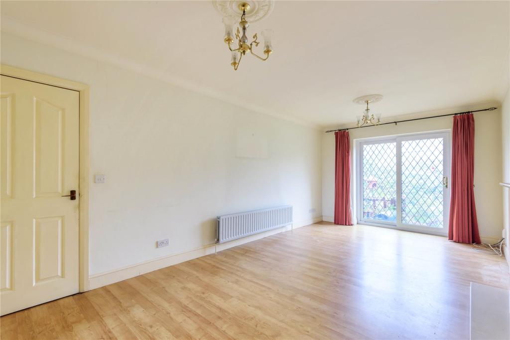
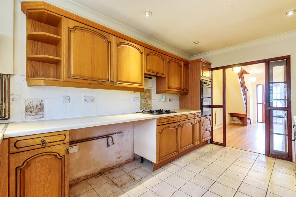
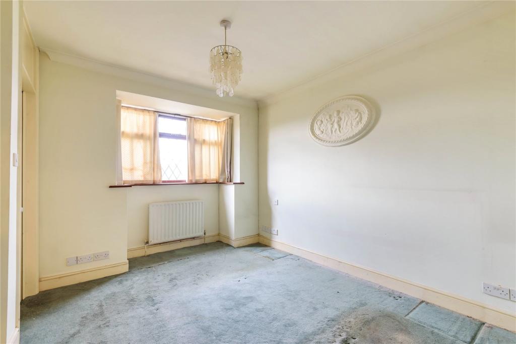
The living space on the ground floor includes two inter-connecting reception rooms, plus a large kitchen and family bathroom. There is a small conservatory off the kitchen.
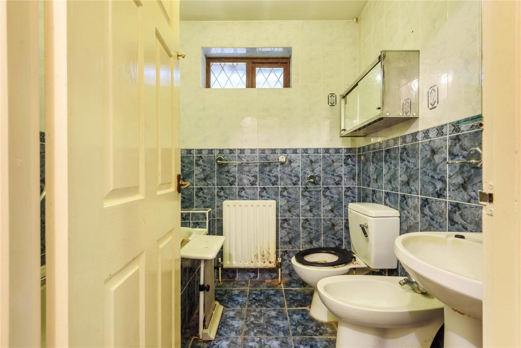
The master bedroom downstairs has its own en suite shower room.
There is a spacious hallway where you will find stairs that lead to a first floor landing, off of which you will find the third bedroom and a bathroom (currently only having a WC and basin but there is space for a bath or shower).
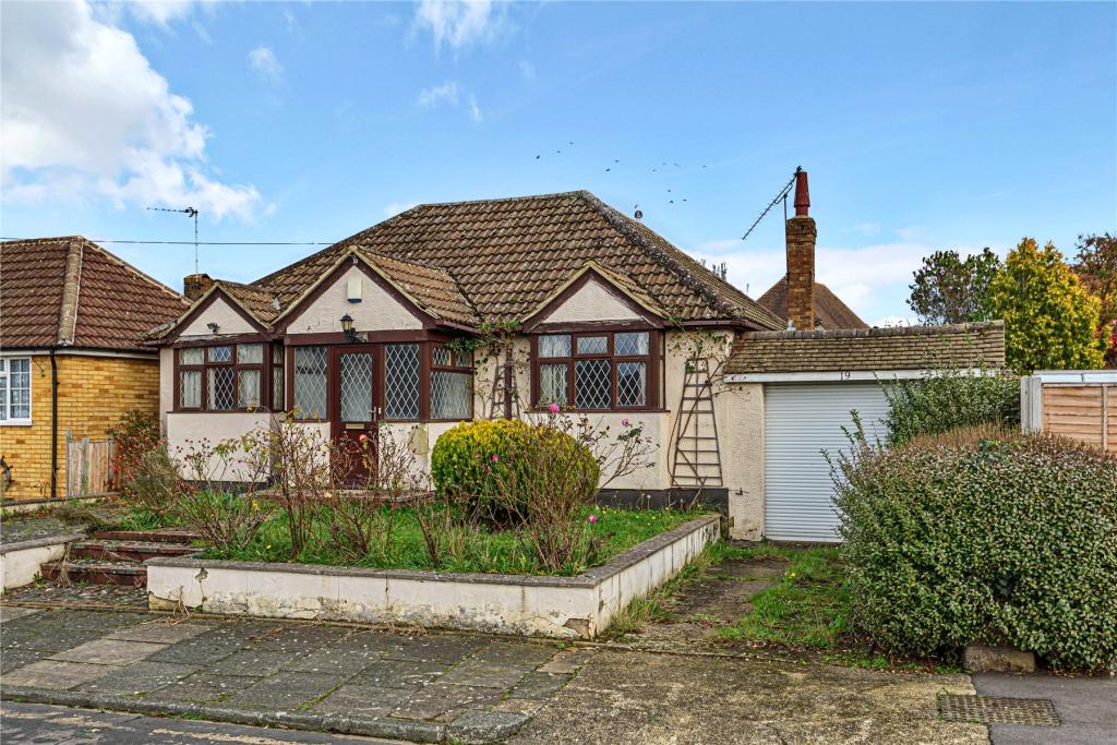
Outside, the property occupies a wide plot which includes front and rear gardens.
The rear garden has an easterly aspect and the front garden has two separate driveways for off-street parking, one of which leads to an attached garage.
Orpington is a thriving suburban town within the M25 with many people drawn to the area for the reputable schools and the railway stations that can transport you into London in as little as 17 minutes. Orpington station is 1.6 miles away. The town centre, under a mile away, has a comprehensive range of shops and facilities including the Walnuts Shopping Centre and Odeon cinema. Sports facilities are also well catered for with the Walnuts Leisure Centre, golf courses, football and rugby clubs all within the area. You will also find larger stores at the Nugent Retail Park along with electrical superstores, furniture shops and DIY centres along the Sevenoaks Way. Shopping centres at Bluewater and Bromley can also be found within 10 miles drive or bus ride.
Local Authority: Bromley
Council Tax Band: E
Listed by
Orpington
Countrywide UK Sales - Connells
Reference: 129064802
EPC Rating & Upgrade Cost
Fetching EPC data… Refresh this page in a moment.
Flood risk
Zone: 1
Risk: Low
Job (default Low)
Floorplans
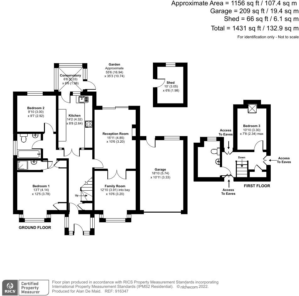
Floorplan
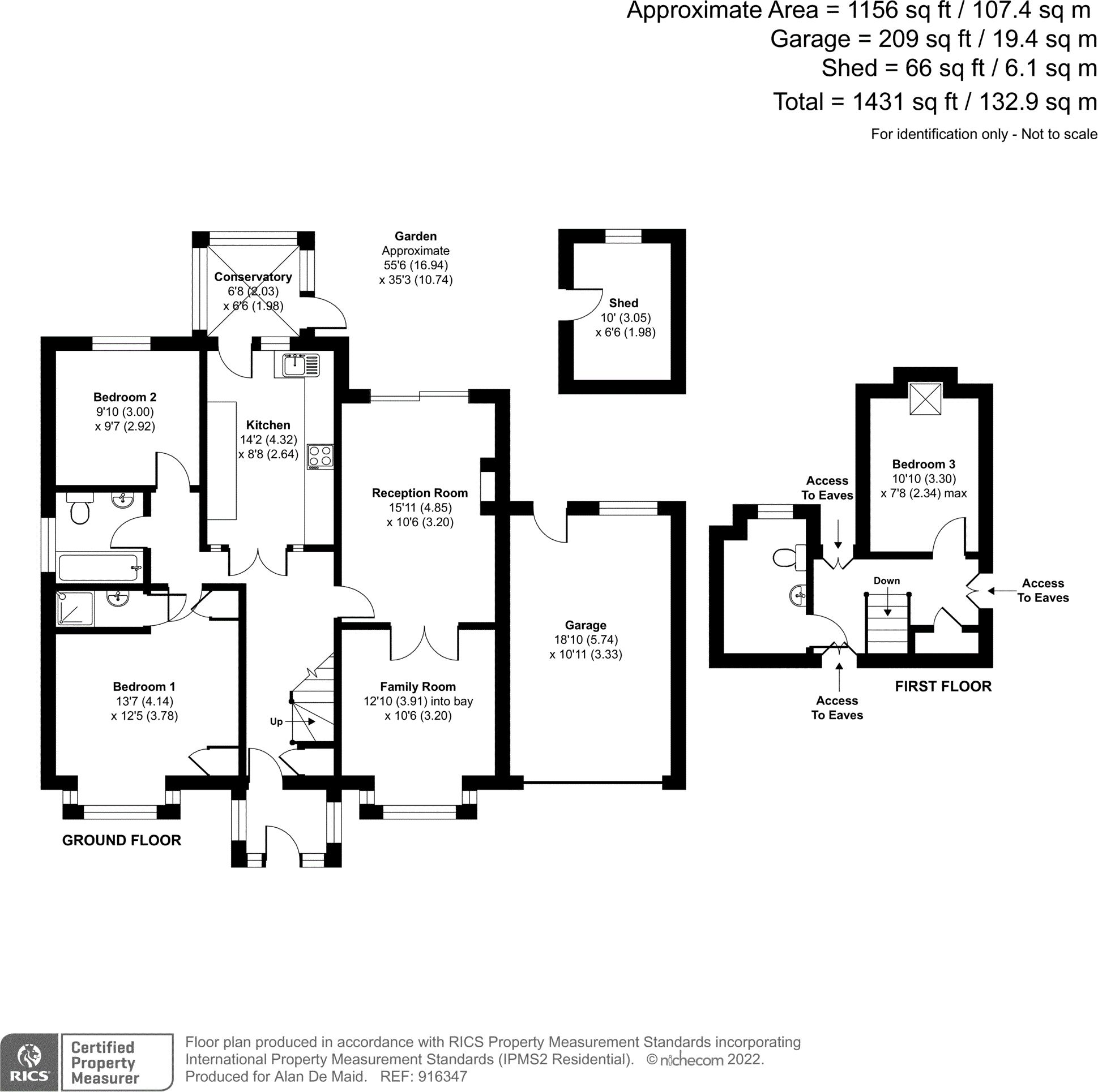
Floorplan
EPC Graphs
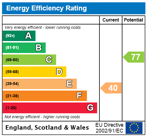
EPC Rating Graph
Price history
| Event | Date | Price | % change |
|---|---|---|---|
| Sold | 26/05/2023 (3 years ago) | £450,000 | — |
Source: HM Land Registry Price Paid Data. Crown copyright.
Sold Comparables
Same street and nearby sales within 0.25 miles (last 5 years). Data from Land Registry Price Paid.
| Address | Price | Date | Type |
|---|---|---|---|
| Same street 13 AXTAINE ROAD, ORPINGTON, BROMLEY, GREATER LONDON, BR5 4HX | £370,000 | 09/06/2023 | Semi-detached |
| Same street 16 AXTAINE ROAD, ORPINGTON, BROMLEY, GREATER LONDON, BR5 4HX | £405,000 | 07/06/2023 | Semi-detached |
| 58 CHELSFIELD LANE, ORPINGTON, BROMLEY, GREATER LONDON, BR5 4HQ | £735,000 | 02/03/2023 | Detached |
| Same street 2 AXTAINE ROAD, ORPINGTON, BROMLEY, GREATER LONDON, BR5 4HX | £512,500 | 05/12/2022 | Detached |
| 41 CHELSFIELD LANE, ORPINGTON, BROMLEY, GREATER LONDON, BR5 4HG | £600,000 | 11/02/2022 | Detached |
| 58 CHELSFIELD LANE, ORPINGTON, BROMLEY, GREATER LONDON, BR5 4HQ | £505,000 | 28/06/2021 | Detached |
Street average: £429,167 (3 sales)
Area average: £613,333 (3 sales)
Capital growth trend
Land Registry outcode average: last 12 months vs 5y and 10y ago (from sold prices).
House Price Index (HM Land Registry — official index, not sold-price averages): Bromley. Series: Detached. As of March 2026.
Rental Range
Estimated market rent for Bromley. Low = conservative, Realistic = average, Optimistic = best case.
Based on Local Authority from postcode lookup → Bromley.
LHA (30th percentile) floor for Outer South East London: £1,546/mo (Apr 2025 – Mar 2026)
Location
Nearby
Nearest stations, universities and amenities (distance from property).
| Type | Name | Distance |
|---|---|---|
| Bus stop | Hail & Ride Waldenhurst Road | 0.1 miles |
| Bus stop | Hail & Ride Rookesley Road | 0.1 miles |
| Shop | This, That & Party | 0.5 miles |
| Shop | Cleanpeople Dry Cleaners | 0.5 miles |
| Train station | St Mary Cray | 1.3 miles |
| Hospital | Chelsfield Park Hospital | 1.5 miles |
| Train station | Orpington | 1.6 miles |
| Hospital | Orpington Hospital | 1.7 miles |
| University | University of Greenwich Avery Hill Campus | 5.0 miles |
| University | Unknown | 5.4 miles |
Street-level crime
| Category | Count |
|---|---|
| Violence and sexual offences | 49 |
| Anti-social behaviour | 25 |
| Vehicle crime | 22 |
| Other theft | 11 |
| Criminal damage and arson | 10 |
| Burglary | 9 |
| Public order | 8 |
| Shoplifting | 7 |
| Robbery | 5 |
| Drugs | 3 |
| Other crime | 3 |
| Theft from the person | 1 |
| Total incidents | 153 |
Within 1 mile during Apr 2026. Source: data.police.uk (England & Wales).
Schools nearby
Nearest open schools with Ofsted ratings (England). Closed schools are not shown. Data from Get Information about Schools and Ofsted.
| Name | Type | Distance | Ofsted |
|---|---|---|---|
| St Philomena's Primary School | Primary | 0.4 miles | Good — 27 May 2010 |
| Harris Primary Academy Orpington | Primary | 0.4 miles | Good — 11 Sep 2019 |
| Harris Academy Orpington | Secondary | 0.5 miles | Good — 17 Jul 2023 |
| Blenheim Primary School | Primary | 0.6 miles | Good — 13 Nov 2014 |
| St. Mary Cray Primary Academy | Primary | 0.7 miles | Good — 16 Oct 2017 |
Rental Comparables
Rental listings exist nearby, but none matched the 3-bedroom count for this property.
Rent-driven metrics
Based on Area rent estimate.
- Rent ratio — Monthly rent ÷ purchase price (1% rule). 1%+ = strong, 0.8–1% = okay, <0.8% = weak for cashflow.
- Max investor price — Rent ÷ 0.8%; the price at which rent would be 0.8% of price (Stoke-style target).
- Target investor price — Rent ÷ 1%; the price at which rent would be 1% of price (strong cashflow band).
- Gross yield — Annual rent as % of purchase price (no costs).