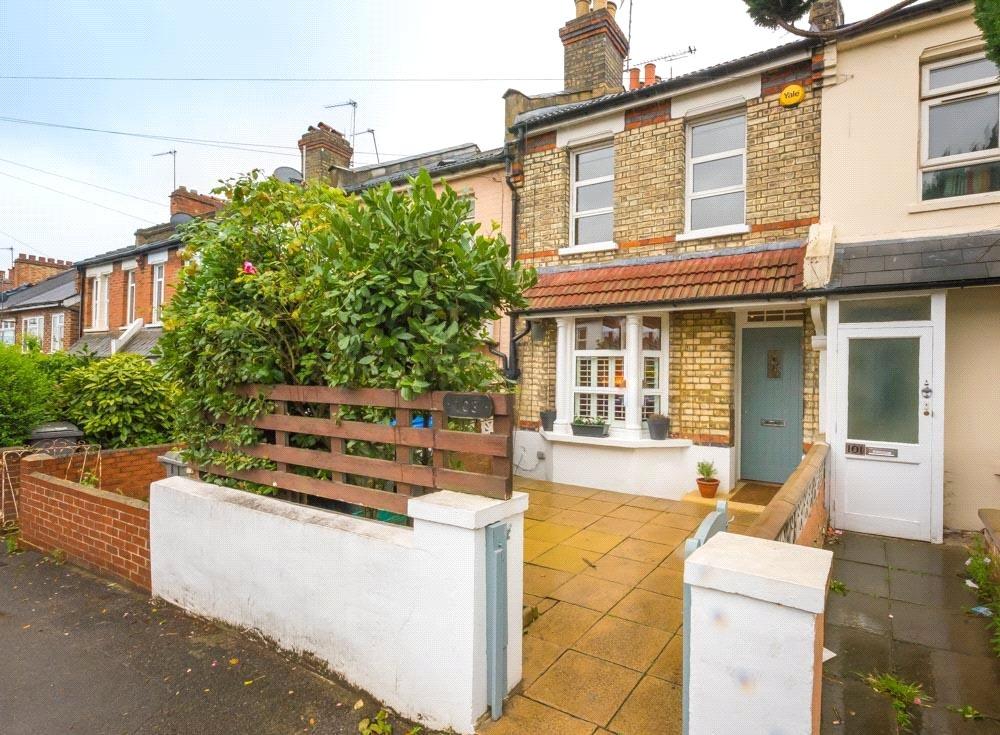
103 RUCKLIDGE AVENUE
LONDON, GREATER LONDON NW10 4QB
£639,500
Property details
Tenure
FREEHOLD
Floor area
78 m²
Last sold
£625,000 Jul 2017
Local average
£936,634 (-31.7%)
Deprivation
Decile 1 (576 of 33,755)
Street crime
893 incidents within 1 mile (Apr 2026)
Additional details
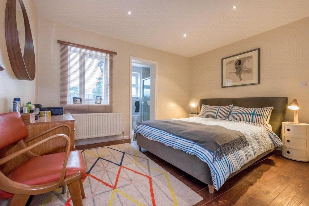
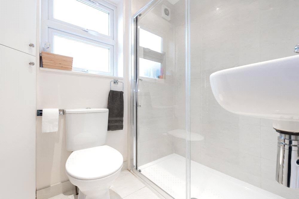
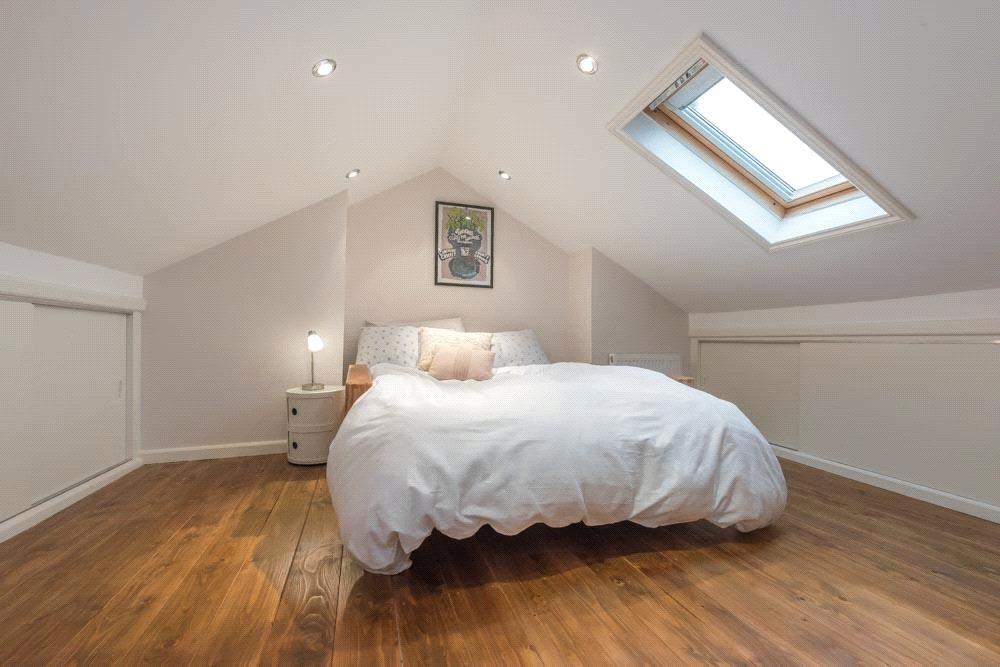
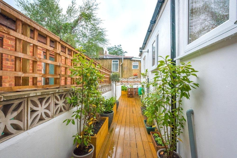
- Garden
- Yes
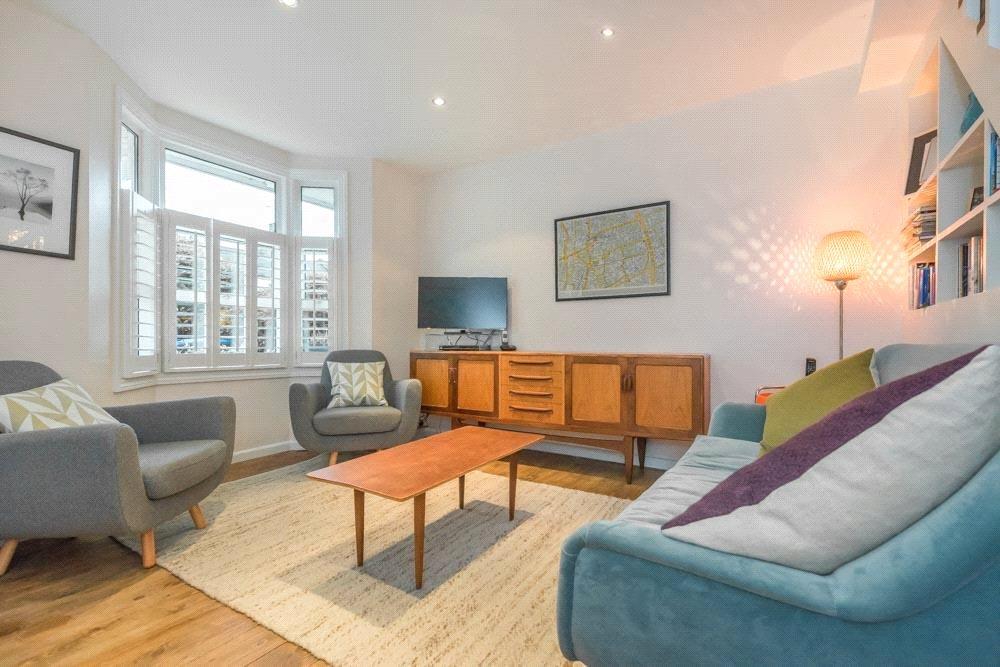
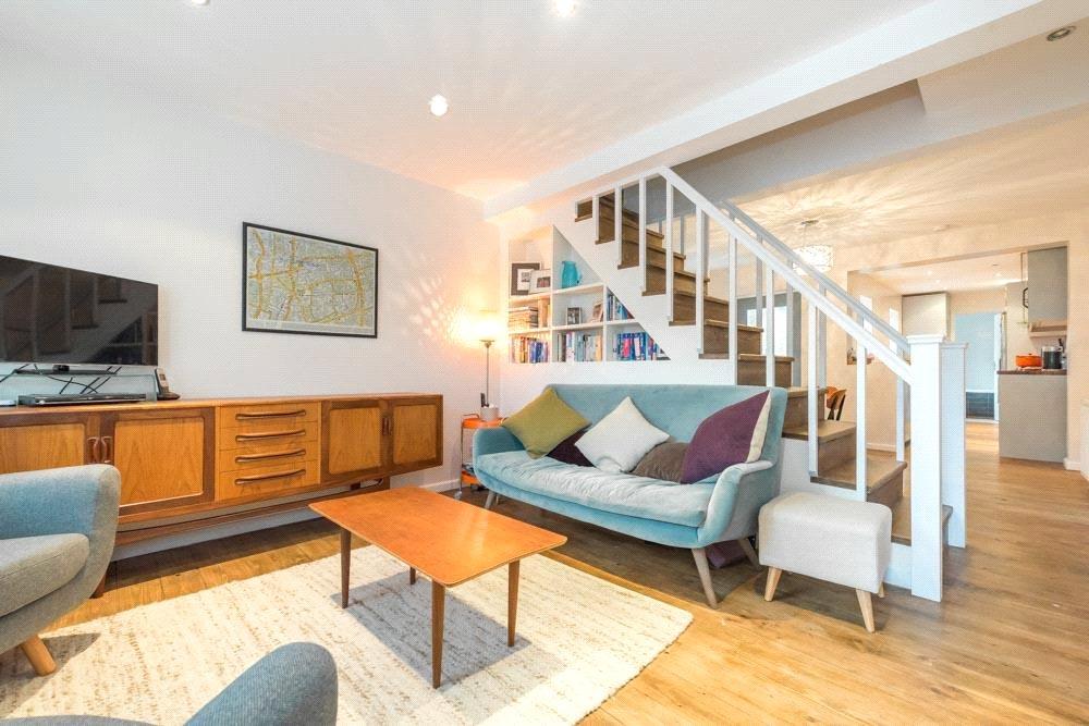
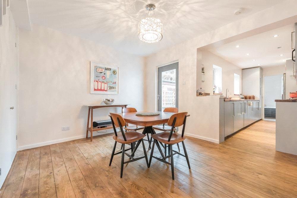
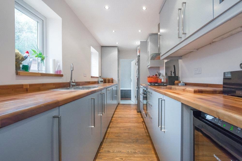
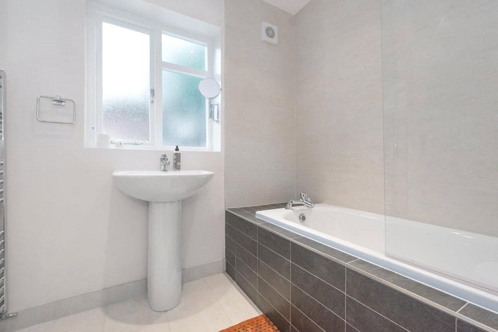
Description
Location:
Rucklidge Avenue is situated in a great value for money area which is currently a rare commodity. The street has a range benefits including a very close proximity to Willesden Junction where you can find transport links including the Bakerloo line, London Overground and National Rail. This is certainly an area to invest in.
Listed by
Kensal Rise and Queens Park
Winkworth
Reference: 63086048
EPC Rating & Upgrade Cost
Fetching EPC data… Refresh this page in a moment.
Flood risk
Zone: 1
Risk: Low
Job (default Low)
Floorplans
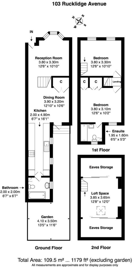
Floorplan
EPC Graphs
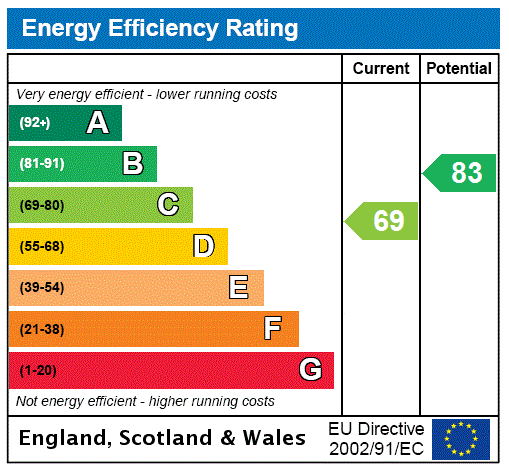
EPC Rating Graph
Price history
79% since 2014
| Event | Date | Price | % change |
|---|---|---|---|
| Sold | 31/07/2017 (8 years ago) | £625,000 | +78.6% |
| Sold | 07/02/2014 (12 years ago) | £350,000 | — |
Source: HM Land Registry Price Paid Data. Crown copyright.
Sold Comparables
Same street and nearby sales within 0.25 miles (last 5 years). Data from Land Registry Price Paid.
| Address | Price | Date | Type |
|---|---|---|---|
| 61 ST JOHNS AVENUE, LONDON, BRENT, GREATER LONDON, NW10 4ED | £1,100,000 | 18/07/2025 | Terraced |
| 9 FORTUNEGATE ROAD, LONDON, BRENT, GREATER LONDON, NW10 9RD | £613,000 | 28/03/2025 | Terraced |
| 7 BOLTON ROAD, LONDON, BRENT, GREATER LONDON, NW10 4BG | £685,000 | 26/02/2025 | Terraced |
| 78A CRAVEN PARK ROAD, HARLESDEN, LONDON, BRENT, GREATER LONDON, NW10 4AE | £350,000 | 04/02/2025 | Terraced |
| Same street 97 RUCKLIDGE AVENUE, LONDON, BRENT, GREATER LONDON, NW10 4QB | £450,000 | 23/01/2023 | Terraced |
| 23 FORTUNEGATE ROAD, LONDON, BRENT, GREATER LONDON, NW10 9RD | £642,500 | 21/12/2022 | Terraced |
| 61 ST JOHNS AVENUE, LONDON, BRENT, GREATER LONDON, NW10 4ED | £1,090,000 | 08/12/2022 | Terraced |
| 107 BURNS ROAD, LONDON, BRENT, GREATER LONDON, NW10 4DU | £715,000 | 11/11/2022 | Terraced |
| 92A BURNS ROAD, LONDON, BRENT, GREATER LONDON, NW10 4DY | £370,000 | 14/09/2022 | Terraced |
| 12 BURNS ROAD, LONDON, BRENT, GREATER LONDON, NW10 4DY | £425,000 | 25/08/2022 | Terraced |
| 50 FORTUNEGATE ROAD, LONDON, BRENT, GREATER LONDON, NW10 9RE | £625,000 | 01/06/2022 | Terraced |
| 66 ST JOHNS AVENUE, LONDON, BRENT, GREATER LONDON, NW10 4EG | £790,000 | 20/10/2021 | Terraced |
| 72A ST MARYS ROAD, LONDON, BRENT, GREATER LONDON, NW10 4AX | £462,500 | 29/06/2021 | Terraced |
| 19 FORTUNEGATE ROAD, LONDON, BRENT, GREATER LONDON, NW10 9RD | £640,000 | 25/06/2021 | Terraced |
Street average: £450,000 (1 sale)
Area average: £654,462 (13 sales)
Capital growth trend
Land Registry outcode average: last 12 months vs 5y and 10y ago (from sold prices).
House Price Index (HM Land Registry — official index, not sold-price averages): Brent. Series: Terraced. As of March 2026.
Rental Range
Estimated market rent for Brent. Low = conservative, Realistic = average, Optimistic = best case.
Based on Local Authority from postcode lookup → Brent.
Location
Nearby
Nearest stations, universities and amenities (distance from property).
| Type | Name | Distance |
|---|---|---|
| Shop | Mc Brasil | 0.1 miles |
| Shop | Best Barbers | 0.1 miles |
| Bus stop | St Mary's Road | 0.1 miles |
| Train station | Harlesden | 0.4 miles |
| Train station | Willesden Junction | 0.6 miles |
| University | Scale Space White City | 2.1 miles |
| University | Kennet West Skills Centre | 2.3 miles |
| Hospital | The Portland Hospital | 4.7 miles |
| Hospital | Sleep & Health Clinic | 4.9 miles |
Street-level crime
| Category | Count |
|---|---|
| Anti-social behaviour | 243 |
| Violence and sexual offences | 227 |
| Vehicle crime | 86 |
| Other theft | 53 |
| Criminal damage and arson | 52 |
| Drugs | 44 |
| Burglary | 40 |
| Public order | 36 |
| Robbery | 29 |
| Shoplifting | 21 |
| Theft from the person | 21 |
| Possession of weapons | 17 |
| Other crime | 13 |
| Bicycle theft | 11 |
| Total incidents | 893 |
Within 1 mile during Apr 2026. Source: data.police.uk (England & Wales).
Schools nearby
Nearest open schools with Ofsted ratings (England). Closed schools are not shown. Data from Get Information about Schools and Ofsted.
| Name | Type | Distance | Ofsted |
|---|---|---|---|
| Maple Walk School | Other | 0.2 miles | — (No rating) |
| Saint Claudine's Catholic School for Girls | Secondary | 0.2 miles | Good — 3 Oct 2013 |
| John Keble CofE Primary School | Primary | 0.2 miles | Good — 26 Jul 2023 |
| Harlesden Primary School | Primary | 0.3 miles | Good — 20 Jul 2022 |
| Newfield Primary School | Primary | 0.3 miles | Good — 4 Jul 2019 |
Rental Comparables
Residential lets from OpenRent and Rightmove for the area (same bedroom count). Use to validate rent estimates. Student lets are excluded.
| Title | Rent | Beds | Distance | As seen on |
|---|---|---|---|---|
| 2 Bed Flat, High St, NW10 | £2,150/mo | 2 | 0.61 miles | OpenRent |
Average rent: £2,150/mo (1 listing)
Rent-driven metrics
Based on OpenRent comparables.
- This street — Gross yield for this street only (Land Registry sales + rental comparables, same postcode + street).
- Rent ratio — Monthly rent ÷ purchase price (1% rule). 1%+ = strong, 0.8–1% = okay, <0.8% = weak for cashflow.
- Max investor price — Rent ÷ 0.8%; the price at which rent would be 0.8% of price (Stoke-style target).
- Target investor price — Rent ÷ 1%; the price at which rent would be 1% of price (strong cashflow band).
- Gross yield — Annual rent as % of purchase price (no costs).
- Cost-to-rent — Price ÷ annual rent (from OpenRent comparables). Under 14× = strong, 14–16× = acceptable, 17×+ = compressed.
- Cashflow — Rent minus mortgage, 10% maintenance, £25/mo compliance. Assumes 75% LTV, 3.95% APR (5yr fixed), 25yr term.
- ROI — Annual profit ÷ cash in (deposit + 4% purchase costs).