46 WESTBOURNE STREET
HOVE, BRIGHTON AND HOVE BN3 5PH
£900 pcm
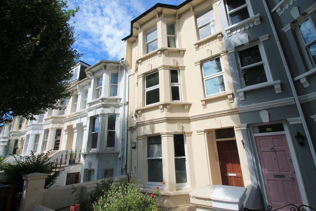
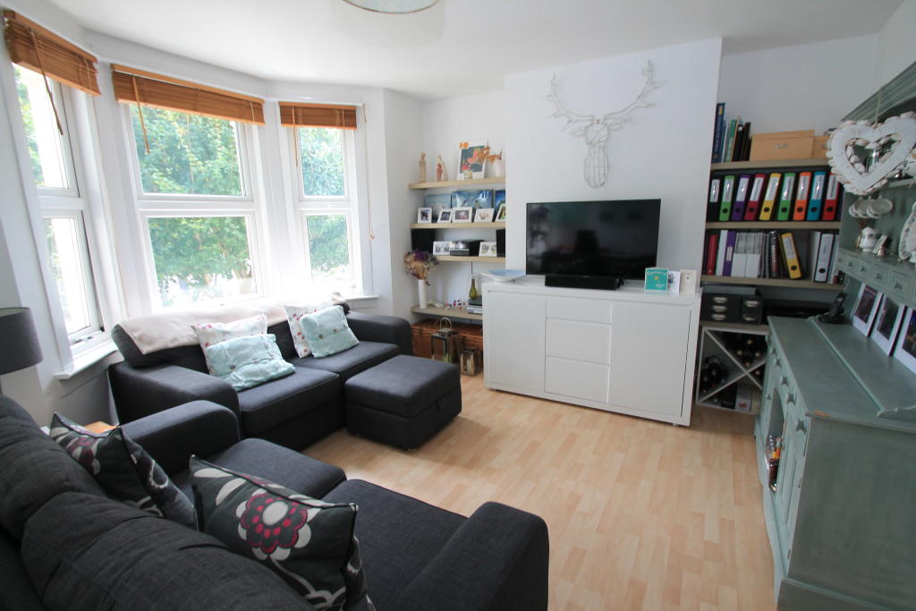
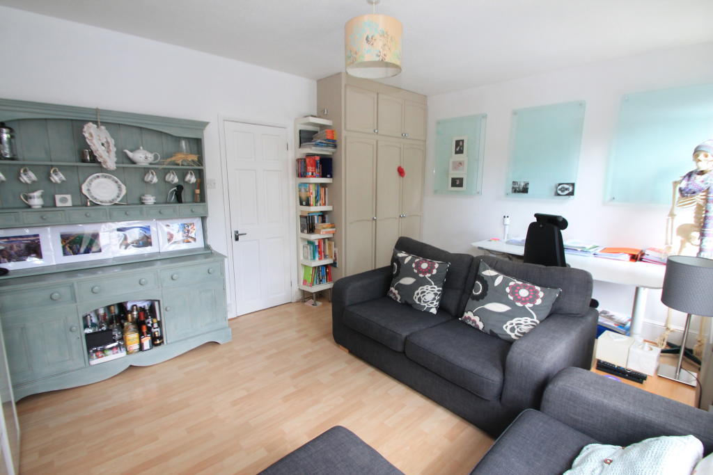
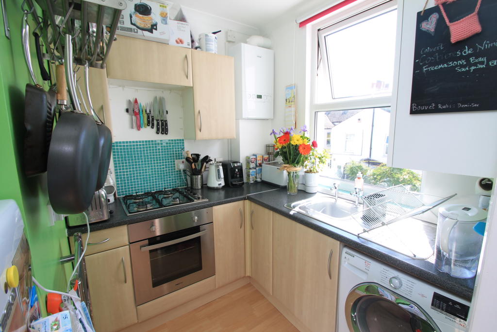
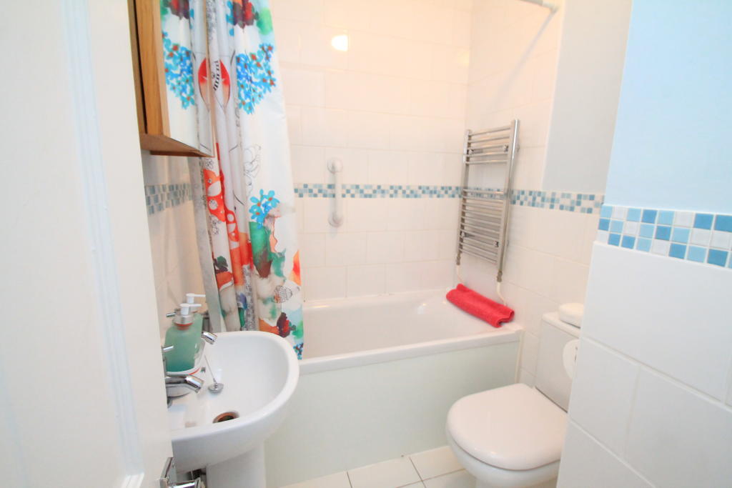
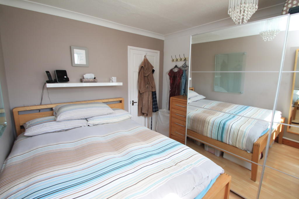
Photo 1 Photo 2 Photo 3 Photo 4 Photo 5 Photo 6
/ 6
Property details
Floor area
39 m²
EPC rating
D
Year built
England and Wales: 1900-1929
Deprivation
Decile 5 (15,974 of 33,755)
Street crime
393 incidents within 1 mile (Apr 2026)
Key features
- One Bedroom Flat
- First Floor
- Kitchen with Applicances
- Good Size Living Room
- Double Bedroom
- Close to Local Shops
- Unfurnished
- Available 21st February
Description
The kitchen is sepearate and is equipped with a washing machine, free standing fridge freezer, oven and gas hob.
The bathroom is a white suite with a wash basin, bath with a shower and a toilet.
The bedroom is a spacious double and has plenty of space for wardrone and chest of drawers.
The flat is neutrally decorated throughout and has wood effect flooring.
Available 21st February.
Listed by
Hove
Countrywide UK Lettings - Connells
Reference: 76796398
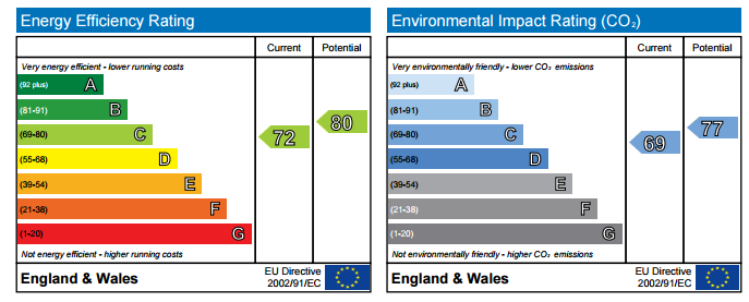
EPC Rating & Upgrade Cost
Current rating: D
Potential rating: C
Inspection date: 05/05/2023
Current heating cost: £783/year
Potential heating cost: £462/year
Est. upgrade cost to C: £14,910
Recommendations
- 50 mm internal or external wall insulation (£4,000 - £14,000)
- Floor insulation (suspended floor) (£800 - £1,200)
- Low energy lighting for all fixed outlets (£10)
- Replace single glazed windows with low-E double glazing (£3,300 - £6,500)
Flood risk
Zone: 1
Risk: Low
Job (default Low)
EPC Graphs
EPC 1
Company ownership
Registered legal owner is a company.
Rental Range
Estimated market rent for Brighton and Hove. Low = conservative, Realistic = average, Optimistic = best case.
Based on Local Authority from postcode lookup → Brighton and Hove.
LHA (30th percentile) floor for Brighton and Hove: £918/mo (Apr 2025 – Mar 2026)
Location
Nearby
Nearest stations, universities and amenities (distance from property).
| Type | Name | Distance |
|---|---|---|
| Shop | Folks | 0.1 miles |
| Shop | Timeless Toys | 0.1 miles |
| Bus stop | Westbourne Street | 0.1 miles |
| Hospital | Aldrington House | 0.2 miles |
| Train station | Aldrington | 0.3 miles |
| Train station | Hove | 0.6 miles |
| Hospital | The Montefiore Hospital | 1.2 miles |
| University | Silverstone SB309 Lecture Theatre | 4.7 miles |
| University | Silverstone SB121 Lecture Theatre | 4.7 miles |
Street-level crime
| Category | Count |
|---|---|
| Violence and sexual offences | 127 |
| Anti-social behaviour | 76 |
| Shoplifting | 41 |
| Public order | 33 |
| Other theft | 31 |
| Criminal damage and arson | 27 |
| Vehicle crime | 18 |
| Other crime | 11 |
| Burglary | 10 |
| Drugs | 6 |
| Possession of weapons | 6 |
| Bicycle theft | 4 |
| Robbery | 3 |
| Total incidents | 393 |
Within 1 mile during Apr 2026. Source: data.police.uk (England & Wales).
Schools nearby
Nearest open schools with Ofsted ratings (England). Closed schools are not shown. Data from Get Information about Schools and Ofsted.
| Name | Type | Distance | Ofsted |
|---|---|---|---|
| St Christopher's School | Other | 0.2 miles | — (No rating) |
| Brighton and Hove Clinic School | Other | 0.2 miles | Outstanding — 18 Jun 2024 |
| St Andrew's CofE (Aided) Primary School | Primary | 0.4 miles | Good — 20 Apr 2015 |
| The Lioncare School | Other | 0.4 miles | Good — 14 Nov 2021 |
| Hove Junior School | Primary | 0.4 miles | Good — 8 Dec 2011 |
Rental Comparables
Loading rental comparables for this postcode. Refresh in a few minutes.