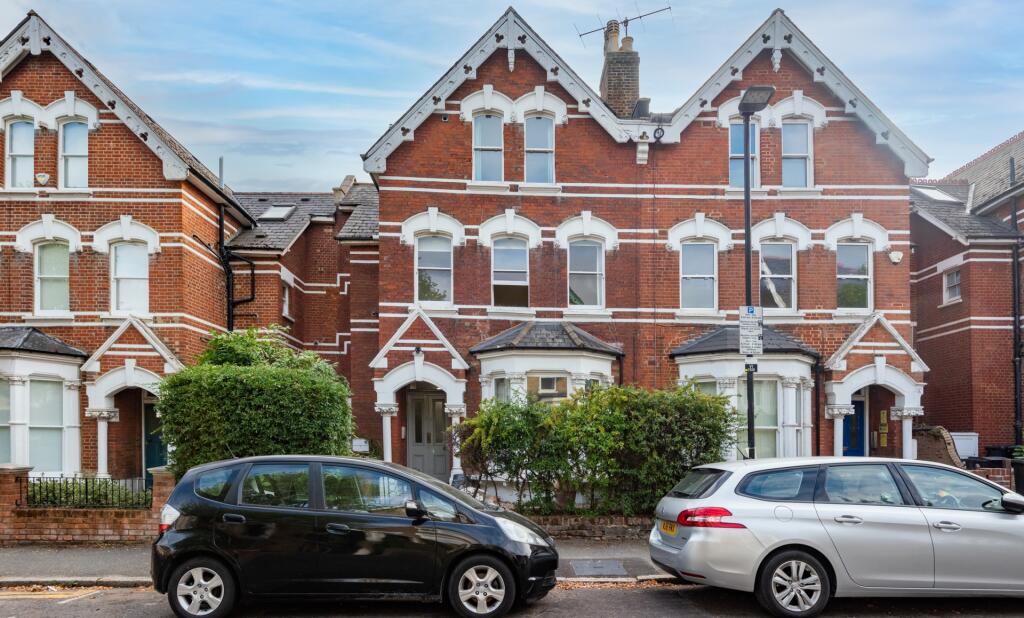
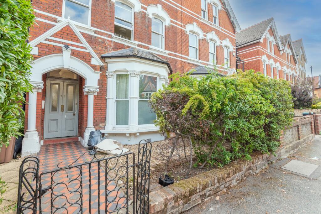
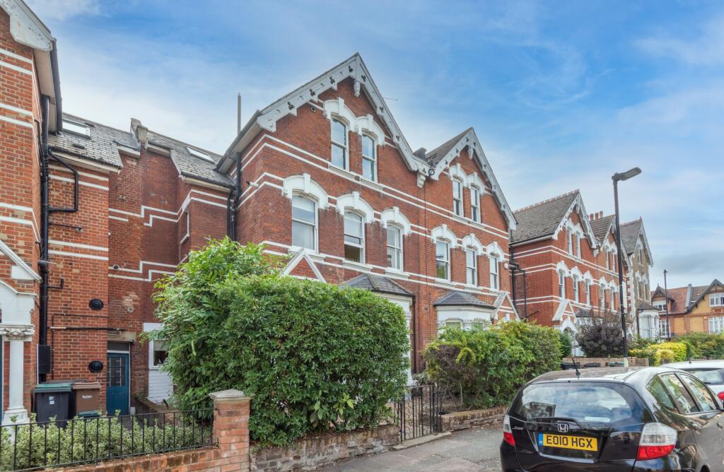
72 VICTORIA ROAD
LONDON, STROUD GREEN, GREATER LONDON N4 3SL
£2,350 pcm


Property details
Deprivation
Decile 4 (11,144 of 33,755)
Street crime
1368 incidents within 1 mile (Apr 2026)
Key features
- Period building
- Split level
- Minutes to Stroud Green High Street
- Short walk to Finsbury Park and the station
- Plenty of natural light
- Seperate utility area
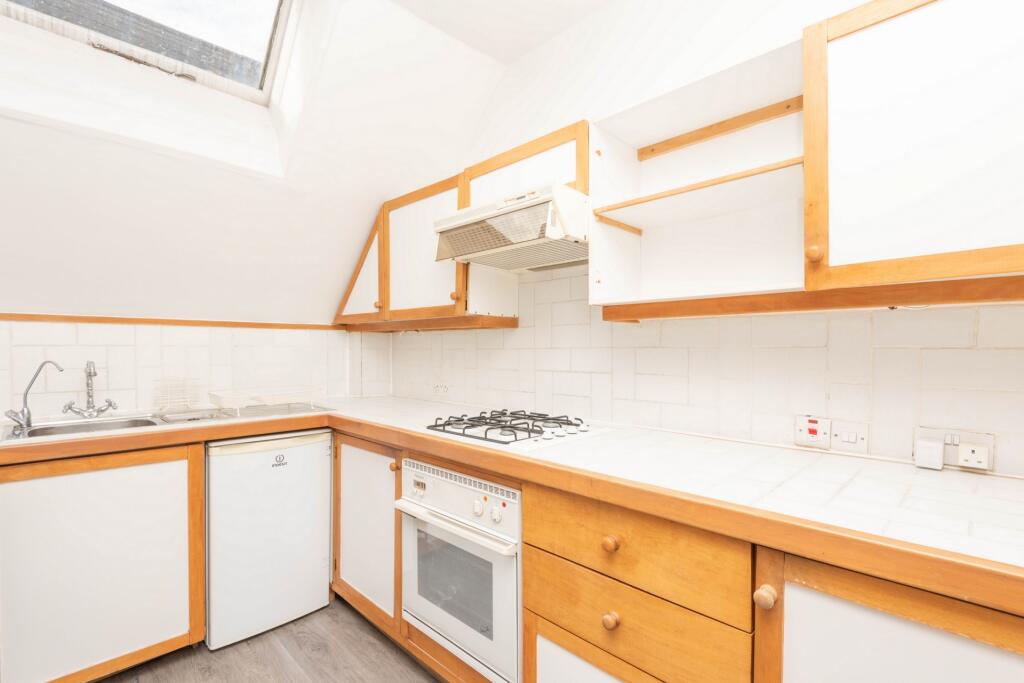
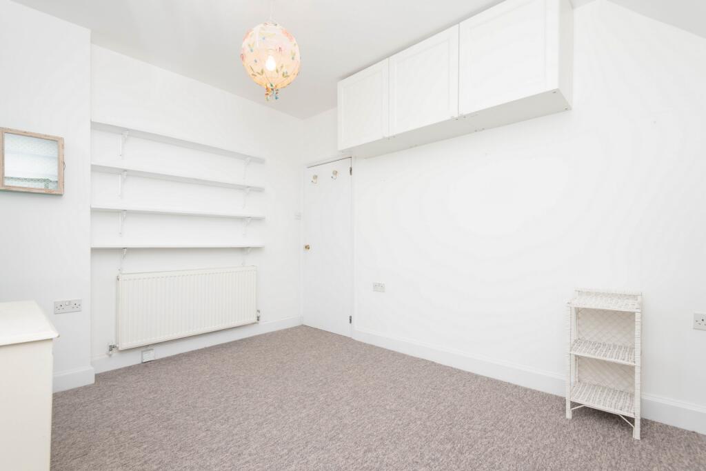
Description
Listed by
London
Alex Marks
Reference: 174948563
Flood risk
Zone: 1
Risk: Low
Job (default Low)
Floorplans

Floor Plan 1
EPC Graphs
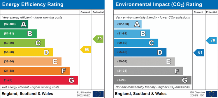
EPC
FENSA Certificates
This property has 1 FENSA certificate(s) on record, indicating window/door installations by FENSA-approved installers.
FENSA Certificate #15483344 Recent
Property Details
Street: 72 Victoria Road
Town: LONDON
Postcode: N4 3SL
Installation Details
Items: 1 door
Certificate Issued: 13/11/2022
Work Completed: 04/11/2022
This certificate data was retrieved from FENSA's database
What is FENSA? FENSA (Fenestration Self-Assessment Scheme) is a government-authorised scheme that monitors building regulation compliance for replacement windows and doors. Certificates indicate that work was completed by FENSA-approved installers.
Company ownership
Registered legal owner is a company.
Company: 72 VICTORIA ROAD MANAGEMENT COMPANY LIMITED (14687618)
Rental Range
Estimated market rent for Haringey. Low = conservative, Realistic = average, Optimistic = best case.
Based on Local Authority from postcode lookup → Haringey.
LHA (30th percentile) floor for Huntingdon: £793/mo (Apr 2025 – Mar 2026)
Location
Nearby
Nearest stations, universities and amenities (distance from property).
| Type | Name | Distance |
|---|---|---|
| Bus stop | Victoria Road (N4) | 0.1 miles |
| Shop | Hornsey Automatic Transmission | 0.1 miles |
| Bus stop | Albert Road | 0.1 miles |
| Shop | Hard Az Nailz | 0.1 miles |
| Train station | Crouch Hill | 0.2 miles |
| Train station | Harringay | 0.5 miles |
| Hospital | Moorfields at Hoxton | 2.7 miles |
| University | Paris Dauphine University - London Campus | 2.7 miles |
| University | University of Wales Trinity Saint David London | 2.8 miles |
| Hospital | Proton International @ UCLH | 3.5 miles |
Street-level crime
| Category | Count |
|---|---|
| Anti-social behaviour | 380 |
| Violence and sexual offences | 248 |
| Shoplifting | 122 |
| Theft from the person | 109 |
| Other theft | 92 |
| Vehicle crime | 85 |
| Public order | 72 |
| Drugs | 63 |
| Robbery | 56 |
| Criminal damage and arson | 51 |
| Burglary | 46 |
| Possession of weapons | 17 |
| Bicycle theft | 14 |
| Other crime | 13 |
| Total incidents | 1368 |
Within 1 mile during Apr 2026. Source: data.police.uk (England & Wales).
Schools nearby
Nearest open schools with Ofsted ratings (England). Closed schools are not shown. Data from Get Information about Schools and Ofsted.
| Name | Type | Distance | Ofsted |
|---|---|---|---|
| St Aidan's Voluntary Controlled Primary School | Primary | 0.3 miles | Outstanding — 12 Sep 2024 |
| Stroud Green Primary School | Primary | 0.3 miles | Good — 4 Mar 2013 |
| Arts and Media School Islington | Secondary | 0.3 miles | Good — 18 Jun 2023 |
| North Islington Nursery School | Nursery | 0.3 miles | Good — 22 Nov 2012 |
| Christ The King Catholic Primary School | Primary | 0.4 miles | Good — 12 Jan 2015 |
Rental Comparables
Loading rental comparables for this postcode. Refresh in a few minutes.