200 Whirley Road
Macclesfield, SK10, SK10 3JJ
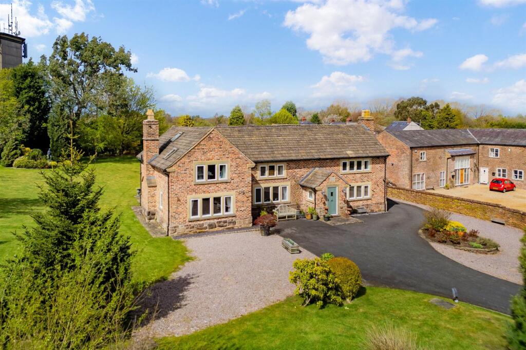
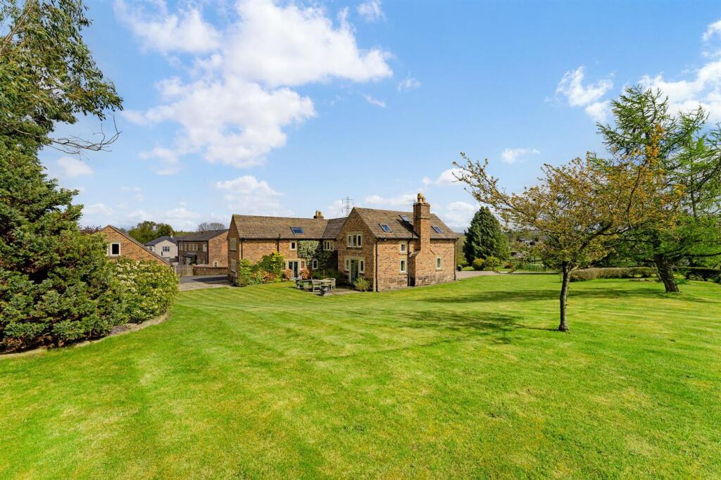
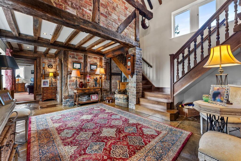
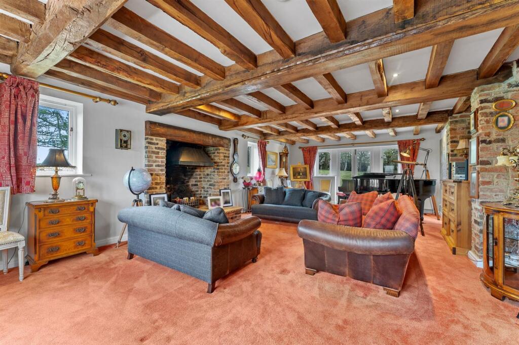
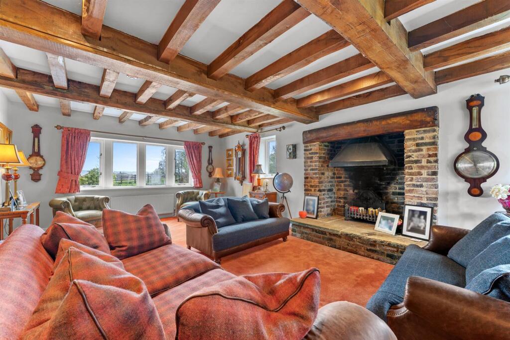
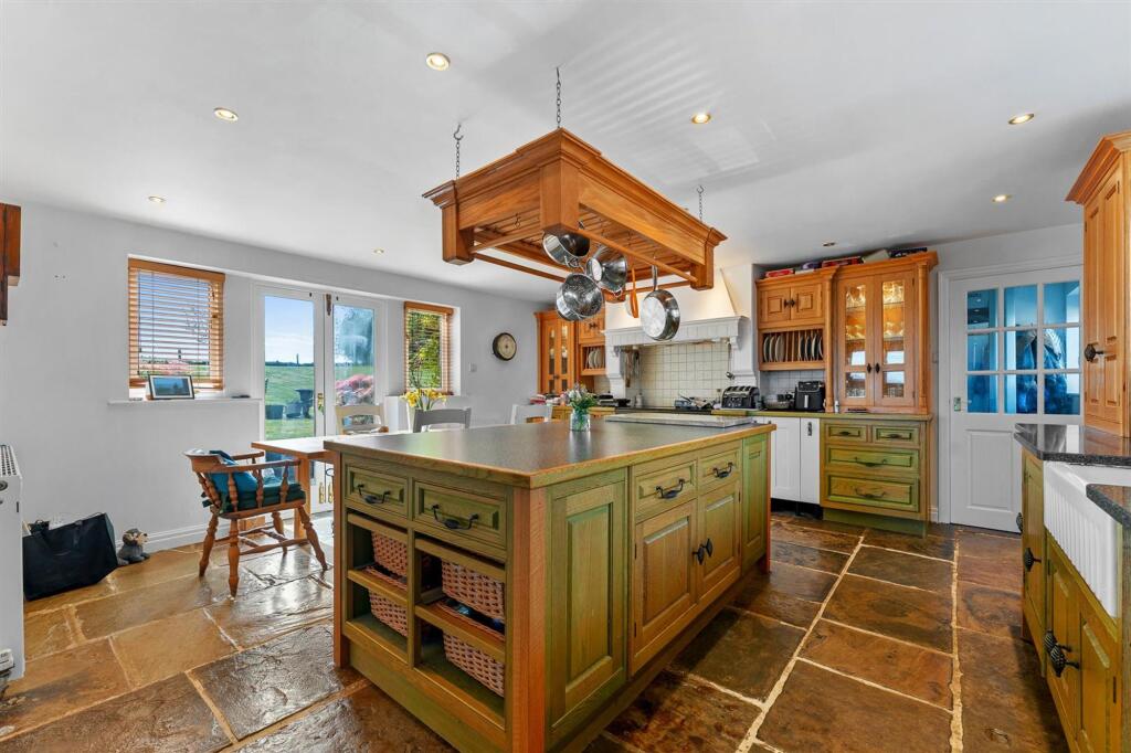
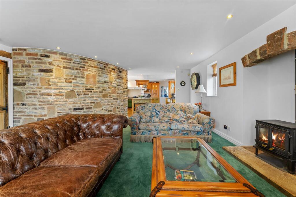
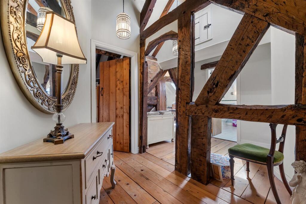
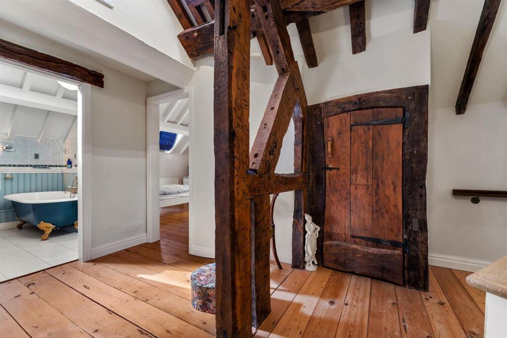
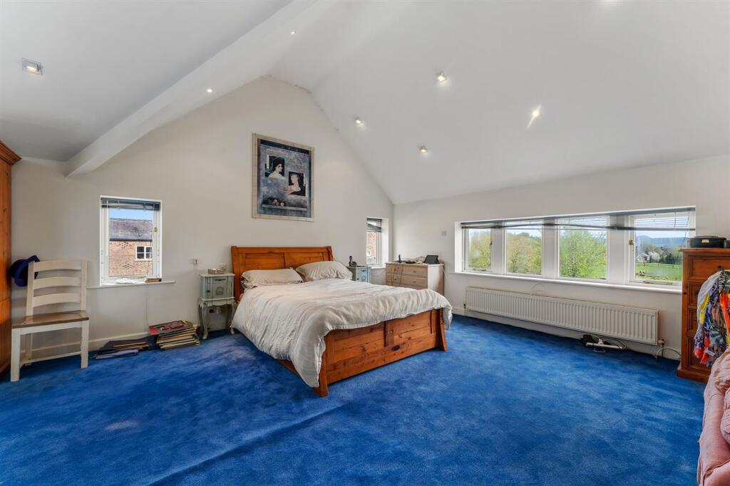
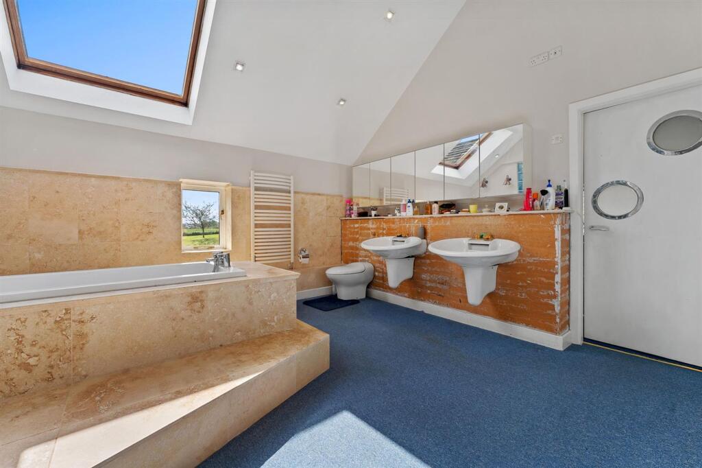
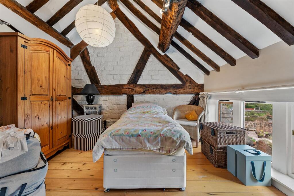
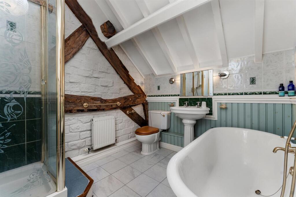
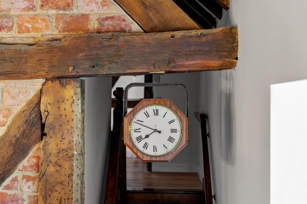
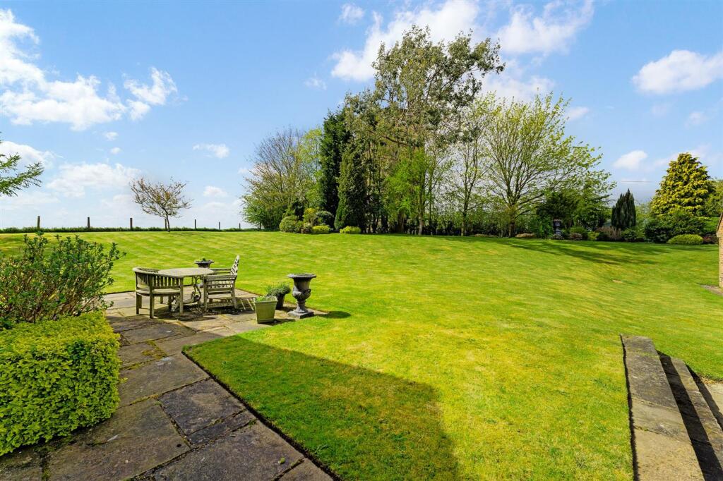
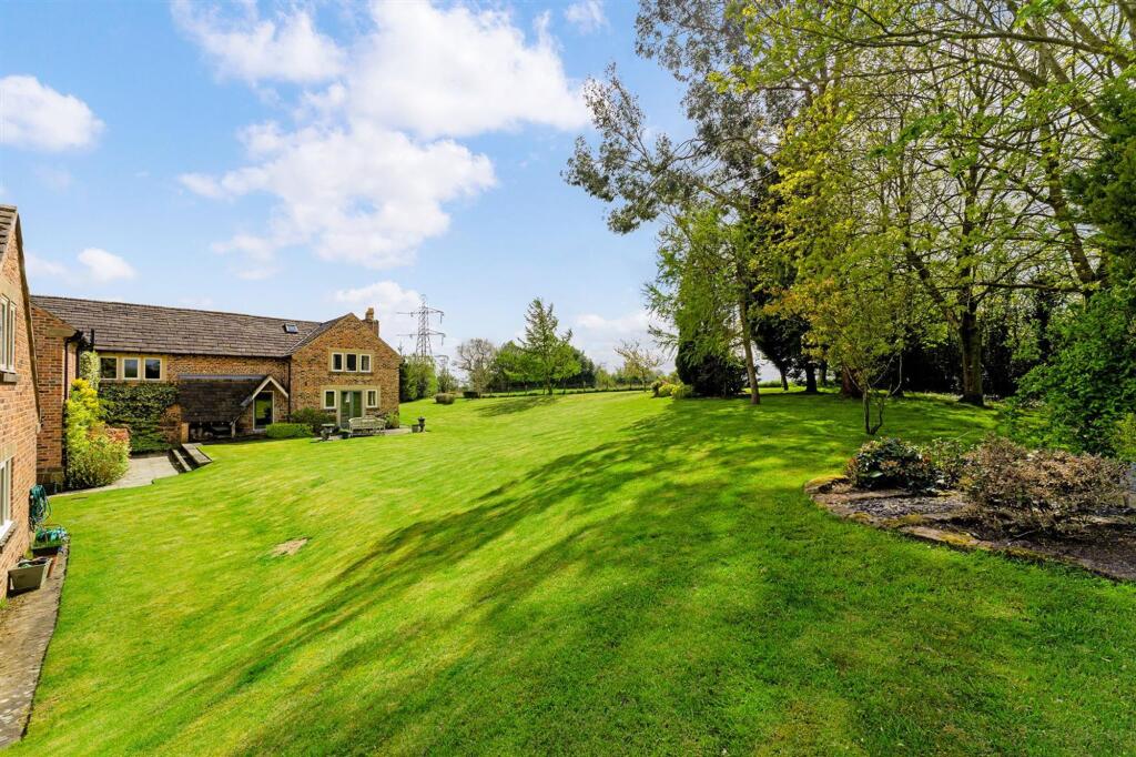
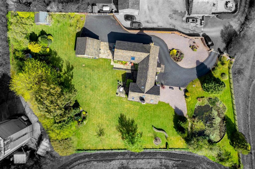
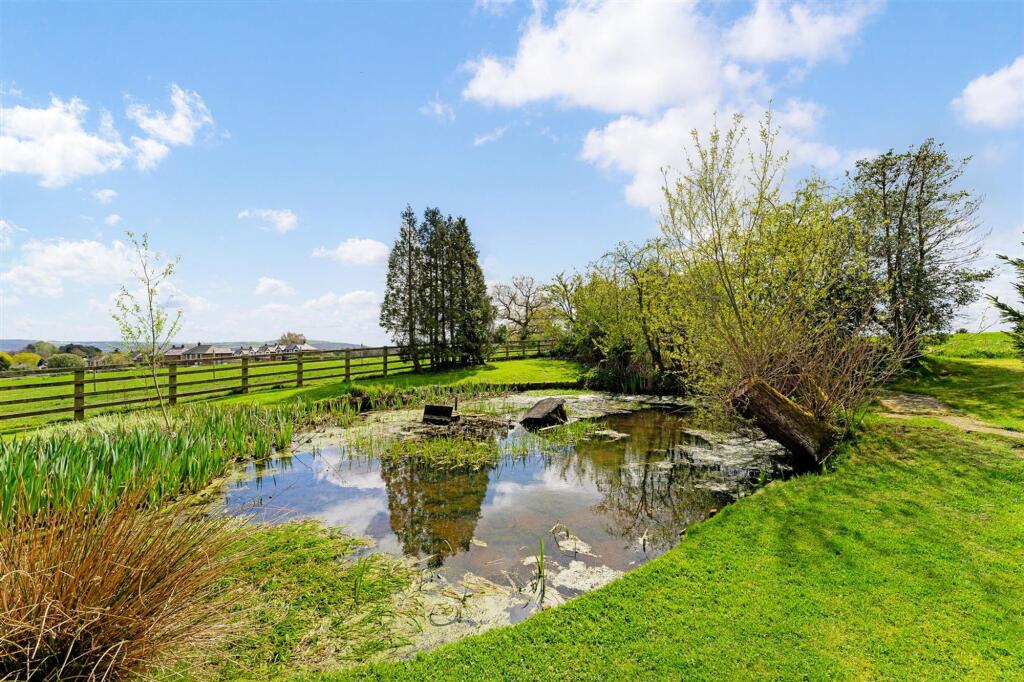
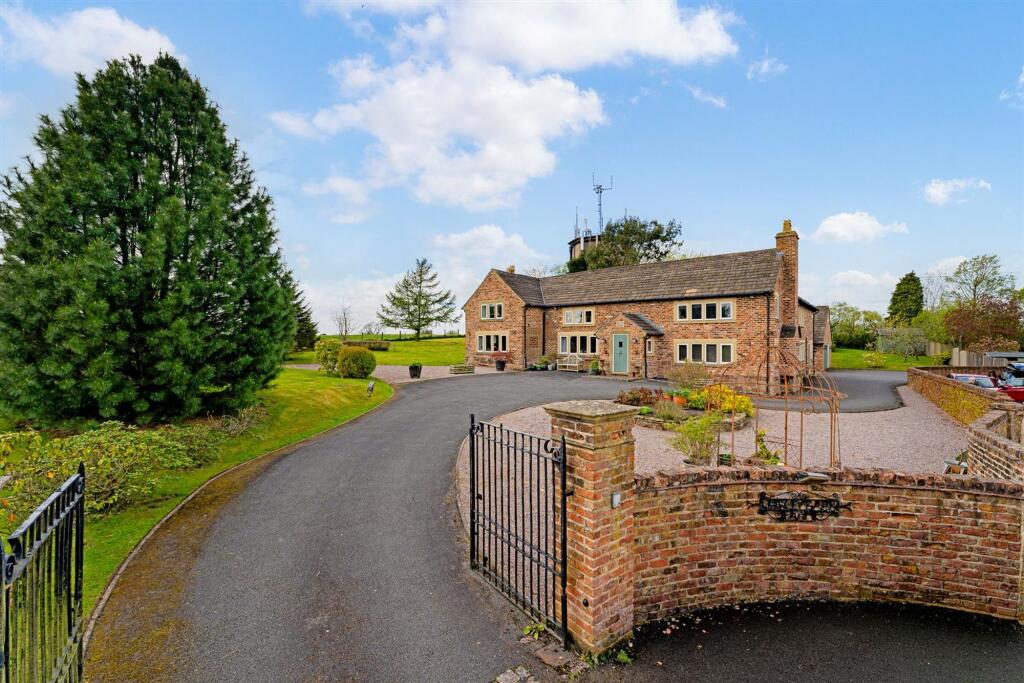
Photo 1 Photo 2 Photo 3 Photo 4 Photo 5 Photo 6 Photo 7 Photo 8 Photo 9 Photo 10 Photo 11 Photo 12 Photo 13 Photo 14 Photo 15 Photo 16 Photo 17 Photo 18 Photo 19
/ 19
Property details
Tenure
FREEHOLD
Local average
£854,632 (+17%)
Deprivation
Decile 10 (32,513 of 33,755)
Street crime
36 incidents within 1 mile (Apr 2026)
Key features
- Countryside Views
- Characterful Detached Home
- Generous Gardens
- Detached Double Garage
Additional details
- Parking
- Yes
- Garden
- Yes
- Listed property
- No
- Restrictions
- No
- Required access
- No
- Rights of way
- No
- Flooded in last 5 years
- No
- Flood defences
- No
Description
EPC Rating: D
Listed by
Alderley Edge
Mosley Jarman
Reference: 89815572
EPC Rating & Upgrade Cost
Fetching EPC data… Refresh this page in a moment.
Flood risk
Zone: 1
Risk: Low
Job (default Low)
Floorplans
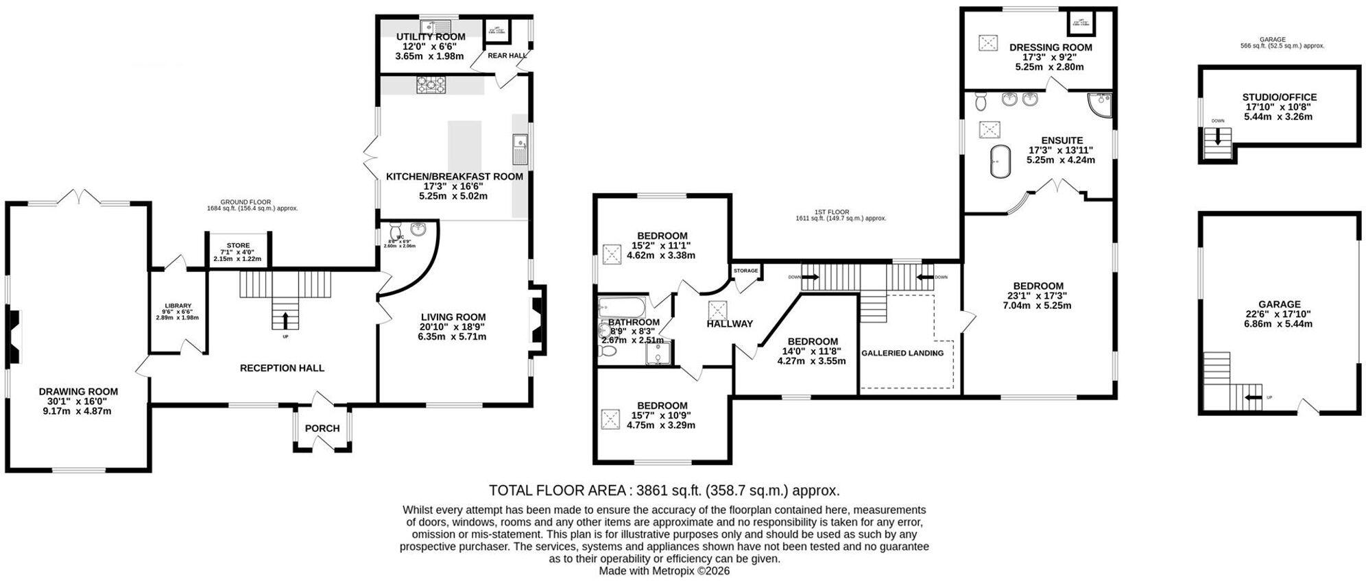
Floorplan 1
EPC Graphs
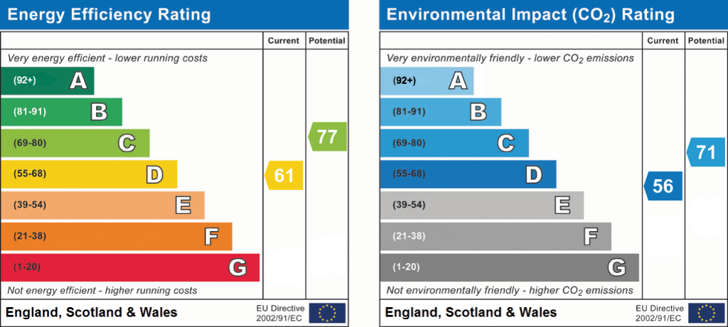
EPC 1
Price history
| Event | Date | Price | % change |
|---|---|---|---|
| Listed for sale | — | £1,000,000 | — |
Source: HM Land Registry Price Paid Data. Crown copyright.
Sold Comparables
Same street and nearby sales within 0.25 miles (last 5 years). Data from Land Registry Price Paid.
| Address | Price | Date | Type |
|---|---|---|---|
| 96 WHIRLEY ROAD, MACCLESFIELD, CHESHIRE EAST, SK10 3JL | £600,000 | 15/09/2023 | Detached |
| BIRCH TREE COTTAGE ANDERTONS LANE, HENBURY, MACCLESFIELD, CHESHIRE EAST, SK10 4RW | £650,000 | 10/12/2021 | Detached |
Area average: £625,000 (2 sales)
Capital growth trend
Land Registry outcode average: last 12 months vs 5y and 10y ago (from sold prices).
House Price Index (HM Land Registry — official index, not sold-price averages): Cheshire East. Series: Detached. As of March 2026.
Rental Range
Estimated market rent for Cheshire East. Low = conservative, Realistic = average, Optimistic = best case.
Based on Local Authority from postcode lookup → Cheshire East.
LHA (30th percentile) floor for East Cheshire: £1,745/mo (Apr 2025 – Mar 2026)
Location
Address
Whirley Road
Nearby
Nearest stations, universities and amenities (distance from property).
| Type | Name | Distance |
|---|---|---|
| Bus stop | Whirleybarn, Whirley Road / Sandy Lane | 0.1 miles |
| Shop | Gulf Store | 0.6 miles |
| Shop | New Image | 0.8 miles |
| Hospital | Rosemount Resource Centre | 1.4 miles |
| Train station | Prestbury | 2.3 miles |
| Train station | Macclesfield | 2.4 miles |
| Hospital | John Munroe Hospital | 10.5 miles |
| University | University of Derby, Buxton | 10.8 miles |
Street-level crime
| Category | Count |
|---|---|
| Violence and sexual offences | 11 |
| Drugs | 10 |
| Anti-social behaviour | 6 |
| Public order | 6 |
| Criminal damage and arson | 1 |
| Other theft | 1 |
| Robbery | 1 |
| Total incidents | 36 |
Within 1 mile during Apr 2026. Source: data.police.uk (England & Wales).
Schools nearby
Nearest open schools with Ofsted ratings (England). Closed schools are not shown. Data from Get Information about Schools and Ofsted.
| Name | Type | Distance | Ofsted |
|---|---|---|---|
| Whirley Primary School | Primary | 0.3 miles | Good — 14 Apr 2011 |
| Eden School | Other | 0.6 miles | Good — 10 Mar 2024 |
| The Fallibroome Academy | Secondary | 0.7 miles | Good — 16 Feb 2023 |
| St Alban's Catholic Primary School, A Voluntary Academy | Primary | 0.9 miles | Outstanding — 26 Nov 2014 |
| The King's School In Macclesfield | Other | 0.9 miles | — (No rating) |
Rental Comparables
Rental listings exist nearby, but none matched the 4-bedroom count for this property.
Rent-driven metrics
Based on Area rent estimate.
- Rent ratio — Monthly rent ÷ purchase price (1% rule). 1%+ = strong, 0.8–1% = okay, <0.8% = weak for cashflow.
- Max investor price — Rent ÷ 0.8%; the price at which rent would be 0.8% of price (Stoke-style target).
- Target investor price — Rent ÷ 1%; the price at which rent would be 1% of price (strong cashflow band).
- Gross yield — Annual rent as % of purchase price (no costs).