25 VICTORIA ROAD
ST AUSTELL, CORNWALL PL25 4QF
£295,000
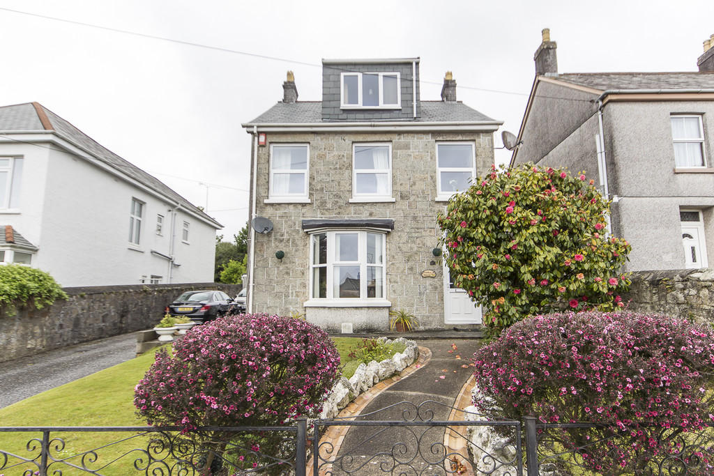
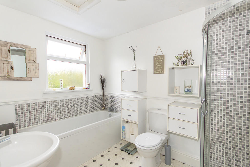
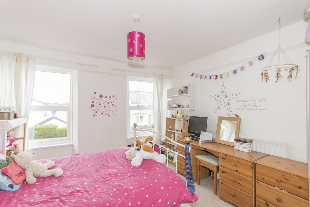

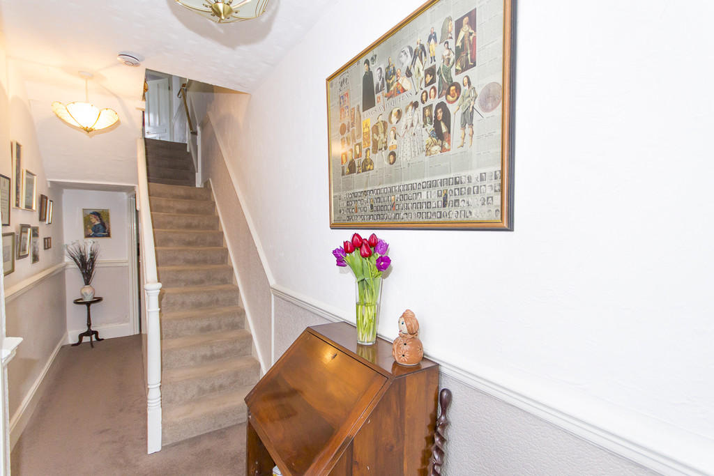
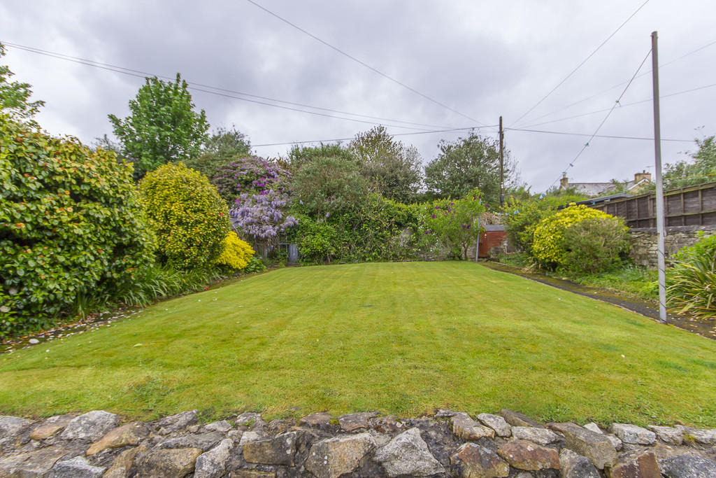
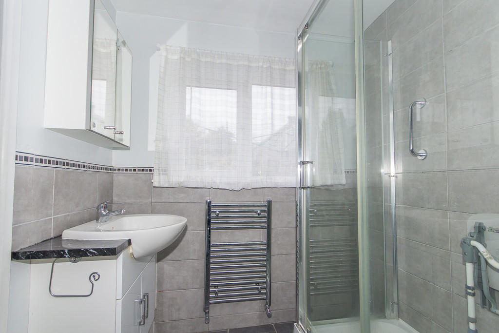
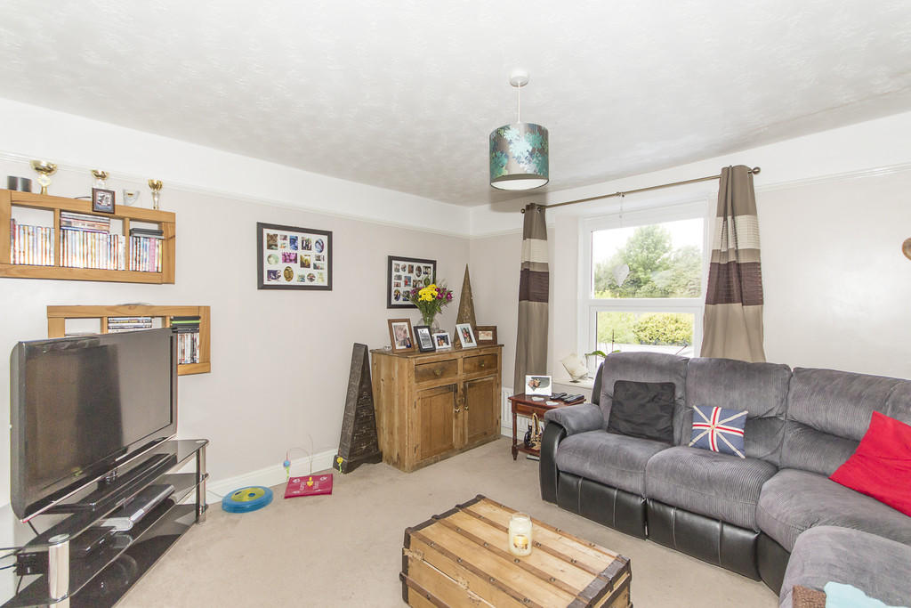
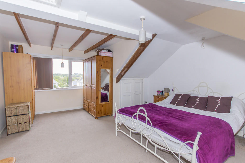
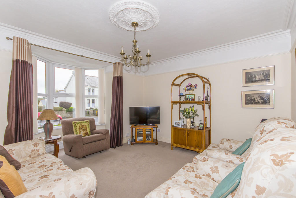
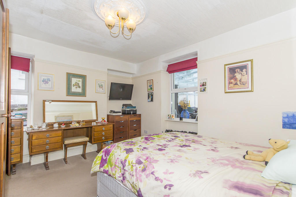
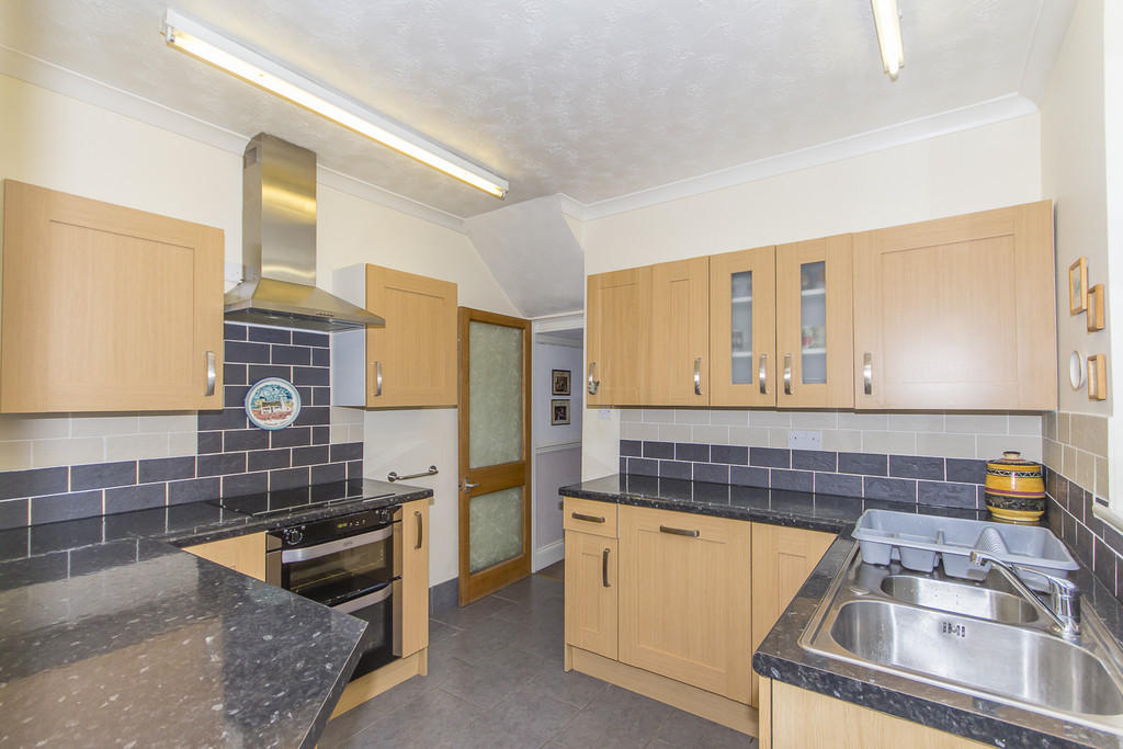
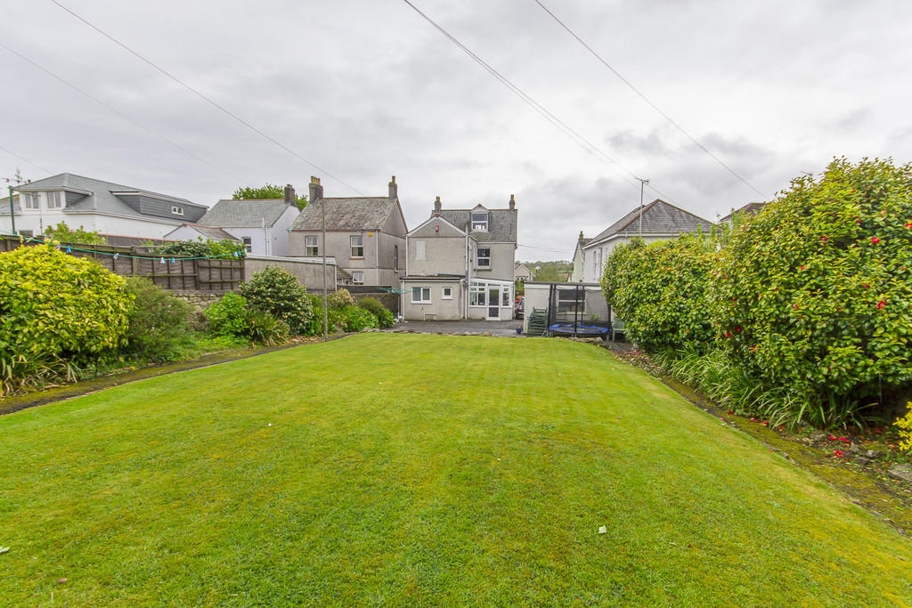
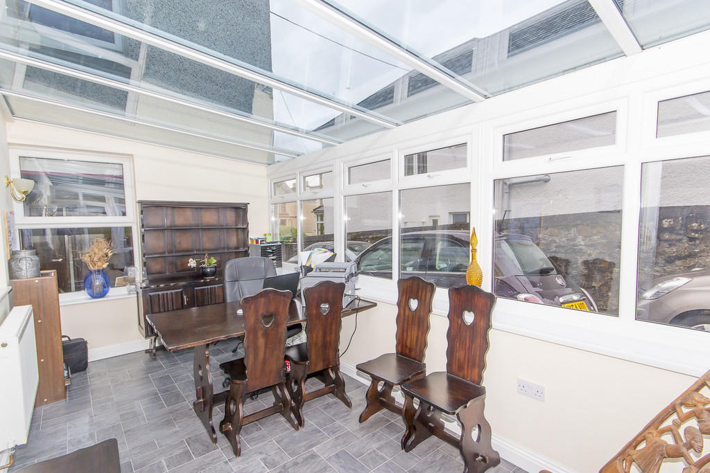
Photo 1 Photo 2 Photo 3 Photo 4 Photo 5 Photo 6 Photo 7 Photo 8 Photo 9 Photo 10 Photo 11 Photo 12 Photo 13 Photo 14
/ 14
Property details
Tenure
FREEHOLD
Last sold
£282,000 Aug 2017
Local average
£365,017 (-19.2%)
Deprivation
Decile 4 (12,146 of 33,755)
Street crime
180 incidents within 1 mile (Apr 2026)
Key features
- currently dual family accommodation
- Easily turned back into a 5 bedroom home
- Lounge and separate dining room
- Kitchen and separate utility room
- Large upvc double glazed conservatory
- Gas central heating and double glazing
- Large enclosed level gardens
- detached 1 and a half size garage
Additional details
- Parking
- Yes
- Garden
- Yes
Description
Dining Room 13' 0'' x 12' 0'' (3.96m x 3.65m)
Kitchen 10' 4'' x 9' 9'' (3.15m x 2.97m)
Utility room 9' 9'' x 6' 0'' (2.97m x 1.83m)
Conservatory 16' 5'' x 7' 7'' (5.00m x 2.31m)
Bedroom 2 12' 1'' x 11' 0'' (3.68m x 3.35m)
Bedroom 3 13' 0'' x 12' 0'' (3.96m x 3.65m)
Bedroom 4 8' 4'' x 7' 0'' (2.54m x 2.13m)
Bedroom 5 8' 8'' x 7' 7'' (2.64m x 2.31m)
Family Bathroom 10' 3'' x 7' 3'' (3.12m x 2.21m)
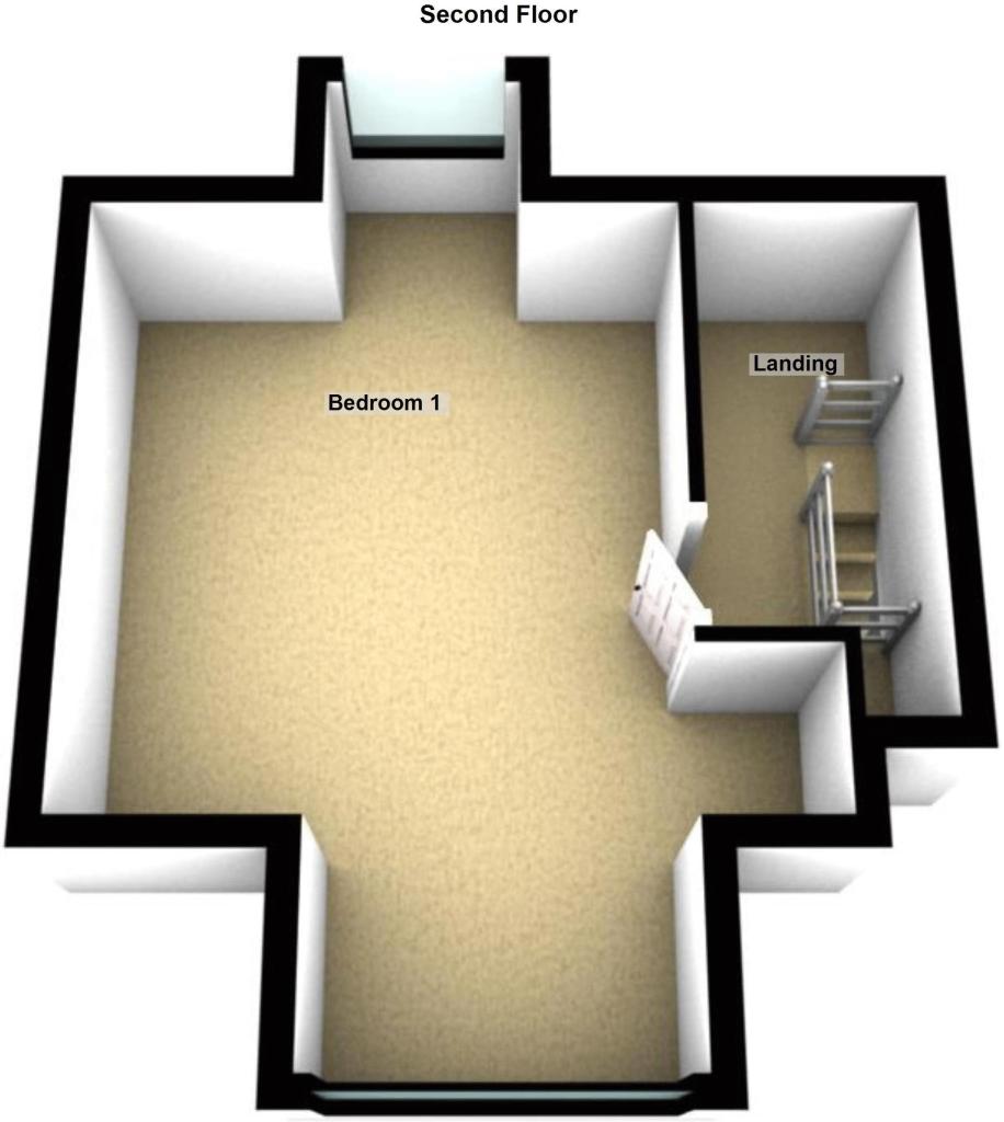
Bedroom 1 13' 5'' x 12' 8'' (4.09m x 3.86m)
Listed by
Plymouth
City Lets
Reference: 60341461
EPC Rating & Upgrade Cost
Fetching EPC data… Refresh this page in a moment.
Flood risk
Zone: 1
Risk: Low
Job (default Low)
Floorplans
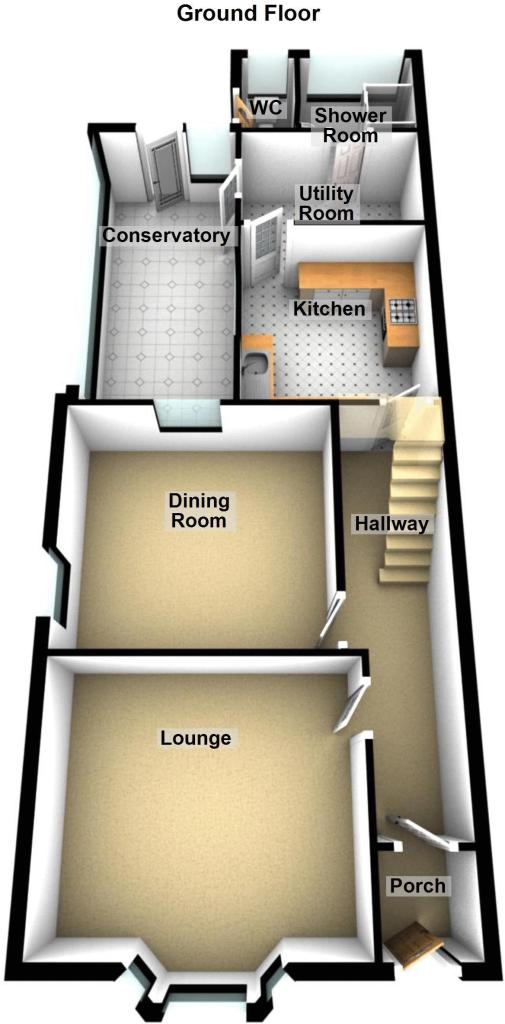
Floorplan 1

Floorplan 2
Floorplan 3
EPC Graphs

EPC Front Page
FENSA Certificates
This property has 1 FENSA certificate(s) on record, indicating window/door installations by FENSA-approved installers.
FENSA Certificate #15116913 Recent
Property Details
Street: 25 Victoria Road
Town: ST. AUSTELL
Postcode: PL25 4QF
Installation Details
Items: 1 door
Certificate Issued: 27/03/2022
Work Completed: 11/01/2022
This certificate data was retrieved from FENSA's database
What is FENSA? FENSA (Fenestration Self-Assessment Scheme) is a government-authorised scheme that monitors building regulation compliance for replacement windows and doors. Certificates indicate that work was completed by FENSA-approved installers.
Price history
41% since 2011
| Event | Date | Price | % change |
|---|---|---|---|
| Sold | 24/08/2017 (8 years ago) | £282,000 | +41% |
| Sold | 14/11/2011 (14 years ago) | £200,000 | — |
Source: HM Land Registry Price Paid Data. Crown copyright.
Sold Comparables
Same street and nearby sales within 0.25 miles (last 5 years). Data from Land Registry Price Paid.
| Address | Price | Date | Type |
|---|---|---|---|
| Same street 53 VICTORIA ROAD, ST AUSTELL, CORNWALL, PL25 4QF | £260,000 | 16/09/2025 | Terraced |
| 17 MITCHELL ROAD, ST AUSTELL, CORNWALL, PL25 3AX | £350,000 | 14/08/2025 | Detached |
| Same street 21 VICTORIA ROAD, ST AUSTELL, CORNWALL, PL25 4QF | £275,000 | 26/03/2025 | Semi-detached |
| 8 BOSCARNE CRESCENT, ST AUSTELL, CORNWALL, PL25 4PW | £330,000 | 14/11/2023 | Detached |
| CHYMAYN PARC WOODLAND ROAD, ST AUSTELL, CORNWALL, PL25 4QZ | £440,000 | 24/11/2021 | Detached |
| 49 MOUNT CHARLES ROAD, ST AUSTELL, CORNWALL, PL25 3LB | £390,000 | 25/06/2021 | Detached |
| 10 CLIFDEN ROAD, ST AUSTELL, CORNWALL, PL25 4NX | £100,000 | 25/06/2021 | Detached |
| 6 BOSCARNE CRESCENT, ST AUSTELL, CORNWALL, PL25 4PW | £235,000 | 18/06/2021 | Detached |
Street average: £267,500 (2 sales)
Area average: £307,500 (6 sales)
Capital growth trend
Land Registry outcode average: last 12 months vs 5y and 10y ago (from sold prices).
House Price Index (HM Land Registry — official index, not sold-price averages): Cornwall. Series: Detached. As of March 2026.
Rental Range
Estimated market rent for Cornwall. Low = conservative, Realistic = average, Optimistic = best case.
Based on Local Authority from postcode lookup → Cornwall.
Location
Nearby
Nearest stations, universities and amenities (distance from property).
| Type | Name | Distance |
|---|---|---|
| Shop | The Co-operative Funeralcare | 0.0 miles |
| Bus stop | Victoria Road | 0.0 miles |
| Shop | Morven Windows | 0.1 miles |
| Train station | St Austell | 0.6 miles |
| Hospital | St Austell Community Hospital | 0.8 miles |
| Train station | Par | 3.3 miles |
| Hospital | Bodmin Hospital | 9.0 miles |
Street-level crime
| Category | Count |
|---|---|
| Violence and sexual offences | 68 |
| Criminal damage and arson | 29 |
| Anti-social behaviour | 24 |
| Public order | 14 |
| Other theft | 13 |
| Shoplifting | 6 |
| Burglary | 5 |
| Other crime | 5 |
| Drugs | 4 |
| Robbery | 4 |
| Vehicle crime | 4 |
| Possession of weapons | 2 |
| Bicycle theft | 1 |
| Theft from the person | 1 |
| Total incidents | 180 |
Within 1 mile during Apr 2026. Source: data.police.uk (England & Wales).
Schools nearby
Nearest open schools with Ofsted ratings (England). Closed schools are not shown. Data from Get Information about Schools and Ofsted.
| Name | Type | Distance | Ofsted |
|---|---|---|---|
| Mount Charles School | Primary | 0.1 miles | Good — 24 Nov 2011 |
| Penrice Academy | Secondary | 0.3 miles | Outstanding — 2 Apr 2014 |
| Restormel Academy | Other | 0.3 miles | Good — 6 Feb 2013 |
| Sandy Hill Academy | Primary | 0.3 miles | Outstanding — 23 Mar 2017 |
| Poltair School | Secondary | 0.6 miles | Good — 24 Apr 2024 |
Rental Comparables
Rental listings exist nearby, but none matched the 5-bedroom count for this property.
Rent-driven metrics
Based on Area rent estimate.
- Rent ratio — Monthly rent ÷ purchase price (1% rule). 1%+ = strong, 0.8–1% = okay, <0.8% = weak for cashflow.
- Max investor price — Rent ÷ 0.8%; the price at which rent would be 0.8% of price (Stoke-style target).
- Target investor price — Rent ÷ 1%; the price at which rent would be 1% of price (strong cashflow band).
- Gross yield — Annual rent as % of purchase price (no costs).