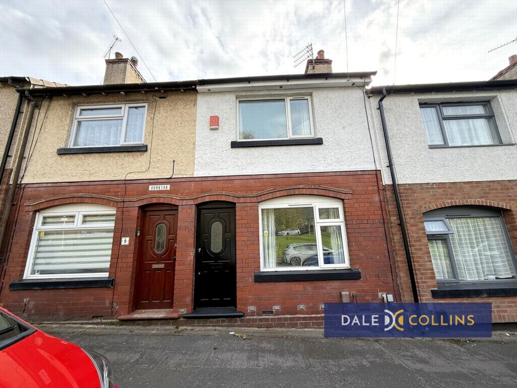
29 DUNKIRK
NEWCASTLE ST5 2SW
£800 pcm
Property details
Floor area
56 m²
Council tax band
A
Year built
England and Wales: 1900-1929
Deprivation
Decile 2 (4,637 of 33,755)
Street crime
321 incidents within 1 mile (Apr 2026)
Key features
- TERRACED HOUSE
- TWO BEDROOMS
- GAS CENTRAL HEATING
- UPVC DOUBLE GLAZING
- CLOSE TO AMENITIES
- GOOD COMMUTER LINKS
Additional details
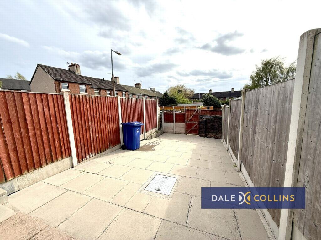
- Garden
- Yes
Description
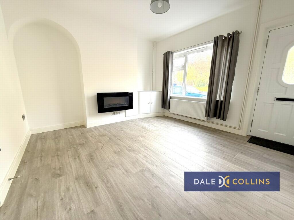
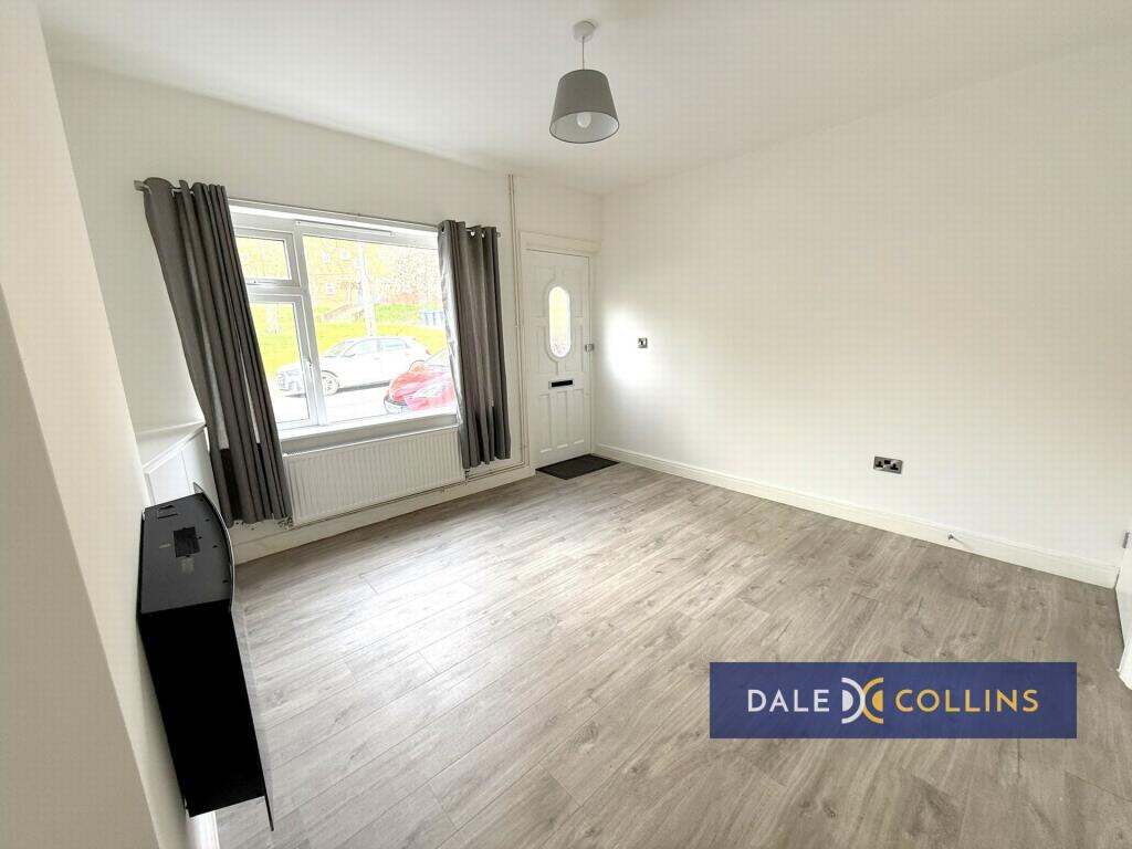
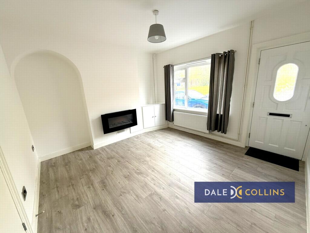
LOUNGE: 12'5" x 11'7" (3.78m x 3.53m), Laminate flooring, uPVC double glazing, central heating radiator.
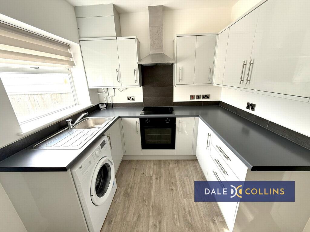
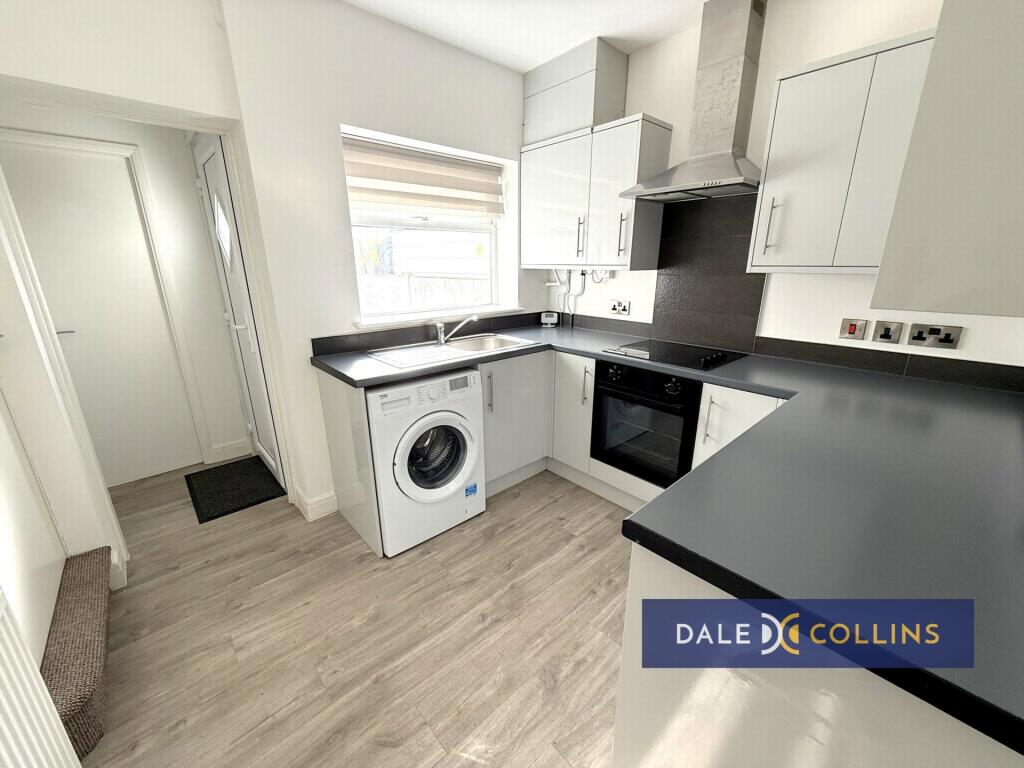
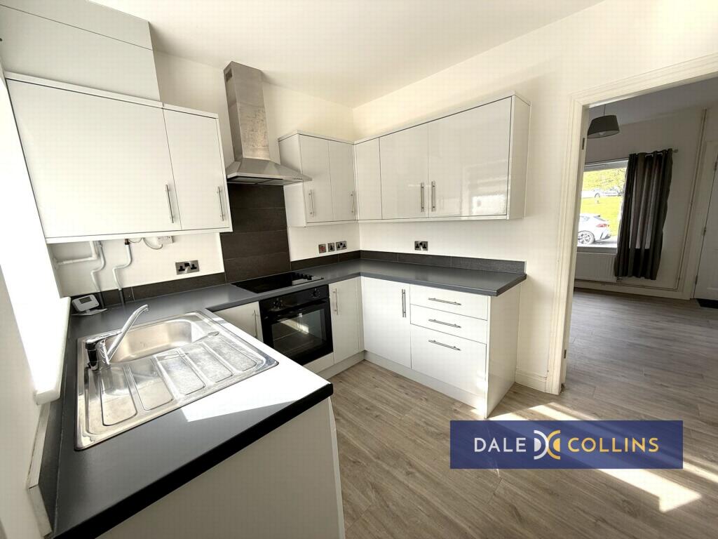
KITCHEN: 9'3" x 8'2" (2.82m x 2.49m), Stainless steel sink unit with cupboards below, base and wall storage units, working surfaces. Integrated electric hob, oven and extractor. Washing machine, fridge freezer, laminate flooring, uPVC double glazing, central heating radiator.
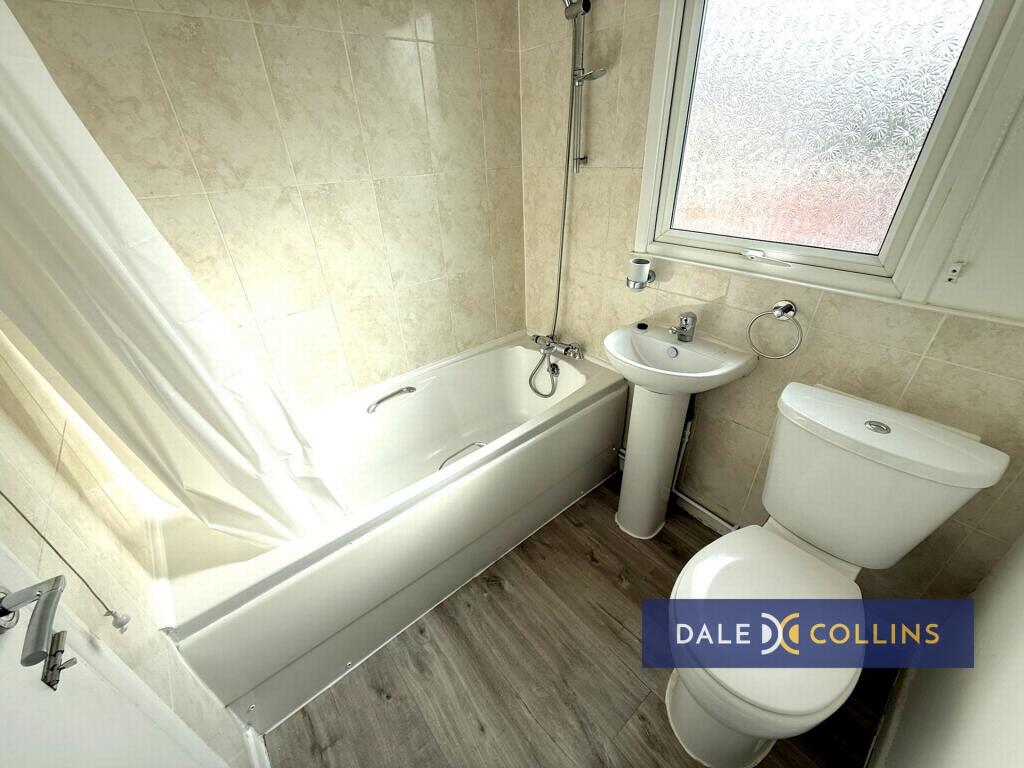
BATHROOM/WC: 6'0" x 5'5" (1.83m x 1.65m), Panelled bath, pedestal wash hand basin, low level WC, central heating radiator, uPVC double glazing, laminate flooring.
FIRST FLOOR
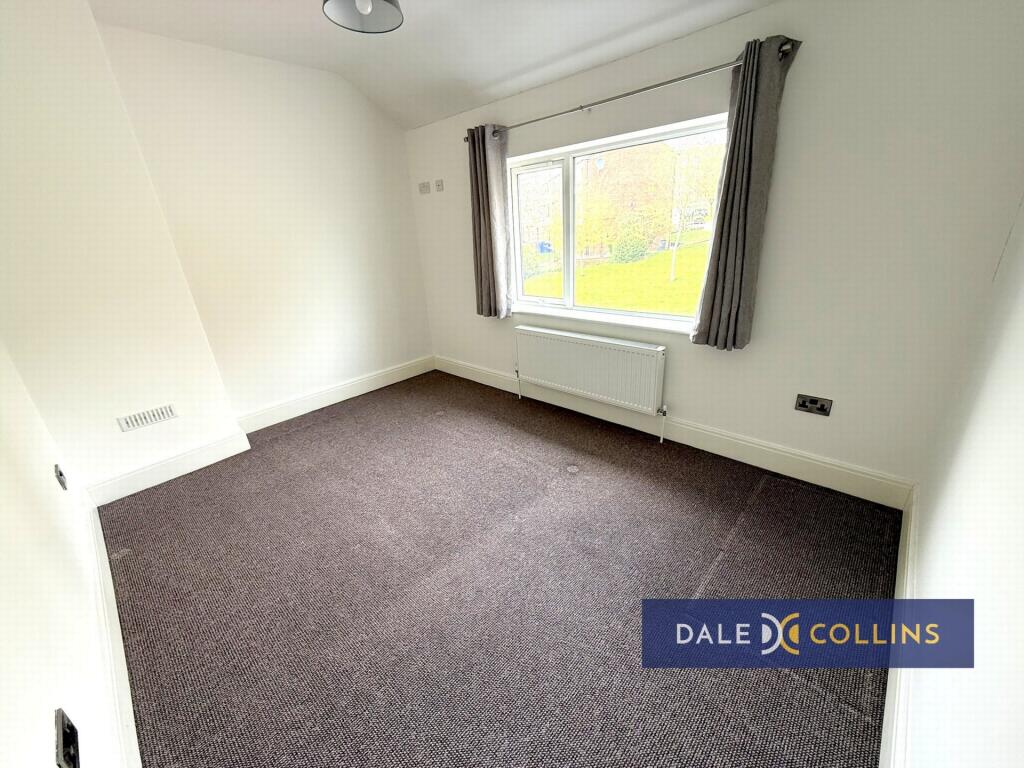
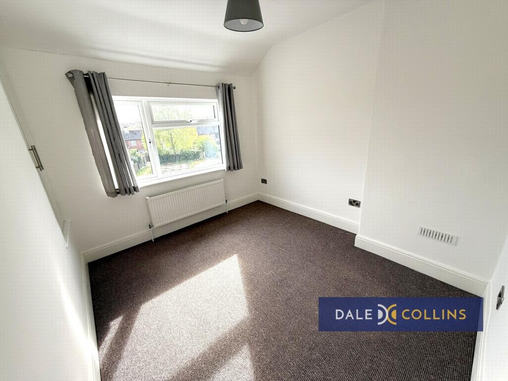
BEDROOM ONE: 12'6" x 9'1" (3.81m x 2.77m), Fitted carpet, uPVC double glazing, central heating radiator.
BEDROOM TWO: 10'8" x 9'6" (3.25m x 2.90m), Fitted carpet, uPVC double glazing, central heating radiator, store.
EXTERNALLY: Enclosed yard to the rear.
Listed by
Trentham
Dale and Collins
Reference: 174483836
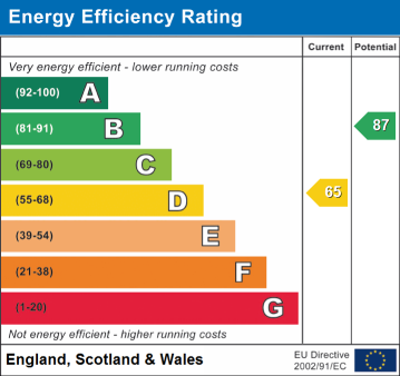
EPC Rating & Upgrade Cost
Fetching EPC data… Refresh this page in a moment.
Flood risk
Zone: 1
Risk: Low
Job (default Low)
EPC Graphs
EPC
Rental Range
Estimated market rent for Newcastle-under-Lyme. Low = conservative, Realistic = average, Optimistic = best case.
Based on Local Authority from postcode lookup → Newcastle-under-Lyme.
LHA (30th percentile) floor for Staffordshire North: £479/mo (Apr 2025 – Mar 2026)
Location
Address
9 Dunkirk
Nearby
Nearest stations, universities and amenities (distance from property).
| Type | Name | Distance |
|---|---|---|
| Shop | Lidl | 0.1 miles |
| Bus stop | Bailey Street | 0.1 miles |
| Bus stop | The Dunkirk Tavern PH | 0.1 miles |
| Shop | A Feast of Flowers | 0.1 miles |
| Hospital | Hartshill Medical Centre | 0.9 miles |
| Hospital | Royal Stoke University Hospital | 1.0 miles |
| University | Keele University | 1.8 miles |
| Train station | Silverdale | 2.0 miles |
| Train station | Longport | 2.1 miles |
| University | University of Staffordshire Stoke Campus | 2.2 miles |
Street-level crime
| Category | Count |
|---|---|
| Violence and sexual offences | 92 |
| Anti-social behaviour | 71 |
| Public order | 31 |
| Shoplifting | 30 |
| Other theft | 20 |
| Criminal damage and arson | 19 |
| Burglary | 15 |
| Drugs | 13 |
| Vehicle crime | 12 |
| Other crime | 8 |
| Robbery | 4 |
| Possession of weapons | 3 |
| Theft from the person | 2 |
| Bicycle theft | 1 |
| Total incidents | 321 |
Within 1 mile during Apr 2026. Source: data.police.uk (England & Wales).
Schools nearby
Nearest open schools with Ofsted ratings (England). Closed schools are not shown. Data from Get Information about Schools and Ofsted.
| Name | Type | Distance | Ofsted |
|---|---|---|---|
| St Mary's Catholic Primary School | Primary | 0.1 miles | Good — 17 Feb 2017 |
| St John Fisher Catholic College | Secondary | 0.3 miles | Requires improvement — 5 Mar 2024 |
| St Giles' and St George's Church of England Academy | Primary | 0.3 miles | Good — 21 May 2023 |
| Newcastle and Stafford Colleges Group | Other | 0.3 miles | — (No rating) |
| Blackfriars Academy | Other | 0.3 miles | Outstanding — 6 Feb 2013 |
Rental Comparables
Residential lets from OpenRent and Rightmove for the area (same bedroom count). Use to validate rent estimates. Student lets are excluded.
Average rent: £842/mo (54 listings)