6 SHAFTMOOR FARM ROAD
BIRMINGHAM, WEST MIDLANDS B28 8EN
Property details
Floor area
92 m²
Council tax band
D
Street crime
565 incidents within 1 mile (Apr 2026)
Key features
- Available January 24th
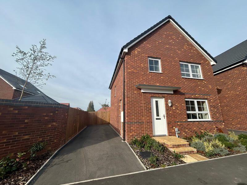
- New detached home
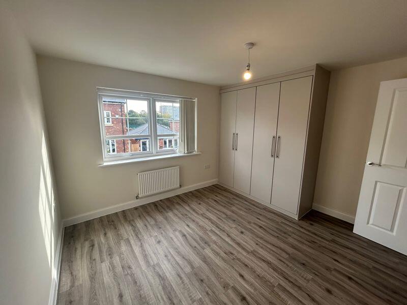
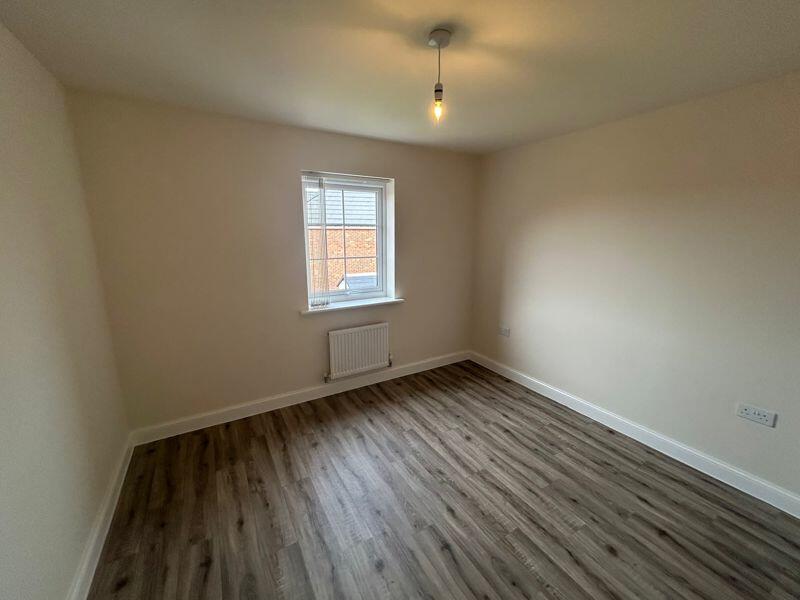
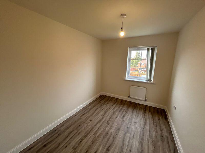
- 3 bedrooms
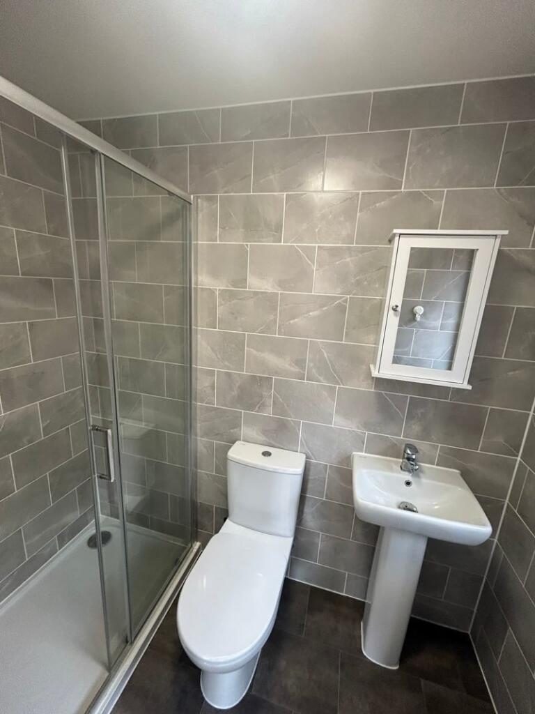
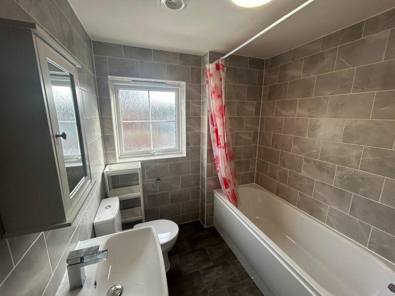
- En-suite to master and fitted wadrobes
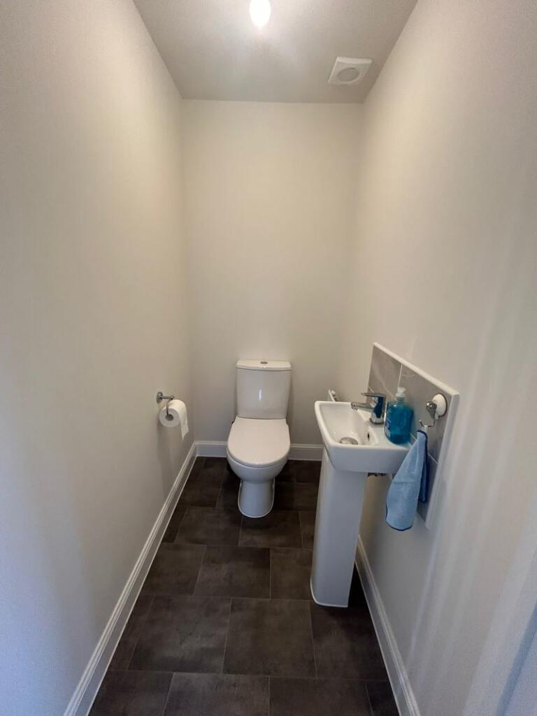
- Downstairs W.C
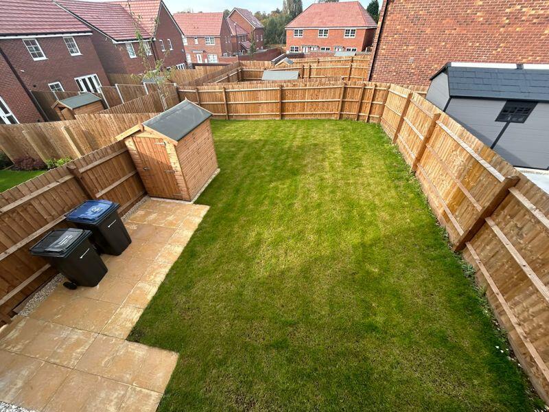
- Large garden
- Driveway
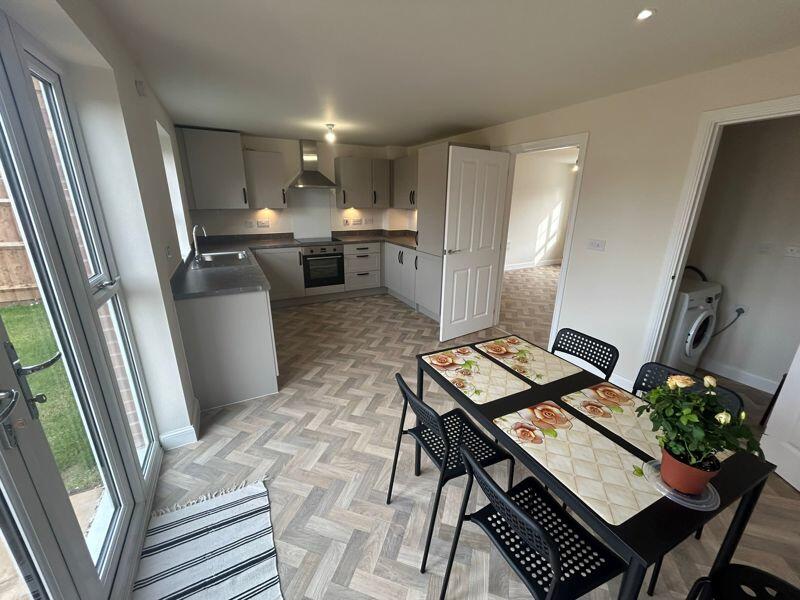
- Part furnished with table and chairs and white goods
- Council tax band D
- EPC grade is B
Additional details
- Parking
- Yes
- Garden
- Yes
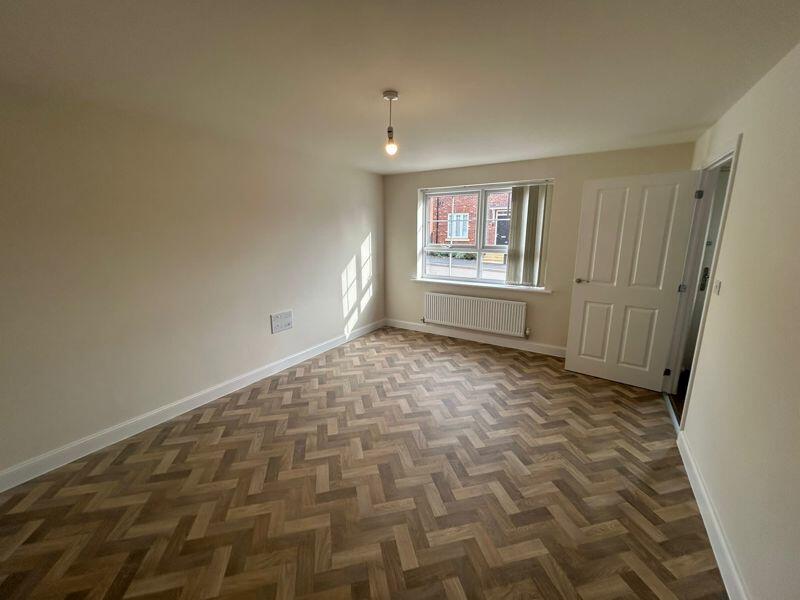
Description
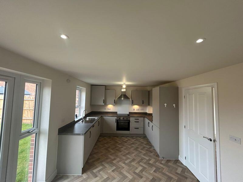
Driveway, hall, lounge, kitchen/diner with dishwasher, fridge freezer, oven and ceramic hob, plus washing machine in separate utility cupboard. Three bedrooms, main bedroom with fitted wardrobes and En-suite shower room. Downstairs W.C.
Large rear garden.
EPC is grade B.
Council tax band D.
Listed by
Solihull
Abode Residential Ltd
Reference: 143246159
EPC Rating & Upgrade Cost
Fetching EPC data… Refresh this page in a moment.
Flood risk
Zone: 2
Risk: In flood risk area
Environment Agency Flood Risk Areas (APSFR)
EPC Graphs

Energy Performance Certificate
Rental Range
Estimated market rent for West Midlands. Low = conservative, Realistic = average, Optimistic = best case.
Based on Postcode area B → West Midlands.
LHA (30th percentile) floor for Birmingham: £823/mo (Apr 2025 – Mar 2026)
Location
Nearby
Nearest stations, universities and amenities (distance from property).
| Type | Name | Distance |
|---|---|---|
| Bus stop | Shaftmoor Lane / Railway Bridge | 0.0 miles |
| Train station | Spring Road | 0.2 miles |
| Shop | Zizzi Desserts | 0.2 miles |
| Shop | Unknown | 0.2 miles |
| Train station | Hall Green | 0.5 miles |
| University | BIMM University Birmingham | 3.0 miles |
| University | University of Birmingham School of Dentistry | 3.2 miles |
| Hospital | Brian Oliver Centre | 4.5 miles |
Street-level crime
| Category | Count |
|---|---|
| Violence and sexual offences | 279 |
| Vehicle crime | 50 |
| Other theft | 43 |
| Criminal damage and arson | 41 |
| Shoplifting | 34 |
| Burglary | 32 |
| Public order | 26 |
| Drugs | 15 |
| Possession of weapons | 11 |
| Anti-social behaviour | 9 |
| Robbery | 9 |
| Other crime | 7 |
| Theft from the person | 6 |
| Bicycle theft | 3 |
| Total incidents | 565 |
Within 1 mile during Apr 2026. Source: data.police.uk (England & Wales).
Schools nearby
Nearest open schools with Ofsted ratings (England). Closed schools are not shown. Data from Get Information about Schools and Ofsted.
| Name | Type | Distance | Ofsted |
|---|---|---|---|
| Yarnfield Primary School | Primary | 0.2 miles | Good — 30 Jun 2022 |
| Al-Burhan Grammar School | Other | 0.3 miles | Good — 10 Oct 2022 |
| Yorkmead Junior and Infant School | Primary | 0.3 miles | Good — 13 Nov 2017 |
| Ninestiles, an Academy | Secondary | 0.4 miles | Good — 8 Jan 2020 |
| Al-Furqan Primary School | Primary | 0.5 miles | Good — 5 Jul 2017 |
Rental Comparables
Residential lets from OpenRent and Rightmove for the area (same bedroom count). Use to validate rent estimates. Student lets are excluded.
| Title | Rent | Beds | Distance | As seen on |
|---|---|---|---|---|
| 3 Bed Semi-Detached House, Fanshawe Road, B27 | £1,250/mo | 3 | 0.82 miles | OpenRent |
Average rent: £1,250/mo (1 listing)