Wade Street
Burslem, ST6 1HN
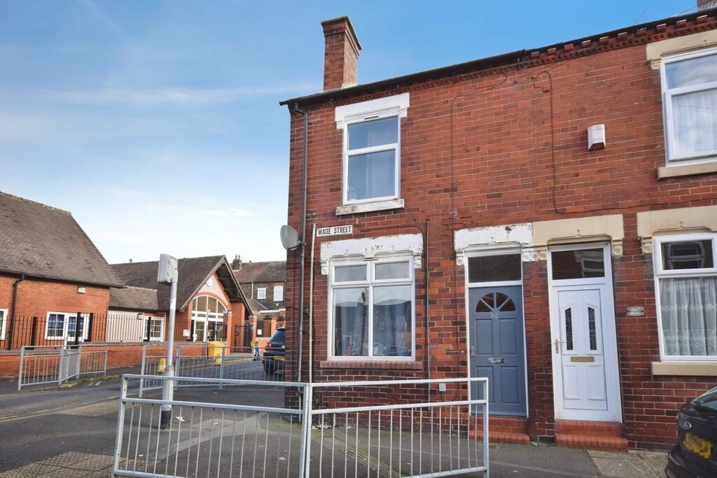
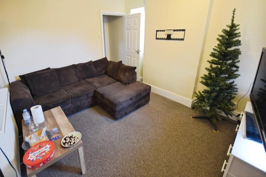

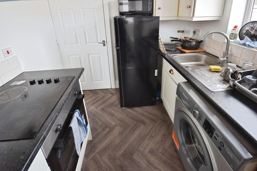
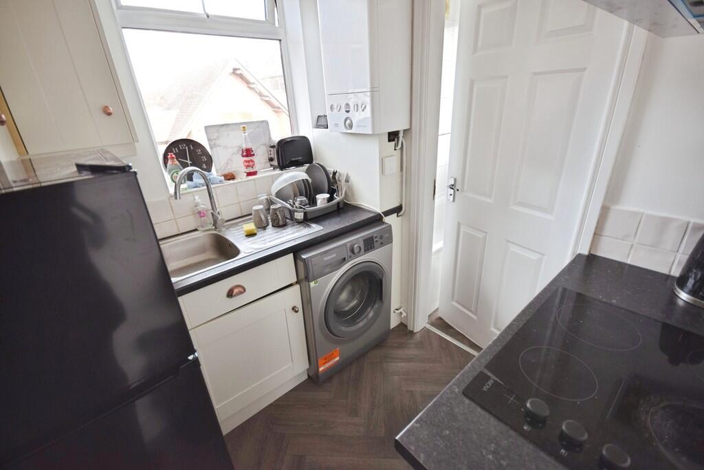
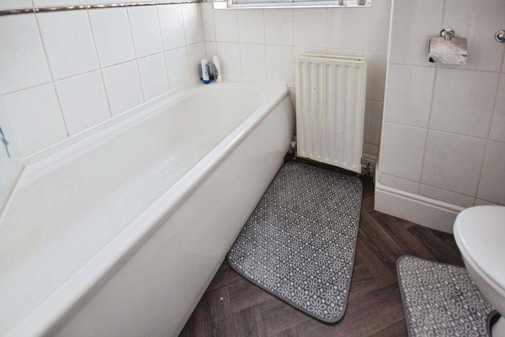
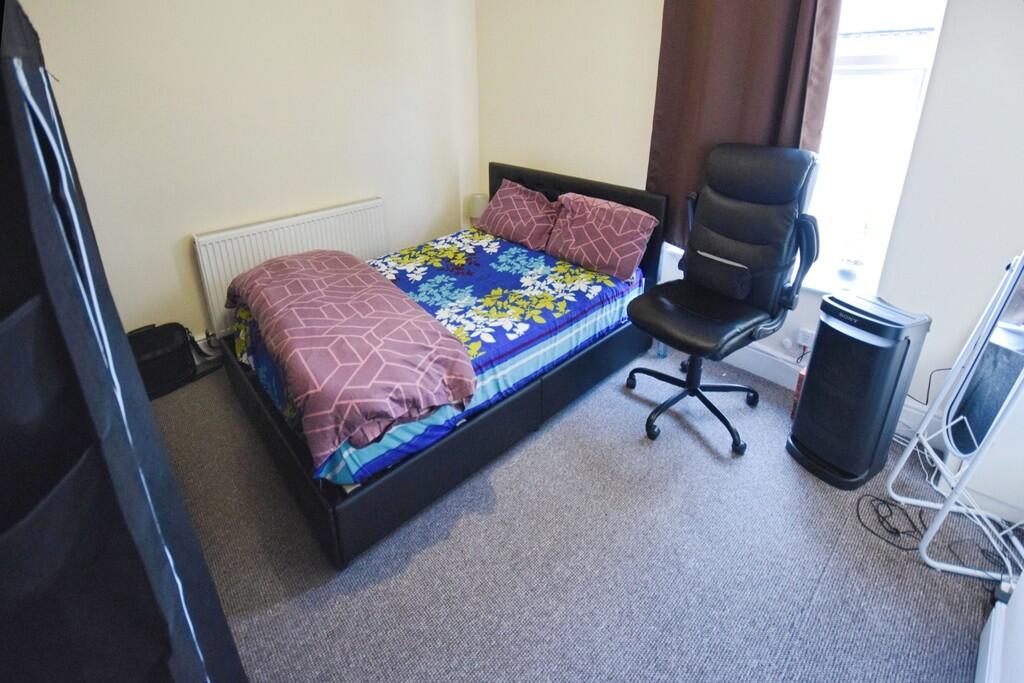
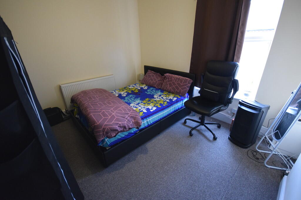
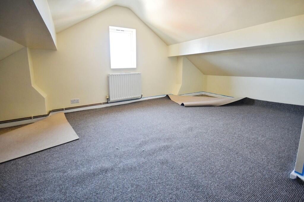
Photo 1 Photo 2 Photo 3 Photo 4 Photo 5 Photo 6 Photo 7 Photo 8 Photo 9
/ 9
Property details
Deprivation
Decile 1 (2,423 of 33,755)
Street crime
382 incidents within 1 mile (Apr 2026)
Key features
- Furnished 1 Bedroom Flat
- Lounge
- Kitchen
- Bathroom
- Loft area
- Close to Burslem town centre
- Council tax band A
- Private front door
Description
LOUNGE Window to rear, radiator, Sofa and tv unit
KITCHEN Range of units with worksurface. integrated oven and hob, washing machine, fridge freezer, Window
BEDROOM Window to front, radiator, double bed and wardrobe
BATHROOM ** panelled bath with shower, was hand basin and Wc. window and radiator.
Listed by
Stoke On Trent
The Property Franchise Group
Reference: 172517645
EPC Rating & Upgrade Cost
Fetching EPC data… Refresh this page in a moment.
Flood risk
Zone: 1
Risk: Low
Job (default Low)
EPC Graphs
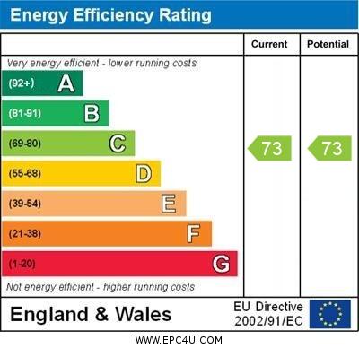
EPC 1
Rental Range
Estimated market rent for Stoke-on-Trent. Low = conservative, Realistic = average, Optimistic = best case.
Based on Local Authority from postcode lookup → Stoke-on-Trent.
LHA (30th percentile) floor for Staffordshire North: £424/mo (Apr 2025 – Mar 2026)
Location
Address
58-92 Wade Street
Nearby
Nearest stations, universities and amenities (distance from property).
| Type | Name | Distance |
|---|---|---|
| Shop | Dartmouth Food & Wine | 0.1 miles |
| Shop | Unity House | 0.1 miles |
| Bus stop | Dartmouth Street | 0.1 miles |
| Bus stop | High Lane / Dartmouth Street | 0.1 miles |
| Hospital | Haywood Hospital Walk-in Centre | 0.5 miles |
| Hospital | Haywood Hospital | 0.5 miles |
| Train station | Longport | 1.5 miles |
| University | University of Staffordshire Stoke Campus | 2.8 miles |
| Train station | Stoke-on-Trent | 2.9 miles |
Street-level crime
| Category | Count |
|---|---|
| Violence and sexual offences | 132 |
| Anti-social behaviour | 86 |
| Public order | 31 |
| Other theft | 23 |
| Shoplifting | 22 |
| Burglary | 20 |
| Criminal damage and arson | 20 |
| Vehicle crime | 17 |
| Drugs | 14 |
| Other crime | 5 |
| Robbery | 5 |
| Bicycle theft | 3 |
| Possession of weapons | 3 |
| Theft from the person | 1 |
| Total incidents | 382 |
Within 1 mile during Apr 2026. Source: data.police.uk (England & Wales).
Schools nearby
Nearest open schools with Ofsted ratings (England). Closed schools are not shown. Data from Get Information about Schools and Ofsted.
| Name | Type | Distance | Ofsted |
|---|---|---|---|
| Jackfield Infant School | Primary | 0.0 miles | Good — 18 Jan 2023 |
| The Valiant School | Other | 0.1 miles | — (No rating) |
| Moorpark Junior School | Primary | 0.1 miles | Good — 11 Jul 2016 |
| Haywood Academy | Secondary | 0.3 miles | Good — 14 Jun 2023 |
| Smallthorne Primary Academy | Primary | 0.6 miles | Good — 18 Dec 2023 |
Rental Comparables
Residential lets from OpenRent and Rightmove for the area (same bedroom count). Use to validate rent estimates. Student lets are excluded.
| Title | Rent | Beds | Distance | As seen on |
|---|---|---|---|---|
| Wade Street, Burslem | £675/mo | 1 | 0 miles | Rightmove |
| 1 Bed Flat, Burslem, ST6 | £675/mo | 1 | 0.08 miles | OpenRent |
| Lingard Street, Burslem, Stoke-on-Trent, ST6 | £750/mo | — | 0.33 miles | Rightmove |
| Kingsware Road, Burslem | £850/mo | 1 | 0.52 miles | Rightmove |
| Kingsware Road, Stoke On Trent | £825/mo | 1 | 0.53 miles | Rightmove |
| Lancashire Court, Federation Road, Burslem, Stoke-on-Trent, ST6 | £600/mo | 1 | 0.7 miles | Rightmove |
| Westport Road, Stoke-On-Trent, ST6 | £625/mo | 1 | 0.73 miles | Rightmove |
| Newcastle Street, Stoke-on-Trent, Staffordshire, ST6 | £750/mo | 1 | 1 miles | Rightmove |
| The Boulevard, Stoke-on-Trent, ST6 | £595/mo | — | 1.08 miles | Rightmove |
| High Street, Tunstall | £550/mo | — | 1.14 miles | Rightmove |
| High Street, Stoke-on-Trent, Staffordshire, ST6 | £550/mo | 1 | 1.21 miles | Rightmove |
| Flat 1, 62 Scott Lidgett Road, Stoke-on Trent | £600/mo | 1 | 1.32 miles | Rightmove |
| Railway Inn Apartments, Stoke-On-Trent, ST6 | £425/mo | 1 | 1.37 miles | Rightmove |
Average rent: £652/mo (13 listings)