Highclere
CONGLETON ROAD, ALDERLEY EDGE, CHESHIRE EAST SK9 7AL
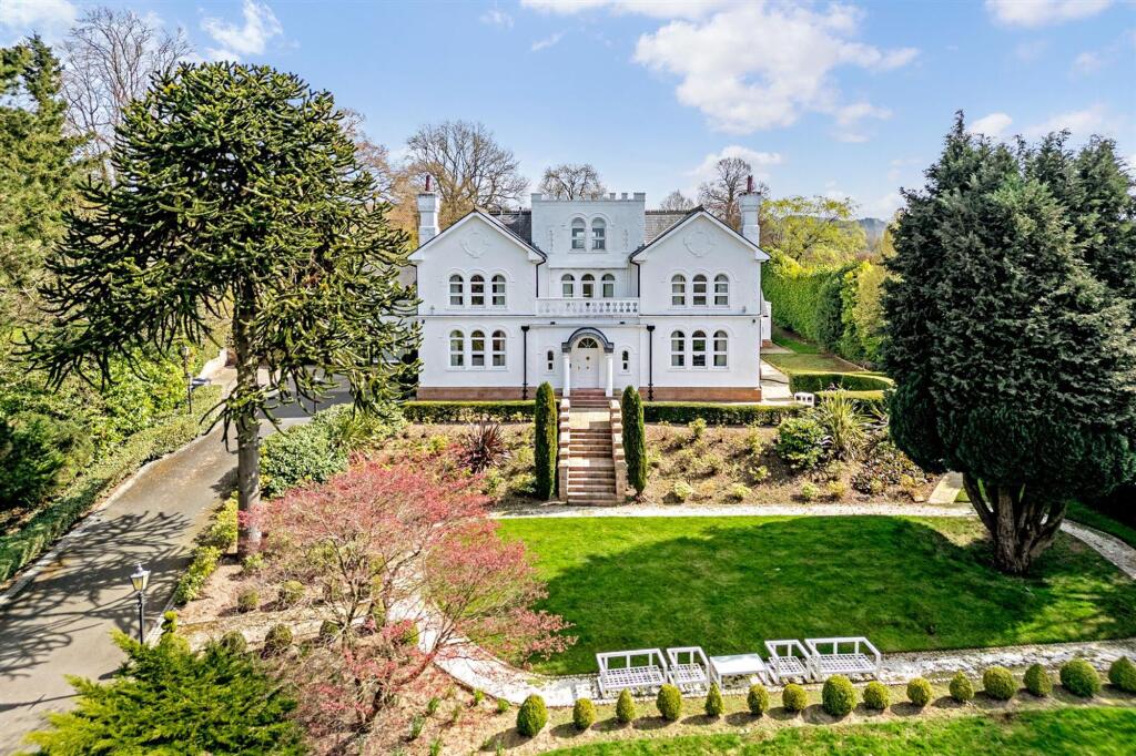
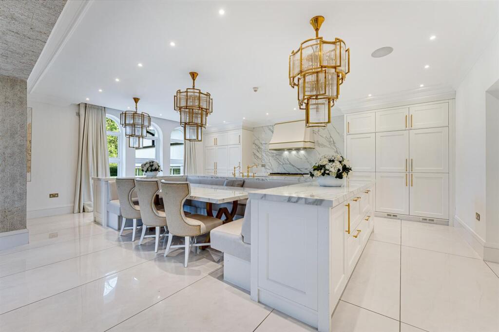
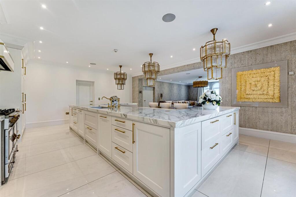
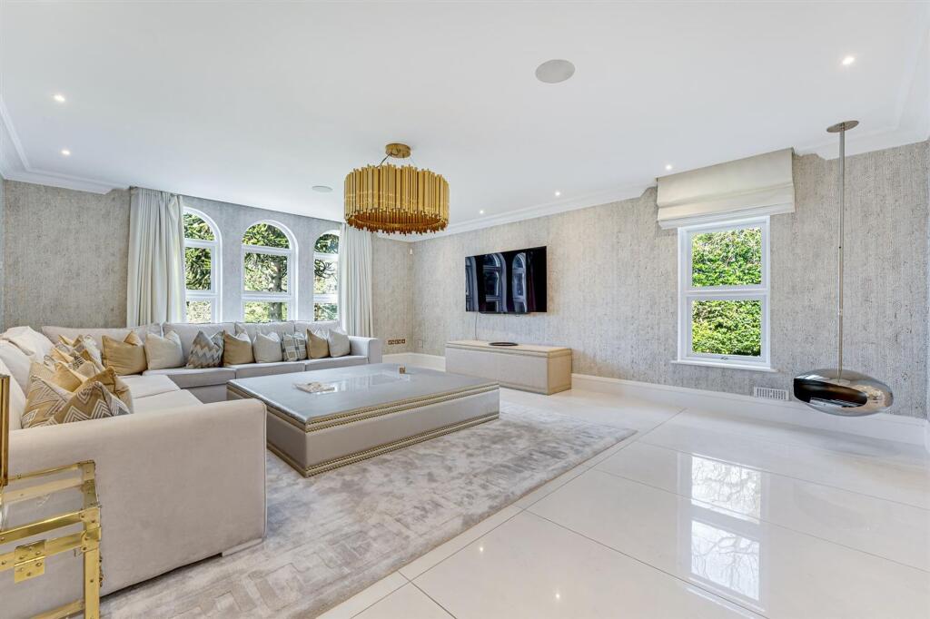
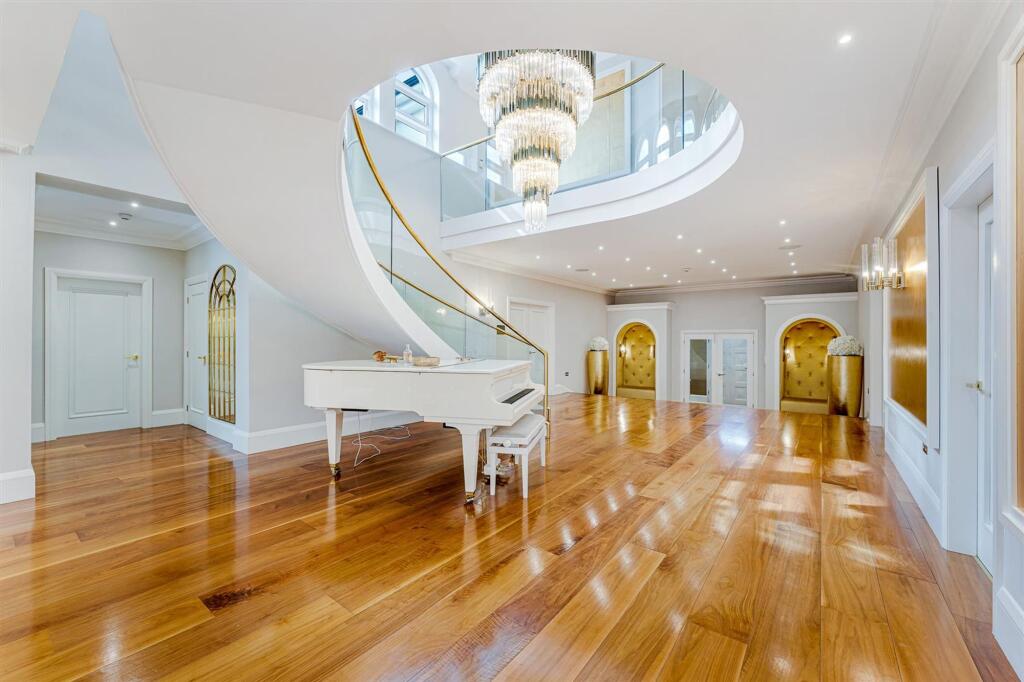
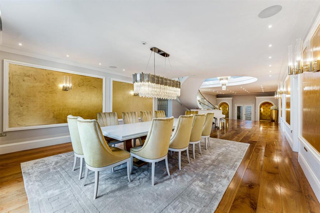
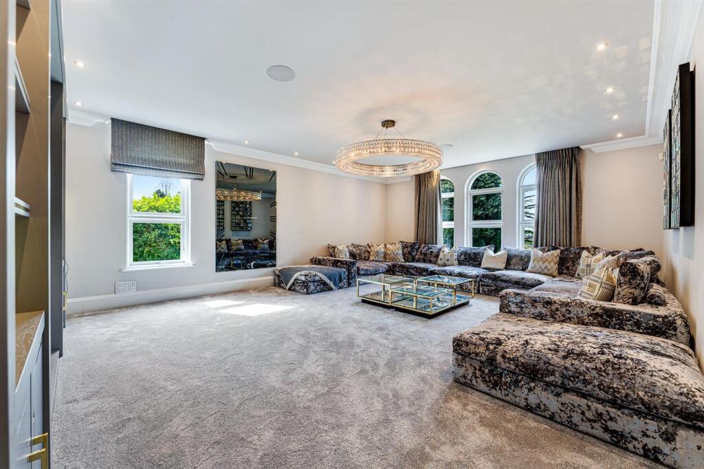
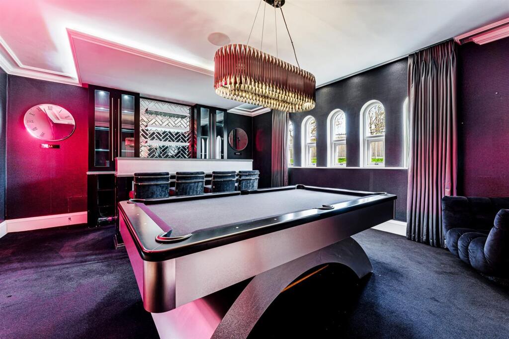
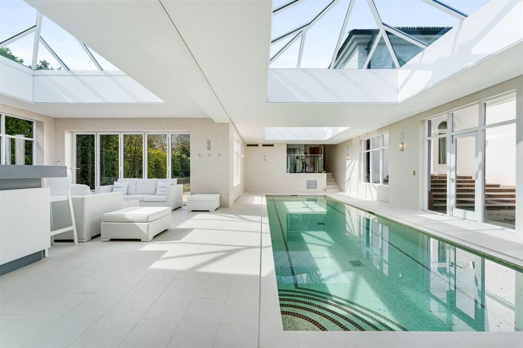
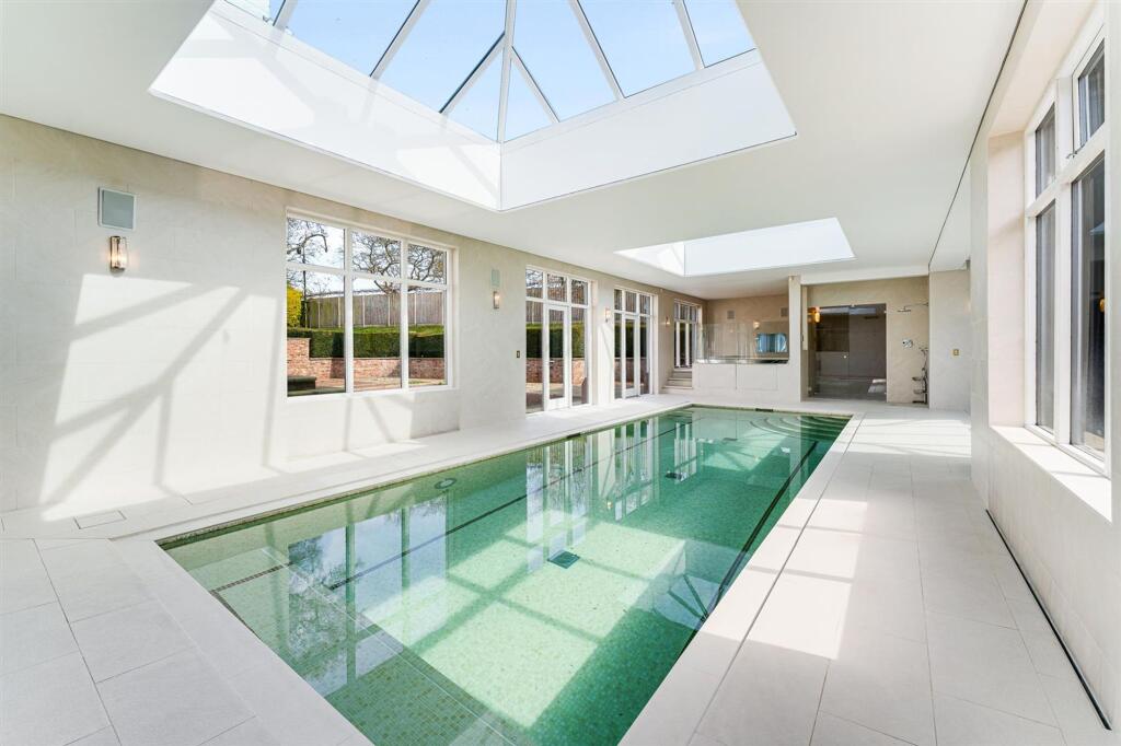
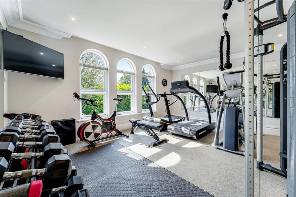
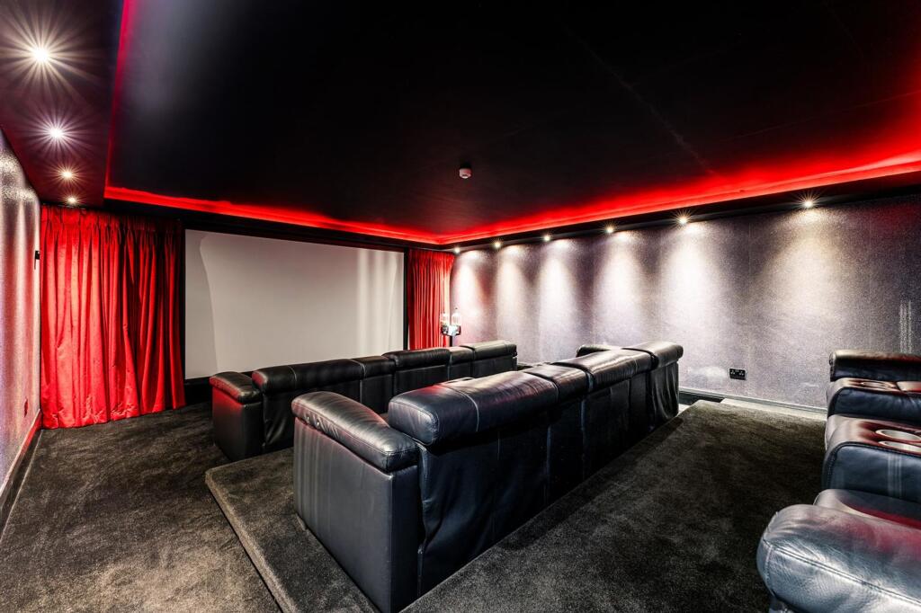
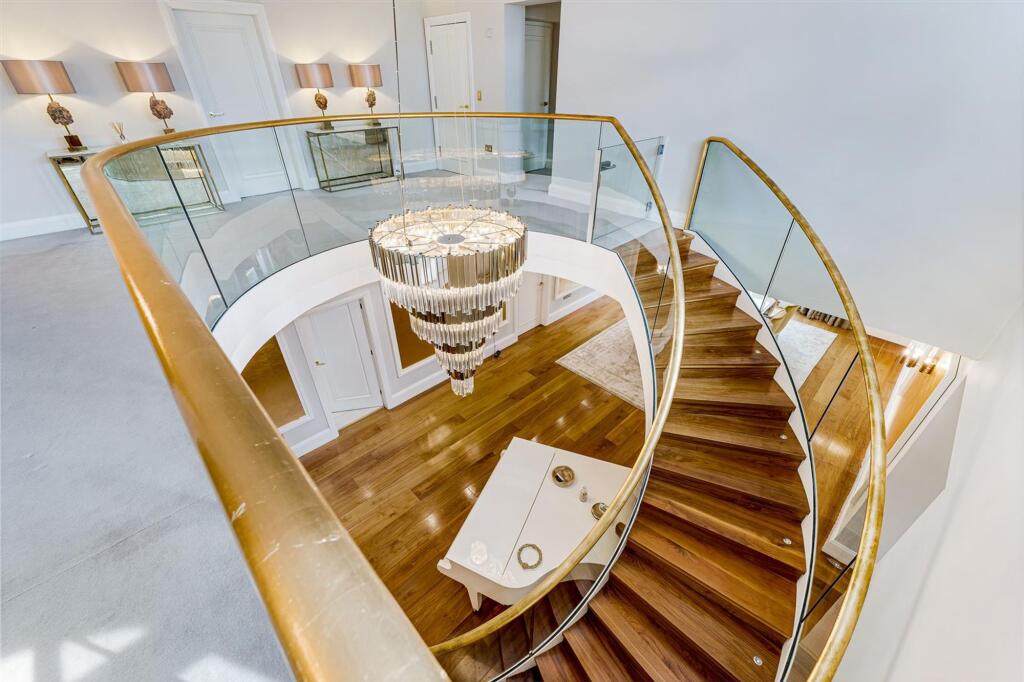
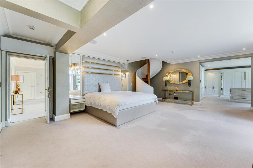
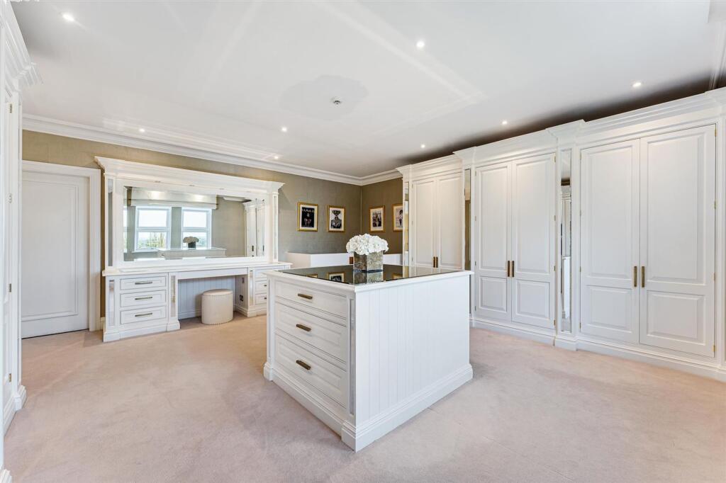
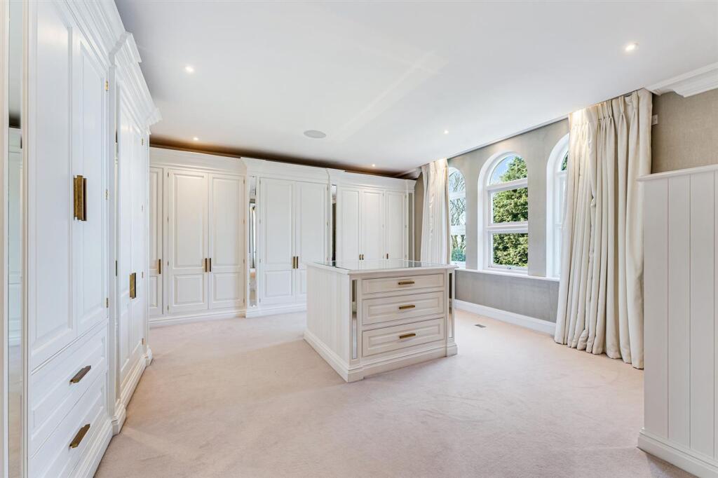
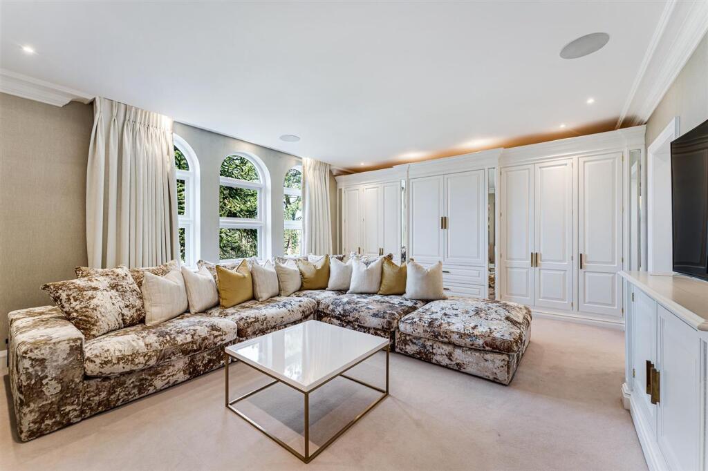
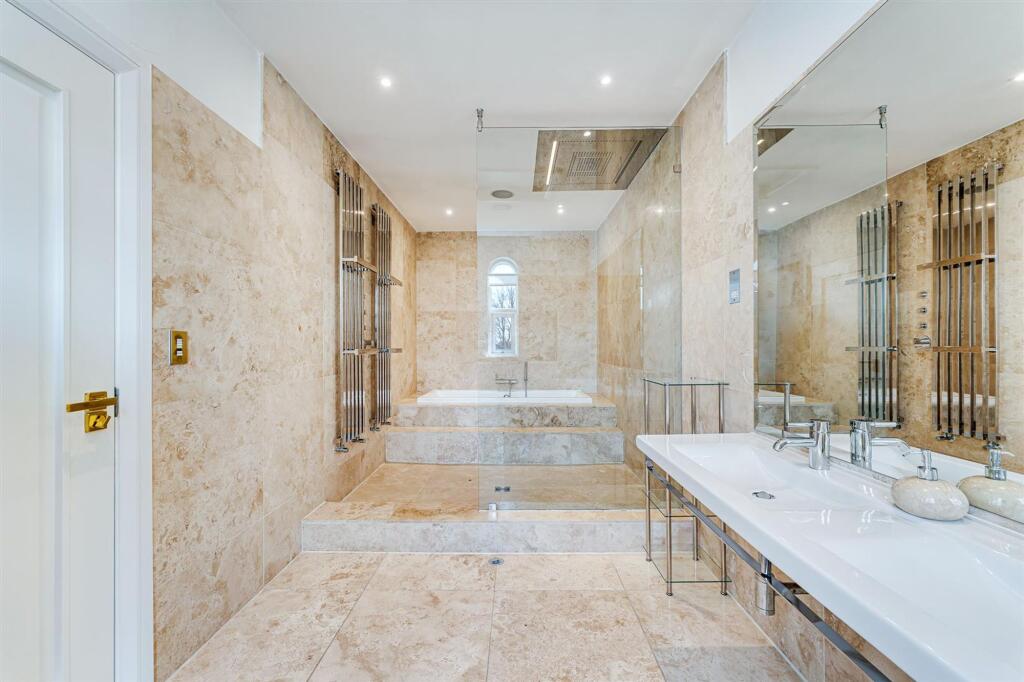
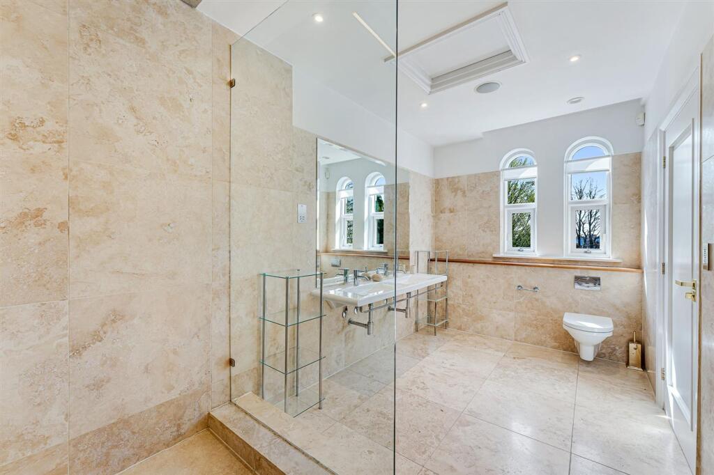
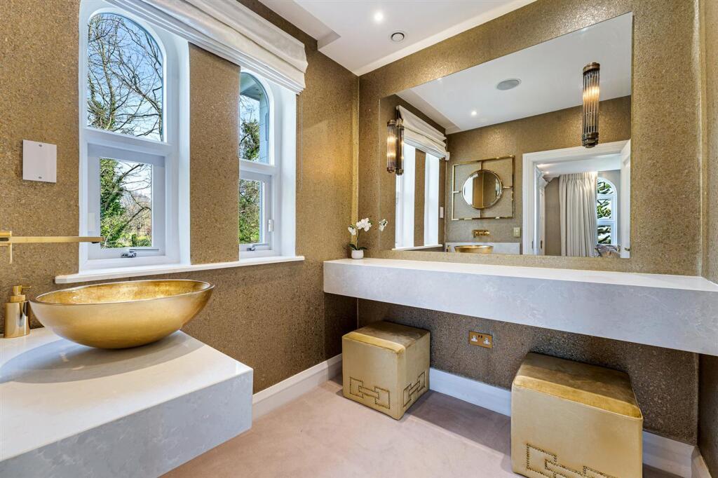
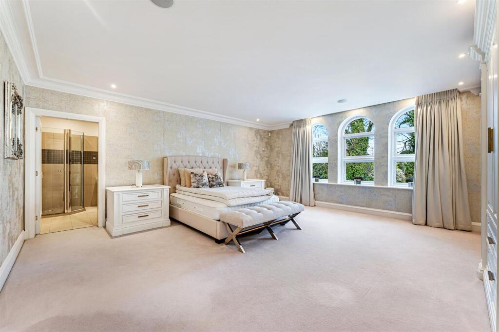
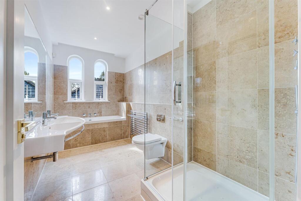
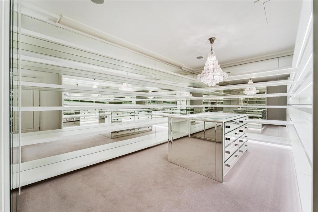
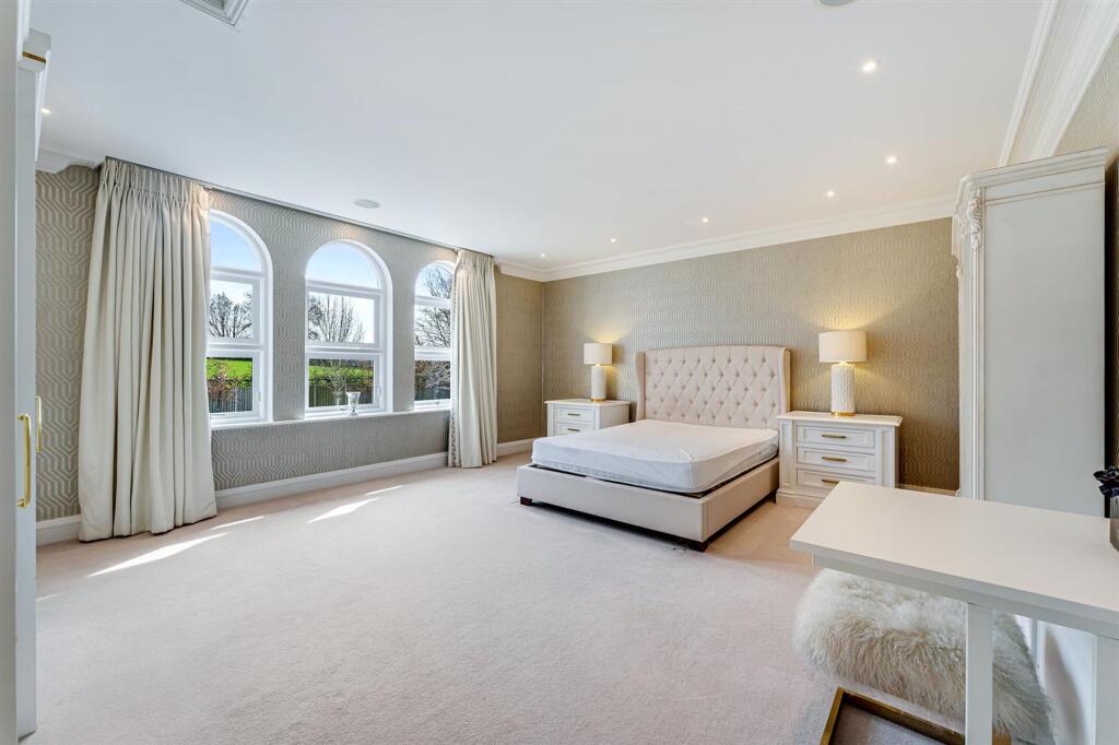
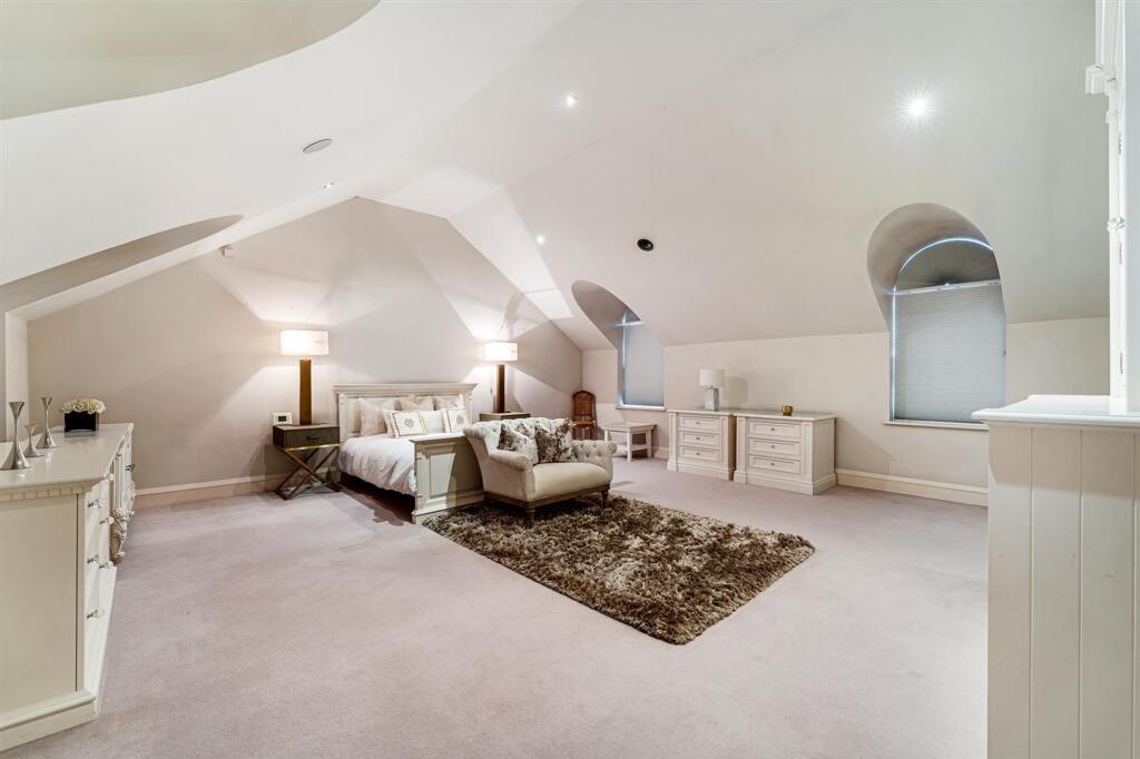
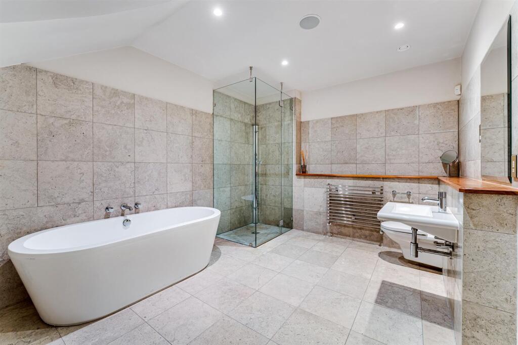
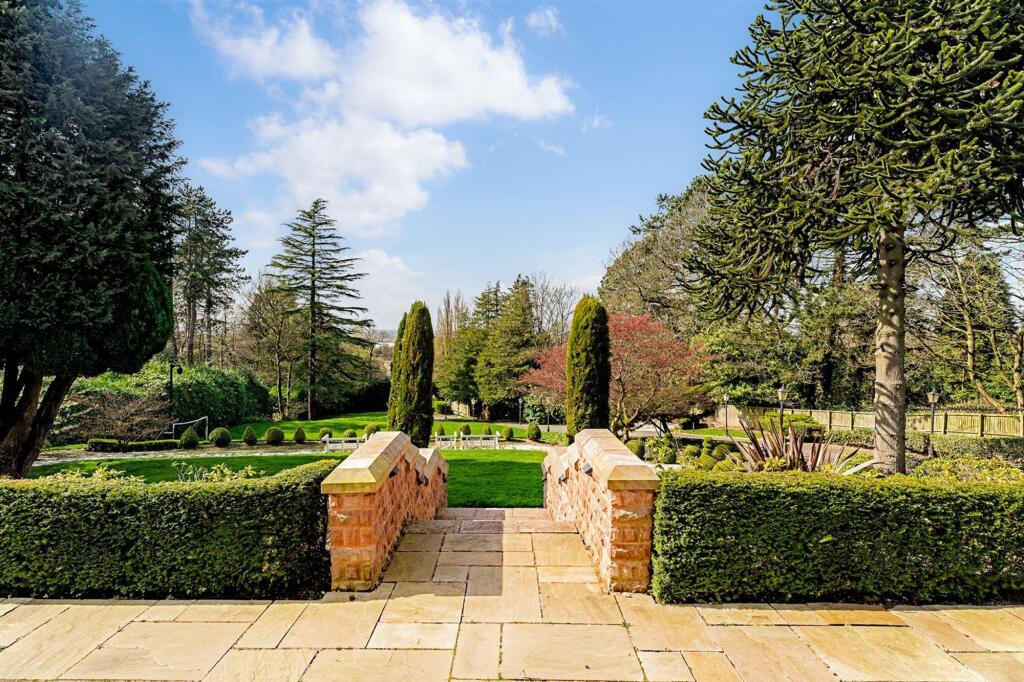
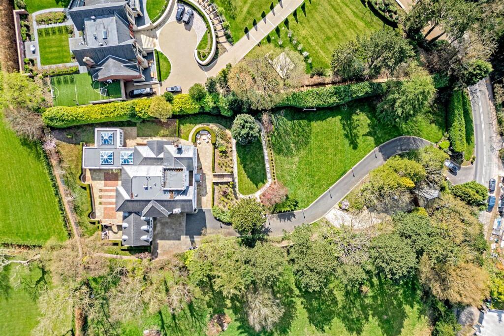
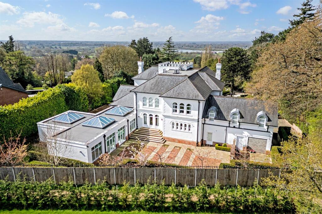
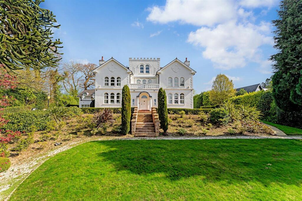
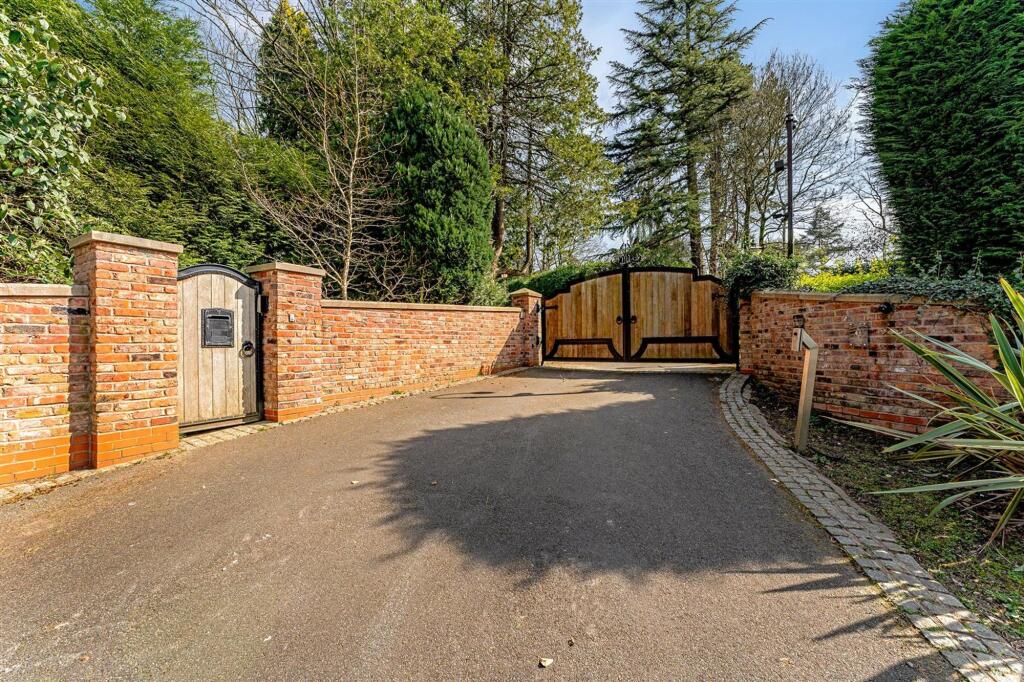
Photo 1 Photo 2 Photo 3 Photo 4 Photo 5 Photo 6 Photo 7 Photo 8 Photo 9 Photo 10 Photo 11 Photo 12 Photo 13 Photo 14 Photo 15 Photo 16 Photo 17 Photo 18 Photo 19 Photo 20 Photo 21 Photo 22 Photo 23 Photo 24 Photo 25 Photo 26 Photo 27 Photo 28 Photo 29 Photo 30 Photo 31
/ 31
Property details
Floor area
950 m²
Last sold
£4,000,000 Aug 2017
Local average
£837,551 (+491%)
Deprivation
Decile 9 (28,188 of 33,755)
Street crime
19 incidents within 1 mile (Apr 2026)
Key features
- Panoramic Views
- Full Leisure Suite
- Commanding Elevated Position
- Village Location
- Detached Garage and Annexe
- Over 10,000 sqft
Additional details
- Parking
- Yes
- Listed property
- No
- Restrictions
- No
- Required access
- No
- Rights of way
- No
- Flooded in last 5 years
- No
- Flood defences
- No
Description
EPC Rating: D
Listed by
Alderley Edge
Mosley Jarman
Reference: 89815752
EPC ratings on this postcode
We don't have a matched EPC for this property yet. Below are efficiency scores and details for other addresses on this postcode.
| Address | Current | Potential | Floor area | Age band | Type |
|---|---|---|---|---|---|
| April Cottage, Congleton Road, ALDERLEY EDGE | 51 | 71 | 91 m² | England and Wales: 1930-1949 | Detached |
| April House, Congleton Road, ALDERLEY EDGE | 61 | 73 | 680 m² | — | Detached |
| Bewdley, Congleton Road, ALDERLEY EDGE | 87 | 88 | 966 m² | — | Detached |
| Caudebec, Congleton Road, ALDERLEY EDGE | 68 | 79 | 519 m² | England and Wales: 1930-1949 | Detached |
| Caudebec, Congleton Road, ALDERLEY EDGE | 70 | 73 | 459 m² | England and Wales: 1930-1949 | Detached |
| Charnwood Cottage, Congleton Road, ALDERLEY EDGE | 64 | 83 | 170 m² | England and Wales: 1950-1966 | Detached |
| Earlswood, Congleton Road, ALDERLEY EDGE | 70 | 75 | 325 m² | England and Wales: 1996-2002 | Detached |
| Highclere, Congleton Road | 58 | 67 | 950 m² | England and Wales: 1930-1949 | House |
| Highclere, Congleton Road, ALDERLEY EDGE | 58 | 67 | 950 m² | England and Wales: 1930-1949 | Detached |
| Southfield, Congleton Road, ALDERLEY EDGE | 81 | 83 | 966 m² | England and Wales: 2012 onwards | Detached |
| Southfield, Congleton Road, ALDERLEY EDGE | 85 | 86 | 1,007 m² | — | Detached |
| The Annexe, Caudebec, Congleton Road, ALDERLEY EDGE | 50 | 51 | 69 m² | England and Wales: 1996-2002 | Flat |
| The Annexe, Caudebec, Congleton Road, ALDERLEY EDGE | 51 | 51 | 69 m² | England and Wales: 1930-1949 | Flat |
Flood risk
Zone: 1
Risk: Low
Job (default Low)
Floorplans
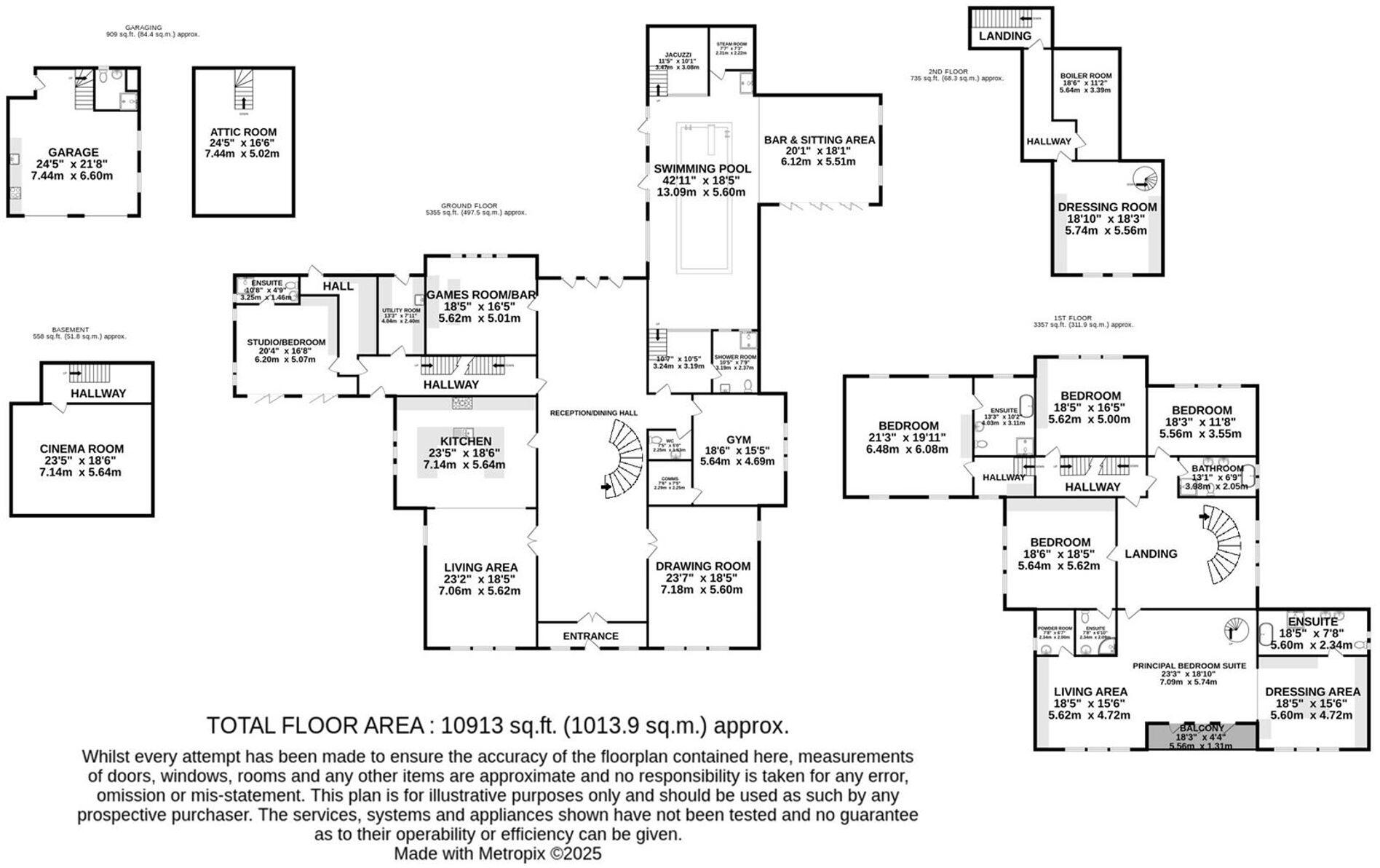
Floorplan 1
EPC Graphs
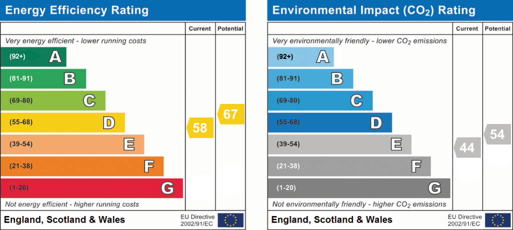
EPC 1
Price history
| Event | Date | Price | % change |
|---|---|---|---|
| Listed for sale | — | £4,950,000 | +23.8% |
| Sold | 04/08/2017 (8 years ago) | £4,000,000 | — |
Source: HM Land Registry Price Paid Data. Crown copyright.
Sold Comparables
Sold comparables data is not available for this property.
Capital growth trend
Land Registry outcode average: last 12 months vs 5y and 10y ago (from sold prices).
House Price Index (HM Land Registry — official index, not sold-price averages): Cheshire East. Series: All dwelling types. As of March 2026.
Rental Range
Estimated market rent for Cheshire East. Low = conservative, Realistic = average, Optimistic = best case.
Based on Local Authority from postcode lookup → Cheshire East.
LHA (30th percentile) floor for West Pennine: Apr 2025 – Mar 2026
Location
Address
Congleton Road
Nearby
Nearest stations, universities and amenities (distance from property).
| Type | Name | Distance |
|---|---|---|
| Bus stop | Nether Alderley, Congleton Road / Alderley Cross | 0.3 miles |
| Shop | Murphy's Barber Shop | 0.6 miles |
| Shop | Coggles | 0.6 miles |
| Train station | Alderley Edge | 0.8 miles |
| Train station | Wilmslow | 2.4 miles |
| Hospital | Rosemount Resource Centre | 4.2 miles |
| Hospital | Altrincham Hospital | 8.1 miles |
| University | University of Manchester Fallowfield Campus | 10.6 miles |
| University | Fallowfield Reception and Richmond Amenities Building | 10.6 miles |
Street-level crime
| Category | Count |
|---|---|
| Drugs | 5 |
| Violence and sexual offences | 4 |
| Public order | 3 |
| Anti-social behaviour | 2 |
| Other theft | 2 |
| Burglary | 1 |
| Criminal damage and arson | 1 |
| Robbery | 1 |
| Total incidents | 19 |
Within 1 mile during Apr 2026. Source: data.police.uk (England & Wales).
Schools nearby
Nearest open schools with Ofsted ratings (England). Closed schools are not shown. Data from Get Information about Schools and Ofsted.
| Name | Type | Distance | Ofsted |
|---|---|---|---|
| Nether Alderley Primary School | Primary | 0.4 miles | Good — 1 May 2012 |
| The Ryleys School | Other | 0.8 miles | — (No rating) |
| Alderley Edge Community Primary School | Primary | 0.9 miles | — (Inspected (no overall grade)) |
| Alderley Edge School for Girls | Other | 0.9 miles | — (No rating) |
| Lindow Community Primary School | Primary | 1.7 miles | Good — 11 Mar 2014 |
Rental Comparables
Residential lets from OpenRent and Rightmove for the area. Bedroom counts vary — use the Beds column to compare like-for-like lets. Student lets are excluded.
| Title | Rent | Beds | Distance | As seen on |
|---|---|---|---|---|
| 1 Bed Semi-Detached House, Welsh Row, SK10 | £2,490/mo | 1 | 0.27 miles | OpenRent |
Average rent: £2,490/mo (1 listing)
Rent-driven metrics
Based on OpenRent comparables.
- Rent ratio — Monthly rent ÷ purchase price (1% rule). 1%+ = strong, 0.8–1% = okay, <0.8% = weak for cashflow.
- Max investor price — Rent ÷ 0.8%; the price at which rent would be 0.8% of price (Stoke-style target).
- Target investor price — Rent ÷ 1%; the price at which rent would be 1% of price (strong cashflow band).
- Gross yield — Annual rent as % of purchase price (no costs).
- Cost-to-rent — Price ÷ annual rent (from OpenRent comparables). Under 14× = strong, 14–16× = acceptable, 17×+ = compressed.
- Cashflow — Rent minus mortgage, 10% maintenance, £25/mo compliance. Assumes 75% LTV, 3.95% APR (5yr fixed), 25yr term.
- ROI — Annual profit ÷ cash in (deposit + 4% purchase costs).
Enter House Number
Enter the house number to help us retrieve more accurate pricing history and property data.
Please log in to submit or correct the house number for this listing.
Log in to continue