St5 1Nd
ST5 1ND
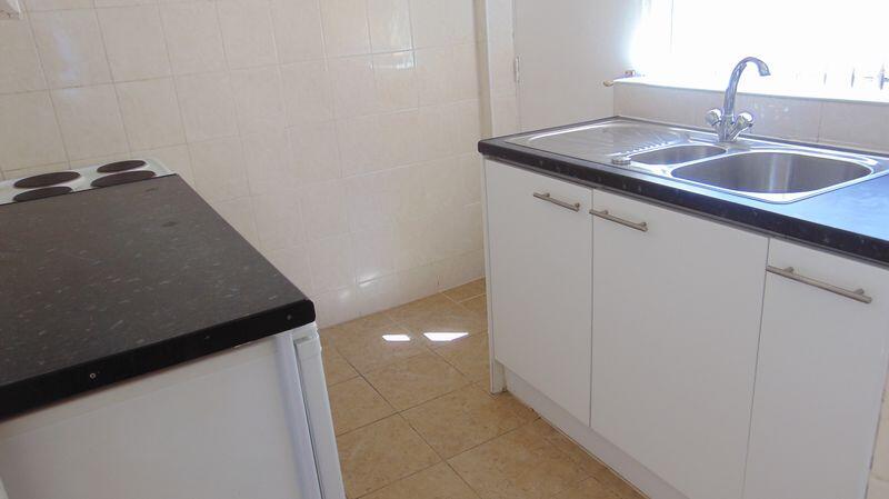
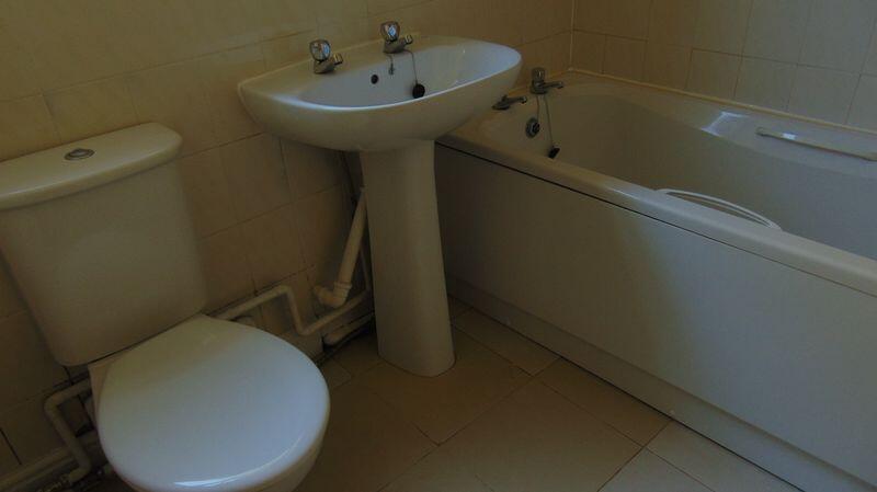
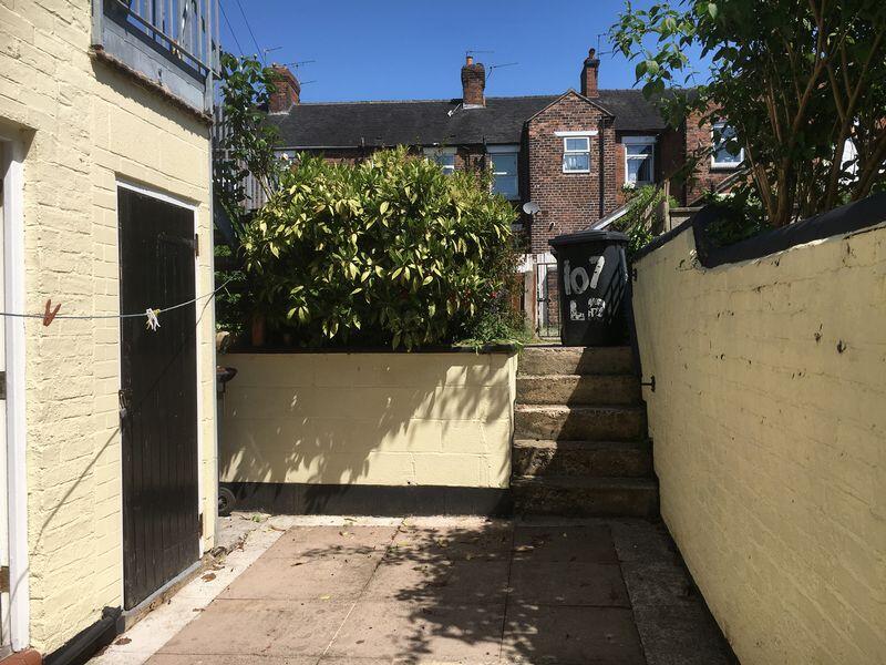
Property details
Council tax band
A
Deprivation
Decile 4 (10,391 of 33,755)
EPC ratings on this postcode
We don't have a matched EPC for this property yet. Below are efficiency scores and details for other addresses on this postcode.
| Address | Current | Potential | Floor area | Age band | Type |
|---|---|---|---|---|---|
| 103, London Road, NEWCASTLE | 47 | 75 | 70 m² | England and Wales: 1900-1929 | Flat |
| 105a, London Road, NEWCASTLE | 75 | 77 | 69 m² | England and Wales: 1900-1929 | Flat |
| 109a, London Road, NEWCASTLE | 71 | 77 | 69 m² | England and Wales: before 1900 | Flat |
| 111-115, London Road, Newcastle under Lyme | 69 | 77 | 523 m² | England and Wales: 1930-1949 | Terraced |
| 121 London Road, NEWCASTLE | 78 | 85 | 144 m² | England and Wales: 2003-2006 | Detached |
| 121, London Road, NEWCASTLE | 73 | 81 | 136 m² | England and Wales: 1996-2002 | Detached |
| 125 LONDON ROAD, NEWCASTLE UNDER LYME, NEWCASTLE UNDER LYME | 61 | 82 | 85 m² | England and Wales: 1930-1949 | Detached |
| 127, London Road, NEWCASTLE | 57 | 76 | 161 m² | England and Wales: 1930-1949 | Detached |
| 75, London Road, NEWCASTLE | 64 | 69 | 11 m² | England and Wales: 1900-1929 | Flat |
| 83, London Road, NEWCASTLE | 67 | 84 | 182 m² | England and Wales: 1900-1929 | Terraced |
| 87 London Road, NEWCASTLE | 75 | 78 | 62 m² | England and Wales: 1900-1929 | Flat |
| 87a, London Road, NEWCASTLE | 75 | 78 | 63 m² | England and Wales: 1900-1929 | Flat |
| 89 London Road, NEWCASTLE | 66 | 81 | 156 m² | England and Wales: before 1900 | Terraced |
| 89, London Road, NEWCASTLE | 51 | 83 | 159 m² | England and Wales: before 1900 | Terraced |
| 91 London Road | 68 | 83 | 157 m² | England and Wales: before 1900 | House |
Flood risk
Zone: 1
Risk: Low
Not in Flood Risk Area (no data)
EPC Graphs

Energy Performance Certificate
Rental Range
Estimated market rent for Newcastle-under-Lyme. Low = conservative, Realistic = average, Optimistic = best case.
Based on Local Authority from postcode lookup → Newcastle-under-Lyme.
LHA (30th percentile) floor for Staffordshire North: £479/mo (Apr 2025 – Mar 2026)
Location
Nearby
Nearest stations, universities and amenities (distance from property).
| Type | Name | Distance |
|---|---|---|
| Hospital | Royal Stoke University Hospital | 0.3 miles |
| Hospital | Hartshill Medical Centre | 0.5 miles |
| Train station | Stoke-on-Trent | 1.6 miles |
| University | University of Staffordshire Stoke Campus | 1.7 miles |
| Train station | Longport | 2.5 miles |
Street-level crime
Crime data is not yet available for this property.
Rental Comparables
Residential lets from OpenRent and Rightmove for the area (same bedroom count). Use to validate rent estimates. Student lets are excluded.
Average rent: £866/mo (49 listings)
Enter House Number
Enter the house number to help us retrieve more accurate pricing history and property data.
Please log in to submit or correct the house number for this listing.
Log in to continue