BUCKFARM
DOVE STREET, ASHBOURNE, ELLASTONE, STAFFORDSHIRE DE6 2GY
£995 pcm
Property details
Floor area
186 m²
EPC rating
D
Year built
England and Wales: 1900-1929
Deprivation
Decile 7 (22,589 of 33,755)
Street crime
0 incidents within 1 mile (May 2026)
Key features
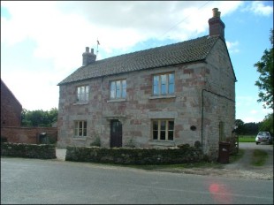
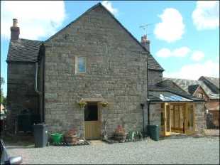
- Stone farmhouse
- Field to rear
- Stone flooring
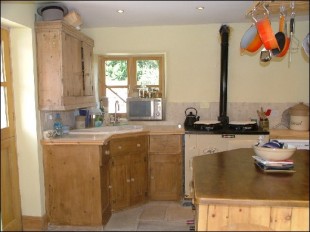
- Arga cooker, belfast sink
- Conservatory
- Bedroom 1 has en-suite bathroom
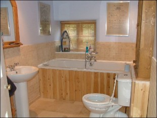
- Family bathroom has shower cubicle & whirlpool bath
- Private drive with gravelled area for parking and double garage
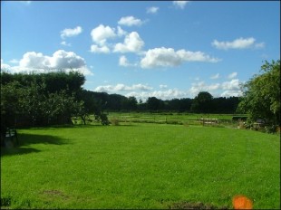
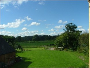
- Large lawned area at rear
- 5 acres of land available
Description
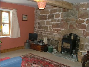
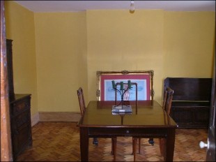
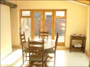
Entrance to Kitchen (14'5" x 10'5") with stone flooring, arga cooker, belfast sink, solid pine wall & base units, centre piece, open fireplace, utility room off double doors to Conservatory (12'2" x 12'2") with stone flooring, double doors to each side leading to rear & door to Study (16'1" x 9'6"). Hallway having heated stone flooring, wc/cloak, leads to Lounge (14'5" x 13'2") with log burner on stone hearth. Dining room (13'4" x 12'11") with wooden flooring.
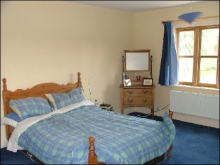
To the first floor is Bed 1/Guest room (14'5" x 12'8") with en-suite wc, basin & double shower cubicle. Bed 2 (16'6" x 13'5"). Bed 3 (15'2" x 8'10"). Bed 4 (12'9" x 6'6") L-shaped. Bathroom has white 3pc suite, whirlpool bath, shower cubicle, tiled flooring.
Outside has private drive to the side of house leads to rear with gravelled area for parking, large lawned area, double garage, leads to orchard, 5 acres of land available.
Listed by
Derby
Leaders and Romans Group
Reference: 13665649
EPC Rating & Upgrade Cost
Current rating: D
Potential rating: B
Inspection date: 08/07/2020
Expiry date: 07/07/2030
Current heating cost: £1,794/year
Potential heating cost: £991/year
Est. upgrade cost to C: £18,900
Recommendations
- 50 mm internal or external wall insulation (£4,000 - £14,000)
- Floor insulation (solid floor) (£4,000 - £6,000)
- Time and temperature zone control (£350 - £450)
- Solar photovoltaic panels, 2.5 kWp (£3,500 - £5,500)
Flood risk
Zone: 1
Risk: Low
Job (default Low)
Rental Range
Estimated market rent for East Staffordshire. Low = conservative, Realistic = average, Optimistic = best case.
Based on Local Authority from postcode lookup → East Staffordshire.
LHA (30th percentile) floor for Peaks & Dales: £898/mo (Apr 2025 – Mar 2026)
Location
Address
Dove Street
Nearby
Nearest stations, universities and amenities (distance from property).
| Type | Name | Distance |
|---|---|---|
| Bus stop | Dove Street | 0.1 miles |
| Shop | Denstone Hall Farm Shop | 1.5 miles |
| Shop | Twine | 1.6 miles |
| Train station | Alton Towers Car Park | 2.2 miles |
| Train station | Runaway Mine Train | 2.5 miles |
| Hospital | Saint Oswald's Hospital | 4.2 miles |
| Hospital | Cheadle Hosptal | 6.9 miles |
| University | Tovell Building, Buxton & Leek College | 11.9 miles |
| University | Buxton & Leek College | 11.9 miles |
Street-level crime
| Category | Count |
|---|---|
| Total incidents | 0 |
Within 1 mile during May 2026. Source: data.police.uk (England & Wales).
Schools nearby
Nearest open schools with Ofsted ratings (England). Closed schools are not shown. Data from Get Information about Schools and Ofsted.
| Name | Type | Distance | Ofsted |
|---|---|---|---|
| Norbury CofE Primary School | Primary | 1.2 miles | Good — 25 Mar 2014 |
| All Saints CofE Academy Denstone | Primary | 1.7 miles | Good — 10 Jan 2012 |
| Ryecroft CofE Middle School | Primary | 1.9 miles | Good — 24 Nov 2017 |
| Dove CofE Academy | Primary | 1.9 miles | Good — 17 Apr 2024 |
| The JCB Academy | Secondary | 2.2 miles | Good — 28 Feb 2024 |
Rental Comparables
Loading rental comparables for this postcode. Refresh in a few minutes.