16 ALBERT TERRACE
STAFFORD, STAFFORD, STAFFORDSHIRE ST16 3EX
Listing type
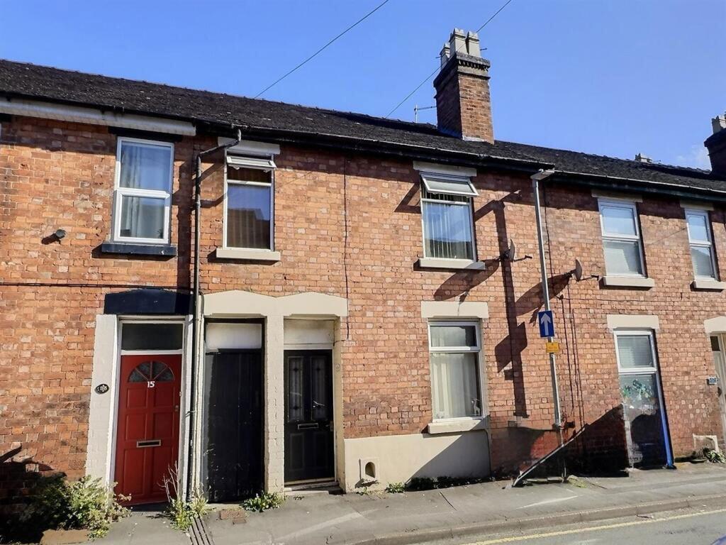
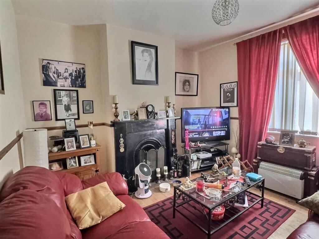
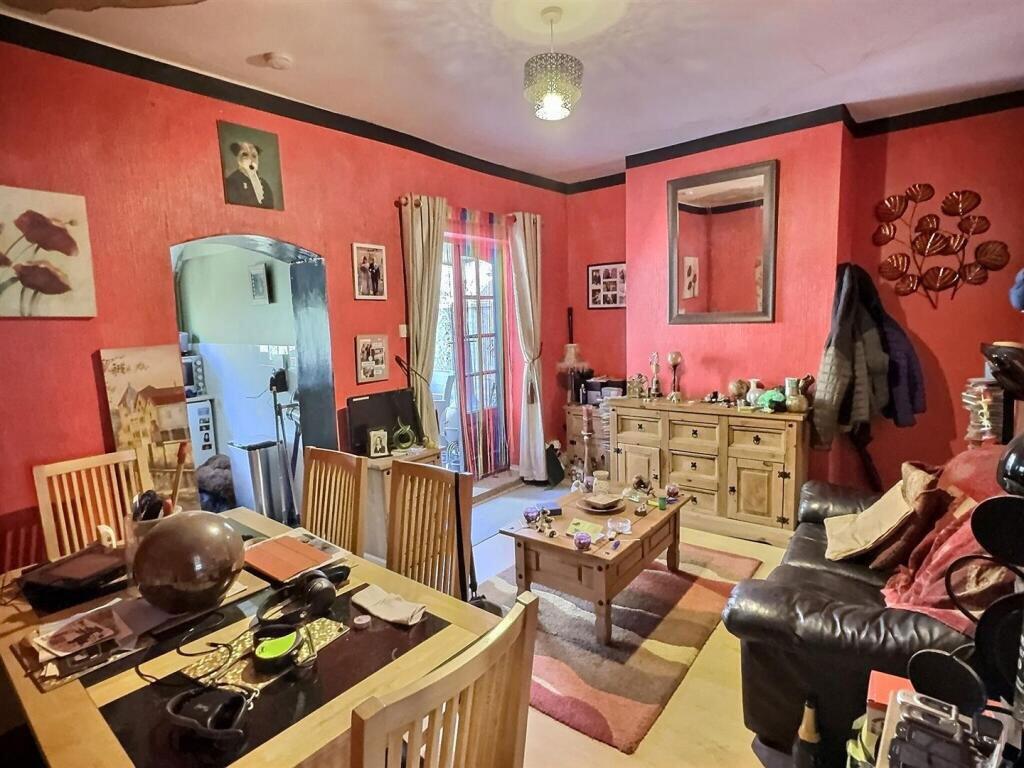
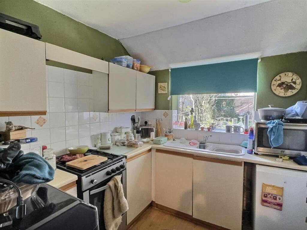
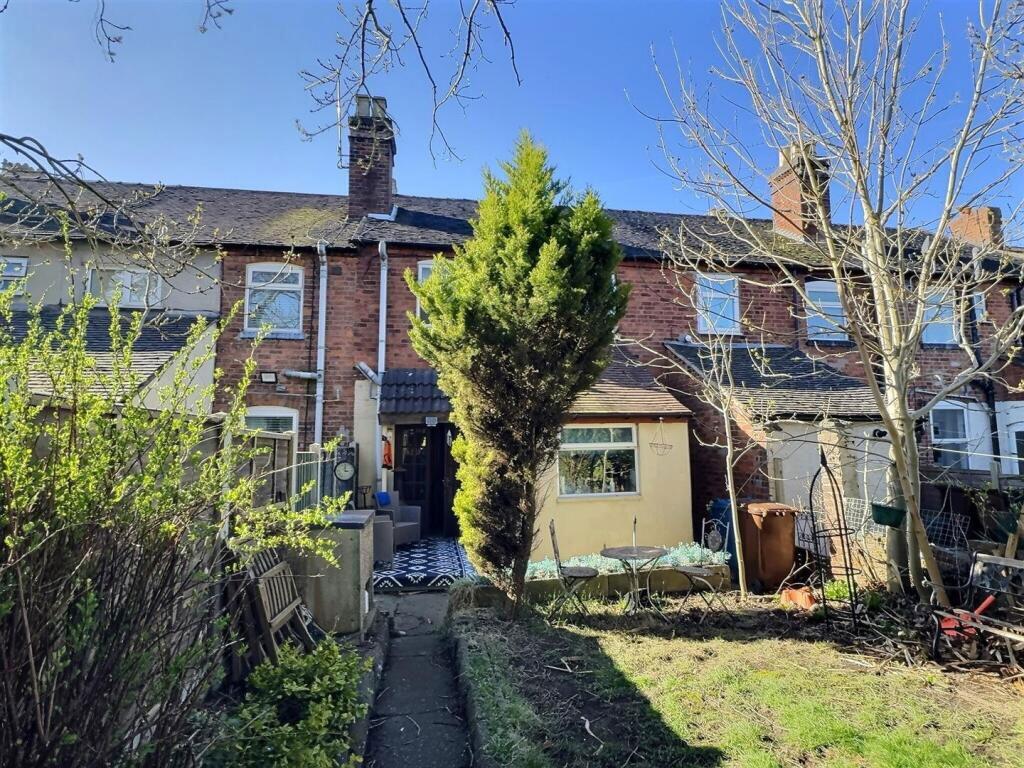
Photo 1 Photo 2 Photo 3 Photo 4 Photo 5 Photo 6 Photo 7 Photo 8
/ 8
Property details
Listing category
Auction
Tenure
FREEHOLD
Floor area
90 m²
Council tax band
A
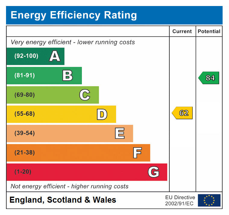
EPC rating
D
Year built
England and Wales: 1900-1929
Last sold
£56,500 May 2002
Price per m²
£1,111/m²
Local average
£178,296 (-43.9%)
Deprivation
Decile 4 (12,511 of 33,755)
Street crime
412 incidents within 1 mile (Apr 2026)
Key features
- Being sold via secure sale online Bidding. Terms and conditions apply.
- located just a short stroll from Stafford town centre
- Easy access to shops
- Ideal low-maintenance buy-to-let investment
- Schools & commuter routes closeby
- Tenanted £615 pcm
Additional details
- Electricity
- Mains supply
- Water
- Mains supply
- Sewerage
- Mains supply
- Heating
- Gas
- Parking
- On street
- Listed property
- No
- Restrictions
- No
- Required access
- No
- Rights of way
- No
- Flooded in last 5 years
- No
- Flood defences
- No
Description
Albert Terrace is located just a short stroll from Stafford town centre, offering easy access to shops, supermarkets, schools, and Stafford Intercity Railway Station, with direct links to Birmingham, Manchester, and London Euston.
Nearby amenities include:
Stafford Castle & Victoria Park
Good local schools including St Patrick's and Stafford Grammar
Council Tax Band: A
Tenure: Freehold
Listed by
Auction
Pattinson Estate Agents
Reference: 160451327
EPC Rating & Upgrade Cost
Current rating: D
Potential rating: B
Inspection date: 16/04/2025
Expiry date: 15/04/2035
Current heating cost: £1,166/year
Potential heating cost: £743/year
Est. upgrade cost to C: £21,125
Recommendations
- Increase loft insulation to 270 mm (£100 - £350)
- Cavity wall insulation (£500 - £1,500)
- 50 mm internal or external wall insulation (£4,000 - £14,000)
- Floor insulation (suspended floor) (£800 - £1,200)
- Upgrade heating controls (£350 - £450)
- Solar water heating (£4,000 - £6,000)
- Solar photovoltaic panels, 2.5 kWp (£3,500 - £5,500)
Flood risk
Zone: 1
Risk: Low
Job (default Low)
Floorplans
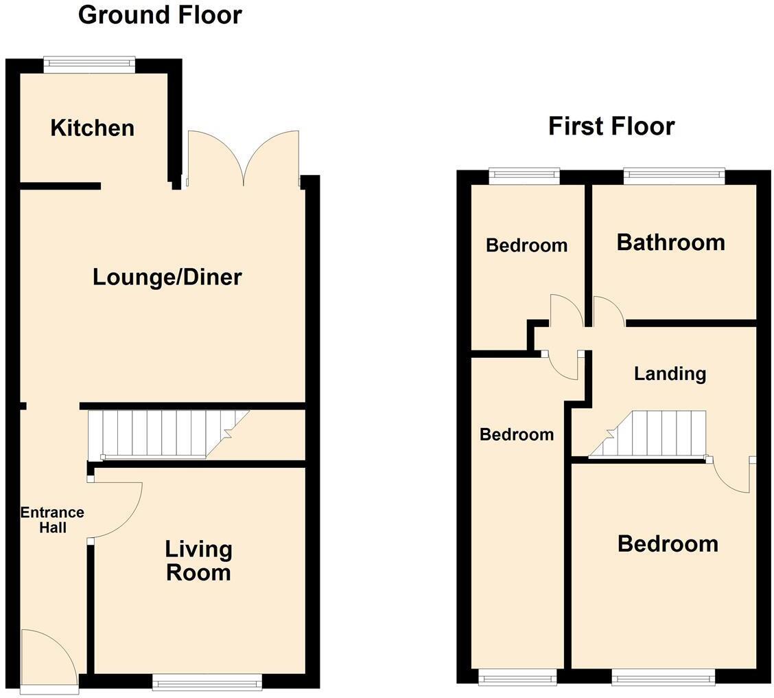
floor plan
EPC Graphs
EPC
Price history
135% since 1996
| Event | Date | Price | % change |
|---|---|---|---|
| Listed for sale | — | £100,000 | +77% |
| Sold | 24/05/2002 (24 years ago) | £56,500 | +54.8% |
| Sold | 03/10/1997 (28 years ago) | £36,500 | +52.1% |
| Sold | 04/11/1996 (29 years ago) | £24,000 | — |
Source: HM Land Registry Price Paid Data. Crown copyright.
Sold Comparables
Same street and nearby sales within 0.25 miles (last 5 years). Data from Land Registry Price Paid.
| Address | Price | Date | Type |
|---|---|---|---|
| 95 SANDON ROAD, STAFFORD, STAFFORDSHIRE, ST16 3HF | £158,000 | 19/12/2025 | Terraced |
| 50 MARSTON ROAD, STAFFORD, STAFFORDSHIRE, ST16 3BU | £160,000 | 14/10/2025 | Terraced |
| 65 CROOKED BRIDGE ROAD, STAFFORD, STAFFORDSHIRE, ST16 3NE | £222,500 | 18/07/2025 | Terraced |
| 46 GAOL ROAD, STAFFORD, STAFFORDSHIRE, ST16 3AR | £71,000 | 25/03/2025 | Terraced |
| 18 LOVATT STREET, STAFFORD, STAFFORDSHIRE, ST16 3DB | £160,000 | 23/11/2023 | Terraced |
| 75 SANDON ROAD, STAFFORD, STAFFORDSHIRE, ST16 3HF | £142,500 | 14/08/2023 | Terraced |
| 47 MARSTON ROAD, STAFFORD, STAFFORDSHIRE, ST16 3BU | £148,850 | 01/08/2023 | Terraced |
| 56 WESTBOURNE VILLAS, STAFFORD, STAFFORDSHIRE, ST16 3NE | £168,000 | 28/07/2023 | Terraced |
| 10 CROOKED BRIDGE ROAD, STAFFORD, STAFFORDSHIRE, ST16 3NE | £98,000 | 21/07/2023 | Terraced |
| 14 VICTORIA TERRACE, STAFFORD, STAFFORDSHIRE, ST16 3HA | £200,000 | 30/06/2023 | Terraced |
| 43 SANDON ROAD, STAFFORD, STAFFORDSHIRE, ST16 3ES | £86,100 | 21/06/2023 | Terraced |
| Same street 30 ALBERT TERRACE, STAFFORD, STAFFORDSHIRE, ST16 3EX | £129,000 | 19/05/2023 | Terraced |
| 6 FRIAR STREET, STAFFORD, STAFFORDSHIRE, ST16 3BB | £170,000 | 28/02/2023 | Terraced |
| 151 MARSTON ROAD, STAFFORD, STAFFORDSHIRE, ST16 3BS | £180,000 | 04/01/2023 | Terraced |
| 39 ROWLEY STREET, STAFFORD, STAFFORDSHIRE, ST16 2RH | £170,000 | 15/12/2022 | Terraced |
| 21 MARSTON ROAD, STAFFORD, STAFFORDSHIRE, ST16 3BS | £153,000 | 25/11/2022 | Terraced |
| 90 VICTORIA TERRACE, STAFFORD, STAFFORDSHIRE, ST16 3HA | £161,000 | 16/11/2022 | Terraced |
| 16 STONE ROAD, STAFFORD, STAFFORDSHIRE, ST16 2RQ | £133,000 | 11/11/2022 | Terraced |
| Same street 5 ALBERT TERRACE, STAFFORD, STAFFORDSHIRE, ST16 3EX | £135,000 | 14/10/2022 | Terraced |
| 40 SANDON ROAD, STAFFORD, STAFFORDSHIRE, ST16 3ES | £151,000 | 16/09/2022 | Terraced |
| 45 FRIAR STREET, STAFFORD, STAFFORDSHIRE, ST16 3BB | £161,000 | 08/09/2022 | Terraced |
| 45 WESTBOURNE VILLAS, STAFFORD, STAFFORDSHIRE, ST16 3NE | £235,000 | 25/08/2022 | Terraced |
| Same street 23 ALBERT TERRACE, STAFFORD, STAFFORDSHIRE, ST16 3EX | £135,000 | 21/07/2022 | Terraced |
| Same street 34 ALBERT TERRACE, STAFFORD, STAFFORDSHIRE, ST16 3EX | £102,000 | 11/04/2022 | Terraced |
| Same street 10 ALBERT TERRACE, STAFFORD, STAFFORDSHIRE, ST16 3EX | £119,950 | 21/02/2022 | Terraced |
| Same street 15 ALBERT TERRACE, STAFFORD, STAFFORDSHIRE, ST16 3EX | £127,000 | 28/10/2021 | Terraced |
| Same street 3 ALBERT TERRACE, STAFFORD, STAFFORDSHIRE, ST16 3EX | £114,000 | 04/10/2021 | Terraced |
Street average: £123,136 (7 sales)
Area average: £156,448 (20 sales)
Capital growth trend
Land Registry outcode average: last 12 months vs 5y and 10y ago (from sold prices).
House Price Index (HM Land Registry — official index, not sold-price averages): Stafford. Series: Terraced. As of March 2026.
Rental Range
Estimated market rent for Stafford. Low = conservative, Realistic = average, Optimistic = best case.
Based on Local Authority from postcode lookup → Stafford.
LHA (30th percentile) floor for Mid Staffs: £738/mo (Apr 2025 – Mar 2026)
Location
Nearby
Nearest stations, universities and amenities (distance from property).
| Type | Name | Distance |
|---|---|---|
| Shop | Unknown | 0.0 miles |
| Shop | Polski Sklep Stafford | 0.0 miles |
| Bus stop | Fancy Walk | 0.0 miles |
| Bus stop | Marston Road | 0.1 miles |
| Hospital | St George's Hospital | 0.5 miles |
| Train station | Stafford | 0.8 miles |
| Hospital | County Hospital | 1.0 miles |
| University | Staffordshire University Blackheath Lane Site | 1.9 miles |
| Train station | Amerton Station | 5.1 miles |
Street-level crime
| Category | Count |
|---|---|
| Violence and sexual offences | 148 |
| Anti-social behaviour | 74 |
| Public order | 42 |
| Shoplifting | 33 |
| Criminal damage and arson | 28 |
| Other theft | 23 |
| Burglary | 16 |
| Other crime | 16 |
| Drugs | 10 |
| Vehicle crime | 10 |
| Bicycle theft | 6 |
| Robbery | 4 |
| Possession of weapons | 1 |
| Theft from the person | 1 |
| Total incidents | 412 |
Within 1 mile during Apr 2026. Source: data.police.uk (England & Wales).
Schools nearby
Nearest open schools with Ofsted ratings (England). Closed schools are not shown. Data from Get Information about Schools and Ofsted.
| Name | Type | Distance | Ofsted |
|---|---|---|---|
| St Patrick's Catholic Primary School | Primary | 0.1 miles | Good — 21 Nov 2022 |
| John Wheeldon Primary Academy | Primary | 0.2 miles | Good — 8 Oct 2019 |
| Tillington Manor Primary School | Primary | 0.7 miles | Requires improvement — 12 Jun 2023 |
| Bailey Street Alternative Provision Academy | Other | 0.8 miles | Requires improvement — 18 Jan 2024 |
| St Austin's Catholic Primary School and Nursery | Primary | 1.0 miles | Good — 5 Dec 2011 |
Rental Comparables
Loading rental comparables for this postcode. Refresh in a few minutes.
Rent-driven metrics
Based on Area rent estimate.
- Rent ratio — Monthly rent ÷ purchase price (1% rule). 1%+ = strong, 0.8–1% = okay, <0.8% = weak for cashflow.
- Max investor price — Rent ÷ 0.8%; the price at which rent would be 0.8% of price (Stoke-style target).
- Target investor price — Rent ÷ 1%; the price at which rent would be 1% of price (strong cashflow band).
- Gross yield — Annual rent as % of purchase price (no costs).