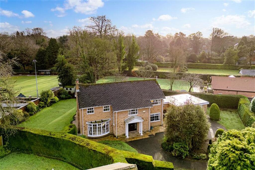
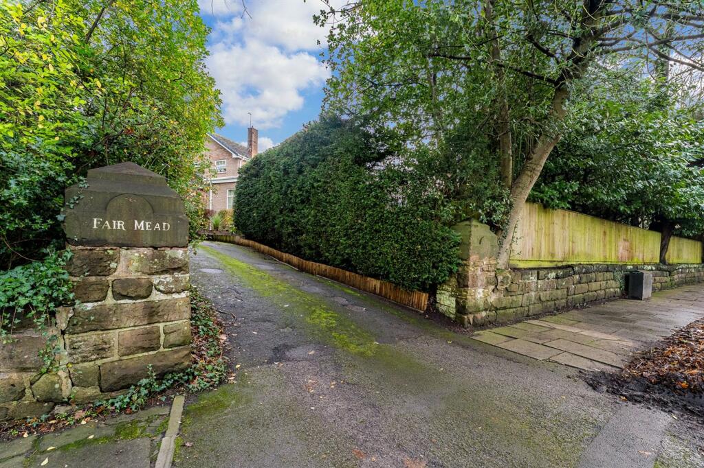
Fairmead
Legh Road, WA16, WA16 8LS
£1,495,000
Property details
Tenure
FREEHOLD
Council tax band
G
Local average
£827,200 (+80.7%)
Deprivation
Decile 10 (33,693 of 33,755)
Street crime
44 incidents within 1 mile (Apr 2026)
Key features
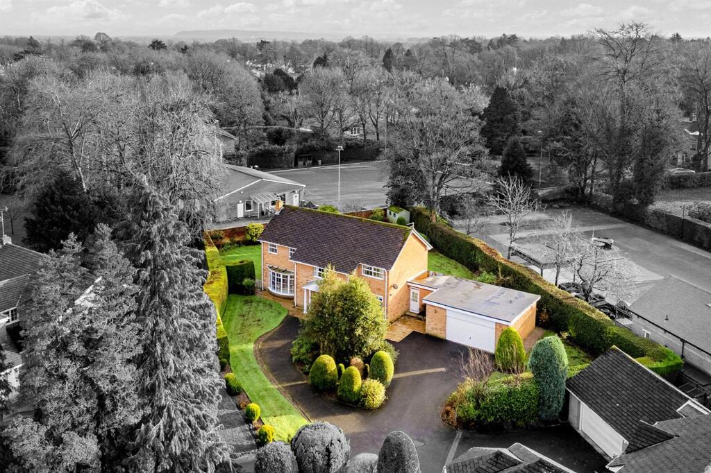
- Exclusive & Peaceful Cul De Sac Setting
- No Onward Chain & An Opportunity Not to be Missed
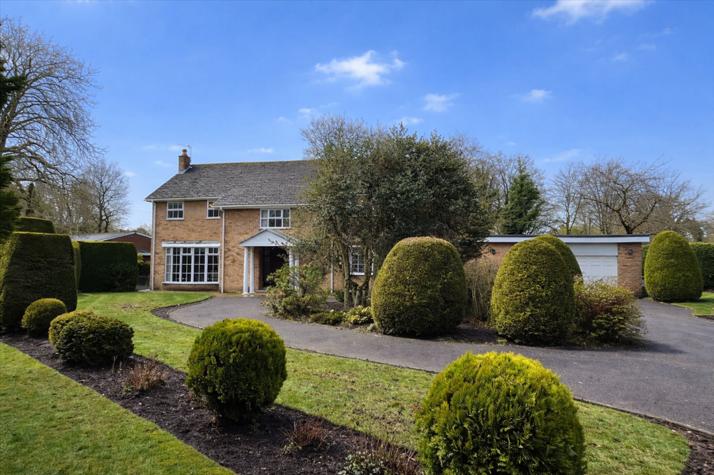
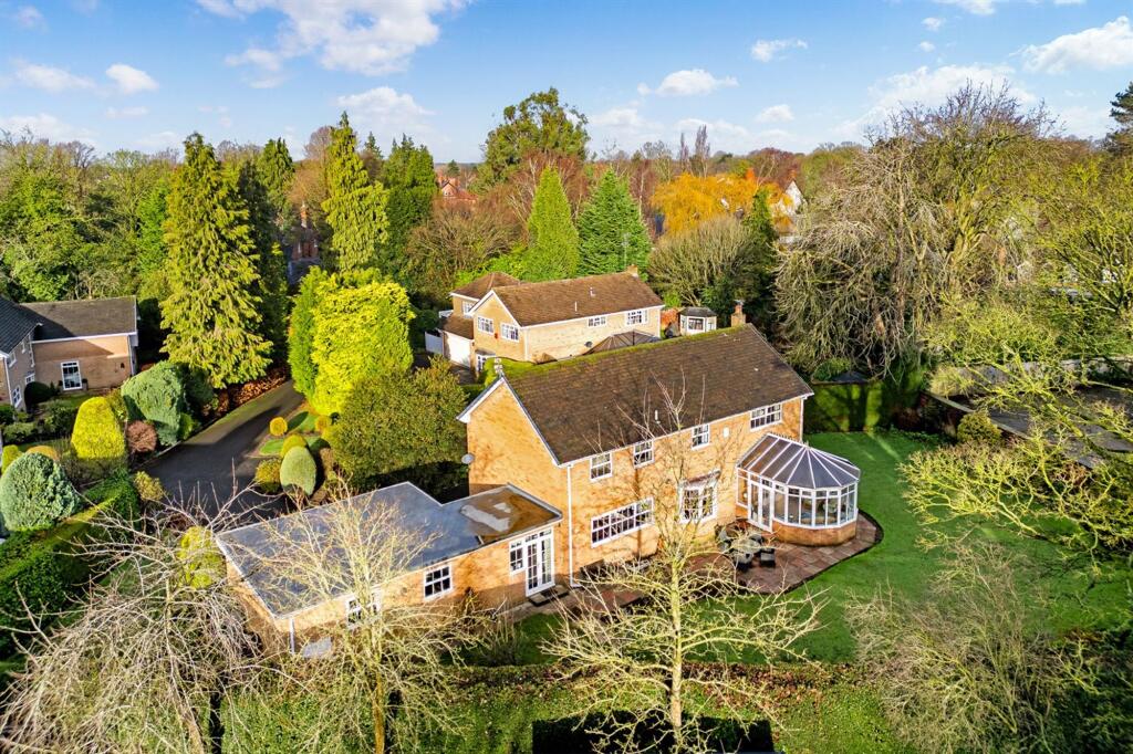
- Attractive Cheshire Brick Residence
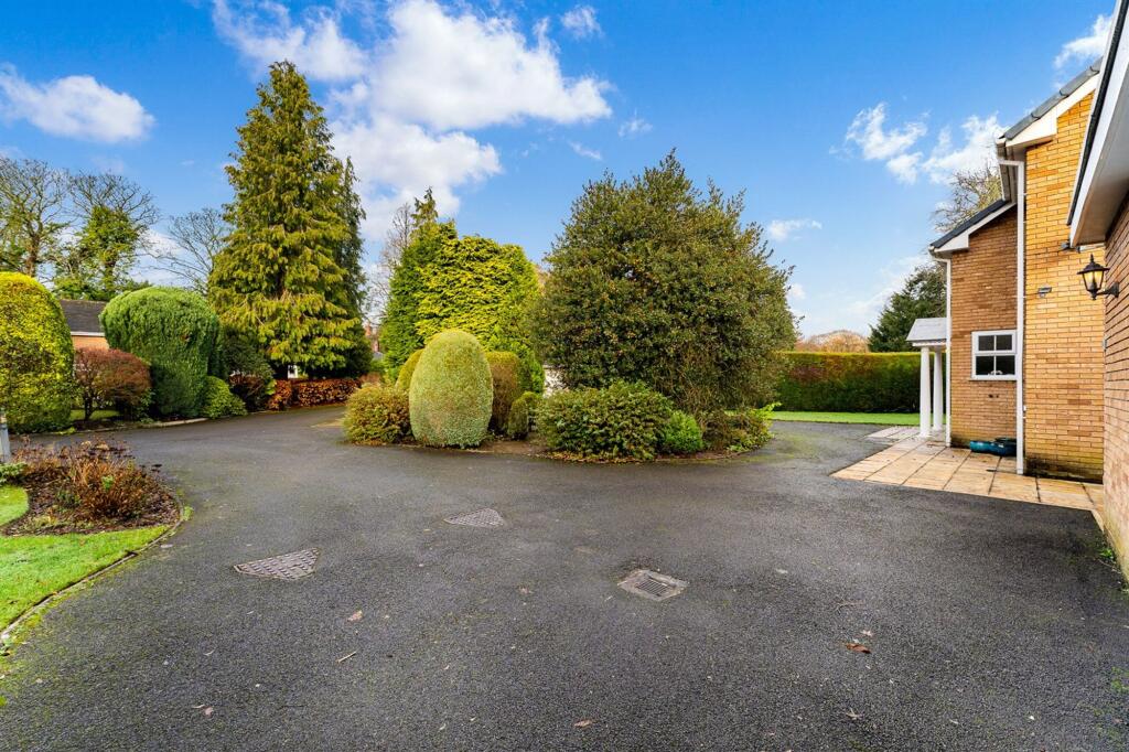
- Mature Private Landscaped Gardens
- Prestigious Legh Road Conservation Area
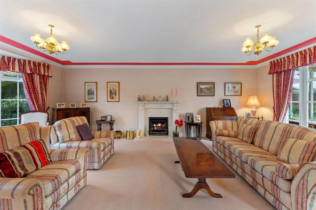
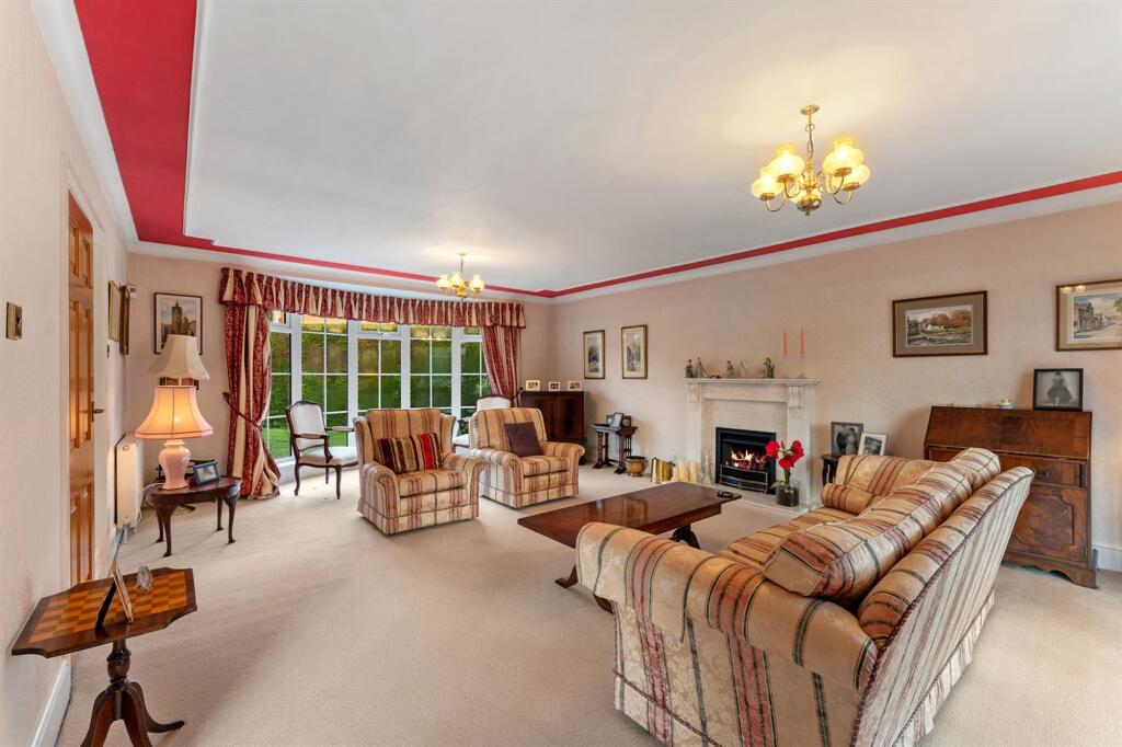
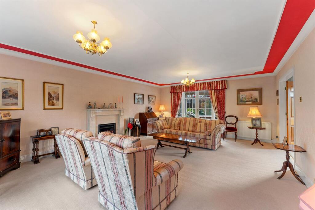
- Spacious Well-Proportioned Accommodation
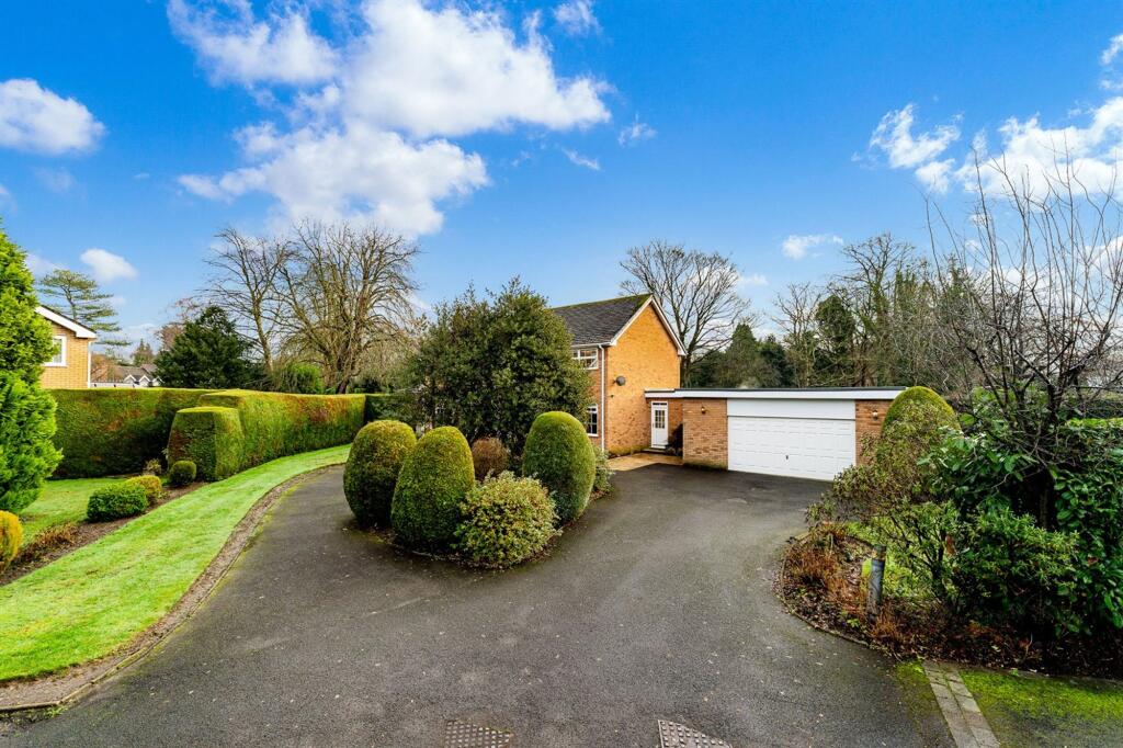
- Integral Double Garage & Generous Driveway
- Rear Aspect Over Bowling Green
- Excellent Scope to Extend (Subject to Planning)
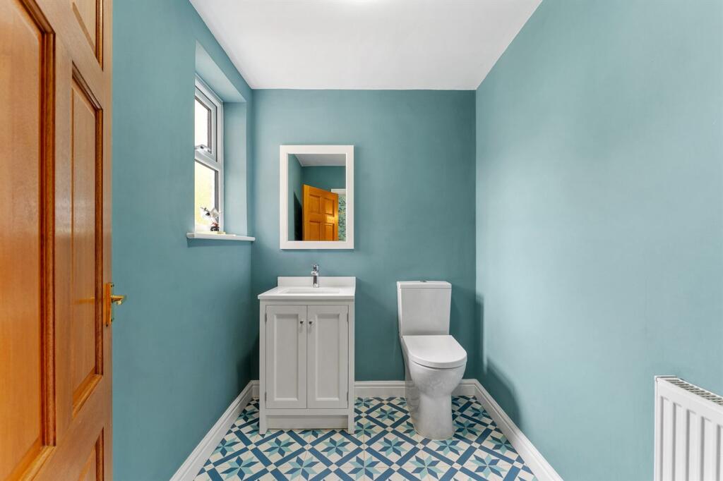
- Four Bedrooms & Two Bathrooms
Additional details
- Parking
- Yes
- Garden
- Yes
- Restrictions
- No
- Rights of way
- No
- Flooded in last 5 years
- No
- Flood defences
- No
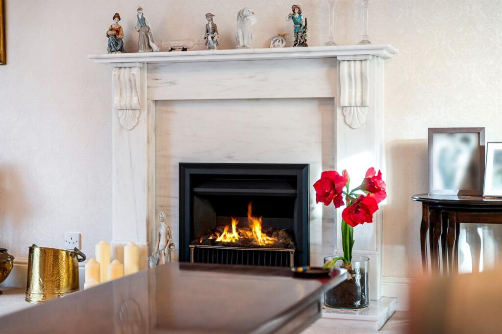
Description
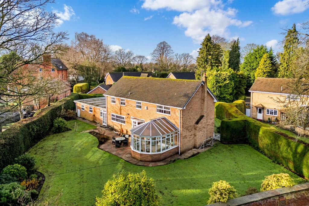
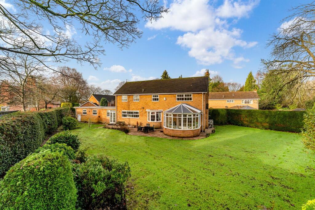
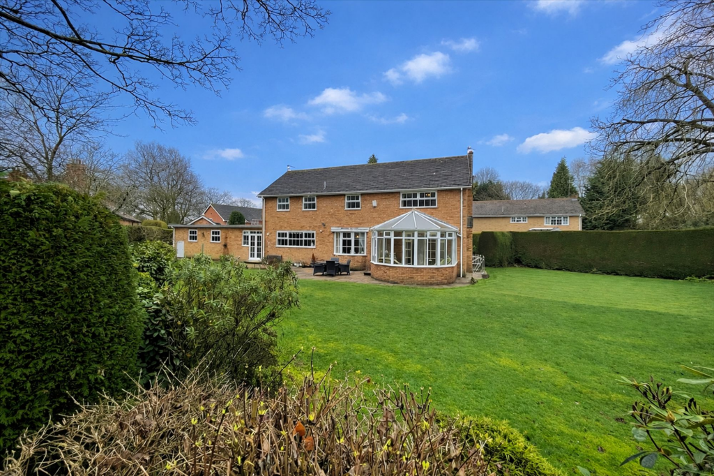
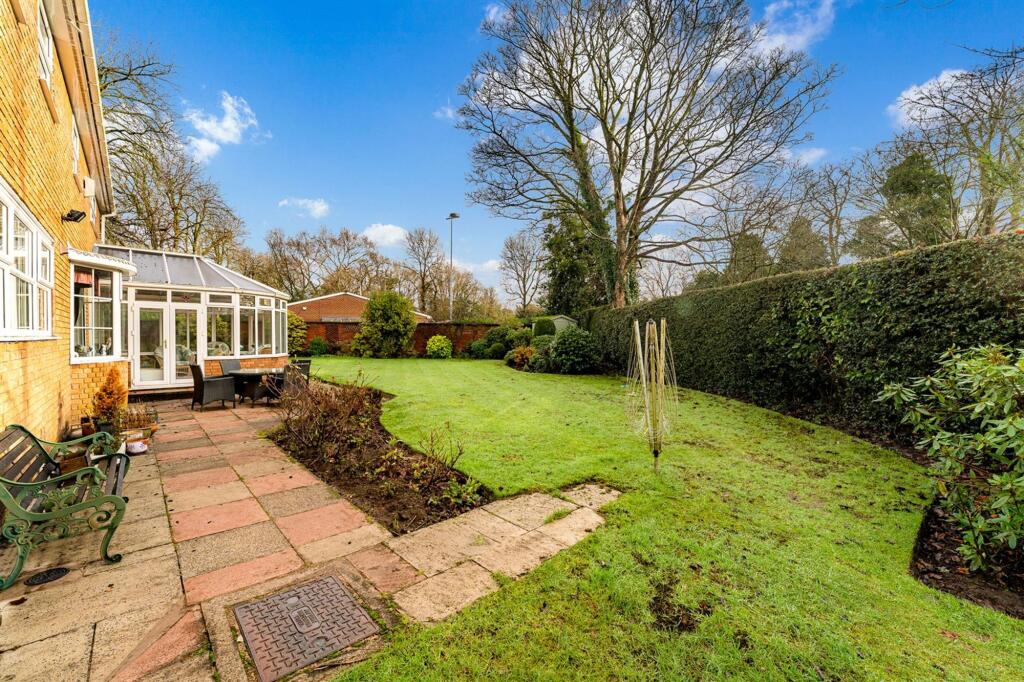
The private rear garden, thoughtfully stocked and predominantly laid to lawn, features a superb entertaining patio and further highlights the exceptional scope to extend and enhance the property to create a truly bespoke family home.
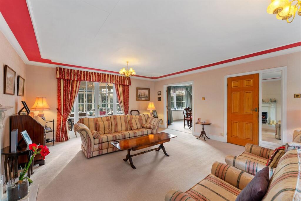
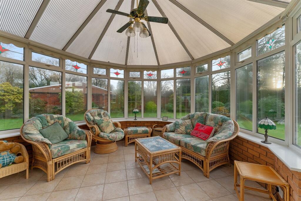
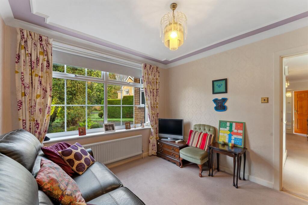
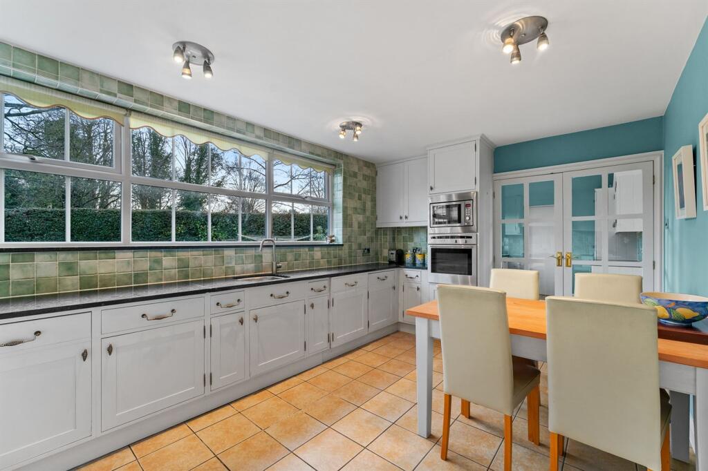
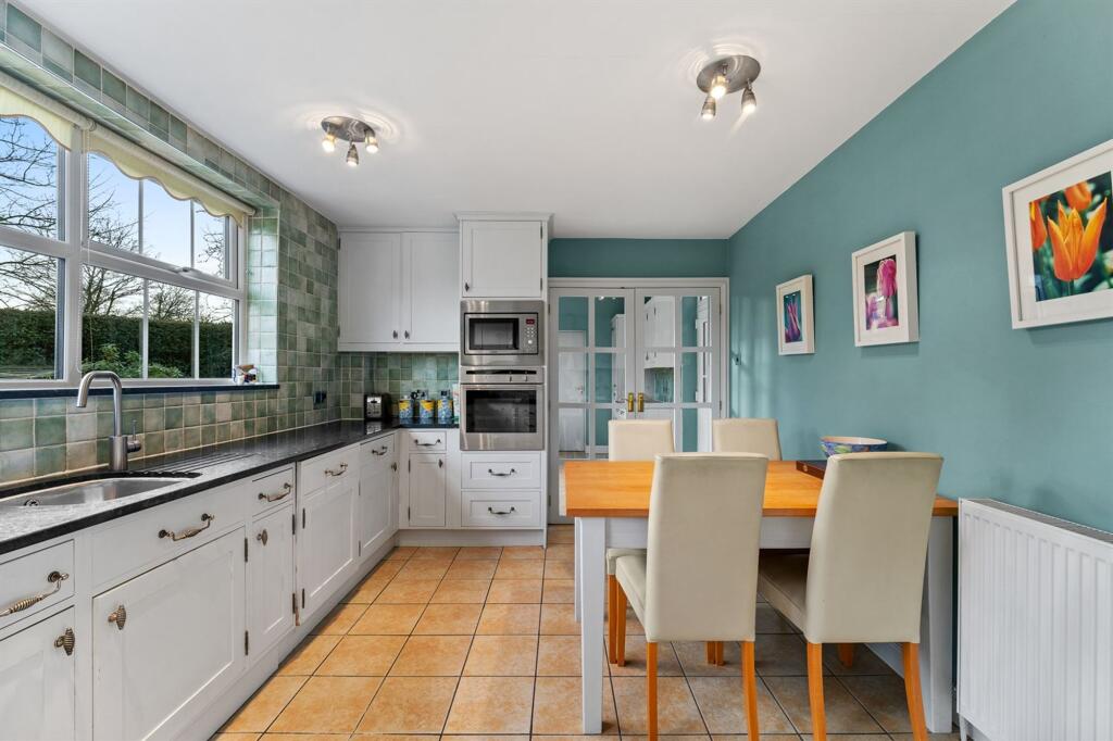
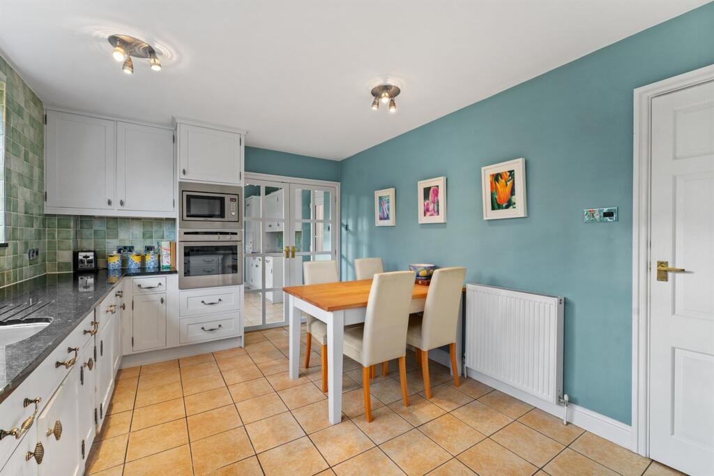
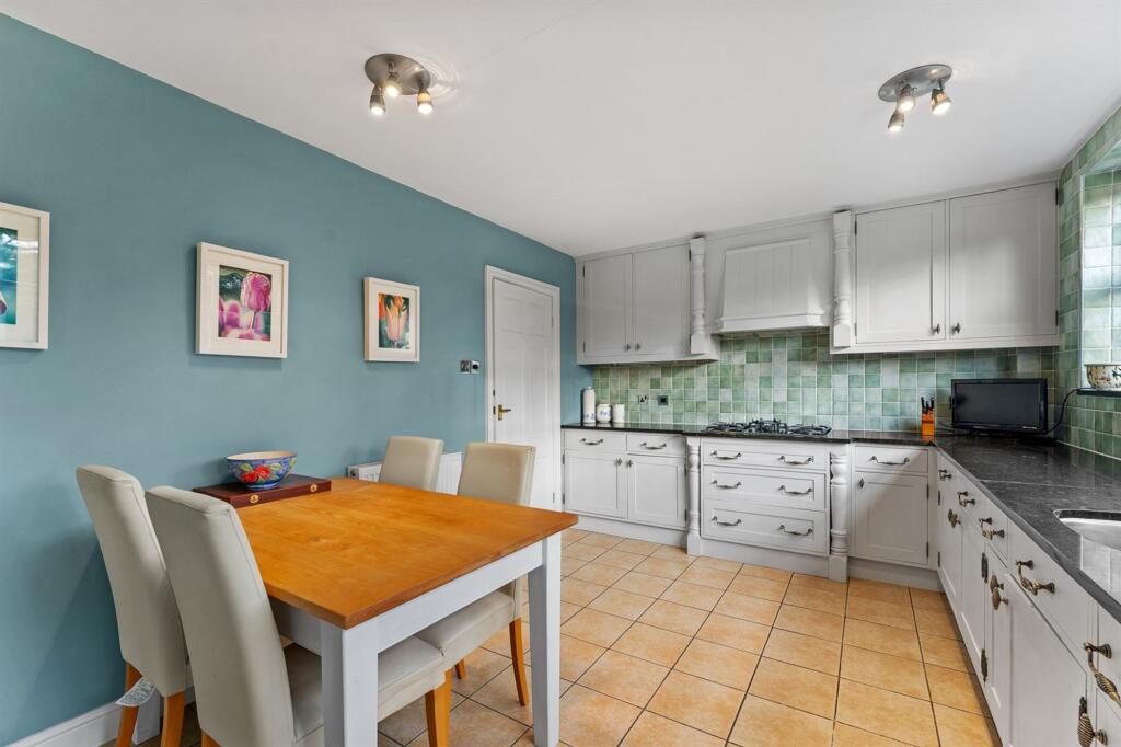
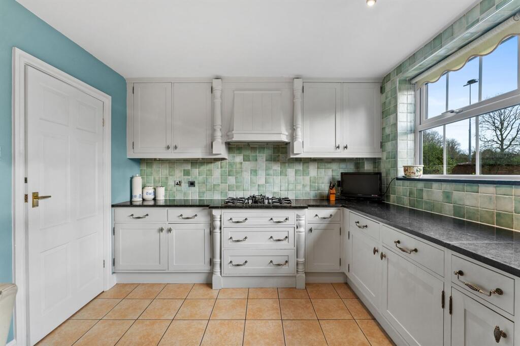
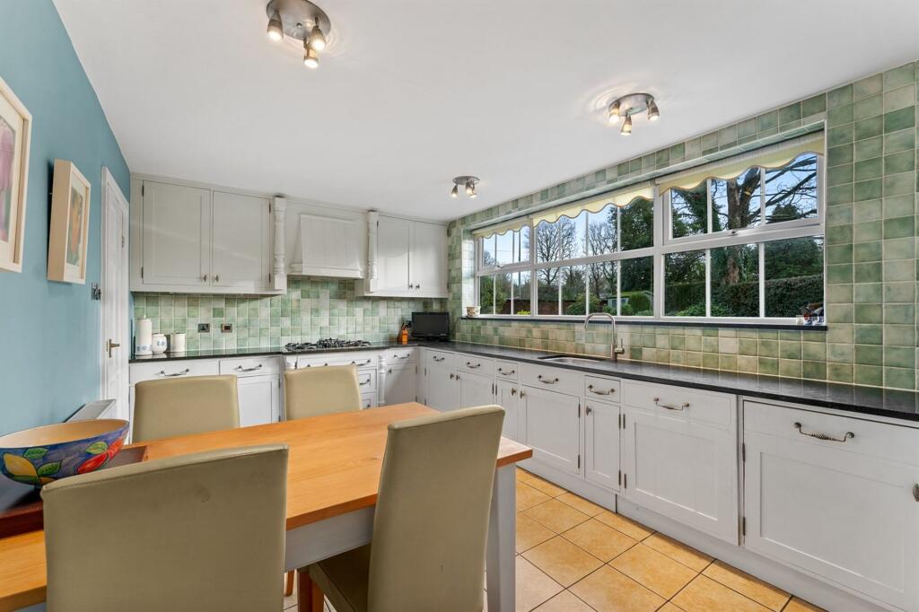
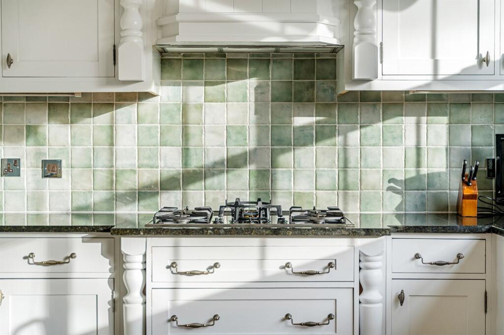
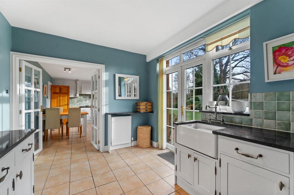
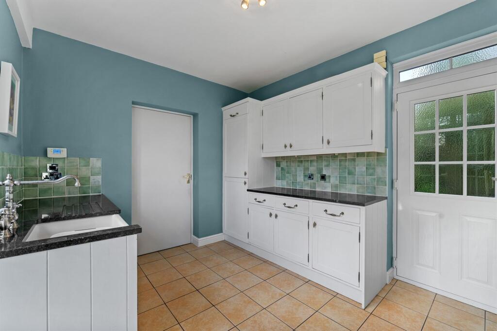
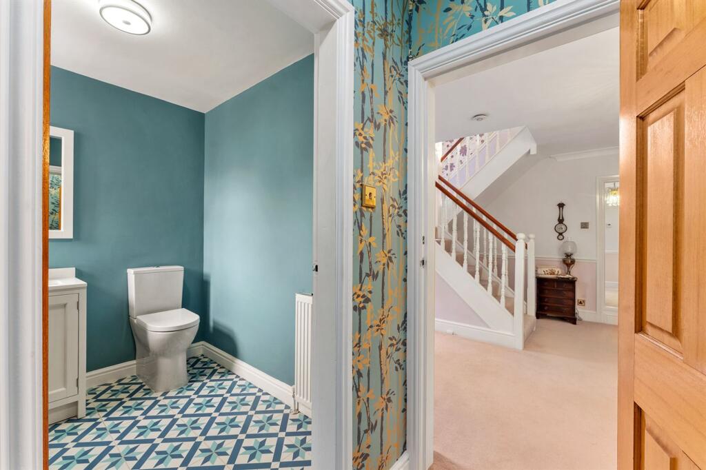
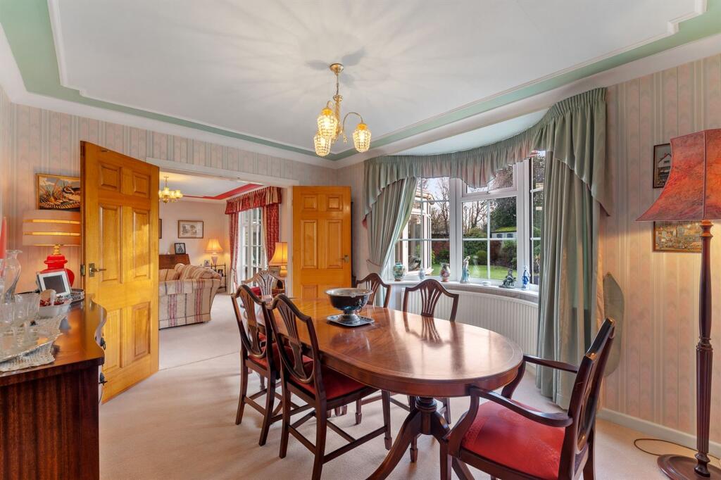
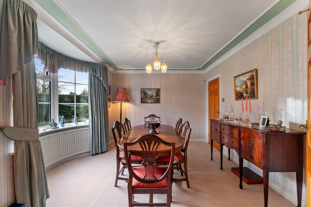
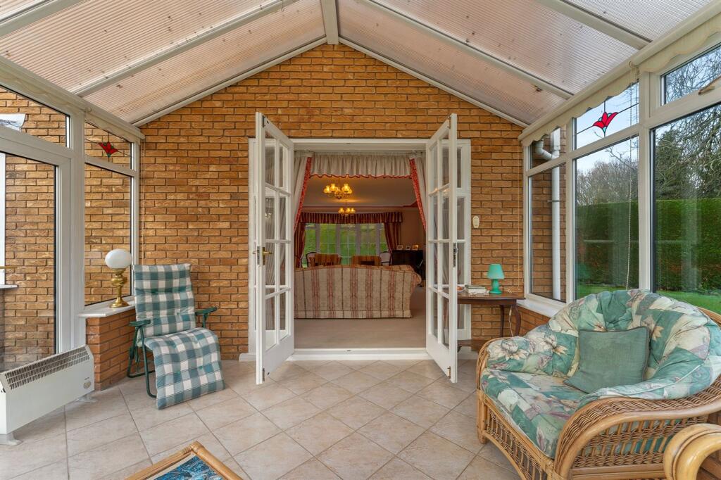
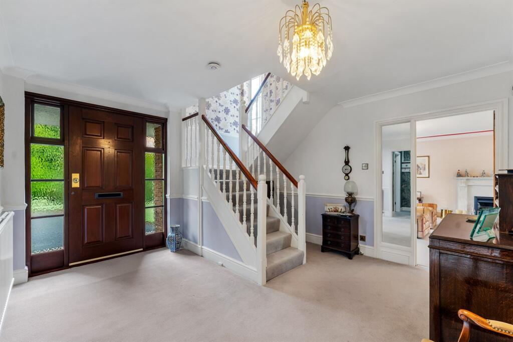
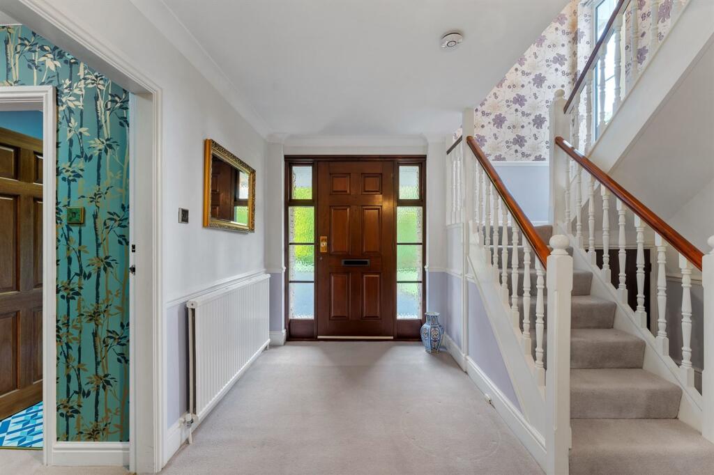
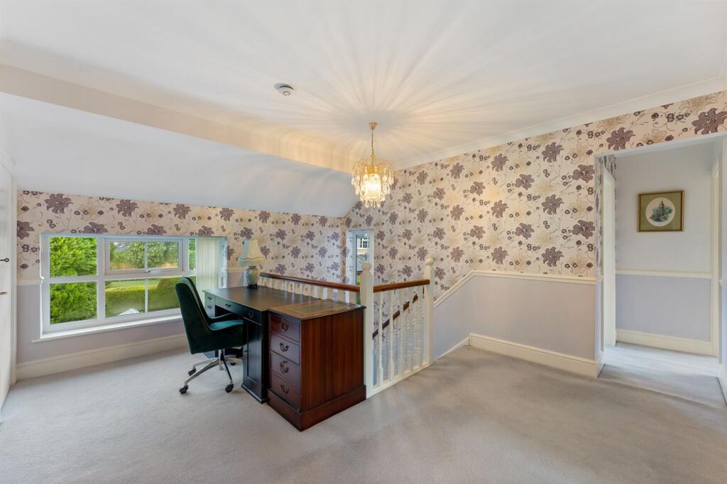
The accommodation is both spacious and versatile. A welcoming entrance hallway with cloakroom and W.C leads through to a flexible sitting room or home office, alongside an impressive bay-fronted living room with double doors opening into a substantial conservatory, perfectly positioned to enjoy views across the garden. Further double doors connect to a formal dining room, also benefiting from a rear bay window. The well-appointed dining kitchen flows seamlessly into a utility room, providing direct access to both the garden and the integral double garage.
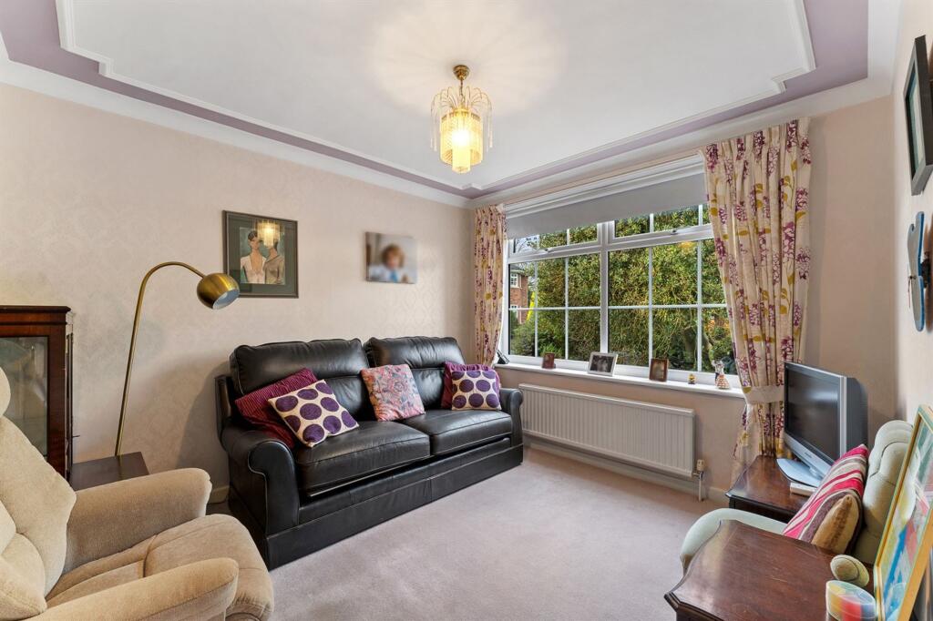
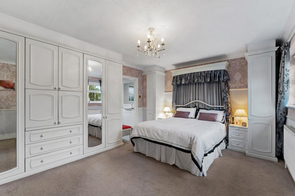
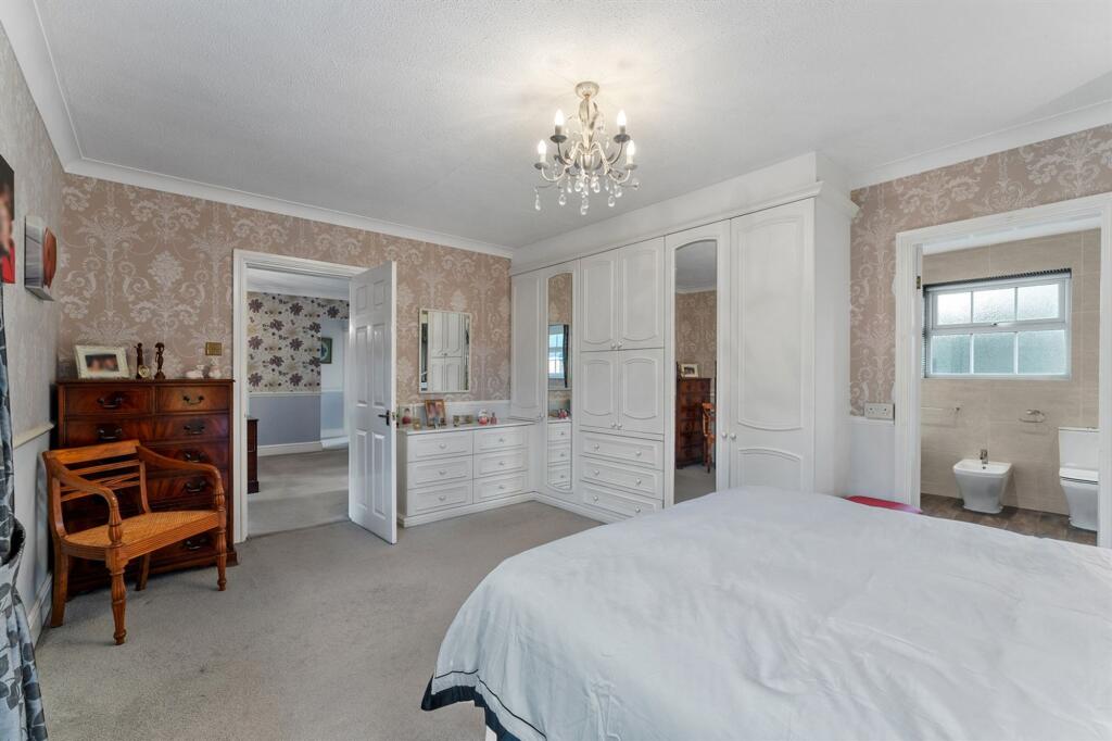
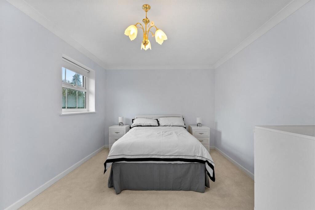
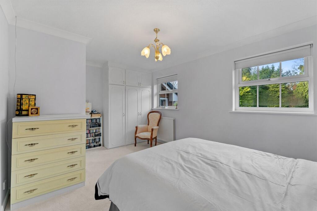
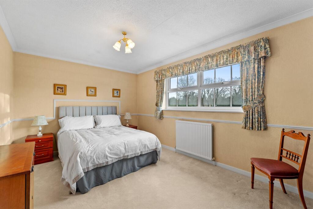
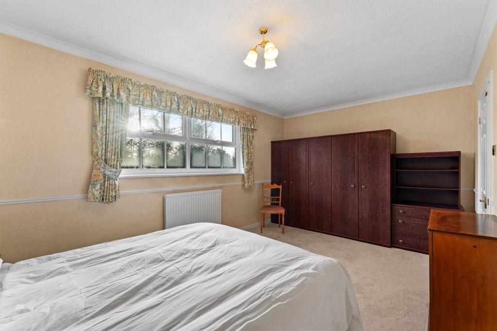
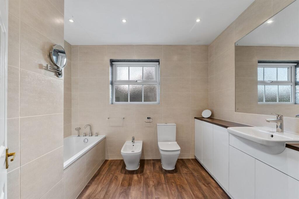
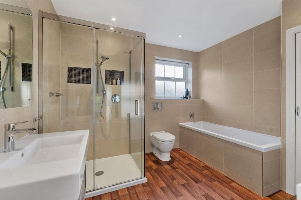
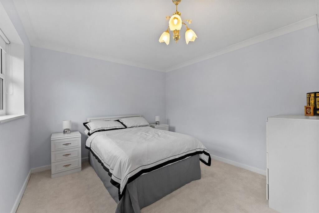
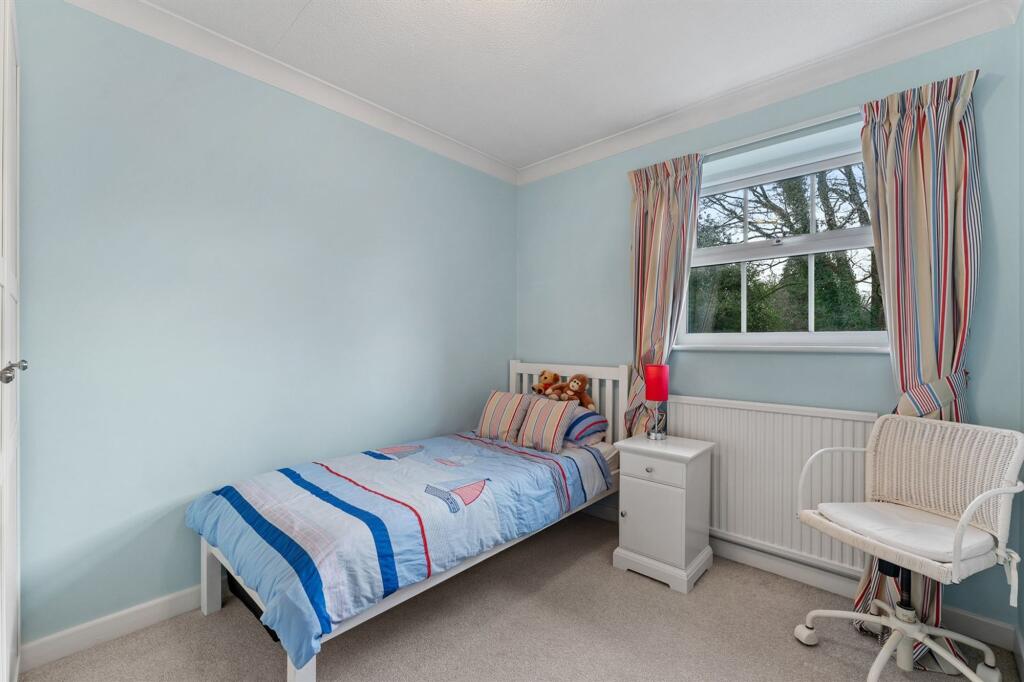
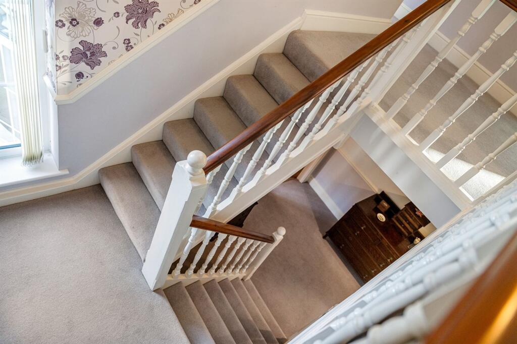
To the first floor, a bright and spacious landing with storage cupboard leads to four generously proportioned bedrooms. The principal bedroom features fitted wardrobes and a recently updated en-suite bathroom. The remaining bedrooms are served by a stylish and well-appointed family bathroom, complete with a walk-in shower.
An exceptional opportunity to acquire a substantial detached family home in one of Knutsfords most desirable locations, offering excellent proportions, outstanding potential, and a prime conservation area setting. Offered for sale with no onward chain.
EPC Rating: D
Listed by
Knutsford
Gascoigne Halman - Connells
Reference: 174768626
EPC ratings on this postcode
We don't have a matched EPC for this property yet. Below are efficiency scores and details for other addresses on this postcode.
| Address | Current | Potential | Floor area | Age band | Type |
|---|---|---|---|---|---|
| 2 Fairmead, Legh Road | 64 | 76 | 253 m² | England and Wales: 1967-1975 | House |
| 2 Fairmead, Legh Road, KNUTSFORD | 64 | 76 | 253 m² | England and Wales: 1967-1975 | Detached |
| 4 Fairmead, Legh Road | 58 | 70 | 226 m² | England and Wales: 1967-1975 | House |
| 4 Fairmead, Legh Road, KNUTSFORD | 58 | 70 | 226 m² | — | Detached |
| Bramley, Legh Road | 19 | 62 | 348 m² | England and Wales: before 1900 | House |
| Bramley, Legh Road, KNUTSFORD | 19 | 62 | 348 m² | England and Wales: before 1900 | Detached |
| Cornbrook, Legh Road | 36 | 74 | 398 m² | England and Wales: before 1900 | House |
| Cornbrook, Legh Road, KNUTSFORD | 65 | 77 | 409 m² | England and Wales: before 1900 | Detached |
| Cornbrook, Legh Road, KNUTSFORD | 36 | 74 | 398 m² | England and Wales: before 1900 | Detached |
| Dovengill, Legh Road | 42 | 53 | 193 m² | England and Wales: before 1900 | Flat |
| Draycote, Legh Road | 67 | 76 | 205 m² | England and Wales: 1976-1982 | House |
| Draycote, Legh Road, KNUTSFORD | 67 | 76 | 205 m² | England and Wales: 1976-1982 | Detached |
| Eskdale, Legh Road, KNUTSFORD | 58 | 71 | 376 m² | England and Wales: before 1900 | Detached |
| Hazelfield, Legh Road | 42 | 63 | 450 m² | England and Wales: 1900-1929 | House |
| Hazelfield, Legh Road, KNUTSFORD | 42 | 63 | 450 m² | — | Detached |
Flood risk
Zone: 1
Risk: Low
Job (default Low)
Floorplans
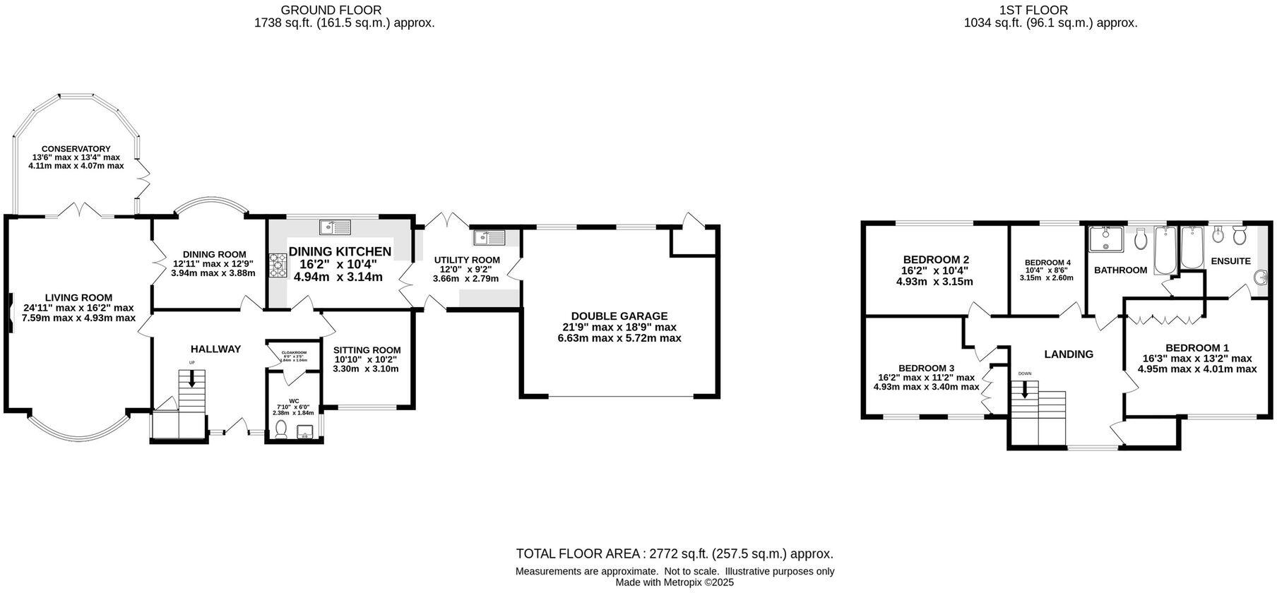
Floorplan 1
Price history
| Event | Date | Price | % change |
|---|---|---|---|
| Listed for sale | — | £1,495,000 | — |
Source: HM Land Registry Price Paid Data. Crown copyright.
Sold Comparables
Same street and nearby sales within 0.25 miles (last 5 years). Data from Land Registry Price Paid.
| Address | Price | Date | Type |
|---|---|---|---|
| 2 CROFT LANE, KNUTSFORD, CHESHIRE EAST, WA16 8QH | £1,000,000 | 04/11/2021 | Other |
Area average: £1,000,000 (1 sale)
Capital growth trend
Land Registry outcode average: last 12 months vs 5y and 10y ago (from sold prices).
House Price Index (HM Land Registry — official index, not sold-price averages): Cheshire East. Series: All dwelling types. As of March 2026.
Rental Range
Estimated market rent for Cheshire East. Low = conservative, Realistic = average, Optimistic = best case.
Based on Local Authority from postcode lookup → Cheshire East.
LHA (30th percentile) floor for East Lancs: £793/mo (Apr 2025 – Mar 2026)
Location
Address
Chelford Road
Nearby
Nearest stations, universities and amenities (distance from property).
| Type | Name | Distance |
|---|---|---|
| Bus stop | Knutsford, Chelford Road / Carrwood | 0.1 miles |
| Shop | Asda Express | 0.3 miles |
| Shop | Paradise Garage | 0.3 miles |
| Train station | Knutsford | 0.5 miles |
| Hospital | Knutsford and District Community Hospital | 0.7 miles |
| Train station | Mobberley | 2.6 miles |
| Hospital | Soss Moss Hospital | 4.1 miles |
| University | University of Chester - Warrington Campus | 11.2 miles |
| University | University Academy 92 | 11.6 miles |
Street-level crime
| Category | Count |
|---|---|
| Violence and sexual offences | 23 |
| Public order | 7 |
| Shoplifting | 5 |
| Other theft | 3 |
| Criminal damage and arson | 2 |
| Anti-social behaviour | 1 |
| Burglary | 1 |
| Drugs | 1 |
| Possession of weapons | 1 |
| Total incidents | 44 |
Within 1 mile during Apr 2026. Source: data.police.uk (England & Wales).
Schools nearby
Nearest open schools with Ofsted ratings (England). Closed schools are not shown. Data from Get Information about Schools and Ofsted.
| Name | Type | Distance | Ofsted |
|---|---|---|---|
| St Vincent De Paul Catholic Primary School | Primary | 0.4 miles | Good — 6 Jun 2013 |
| Manor Park Primary School and Nursery | Primary | 0.6 miles | Good — 13 Sep 2023 |
| Bexton Primary School | Primary | 0.6 miles | Good — 5 Mar 2018 |
| Egerton Primary School | Primary | 0.7 miles | Good — 13 Feb 2023 |
| Adelaide Heath Academy | Other | 0.8 miles | Good — 24 Jul 2024 |
Rental Comparables
Residential lets from OpenRent and Rightmove for the area (same bedroom count). Use to validate rent estimates. Student lets are excluded.
| Title | Rent | Beds | Distance | As seen on |
|---|---|---|---|---|
| 4 Bed Detached House, Grove Park, WA16 | £2,000/mo | 4 | 0.27 miles | OpenRent |
| 4 Bed Detached House, Plumley Moor Road, WA16 | £8,200/mo | 4 | 0.5 miles | OpenRent |
Average rent: £5,100/mo (2 listings)
Rent-driven metrics
Based on OpenRent comparables.
- Rent ratio — Monthly rent ÷ purchase price (1% rule). 1%+ = strong, 0.8–1% = okay, <0.8% = weak for cashflow.
- Max investor price — Rent ÷ 0.8%; the price at which rent would be 0.8% of price (Stoke-style target).
- Target investor price — Rent ÷ 1%; the price at which rent would be 1% of price (strong cashflow band).
- Gross yield — Annual rent as % of purchase price (no costs).
- Cost-to-rent — Price ÷ annual rent (from OpenRent comparables). Under 14× = strong, 14–16× = acceptable, 17×+ = compressed.
- Cashflow — Rent minus mortgage, 10% maintenance, £25/mo compliance. Assumes 75% LTV, 3.95% APR (5yr fixed), 25yr term.
- ROI — Annual profit ÷ cash in (deposit + 4% purchase costs).
Enter House Number
Enter the house number to help us retrieve more accurate pricing history and property data.
Please log in to submit or correct the house number for this listing.
Log in to continue