173 EDWARD STREET
BRIGHTON, BRIGHTON AND HOVE BN2 0JB
£650 pcm

Property details
Deprivation
Decile 2 (5,101 of 33,755)
Street crime
1444 incidents within 1 mile (Mar 2026)
Key features
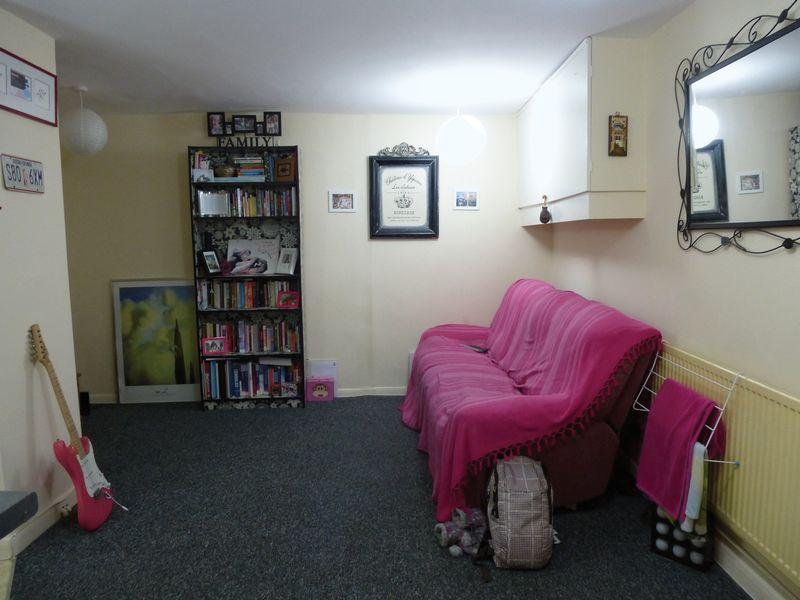
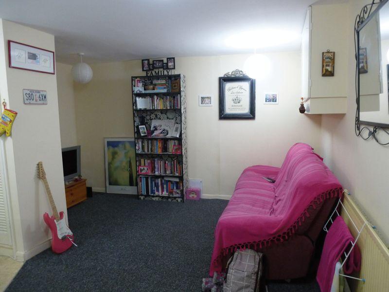
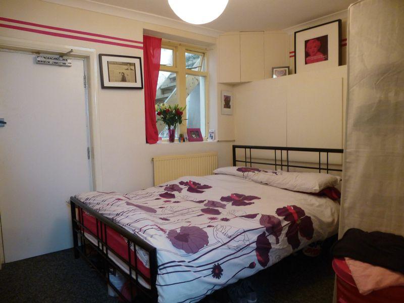
- Good size LGF studio flat
- Self contained
- Separate sleeping area
- Modern open plan kitchen
- Bathroom
- Good location
- Available 30/09/2013
- Unfurnished
Description
Listed by
Hove
Simply Lettings
Reference: 43321964
EPC Rating & Upgrade Cost
Fetching EPC data… Refresh this page in a moment.
Flood risk
Zone: 1
Risk: Low
Job (default Low)
Company ownership
Registered legal owner is a company.
Company: PONDTREE LIMITED (01754271)
Rental Range
Estimated market rent for Brighton and Hove. Low = conservative, Realistic = average, Optimistic = best case.
Based on Local Authority from postcode lookup → Brighton and Hove.
LHA (30th percentile) floor for Brighton and Hove: Apr 2025 – Mar 2026
Location
Nearby
Nearest stations, universities and amenities (distance from property).
| Type | Name | Distance |
|---|---|---|
| Shop | Metropolis | 0.0 miles |
| Shop | Wheeler's | 0.0 miles |
| Bus stop | Law Courts | 0.1 miles |
| Bus stop | Royal Pavilion | 0.1 miles |
| Train station | Aquarium | 0.3 miles |
| Train station | Brighton | 0.5 miles |
| University | University of Brighton Phoenix Halls | 0.5 miles |
| Hospital | Royal Sussex County Hospital | 0.7 miles |
| Hospital | The Royal Alexandra Children's Hospital | 0.8 miles |
| University | University of Brighton Moulesecoomb Campus | 1.5 miles |
Street-level crime
| Category | Count |
|---|---|
| Violence and sexual offences | 404 |
| Anti-social behaviour | 294 |
| Shoplifting | 220 |
| Public order | 109 |
| Drugs | 106 |
| Other theft | 104 |
| Criminal damage and arson | 67 |
| Other crime | 36 |
| Burglary | 33 |
| Robbery | 23 |
| Vehicle crime | 16 |
| Possession of weapons | 13 |
| Theft from the person | 13 |
| Bicycle theft | 6 |
| Total incidents | 1444 |
Within 1 mile during Mar 2026. Source: data.police.uk (England & Wales).
Schools nearby
Nearest open schools with Ofsted ratings (England). Closed schools are not shown. Data from Get Information about Schools and Ofsted.
| Name | Type | Distance | Ofsted |
|---|---|---|---|
| Carlton Hill Primary School | Primary | 0.2 miles | Good — 28 Mar 2014 |
| Tarnerland Nursery School | Nursery | 0.2 miles | Outstanding — 7 Jan 2014 |
| Royal Spa Nursery School | Nursery | 0.3 miles | Outstanding — 26 Jun 2015 |
| Middle Street Primary School | Primary | 0.4 miles | Good — 11 Jul 2024 |
| Queen's Park Primary School | Primary | 0.4 miles | Requires improvement — 19 Oct 2023 |
Rental Comparables
Residential lets from OpenRent and Rightmove for the area. Bedroom counts vary — use the Beds column to compare like-for-like lets. Student lets are excluded.
| Title | Rent | Beds | Distance | As seen on |
|---|---|---|---|---|
| 3 Bed Terraced House, St. James's Street, BN2 | £3,800/mo | 3 | 0.11 miles | OpenRent |
| 1 Bed Flat, Marine Parade, BN2 | £1,950/mo | 1 | 0.17 miles | OpenRent |
| 2 Bed Flat, Walk House, BN1 | £1,870/mo | 2 | 0.21 miles | OpenRent |
| 2 Bed Flat, Old Steine, BN1 | £1,650/mo | 2 | 0.23 miles | OpenRent |
| 1 Bed Flat, Egremont Place, BN2 | £1,600/mo | 1 | 0.25 miles | OpenRent |
Average rent: £2,174/mo (5 listings)