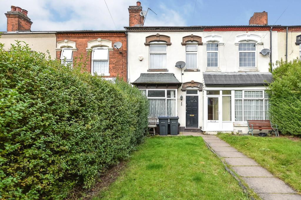
Minstead Road
Erdington, Birmingham, West Midlands, B24, B24 8PX
Property details
Council tax band
TBC
Last sold
£170,000
Local average
£230,289 (-26.2%)
Deprivation
Decile 1 (1,009 of 33,755)
Street crime
463 incidents within 1 mile (Apr 2026)
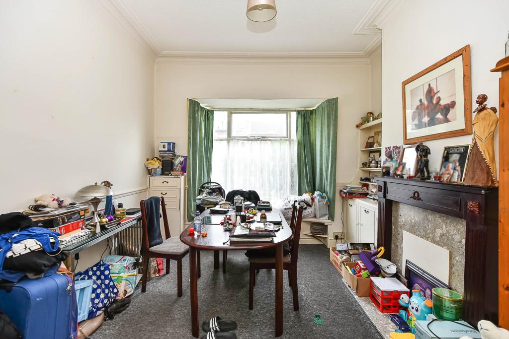
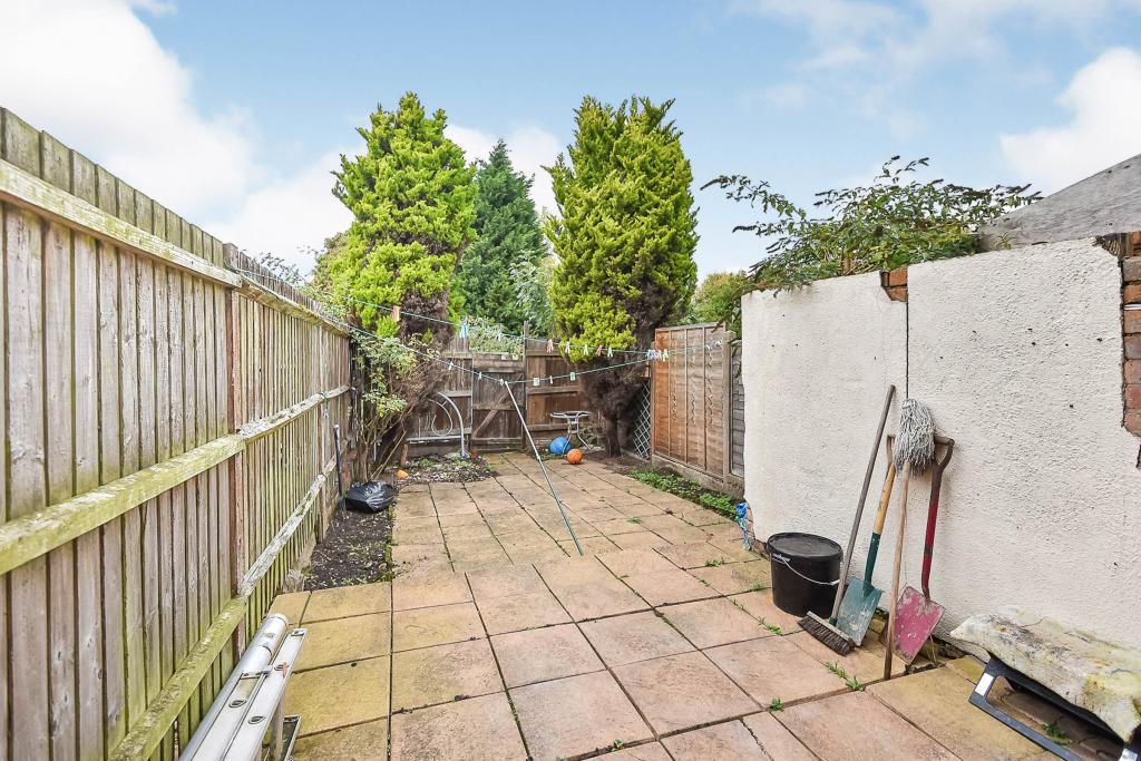
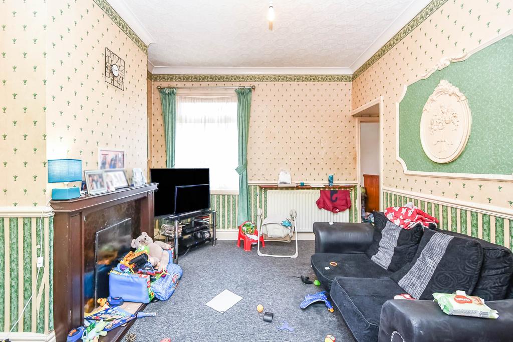
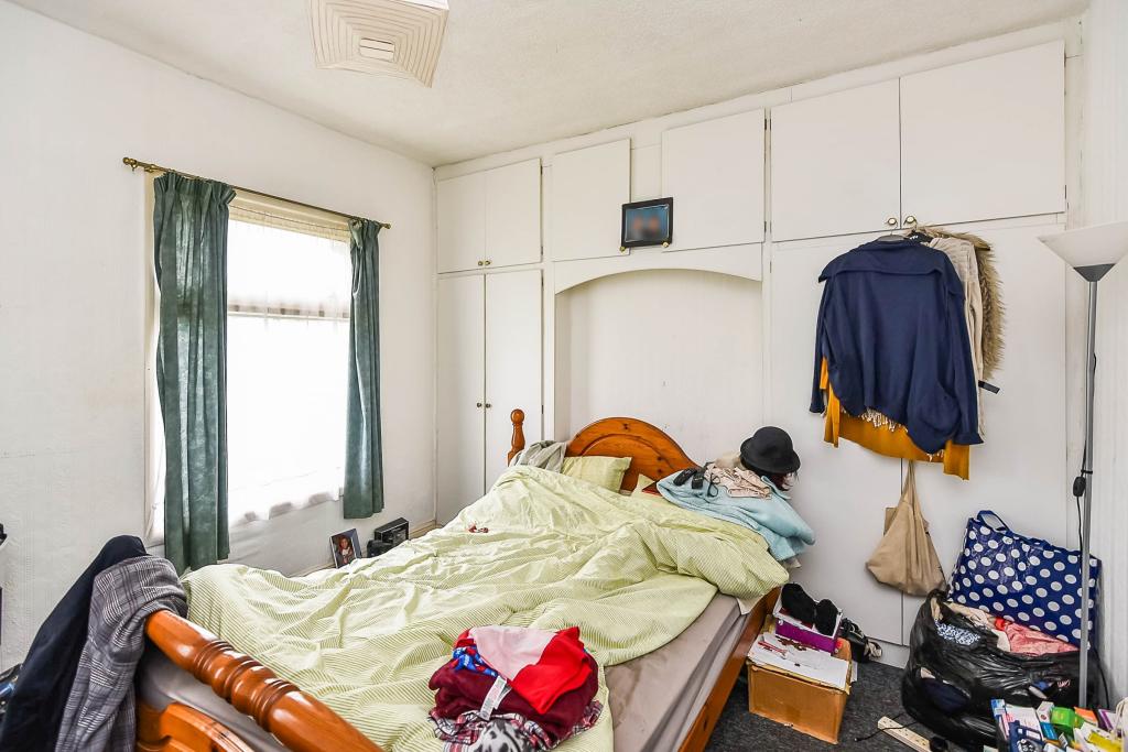
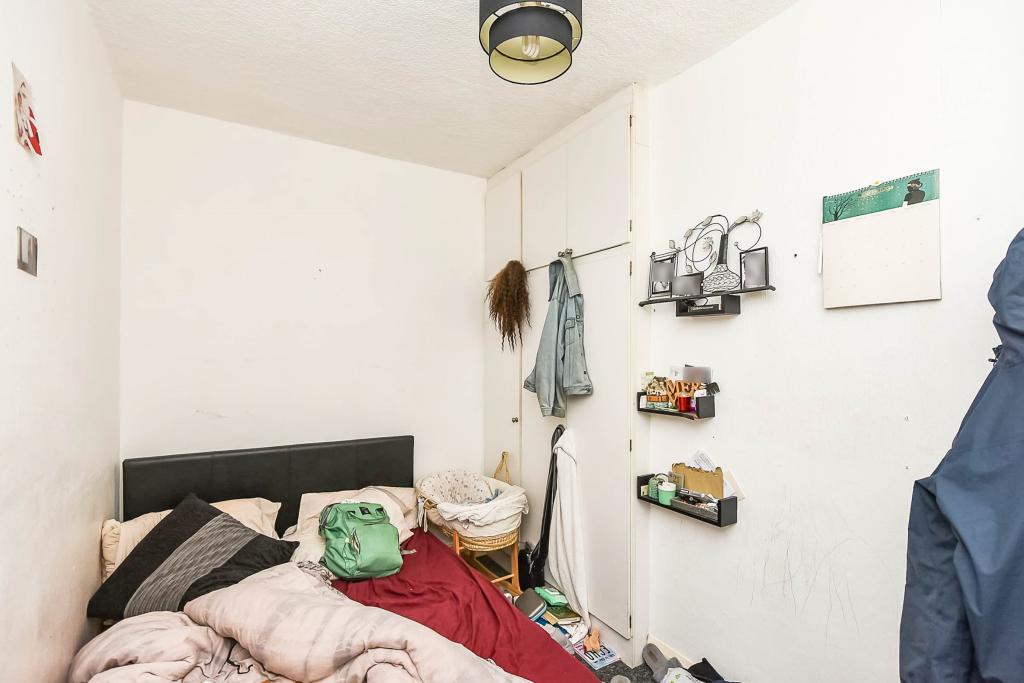
Key features
- Investment opportunity
- Three bedrooms
- Two reception rooms
- Popular residential area
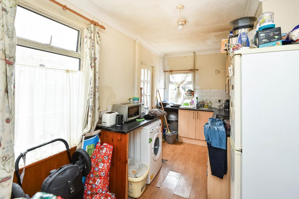
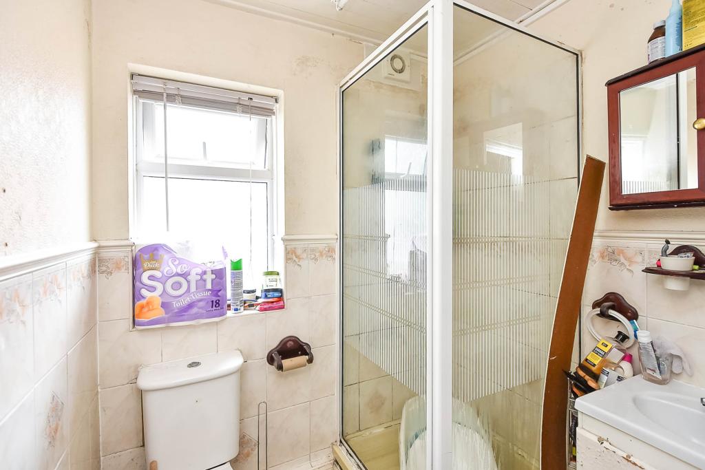
Description
Situated in the popular residential area of Erdington close to local amenities, schools, shops and parks with transport links into Sutton Coldfield and Birmingham City Centre.
Listed by
Erdington
Countrywide UK Sales - Connells
Reference: 85989700
EPC ratings on this postcode
We don't have a matched EPC for this property yet. Below are efficiency scores and details for other addresses on this postcode.
| Address | Current | Potential | Floor area | Age band | Type |
|---|---|---|---|---|---|
| 100, Minstead Road, BIRMINGHAM | 63 | 89 | 88 m² | England and Wales: 1900-1929 | Terraced |
| 102 Minstead Road, BIRMINGHAM | 70 | 87 | 87 m² | England and Wales: 1900-1929 | Terraced |
| 102, Minstead Road, BIRMINGHAM | 59 | 84 | 89 m² | England and Wales: 1900-1929 | Terraced |
| 104 Minstead Road, BIRMINGHAM | 69 | 88 | 111 m² | England and Wales: 1900-1929 | Terraced |
| 106, Minstead Road, BIRMINGHAM | 48 | 87 | 89 m² | England and Wales: 1900-1929 | Terraced |
| 108 Minstead Road, BIRMINGHAM | 71 | 81 | 133 m² | England and Wales: 1900-1929 | Terraced |
| 110, Minstead Road, BIRMINGHAM | 67 | 84 | 87 m² | England and Wales: 1930-1949 | Terraced |
| 112 Minstead Road, BIRMINGHAM | 65 | 85 | 87 m² | England and Wales: 1900-1929 | Terraced |
| 116 Minstead Road, BIRMINGHAM | 63 | 86 | 100 m² | England and Wales: 1900-1929 | Terraced |
| 118 Minstead Road, BIRMINGHAM | 61 | 79 | 87 m² | England and Wales: 1900-1929 | Terraced |
| 118, Minstead Road, BIRMINGHAM | 63 | 87 | 96 m² | England and Wales: 1900-1929 | Terraced |
| 120 MINSTEAD ROAD, BIRMINGHAM | 47 | 88 | 88 m² | England and Wales: 1930-1949 | Terraced |
| 122, Minstead Road, BIRMINGHAM | 49 | 82 | 102 m² | England and Wales: 1900-1929 | Terraced |
| 124, Minstead Road, BIRMINGHAM | 59 | 81 | 98 m² | England and Wales: 1900-1929 | Terraced |
| 126 Minstead Road, BIRMINGHAM | 70 | 77 | 146 m² | — | Terraced |
Flood risk
Zone: 2
Risk: In flood risk area
Environment Agency Flood Risk Areas (APSFR)
Floorplans
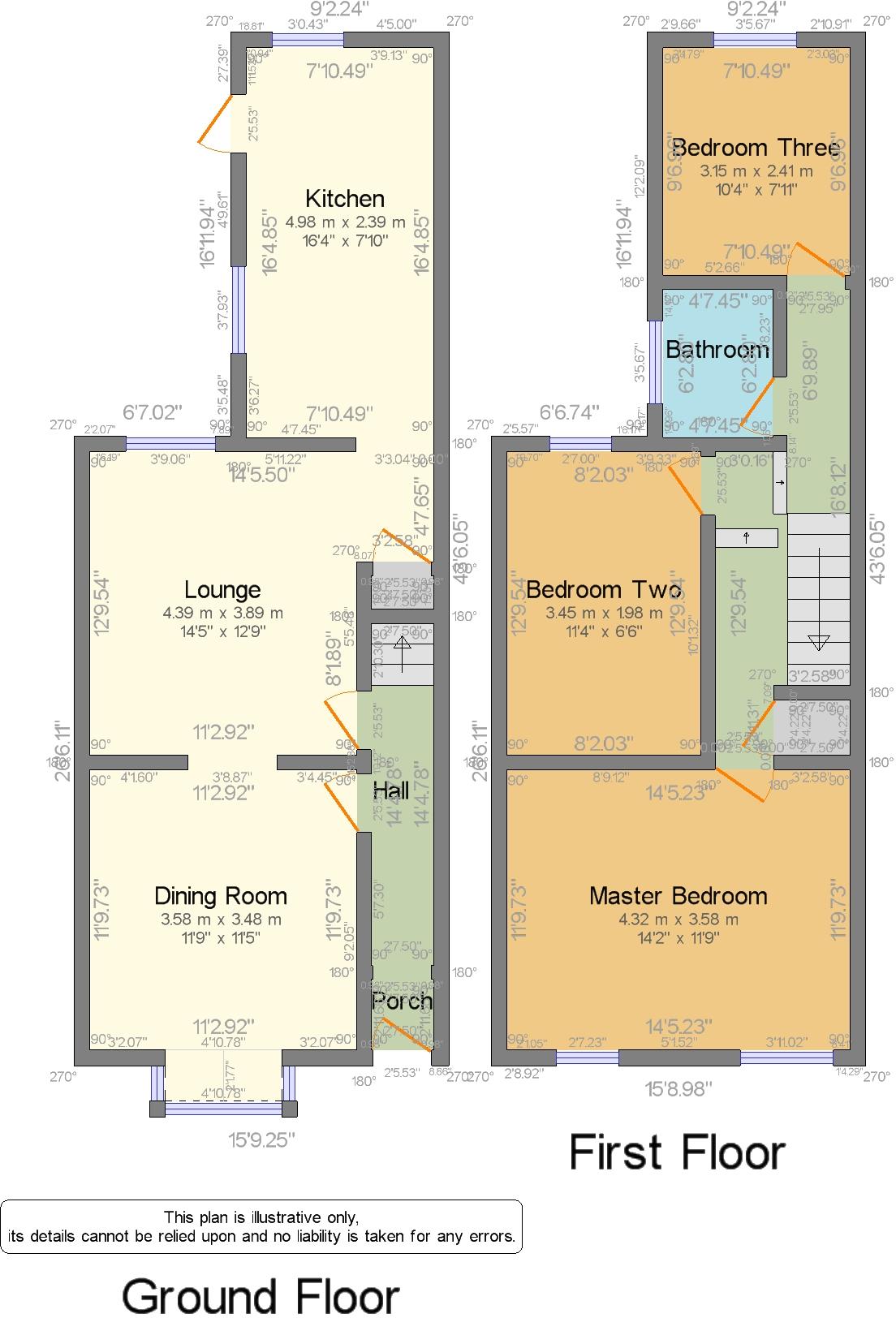
CWQuickSketch.jpg
EPC Graphs
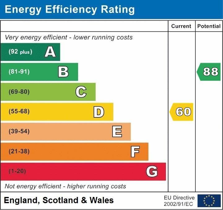
EPC.jpg
Price history
89% since 2002
| Event | Date | Price | % change |
|---|---|---|---|
| Sold | 01/01/2023 (3 years ago) | £170,000 | +30.8% |
| Sold | 01/01/2006 (20 years ago) | £130,000 | +44.5% |
| Sold | 01/01/2002 (24 years ago) | £89,950 | — |
Source: HM Land Registry Price Paid Data. Crown copyright.
Sold Comparables
Same street and nearby sales within 0.25 miles (last 5 years). Data from Land Registry Price Paid.
| Address | Price | Date | Type |
|---|---|---|---|
| 19 ARMADA CLOSE, BIRMINGHAM, WEST MIDLANDS, B23 7PB | £210,000 | 18/12/2025 | Terraced |
| Same street 126 MINSTEAD ROAD, BIRMINGHAM, WEST MIDLANDS, B24 8PX | £150,000 | 17/12/2025 | Terraced |
| 133 MINSTEAD ROAD, ERDINGTON, BIRMINGHAM, WEST MIDLANDS, B24 8PR | £180,000 | 17/11/2023 | Terraced |
| 19 ST DOMINICS ROAD, BIRMINGHAM, WEST MIDLANDS, B24 8LL | £150,000 | 01/09/2023 | Terraced |
| 190 HAWKESYARD ROAD, BIRMINGHAM, WEST MIDLANDS, B24 8LH | £175,000 | 20/06/2023 | Terraced |
| Same street 130 MINSTEAD ROAD, BIRMINGHAM, WEST MIDLANDS, B24 8PX | £170,000 | 26/04/2023 | Terraced |
| 38 OVAL ROAD, ERDINGTON, BIRMINGHAM, WEST MIDLANDS, B24 8PL | £150,000 | 24/04/2023 | Terraced |
| 71 HAWKESYARD ROAD, BIRMINGHAM, WEST MIDLANDS, B24 8LP | £177,000 | 21/04/2023 | Terraced |
| 96 HAWKESYARD ROAD, BIRMINGHAM, WEST MIDLANDS, B24 8LF | £100,000 | 20/04/2023 | Terraced |
| 46 DOWNSIDE ROAD, BIRMINGHAM, WEST MIDLANDS, B24 8PH | £202,000 | 07/03/2023 | Terraced |
| 111 MINSTEAD ROAD, ERDINGTON, BIRMINGHAM, WEST MIDLANDS, B24 8PR | £180,000 | 27/01/2023 | Terraced |
| 141 MINSTEAD ROAD, ERDINGTON, BIRMINGHAM, WEST MIDLANDS, B24 8PR | £253,500 | 29/09/2022 | Terraced |
| 50 MINSTEAD ROAD, ERDINGTON, BIRMINGHAM, WEST MIDLANDS, B24 8PT | £220,000 | 26/08/2022 | Terraced |
| 50 OVAL ROAD, ERDINGTON, BIRMINGHAM, WEST MIDLANDS, B24 8PL | £260,000 | 26/08/2022 | Terraced |
| 21 MINSTEAD ROAD, ERDINGTON, BIRMINGHAM, WEST MIDLANDS, B24 8PS | £300,000 | 19/08/2022 | Terraced |
| 94 GRAVELLY HILL, BIRMINGHAM, WEST MIDLANDS, B23 7PF | £175,000 | 16/08/2022 | Terraced |
| 68 MINSTEAD ROAD, ERDINGTON, BIRMINGHAM, WEST MIDLANDS, B24 8PT | £165,000 | 15/07/2022 | Terraced |
| 7 ST DOMINICS ROAD, BIRMINGHAM, WEST MIDLANDS, B24 8LN | £180,000 | 01/06/2022 | Terraced |
| 124 HAWKESYARD ROAD, BIRMINGHAM, WEST MIDLANDS, B24 8LF | £185,000 | 27/05/2022 | Terraced |
| 174 HAWKESYARD ROAD, BIRMINGHAM, WEST MIDLANDS, B24 8LH | £152,000 | 01/04/2022 | Terraced |
| 21 ST DOMINICS ROAD, BIRMINGHAM, WEST MIDLANDS, B24 8LL | £128,500 | 21/02/2022 | Terraced |
| 244 TYBURN ROAD, BIRMINGHAM, WEST MIDLANDS, B24 8LS | £153,000 | 20/01/2022 | Terraced |
| Same street 120 MINSTEAD ROAD, BIRMINGHAM, WEST MIDLANDS, B24 8PX | £173,000 | 29/09/2021 | Other |
Street average: £164,333 (3 sales)
Area average: £184,800 (20 sales)
Capital growth trend
Land Registry outcode average: last 12 months vs 5y and 10y ago (from sold prices).
House Price Index (HM Land Registry — official index, not sold-price averages): Birmingham. Series: Terraced. As of March 2026.
Rental Range
Estimated market rent for Birmingham. Low = conservative, Realistic = average, Optimistic = best case.
Based on Local Authority from postcode lookup → Birmingham.
LHA (30th percentile) floor for Birmingham: £823/mo (Apr 2025 – Mar 2026)
Location
Address
Minstead Road
Nearby
Nearest stations, universities and amenities (distance from property).
| Type | Name | Distance |
|---|---|---|
| Bus stop | Gravelly Hill / The Mount | 0.1 miles |
| Shop | Unknown | 0.3 miles |
| Train station | Gravelly Hill | 0.4 miles |
| Shop | B-SAWZ | 0.6 miles |
| Train station | Aston | 0.9 miles |
| University | BIMM University Birmingham | 2.7 miles |
| University | University of Birmingham School of Dentistry | 4.9 miles |
| Hospital | Brian Oliver Centre | 5.3 miles |
| Hospital | Bilston Street Surgery | 11.5 miles |
Street-level crime
| Category | Count |
|---|---|
| Violence and sexual offences | 217 |
| Criminal damage and arson | 42 |
| Shoplifting | 35 |
| Vehicle crime | 34 |
| Other theft | 26 |
| Public order | 25 |
| Burglary | 22 |
| Drugs | 22 |
| Robbery | 14 |
| Anti-social behaviour | 7 |
| Other crime | 7 |
| Possession of weapons | 7 |
| Bicycle theft | 3 |
| Theft from the person | 2 |
| Total incidents | 463 |
Within 1 mile during Apr 2026. Source: data.police.uk (England & Wales).
Schools nearby
Nearest open schools with Ofsted ratings (England). Closed schools are not shown. Data from Get Information about Schools and Ofsted.
| Name | Type | Distance | Ofsted |
|---|---|---|---|
| Spring Hill High School | Other | 0.3 miles | Good — 28 Nov 2022 |
| Slade Primary School | Primary | 0.3 miles | Good — 6 Jan 2019 |
| Ss Mary & John Catholic Primary School | Primary | 0.5 miles | Good — 8 May 2023 |
| Erdington Hall Primary School | Primary | 0.5 miles | Good — 24 Jun 2016 |
| E-ACT Nechells Academy | Primary | 0.6 miles | Good — 29 Jun 2021 |
Rental Comparables
Rental listings exist nearby, but none matched the 3-bedroom count for this property.
Rent-driven metrics
Based on Area rent estimate.
- Rent ratio — Monthly rent ÷ purchase price (1% rule). 1%+ = strong, 0.8–1% = okay, <0.8% = weak for cashflow.
- Max investor price — Rent ÷ 0.8%; the price at which rent would be 0.8% of price (Stoke-style target).
- Target investor price — Rent ÷ 1%; the price at which rent would be 1% of price (strong cashflow band).
- Gross yield — Annual rent as % of purchase price (no costs).
Enter House Number
Enter the house number to help us retrieve more accurate pricing history and property data.
Please log in to submit or correct the house number for this listing.
Log in to continue