Rushlade Farm House
Land and Barns for Development, Hilderstone, ST15 8RQ

DJI_0223.JPG DJI_0234.JPG DJI_0218.JPG RHM_3101.jpeg RHM_3095.jpeg RHM_3097.jpeg RHM_3091.jpeg Elevations proposed image .jpg floorplan proposed image .jpg garden layout proposed image .jpg DJI_0237.JPG RHM_3086.jpeg DJI_0242.JPG Elevation proposed image .jpg elevation image first floor.jpg Proposed single garden parking .jpg DJI_0247.JPG DJI_0244.JPG DJI_0221.JPG Rushlade Boundary.jpg
/ 20
Property details
Tenure
FREEHOLD
Council tax band
G
Local average
£789,375 (+26.7%)
Deprivation
Decile 8 (24,423 of 33,755)
Street crime
4 incidents within 1 mile (May 2026)
Key features
- Best and Final Offers by 19th August at 12 Noon
- House, Land and Barn for Development
- 8.92 Acres
- All Enquires to Ashbourne Office
Additional details
- Parking
- Yes
- Garden
- Yes
Description
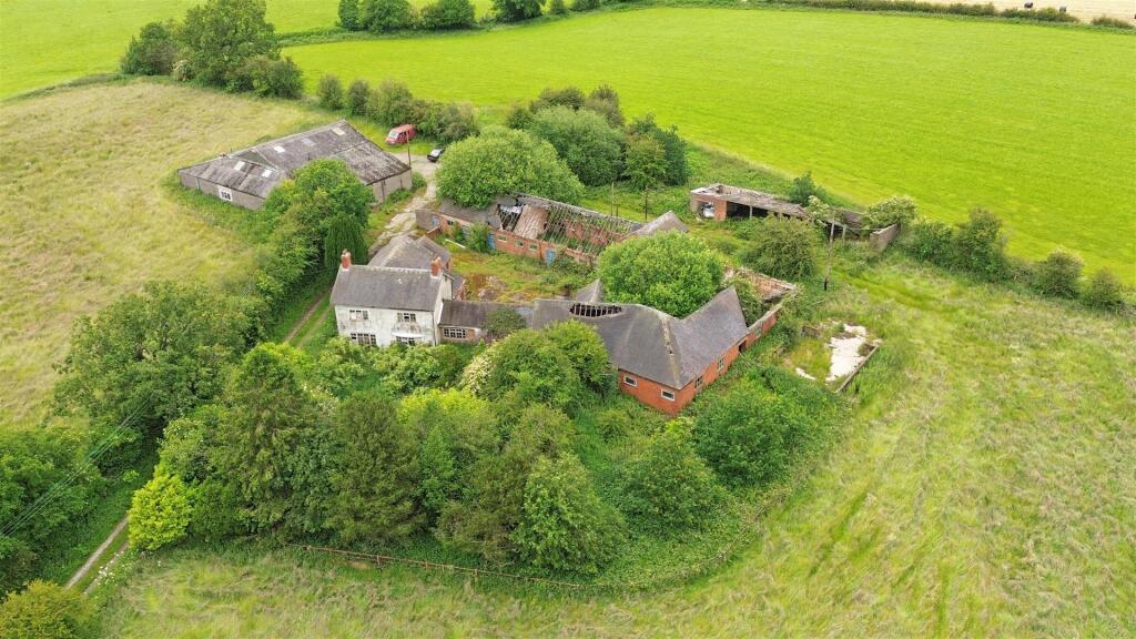
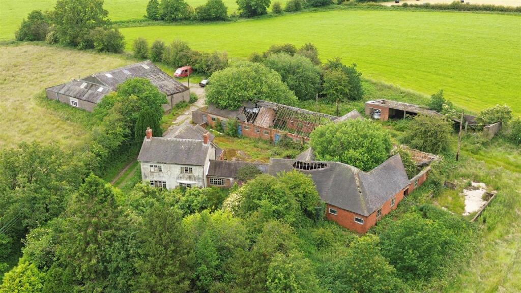
Summary - A rare opportunity to purchase a farmhouse and outbuildings with planning consent to convert to provide a total of 5 dwellings and land extending to 8.92 acres in all.
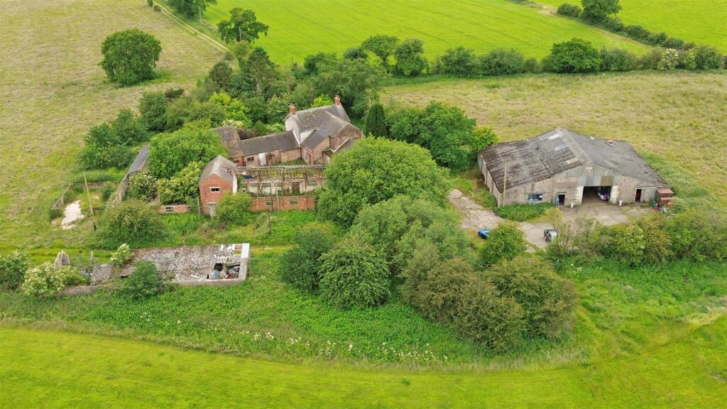
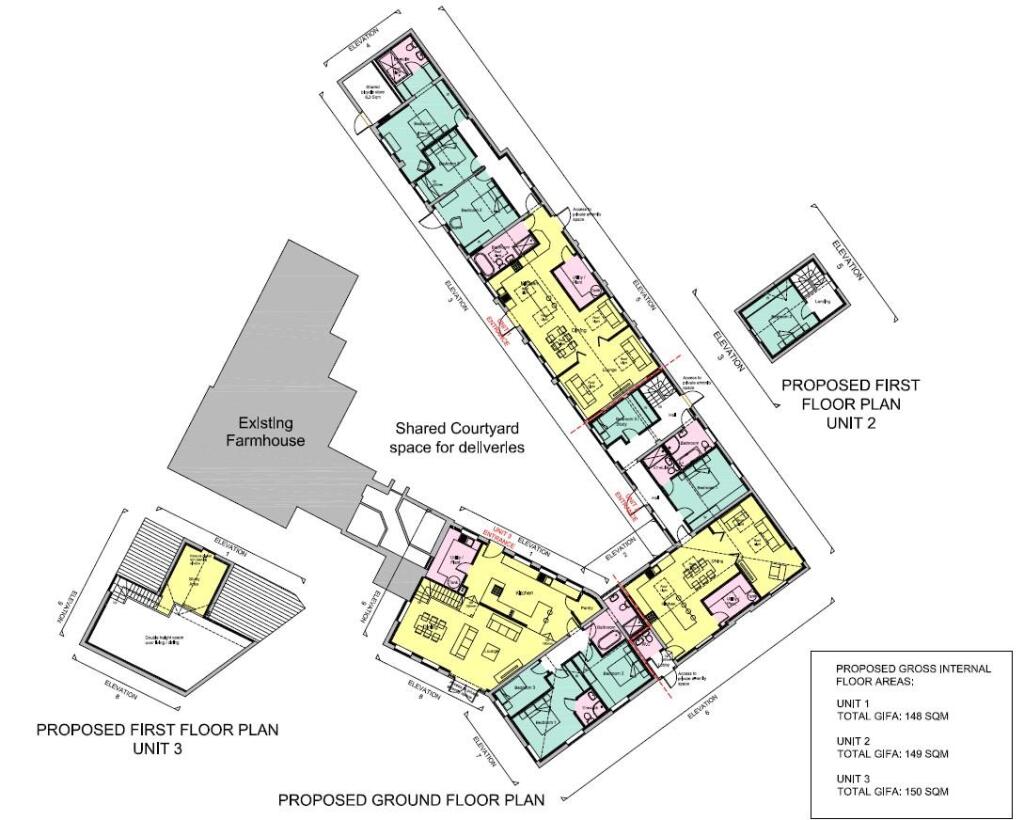
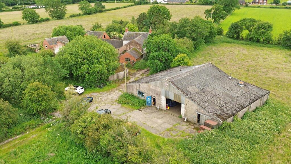
The traditional buildings have been granted prior approval to convert into three residential dwellings with the barn (previously a commercial building) granted prior approval for a single dwelling extending to 5000 sq. ft internal floor area.
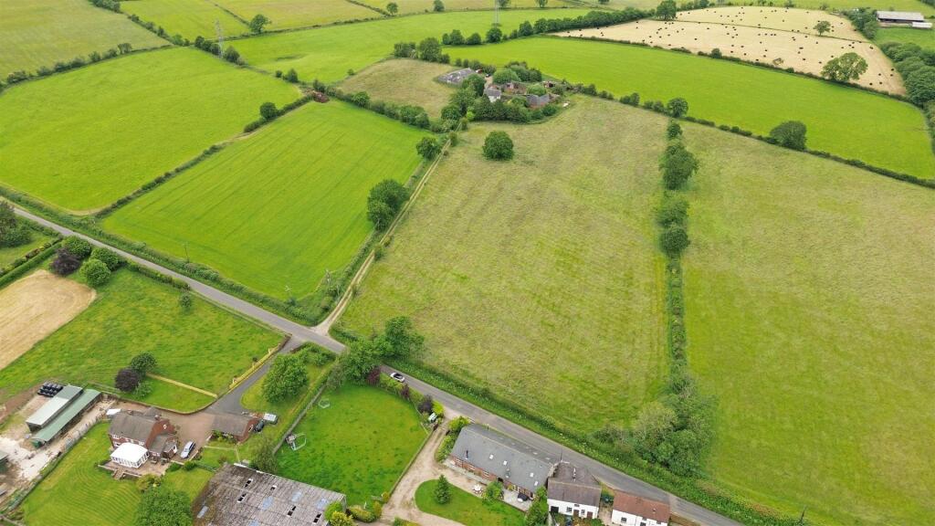
Splendidly well located on the edge of HIlderstone in a beautiful rural location surrounded by its own land with private access drive.
Providing a lovely blend of rural living with the convenience of access to local link roads including the A50
For sale with no upward chain
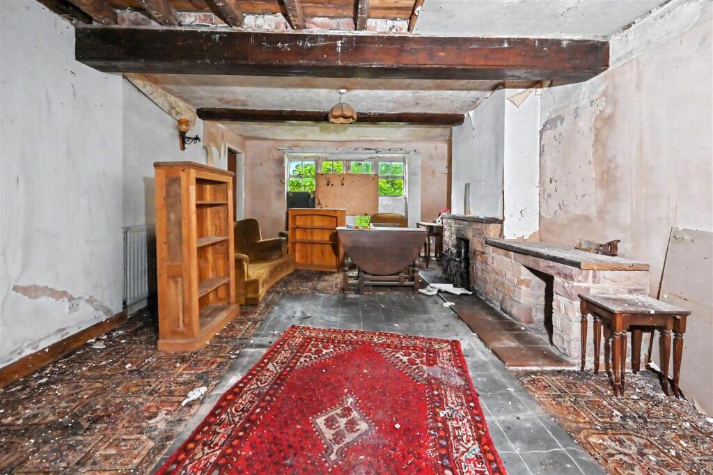
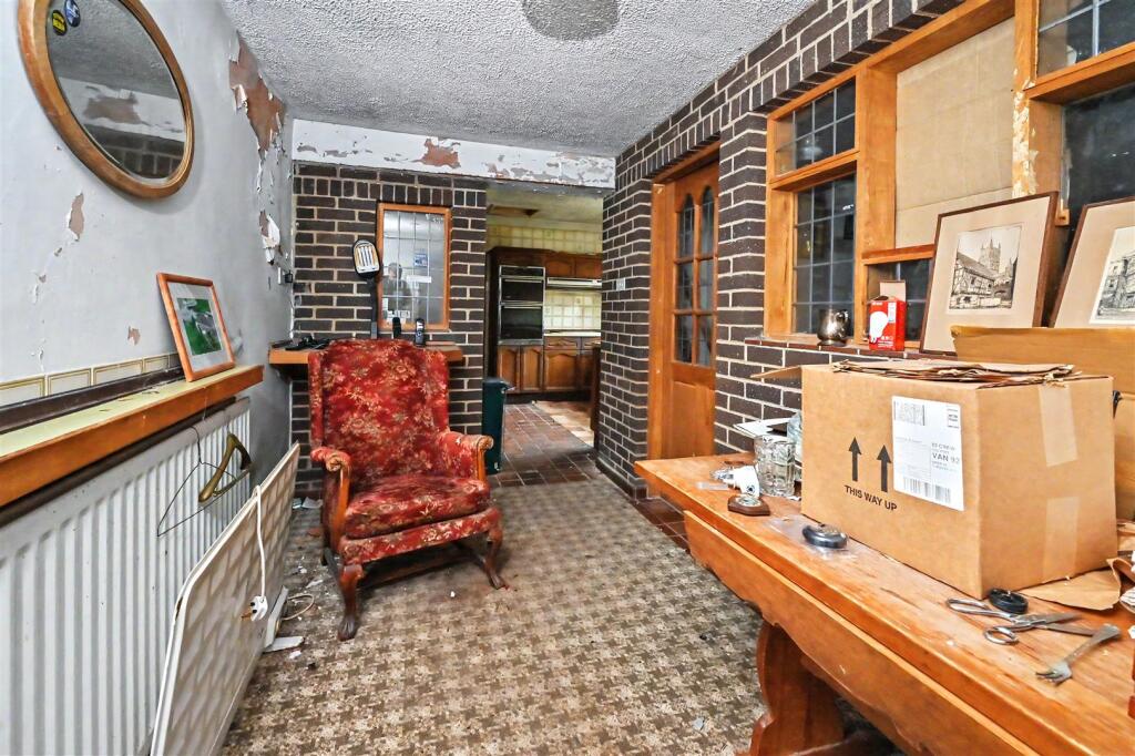
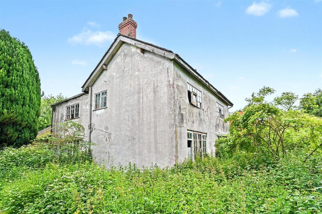
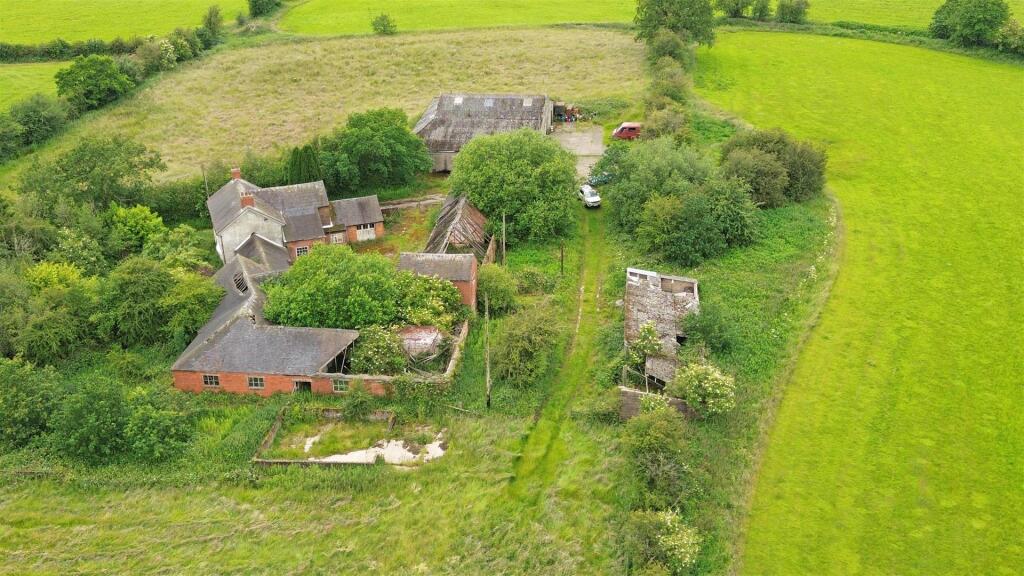
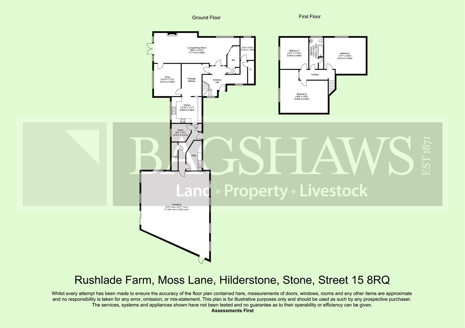
Farm House - This traditional farmhouse is in need of complete renovation. The accommodation comprises of main door leading into the Entrance Hall with stairs rising to first floor level and internal access into the spacious Lounge / Dining Room with a Bar area set in one corner and double doors opening onto the garden, with internal door through to the Snug which in turn leads back through to the Passage Hallway providing internal access to the Entrance Hall and Kitchen.
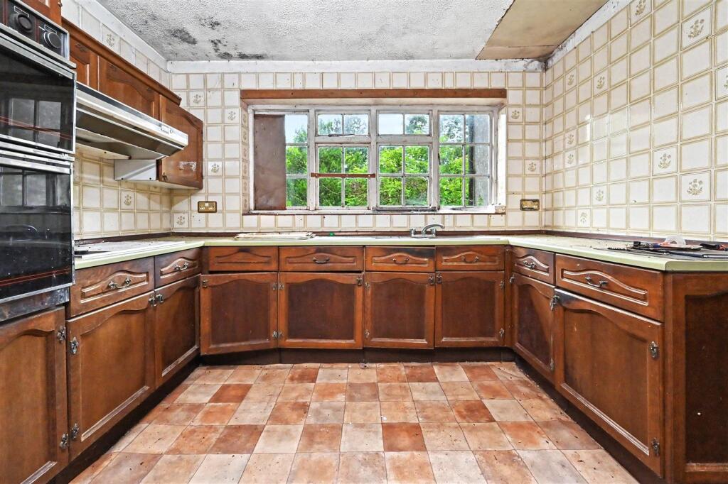
The Kitchen has a range of matching wall and base units with worksurface over, sink and drainer, electric oven, internal doors through to Inner Passage which provides access to the Pantry and the Utility Room with sink and drainer. The passage continues to provide access to the Workshop with external access doors.
On the first floor is a landing area providing access to all three spacious double bedrooms and bathroom.
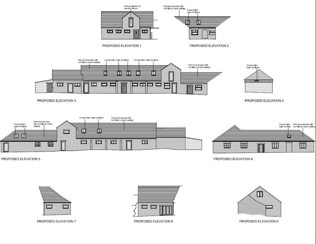
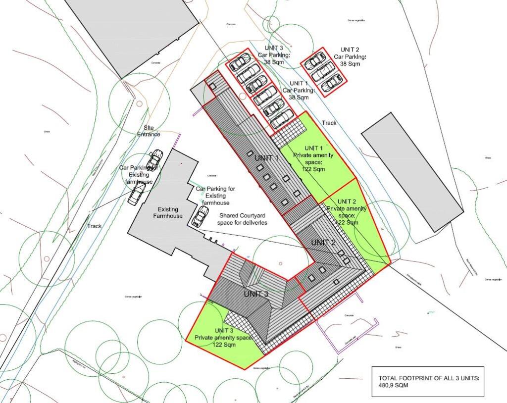
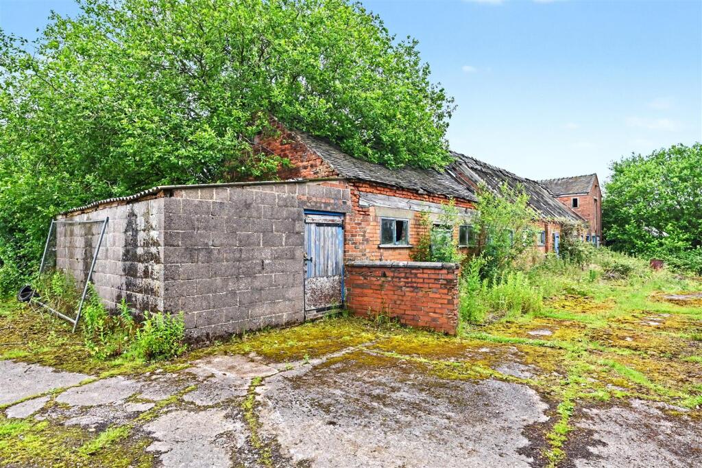
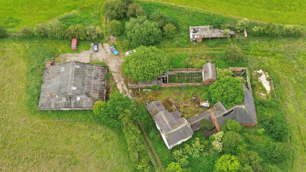
Traditional Barns Development - The traditional barns are situated adjacent and to the main farmhouse with the former farm yard proposed as being a shared space to service the farmhouse and barns once converted. Further information on the planning consent can be found on Stafford Borough Council planning portal using reference number 26/41902/PAR.
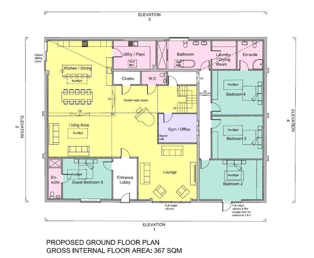
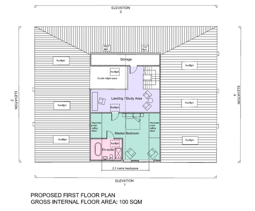
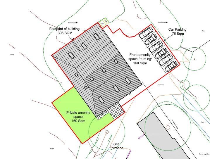
Commercial Building To Convert - The large commercial building is situated on the North side at the end of the private driveway , it would make an excellent self-contained single dwelling with the proposed accommodation extending across two floors and the proposed gross internal area expected to be approximately 5000 sq. ft.
The building was previously used as a mechanical workshop and has been granted change of use status from commercial (Class E) to a single dwelling house (Class C3).
Further details of the planning consent can be found on the Stafford Borough Council searching planning reference number 26/41903/POTH
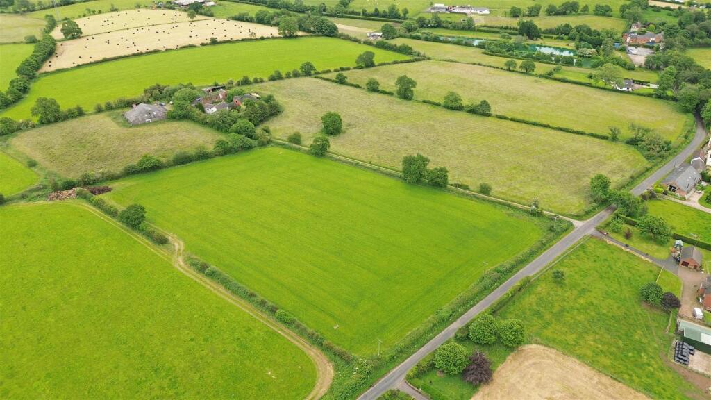
Land - The land is situated to the North and South of the drive in two enclosures. It is bordered by hedging and provides fairly level pasture which is suitable for grazing and mowing alike. The Southern paddock is the larger of the two field and extends to Moss Lane and wraps around the farmhouse and traditional barns.
The smaller paddock is to the North and the larger commercial buildings is set within this paddock in the eastern corner.
The site in total extends to 8.92 acres in all
General Information -
Services - Farmhouse - Mains Water and Electricity are connected. Private drainage.
Tenure And Possession - The property is sold Freehold with vacant possession.
Rights Of Way, Wayleaves And Easements - The property is sold subject to and with the benefit of all rights of way, easements and wayleaves whether or not defined in these particulars. It is uncertain whether there is a formal right of way for the neighbouring land owner to use the drive to access the field to the north, a buyer should satisfy themselves as to the validity of any right of way.
Fixtures And Fittings - Only those fixtures and fittings referred to in the sale particulars are included in the purchase price. Bagshaws have not tested any equipment, fixtures, fittings or services and no guarantee is given that they are in good working order.
Local Authority And Council Tax Band - Stafford Borough Council
Council Tax Band - G
Planning Information - The site has two relevant planning applications for prior approval on the Stafford Borough Council website;
Traditional barns ref: 26/41902/PAR
Commercial building 26/41903/POTH
Energy Performance Certificate - House - Rating ‘G’
Viewings - Strictly by appointment through the Ashbourne Office of Bagshaw's as sole agents on or e-mail: .
Method Of Sale - The property is offered by Private Treaty -Closing date for ‘Best and Final’ offers Wednesday 19th August 2026 at 12 noon.
Offers should be submitted in writing with accompanying proof of funds.
The vendor reserves the right to agree a sale prior to the closing date.
Broadband Connectivity - It is understood that the property benefits from a satisfactory broadband service; however, due to the property's location, connection speeds may fluctuate. We recommend that prospective purchasers consult to obtain an estimated broadband speed for the area.
Mobile Network Coverage - Owing to the property's location, mobile network coverage may be limited. Prospective purchasers are advised to consult the website of Ofcom ( to obtain an estimate of the signal strength for this area.
Agents Notes - Bagshaws LLP have made every reasonable effort to ensure these details offer an accurate and fair description of the property. The particulars are produced in good faith, for guidance only and do not constitute or form an offer or part of the contract for sale. Bagshaws LLP and their employees are not authorised to give any warranties or representations in relation to the sale and give notice that all plans, measurements, distances, areas and any other details referred to are approximate and based on information available at the time of printing.
Listed by
Ashbourne
Bagshaws
Reference: 90648519
EPC ratings on this postcode
We don't have a matched EPC for this property yet. Below are efficiency scores and details for other addresses on this postcode.
| Address | Current | Potential | Floor area | Age band | Type |
|---|---|---|---|---|---|
| 10 Moss Lane, Hilderstone, STONE | 68 | 74 | 82 m² | England and Wales: 1950-1966 | Detached |
| 12 Moss Lane, Hilderstone, STONE | 83 | 85 | 65 m² | England and Wales: 1950-1966 | Terraced |
| 18 Moss Lane, Hilderstone | 50 | 77 | 73 m² | England and Wales: 1950-1966 | House |
| 18 Moss Lane, Hilderstone, STONE | 50 | 77 | 73 m² | England and Wales: 1950-1966 | Terraced |
| 20 Moss Lane, Hilderstone | 64 | 84 | 71 m² | England and Wales: 1950-1966 | House |
| 20 Moss Lane, Hilderstone, STONE | 64 | 84 | 71 m² | England and Wales: 1950-1966 | Detached |
| 22, Moss Lane, Hilderstone | 68 | 85 | 82 m² | England and Wales: 1950-1966 | House |
| 22, Moss Lane, Hilderstone, STONE | 68 | 85 | 82 m² | England and Wales: 1950-1966 | Detached |
| 24, Moss Lane, Hilderstone | 60 | 83 | 85 m² | England and Wales: 1950-1966 | House |
| 24, Moss Lane, Hilderstone, STONE | 60 | 83 | 85 m² | England and Wales: 1950-1966 | Terraced |
| 26 Moss Lane, Hilderstone | 69 | 84 | 83 m² | England and Wales: 1950-1966 | House |
| 26 Moss Lane, Hilderstone, STONE | 69 | 84 | 83 m² | England and Wales: 1950-1966 | Terraced |
| 34, Moss Lane, Hilderstone | 58 | 60 | 73 m² | England and Wales: 1930-1949 | House |
| 34, Moss Lane, Hilderstone | 63 | 88 | 72 m² | England and Wales: 1900-1929 | House |
| 34, Moss Lane, Hilderstone, STONE | 63 | 88 | 72 m² | England and Wales: 1900-1929 | Detached |
Flood risk
Zone: 1
Risk: Low
Job (default Low)
Floorplans
Picture1.jpg
Price history
| Event | Date | Price | % change |
|---|---|---|---|
| Listed for sale | — | £1,000,000 | — |
Source: HM Land Registry Price Paid Data. Crown copyright.
Sold Comparables
Same street and nearby sales within 0.25 miles (last 5 years). Data from Land Registry Price Paid.
| Address | Price | Date | Type |
|---|---|---|---|
| WHITE HEATHER MOSS LANE, HILDERSTONE, STONE, STAFFORD, STAFFORDSHIRE, ST15 8RQ | £645,000 | 16/10/2024 | Other |
| NEW BEECH TREE FARM MOSS LANE, HILDERSTONE, STONE, STAFFORD, STAFFORDSHIRE, ST15 8RQ | £82,000 | 21/12/2023 | Other |
Area average: £363,500 (2 sales)
Capital growth trend
House Price Index (HM Land Registry — official index, not sold-price averages): Stafford. Series: All dwelling types. As of April 2026.
Rental Range
Estimated market rent for Stafford. Low = conservative, Realistic = average, Optimistic = best case.
Based on Local Authority from postcode lookup → Stafford.
LHA (30th percentile) floor for Staffordshire North: Apr 2025 – Mar 2026
Location
Address
Moss Lane
Nearby
Nearest stations, universities and amenities (distance from property).
| Type | Name | Distance |
|---|---|---|
| Bus stop | Balaam's Lane | 0.1 miles |
| Train station | Blythe Bridge | 2.7 miles |
| Shop | Blythe Off Licence & Convenience Store | 2.9 miles |
| Shop | Westbridge Furniture | 2.9 miles |
| Train station | Caverswall Road | 3.2 miles |
| Hospital | Cheadle Hosptal | 5.2 miles |
| Hospital | North Staffordshire Nuffield Hospital | 7.3 miles |
| University | Staffordshire University Blackheath Lane Site | 8.1 miles |
| University | Keele University | 9.4 miles |
Street-level crime
| Category | Count |
|---|---|
| Violence and sexual offences | 3 |
| Anti-social behaviour | 1 |
| Total incidents | 4 |
Within 1 mile during May 2026. Source: data.police.uk (England & Wales).
Schools nearby
Nearest open schools with Ofsted ratings (England). Closed schools are not shown. Data from Get Information about Schools and Ofsted.
| Name | Type | Distance | Ofsted |
|---|---|---|---|
| Fulford Primary School | Primary | 0.5 miles | Good — 21 Dec 2012 |
| Meir Heath Academy | Primary | 2.1 miles | Good — 10 Feb 2012 |
| St Matthews Church of England Academy | Primary | 2.4 miles | Good — 13 Sep 2011 |
| Oulton CofE First School | Primary | 2.5 miles | Good — 14 Oct 2011 |
| The William Amory Primary School | Primary | 2.6 miles | Good — 17 Jul 2024 |
Rental Comparables
Rental comparables are temporarily unavailable while listing-site fetches are paused. Try again later.
Rent-driven metrics
Based on Area rent estimate.
- Rent ratio — Monthly rent ÷ purchase price (1% rule). 1%+ = strong, 0.8–1% = okay, <0.8% = weak for cashflow.
- Max investor price — Rent ÷ 0.8%; the price at which rent would be 0.8% of price (Stoke-style target).
- Target investor price — Rent ÷ 1%; the price at which rent would be 1% of price (strong cashflow band).
- Gross yield — Annual rent as % of purchase price (no costs).
Enter House Number
Enter the house number to help us retrieve more accurate pricing history and property data.
Please log in to submit or correct the house number for this listing.
Log in to continue