Wolverley Grange
Alvaston, DE24 0SS
£550 pcm
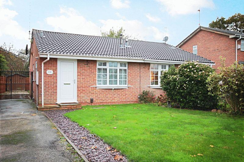
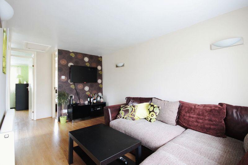
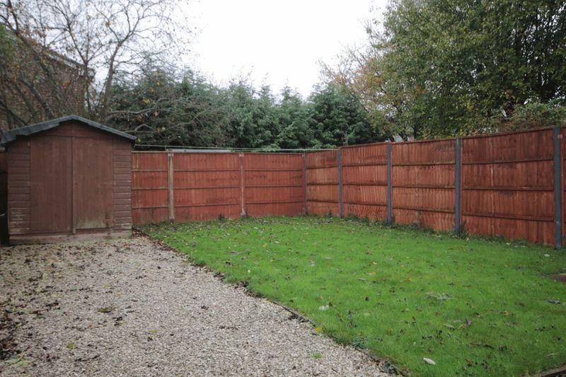
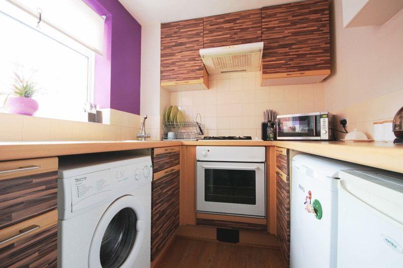
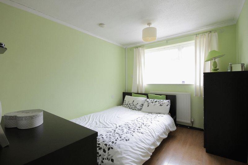
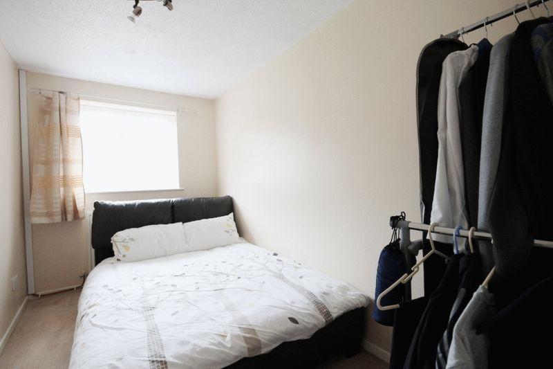
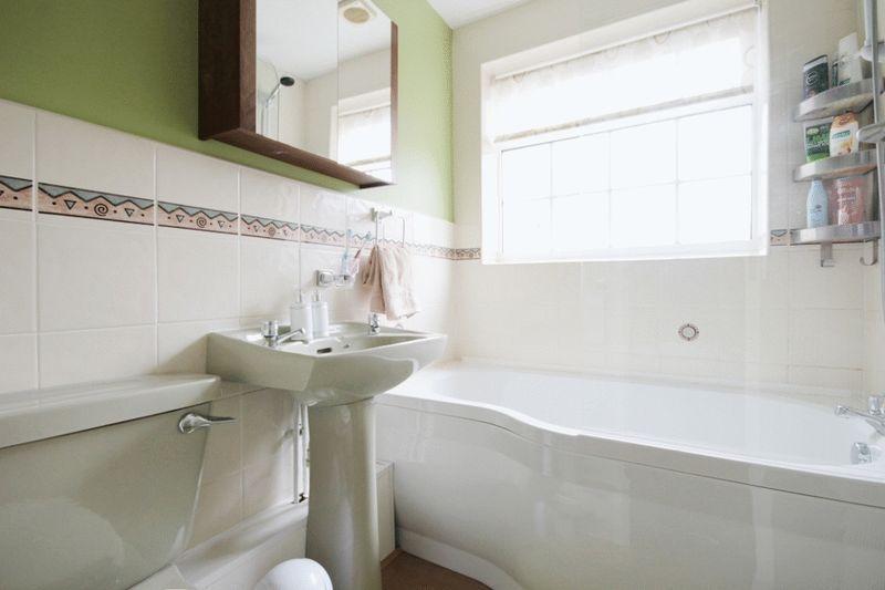
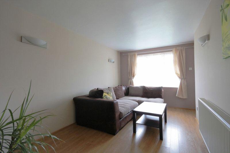
Photo 1 Lounge rear garden kitchen bedroom one bedroom two Photo 7 lounge aspect 2
/ 8
Property details
Deprivation
Decile 6 (18,572 of 33,755)
Street crime
163 incidents within 1 mile (Apr 2026)
Additional details
- Parking
- Yes
- Garden
- Yes
Description
Entrance Hall with the boiler contained in cupboard.
Lounge - 17' 9'' x 8' 8'' (5.41m x 2.64m) laminate flooring and wall lights.
Kitchen - A range of wall, base and drawer units, roll edge laminate work tops, tiled splash backs, stainless steel sink and drainer with mixer tap, integrated electric oven, inset gas hob with cooker hood over, washing machine, under worktop fridge, laminate flooring.
Bedroom One - 10' 6'' x 8' 8'' (3.20m x 2.64m) built in wardrobe and laminate flooring.
Bedroom Two - 13' 3'' x 6' 7'' (4.04m x 2.01m) radiator and fitted carpet.
Bathroom -pedestal hand wash basin, low level W.C, 'P' shaped shower bath with mixer tap and shower head attachment, radiator, extractor, half height tiled walls and full tiling to the bath.
Outside
To the front of the property is a fore garden with lawn alongside a good sized driveway providing ample off road parking for approximately 3 cars and gated access to the rear garden. To the rear is a generous sized enclosed garden with patio, lawn, fenced boundaries and useful large wooden shed.
The property benefits from uPVC double glazing and gas central heating.
Listed by
Loughborough
Countrywide UK Lettings - Connells
Reference: 45187758
EPC ratings on this postcode
We don't have a matched EPC for this property yet. Below are efficiency scores and details for other addresses on this postcode.
| Address | Current | Potential | Floor area | Age band | Type |
|---|---|---|---|---|---|
| 11, Wolverley Grange, Alvaston, DERBY | 70 | 88 | 54 m² | England and Wales: 1983-1990 | Detached |
| 12 Wolverley Grange, Alvaston, DERBY | 50 | 90 | 54 m² | England and Wales: 1983-1990 | Detached |
| 13 Wolverley Grange, Alvaston, DERBY | 72 | 90 | 47 m² | England and Wales: 1967-1975 | Terraced |
| 13, Wolverley Grange, Alvaston, DERBY | 51 | 89 | 48 m² | England and Wales: 1983-1990 | Terraced |
| 14, Wolverley Grange, Alvaston, DERBY | 71 | 87 | 55 m² | England and Wales: 1991-1995 | Detached |
| 15, Wolverley Grange, Alvaston, DERBY | 70 | 89 | 44 m² | England and Wales: 1976-1982 | Terraced |
| 16 Wolverley Grange, Alvaston, DERBY | 72 | 89 | 46 m² | England and Wales: 1983-1990 | Detached |
| 17, Wolverley Grange, Alvaston, DERBY | 74 | 88 | 75 m² | England and Wales: 1983-1990 | Detached |
| 19, Wolverley Grange, Alvaston, DERBY | 66 | 92 | 41 m² | England and Wales: 1976-1982 | Detached |
| 21, Wolverley Grange, Alvaston, DERBY | 56 | 91 | 41 m² | England and Wales: 1983-1990 | Detached |
| 23 Wolverley Grange, Alvaston, DERBY | 72 | 89 | 46 m² | England and Wales: 1983-1990 | Detached |
| 23, Wolverley Grange, Alvaston, DERBY | 65 | 90 | 46 m² | England and Wales: 1983-1990 | Detached |
| 24, Wolverley Grange, Alvaston, DERBY | 59 | 90 | 31 m² | England and Wales: 1976-1982 | Detached |
| 27 Wolverley Grange, Alvaston, DERBY | 67 | 86 | 49 m² | England and Wales: 1983-1990 | Detached |
| 29, Wolverley Grange, Alvaston, DERBY | 70 | 87 | 73 m² | England and Wales: 1983-1990 | Detached |
Flood risk
Zone: 1
Risk: Low
Job (default Low)
EPC Graphs
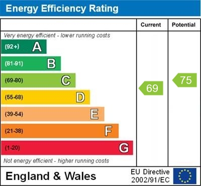
EPC 1
Rental Range
Estimated market rent for Derby. Low = conservative, Realistic = average, Optimistic = best case.
Based on Local Authority from postcode lookup → Derby.
LHA (30th percentile) floor for Derby: £593/mo (Apr 2025 – Mar 2026)
Location
Address
Wolverley Grange
Nearby
Nearest stations, universities and amenities (distance from property).
| Type | Name | Distance |
|---|---|---|
| Bus stop | James Wyatt | 0.1 miles |
| Shop | Tesco Express | 0.2 miles |
| Shop | Sak + American Candy | 0.2 miles |
| Train station | Spondon | 1.4 miles |
| Train station | Peartree | 2.6 miles |
| University | Derby Law School | 3.8 miles |
| University | Agard Court | 3.8 miles |
| Hospital | Royal Derby Hospital | 4.5 miles |
| Hospital | Nuffield Health Derby Hospital | 5.0 miles |
Street-level crime
| Category | Count |
|---|---|
| Violence and sexual offences | 70 |
| Shoplifting | 33 |
| Anti-social behaviour | 21 |
| Vehicle crime | 10 |
| Public order | 9 |
| Other theft | 5 |
| Criminal damage and arson | 4 |
| Drugs | 3 |
| Other crime | 2 |
| Robbery | 2 |
| Bicycle theft | 1 |
| Burglary | 1 |
| Possession of weapons | 1 |
| Theft from the person | 1 |
| Total incidents | 163 |
Within 1 mile during Apr 2026. Source: data.police.uk (England & Wales).
Schools nearby
Nearest open schools with Ofsted ratings (England). Closed schools are not shown. Data from Get Information about Schools and Ofsted.
| Name | Type | Distance | Ofsted |
|---|---|---|---|
| Alvaston Infant and Nursery School | Primary | 0.4 miles | Good — 15 Nov 2017 |
| Alvaston Junior Academy | Primary | 0.4 miles | Requires improvement — 10 Sep 2024 |
| St John Fisher Catholic Voluntary Academy | Primary | 0.6 miles | Good — 3 Dec 2023 |
| Oakwood Infant and Nursery School | Primary | 0.8 miles | Good — 28 Feb 2018 |
| Clover Leys Spencer Academy | Primary | 0.9 miles | Good — 3 Jul 2024 |
Rental Comparables
Rental comparables are temporarily unavailable while listing-site fetches are paused. Try again later.
Enter House Number
Enter the house number to help us retrieve more accurate pricing history and property data.
Please log in to submit or correct the house number for this listing.
Log in to continue