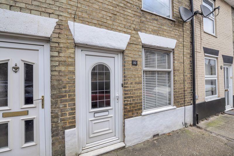
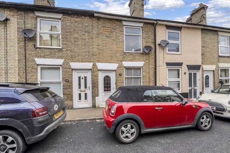
10 ETNA ROAD
BURY ST EDMUNDS, SUFFOLK IP33 1JF
Property details
Tenure
FREEHOLD
Floor area
64 m²
Council tax band
B
Last sold
£220,000 Sep 2025
Local average
£287,591 (-20%)
Deprivation
Decile 8 (25,603 of 33,755)
Street crime
159 incidents within 1 mile (Mar 2026)
Key features
- Close to Town & Train Station
- Characterful Property
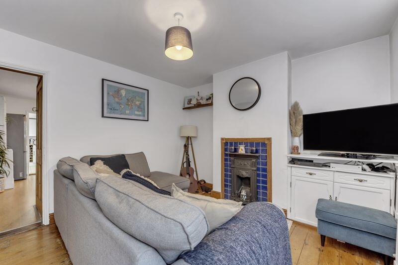
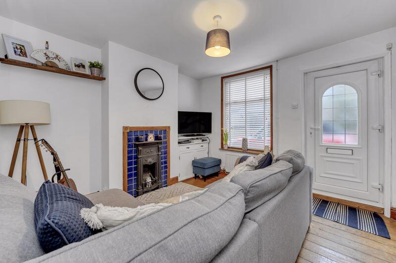
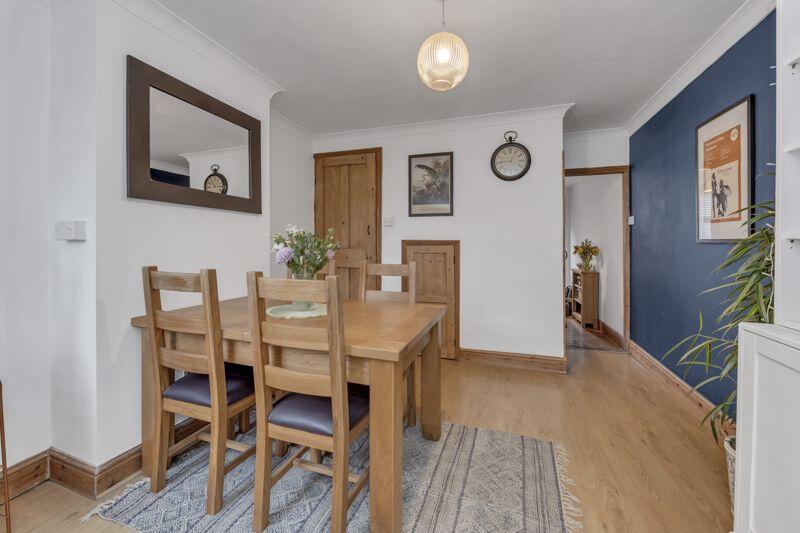
- Sitting Room
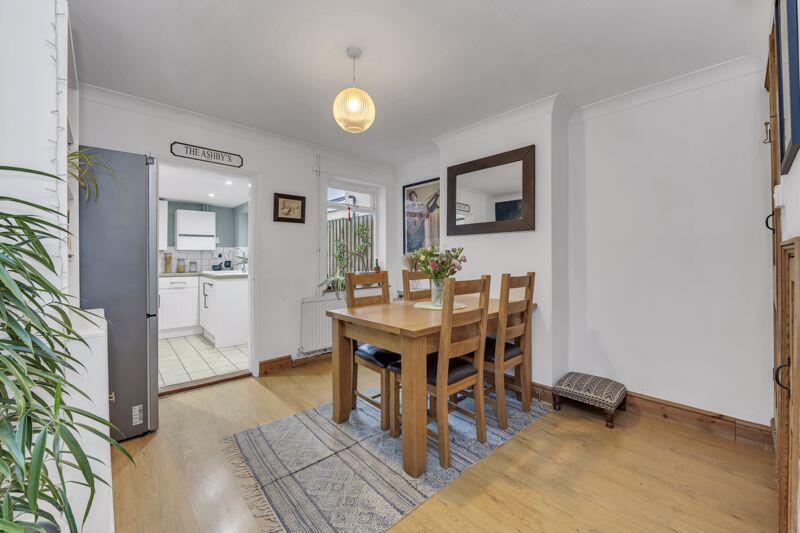
- Dining Room
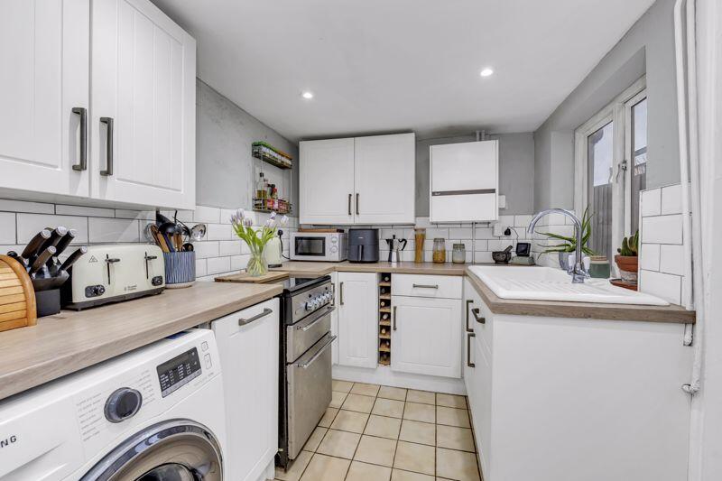
- Kitchen
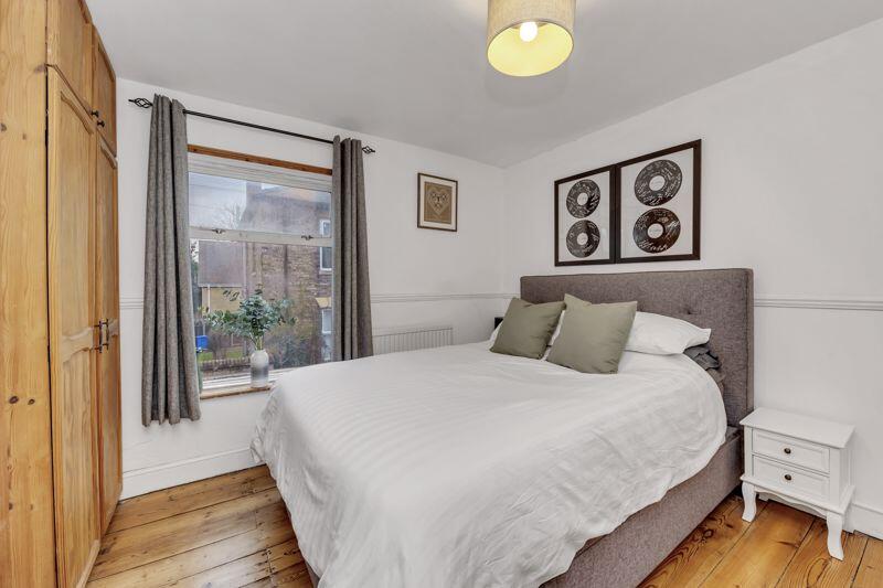
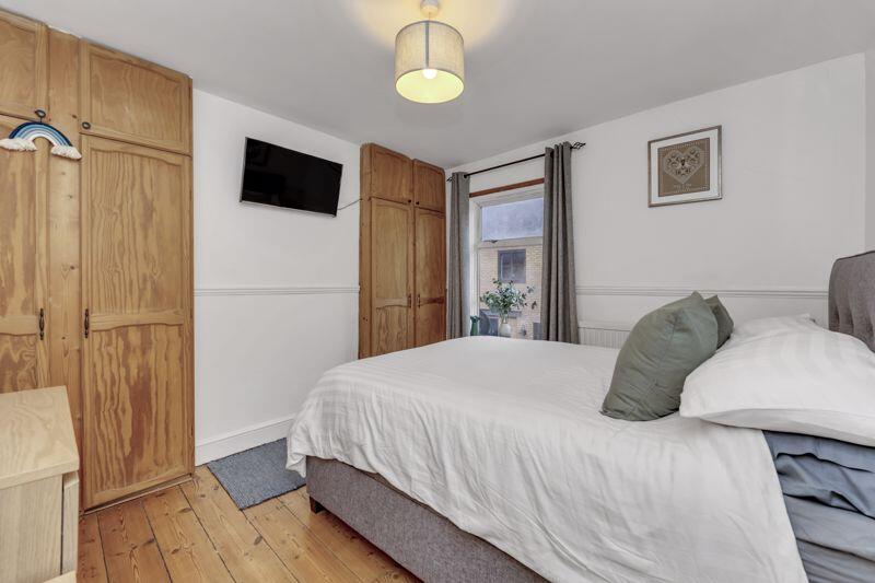
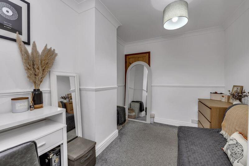
- Two Bedrooms
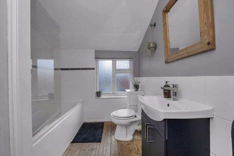
- Bathroom
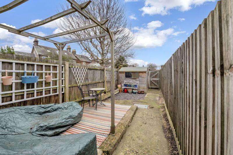
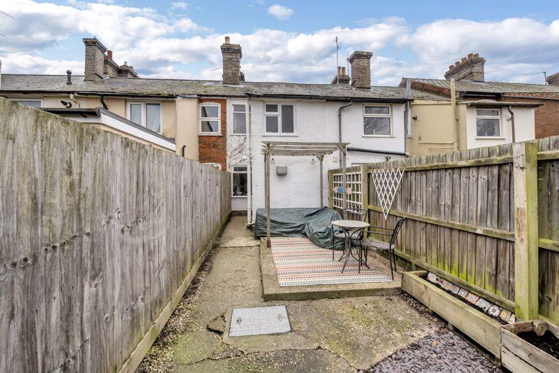
- Garden
- On Street Parking
Additional details
- Garden
- Yes
Description
The accommodation comprises on the ground floor of a sitting room, dining room and kitchen. Moving to the first floor, there are two bedrooms, both with built-in cupboards and the bathroom completes the accommodation on offer.
Outside, the low maintenance rear garden benefits from a seating area, garden shed and access to the rear of the property. Parking is via on street at the front of the property.
Additional Information:
Tenure: Freehold
Mobile Coverage: EE, O2, Three & Vodafone are listed as 'likely' in this area. (Source Ofcom)
Broadband: Standard, Superfast & Ultrafast are available in this area. (Source Ofcom)
Services: Mains Gas, Electric, Water and Drainage. Heating via gas central heating. (Please note that none of these services have been tested by the selling agent.)
Listed by
Bury St Edmunds
Ewin Residential Limited
Reference: 158104733
EPC Rating & Upgrade Cost
Fetching EPC data… Refresh this page in a moment.
Flood risk
Zone: 1
Risk: Low
Job (default Low)
Floorplans
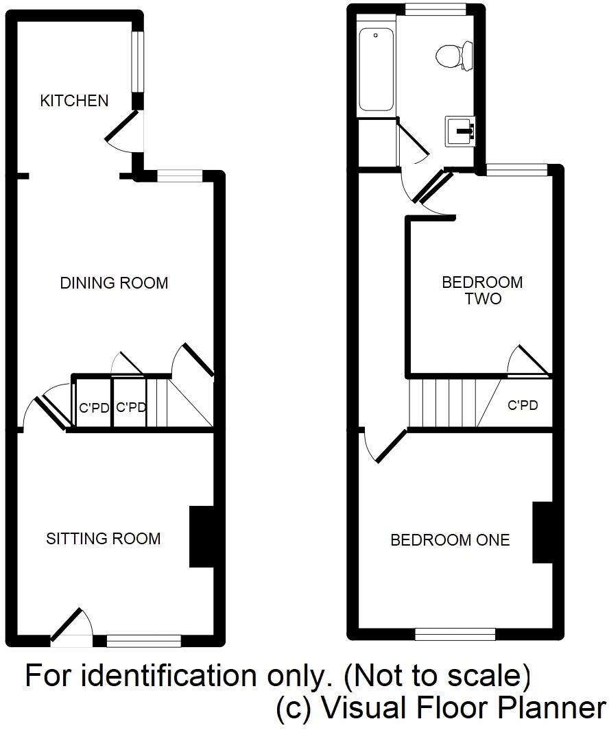
Floorplan
EPC Graphs

Energy Performance Certificate
FENSA Certificates
This property has 1 FENSA certificate(s) on record, indicating window/door installations by FENSA-approved installers.
FENSA Certificate #4378674
Property Details
Street: 10 Etna Road
Town: BURY ST. EDMUNDS
Postcode: IP33 1JF
Installation Details
Items: 2 doors
Certificate Issued: 08/01/2007
Work Completed: 05/12/2006
This certificate data was retrieved from FENSA's database
What is FENSA? FENSA (Fenestration Self-Assessment Scheme) is a government-authorised scheme that monitors building regulation compliance for replacement windows and doors. Certificates indicate that work was completed by FENSA-approved installers.
Price history
| Event | Date | Price | % change |
|---|---|---|---|
| Sold | 19/09/2025 (8 months ago) | £220,000 | — |
Source: HM Land Registry Price Paid Data. Crown copyright.
Sold Comparables
Same street and nearby sales within 0.25 miles (last 5 years). Data from Land Registry Price Paid.
| Address | Price | Date | Type |
|---|---|---|---|
| 13 LONG BRACKLAND, BURY ST EDMUNDS, WEST SUFFOLK, SUFFOLK, IP33 1JH | £228,000 | 19/12/2025 | Terraced |
| 17 IPSWICH STREET, BURY ST EDMUNDS, WEST SUFFOLK, SUFFOLK, IP33 1SX | £215,000 | 18/12/2025 | Terraced |
| REEDS BUILDINGS 7 NORTHGATE STREET, BURY ST EDMUNDS, WEST SUFFOLK, SUFFOLK, IP33 1HU | £219,500 | 10/10/2023 | Terraced |
| 1 IPSWICH STREET, BURY ST EDMUNDS, WEST SUFFOLK, SUFFOLK, IP33 1SX | £278,000 | 29/09/2023 | Terraced |
| 53A ST JOHNS STREET, BURY ST EDMUNDS, WEST SUFFOLK, SUFFOLK, IP33 1SP | £280,500 | 11/08/2023 | Terraced |
| 10 OUT NORTHGATE, BURY ST EDMUNDS, WEST SUFFOLK, SUFFOLK, IP33 1JQ | £265,000 | 15/06/2023 | Terraced |
| 4 PECKHAM STREET, BURY ST EDMUNDS, WEST SUFFOLK, SUFFOLK, IP33 1SY | £225,000 | 10/03/2023 | Terraced |
| 86 NORTHGATE STREET, BURY ST EDMUNDS, WEST SUFFOLK, SUFFOLK, IP33 1HY | £299,995 | 10/03/2023 | Terraced |
| 85 CANNON STREET, BURY ST EDMUNDS, WEST SUFFOLK, SUFFOLK, IP33 1JR | £230,000 | 01/12/2022 | Terraced |
| 9 IPSWICH STREET, BURY ST EDMUNDS, WEST SUFFOLK, SUFFOLK, IP33 1SX | £195,000 | 07/11/2022 | Terraced |
| 11 BOUGHTON WAY, BURY ST EDMUNDS, WEST SUFFOLK, SUFFOLK, IP33 1AG | £452,000 | 06/09/2022 | Terraced |
| 30 IPSWICH COURT, BURY ST EDMUNDS, WEST SUFFOLK, SUFFOLK, IP33 1ST | £166,000 | 22/07/2022 | Terraced |
| 9 BOUGHTON WAY, BURY ST EDMUNDS, WEST SUFFOLK, SUFFOLK, IP33 1AG | £420,000 | 30/06/2022 | Terraced |
| 4 ST JOHNS MEWS, BURY ST EDMUNDS, WEST SUFFOLK, SUFFOLK, IP33 1AL | £210,000 | 30/05/2022 | Terraced |
| 26 PECKHAM STREET, BURY ST EDMUNDS, WEST SUFFOLK, SUFFOLK, IP33 1SY | £201,000 | 04/03/2022 | Terraced |
| 36 FORNHAM ROAD, BURY ST EDMUNDS, WEST SUFFOLK, SUFFOLK, IP32 6AH | £342,000 | 28/01/2022 | Terraced |
| 70 CANNON STREET, BURY ST EDMUNDS, WEST SUFFOLK, SUFFOLK, IP33 1JN | £235,000 | 24/01/2022 | Terraced |
| 5 IPSWICH STREET, BURY ST EDMUNDS, WEST SUFFOLK, SUFFOLK, IP33 1SX | £235,000 | 29/10/2021 | Terraced |
| 92 MALTINGS WAY, BURY ST EDMUNDS, WEST SUFFOLK, SUFFOLK, IP32 6EZ | £280,000 | 29/10/2021 | Terraced |
| 68 CANNON STREET, BURY ST EDMUNDS, WEST SUFFOLK, SUFFOLK, IP33 1JN | £229,950 | 07/10/2021 | Terraced |
| Same street 8 ETNA ROAD, BURY ST EDMUNDS, WEST SUFFOLK, SUFFOLK, IP33 1JF | £245,000 | 21/09/2021 | Terraced |
| Same street 9 ETNA ROAD, BURY ST EDMUNDS, WEST SUFFOLK, SUFFOLK, IP33 1JF | £220,000 | 22/07/2021 | Terraced |
Street average: £232,500 (2 sales)
Area average: £260,347 (20 sales)
Capital growth trend
Land Registry outcode average: last 12 months vs 5y and 10y ago (from sold prices).
House Price Index (HM Land Registry — official index, not sold-price averages): West Suffolk. Series: Terraced. As of March 2026.
Rental Range
Estimated market rent for West Suffolk. Low = conservative, Realistic = average, Optimistic = best case.
Based on Local Authority from postcode lookup → West Suffolk.
LHA (30th percentile) floor for Bury St Edmunds: £773/mo (Apr 2025 – Mar 2026)
Location
Nearby
Nearest stations, universities and amenities (distance from property).
| Type | Name | Distance |
|---|---|---|
| Shop | Urban Society | 0.0 miles |
| Shop | Northgate Video | 0.1 miles |
| Bus stop | Tayfen Terrace | 0.1 miles |
| Train station | Bury St Edmunds | 0.2 miles |
| Hospital | St Edmunds Hospital | 0.9 miles |
| Hospital | West Suffolk Hospital | 1.5 miles |
| Train station | Thurston | 3.9 miles |
Street-level crime
| Category | Count |
|---|---|
| Violence and sexual offences | 64 |
| Shoplifting | 24 |
| Criminal damage and arson | 19 |
| Public order | 11 |
| Other theft | 10 |
| Anti-social behaviour | 9 |
| Drugs | 9 |
| Other crime | 3 |
| Possession of weapons | 2 |
| Robbery | 2 |
| Theft from the person | 2 |
| Vehicle crime | 2 |
| Bicycle theft | 1 |
| Burglary | 1 |
| Total incidents | 159 |
Within 1 mile during Mar 2026. Source: data.police.uk (England & Wales).
Schools nearby
Nearest open schools with Ofsted ratings (England). Closed schools are not shown. Data from Get Information about Schools and Ofsted.
| Name | Type | Distance | Ofsted |
|---|---|---|---|
| King Edward VI CEVC School | Secondary | 0.5 miles | Good — 28 Mar 2019 |
| Priory School | Other | 0.6 miles | Outstanding — 1 Dec 2014 |
| St Edmundsbury CofE Primary Academy | Primary | 0.6 miles | Requires improvement — 13 May 2024 |
| Bury St Edmunds County High School | Secondary | 0.7 miles | Good — 15 May 2022 |
| Tollgate Primary School | Primary | 0.7 miles | Good — 16 Nov 2023 |
Rental Comparables
Loading rental comparables for this postcode. Refresh in a few minutes.
Rent-driven metrics
Based on Area rent estimate.
- Rent ratio — Monthly rent ÷ purchase price (1% rule). 1%+ = strong, 0.8–1% = okay, <0.8% = weak for cashflow.
- Max investor price — Rent ÷ 0.8%; the price at which rent would be 0.8% of price (Stoke-style target).
- Target investor price — Rent ÷ 1%; the price at which rent would be 1% of price (strong cashflow band).
- Gross yield — Annual rent as % of purchase price (no costs).