Leicestershire
LE7 2PX
£119,950
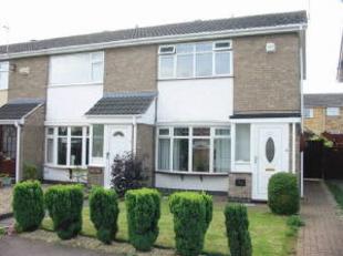
Photo 1
/ 1
Property details
Last sold
£125,000
Local average
£218,479 (-45.1%)
Deprivation
Decile 8 (26,770 of 33,755)
Street crime
135 incidents within 1 mile (Mar 2026)
Key features
- End Town House
- Two Bedrooms
- U.P.V.C. D/g And Soffits
- Combi-boiler
- Garage
- Kitchen/diner
- Central Heating
- Quiet Location
Description
Listed by
Syston - Sales
A&S Nest Ltd
Reference: 9572627
EPC ratings on this postcode
We don't have a matched EPC for this property yet. Below are efficiency scores and details for other addresses on this postcode.
| Address | Current | Potential | Floor area | Age band | Type |
|---|---|---|---|---|---|
| 10 Oak Drive, Syston, LEICESTER | 60 | 73 | 96 m² | — | Terraced |
| 10, Oak Drive, Syston, LEICESTER | 62 | 80 | 80 m² | England and Wales: 1950-1966 | Detached |
| 10, Oak Drive, Syston, LEICESTER | 68 | 85 | 78 m² | England and Wales: 1967-1975 | Detached |
| 19, Oak Drive, Syston, LEICESTER | 68 | 83 | 99 m² | England and Wales: 1967-1975 | Detached |
| 21 OAK DRIVE, SYSTON, SYSTON | 68 | 86 | 83 m² | England and Wales: 1967-1975 | Detached |
| 23 OAK DRIVE, SYSTON, SYSTON | 72 | 83 | 113 m² | England and Wales: 1967-1975 | Detached |
| 23 OAK DRIVE, SYSTON, SYSTON | 53 | 83 | 113 m² | England and Wales: 1967-1975 | Detached |
| 25, Oak Drive, Syston, LEICESTER | 83 | 86 | 80 m² | England and Wales: 1967-1975 | Detached |
| 3, Oak Drive, Syston, LEICESTER | 41 | 76 | 78 m² | England and Wales: 1950-1966 | Detached |
| 31, Oak Drive, Syston, LEICESTER | 70 | 86 | 70 m² | England and Wales: 1976-1982 | Detached |
| 32, Oak Drive, Syston, LEICESTER | 67 | 91 | 60 m² | England and Wales: 1976-1982 | Terraced |
| 34 Oak Drive, Syston, LEICESTER | 72 | 78 | 57 m² | England and Wales: 1976-1982 | Terraced |
| 35, Oak Drive, Syston, LEICESTER | 55 | 84 | 62 m² | England and Wales: 1967-1975 | Terraced |
| 38 Oak Drive, Syston, LEICESTER | 66 | 84 | 61 m² | England and Wales: 1950-1966 | Detached |
| 38, Oak Drive, Syston, LEICESTER | 59 | 84 | 60 m² | England and Wales: 1950-1966 | Detached |
Flood risk
Zone: 1
Risk: Low
Job (default Low)
Price history
10% since 2004
| Event | Date | Price | % change |
|---|---|---|---|
| Sold | 01/01/2010 (16 years ago) | £125,000 | +4.6% |
| Sold | 01/01/2006 (20 years ago) | £119,500 | +5.3% |
| Sold | 01/01/2004 (22 years ago) | £113,500 | — |
Source: HM Land Registry Price Paid Data. Crown copyright.
Sold Comparables
Same street and nearby sales within 0.25 miles (last 5 years). Data from Land Registry Price Paid.
| Address | Price | Date | Type |
|---|---|---|---|
| 71 OAK DRIVE, SYSTON, LEICESTER, CHARNWOOD, LEICESTERSHIRE, LE7 2PX | £195,000 | 16/01/2026 | Terraced |
| 40 OAK DRIVE, SYSTON, LEICESTER, CHARNWOOD, LEICESTERSHIRE, LE7 2PX | £212,500 | 27/10/2023 | Terraced |
| 15 ASH DRIVE, SYSTON, LEICESTER, CHARNWOOD, LEICESTERSHIRE, LE7 2PQ | £162,000 | 26/08/2022 | Terraced |
| 12 SOUTHFIELD AVENUE, SYSTON, LEICESTER, CHARNWOOD, LEICESTERSHIRE, LE7 2LL | £180,000 | 11/02/2022 | Terraced |
| 41 OAK DRIVE, SYSTON, LEICESTER, CHARNWOOD, LEICESTERSHIRE, LE7 2PX | £190,000 | 30/11/2021 | Terraced |
| 10 SOUTHFIELD AVENUE, SYSTON, LEICESTER, CHARNWOOD, LEICESTERSHIRE, LE7 2LL | £200,000 | 26/11/2021 | Terraced |
| 63 OAK DRIVE, SYSTON, LEICESTER, CHARNWOOD, LEICESTERSHIRE, LE7 2PX | £184,000 | 15/10/2021 | Terraced |
Area average: £189,071 (7 sales)
Capital growth trend
Land Registry outcode average: last 12 months vs 5y and 10y ago (from sold prices).
House Price Index (HM Land Registry — official index, not sold-price averages): Charnwood. Series: Terraced. As of February 2026.
Rental Range
Estimated market rent for Charnwood. Low = conservative, Realistic = average, Optimistic = best case.
Based on Local Authority from postcode lookup → Charnwood.
LHA (30th percentile) floor for Leicester: £648/mo (Apr 2025 – Mar 2026)
Location
Address
Oak Drive
Nearby
Nearest stations, universities and amenities (distance from property).
| Type | Name | Distance |
|---|---|---|
| Bus stop | Quenby Crescent | 0.4 miles |
| Bus stop | Barkby Road Cemetery | 0.4 miles |
| Shop | Bargain Booze | 0.4 miles |
| Shop | Aldi | 0.4 miles |
| Train station | Syston | 0.4 miles |
| Train station | Leicester North | 3.0 miles |
| Hospital | The Willows | 3.0 miles |
| Hospital | Arnold Lodge Regional Secure Unit | 3.1 miles |
| University | Unknown | 4.9 miles |
| University | De Montfort University | 5.0 miles |
Street-level crime
| Category | Count |
|---|---|
| Violence and sexual offences | 47 |
| Anti-social behaviour | 30 |
| Criminal damage and arson | 14 |
| Shoplifting | 14 |
| Other theft | 10 |
| Public order | 7 |
| Vehicle crime | 5 |
| Drugs | 3 |
| Burglary | 2 |
| Other crime | 2 |
| Possession of weapons | 1 |
| Total incidents | 135 |
Within 1 mile during Mar 2026. Source: data.police.uk (England & Wales).
Schools nearby
Nearest open schools with Ofsted ratings (England). Closed schools are not shown. Data from Get Information about Schools and Ofsted.
| Name | Type | Distance | Ofsted |
|---|---|---|---|
| The Merton Primary School | Primary | 0.1 miles | Good — 28 Aug 2014 |
| Bishop Ellis Catholic Voluntary Academy | Primary | 0.8 miles | Good — 3 Sep 2012 |
| St Peter and St Paul Church of England Academy | Primary | 0.8 miles | Good — 7 Jan 2015 |
| The Roundhill Academy | Secondary | 0.8 miles | Requires improvement — 26 Sep 2023 |
| Eastfield Primary School | Primary | 0.9 miles | Requires improvement — 3 Dec 2023 |
Rental Comparables
Residential lets from OpenRent and Rightmove for the area (same bedroom count). Use to validate rent estimates. Student lets are excluded.
| Title | Rent | Beds | Distance | As seen on |
|---|---|---|---|---|
| 2 Bed Semi-Detached House, Pine Drive, LE7 | £1,200/mo | 2 | 0.09 miles | OpenRent |
| 2 Bed Flat, Melton Road, LE7 | £800/mo | 2 | 0.39 miles | OpenRent |
| 2 Bed Terraced House, St. Peters Street, LE7 | £975/mo | 2 | 0.4 miles | OpenRent |
| 2 Bed Terraced House, Wolsey Way, LE7 | £995/mo | 2 | 0.56 miles | OpenRent |
| 2 Bed Terraced House, West Street, LE7 | £995/mo | 2 | 0.58 miles | OpenRent |
| 2 Bed Flat, Hallaton Drive, LE7 | £850/mo | 2 | 0.63 miles | OpenRent |
| 2 Bed Terraced House, Abbotts Close, LE7 | £785/mo | 2 | 0.66 miles | OpenRent |
| 2 Bed Flat, Malt House Court, LE7 | £900/mo | 2 | 0.7 miles | OpenRent |
| 2 Bed Terraced House, Preston Close, LE7 | £895/mo | 2 | 0.71 miles | OpenRent |
| 2 Bed Terraced House, St Columba Way, LE7 | £895/mo | 2 | 0.8 miles | OpenRent |
Average rent: £929/mo (10 listings)
Rent-driven metrics
Based on OpenRent comparables.
- Rent ratio — Monthly rent ÷ purchase price (1% rule). 1%+ = strong, 0.8–1% = okay, <0.8% = weak for cashflow.
- Max investor price — Rent ÷ 0.8%; the price at which rent would be 0.8% of price (Stoke-style target).
- Target investor price — Rent ÷ 1%; the price at which rent would be 1% of price (strong cashflow band).
- Gross yield — Annual rent as % of purchase price (no costs).
- Cost-to-rent — Price ÷ annual rent (from OpenRent comparables). Under 14× = strong, 14–16× = acceptable, 17×+ = compressed.
- Cashflow — Rent minus mortgage, 10% maintenance, £25/mo compliance. Assumes 75% LTV, 3.95% APR (5yr fixed), 25yr term.
- ROI — Annual profit ÷ cash in (deposit + 4% purchase costs).
Enter House Number
Enter the house number to help us retrieve more accurate pricing history and property data.
Please log in to submit or correct the house number for this listing.
Log in to continue