10 CHARLOTTE STREET
CHESTER, CHESTER, CHESHIRE CH1 4JN
£525 pcm
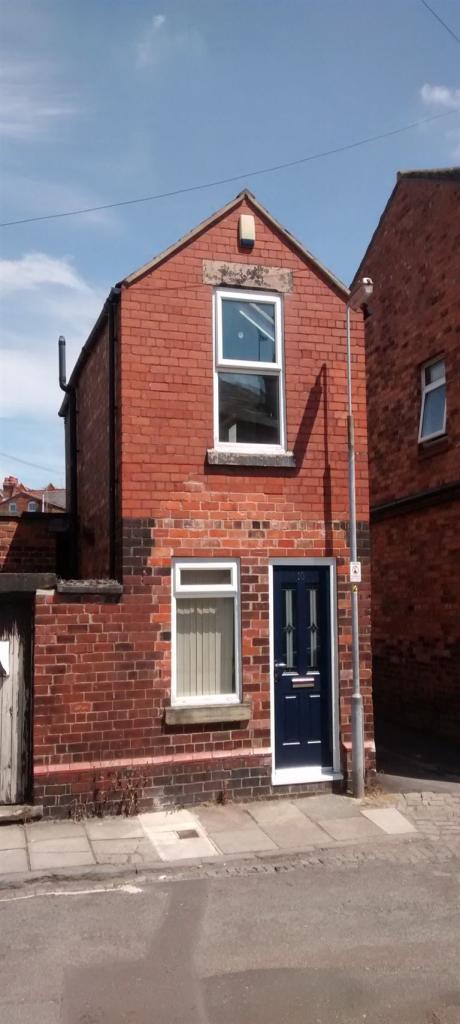
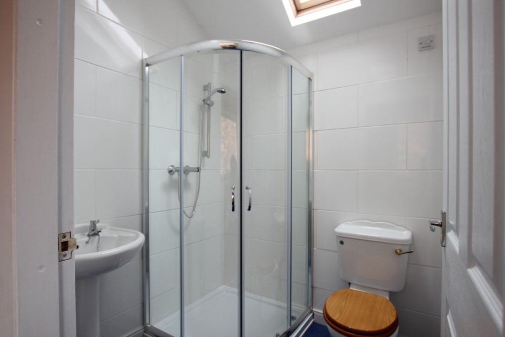
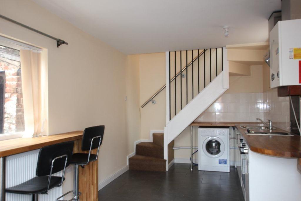
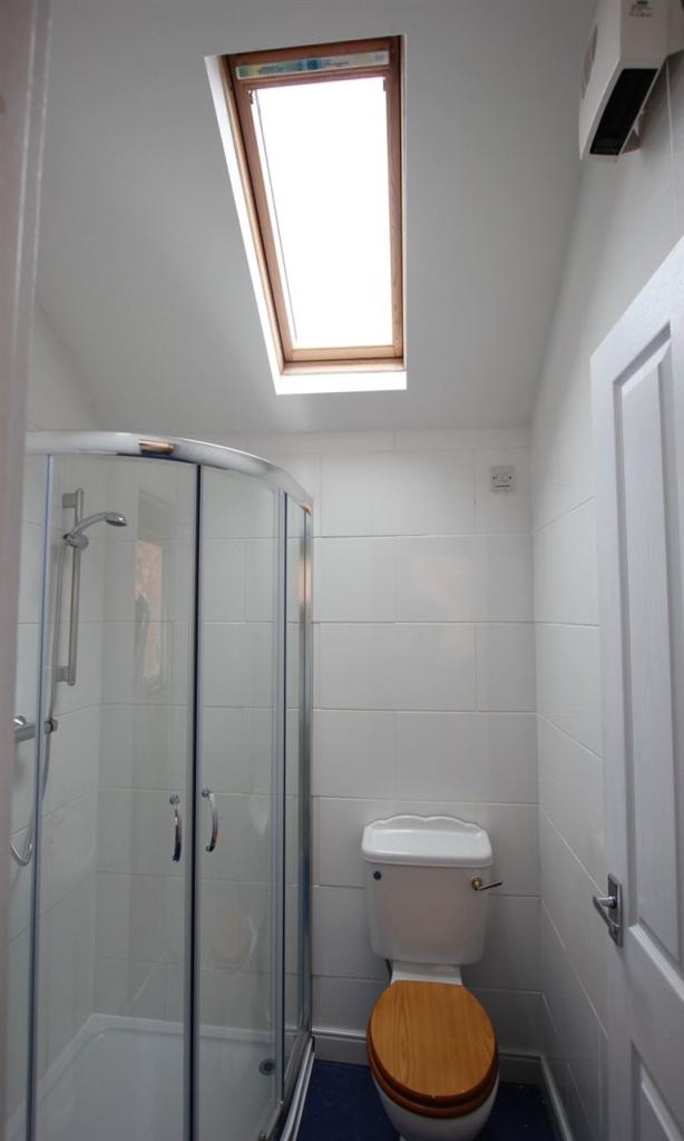
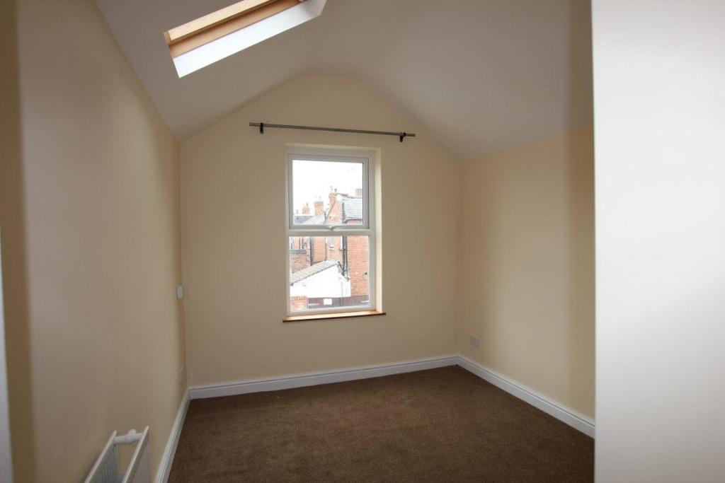
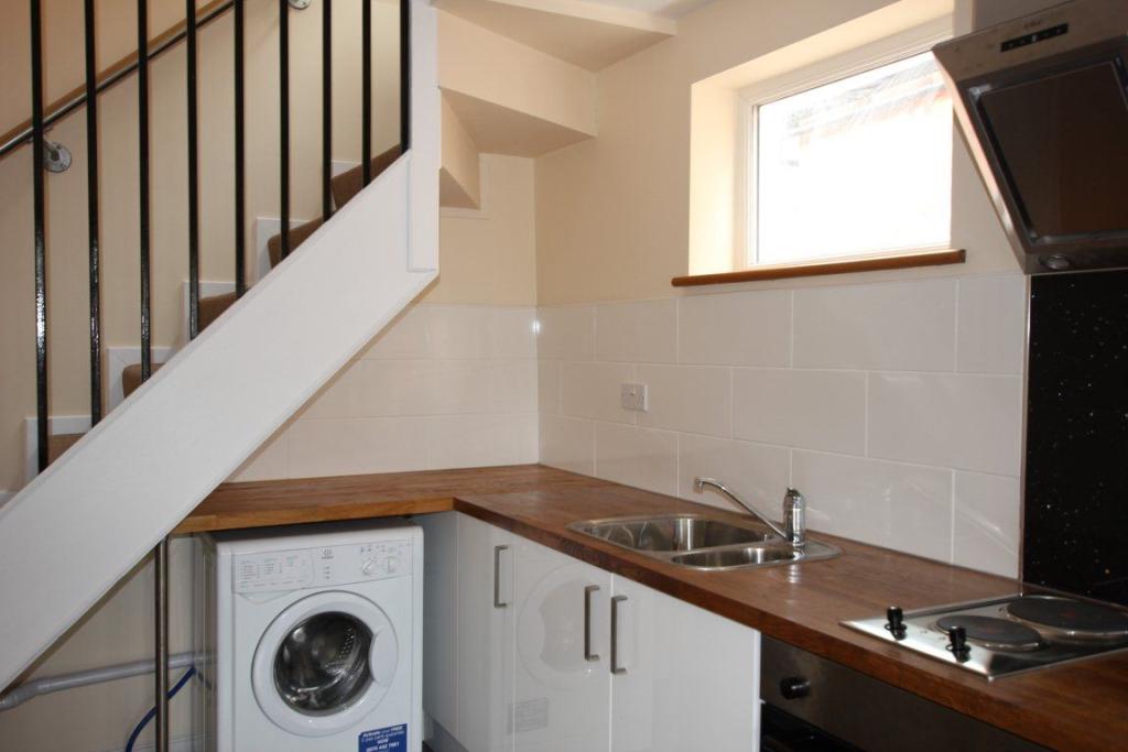
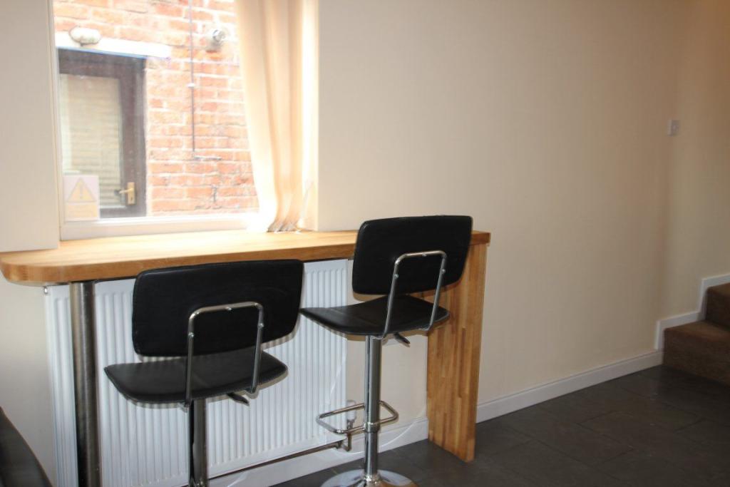
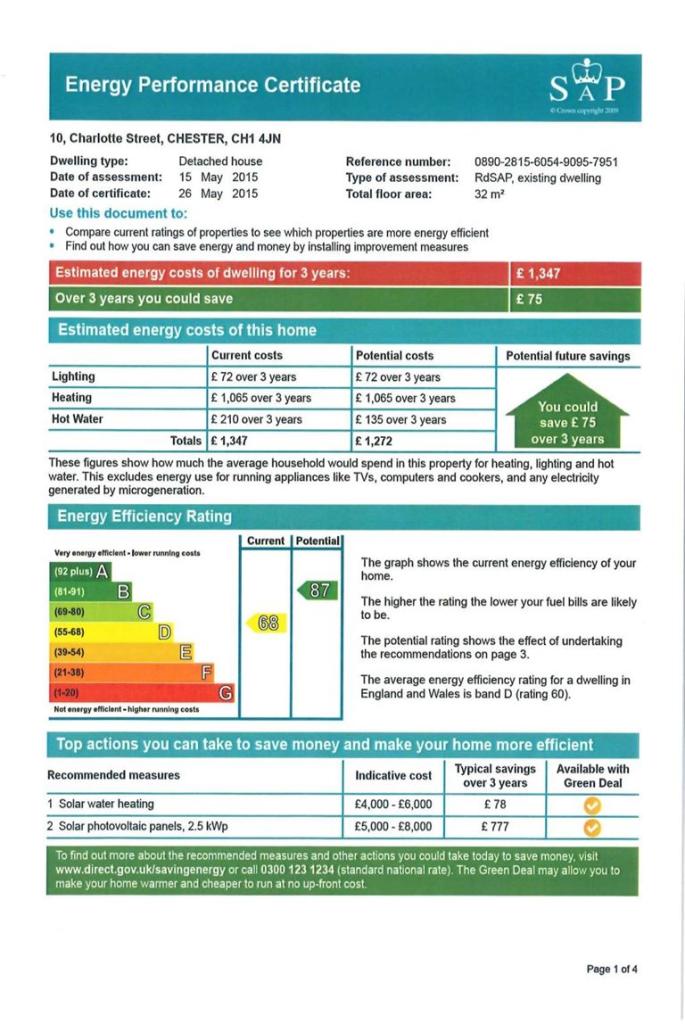
Photo 1 Photo 2 Photo 3 Photo 4 Photo 5 Photo 6 Photo 7 Photo 8
/ 8
Property details
Floor area
32 m²
EPC rating
D
Year built
England and Wales: 1900-1929
Street crime
388 incidents within 1 mile (Apr 2026)
Key features
- Terraced House
- Part Furnished Property
- Street parking Available
- 1 Bedroom
- 1 Reception
- 1 Separate Bathroom
Additional details
- Parking
- Yes
Description
Matthews of Chester are pleased to offer this recently renovated one bedroomed property for rental.
This quaint property briefly comrpises of: open plan kitchen/living room, kitchen with real oak work surfaces, breakfast bar with two stools and grey slate floors to the downstairs areas. To the first floor there is one double bedroom with velux window and bathroom with shower cubicle.
EPC Rating D
Listed by
Chester
The Lomond Group
Reference: 62574361
EPC Rating & Upgrade Cost
Current rating: D
Potential rating: B
Inspection date: 15/05/2015
Expiry date: 14/05/2025 (expired)
Est. upgrade cost to C: £11,500
Recommendations
- Solar water heating (£4,000 - £6,000)
- Solar photovoltaic panels, 2.5 kWp (£5,000 - £8,000)
Flood risk
Zone: 1
Risk: Low
Job (default Low)
Rental Range
Estimated market rent for Cheshire West and Chester. Low = conservative, Realistic = average, Optimistic = best case.
Based on Local Authority from postcode lookup → Cheshire West and Chester.
Location
Nearby
Nearest stations, universities and amenities (distance from property).
| Type | Name | Distance |
|---|---|---|
| Bus stop | Chester, South View Road / Charlotte Street | 0.0 miles |
| Bus stop | Chester, South View Road / Earls Port | 0.0 miles |
| Shop | The MOT & Service Centre | 0.2 miles |
| Shop | B @ 49 | 0.2 miles |
| University | University of Chester | 0.5 miles |
| Train station | Grosvenor Park Miniature Railway | 0.9 miles |
| Train station | Chester | 0.9 miles |
| Hospital | The Mulberry Centre | 1.0 miles |
| University | University of Chester - Kingsway | 1.4 miles |
| Hospital | Tarporley War Memorial Hospital | 10.0 miles |
Street-level crime
| Category | Count |
|---|---|
| Violence and sexual offences | 123 |
| Public order | 65 |
| Shoplifting | 59 |
| Anti-social behaviour | 42 |
| Drugs | 23 |
| Other theft | 19 |
| Criminal damage and arson | 18 |
| Burglary | 11 |
| Theft from the person | 9 |
| Vehicle crime | 6 |
| Bicycle theft | 5 |
| Possession of weapons | 3 |
| Robbery | 3 |
| Other crime | 2 |
| Total incidents | 388 |
Within 1 mile during Apr 2026. Source: data.police.uk (England & Wales).
Schools nearby
Nearest open schools with Ofsted ratings (England). Closed schools are not shown. Data from Get Information about Schools and Ofsted.
| Name | Type | Distance | Ofsted |
|---|---|---|---|
| The Queen's School | Other | 0.3 miles | — (No rating) |
| Chester Blue Coat Church of England Primary School | Primary | 0.3 miles | Good — 19 Mar 2023 |
| University of Chester | Other | 0.4 miles | — (No rating) |
| Abbey School for Exceptional Children | Other | 0.4 miles | Good — 16 Oct 2022 |
| The Grosvenor Park Church of England Academy | Primary | 0.7 miles | Good — 8 Mar 2023 |
Rental Comparables
Rental comparables are temporarily unavailable while listing-site fetches are paused. Try again later.