47 WICKSTEAD AVENUE
LUTON, LUTON LU4 9DW
£335,000
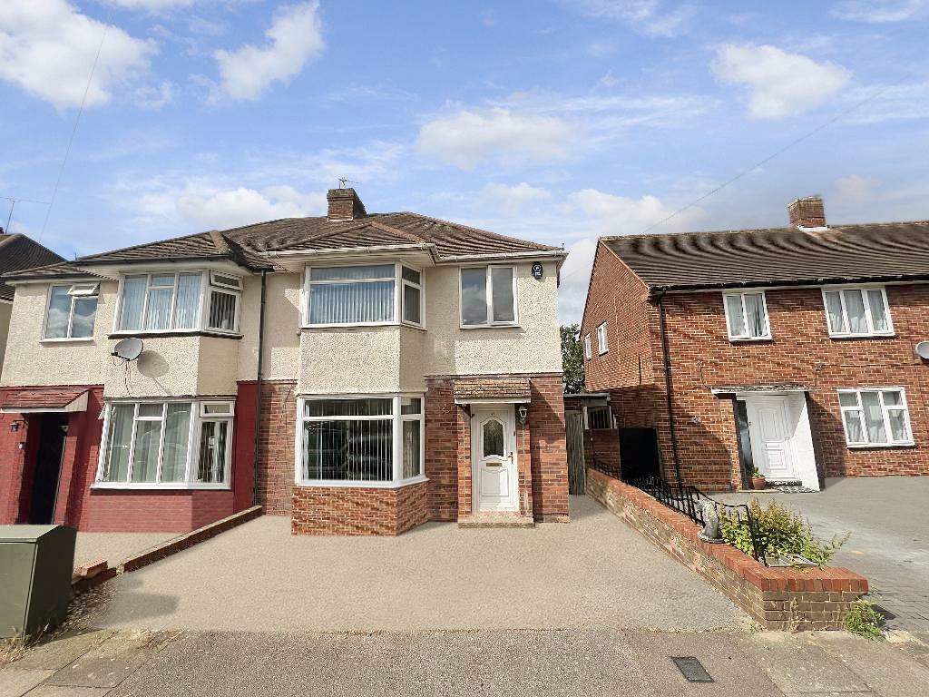
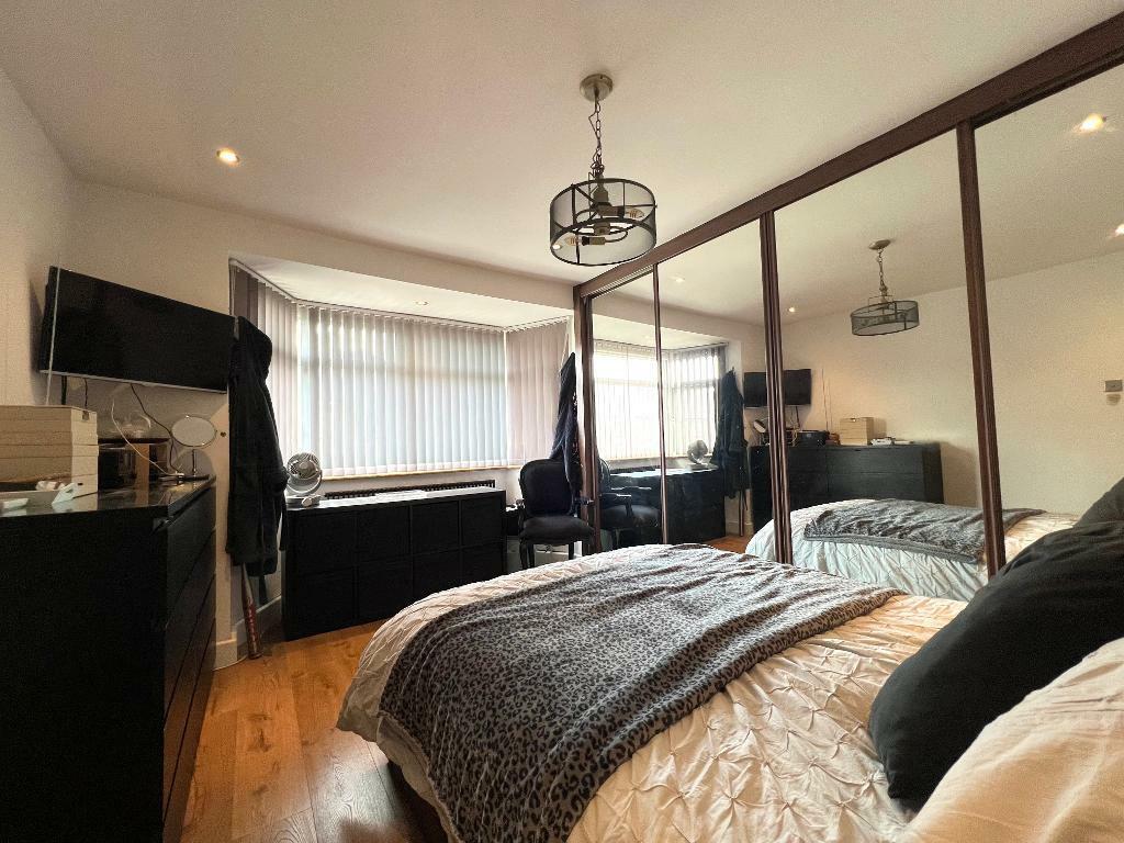
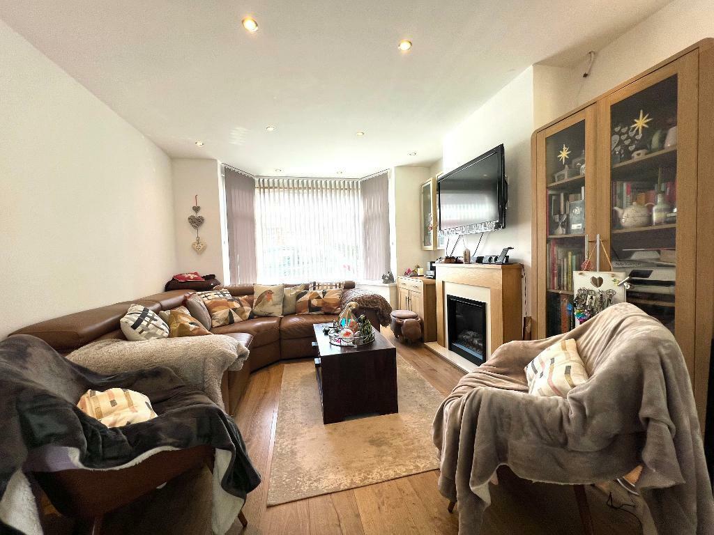
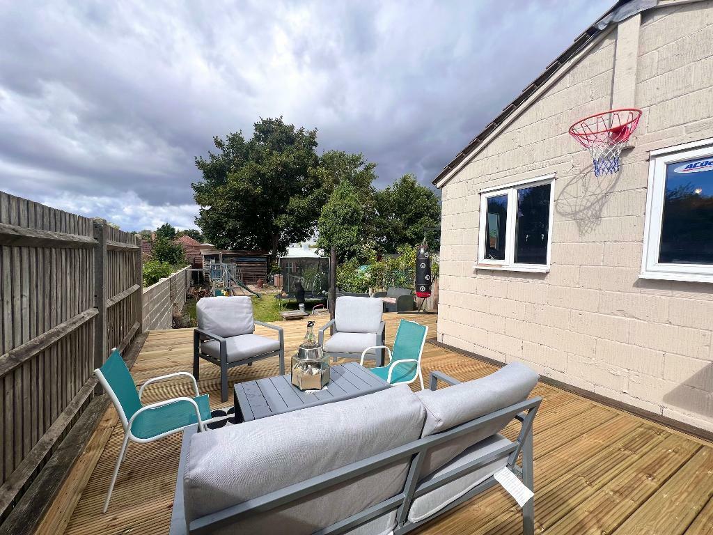
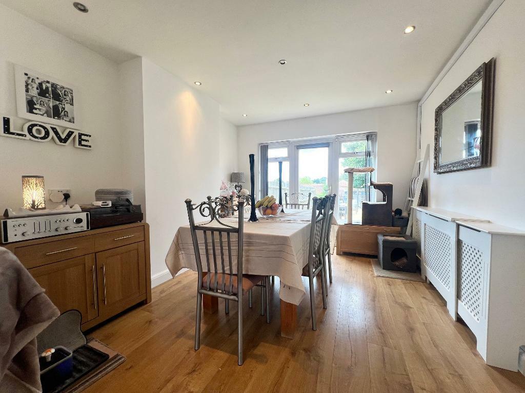
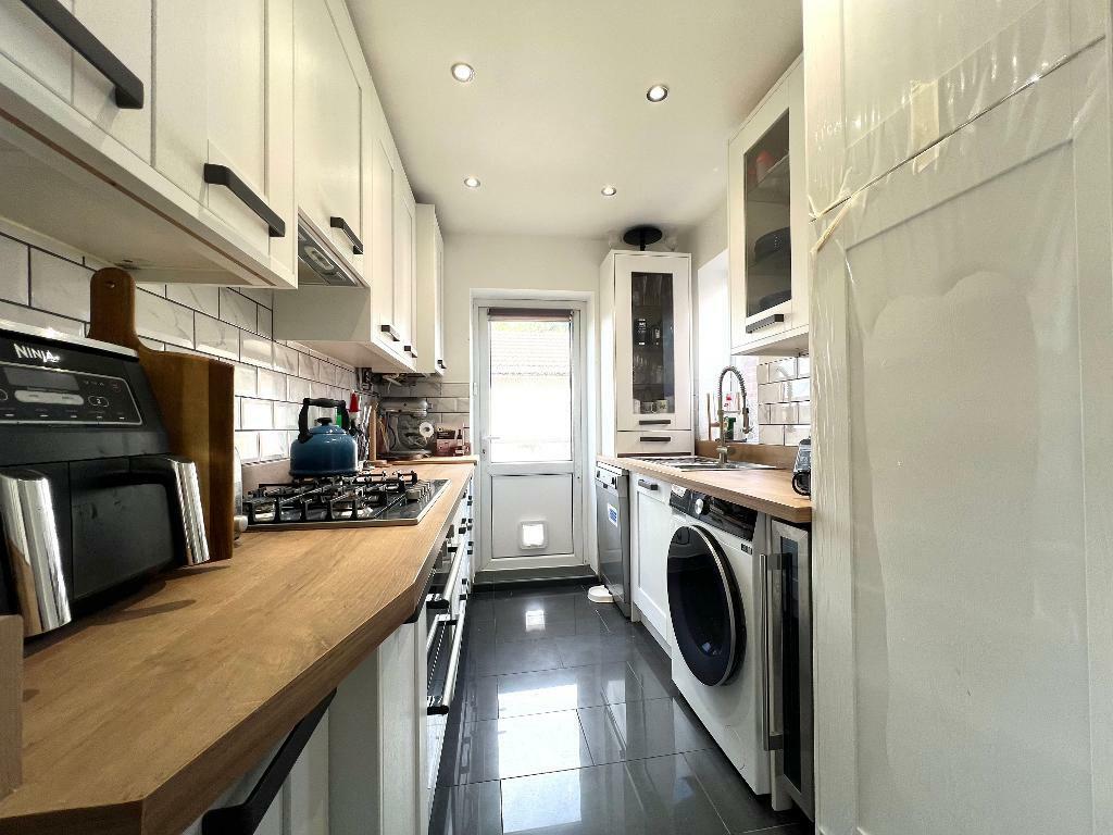
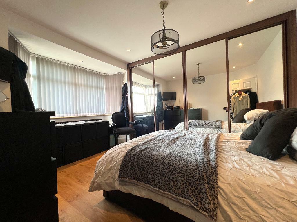
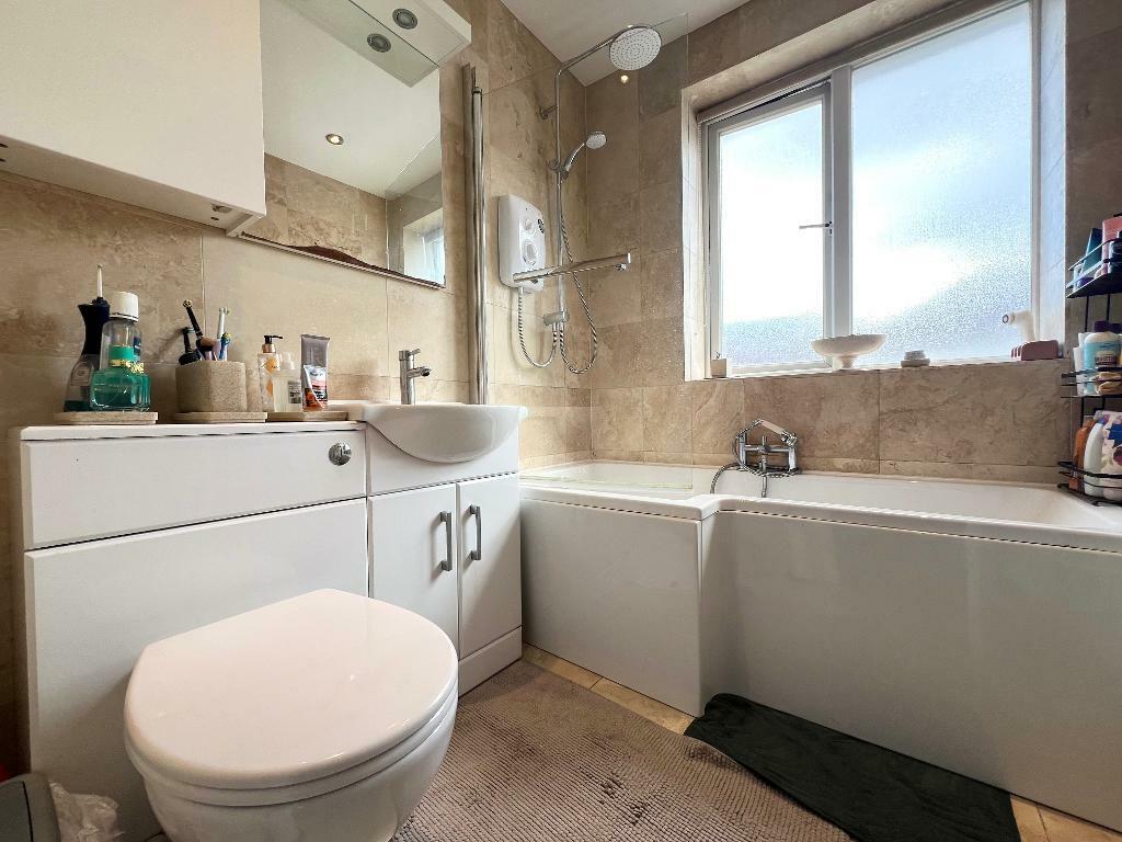
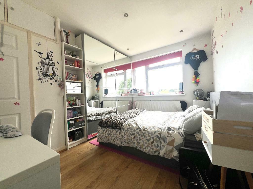
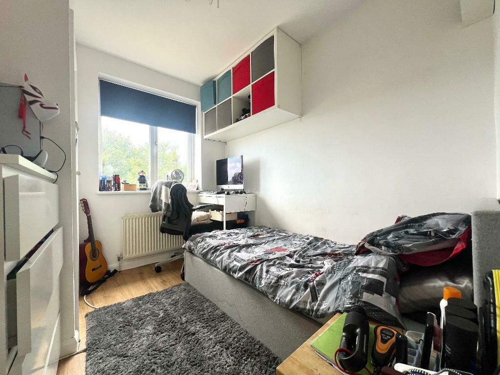
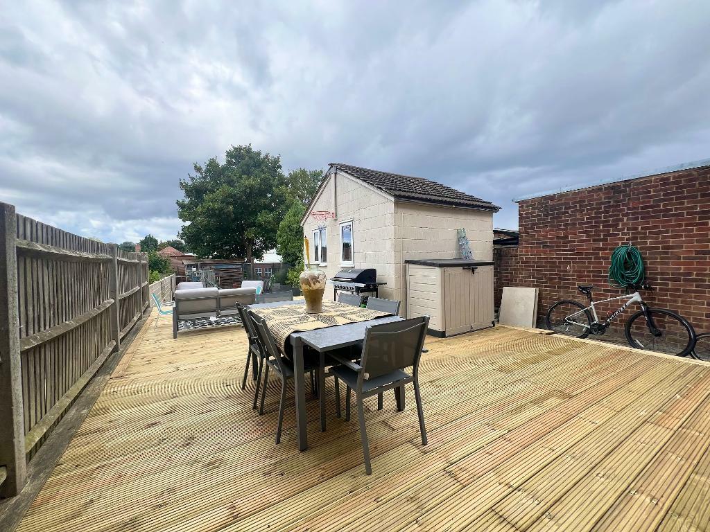
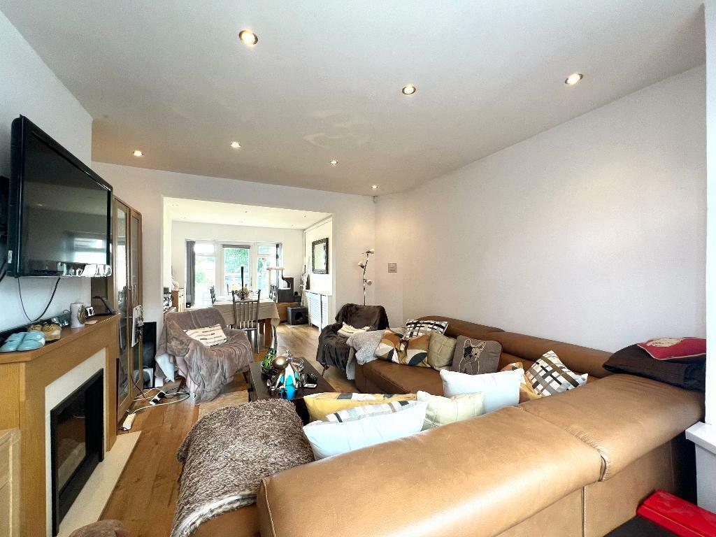
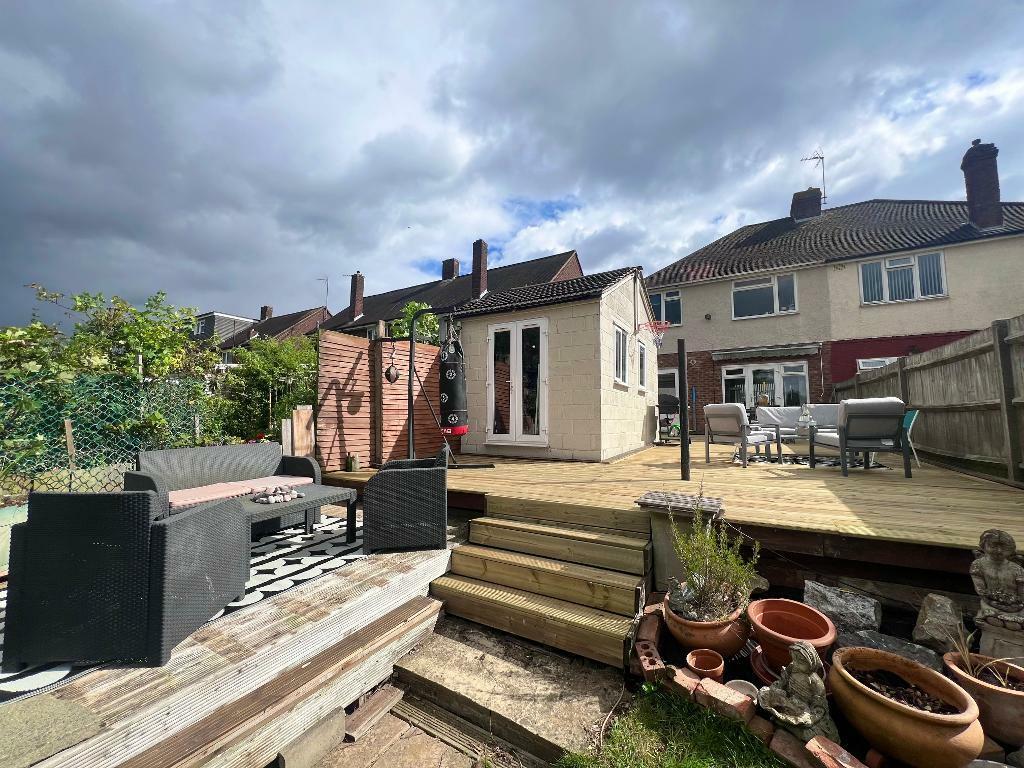
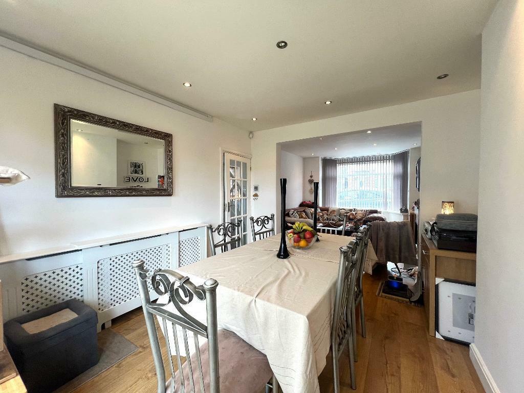
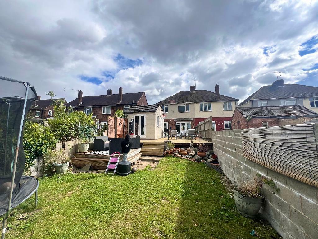
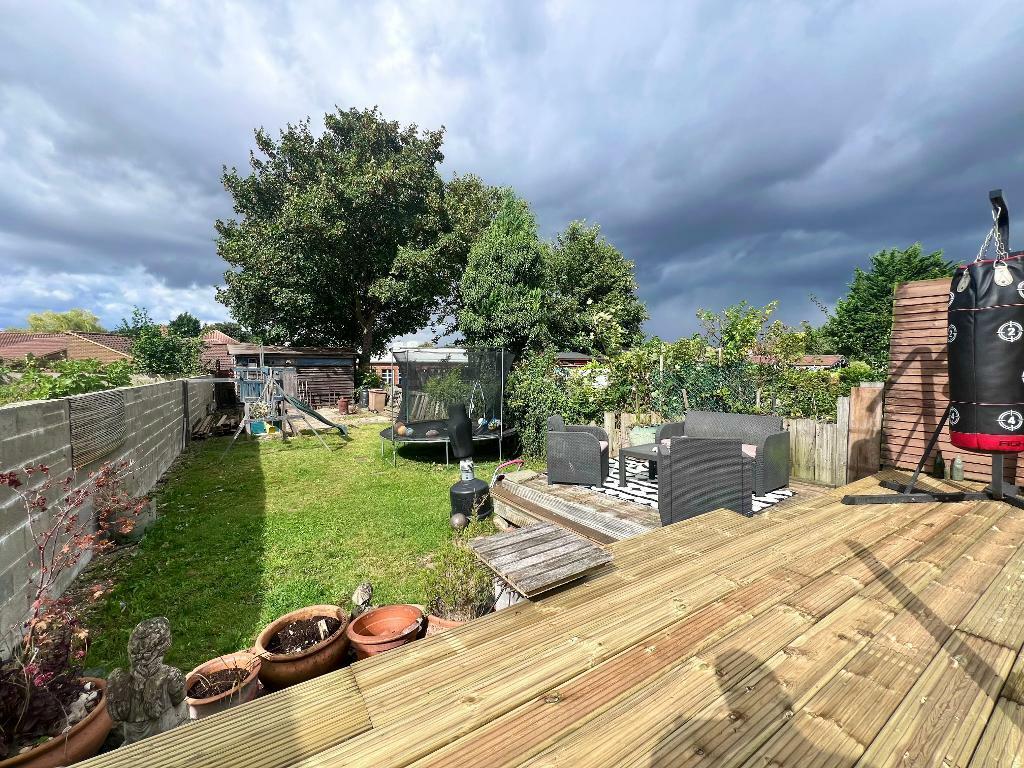
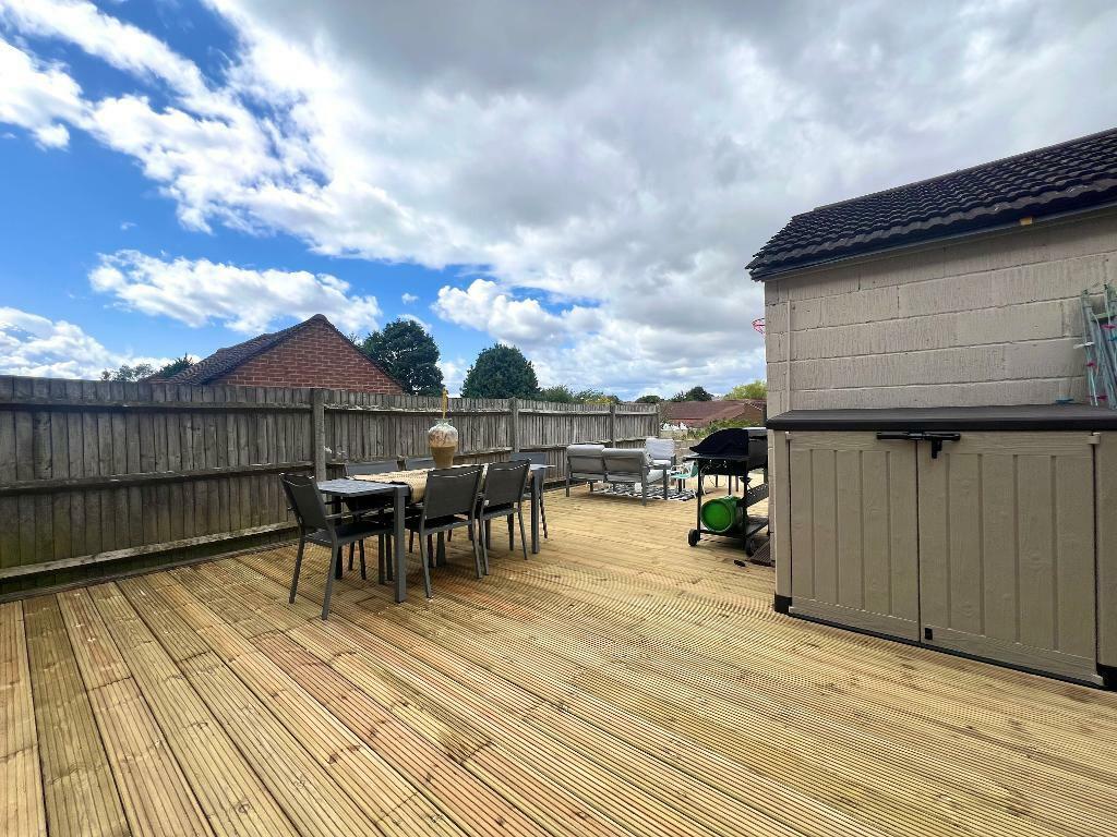
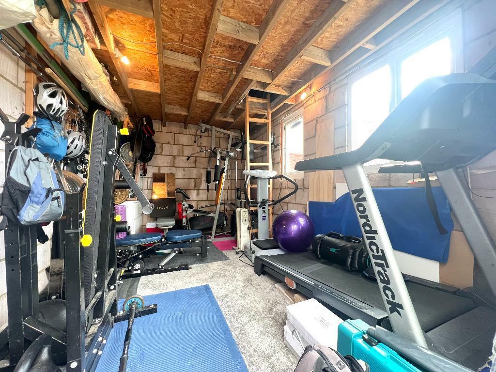
Photo 1 Photo 2 Photo 3 Photo 4 Photo 5 Photo 6 Photo 7 Photo 8 Photo 9 Photo 10 Photo 11 Photo 12 Photo 13 Photo 14 Photo 15 Photo 16 Photo 17 Photo 18
/ 18
Property details
Tenure
FREEHOLD
Floor area
84 m²
Council tax band
B
EPC rating
C
Year built
England and Wales: 1950-1966
Last sold
£333,000 Dec 2024
Price per m²
£3,988/m²
Local average
£328,713 (+1.9%)
Deprivation
Decile 3 (9,836 of 33,755)
Street crime
332 incidents within 1 mile (Apr 2026)
Key features
- INDIGO RESIDENTIAL
- Traditional Bay Fronted Family Home
- Three Bedrooms
- Refitted Kitchen
- Newly Laid Decking
- Out House
- Electric Car Charging Point
- No Upper Chain Complications
- Walking Distance To Leagrave Station
- Double Glazed And Gas Central Heating
Additional details
- Parking
- Yes
- Garden
- Yes
Description
WELL PRESENTED THROUGHOUT with NO UPPER CHAIN COMPLICATIONS, REFITTED KITCHEN and NEW DECKING.
DESCRIPTION:
Internally this lovely family home benefits from an entrance hall, bay fronted living room with feature fire place and opens through to the dining room with French doors to the rear garden. There is a newly refitted kitchen benefiting from a range of wall and base units, inset sink unit, built in oven, hob and extractor, space for all appliances, tiled flooring and door to the rear garden.
To the first floor there is a landing, three well proportioned bedrooms with the master benefiting from a bay window and built in wardrobes. The fully tiled family bathroom benefits from a P shaped bath with shower over, vanity wash hand basin and WC.
Externally there is a driveway and large rear garden with newly laid large decking area with the remainder laid to lawn, shed and an out house
Other benefits iclude electric car charger point. spot lights to ceiling, double glazing and gas central heating.
Located in the popular Leagrave area of Luton. There are an array of shops, bus routes, supermarkets and other amenities all nearby and Leagrave station is just over half a mile away offering direct routes to and from London. The area has proved popular amongst families and children will often attend Beechwood Primary and Challney Secondary as their schools.
EPC rating TBA.
Listed by
Barton Road
Indigo Residential
Reference: 152420066
EPC Rating & Upgrade Cost
Current rating: C
Potential rating: B
Inspection date: 04/10/2024
Expiry date: 03/10/2034
Current heating cost: £729/year
Potential heating cost: £679/year
Est. upgrade cost to C: £14,500
Recommendations
- Floor insulation (solid floor) (£4,000 - £6,000)
- Solar water heating (£4,000 - £6,000)
- Solar photovoltaic panels, 2.5 kWp (£3,500 - £5,500)
Flood risk
Zone: 1
Risk: Low
Job (default Low)
Floorplans
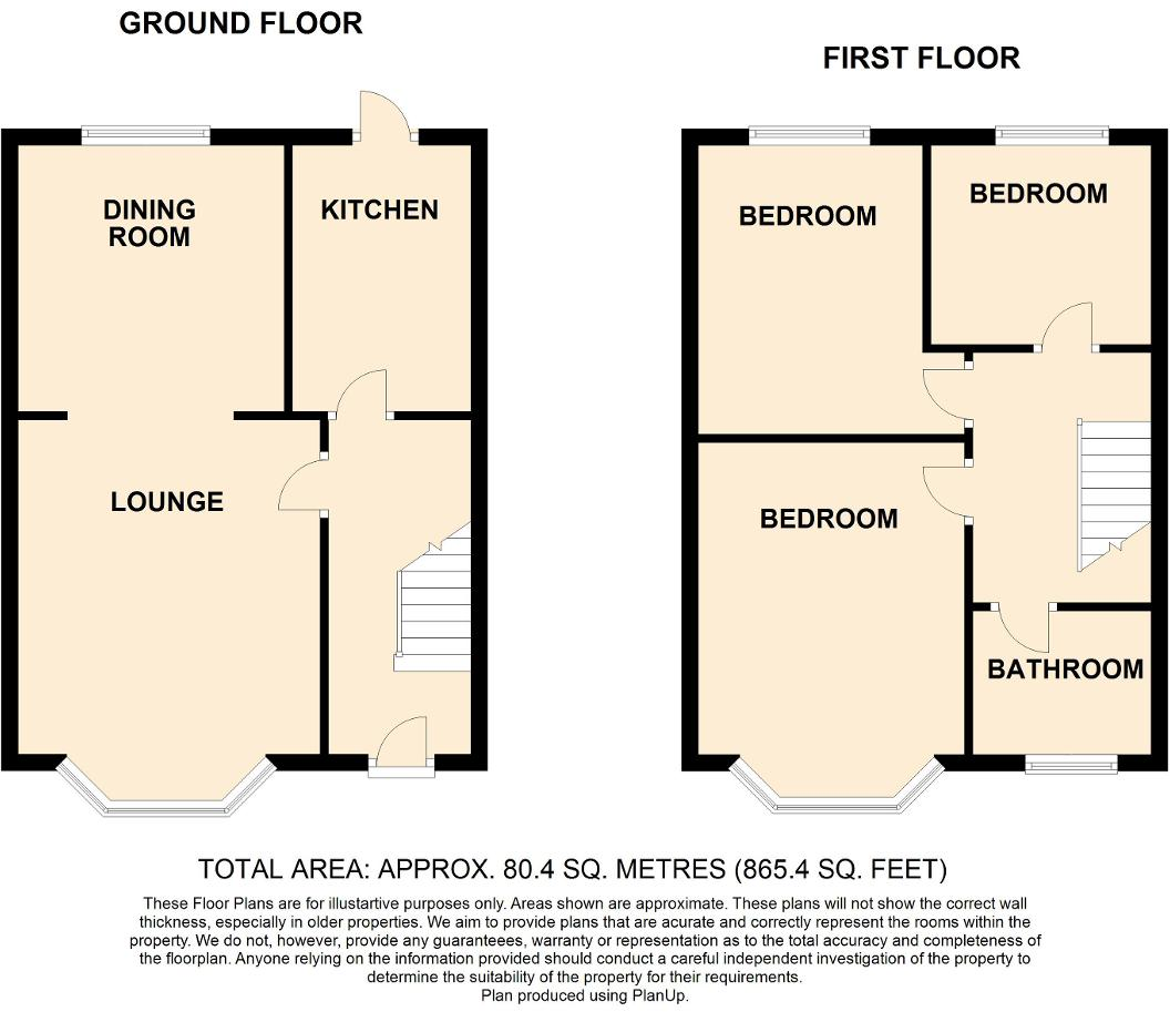
Floorplan 1
Price history
| Event | Date | Price | % change |
|---|---|---|---|
| Sold | 19/12/2024 (1 year ago) | £333,000 | — |
Source: HM Land Registry Price Paid Data. Crown copyright.
Sold Comparables
Same street and nearby sales within 0.25 miles (last 5 years). Data from Land Registry Price Paid.
| Address | Price | Date | Type |
|---|---|---|---|
| 46 WICKSTEAD AVENUE, LUTON, LU4 9DP | £322,500 | 20/01/2026 | Semi-detached |
| 48 DORDANS ROAD, LUTON, LU4 9BS | £250,000 | 09/12/2025 | Semi-detached |
| 52 ROMAN ROAD, LUTON, LU4 9DN | £357,000 | 15/08/2025 | Semi-detached |
| Same street 79 WICKSTEAD AVENUE, LUTON, LU4 9DW | £385,000 | 12/05/2023 | Semi-detached |
| 86 PEMBROKE AVENUE, LUTON, LU4 9BJ | £285,000 | 05/05/2023 | Semi-detached |
| 99 LINDEN ROAD, LUTON, LU4 9QZ | £345,000 | 02/05/2023 | Semi-detached |
| Same street 67A WICKSTEAD AVENUE, LUTON, LU4 9DW | £255,000 | 03/04/2023 | Detached |
| 90 LINDEN ROAD, LUTON, LU4 9QZ | £295,000 | 24/02/2023 | Semi-detached |
| 99 ROMAN ROAD, LUTON, LU4 9DL | £230,000 | 24/02/2023 | Semi-detached |
| Same street 45 WICKSTEAD AVENUE, LUTON, LU4 9DW | £320,000 | 21/12/2022 | Semi-detached |
| 56 ROMAN ROAD, LUTON, LU4 9DN | £322,500 | 20/12/2022 | Semi-detached |
| 76 ROMAN ROAD, LUTON, LU4 9DN | £360,000 | 16/12/2022 | Semi-detached |
| 32 WICKSTEAD AVENUE, LUTON, LU4 9DP | £190,000 | 16/12/2022 | Semi-detached |
| 90 MORGAN CLOSE, LUTON, LU4 9GN | £350,000 | 18/11/2022 | Semi-detached |
| 34 TENBY DRIVE, LUTON, LU4 9BL | £305,000 | 03/10/2022 | Semi-detached |
| 57 DORDANS ROAD, LUTON, LU4 9BS | £290,000 | 07/07/2022 | Semi-detached |
| 75 LINDEN ROAD, LUTON, LU4 9QZ | £257,000 | 05/05/2022 | Semi-detached |
| 249 BEECHWOOD ROAD, LUTON, LU4 9RA | £345,000 | 29/03/2022 | Semi-detached |
| 97 MORGAN CLOSE, LUTON, LU4 9GN | £385,000 | 23/03/2022 | Semi-detached |
| 101 LINDEN ROAD, LUTON, LU4 9QZ | £260,000 | 21/03/2022 | Semi-detached |
| Same street 69B WICKSTEAD AVENUE, LUTON, LU4 9DW | £410,000 | 10/03/2022 | Detached |
| 54 ROMAN ROAD, LUTON, LU4 9DN | £275,000 | 09/03/2022 | Semi-detached |
| 94 MORGAN CLOSE, LUTON, LU4 9GN | £390,000 | 25/02/2022 | Semi-detached |
| 53A DORDANS ROAD, LUTON, LU4 9BS | £263,000 | 21/02/2022 | Semi-detached |
| Same street 65 WICKSTEAD AVENUE, LUTON, LU4 9DW | £325,000 | 18/02/2022 | Semi-detached |
Street average: £339,000 (5 sales)
Area average: £303,850 (20 sales)
Capital growth trend
Land Registry outcode average: last 12 months vs 5y and 10y ago (from sold prices).
House Price Index (HM Land Registry — official index, not sold-price averages): Luton. Series: Semi-detached. As of March 2026.
Rental Range
Estimated market rent for Luton. Low = conservative, Realistic = average, Optimistic = best case.
Based on Local Authority from postcode lookup → Luton.
LHA (30th percentile) floor for Luton: £1,097/mo (Apr 2025 – Mar 2026)
Location
Nearby
Nearest stations, universities and amenities (distance from property).
| Type | Name | Distance |
|---|---|---|
| Shop | Hamza Supermarket | 0.2 miles |
| Shop | Cutz | 0.2 miles |
| Bus stop | Roman Road | 0.3 miles |
| Train station | Leagrave | 0.4 miles |
| Bus stop | Station Road | 0.4 miles |
| Hospital | Luton and Dunstable Hospital | 0.9 miles |
| Hospital | Widecombe Nursing Home | 1.6 miles |
| Train station | Luton | 2.2 miles |
| University | University of Bedfordshire | 2.5 miles |
Street-level crime
| Category | Count |
|---|---|
| Violence and sexual offences | 136 |
| Anti-social behaviour | 56 |
| Criminal damage and arson | 26 |
| Vehicle crime | 24 |
| Drugs | 22 |
| Public order | 21 |
| Other theft | 18 |
| Other crime | 9 |
| Burglary | 7 |
| Shoplifting | 5 |
| Possession of weapons | 4 |
| Robbery | 3 |
| Theft from the person | 1 |
| Total incidents | 332 |
Within 1 mile during Apr 2026. Source: data.police.uk (England & Wales).
Schools nearby
Nearest open schools with Ofsted ratings (England). Closed schools are not shown. Data from Get Information about Schools and Ofsted.
| Name | Type | Distance | Ofsted |
|---|---|---|---|
| Beechwood Primary School | Primary | 0.1 miles | Good — 14 Oct 2019 |
| Norton Road Primary School | Primary | 0.4 miles | Good — 13 May 2024 |
| St Joseph's Catholic Primary School | Primary | 0.5 miles | Good — 6 Dec 2017 |
| Challney High School for Girls | Secondary | 0.6 miles | Outstanding — 10 Feb 2020 |
| King's House Moorlands | Other | 0.6 miles | Good — 11 May 2022 |
Rental Comparables
Rental listings exist nearby, but none matched the 3-bedroom count for this property.
Rent-driven metrics
Based on Area rent estimate.
- Rent ratio — Monthly rent ÷ purchase price (1% rule). 1%+ = strong, 0.8–1% = okay, <0.8% = weak for cashflow.
- Max investor price — Rent ÷ 0.8%; the price at which rent would be 0.8% of price (Stoke-style target).
- Target investor price — Rent ÷ 1%; the price at which rent would be 1% of price (strong cashflow band).
- Gross yield — Annual rent as % of purchase price (no costs).