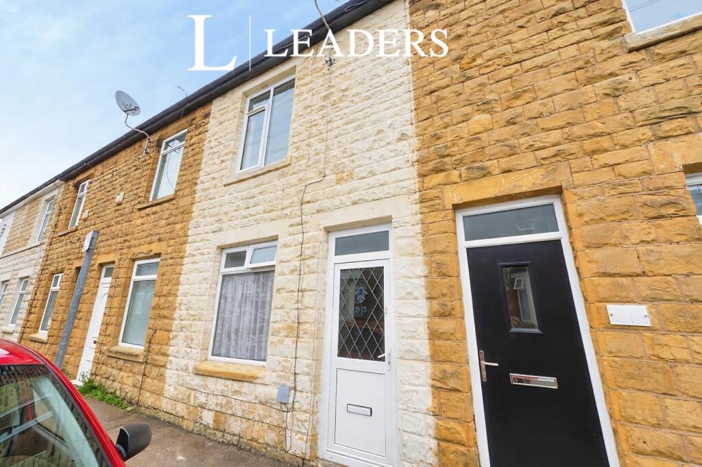
56 WELBECK STREET
MANSFIELD, MANSFIELD, NOTTINGHAMSHIRE NG18 1TG
£795 pcm
Property details
Floor area
89 m²
Deprivation
Decile 2 (3,519 of 33,755)
Street crime
604 incidents within 1 mile (Apr 2026)
Key features
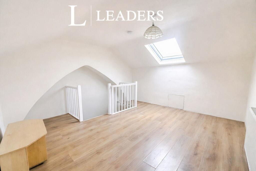
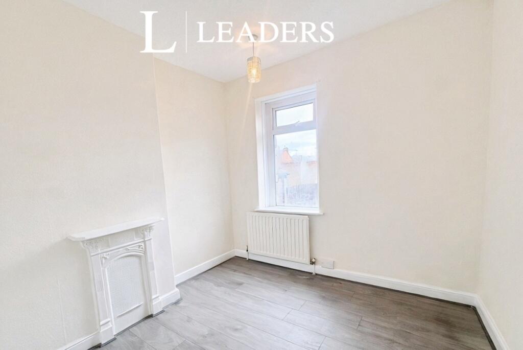
- 3 double bedrooms
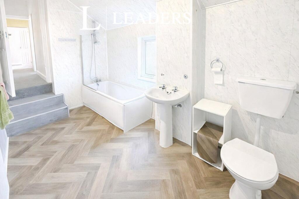
- Family bathroom
- 2 Reception Rooms
- Close to town centre
Additional details
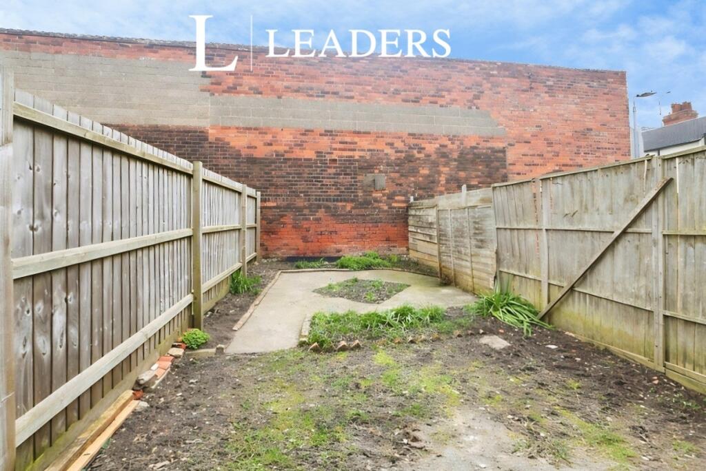
- Garden
- Yes
Description
*READY NOW*
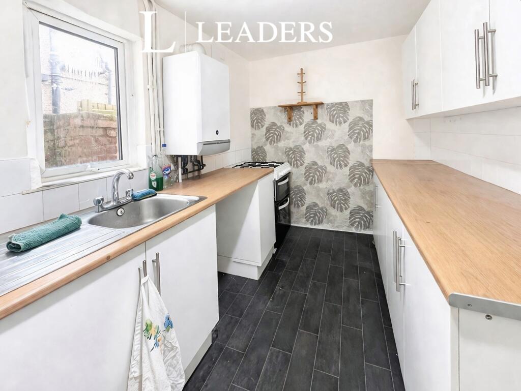
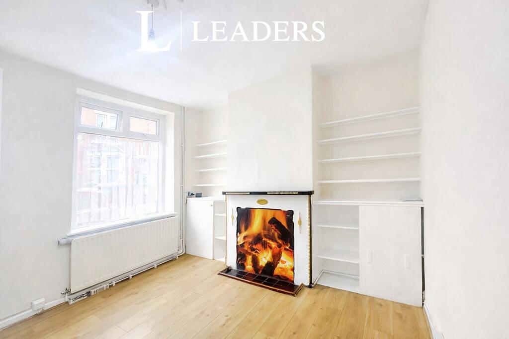
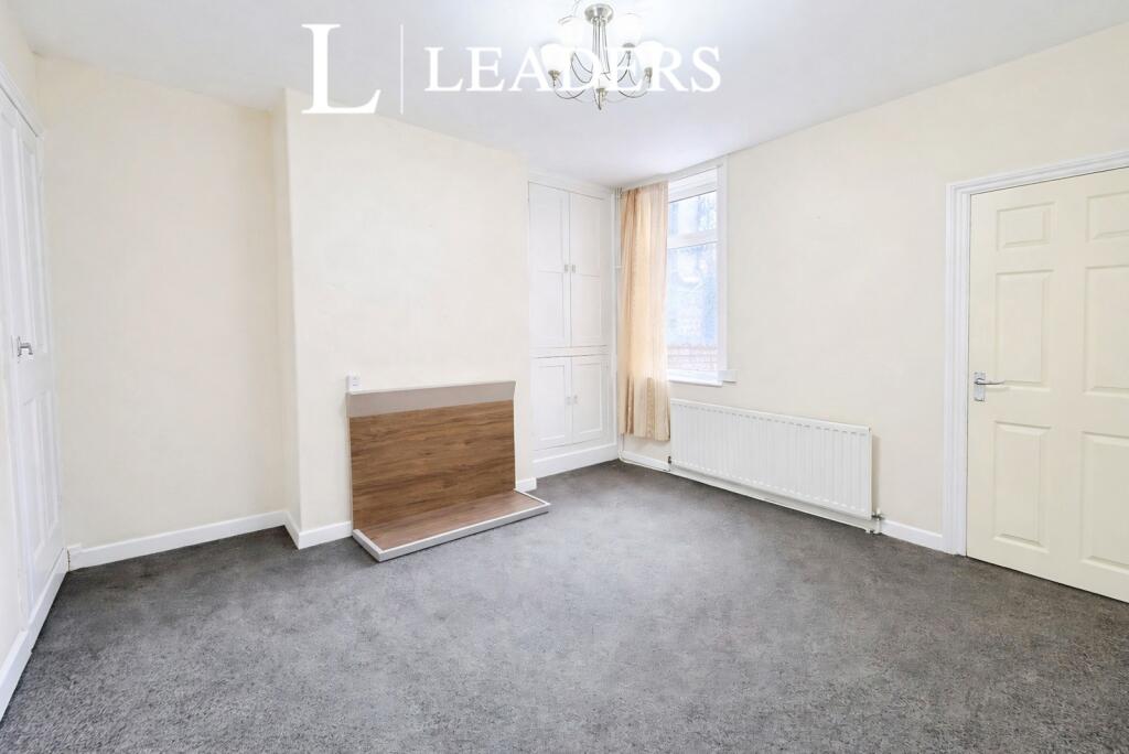
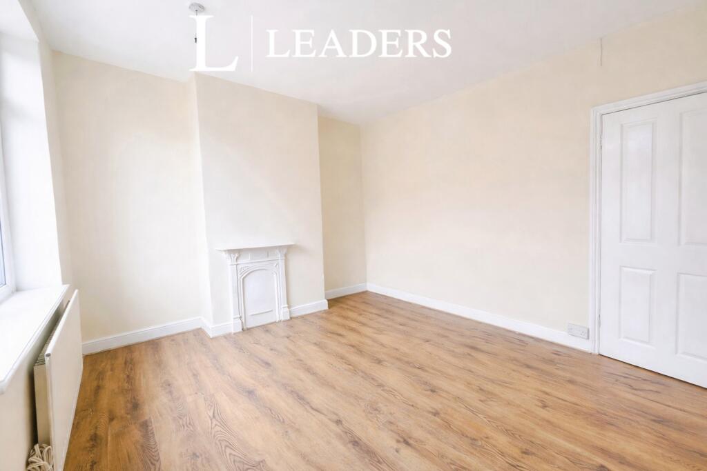
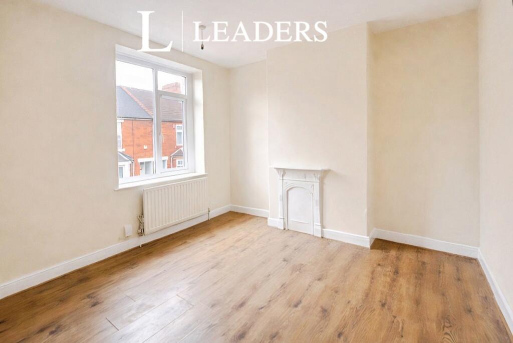
A beautiful terraced house boasting three bedrooms located in a heart of Mansfield. This charming property offers a spacious living room, a modern kitchen and a dining area perfect for entertaining guests. Upstairs is a master bedroom, while the other two bedrooms are generously sized and share a well-appointed family bathroom. The house also benefits from a private garden, ideal for outdoor relaxation and al fresco dining. Situated in a sought-after area, this property is close to local amenities, schools, and transport links, making it a convenient and desirable place to call home. With its tasteful decor, ample living space, and excellent location, this terraced house is a fantastic opportunity for those seeking a comfortable and stylish living environment. Contact us today to arrange a viewing and make this property your new home.
Listed by
Mansfield
Leaders and Romans Group
Reference: 173623151
EPC Rating & Upgrade Cost
Fetching EPC data… Refresh this page in a moment.
Flood risk
Zone: 1
Risk: Low
Job (default Low)
EPC Graphs
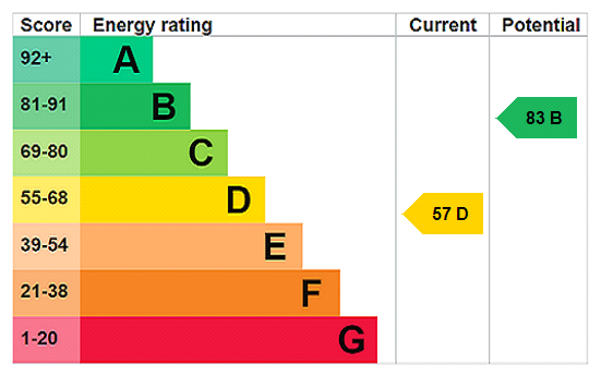
EPC Rating Graph
Rental Range
Estimated market rent for Mansfield. Low = conservative, Realistic = average, Optimistic = best case.
Based on Local Authority from postcode lookup → Mansfield.
LHA (30th percentile) floor for North Nottingham: £583/mo (Apr 2025 – Mar 2026)
Location
Nearby
Nearest stations, universities and amenities (distance from property).
| Type | Name | Distance |
|---|---|---|
| Bus stop | Thoresby Street | 0.1 miles |
| Bus stop | Rosemary Street | 0.1 miles |
| Shop | Unknown | 0.1 miles |
| Shop | Justina Corner Shop | 0.1 miles |
| Hospital | Mansfield Community Hospital | 0.4 miles |
| Train station | Mansfield | 0.4 miles |
| Train station | Mansfield Woodhouse | 1.1 miles |
| Hospital | Kings Mill Hospital | 1.5 miles |
| University | Nottingham Trent University Vision University Centre | 1.9 miles |
| University | Clinical Sciences | 10.9 miles |
Street-level crime
| Category | Count |
|---|---|
| Violence and sexual offences | 203 |
| Shoplifting | 90 |
| Anti-social behaviour | 82 |
| Criminal damage and arson | 43 |
| Public order | 40 |
| Vehicle crime | 40 |
| Other theft | 37 |
| Drugs | 23 |
| Possession of weapons | 13 |
| Robbery | 12 |
| Burglary | 11 |
| Other crime | 7 |
| Theft from the person | 3 |
| Total incidents | 604 |
Within 1 mile during Apr 2026. Source: data.police.uk (England & Wales).
Schools nearby
Nearest open schools with Ofsted ratings (England). Closed schools are not shown. Data from Get Information about Schools and Ofsted.
| Name | Type | Distance | Ofsted |
|---|---|---|---|
| St Philip Neri With St Bede Catholic Voluntary Academy | Primary | 0.1 miles | Good — 31 Oct 2012 |
| R.E.A.L. Independent Schools Mansfield | Other | 0.4 miles | Good — 2 May 2024 |
| Wainwright Primary Academy | Primary | 0.5 miles | Good — 19 Sep 2023 |
| All Saints' Catholic Voluntary Academy | Secondary | 0.5 miles | Good — 19 Apr 2012 |
| Queen Elizabeth's Academy | Secondary | 0.5 miles | Good — 14 Jun 2023 |
Rental Comparables
Rental listings exist nearby, but none matched the 3-bedroom count for this property.