1 HEOLY MYNYDD
NEWCASTLE EMLYN, BEULAH, CEREDIGION SA38 9QF
£79,500
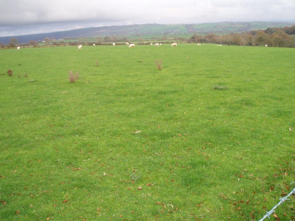
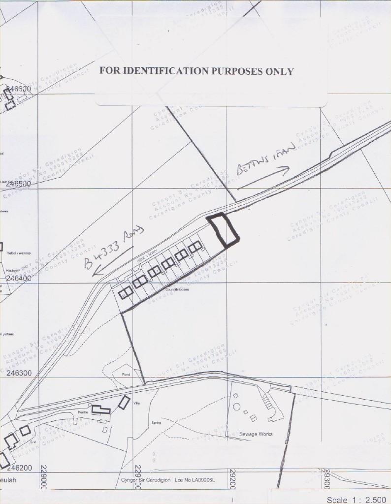
Photo 1 Photo 2
/ 2
Property details
Tenure
FREEHOLD
Last sold
£102,000 Nov 2012
Local average
£40,000 (+98.8%)
Street crime
2 incidents within 1 mile (Apr 2026)
Key features
- Dimensions 60' x 120'
Additional details
- Parking
- Yes
Description
The plot lies alongside a minor district road, leading off from the B4333 Newcastle Emlyn - Aberporth roadway, running through the centre of Beulah, which provides for filling station and agricultural merchants, chapel and primary school. A limited bus service serves the district. Newcastle Emlyn provides for a wide array of everyday retail, banking, social, leisure and educational facilities. The similar Market Town of Cardigan is some 8 miles distant. Aberporth is some 4 miles away.
Description
A level plot, with approximate dimensions 60' frontage x 120' depth (in line with rear fence of car parking area). Mains services are available in the vicinity. Outline Consent for erection of a Dwelling. Outline Planning consent Reference - A071097 (Granted by Ceredigion County Council, 05/02/08).
Listed by
Ceredigion
DAI LEWIS CYF
Reference: 32171341
Flood risk
Zone: 1
Risk: Low
Job (default Low)
FENSA Certificates
This property has 1 FENSA certificate(s) on record, indicating window/door installations by FENSA-approved installers.
FENSA Certificate #13250907
Property Details
Street: 1 Heol y Mynydd
Town: Beulah
Postcode: SA38 9QF
Installation Details
Items: 2 windows and 2 doors
Certificate Issued: 19/11/2018
Work Completed: 04/06/2018
This certificate data was retrieved from FENSA's database
What is FENSA? FENSA (Fenestration Self-Assessment Scheme) is a government-authorised scheme that monitors building regulation compliance for replacement windows and doors. Certificates indicate that work was completed by FENSA-approved installers.
Price history
| Event | Date | Price | % change |
|---|---|---|---|
| Sold | 30/11/2012 (13 years ago) | £102,000 | — |
Source: HM Land Registry Price Paid Data. Crown copyright.
Sold Comparables
Sold comparables data is not available for this property.
Capital growth trend
House Price Index (HM Land Registry — official index, not sold-price averages): Ceredigion. Series: All dwelling types. As of March 2026.
Rental Range
Estimated market rent for Ceredigion. Low = conservative, Realistic = average, Optimistic = best case.
Based on Local Authority from postcode lookup → Ceredigion.
Location
Nearby
Nearest stations, universities and amenities (distance from property).
| Type | Name | Distance |
|---|---|---|
| Bus stop | Beulah | 0.2 miles |
| Bus stop | Gogerddan Arms | 1.9 miles |
| Shop | Gogerddan Garage | 1.9 miles |
| Shop | Allaways Coffee | 2.5 miles |
| Train station | Pontgoch | 4.3 miles |
| Train station | Pontprenshitw | 5.0 miles |
Street-level crime
| Category | Count |
|---|---|
| Violence and sexual offences | 2 |
| Total incidents | 2 |
Within 1 mile during Apr 2026. Source: data.police.uk (England & Wales).
Schools nearby
Nearest open schools with Ofsted ratings (England). Closed schools are not shown. Data from Get Information about Schools and Ofsted.
| Name | Type | Distance | Ofsted |
|---|---|---|---|
| Ysgol Cenarth | Other | 3.2 miles | — (No rating) |
| Ysgol Y Ddwylan | Other | 3.7 miles | — (No rating) |
| Ysgol Aberporth | Other | 3.9 miles | — (No rating) |
| Ysgol Gyfun Emlyn | Other | 3.9 miles | — (No rating) |
Rental Comparables
Loading rental comparables for this postcode. Refresh in a few minutes.
Rent-driven metrics
Based on Area rent estimate.
- Rent ratio — Monthly rent ÷ purchase price (1% rule). 1%+ = strong, 0.8–1% = okay, <0.8% = weak for cashflow.
- Max investor price — Rent ÷ 0.8%; the price at which rent would be 0.8% of price (Stoke-style target).
- Target investor price — Rent ÷ 1%; the price at which rent would be 1% of price (strong cashflow band).
- Gross yield — Annual rent as % of purchase price (no costs).