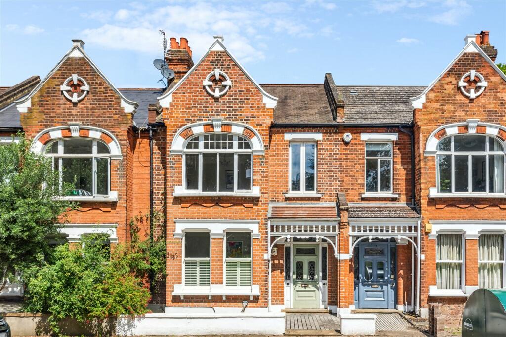
29 EMMANUEL ROAD
LONDON, GREATER LONDON SW12 0HF


Property details
Tenure
FREEHOLD
Floor area
89 m²
Council tax band
D
Last sold
£778,000 Feb 2025
Local average
£584,281 (+36.1%)
Deprivation
Decile 9 (28,047 of 33,755)
Street crime
747 incidents within 1 mile (Apr 2026)
Key features
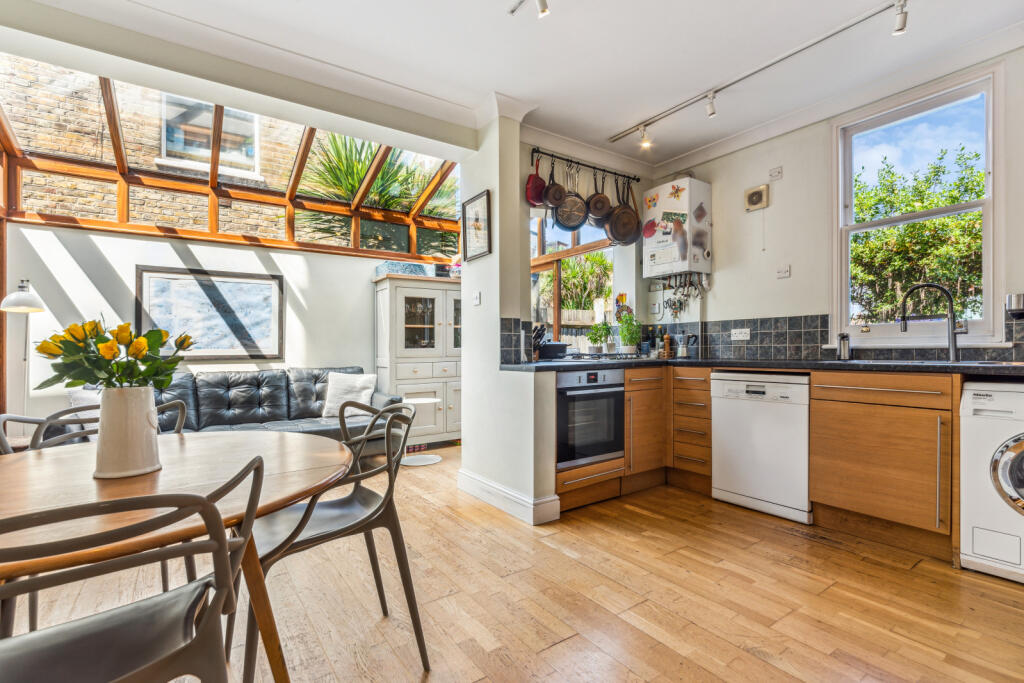
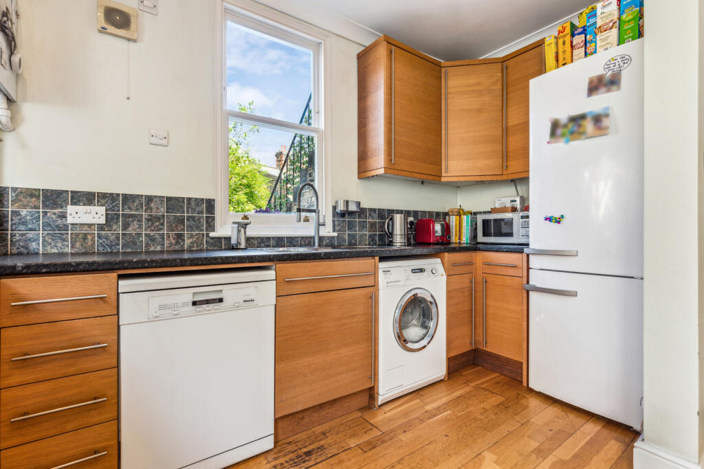
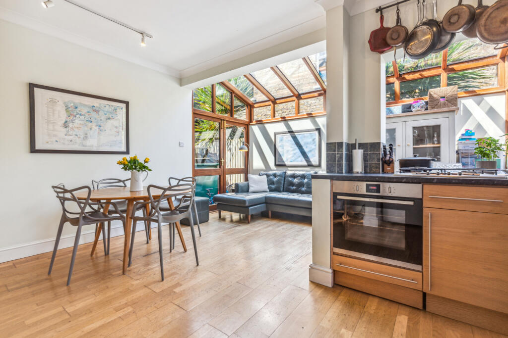
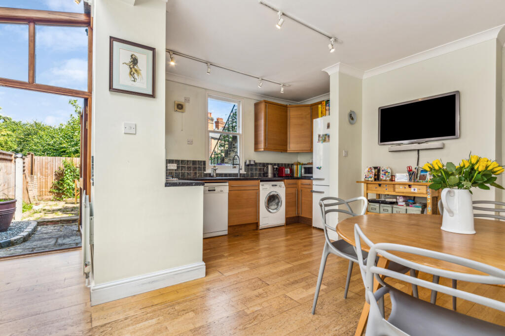
- Kitchen dining room
- One reception room
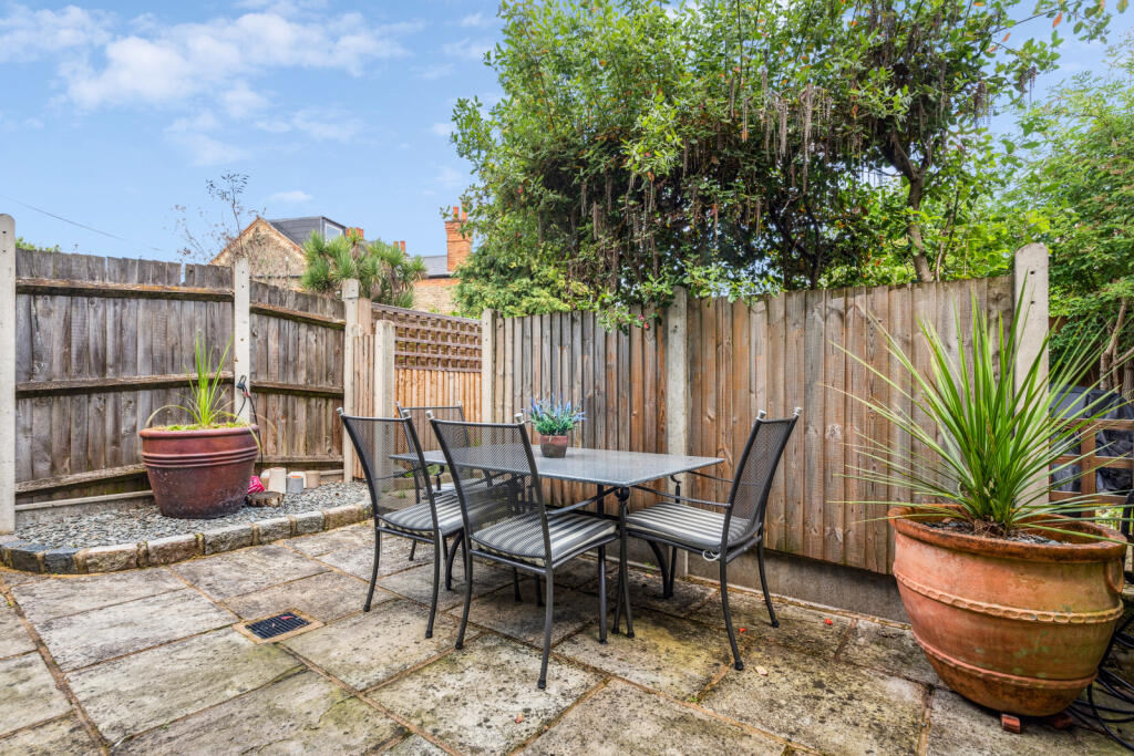
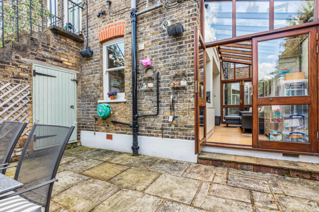
- Court yard
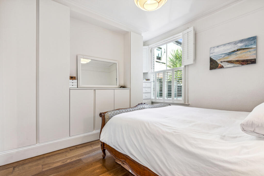
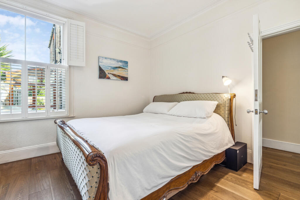
- Two bedrooms
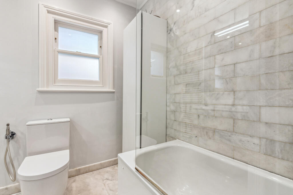
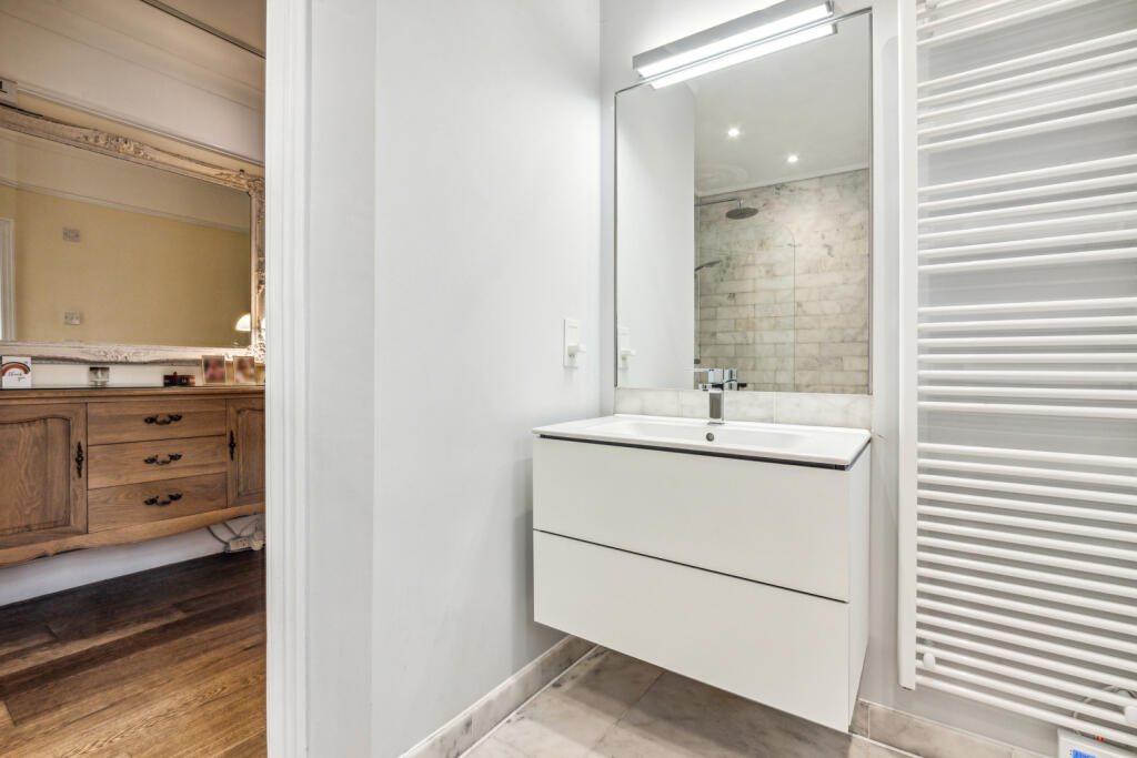
- One bathroom
- Garden
Additional details
- Garden
- Yes
Description
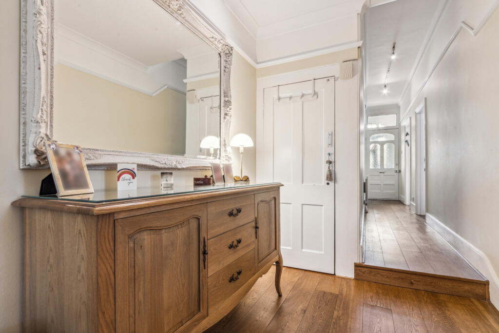
Towards the front of the property is a bright and spacious reception room, this space has large bay windows, and a striking feature fireplace. Leading down the hall reveals two spacious double bedrooms, with one benefiting from bespoke fitted wardrobes. A further contemporary family bathroom with a bath can be found and a storage cupboard. The open-plan kitchen dining room is to the rear of the property and benefits from timber framed extension with glass, allowing an abundance of natural light to flood this space.
The kitchen itself benefits from plenty of wall and base units, and integrated appliances. This space accommodates space for a dining table and seating area, making it the perfect space for everyday living and entertaining. The kitchen seamlessly opens to the patio garden with ample seating space.
This fantastic example of a ‘Hydefarm Estate’ flat can be found on Emmanuel Road, which is a pretty, residential street overlooking the green open spaces of Tooting Bec Common. There is a large selection of shops, bars, and restaurants nearby in Balham. Transport can be found close by at Balham Station offering both Overground and Underground services. Furthermore, the area is also renowned for its outstanding schools (subject to entrance and catchment).
Council Tax Band: D | EPC: C | Tenure: Freehold
Listed by
Balham & Tooting
Rampton Baseley
Reference: 151229411
EPC Rating & Upgrade Cost
Fetching EPC data… Refresh this page in a moment.
Flood risk
Zone: 1
Risk: Low
Job (default Low)
Floorplans
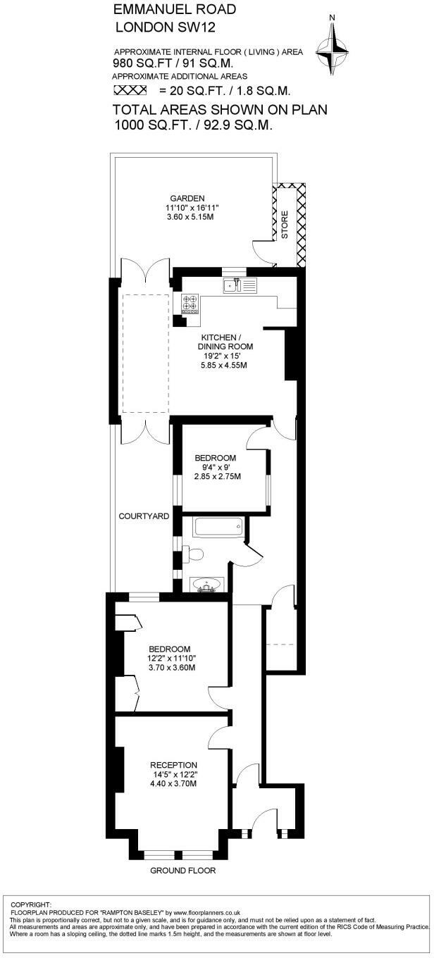
Floorplan
EPC Graphs
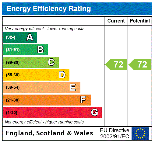
EPC Rating Graph
Price history
11014% since 2025
| Event | Date | Price | % change |
|---|---|---|---|
| Sold | 06/02/2025 (1 year ago) | £778,000 | +11014.3% |
| Sold | 06/02/2025 (1 year ago) | £7,000 | — |
Source: HM Land Registry Price Paid Data. Crown copyright.
Sold Comparables
Same street and nearby sales within 0.25 miles (last 5 years). Data from Land Registry Price Paid.
| Address | Price | Date | Type |
|---|---|---|---|
| 82A HAVERHILL ROAD, LONDON, LAMBETH, GREATER LONDON, SW12 0HB | £720,795 | 12/12/2025 | Flat |
| 53A MIDMOOR ROAD, LONDON, LAMBETH, GREATER LONDON, SW12 0ES | £875,000 | 05/12/2025 | Flat |
| 23A BURNBURY ROAD, LONDON, LAMBETH, GREATER LONDON, SW12 0EQ | £820,000 | 18/11/2025 | Flat |
| 25A FIELDHOUSE ROAD, LONDON, LAMBETH, GREATER LONDON, SW12 0HL | £805,000 | 15/08/2025 | Flat |
| 25A BURNBURY ROAD, LONDON, LAMBETH, GREATER LONDON, SW12 0EG | £915,000 | 31/01/2025 | Flat |
| 36 TENHAM AVENUE, LONDON, LAMBETH, GREATER LONDON, SW2 4XR | £645,000 | 21/01/2025 | Flat |
| 41 MIDMOOR ROAD, LONDON, LAMBETH, GREATER LONDON, SW12 0ES | £600,000 | 18/12/2023 | Flat |
| 88A HAVERHILL ROAD, LONDON, LAMBETH, GREATER LONDON, SW12 0HB | £981,000 | 24/11/2023 | Flat |
| 21 FLAT 3 RASTELL AVENUE, LONDON, LAMBETH, GREATER LONDON, SW2 4XP | £575,000 | 23/11/2023 | Flat |
| 3D BURNBURY ROAD, LONDON, LAMBETH, GREATER LONDON, SW12 0EH | £680,000 | 09/11/2023 | Flat |
| 39D FIELDHOUSE ROAD, LONDON, LAMBETH, GREATER LONDON, SW12 0HL | £863,000 | 26/10/2023 | Flat |
| 99A RADBOURNE ROAD, LONDON, LAMBETH, GREATER LONDON, SW12 0EE | £839,250 | 25/08/2023 | Flat |
| 60A BURNBURY ROAD, LONDON, LAMBETH, GREATER LONDON, SW12 0EL | £725,000 | 04/08/2023 | Flat |
| 23 MIDMOOR ROAD, LONDON, LAMBETH, GREATER LONDON, SW12 0EW | £465,000 | 31/07/2023 | Flat |
| 39A BURNBURY ROAD, LONDON, LAMBETH, GREATER LONDON, SW12 0EG | £751,000 | 21/07/2023 | Flat |
| 23 GLENFIELD ROAD, LONDON, LAMBETH, GREATER LONDON, SW12 0HQ | £765,000 | 30/06/2023 | Flat |
| 78A HAVERHILL ROAD, LONDON, LAMBETH, GREATER LONDON, SW12 0HB | £710,000 | 12/05/2023 | Flat |
| 11A GLENFIELD ROAD, LONDON, LAMBETH, GREATER LONDON, SW12 0HQ | £806,000 | 22/12/2022 | Flat |
| 73 LOWER MAISONETTE HAVERHILL ROAD, LONDON, LAMBETH, GREATER LONDON, SW12 0HE | £710,000 | 09/12/2022 | Flat |
| Same street 29A EMMANUEL ROAD, LONDON, LAMBETH, GREATER LONDON, SW12 0HF | £775,000 | 30/11/2022 | Flat |
| 34 BURNBURY ROAD, LONDON, LAMBETH, GREATER LONDON, SW12 0EJ | £740,000 | 18/11/2022 | Flat |
| Same street 25A EMMANUEL ROAD, LONDON, LAMBETH, GREATER LONDON, SW12 0HF | £955,000 | 01/07/2022 | Terraced |
| Same street 34A EMMANUEL ROAD, LONDON, LAMBETH, GREATER LONDON, SW12 0HF | £1,000,000 | 01/04/2022 | Flat |
Street average: £910,000 (3 sales)
Area average: £749,552 (20 sales)
Capital growth trend
Land Registry outcode average: last 12 months vs 5y and 10y ago (from sold prices).
House Price Index (HM Land Registry — official index, not sold-price averages): Lambeth. Series: Flats and maisonettes. As of March 2026.
Rental Range
Estimated market rent for Lambeth. Low = conservative, Realistic = average, Optimistic = best case.
Based on Local Authority from postcode lookup → Lambeth.
LHA (30th percentile) floor for Huntingdon: £793/mo (Apr 2025 – Mar 2026)
Location
Nearby
Nearest stations, universities and amenities (distance from property).
| Type | Name | Distance |
|---|---|---|
| Bus stop | Emmanuel Road | 0.1 miles |
| Shop | Robert Kirby London | 0.1 miles |
| Bus stop | Burnbury Road | 0.1 miles |
| Shop | Handsome Hound | 0.1 miles |
| Train station | Streatham Hill | 0.5 miles |
| Train station | Balham | 0.6 miles |
| University | Horton Halls Reception | 1.8 miles |
| Hospital | British Home & Hospital for Incurables | 1.9 miles |
| Hospital | Bridge Lane Health Centre | 2.5 miles |
| University | University of Wales Trinity Saint David London Campus | 2.9 miles |
Street-level crime
| Category | Count |
|---|---|
| Anti-social behaviour | 187 |
| Violence and sexual offences | 176 |
| Shoplifting | 63 |
| Vehicle crime | 59 |
| Other theft | 50 |
| Public order | 49 |
| Criminal damage and arson | 31 |
| Theft from the person | 30 |
| Drugs | 27 |
| Burglary | 25 |
| Robbery | 22 |
| Bicycle theft | 18 |
| Possession of weapons | 6 |
| Other crime | 4 |
| Total incidents | 747 |
Within 1 mile during Apr 2026. Source: data.police.uk (England & Wales).
Schools nearby
Nearest open schools with Ofsted ratings (England). Closed schools are not shown. Data from Get Information about Schools and Ofsted.
| Name | Type | Distance | Ofsted |
|---|---|---|---|
| Telferscot Primary School | Primary | 0.1 miles | Outstanding — 12 Dec 2014 |
| St Bede's Catholic Infant School | Primary | 0.2 miles | Good — 24 Jul 2013 |
| The White House Preparatory School & Woodentops Kindergarten | Other | 0.3 miles | — (No rating) |
| Henry Cavendish Primary School | Primary | 0.3 miles | Outstanding — 2 Jul 2024 |
| Streatham & Clapham High School | Other | 0.5 miles | — (No rating) |
Rental Comparables
Loading rental comparables for this postcode. Refresh in a few minutes.
Rent-driven metrics
Based on Area rent estimate.
- Rent ratio — Monthly rent ÷ purchase price (1% rule). 1%+ = strong, 0.8–1% = okay, <0.8% = weak for cashflow.
- Max investor price — Rent ÷ 0.8%; the price at which rent would be 0.8% of price (Stoke-style target).
- Target investor price — Rent ÷ 1%; the price at which rent would be 1% of price (strong cashflow band).
- Gross yield — Annual rent as % of purchase price (no costs).