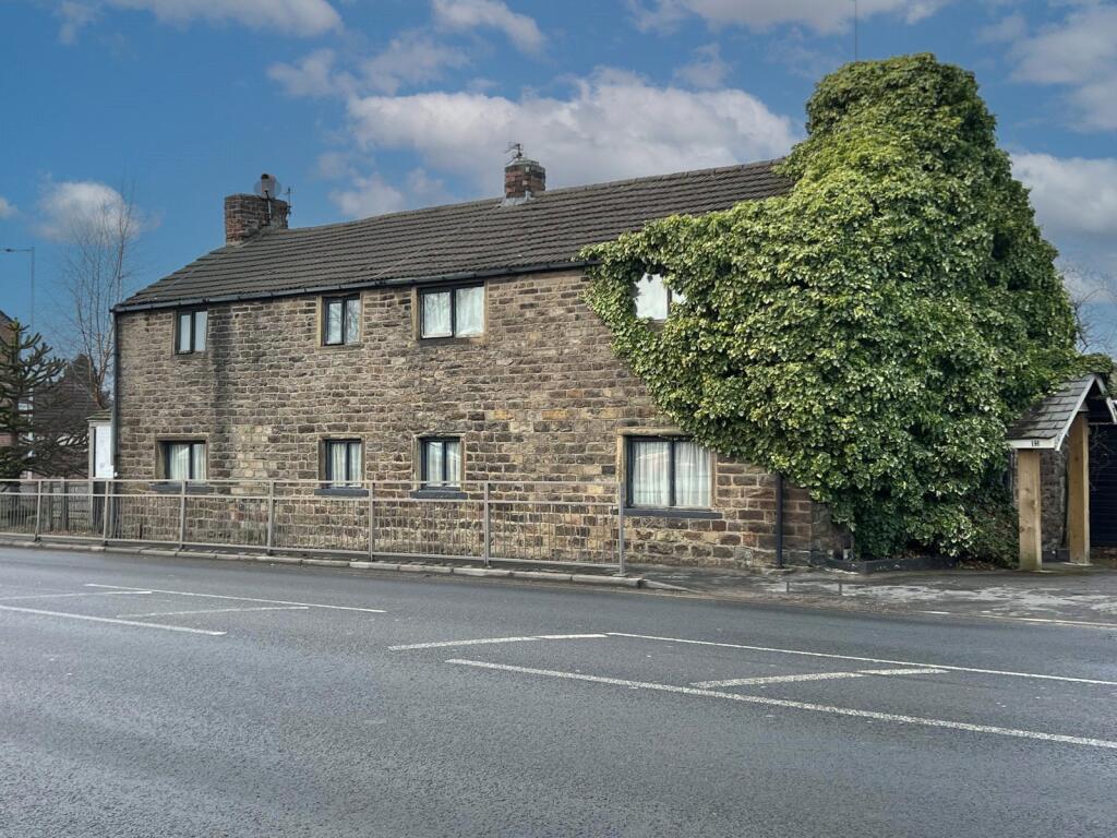
Buxton Road
High Lane, Stockport, SK6, SK6 8DY
Property details
Tenure
FREEHOLD
Floor area
90 m²
Council tax band
B
Local average
£442,648 (-13%)
Deprivation
Decile 9 (29,572 of 33,755)
Street crime
1 incident within 1 mile (Apr 2026)
Key features
- No Onward Chain
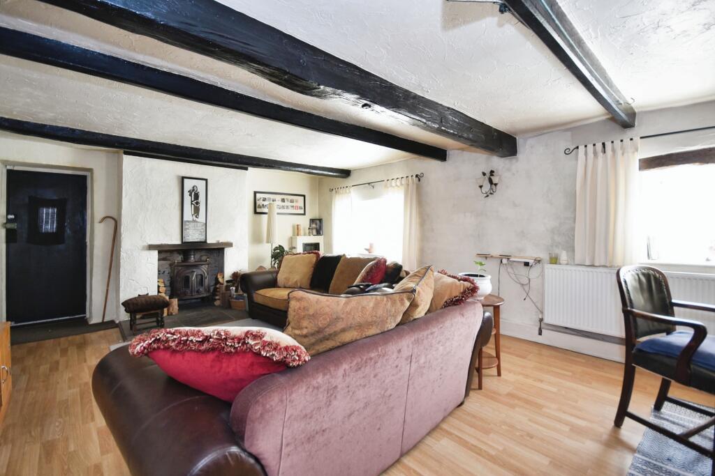
- Detached Stone Cottage
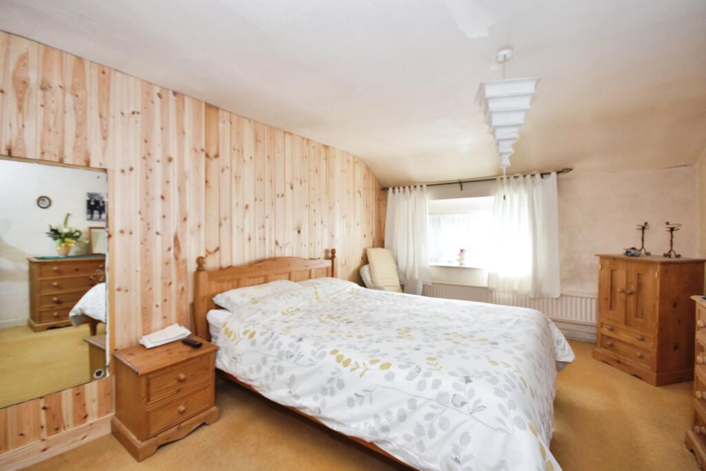
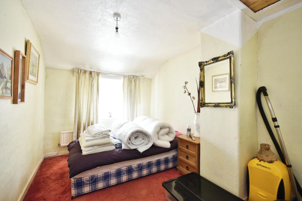
- Four Bedrooms
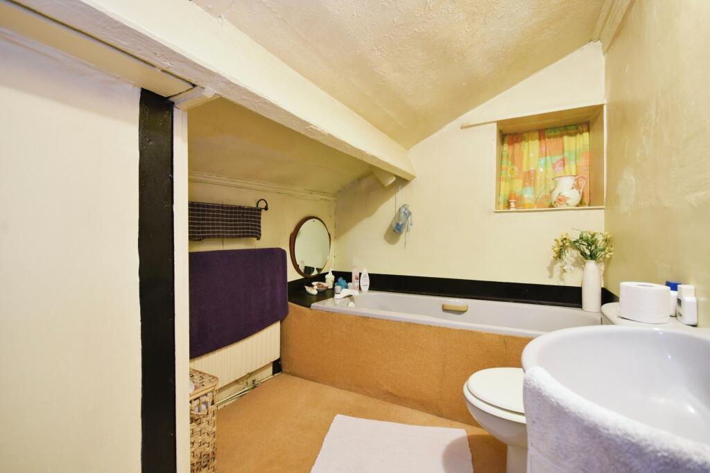
- Two Bathrooms
- Study/Office
- Games Room
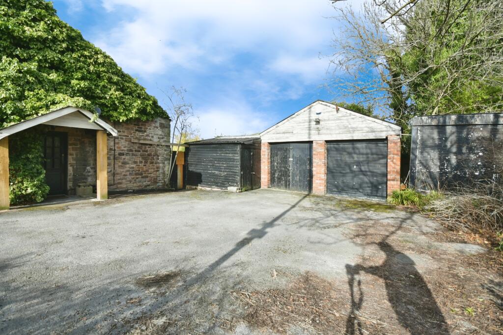
- Double & Single Garage
Additional details
- Parking
- Yes
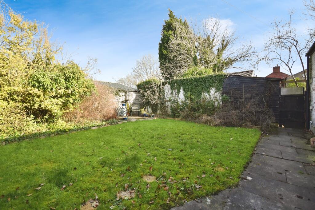
- Garden
- Yes
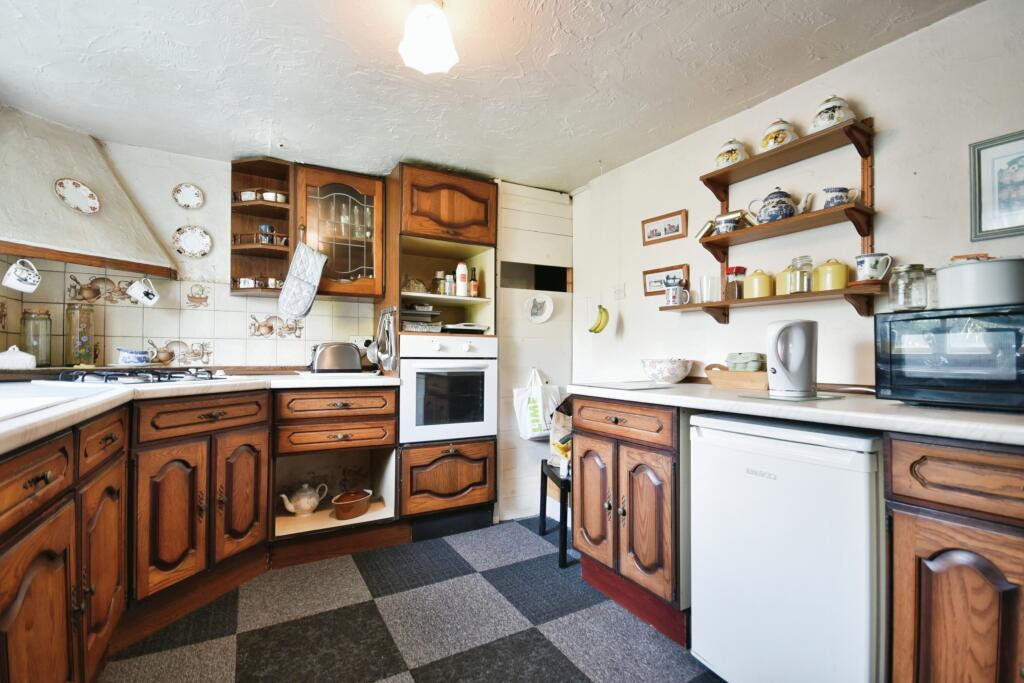
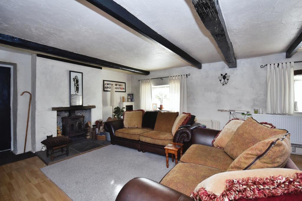
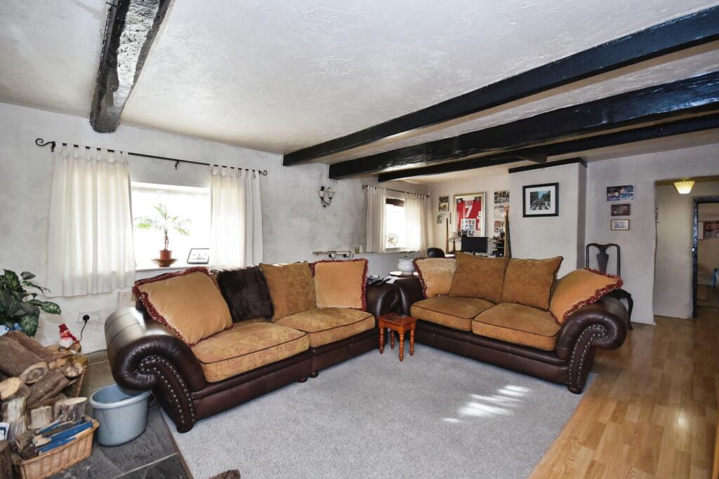
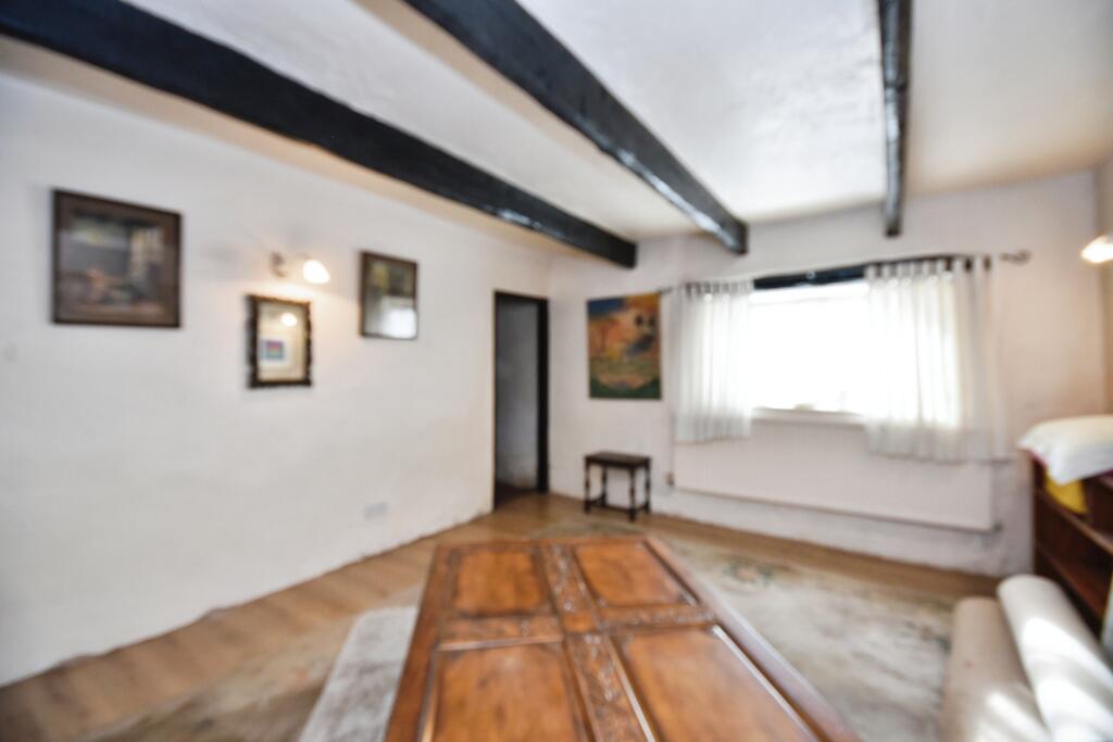
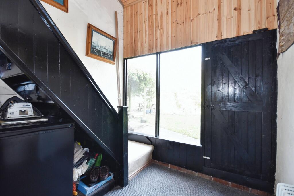
Description
Listed by
Disley
Countrywide UK Sales - Connells
Reference: 159113687
EPC Rating & Upgrade Cost
Fetching EPC data… Refresh this page in a moment.
Flood risk
Zone: 1
Risk: Low
Job (default Low)
Floorplans
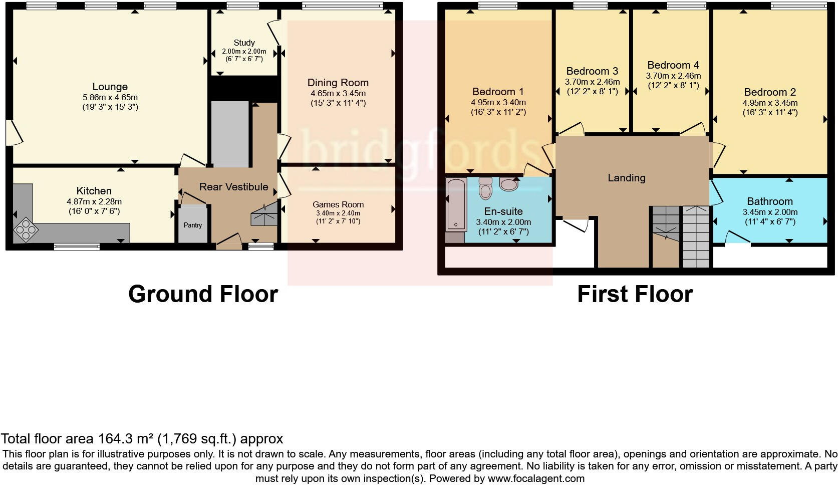
Floorplan
EPC Graphs
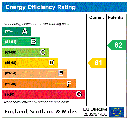
EPC Rating Graph
Price history
| Event | Date | Price | % change |
|---|---|---|---|
| Listed for sale | — | £385,000 | — |
Source: HM Land Registry Price Paid Data. Crown copyright.
Sold Comparables
Same street and nearby sales within 0.25 miles (last 5 years). Data from Land Registry Price Paid.
| Address | Price | Date | Type |
|---|---|---|---|
| 2 ORFORD CLOSE, HIGH LANE, STOCKPORT, GREATER MANCHESTER, SK6 8DS | £395,000 | 23/01/2026 | Detached |
| 3 WOODSIDE DRIVE, HIGH LANE, STOCKPORT, GREATER MANCHESTER, SK6 8HU | £320,000 | 02/12/2025 | Detached |
| 37 HARTINGTON ROAD, DISLEY, STOCKPORT, GREATER MANCHESTER, SK12 2NB | £735,000 | 21/11/2025 | Detached |
| 4 ORFORD CLOSE, HIGH LANE, STOCKPORT, GREATER MANCHESTER, SK6 8DS | £340,000 | 28/07/2025 | Detached |
| 5 ASHBOURNE DRIVE, HIGH LANE, STOCKPORT, GREATER MANCHESTER, SK6 8DB | £415,000 | 18/07/2025 | Detached |
| 9 CARR BROW, HIGH LANE, STOCKPORT, GREATER MANCHESTER, SK6 8EX | £630,000 | 28/01/2025 | Detached |
| 17 THORNWAY, HIGH LANE, STOCKPORT, GREATER MANCHESTER, SK6 8EL | £365,000 | 14/12/2023 | Detached |
| 6 BRAMWAY, HIGH LANE, STOCKPORT, GREATER MANCHESTER, SK6 8EN | £390,000 | 20/10/2023 | Detached |
| 9 DENE WAY, HIGH LANE, STOCKPORT, GREATER MANCHESTER, SK6 8EQ | £412,500 | 29/09/2023 | Detached |
| 8 BROADWOOD CLOSE, DISLEY, STOCKPORT, GREATER MANCHESTER, SK12 2NJ | £585,000 | 23/08/2023 | Detached |
| 196 BUXTON ROAD, DISLEY, STOCKPORT, GREATER MANCHESTER, SK12 2LH | £500,000 | 18/08/2023 | Detached |
| 22 HARTINGTON ROAD, HIGH LANE, STOCKPORT, GREATER MANCHESTER, SK6 8BY | £345,000 | 02/06/2023 | Detached |
| 4 HARTINGTON ROAD, HIGH LANE, STOCKPORT, GREATER MANCHESTER, SK6 8BY | £386,050 | 12/05/2023 | Detached |
| 44 THORNWAY, HIGH LANE, STOCKPORT, GREATER MANCHESTER, SK6 8EL | £460,000 | 12/12/2022 | Detached |
| 20 DOVEDALE CLOSE, HIGH LANE, STOCKPORT, GREATER MANCHESTER, SK6 8DU | £375,000 | 02/11/2022 | Detached |
| 15 HARTINGTON ROAD, HIGH LANE, STOCKPORT, GREATER MANCHESTER, SK6 8BY | £465,000 | 31/10/2022 | Detached |
| 30 ASHBOURNE DRIVE, HIGH LANE, STOCKPORT, GREATER MANCHESTER, SK6 8DB | £420,000 | 17/10/2022 | Detached |
| 17 DOVEDALE CLOSE, HIGH LANE, STOCKPORT, GREATER MANCHESTER, SK6 8DU | £435,000 | 23/09/2022 | Detached |
| 27A ANDREW LANE, HIGH LANE, STOCKPORT, GREATER MANCHESTER, SK6 8HX | £552,500 | 22/08/2022 | Detached |
| 19 THORNWAY, HIGH LANE, STOCKPORT, GREATER MANCHESTER, SK6 8EL | £560,000 | 12/08/2022 | Detached |
| Same street 143 BUXTON ROAD, HIGH LANE, STOCKPORT, GREATER MANCHESTER, SK6 8DY | £219,000 | 19/07/2021 | Terraced |
Street average: £219,000 (1 sale)
Area average: £454,303 (20 sales)
Capital growth trend
Land Registry outcode average: last 12 months vs 5y and 10y ago (from sold prices).
House Price Index (HM Land Registry — official index, not sold-price averages): Stockport. Series: Detached. As of March 2026.
Rental Range
Estimated market rent for Stockport. Low = conservative, Realistic = average, Optimistic = best case.
Based on Local Authority from postcode lookup → Stockport.
LHA (30th percentile) floor for Oldham & Rochdale: £947/mo (Apr 2025 – Mar 2026)
Location
Address
145 Buxton Road
Nearby
Nearest stations, universities and amenities (distance from property).
| Type | Name | Distance |
|---|---|---|
| Bus stop | High Lane, Buxton Road / near Andrews Lane | 0.0 miles |
| Shop | Cowburn's Family Bakery | 0.1 miles |
| Bus stop | High Lane, Buxton Road / near Carr Brow | 0.1 miles |
| Shop | HLG High Lane | 0.1 miles |
| Train station | Middlewood | 0.8 miles |
| Train station | Disley | 1.1 miles |
| Hospital | Newlands Care Home | 6.4 miles |
| Hospital | Rosemount Resource Centre | 7.9 miles |
| University | Fallowfield Reception and Richmond Amenities Building | 8.2 miles |
| University | University of Derby, Buxton | 9.5 miles |
Street-level crime
| Category | Count |
|---|---|
| Burglary | 1 |
| Total incidents | 1 |
Within 1 mile during Apr 2026. Source: data.police.uk (England & Wales).
Schools nearby
Nearest open schools with Ofsted ratings (England). Closed schools are not shown. Data from Get Information about Schools and Ofsted.
| Name | Type | Distance | Ofsted |
|---|---|---|---|
| High Lane Primary School | Primary | 0.2 miles | Good — 27 Jan 2014 |
| Brookside Primary School | Primary | 0.3 miles | Requires improvement — 26 Jul 2023 |
| Windlehurst School | Other | 1.1 miles | Good — 28 Apr 2022 |
| Disley Primary School | Primary | 1.3 miles | Good — 24 Nov 2011 |
| Hague Bar Primary School | Primary | 1.6 miles | Good — 22 Apr 2013 |
Rental Comparables
Loading rental comparables for this postcode. Refresh in a few minutes.
Rent-driven metrics
Based on Area rent estimate.
- Rent ratio — Monthly rent ÷ purchase price (1% rule). 1%+ = strong, 0.8–1% = okay, <0.8% = weak for cashflow.
- Max investor price — Rent ÷ 0.8%; the price at which rent would be 0.8% of price (Stoke-style target).
- Target investor price — Rent ÷ 1%; the price at which rent would be 1% of price (strong cashflow band).
- Gross yield — Annual rent as % of purchase price (no costs).