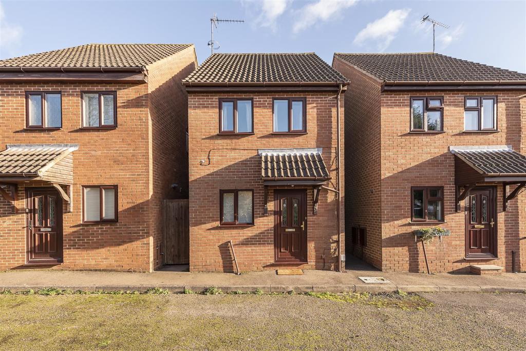
3 THE CHENNIES
HARPENDEN, HERTFORDSHIRE AL5 1AS
Property details
Tenure
FREEHOLD
Floor area
54 m²
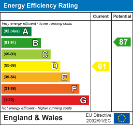
EPC rating
D
Last sold
£345,000 Nov 2023
Price per m²
£6,481/m²
Local average
£1,453,261 (-75.9%)
Deprivation
Decile 9 (30,066 of 33,755)
Street crime
69 incidents within 1 mile (Apr 2026)
Key features
- Built circa 20 years ago
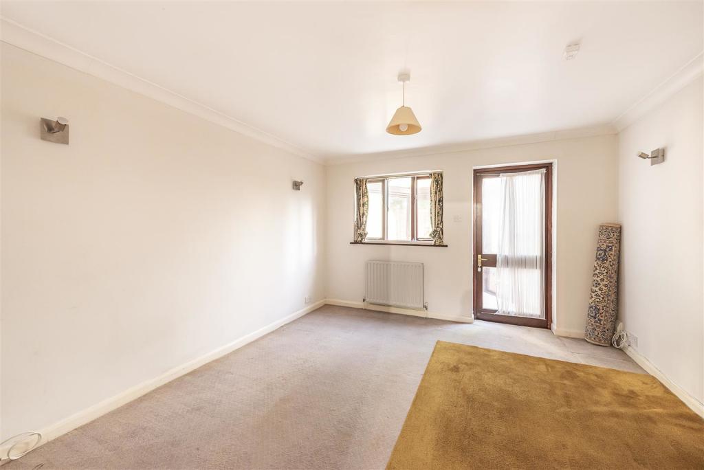
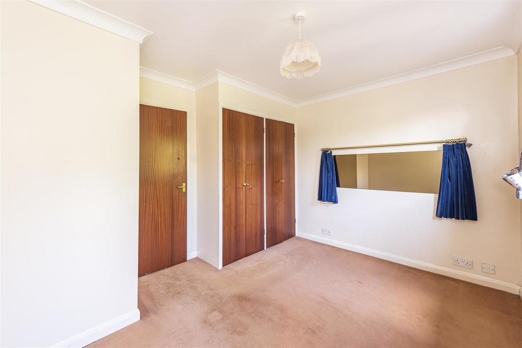
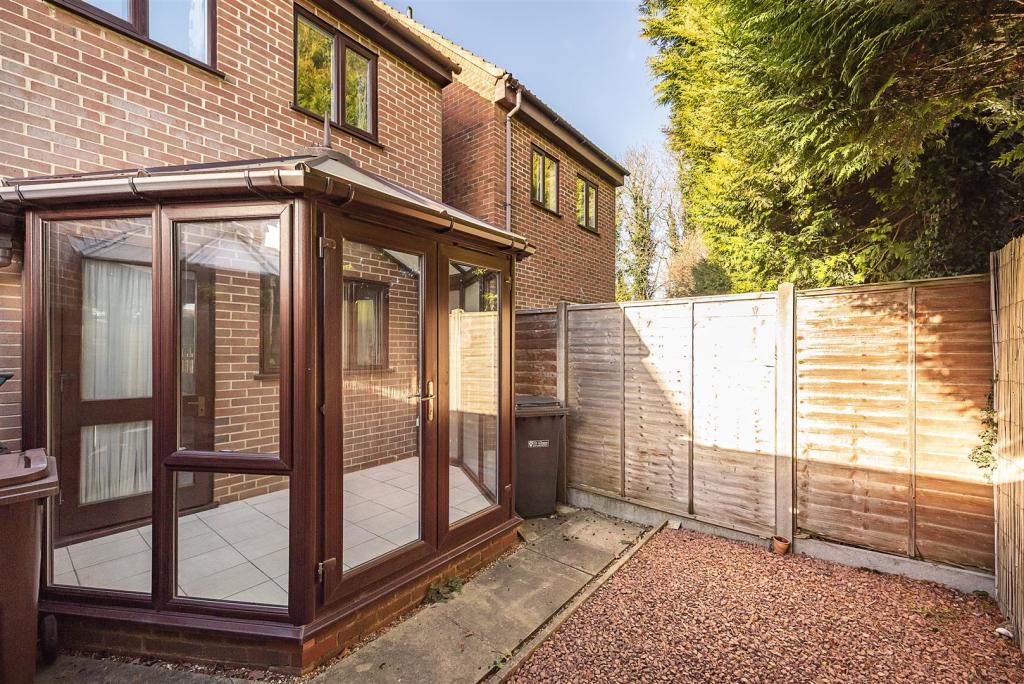
- Living Room plus Conservatory
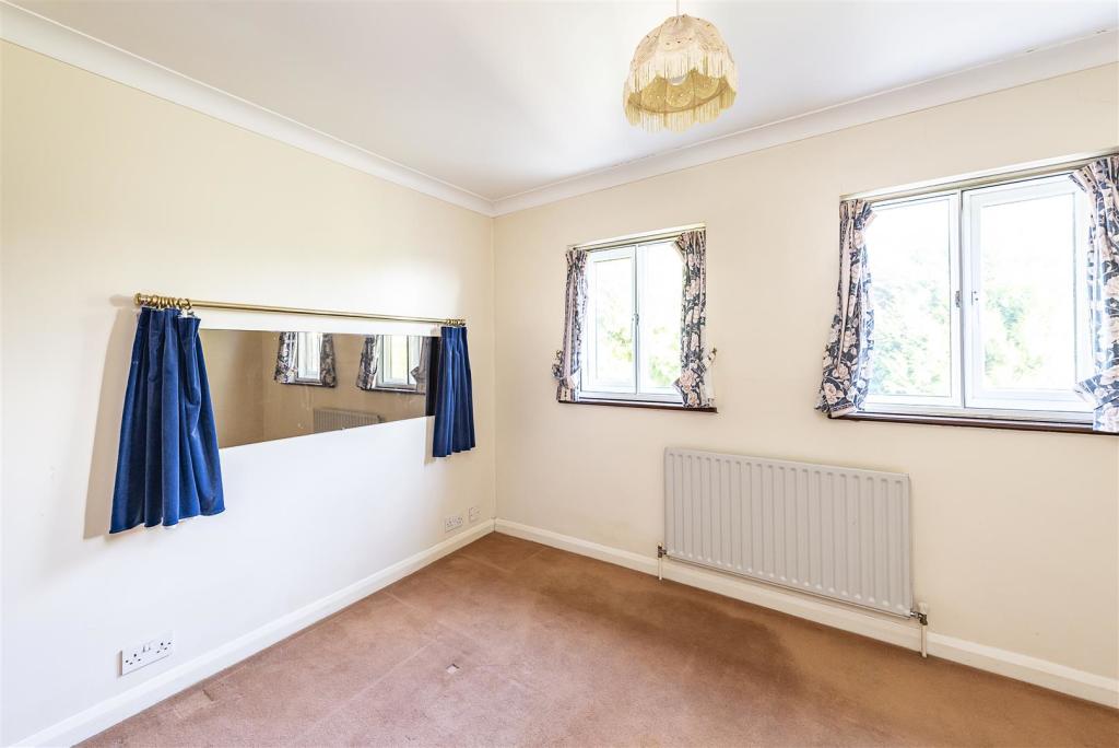
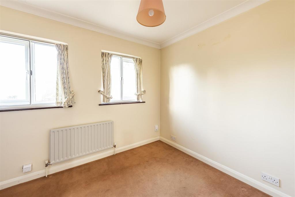
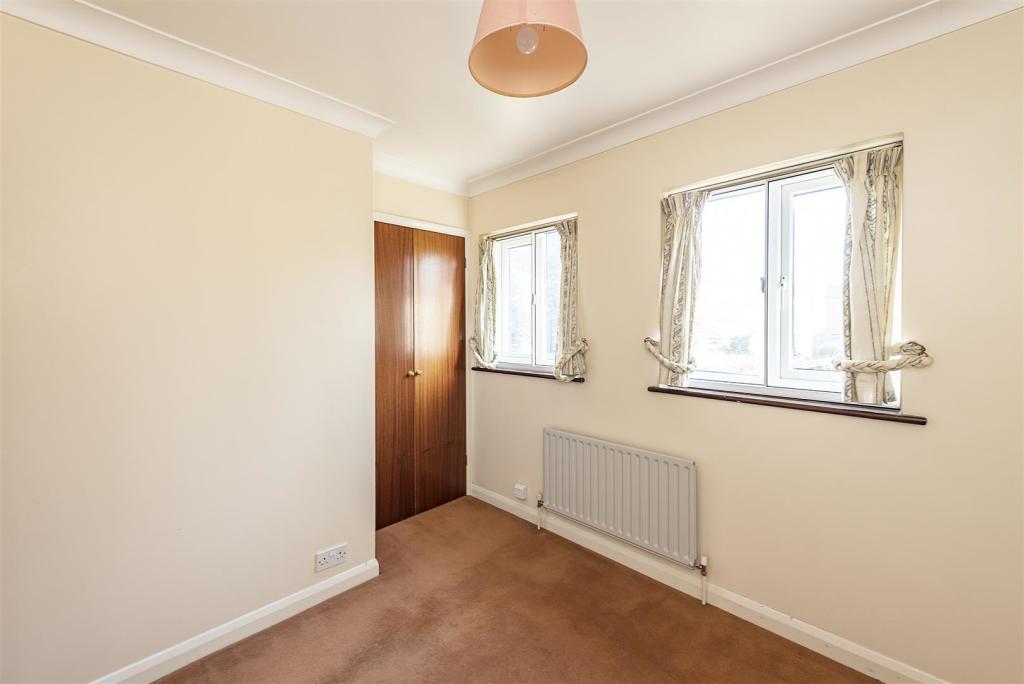
- Two Bedrooms
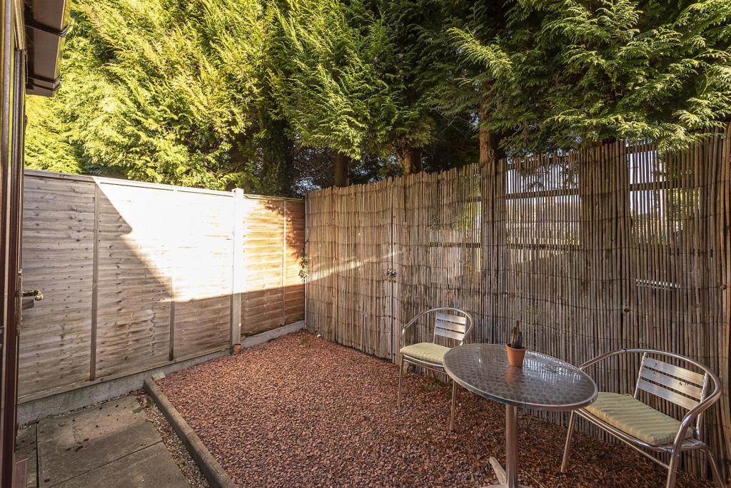
- Courtyard garden
- Garage en bloc
- Close to amenities of Southdown
- Walking distance to station
- Chain Free
Additional details
- Parking
- Yes
- Garden
- Yes
Description
Entrance Hall -
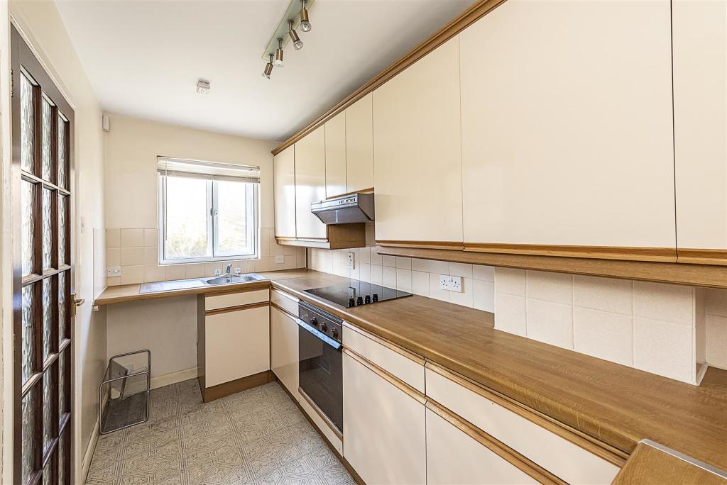
Kitchen - 3.56 x 1.75 (11'8" x 5'8") -
Living Room - 3.97 x 3.55 (13'0" x 11'7") -
Conservatory -
Cloakroom -
Bedroom One - 3.07 (max) x 3.55 (10'0" (max) x 11'7") -
Bedroom Two - 2.48 x 2.60 (8'1" x 8'6") -
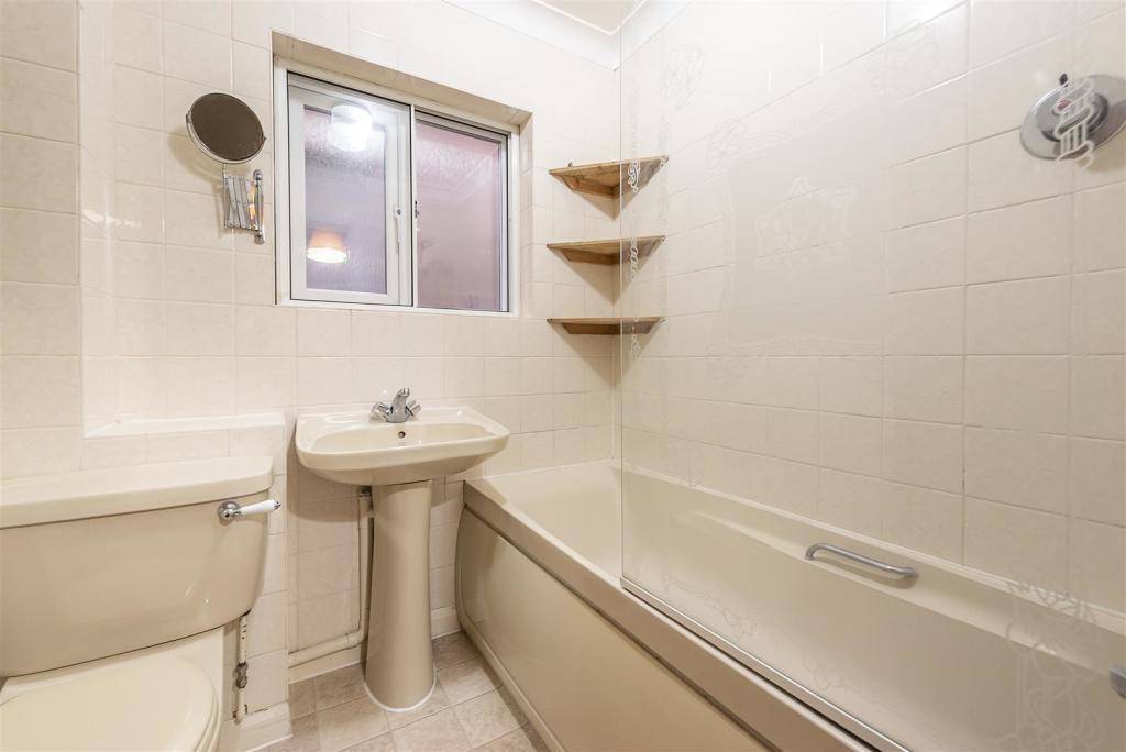
Bathroom -
Listed by
Harpenden
Whittaker & Co
Reference: 130825829
EPC Rating & Upgrade Cost
Current rating: D
Potential rating: B
Inspection date: 13/01/2023
Expiry date: 12/01/2033
Current heating cost: £504/year
Potential heating cost: £374/year
Est. upgrade cost to C: £17,523
Recommendations
- Floor insulation (solid floor) (£4,000 - £6,000)
- Add additional 80 mm jacket to hot water cylinder (£15 - £30)
- Upgrade heating controls (£350 - £450)
- Replace boiler with new condensing boiler (£2,200 - £3,000)
- Solar water heating (£4,000 - £6,000)
- Solar photovoltaic panels, 2.5 kWp (£3,500 - £5,500)
Flood risk
Zone: 1
Risk: Low
Job (default Low)
Floorplans

3 The Chennies, Harpenden (1).JPG
EPC Graphs
EE Rating
Price history
| Event | Date | Price | % change |
|---|---|---|---|
| Sold | 14/11/2023 (2 years ago) | £345,000 | — |
Source: HM Land Registry Price Paid Data. Crown copyright.
Sold Comparables
Same street and nearby sales within 0.25 miles (last 5 years). Data from Land Registry Price Paid.
| Address | Price | Date | Type |
|---|---|---|---|
| 15 FOVANT CLOSE, HARPENDEN, ST ALBANS, HERTFORDSHIRE, AL5 1RN | £580,000 | 20/01/2026 | Detached |
| 128 EASTMOOR PARK, HARPENDEN, ST ALBANS, HERTFORDSHIRE, AL5 1BP | £1,110,000 | 12/02/2025 | Detached |
| 15 EASTMOOR PARK, HARPENDEN, ST ALBANS, HERTFORDSHIRE, AL5 1BN | £885,000 | 11/08/2023 | Detached |
| 18 TARRANT DRIVE, HARPENDEN, ST ALBANS, HERTFORDSHIRE, AL5 1RP | £695,000 | 14/12/2022 | Detached |
| 15 TARRANT DRIVE, HARPENDEN, ST ALBANS, HERTFORDSHIRE, AL5 1RP | £665,000 | 12/10/2022 | Detached |
| 80 EASTMOOR PARK, HARPENDEN, ST ALBANS, HERTFORDSHIRE, AL5 1BP | £1,200,100 | 23/09/2022 | Detached |
| 5 FOVANT CLOSE, HARPENDEN, ST ALBANS, HERTFORDSHIRE, AL5 1RN | £660,000 | 20/07/2022 | Detached |
| 14 CRANBOURNE DRIVE, HARPENDEN, ST ALBANS, HERTFORDSHIRE, AL5 1RL | £700,000 | 14/04/2022 | Detached |
| 45 BROADSTONE ROAD, HARPENDEN, ST ALBANS, HERTFORDSHIRE, AL5 1RD | £730,000 | 22/03/2022 | Detached |
| 10 MAGNA CLOSE, HARPENDEN, ST ALBANS, HERTFORDSHIRE, AL5 1RH | £820,000 | 28/02/2022 | Detached |
| 21 EAST COMMON, HARPENDEN, ST ALBANS, HERTFORDSHIRE, AL5 1BJ | £1,100,000 | 14/01/2022 | Detached |
| 51 EASTMOOR PARK, HARPENDEN, ST ALBANS, HERTFORDSHIRE, AL5 1BN | £900,000 | 07/12/2021 | Detached |
| WOODLANDS EAST COMMON, HARPENDEN, ST ALBANS, HERTFORDSHIRE, AL5 1DG | £2,700,000 | 12/11/2021 | Detached |
| 73 CRAVELLS ROAD, HARPENDEN, ST ALBANS, HERTFORDSHIRE, AL5 1BH | £685,000 | 09/07/2021 | Detached |
| 9 EASTMOOR PARK, HARPENDEN, ST ALBANS, HERTFORDSHIRE, AL5 1BN | £500,000 | 29/06/2021 | Detached |
Area average: £928,673 (15 sales)
Capital growth trend
Land Registry outcode average: last 12 months vs 5y and 10y ago (from sold prices).
House Price Index (HM Land Registry — official index, not sold-price averages): St Albans. Series: Detached. As of March 2026.
Company ownership
Registered legal owner is a company.
Company: AQUACARE INTERNATIONAL FOUNDATION
Rental Range
Estimated market rent for St Albans. Low = conservative, Realistic = average, Optimistic = best case.
Based on Local Authority from postcode lookup → St Albans.
LHA (30th percentile) floor for Luton: £873/mo (Apr 2025 – Mar 2026)
Location
Nearby
Nearest stations, universities and amenities (distance from property).
| Type | Name | Distance |
|---|---|---|
| Shop | Harpenden Cycles | 0.2 miles |
| Shop | Studio 117 | 0.2 miles |
| Bus stop | Queens Road | 0.2 miles |
| Bus stop | Unknown | 0.2 miles |
| Train station | Harpenden | 0.8 miles |
| Hospital | Harpenden Memorial Hospital | 1.1 miles |
| Hospital | Spire Hospital | 1.8 miles |
| Train station | St Albans City | 3.8 miles |
| University | Unknown | 5.2 miles |
| University | University Of Bedfordshire | 5.7 miles |
Street-level crime
| Category | Count |
|---|---|
| Violence and sexual offences | 14 |
| Shoplifting | 13 |
| Anti-social behaviour | 9 |
| Criminal damage and arson | 7 |
| Vehicle crime | 7 |
| Other theft | 6 |
| Burglary | 5 |
| Other crime | 2 |
| Public order | 2 |
| Robbery | 2 |
| Bicycle theft | 1 |
| Drugs | 1 |
| Total incidents | 69 |
Within 1 mile during Apr 2026. Source: data.police.uk (England & Wales).
Schools nearby
Nearest open schools with Ofsted ratings (England). Closed schools are not shown. Data from Get Information about Schools and Ofsted.
| Name | Type | Distance | Ofsted |
|---|---|---|---|
| The Grove Junior School | Primary | 0.4 miles | Good — 15 Apr 2013 |
| The Grove Infant and Nursery School | Primary | 0.4 miles | Outstanding — 17 Dec 2023 |
| St Dominic Catholic Primary School | Primary | 0.6 miles | Outstanding — 18 Jan 2024 |
| High Beeches Primary School | Primary | 0.7 miles | Outstanding — 26 Apr 2017 |
| Aldwickbury School | Other | 0.8 miles | — (No rating) |
Rental Comparables
Rental listings exist nearby, but none matched the 2-bedroom count for this property.
Rent-driven metrics
Based on Area rent estimate.
- Rent ratio — Monthly rent ÷ purchase price (1% rule). 1%+ = strong, 0.8–1% = okay, <0.8% = weak for cashflow.
- Max investor price — Rent ÷ 0.8%; the price at which rent would be 0.8% of price (Stoke-style target).
- Target investor price — Rent ÷ 1%; the price at which rent would be 1% of price (strong cashflow band).
- Gross yield — Annual rent as % of purchase price (no costs).