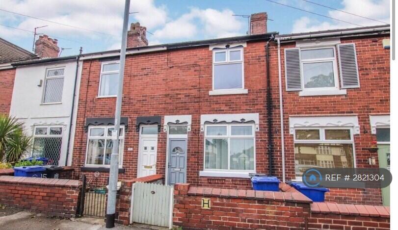
Basford Park Road
Newcastle-Under-Lyme, ST5, ST5 0PS
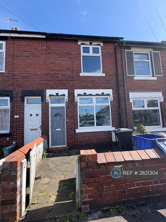
Property details
Deprivation
Decile 8 (25,661 of 33,755)
Street crime
326 incidents within 1 mile (Apr 2026)
Key features
- No Agent Fees
- Students Can Enquire
- Property Reference Number: 2821304
Description
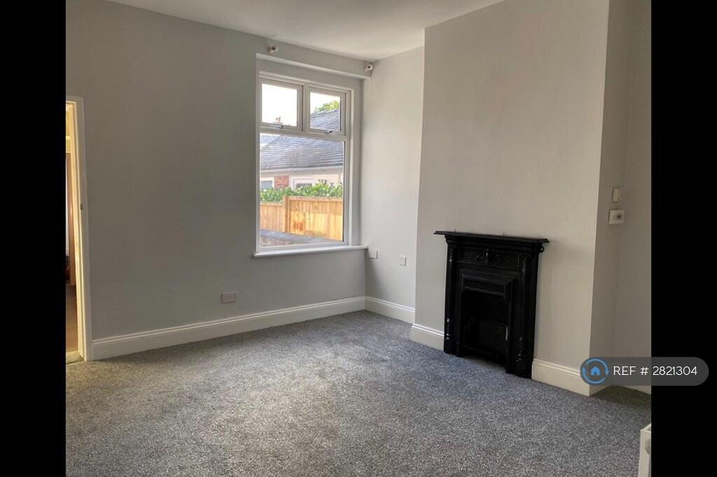
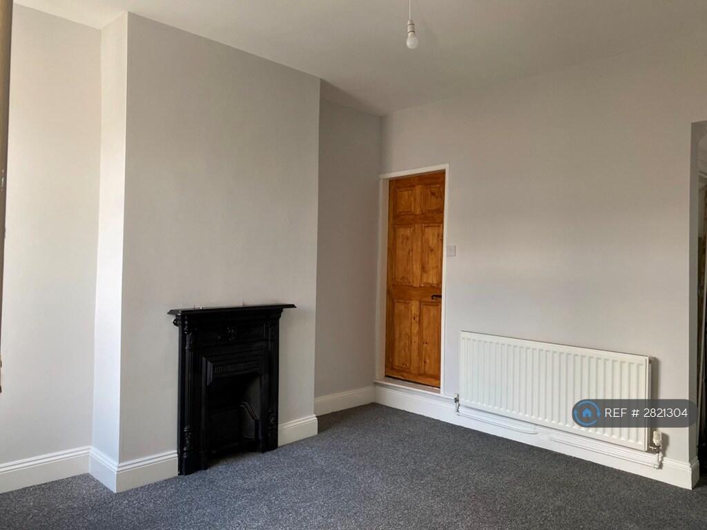
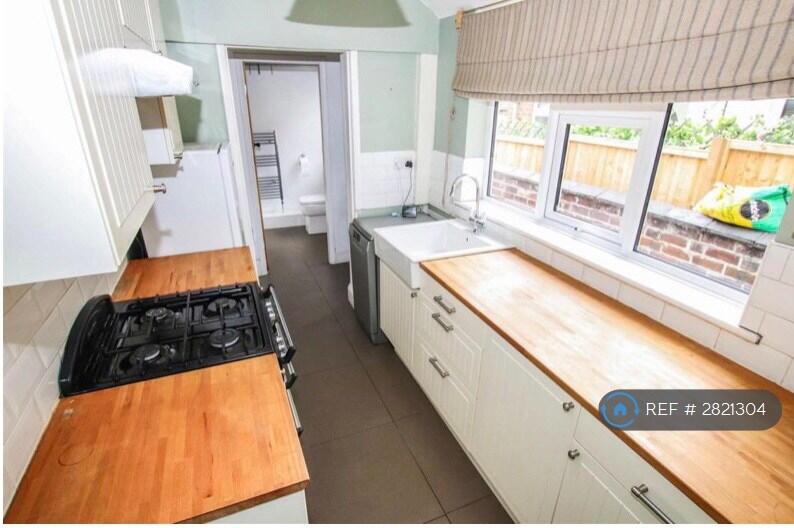
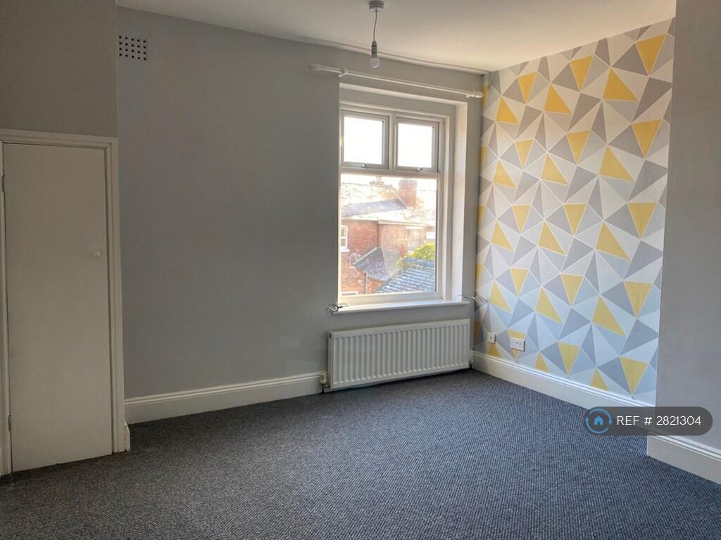
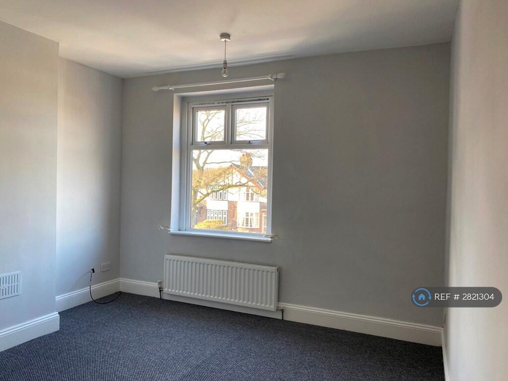
We are proud to offer this delightful 2 bedroom, 1 bathroom terraced house in a great location.
Available to move in from 16 April 2026. Property is offered unfurnished.
Viewing highly recommended. Contact OpenRent today for more details or to arrange a viewing!
Summary
Rent £795.00 per month (£183.46 per week)
Deposit / Bond is £917.30
Minimum tenancy is 6 months
Maximum number of tenants is 2
Summary & Exclusions:
- Rent Amount: £795.00 per month (£183.46 per week)
- Deposit / Bond: £917.30
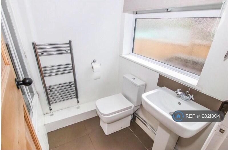
- 2 Bedrooms
- 1 Bathrooms
- Property comes unfurnished
- Available to move in from 16 April 2026
- Minimum tenancy term is 6 months
- Maximum number of tenants is 2
- Students welcome to enquire
- No Pets, sorry
- No Smokers
- Family Friendly
- Bills not included
- No Parking Available
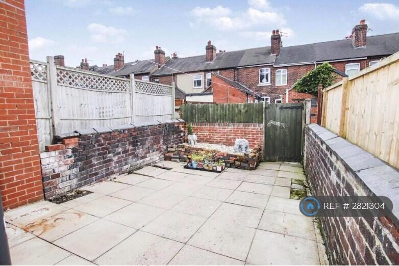
- No Garden Access
- EPC Rating: Currently Being Obtained
If calling, please quote reference: 2821304
Fees:
You will not be charged any admin fees.
Contact today to book a viewing and have the landlord show you round!
Request Details form responded to 24/7, with phone bookings available 9am-9pm, 7 days a week.
Listed by
London
Techbeard Ltd
Reference: 173275934
EPC ratings on this postcode
We don't have a matched EPC for this property yet. Below are efficiency scores and details for other addresses on this postcode.
| Address | Current | Potential | Floor area | Age band | Type |
|---|---|---|---|---|---|
| 101 Basford Park Road, NEWCASTLE | 70 | 80 | 65 m² | England and Wales: 1900-1929 | Terraced |
| 103, Basford Park Road | 58 | 83 | 72 m² | England and Wales: 1900-1929 | House |
| 103, Basford Park Road | 48 | 61 | 85 m² | England and Wales: 1900-1929 | House |
| 103, Basford Park Road, NEWCASTLE | 58 | 83 | 72 m² | England and Wales: 1900-1929 | Terraced |
| 105 Basford Park Road | 73 | 87 | 73 m² | England and Wales: 1930-1949 | House |
| 105 Basford Park Road, NEWCASTLE | 73 | 87 | 73 m² | England and Wales: 1930-1949 | Terraced |
| 105, Basford Park Road | 21 | 65 | 67 m² | England and Wales: 1900-1929 | House |
| 105, Basford Park Road, NEWCASTLE | 21 | 65 | 67 m² | England and Wales: 1900-1929 | Terraced |
| 107 Basford Park Road | 53 | 75 | 71 m² | England and Wales: 1930-1949 | House |
| 107 Basford Park Road, NEWCASTLE | 53 | 75 | 71 m² | England and Wales: 1930-1949 | Terraced |
| 107, Basford Park Road | 46 | 79 | 79 m² | England and Wales: 1930-1949 | House |
| 107, Basford Park Road, NEWCASTLE | 46 | 79 | 79 m² | England and Wales: 1930-1949 | Terraced |
| 109 Basford Park Road | 67 | 80 | 90 m² | England and Wales: 1930-1949 | House |
| 109 Basford Park Road, NEWCASTLE | 67 | 80 | 90 m² | England and Wales: 1930-1949 | Detached |
| 109, Basford Park Road | 71 | 71 | 102 m² | England and Wales: 1930-1949 | House |
Flood risk
Zone: 1
Risk: Low
Job (default Low)
Rental Range
Estimated market rent for Newcastle-under-Lyme. Low = conservative, Realistic = average, Optimistic = best case.
Based on Local Authority from postcode lookup → Newcastle-under-Lyme.
LHA (30th percentile) floor for Staffordshire North: £479/mo (Apr 2025 – Mar 2026)
Location
Address
Basford Park Road
Nearby
Nearest stations, universities and amenities (distance from property).
| Type | Name | Distance |
|---|---|---|
| Bus stop | Bleak Street | 0.0 miles |
| Bus stop | May Avenue | 0.1 miles |
| Shop | Morrisons Daily | 0.1 miles |
| Hospital | Hartshill Medical Centre | 0.8 miles |
| Hospital | North Staffordshire Hospital | 1.0 miles |
| Train station | Longport | 1.4 miles |
| University | University of Staffordshire Stoke Campus | 1.6 miles |
| Train station | Stoke-on-Trent | 1.6 miles |
Street-level crime
| Category | Count |
|---|---|
| Violence and sexual offences | 99 |
| Anti-social behaviour | 64 |
| Public order | 34 |
| Shoplifting | 22 |
| Other theft | 21 |
| Criminal damage and arson | 19 |
| Burglary | 16 |
| Drugs | 16 |
| Vehicle crime | 14 |
| Other crime | 9 |
| Possession of weapons | 6 |
| Robbery | 3 |
| Theft from the person | 2 |
| Bicycle theft | 1 |
| Total incidents | 326 |
Within 1 mile during Apr 2026. Source: data.police.uk (England & Wales).
Schools nearby
Nearest open schools with Ofsted ratings (England). Closed schools are not shown. Data from Get Information about Schools and Ofsted.
| Name | Type | Distance | Ofsted |
|---|---|---|---|
| May Bank Infants' School | Primary | 0.1 miles | Good — 21 Jan 2024 |
| St Wulstan's Catholic Primary School | Primary | 0.5 miles | Good — 19 Jul 2013 |
| St Margaret's CofE (VC) Junior School | Primary | 0.5 miles | Good — 1 May 2014 |
| Lyme Brook Independent School | Other | 0.5 miles | Good — 22 Oct 2023 |
| The Orme Academy | Secondary | 0.6 miles | Good — 9 Jul 2024 |
Rental Comparables
Residential lets from OpenRent and Rightmove for the area (same bedroom count). Use to validate rent estimates. Student lets are excluded.
Average rent: £862/mo (53 listings)
Enter House Number
Enter the house number to help us retrieve more accurate pricing history and property data.
Please log in to submit or correct the house number for this listing.
Log in to continue