22 WEDGEWOOD DRIVE
WIDNES, HALTON WA8 9RJ
£250,000
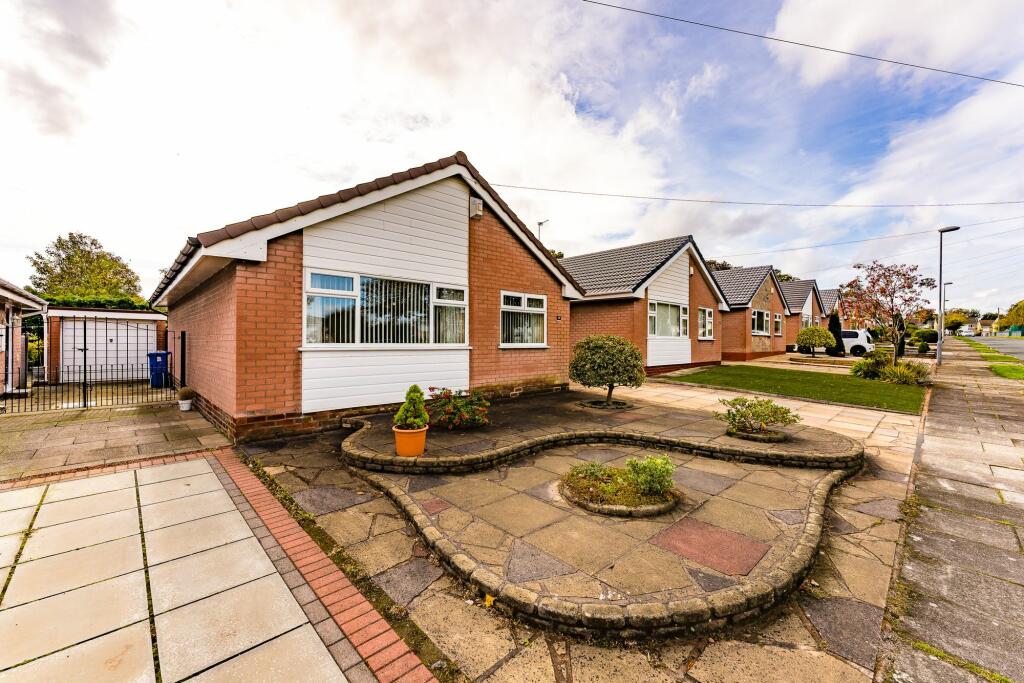
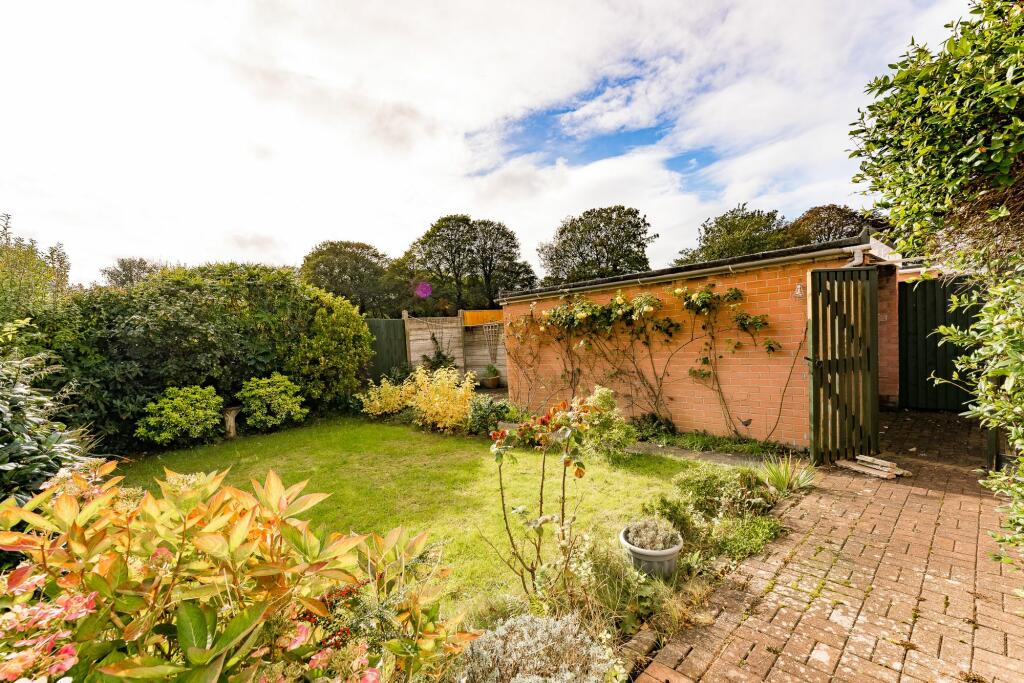
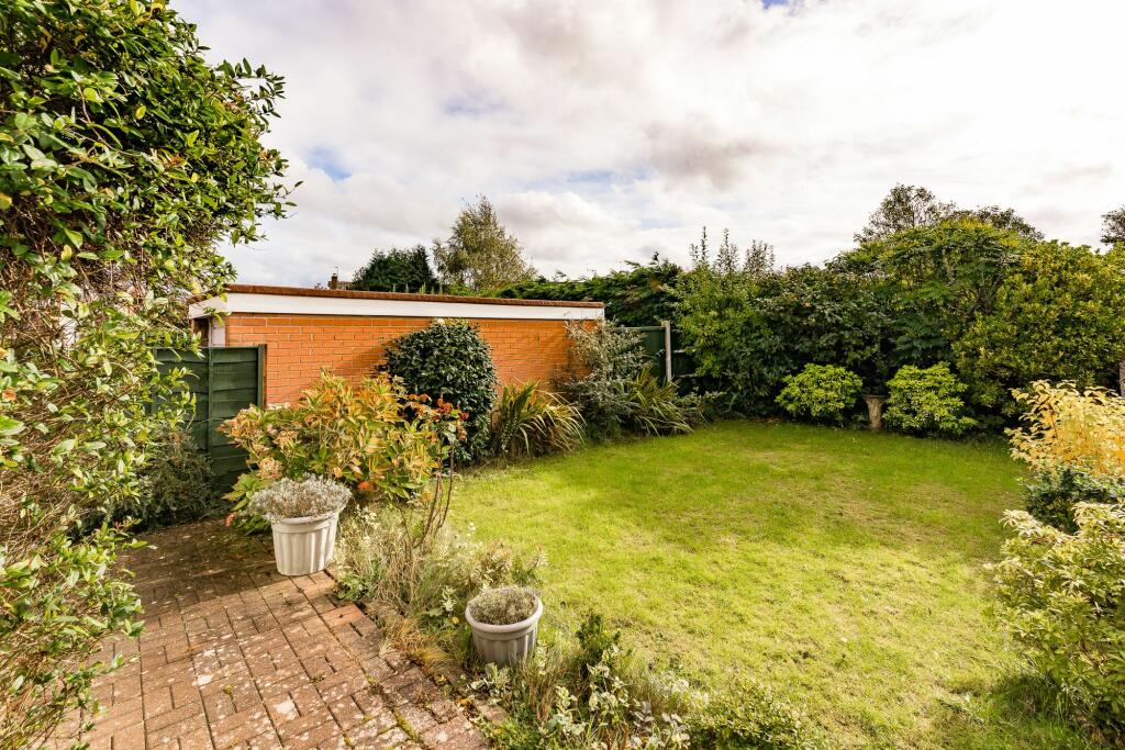
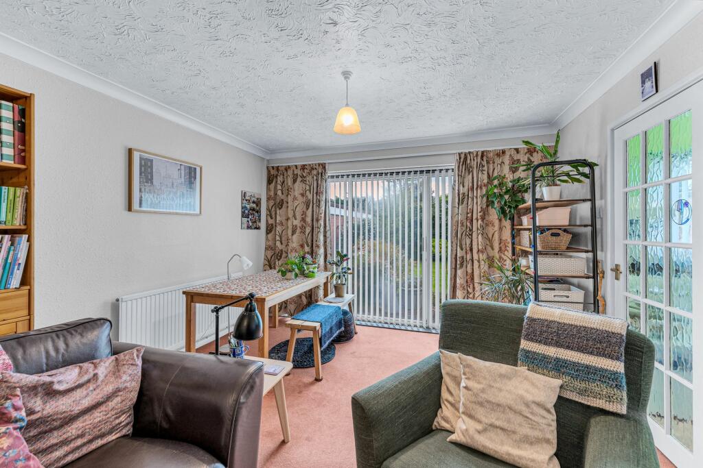
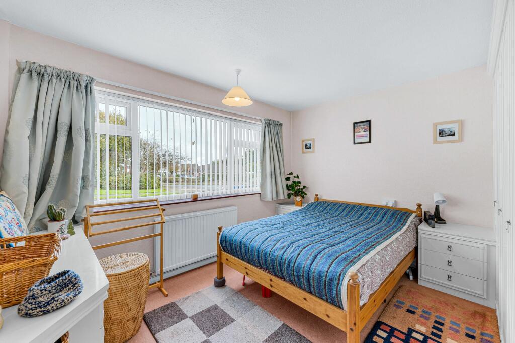
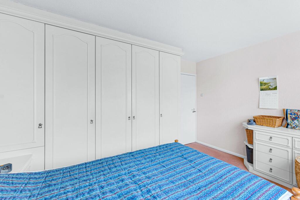

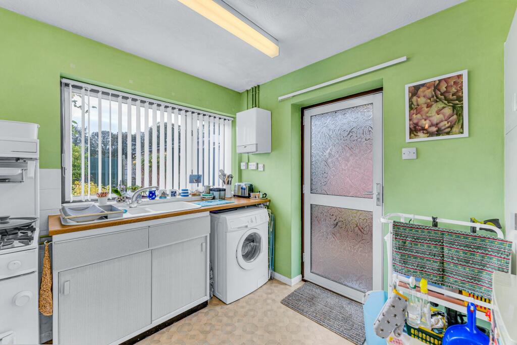
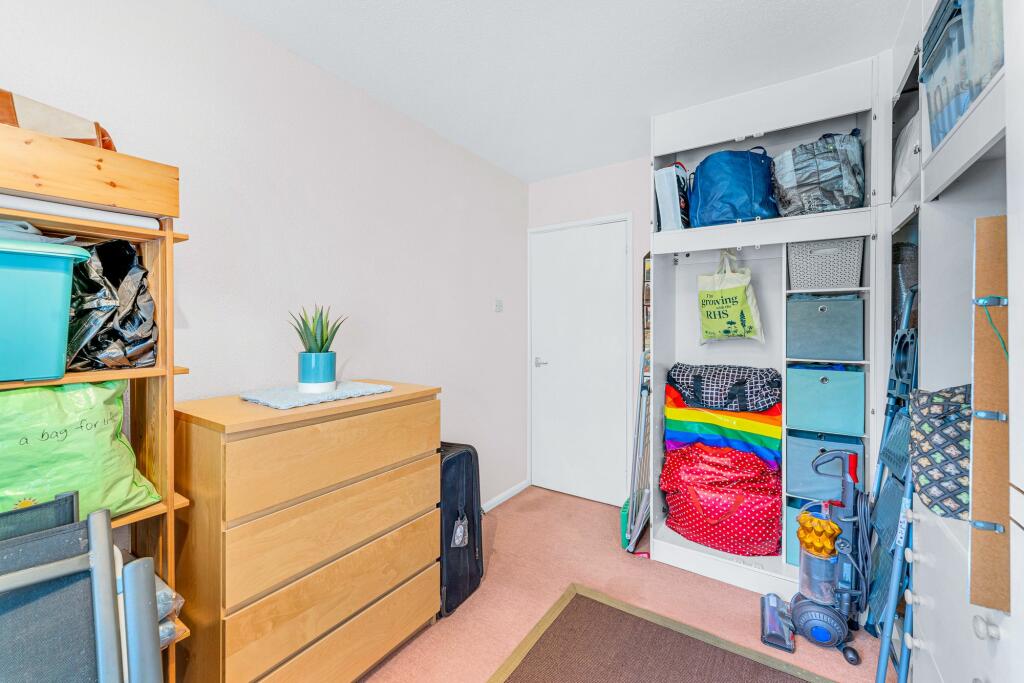
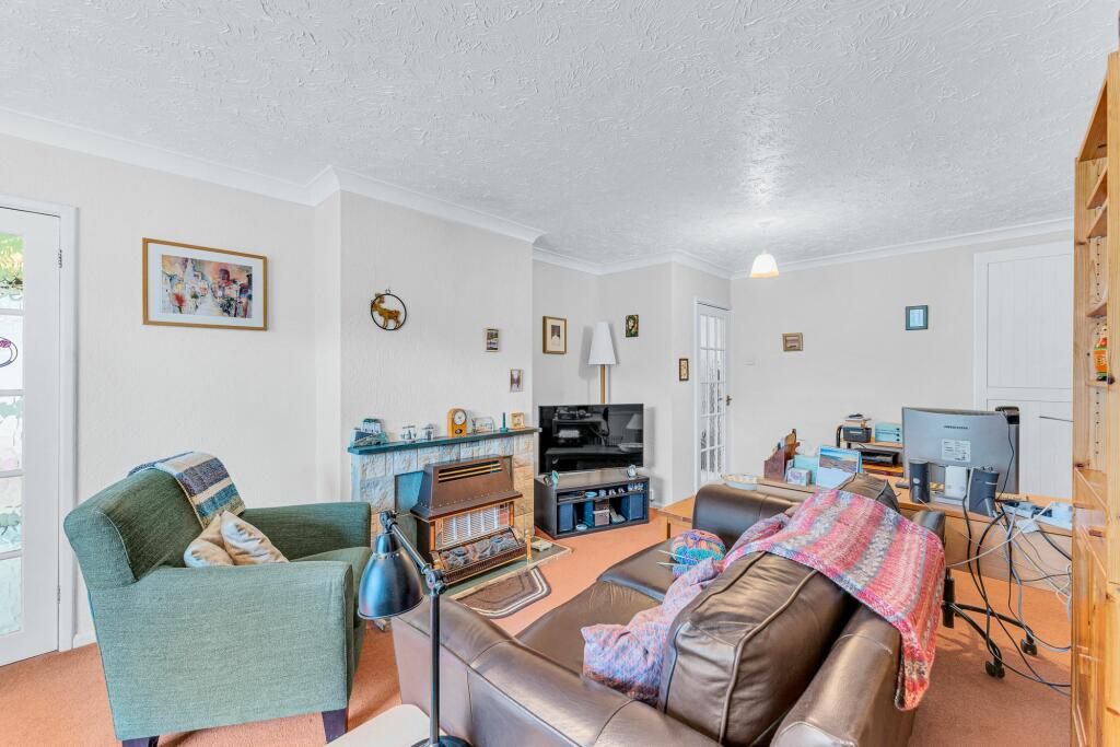
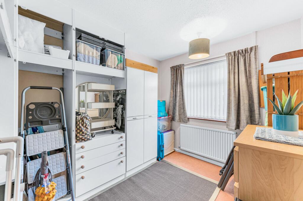
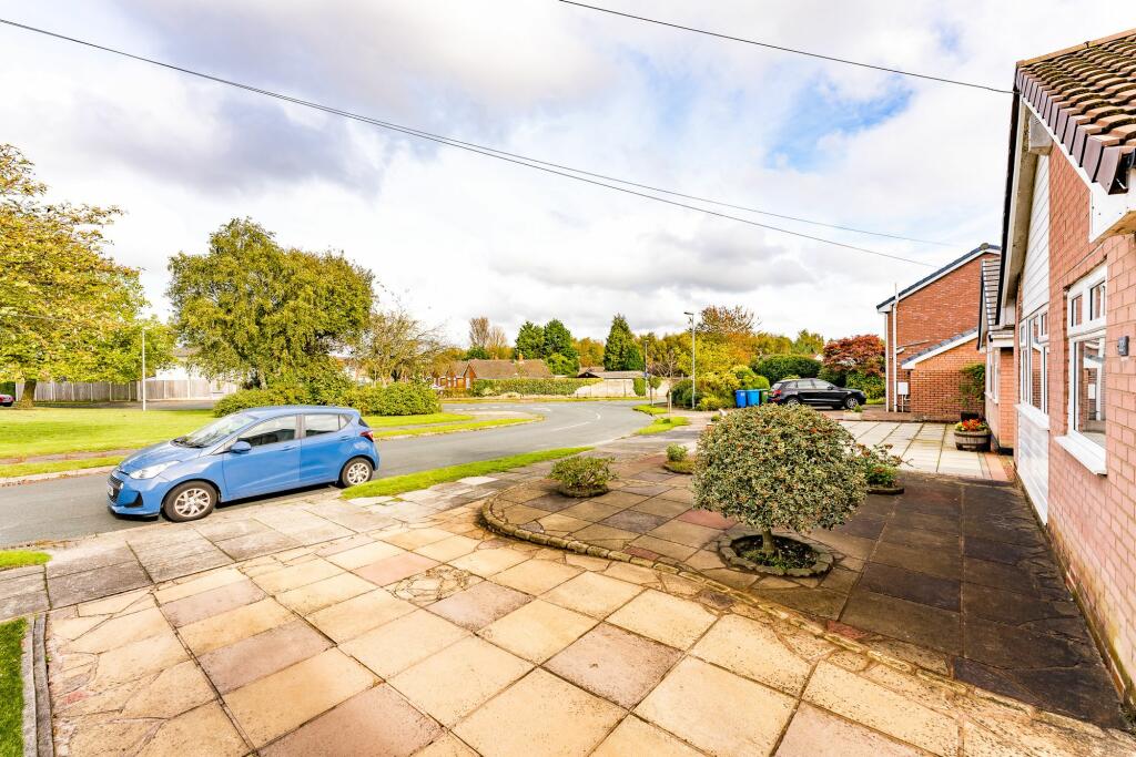
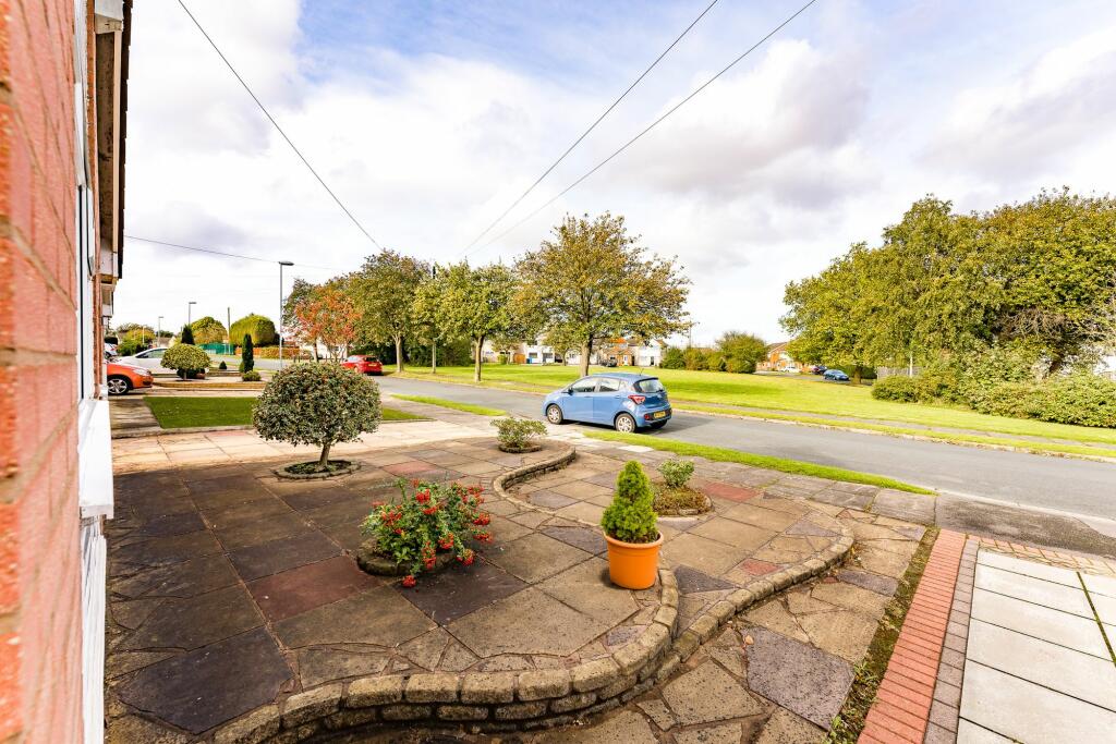
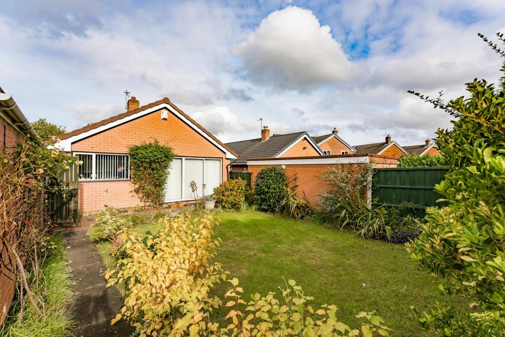
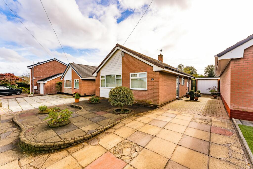
Photo 1 Photo 2 Photo 3 Photo 4 Photo 5 Photo 6 Photo 7 Photo 8 Photo 9 Photo 10 Photo 11 Photo 12 Photo 13 Photo 14 Photo 15 Photo 16
/ 16
Property details
Tenure
FREEHOLD
Floor area
63 m²
Council tax band
C
EPC rating
D
Year built
England and Wales: 1967-1975
Last sold
£260,000 Feb 2024
Price per m²
£3,968/m²
Local average
£190,000 (+31.6%)
Deprivation
Decile 10 (31,258 of 33,755)
Street crime
91 incidents within 1 mile (Mar 2026)
Additional details
- Parking
- Yes
- Garden
- Yes
Description
Step inside, and the bright and cozy atmosphere will welcome you. The bungalow offers two spacious double bedrooms, both with plenty of natural light and ample space for all your furnishings. The family bathroom features a modern suite and is fitted with quality fixtures and fittings.
The kitchen features ample counterspace and storage units, with all the features one might need. This leads to a spacious lounge/diner, ideal for multiple use as an office or craft room whilst overlooking the garden offering direct access to the garden via a sliding door, making indoor-outdoor living a breeze.
Outside, the generous gardens provide plenty of space for relaxation and outdoor activities. The bungalow offers a secure garage and a large driveway providing ample off-street parking.
In summary, this two-bedroom detached bungalow situated in one of the area's most popular locations is a rare gem. Call us today to arrange a viewing and experience the beauty of this breathtaking property firsthand!
EPC Rating: D
Listed by
Widnes
Ashtons Estate Agency
Reference: 143450996
EPC Rating & Upgrade Cost
Current rating: D
Potential rating: B
Inspection date: 04/05/2016
Current heating cost: £533/year
Potential heating cost: £416/year
Est. upgrade cost to C: £19,525
Recommendations
- Floor insulation (solid floor) (£4,000 - £6,000)
- Low energy lighting for all fixed outlets (£25)
- Upgrade heating controls (£350 - £450)
- Replace boiler with new condensing boiler (£2,200 - £3,000)
- Solar water heating (£4,000 - £6,000)
- Solar photovoltaic panels, 2.5 kWp (£5,000 - £8,000)
Flood risk
Zone: 1
Risk: Low
Job (default Low)
Floorplans
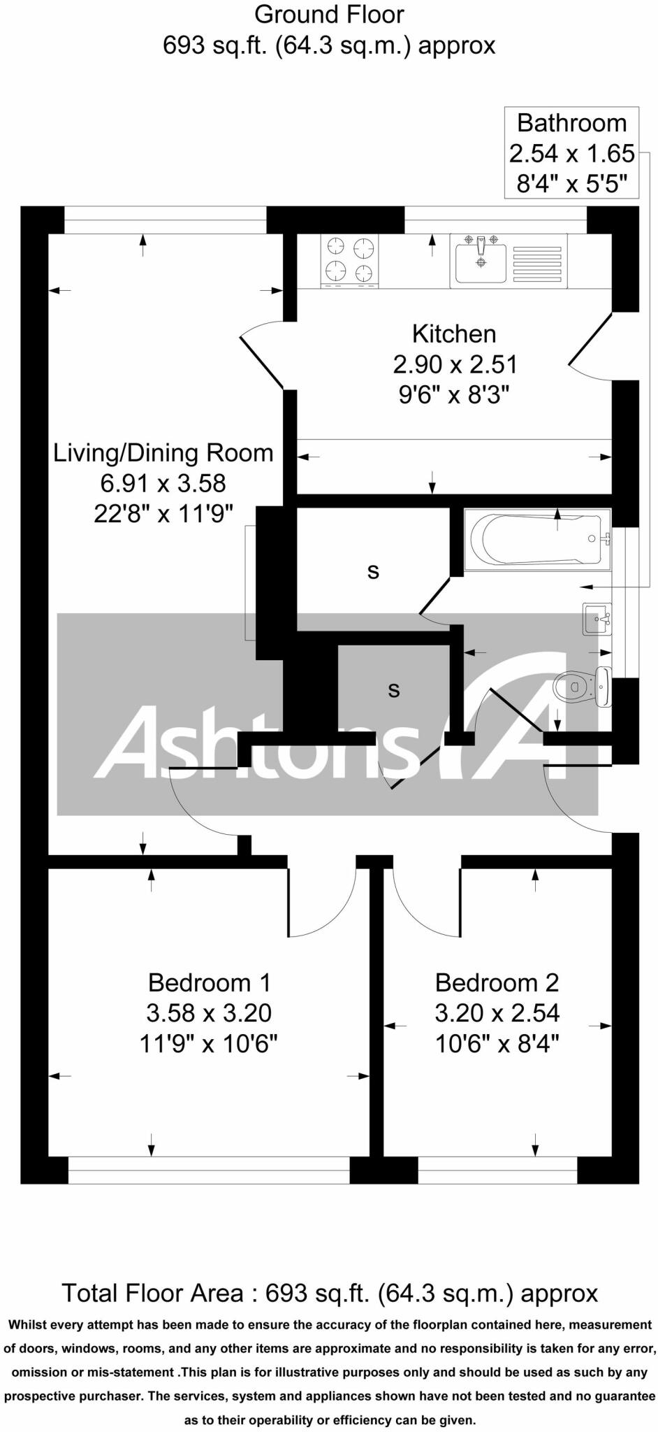
Floorplan 1
Price history
68% since 2017
| Event | Date | Price | % change |
|---|---|---|---|
| Sold | 28/02/2024 (2 years ago) | £260,000 | +67.7% |
| Sold | 11/01/2017 (9 years ago) | £155,000 | — |
Source: HM Land Registry Price Paid Data. Crown copyright.
Sold Comparables
Same street and nearby sales within 0.25 miles (last 5 years). Data from Land Registry Price Paid.
| Address | Price | Date | Type |
|---|---|---|---|
| 31 EASTBURY CLOSE, WIDNES, HALTON, WA8 9WW | £190,000 | 21/09/2023 | Other |
| Same street 24 WEDGEWOOD DRIVE, WIDNES, HALTON, WA8 9RJ | £365,000 | 28/04/2023 | Detached |
Street average: £365,000 (1 sale)
Area average: £190,000 (1 sale)
Capital growth trend
Land Registry outcode average: last 12 months vs 5y and 10y ago (from sold prices).
House Price Index (HM Land Registry — official index, not sold-price averages): Halton. Series: All dwelling types. As of March 2026.
Rental Range
Estimated market rent for Halton. Low = conservative, Realistic = average, Optimistic = best case.
Based on Local Authority from postcode lookup → Halton.
LHA (30th percentile) floor for North Cheshire: £588/mo (Apr 2025 – Mar 2026)
Location
Nearby
Nearest stations, universities and amenities (distance from property).
| Type | Name | Distance |
|---|---|---|
| Shop | Unknown | 0.1 miles |
| Shop | Anderson's Newsagents | 0.2 miles |
| Bus stop | Church View | 0.2 miles |
| Train station | Widnes | 0.6 miles |
| Train station | Hough Green | 2.2 miles |
| Hospital | Elizabeth Court Care Centre | 3.2 miles |
| Hospital | Whiston Hospital | 3.4 miles |
| University | Liverpool Hope University | 6.9 miles |
| University | University of Chester - Warrington Campus | 7.6 miles |
Street-level crime
| Category | Count |
|---|---|
| Violence and sexual offences | 36 |
| Anti-social behaviour | 16 |
| Public order | 13 |
| Other theft | 6 |
| Criminal damage and arson | 4 |
| Shoplifting | 4 |
| Vehicle crime | 4 |
| Drugs | 3 |
| Bicycle theft | 2 |
| Possession of weapons | 2 |
| Other crime | 1 |
| Total incidents | 91 |
Within 1 mile during Mar 2026. Source: data.police.uk (England & Wales).
Schools nearby
Nearest open schools with Ofsted ratings (England). Closed schools are not shown. Data from Get Information about Schools and Ofsted.
| Name | Type | Distance | Ofsted |
|---|---|---|---|
| Lunts Heath Primary School | Primary | 0.1 miles | — (Inspected (no overall grade)) |
| Farnworth Church of England Controlled Primary School | Primary | 0.2 miles | Good — 28 Sep 2023 |
| Birchfield Nursery School | Nursery | 0.7 miles | Good — 28 Nov 2013 |
| Moorfield Primary School | Primary | 0.8 miles | Good — 4 Nov 2019 |
| Fairfield Primary School | Primary | 0.8 miles | Good — 3 Feb 2015 |
Rental Comparables
Loading rental comparables for this postcode. Refresh in a few minutes.
Rent-driven metrics
Based on Area rent estimate.
- Rent ratio — Monthly rent ÷ purchase price (1% rule). 1%+ = strong, 0.8–1% = okay, <0.8% = weak for cashflow.
- Max investor price — Rent ÷ 0.8%; the price at which rent would be 0.8% of price (Stoke-style target).
- Target investor price — Rent ÷ 1%; the price at which rent would be 1% of price (strong cashflow band).
- Gross yield — Annual rent as % of purchase price (no costs).