Rowarth
High Peak, SK22 1EA
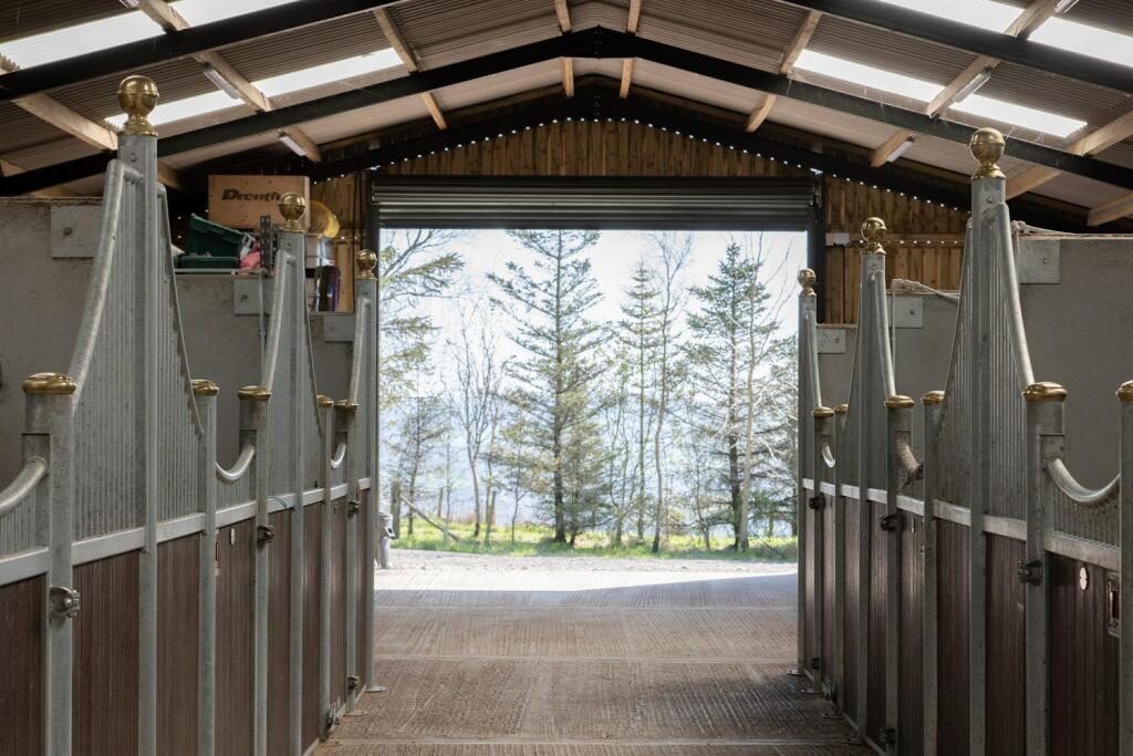
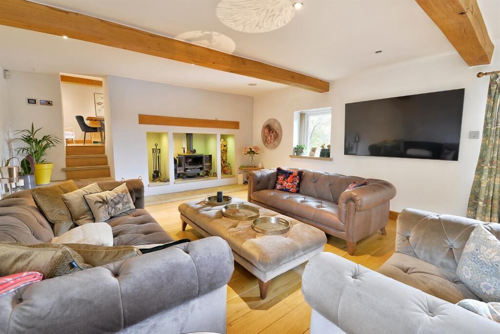
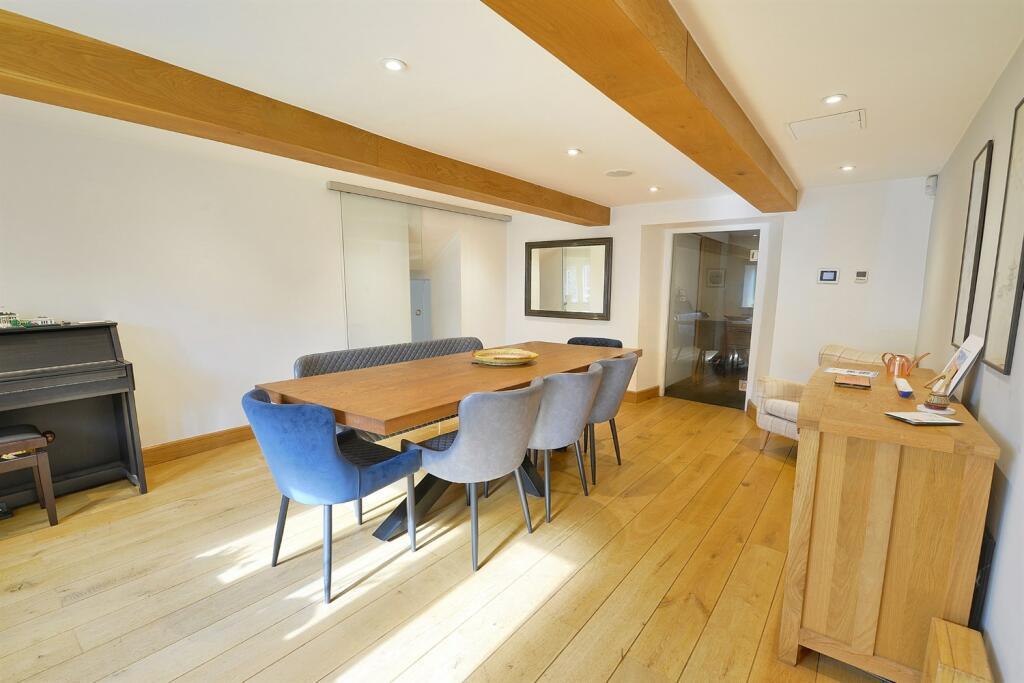
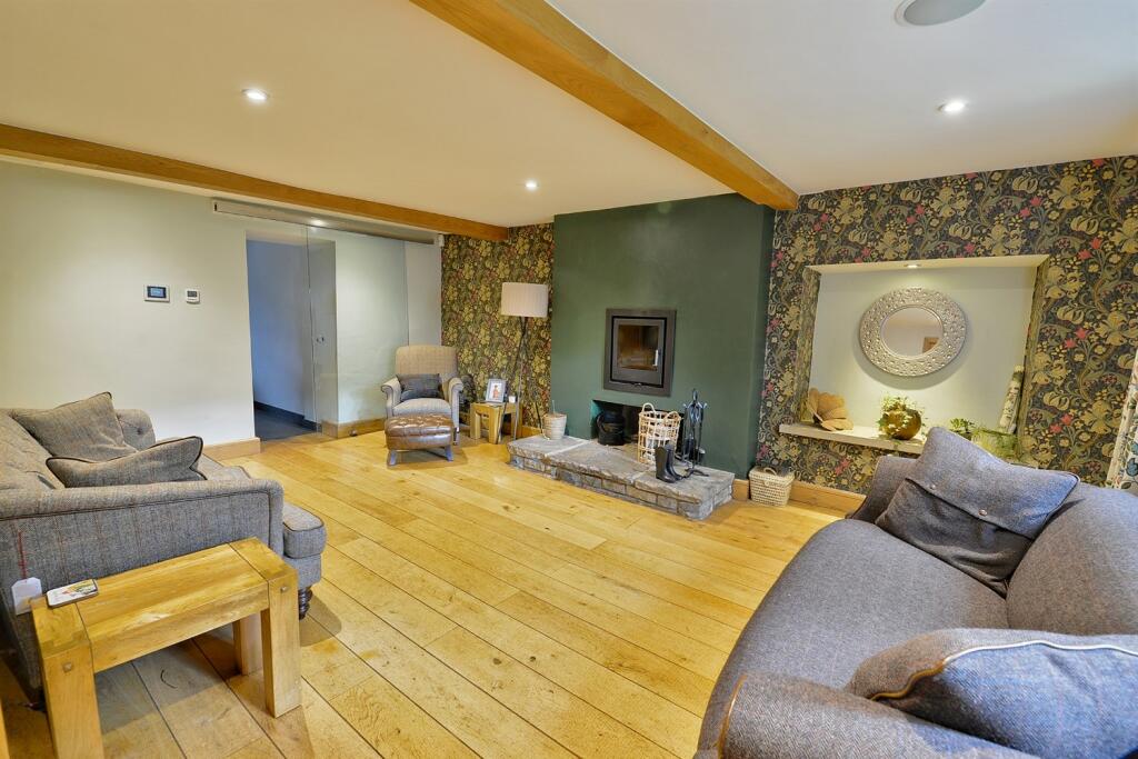
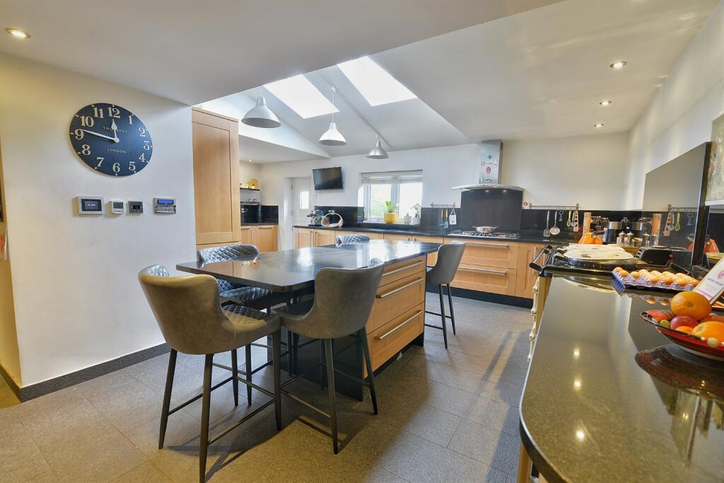
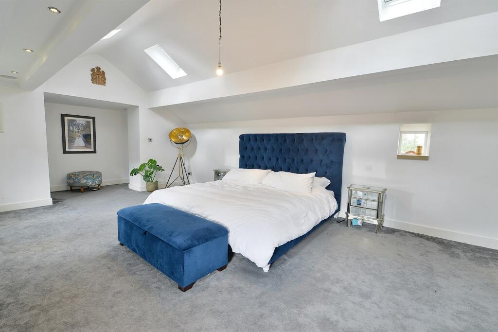
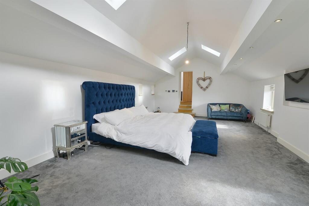
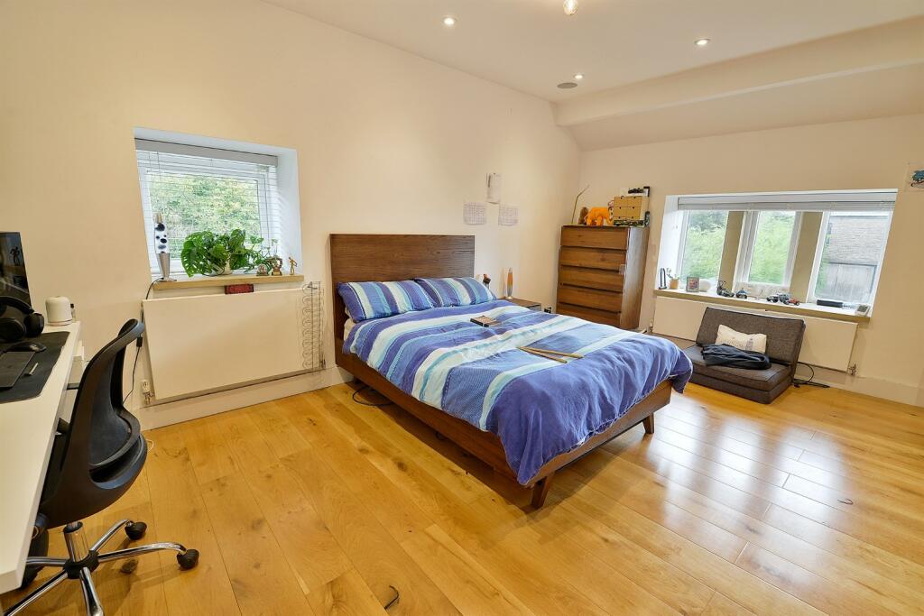
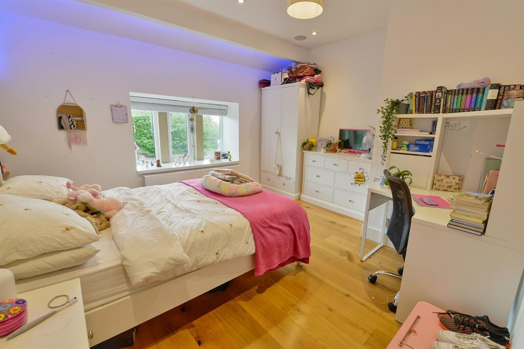
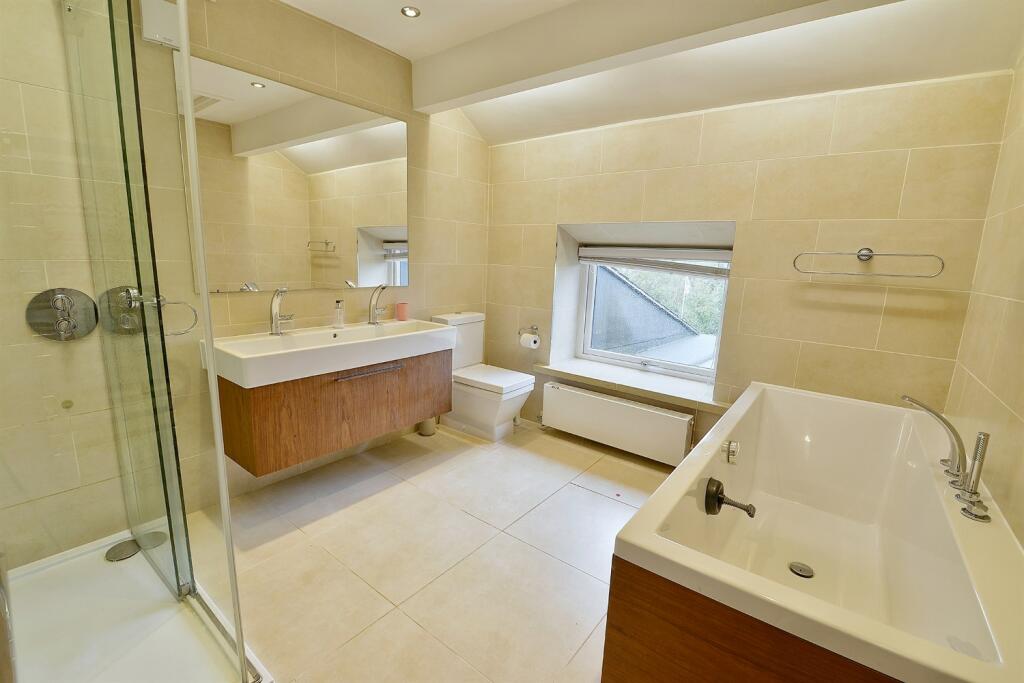
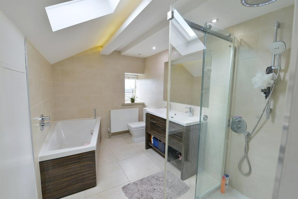
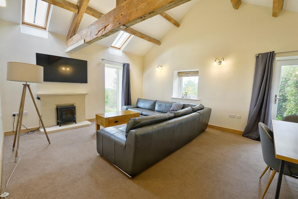

(Main) Arena Entrance Land Buildings Stables Outside Stables Stables Living Room Dining Room Family Room Family Room Dining Room Kitchen Kitchen Kitchen Bedroom Bedroom Bedroom Bedroom Bathroom En Suite 2 Bed Annexe 2 Bed Annexe 2 Bed Annexe 2 Bed Annexe 2 Bed Annexe 2 Bed Annexe Outside Outside Outside Outside Outside Outside
/ 35
Property details
Tenure
FREEHOLD
Local average
£692,813 (+116.5%)
Deprivation
Decile 7 (22,779 of 33,755)
Street crime
1 incident within 1 mile (Apr 2026)
Key features
- VARIOUS ONSITE INCOME/BUSINESS OPPORTUNITIES , CONTACT MANAGER JAMES COPPOCK FOR MORE INFORMATION
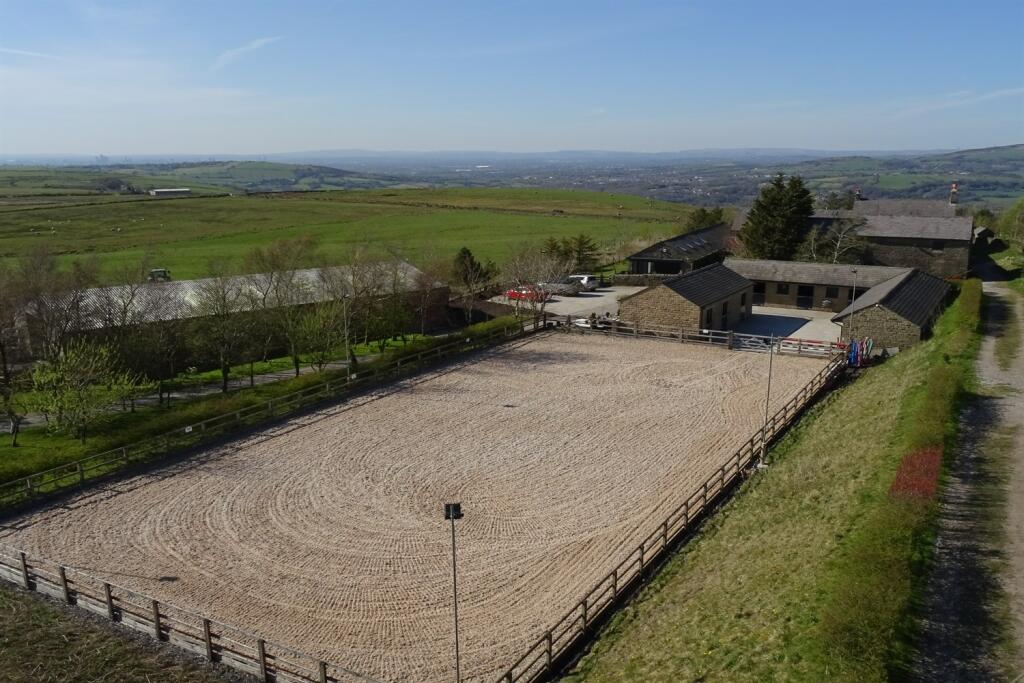
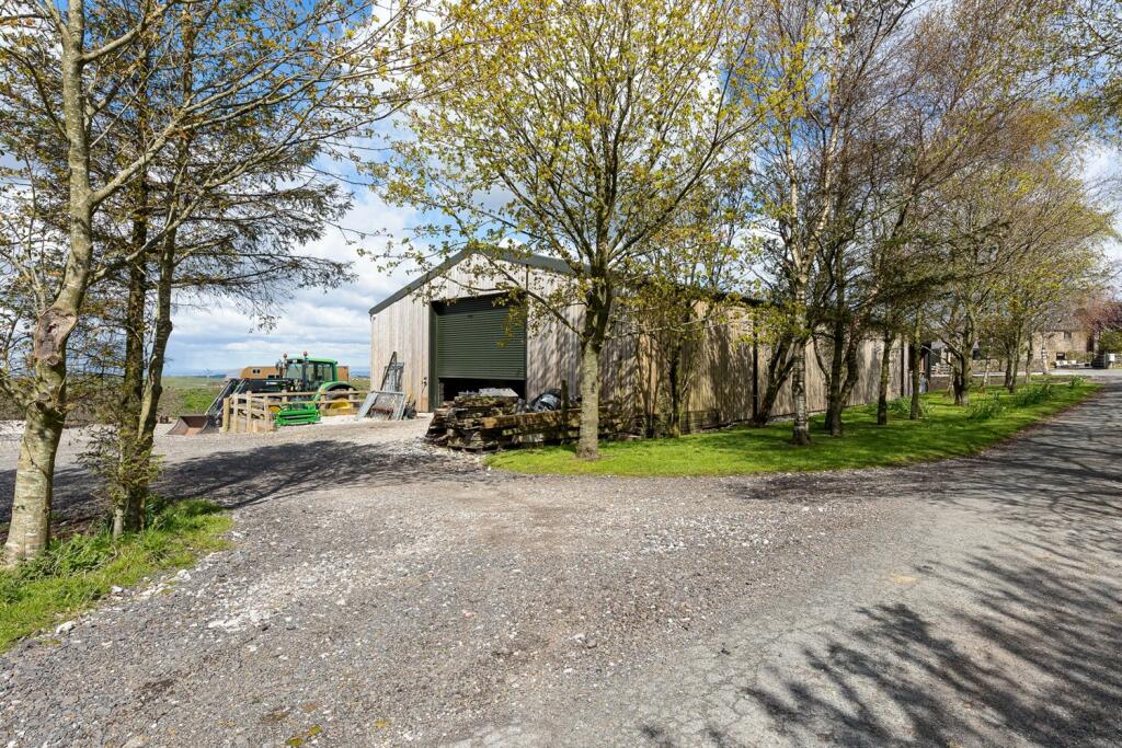
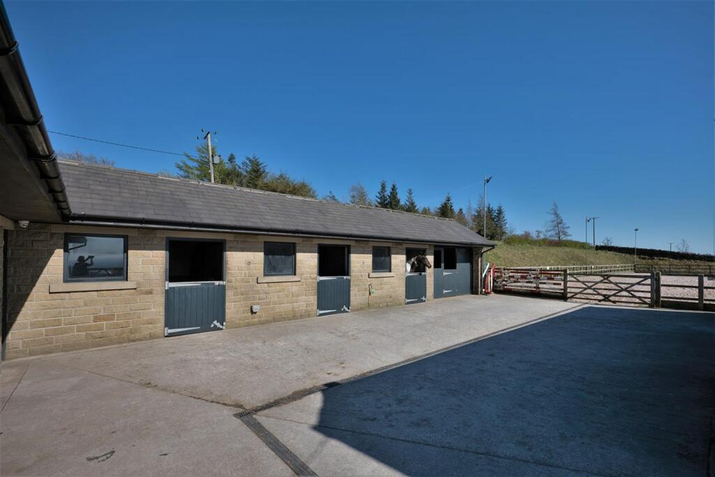
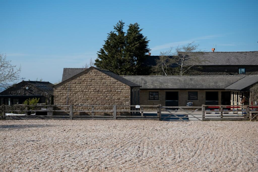
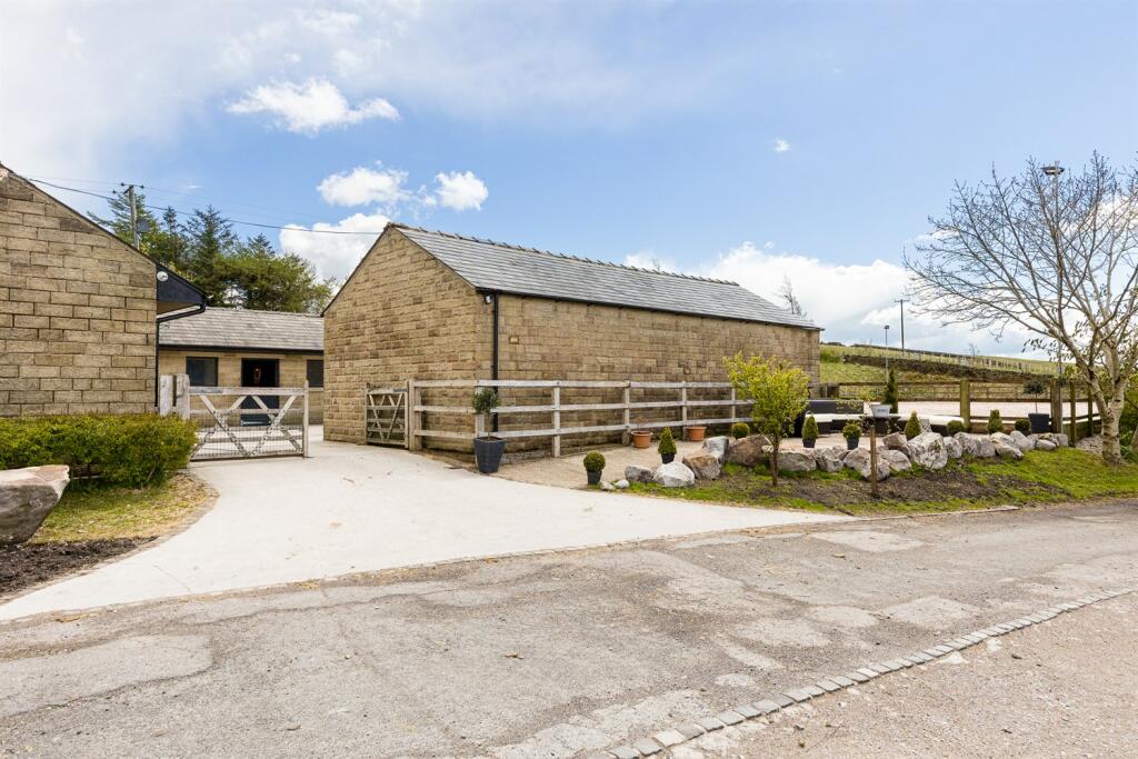
- An outstanding equestrian property
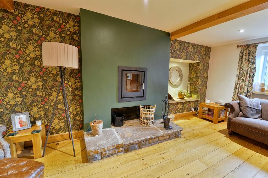
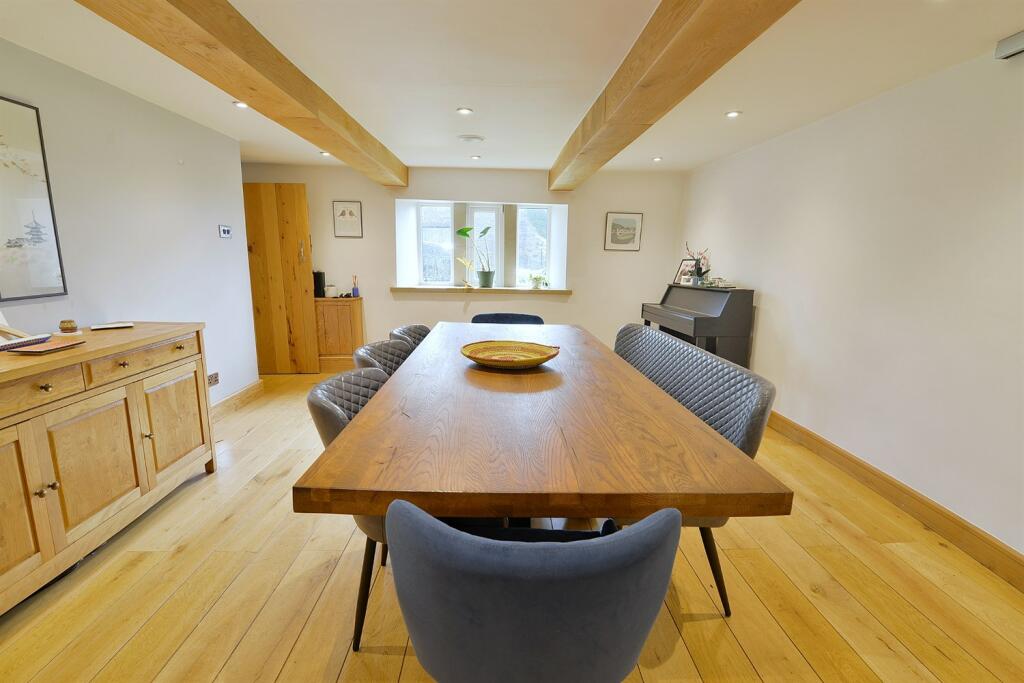
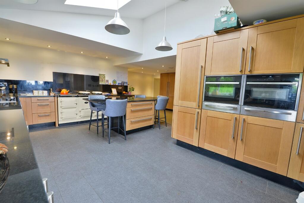
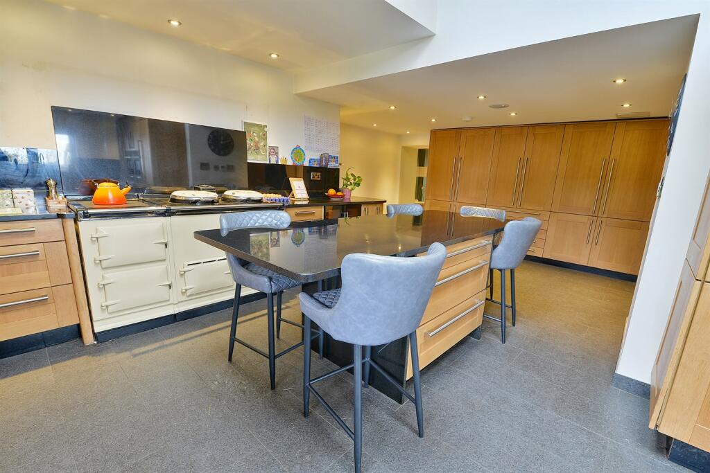
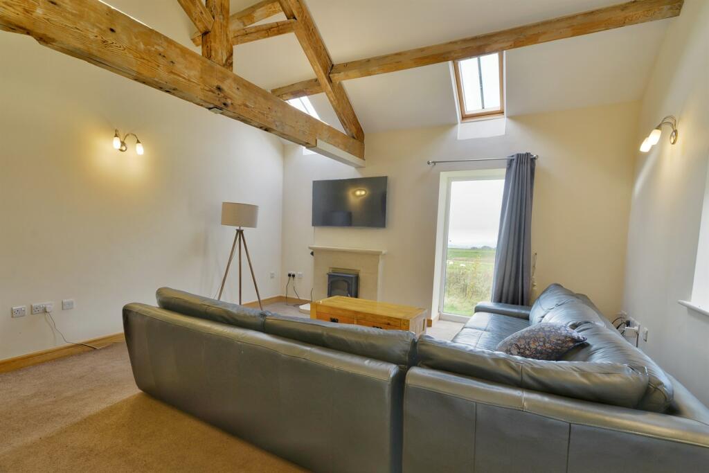
- Beautiful contemporary accommodation
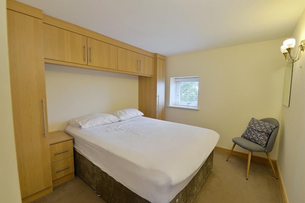
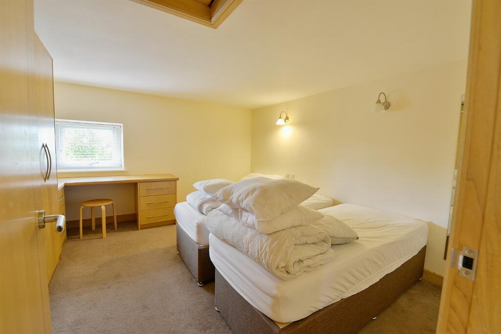
- Two bedroom self-contained annexe
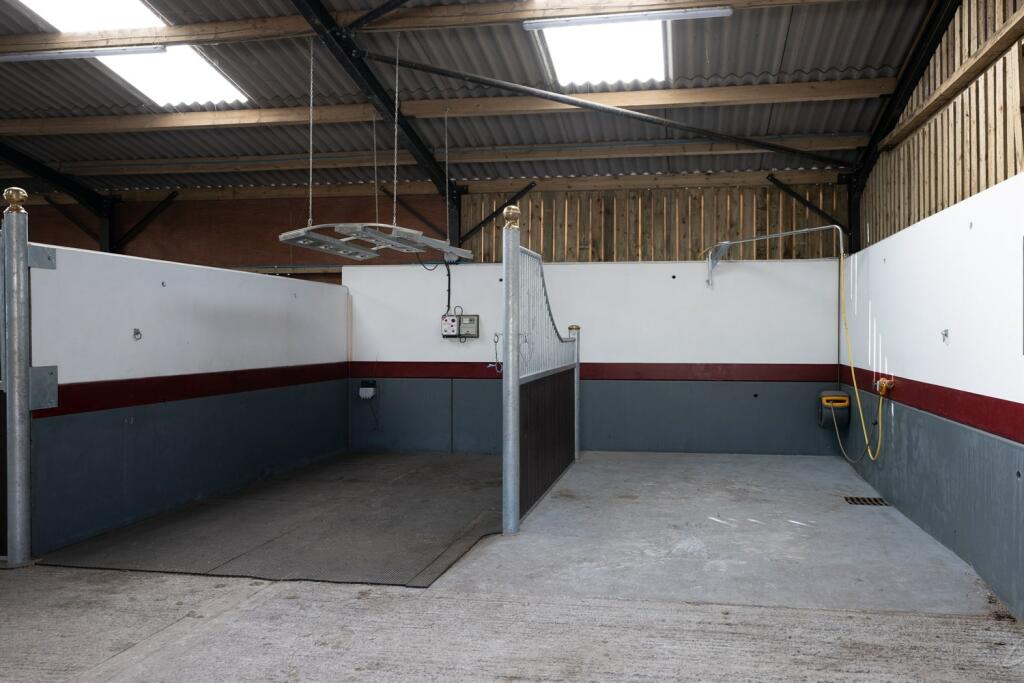
- 16 stables with potential for more
- Horse solarium & hot water shower
- Large home office/gym
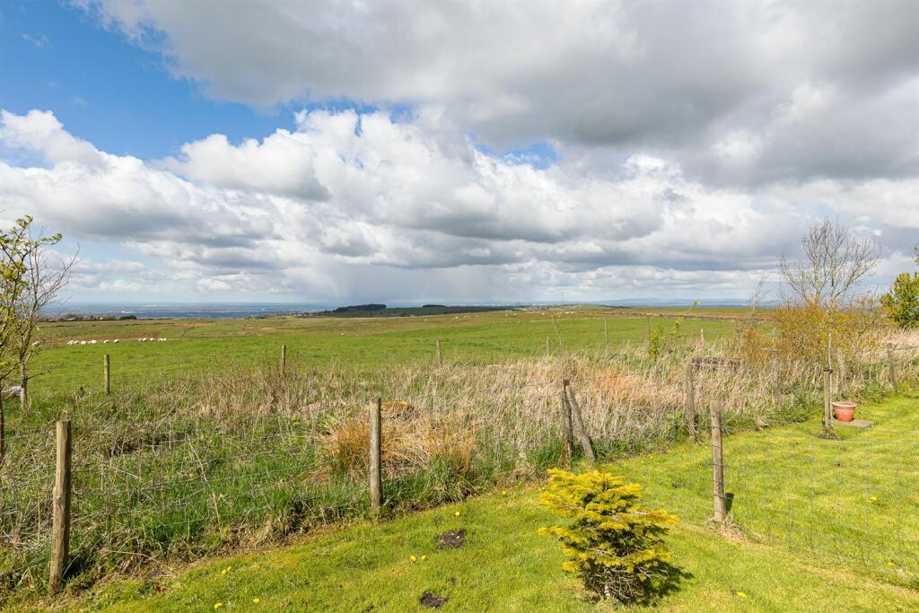
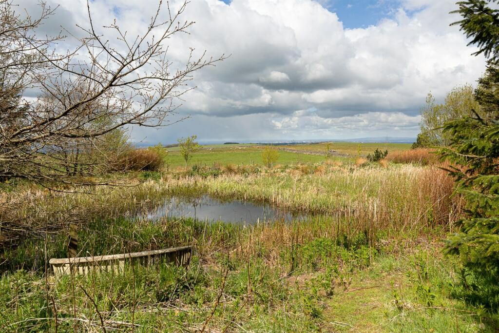
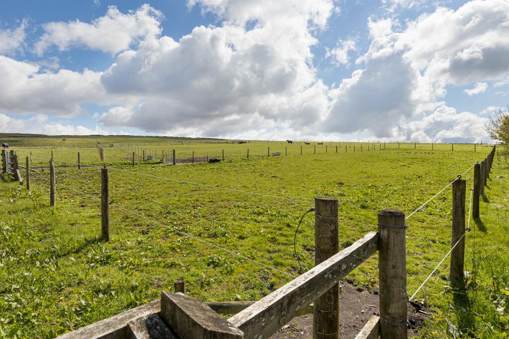
- Large parcel of land (aprox 80 acres) let to a local farmer and maintained
Description
**
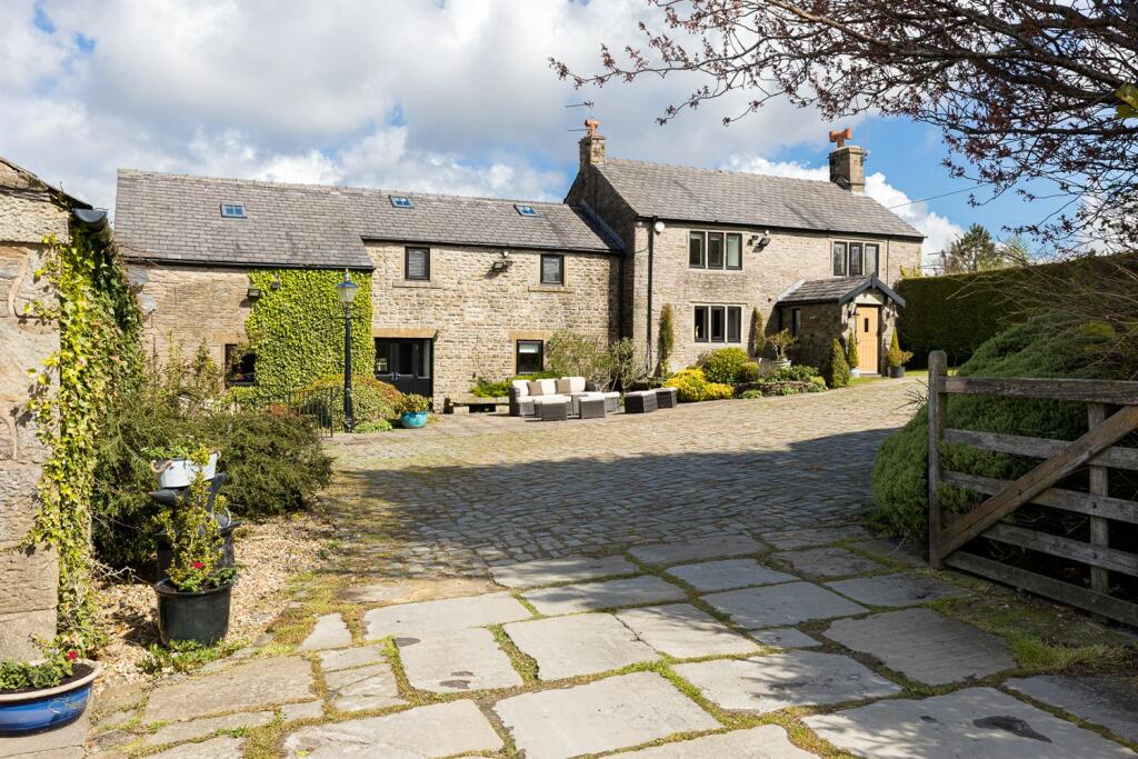
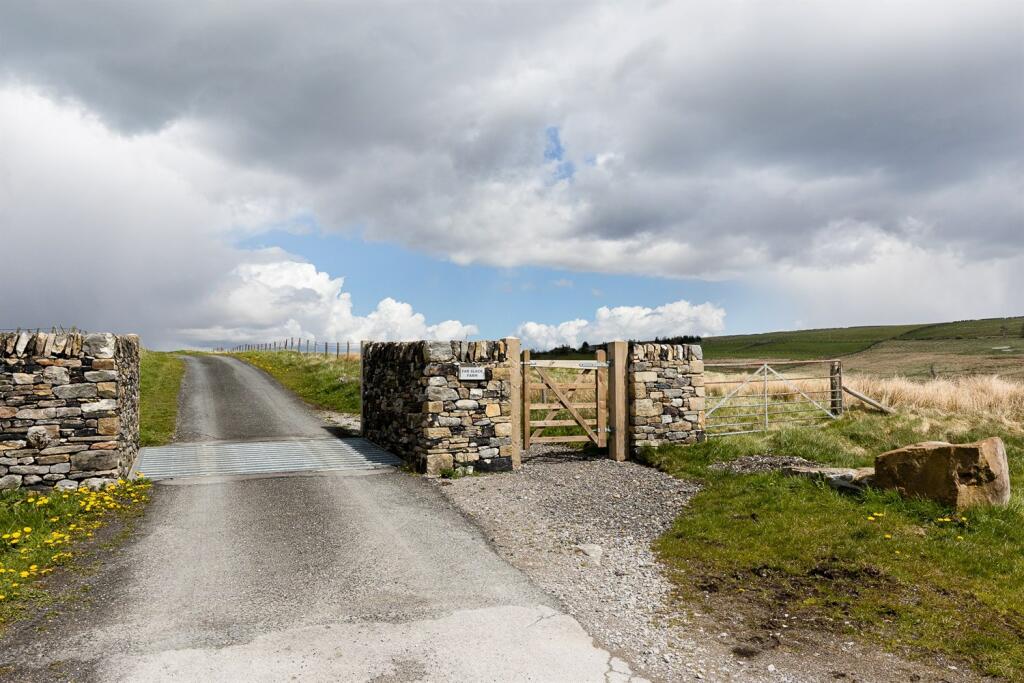
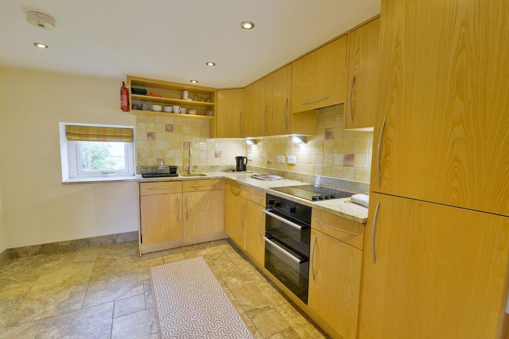
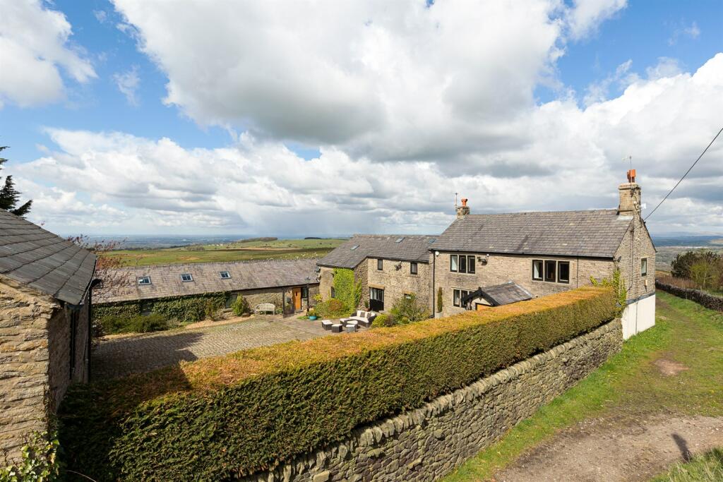
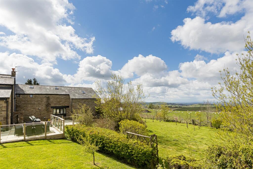
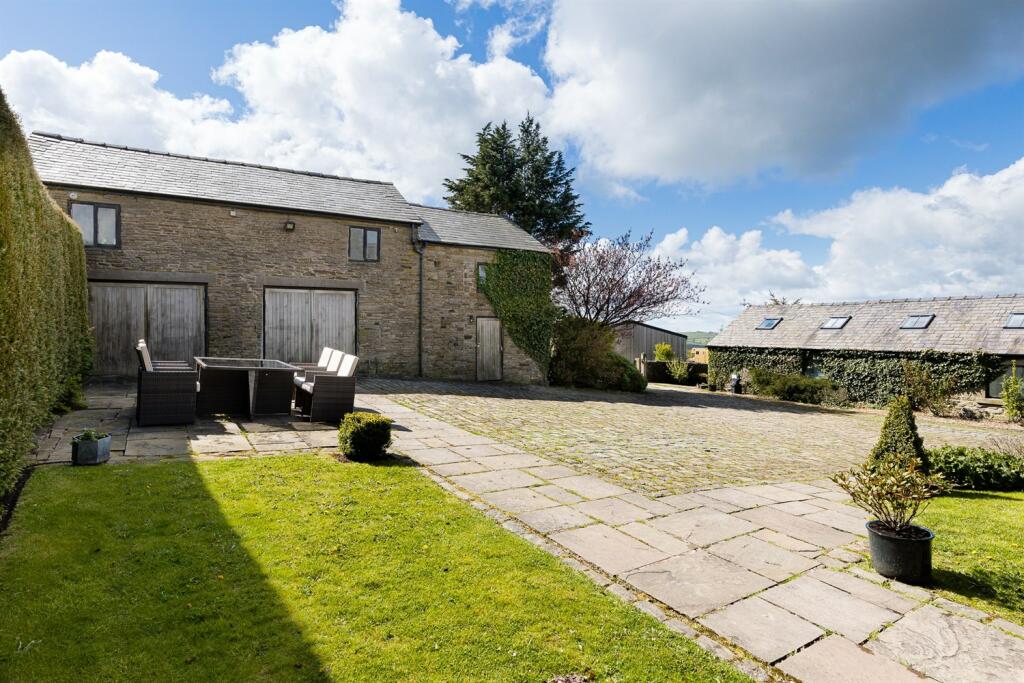
The sale of Far Slack Farm provides potential purchasers with the opportunity to acquire a stunning rural residence and equestrian property set in the heart of aprox 100 acres and surrounded by beautiful countryside, yet still with proximity to Manchester city centre. This traditional Derbyshire farmhouse has been has been updated and improved to create a superb contemporary family home. Immaculately presented traditional farm house, two bedroom attached annexe and a variety of outbuildings suitable for a a range of uses.
LOCATION**
Rowarth is a pretty hamlet nestling in the Derbyshire hills above Mellor. Marple Bridge caters for most day to day requirements whilst nearby Marple and New Mills offer a wide range of shops, restaurants, educational and recreational facilities. For the commuter both the Marple and New Mills stations offer services to Manchester city centre and the access points to the Northwest motorway network can be found at Stockport East and Bredbury junctions.
Listed by
Marple Bridge
Gascoigne Halman - Connells
Reference: 140317394
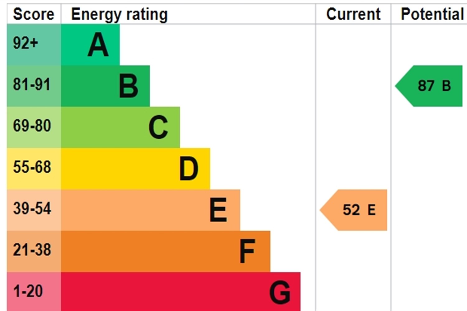
EPC ratings on this postcode
We don't have a matched EPC for this property yet. Below are efficiency scores and details for other addresses on this postcode.
| Address | Current | Potential | Floor area | Age band | Type |
|---|---|---|---|---|---|
| Annexe Far Slack Farm, Rowarth | 70 | 88 | 76 m² | England and Wales: 1991-1995 | Bungalow |
| Annexe Far Slack Farm, Rowarth, HIGH PEAK | 70 | 88 | 76 m² | England and Wales: 1991-1995 | Detached |
| Far Slack Farm, Rowarth | 52 | 87 | 322 m² | England and Wales: 1900-1929 | House |
| Far Slack Farm, Rowarth | 66 | 79 | 505 m² | England and Wales: before 1900 | House |
| Far Slack Farm, Rowarth | 46 | 47 | 387 m² | England and Wales: before 1900 | House |
| Far Slack Farm, Rowarth, HIGH PEAK | 52 | 87 | 322 m² | England and Wales: 1900-1929 | Detached |
| Far Slack Farm, Rowarth, HIGH PEAK | 66 | 79 | 505 m² | England and Wales: before 1900 | Detached |
Flood risk
Zone: 1
Risk: Low
Job (default Low)
Floorplans
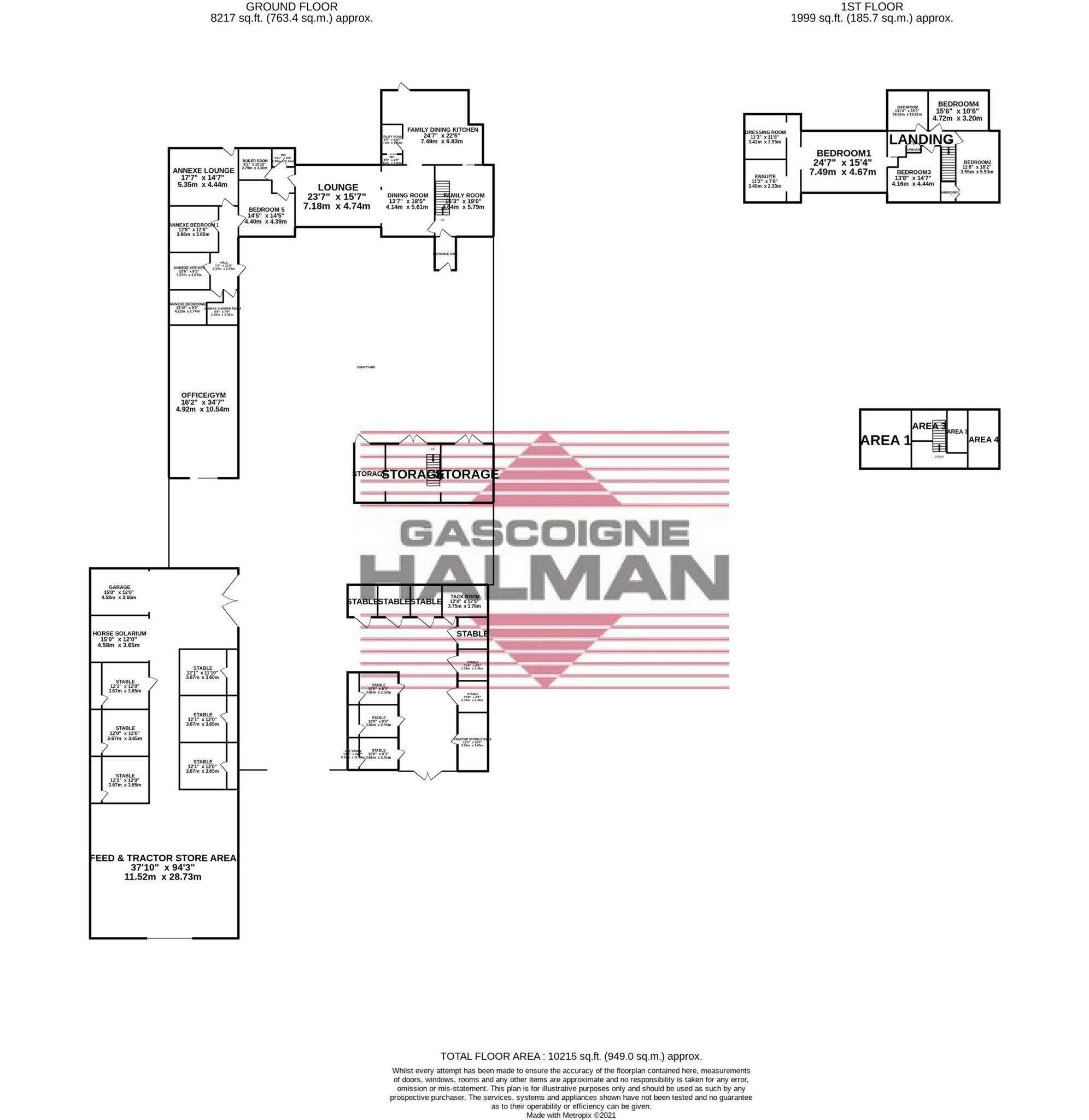
Floorplan
EPC Graphs
Other
Price history
No sales history found for this property in Land Registry Price Paid data.
Sold Comparables
Sold comparables data is not available for this property.
Capital growth trend
Land Registry outcode average: last 12 months vs 5y and 10y ago (from sold prices).
House Price Index (HM Land Registry — official index, not sold-price averages): High Peak. Series: Detached. As of March 2026.
Rental Range
Estimated market rent for High Peak. Low = conservative, Realistic = average, Optimistic = best case.
Based on Local Authority from postcode lookup → High Peak.
LHA (30th percentile) floor for Southern Greater Manchester: Apr 2025 – Mar 2026
Location
Address
Gun Road
Nearby
Nearest stations, universities and amenities (distance from property).
| Type | Name | Distance |
|---|---|---|
| Bus stop | Monks Road | 1.3 miles |
| Shop | Charlesworth Motors | 1.6 miles |
| Shop | Unknown | 1.6 miles |
| Train station | Broadbottom | 2.5 miles |
| Train station | Dinting | 2.8 miles |
| Hospital | Park Lodge Independent Hospital | 4.1 miles |
| Hospital | The Meadows | 5.7 miles |
| University | UK Management College | 8.6 miles |
| University | University of Manchester Fallowfield Campus | 9.7 miles |
Street-level crime
| Category | Count |
|---|---|
| Other crime | 1 |
| Total incidents | 1 |
Within 1 mile during Apr 2026. Source: data.police.uk (England & Wales).
Schools nearby
Nearest open schools with Ofsted ratings (England). Closed schools are not shown. Data from Get Information about Schools and Ofsted.
| Name | Type | Distance | Ofsted |
|---|---|---|---|
| Charlesworth Voluntary Controlled Primary School | Primary | 1.6 miles | Good — 26 Nov 2023 |
| Thornsett Primary School (High Peak Federation) | Primary | 2.0 miles | Good — 23 Jun 2024 |
| Simmondley Primary School | Primary | 2.2 miles | Good — 19 Jan 2016 |
| St Margaret's Catholic Voluntary Academy | Primary | 2.2 miles | Good — 3 Nov 2016 |
| Hayfield Primary School | Primary | 2.3 miles | Good — 14 Mar 2012 |
Rental Comparables
Loading rental comparables for this postcode. Refresh in a few minutes.
Rent-driven metrics
Based on Area rent estimate.
- Rent ratio — Monthly rent ÷ purchase price (1% rule). 1%+ = strong, 0.8–1% = okay, <0.8% = weak for cashflow.
- Max investor price — Rent ÷ 0.8%; the price at which rent would be 0.8% of price (Stoke-style target).
- Target investor price — Rent ÷ 1%; the price at which rent would be 1% of price (strong cashflow band).
- Gross yield — Annual rent as % of purchase price (no costs).
Enter House Number
Enter the house number to help us retrieve more accurate pricing history and property data.
Please log in to submit or correct the house number for this listing.
Log in to continue