FLAT 3
1 SUFFOLK ROAD, LONDON, GREATER LONDON SE25 6EY
£1,475 pcm
Property details
Floor area
53 m²
Council tax band
TBC
Year built
England and Wales: 1900-1929
Deprivation
Decile 3 (7,952 of 33,755)
Street crime
570 incidents within 1 mile (Apr 2026)
Key features
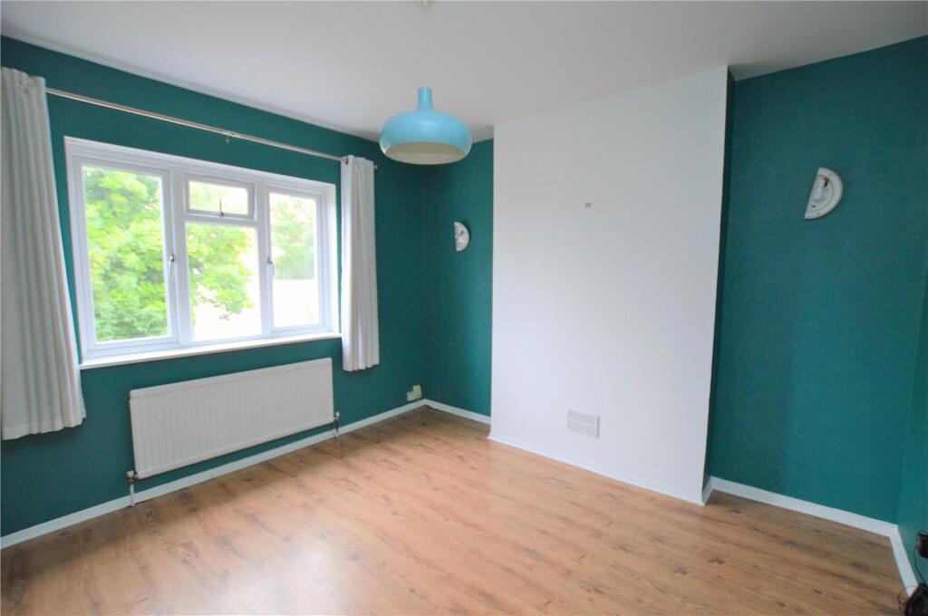
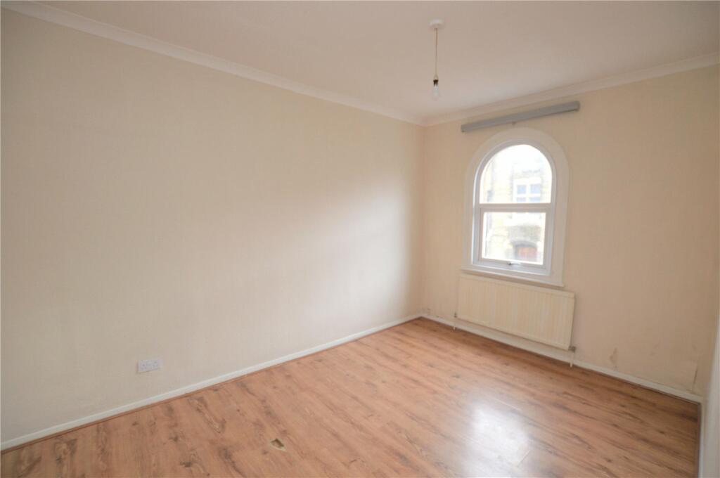
- 2 Bedrooms
- 1 Reception Room
- First Floor
- Conversion
- Close To Station
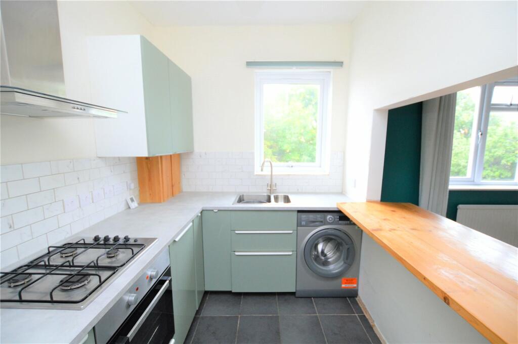
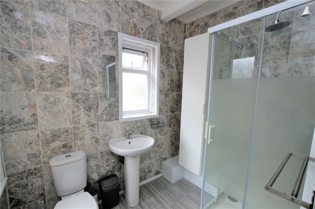
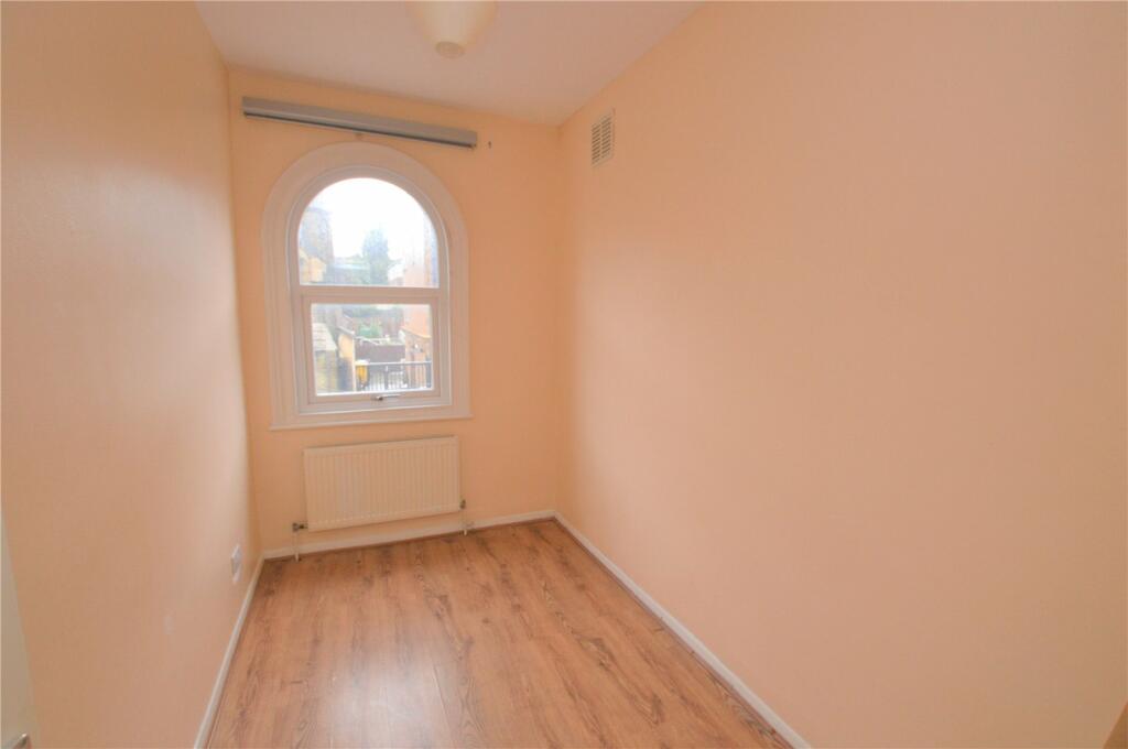
Description
Local Amenities:
Tesco Express (Approx. 0.1 miles)
Sainsbury's (Approx. 0.4 miles)
South Norwood Leisure Centre (Approx. 0.5 miles)
DIRECTIONS
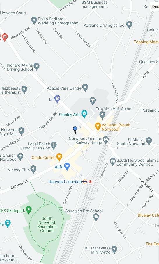
Suffolk Road is a quiet side road just off South Norwood Hill (A215) which is a hugely popular road. Neighbouring areas are easily reached by public transport with links to London via Norwood Junction Railway Station and also close by are the Fantastic Norwood lakes . The popular Crystal Palace Triangle is nearby with a variety of shops, restaurants and bars, also Crystal Palace Park, National Sports Centre and the Brand New Everyman Cinema are close at hand offering numerous leisure pursuits
TRANSPORT
Norwood Junction (Approx. 0.2 miles)
Selhurst (Approx. 0.8 miles)
Harrington Road Tramlink (Approx. 0.8 miles)
Listed by
South Norwood
Streets Ahead
Reference: 138355490
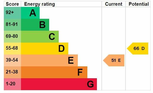
EPC Rating & Upgrade Cost
Fetching EPC data… Refresh this page in a moment.
Flood risk
Zone: 1
Risk: Low
Job (default Low)
Floorplans
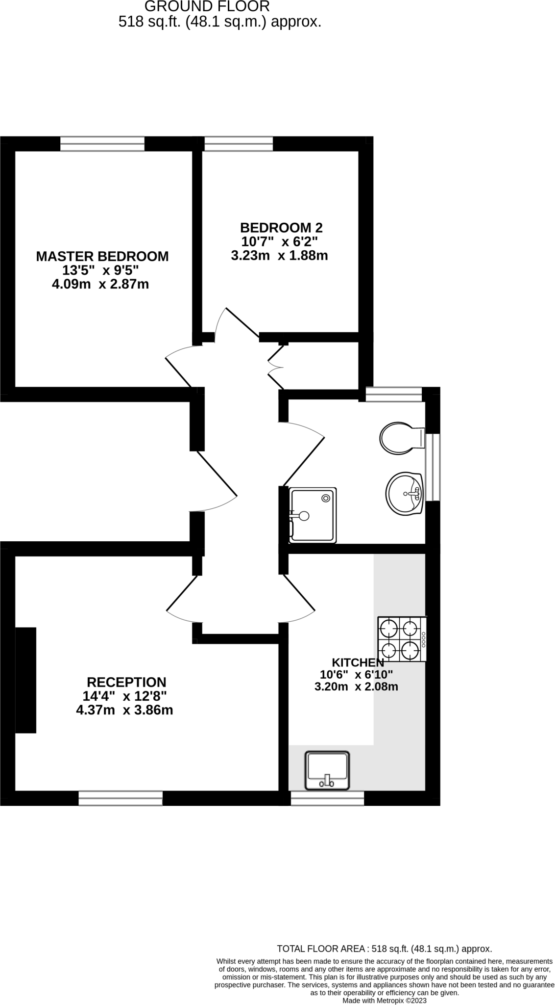
Floorplan
EPC Graphs
Picture No. 12
Company ownership
Rental Range
Estimated market rent for Croydon. Low = conservative, Realistic = average, Optimistic = best case.
Based on Local Authority from postcode lookup → Croydon.
LHA (30th percentile) floor for Stevenage & North Herts: £972/mo (Apr 2025 – Mar 2026)
Location
Nearby
Nearest stations, universities and amenities (distance from property).
| Type | Name | Distance |
|---|---|---|
| Shop | Tesco Express | 0.0 miles |
| Bus stop | Portland Road | 0.0 miles |
| Bus stop | Stanley Hall | 0.1 miles |
| Shop | Just Computers | 0.1 miles |
| Train station | Norwood Junction | 0.2 miles |
| Train station | Selhurst | 0.7 miles |
| Hospital | Shirley Oaks Hospital | 1.5 miles |
| Hospital | Unknown | 1.5 miles |
| University | City St Georges Tooting | 4.7 miles |
| University | King's College London, Denmark Hill Campus (West) | 4.8 miles |
Street-level crime
| Category | Count |
|---|---|
| Violence and sexual offences | 177 |
| Anti-social behaviour | 131 |
| Vehicle crime | 50 |
| Criminal damage and arson | 36 |
| Drugs | 35 |
| Other theft | 35 |
| Shoplifting | 28 |
| Public order | 19 |
| Burglary | 17 |
| Theft from the person | 13 |
| Robbery | 9 |
| Other crime | 8 |
| Possession of weapons | 8 |
| Bicycle theft | 4 |
| Total incidents | 570 |
Within 1 mile during Apr 2026. Source: data.police.uk (England & Wales).
Schools nearby
Nearest open schools with Ofsted ratings (England). Closed schools are not shown. Data from Get Information about Schools and Ofsted.
| Name | Type | Distance | Ofsted |
|---|---|---|---|
| Harris Academy South Norwood | Secondary | 0.1 miles | Good — 21 Sep 2022 |
| Harris Aspire Academy | Other | 0.1 miles | Outstanding — 17 Dec 2023 |
| Harris Professional Skills Sixth Form | Other | 0.1 miles | — (No rating) |
| St Mark's Church of England Primary Academy | Primary | 0.2 miles | Good — 5 Jul 2017 |
| Beckmead College | Other | 0.3 miles | Good — 9 Jun 2024 |
Rental Comparables
Residential lets from OpenRent and Rightmove for the area (same bedroom count). Use to validate rent estimates. Student lets are excluded.
| Title | Rent | Beds | Distance | As seen on |
|---|---|---|---|---|
| 2 Bed Flat, Holmesdale Road, SE25 | £1,650/mo | 2 | 0.08 miles | OpenRent |
Average rent: £1,650/mo (1 listing)