2 Bedroom flat to rent
Montagu Street, Swindon, SN2 2HN
£800 pcm
Property details
Deprivation
Decile 7 (22,415 of 33,755)
Street crime
423 incidents within 1 mile (Apr 2026)
Key features
- 2 Double Bedrooms
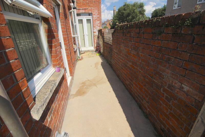
- Courtyard garden
- Allocated parking
- Utility Room
- Ground floor flat
Additional details
- Parking
- Yes
- Garden
- Yes
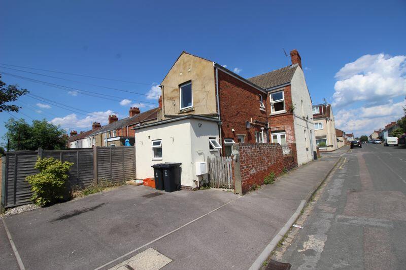
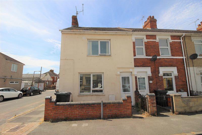
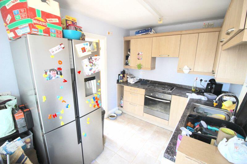
Description
Get Sold UK are pleased to offer this 2 bedroom flat to rent.
The flat consists of 2 double bedrooms, fully fitted kitchen leading to utility room and a large lounge. Courtyard garden and allocated parking to the rear. The property is situated in Rodbourne & located only a short walk from the Designer Outlet Centre and major bus routes, as well as being a walk-able commute in to Swindon's Town Centre.
A viewing is highly recommended.
Council tax band: A
EPC rating: D
Listed by
Swindon
MOOVEeasy UK
Reference: 156741542
EPC Rating & Upgrade Cost
Fetching EPC data… Refresh this page in a moment.
Flood risk
Zone: 1
Risk: Low
Job (default Low)
Rental Range
Estimated market rent for Swindon. Low = conservative, Realistic = average, Optimistic = best case.
Based on Local Authority from postcode lookup → Swindon.
LHA (30th percentile) floor for Swindon: £783/mo (Apr 2025 – Mar 2026)
Location
Address
97 Montagu Street
Nearby
Nearest stations, universities and amenities (distance from property).
| Type | Name | Distance |
|---|---|---|
| Shop | Morrison Food And Wine | 0.1 miles |
| Bus stop | Meadow Road | 0.2 miles |
| Shop | Home Bargains | 0.2 miles |
| Bus stop | The Dolphin | 0.3 miles |
| University | Oxford Brookes University - Swindon Campus | 0.5 miles |
| University | Royal Agricultural University (Cultural Heritage Institute) | 0.6 miles |
| Train station | Swindon | 0.9 miles |
| Hospital | Marlborough House | 1.0 miles |
| Train station | Taw Valley Halt | 2.2 miles |
| Hospital | The Ridgeway Hospital | 2.8 miles |
Street-level crime
| Category | Count |
|---|---|
| Violence and sexual offences | 112 |
| Anti-social behaviour | 77 |
| Shoplifting | 53 |
| Criminal damage and arson | 43 |
| Vehicle crime | 41 |
| Public order | 26 |
| Other theft | 20 |
| Drugs | 12 |
| Bicycle theft | 10 |
| Burglary | 8 |
| Robbery | 8 |
| Other crime | 5 |
| Possession of weapons | 5 |
| Theft from the person | 3 |
| Total incidents | 423 |
Within 1 mile during Apr 2026. Source: data.police.uk (England & Wales).
Schools nearby
Nearest open schools with Ofsted ratings (England). Closed schools are not shown. Data from Get Information about Schools and Ofsted.
| Name | Type | Distance | Ofsted |
|---|---|---|---|
| Even Swindon Primary School | Primary | 0.2 miles | Good — 9 Jan 2015 |
| UTC Swindon | Secondary | 0.6 miles | Requires improvement — 25 Jun 2024 |
| Robert Le Kyng Primary School | Primary | 0.6 miles | Good — 12 Oct 2011 |
| Westlea Primary School | Primary | 0.8 miles | Good — 18 Jul 2023 |
| Ferndale Primary School & Nursery | Primary | 0.8 miles | Good — 28 Feb 2014 |
Rental Comparables
Residential lets from OpenRent and Rightmove for the area (same bedroom count). Use to validate rent estimates. Student lets are excluded.
| Title | Rent | Beds | Distance | As seen on |
|---|---|---|---|---|
| 2 Bed Flat, Wiltshire Court, SN1 | £1,050/mo | 2 | 0.83 miles | OpenRent |
Average rent: £1,050/mo (1 listing)