13 UNDERWOOD ROAD
NEWCASTLE, NEWCASTLE, STAFFORDSHIRE ST5 6QG
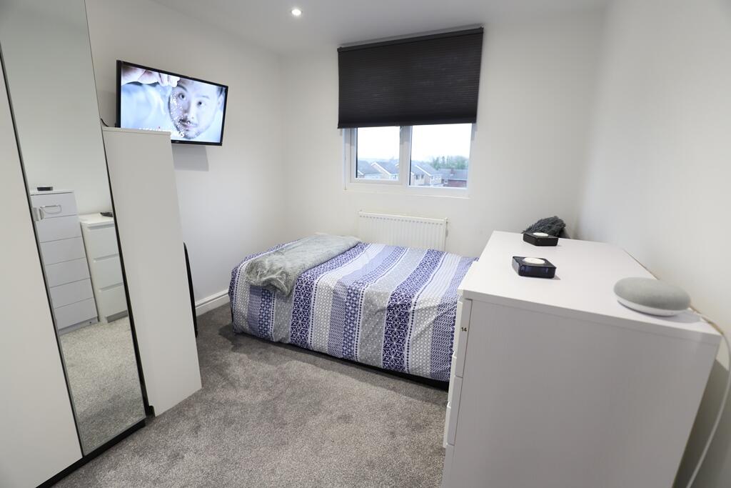
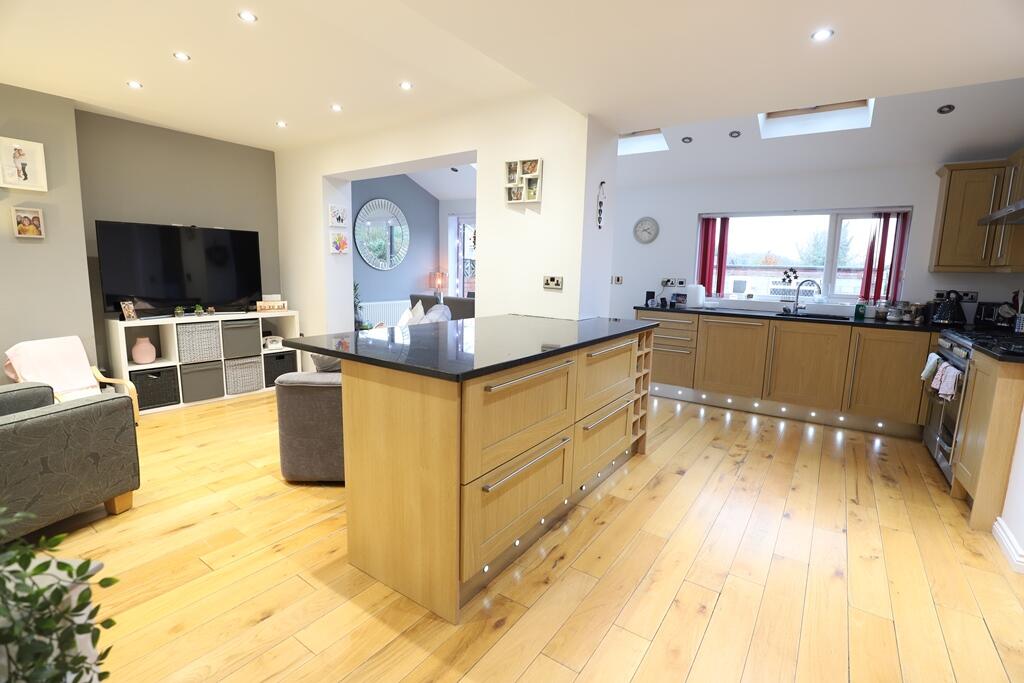
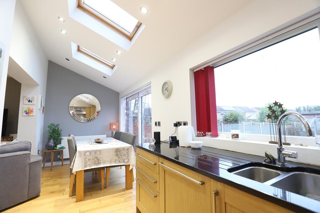
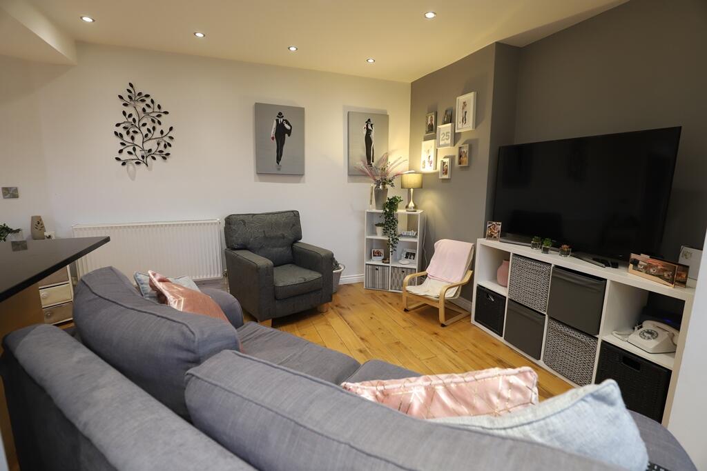
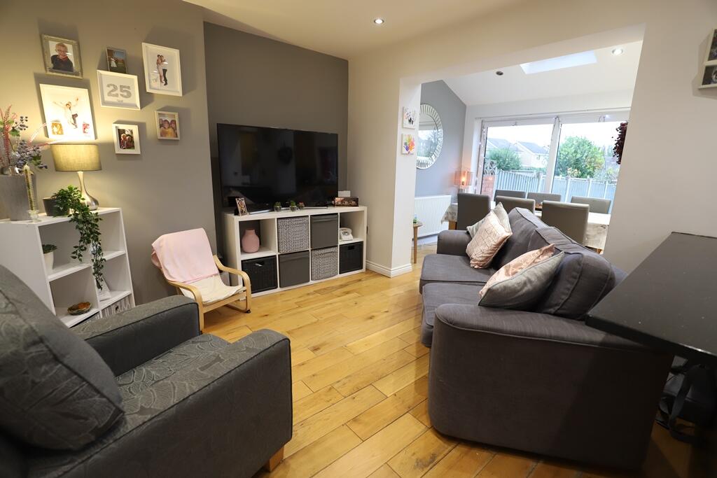
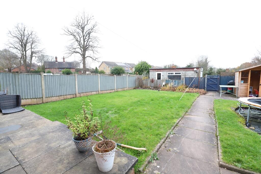
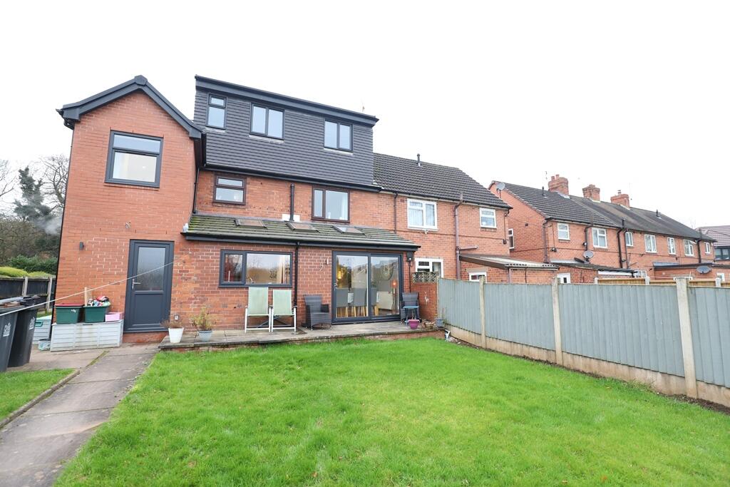
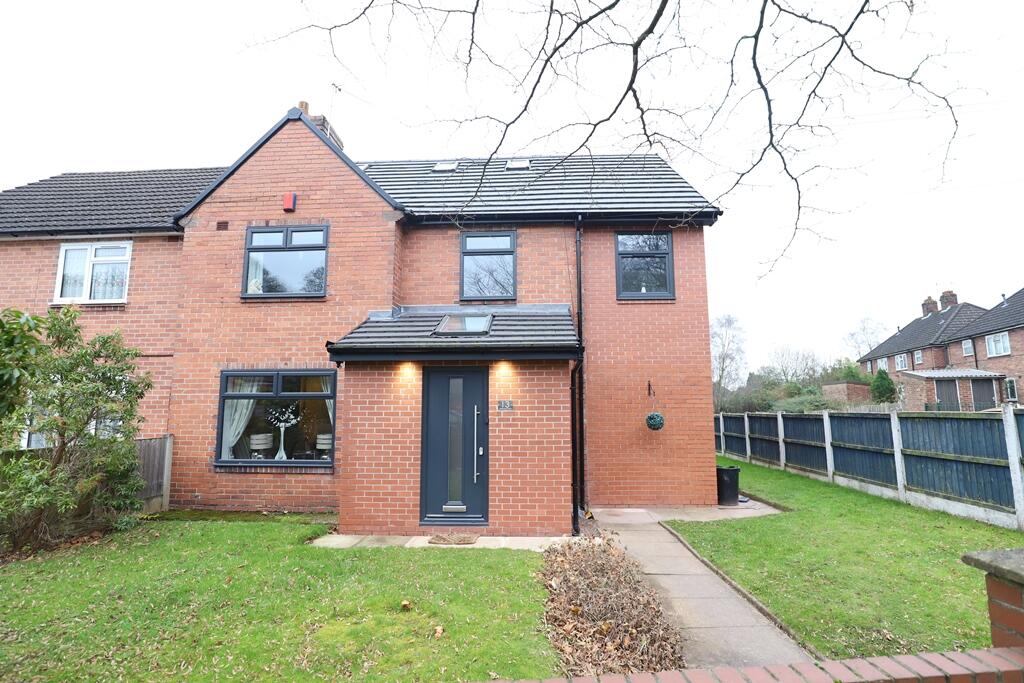
Photo 1 Photo 2 Photo 3 Photo 4 Photo 5 Photo 6 Photo 7 Photo 8
/ 8
Property details
Floor area
155 m²
Council tax band
A
EPC rating
C
Year built
England and Wales: 1930-1949
Last sold
£36,000 Jul 1995
Price per m²
£3/m²
Local average
£199,596 (-99.7%)
Deprivation
Decile 4 (10,985 of 33,755)
Street crime
60 incidents within 1 mile (Apr 2026)
Key features
- Short Drive to Keele Uni
- Council Tax Band: A
- All bills included
- EPC: C
- Plenty of parking available
- Double glazing
- Shower
- Washing machine
- Fridge Freezer
Additional details
- Heating
- Double glazing
- Parking
- Yes
- Garden
- Private garden
- Listed property
- No
Description
A fantastic 8 bedroom, 8 bathroom property. Very close to Keele University, very modern throughout. Gas, Water, Electricity & Broadband included.
The open plan kitchen / dining / lounge space is a beautiful, large, open plan room. Fantastic for a group communal area, allowing everyone to congregate together whilst cooking, dining, watching TV, gaming etc. Sofas, TV, Dining Furniture is all provided. The kitchen is fitted with a range cooker with double oven, 2 fridge freezers, microwaves and dishwasher. There is also a utility room for washing clothes. Patio doors take you to a patio and lawned garden
Please note some furniture will change to what is shown in the photographs.
Whilst the details listed within this description are believed to be accurate and upto date you should check with the agent that any appliances listed will be present at the start of the let. Where a property is let unfurnished, should an appliance become faulty the landlord may not replace it - excluding cookers & boilers for which the landlord remains responsible. In some instances gas fires may have been disconnected where central heating systems are present. EPC rating: C.
Listed by
Newcastle-Under-Lyme
The Property Franchise Group
Reference: 171114650
EPC Rating & Upgrade Cost
Current rating: C
Potential rating: B
Inspection date: 04/12/2019
Expiry date: 03/12/2029
Current heating cost: £651/year
Potential heating cost: £651/year
Est. upgrade cost to C: £4,500
Recommendations
- Solar photovoltaic panels, 2.5 kWp (£3,500 - £5,500)
Flood risk
Zone: 1
Risk: Low
Job (default Low)
Price history
| Event | Date | Price | % change |
|---|---|---|---|
| Sold | 27/07/1995 (30 years ago) | £36,000 | — |
Source: HM Land Registry Price Paid Data. Crown copyright.
Sold Comparables
Same street and nearby sales within 0.25 miles (last 5 years). Data from Land Registry Price Paid.
| Address | Price | Date | Type |
|---|---|---|---|
| 7 EDALE CLOSE, NEWCASTLE, NEWCASTLE-UNDER-LYME, STAFFORDSHIRE, ST5 6RP | £163,000 | 25/07/2025 | Semi-detached |
| 12 UNDERWOOD ROAD, NEWCASTLE, NEWCASTLE-UNDER-LYME, STAFFORDSHIRE, ST5 6QF | £142,000 | 07/03/2025 | Semi-detached |
| 44 UNDERWOOD ROAD, NEWCASTLE, NEWCASTLE-UNDER-LYME, STAFFORDSHIRE, ST5 6QF | £125,000 | 06/12/2024 | Semi-detached |
| 108 UNDERWOOD ROAD, NEWCASTLE, NEWCASTLE-UNDER-LYME, STAFFORDSHIRE, ST5 6QF | £170,000 | 23/09/2024 | Semi-detached |
| 30 UNDERWOOD ROAD, NEWCASTLE, NEWCASTLE-UNDER-LYME, STAFFORDSHIRE, ST5 6QF | £125,000 | 10/05/2024 | Semi-detached |
| 193 HIGH STREET, SILVERDALE, NEWCASTLE, NEWCASTLE-UNDER-LYME, STAFFORDSHIRE, ST5 6JZ | £400,000 | 31/03/2023 | Semi-detached |
| 25 BUXTON AVENUE, NEWCASTLE, NEWCASTLE-UNDER-LYME, STAFFORDSHIRE, ST5 6RG | £80,000 | 24/03/2023 | Semi-detached |
| 76 UNDERWOOD ROAD, NEWCASTLE, NEWCASTLE-UNDER-LYME, STAFFORDSHIRE, ST5 6QF | £122,000 | 03/02/2023 | Semi-detached |
| 53 BUXTON AVENUE, NEWCASTLE, NEWCASTLE-UNDER-LYME, STAFFORDSHIRE, ST5 6RG | £110,000 | 08/12/2022 | Semi-detached |
| 12 BUXTON AVENUE, NEWCASTLE, NEWCASTLE-UNDER-LYME, STAFFORDSHIRE, ST5 6RG | £133,000 | 20/10/2022 | Semi-detached |
| 40 UNDERWOOD ROAD, NEWCASTLE, NEWCASTLE-UNDER-LYME, STAFFORDSHIRE, ST5 6QF | £115,000 | 14/10/2022 | Semi-detached |
| Same street 95 UNDERWOOD ROAD, NEWCASTLE, NEWCASTLE-UNDER-LYME, STAFFORDSHIRE, ST5 6QG | £185,000 | 23/09/2022 | Semi-detached |
| 29 SCOT HAY ROAD, SILVERDALE, NEWCASTLE, NEWCASTLE-UNDER-LYME, STAFFORDSHIRE, ST5 6RQ | £124,000 | 10/05/2022 | Semi-detached |
| Same street 59 UNDERWOOD ROAD, NEWCASTLE, NEWCASTLE-UNDER-LYME, STAFFORDSHIRE, ST5 6QG | £112,500 | 24/03/2022 | Semi-detached |
| 9 MATLOCK PLACE, NEWCASTLE, NEWCASTLE-UNDER-LYME, STAFFORDSHIRE, ST5 6RE | £104,000 | 16/12/2021 | Semi-detached |
| 16 BUXTON AVENUE, NEWCASTLE, NEWCASTLE-UNDER-LYME, STAFFORDSHIRE, ST5 6RG | £115,000 | 29/11/2021 | Semi-detached |
| 5 SCOT HAY ROAD, SILVERDALE, NEWCASTLE, NEWCASTLE-UNDER-LYME, STAFFORDSHIRE, ST5 6RJ | £137,950 | 17/08/2021 | Semi-detached |
Street average: £148,750 (2 sales)
Area average: £144,397 (15 sales)
Capital growth trend
Land Registry outcode average: last 12 months vs 5y and 10y ago (from sold prices).
House Price Index (HM Land Registry — official index, not sold-price averages): Newcastle-under-Lyme. Series: Semi-detached. As of March 2026.
Rental Range
Estimated market rent for Newcastle-under-Lyme. Low = conservative, Realistic = average, Optimistic = best case.
Based on Local Authority from postcode lookup → Newcastle-under-Lyme.
LHA (30th percentile) floor for Staffordshire North: £424/mo (Apr 2025 – Mar 2026)
Location
Nearby
Nearest stations, universities and amenities (distance from property).
| Type | Name | Distance |
|---|---|---|
| Bus stop | Underwood Road | 0.1 miles |
| Shop | One Stop | 0.4 miles |
| Shop | Co-op Food | 0.6 miles |
| University | Keele University | 1.1 miles |
| Train station | Silverdale | 1.5 miles |
| Train station | Apedale Road | 1.7 miles |
| Hospital | Bradwell Hospital | 2.5 miles |
| Hospital | Royal Stoke University Hospital | 3.0 miles |
| University | University of Staffordshire Stoke Campus | 4.2 miles |
Street-level crime
| Category | Count |
|---|---|
| Violence and sexual offences | 27 |
| Anti-social behaviour | 14 |
| Other theft | 5 |
| Public order | 4 |
| Burglary | 3 |
| Criminal damage and arson | 3 |
| Possession of weapons | 2 |
| Drugs | 1 |
| Other crime | 1 |
| Total incidents | 60 |
Within 1 mile during Apr 2026. Source: data.police.uk (England & Wales).
Schools nearby
Nearest open schools with Ofsted ratings (England). Closed schools are not shown. Data from Get Information about Schools and Ofsted.
| Name | Type | Distance | Ofsted |
|---|---|---|---|
| St Luke's CofE (C) Primary School | Primary | 0.1 miles | Requires improvement — 26 Jan 2023 |
| St John's CofE (C) Primary School | Primary | 0.7 miles | Requires improvement — 13 Jul 2023 |
| Silverdale Primary Academy | Primary | 0.8 miles | Good — 29 Nov 2023 |
| University of Keele | Other | 0.8 miles | — (No rating) |
| Knutton St Marys CofE Academy | Primary | 1.4 miles | Good — 4 Jun 2019 |
Rental Comparables
Residential lets from OpenRent and Rightmove for the area (same bedroom count). Use to validate rent estimates. Student lets are excluded.
Average rent: £698/mo (33 listings)
Rent-driven metrics
Based on OpenRent comparables.
- Rent ratio — Monthly rent ÷ purchase price (1% rule). 1%+ = strong, 0.8–1% = okay, <0.8% = weak for cashflow.
- Max investor price — Rent ÷ 0.8%; the price at which rent would be 0.8% of price (Stoke-style target).
- Target investor price — Rent ÷ 1%; the price at which rent would be 1% of price (strong cashflow band).
- Gross yield — Annual rent as % of purchase price (no costs).
- Cost-to-rent — Price ÷ annual rent (from OpenRent comparables). Under 14× = strong, 14–16× = acceptable, 17×+ = compressed.
- Cashflow — Rent minus mortgage, 10% maintenance, £25/mo compliance. Assumes 75% LTV, 3.95% APR (5yr fixed), 25yr term.
- ROI — Annual profit ÷ cash in (deposit + 4% purchase costs).