FLAT 3
3 WEST EATON PLACE, LONDON, GREATER LONDON SW1X 8LU
£5,417 pcm
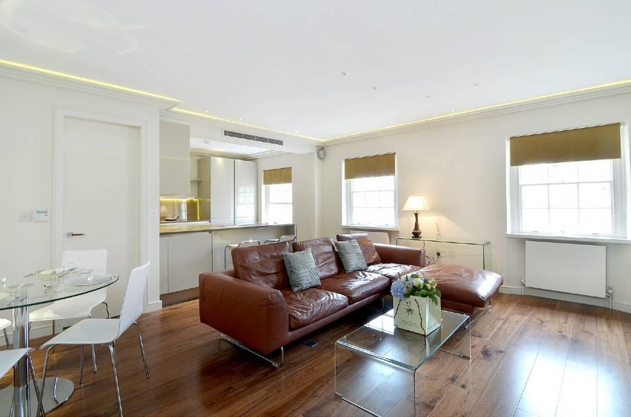
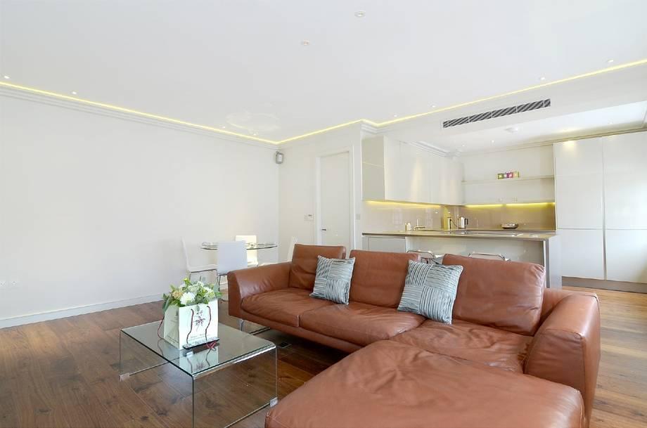
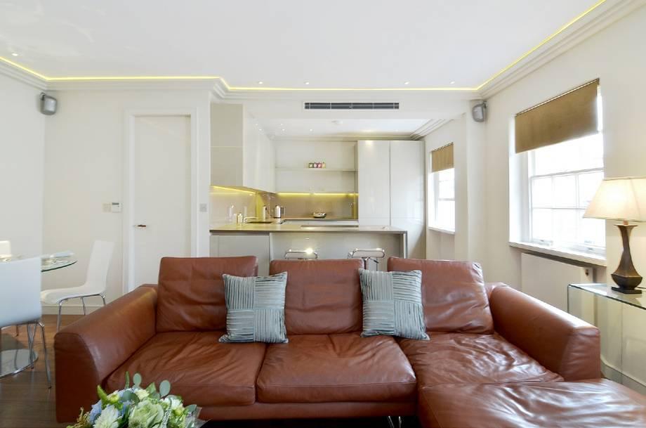
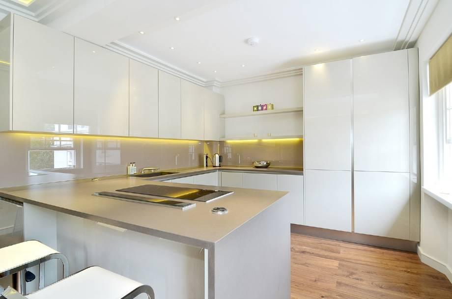
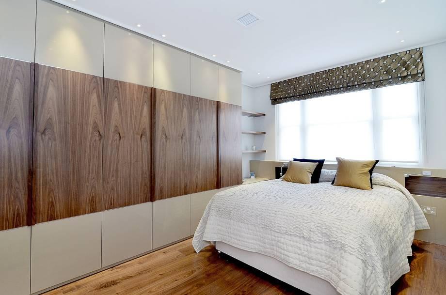
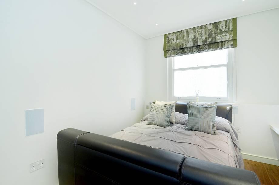
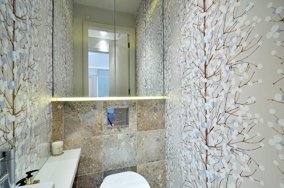
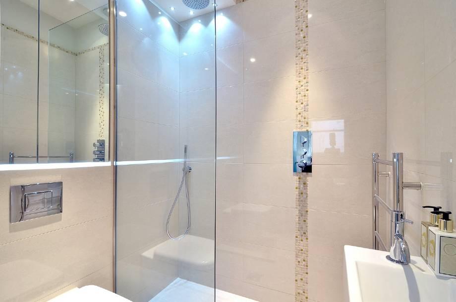
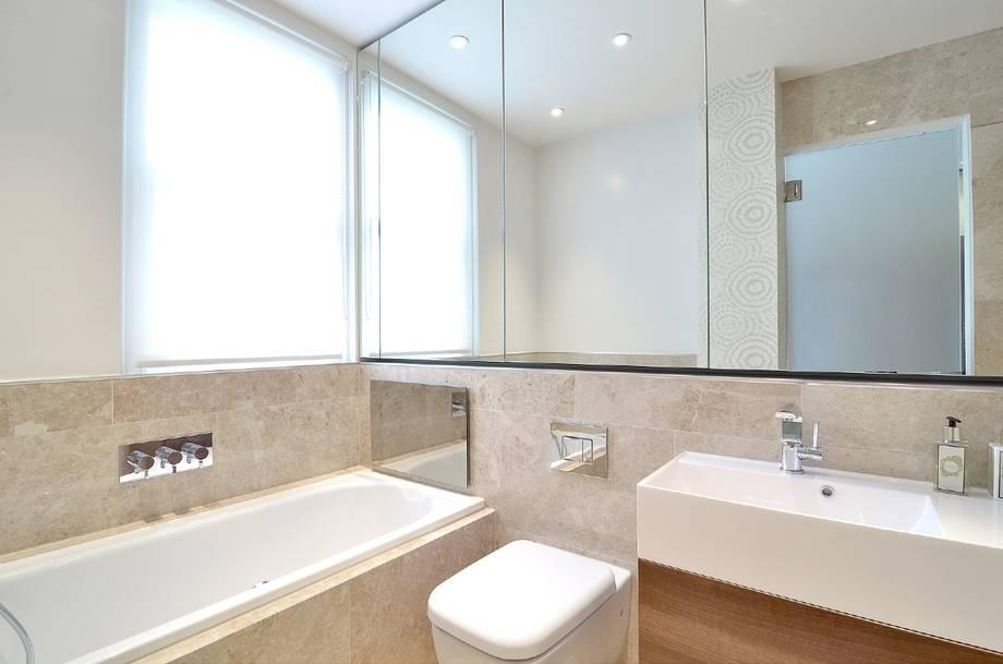
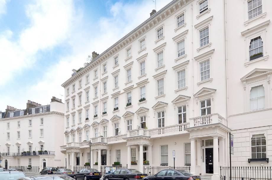
Photo 1 Photo 2 Photo 3 Photo 4 Photo 5 Photo 6 Photo 7 Photo 8 Photo 9 Photo 10
/ 10
Property details
Floor area
190 m²
Year built
England and Wales: before 1900
Deprivation
Decile 8 (26,347 of 33,755)
Street crime
1208 incidents within 1 mile (Apr 2026)
Description
The property, which is furnished with all essentials, consists of a stunning reception room with wood floors and dining table to seat four, 3D cinema system with 7.1 surround sound speakers, stylish guest cloakroom, open plan kitchen complete with all major appliances, master bedroom with extensive fitted wardrobes and beautiful marble en suite bathroom with built in television/audio system and separate wet room shower cubicle, second guest double bedroom with clever pop up television, fitted wardrobes and further stunning en suite wet room. Both bathrooms have excellent storage.
This exceptional property further benefits from remote control mood lighting and televisions in all principle rooms.
The nearest underground station is moments away at Sloane Square.
Listed by
Sloane Square
The Lomond Group
Reference: 39639572
EPC Rating & Upgrade Cost
Fetching EPC data… Refresh this page in a moment.
Flood risk
Zone: 1
Risk: Low
Job (default Low)
Company ownership
Registered legal owner is a company.
Company: SEAWARD RESOURCES LIMITED
Rental Range
Estimated market rent for Kensington and Chelsea. Low = conservative, Realistic = average, Optimistic = best case.
Based on Local Authority from postcode lookup → Kensington and Chelsea.
LHA (30th percentile) floor for Central London: £1,789/mo (Apr 2025 – Mar 2026)
Location
Nearby
Nearest stations, universities and amenities (distance from property).
| Type | Name | Distance |
|---|---|---|
| Shop | Tanner Krolle | 0.0 miles |
| Shop | Emilia Wickstead | 0.1 miles |
| Bus stop | Eaton Square | 0.1 miles |
| Bus stop | Sloane Square Station | 0.1 miles |
| Train station | Sloane Square | 0.2 miles |
| Train station | London Victoria | 0.5 miles |
| University | National Heart and Lung Institute | 0.8 miles |
| University | University of Notre Dame | 1.4 miles |
| Hospital | Bridge Lane Health Centre | 1.6 miles |
| Hospital | Tunica Diagnostics | 1.8 miles |
Street-level crime
| Category | Count |
|---|---|
| Anti-social behaviour | 270 |
| Violence and sexual offences | 181 |
| Other theft | 180 |
| Theft from the person | 142 |
| Shoplifting | 135 |
| Vehicle crime | 77 |
| Public order | 64 |
| Criminal damage and arson | 39 |
| Burglary | 35 |
| Drugs | 32 |
| Robbery | 24 |
| Bicycle theft | 12 |
| Other crime | 11 |
| Possession of weapons | 6 |
| Total incidents | 1208 |
Within 1 mile during Apr 2026. Source: data.police.uk (England & Wales).
Schools nearby
Nearest open schools with Ofsted ratings (England). Closed schools are not shown. Data from Get Information about Schools and Ofsted.
| Name | Type | Distance | Ofsted |
|---|---|---|---|
| Inchbald School of Design | Other | 0.1 miles | — (No rating) |
| Eaton House School | Other | 0.1 miles | — (No rating) |
| Holy Trinity CofE Primary School | Primary | 0.1 miles | Good — 13 Dec 2012 |
| More House School | Other | 0.2 miles | — (No rating) |
| Sussex House School | Other | 0.2 miles | — (No rating) |
Rental Comparables
Loading rental comparables for this postcode. Refresh in a few minutes.