52 NORFOLK ROAD
ENFIELD, GREATER LONDON EN3 4BG
£300 pcm
Property details
Floor area
71 m²
EPC rating
C
Last sold
£268,000 Apr 2014
Price per m²
£4/m²
Local average
£2,297,103 (-100%)
Deprivation
Decile 2 (6,190 of 33,755)
Street crime
508 incidents within 1 mile (Apr 2026)
Description
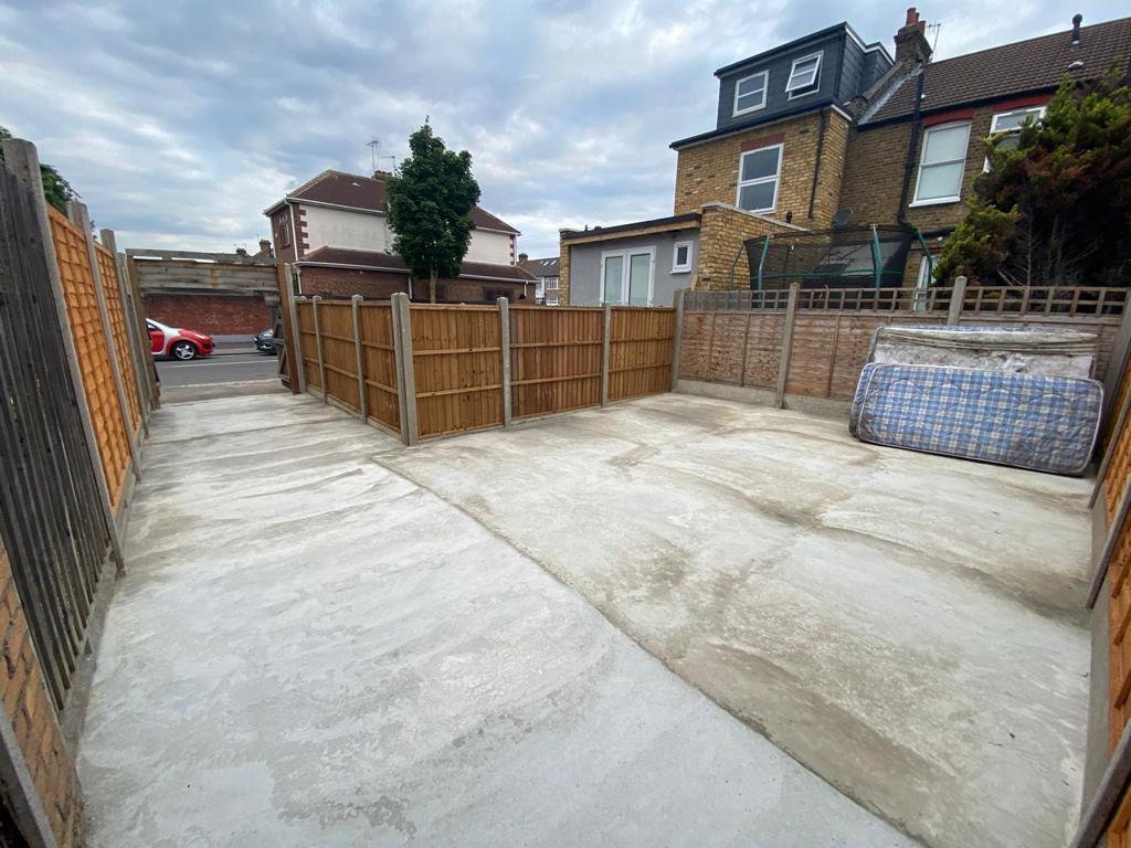
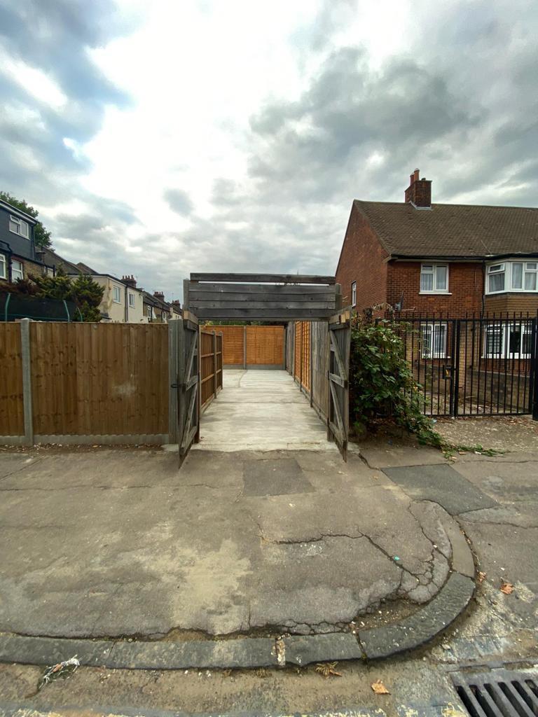
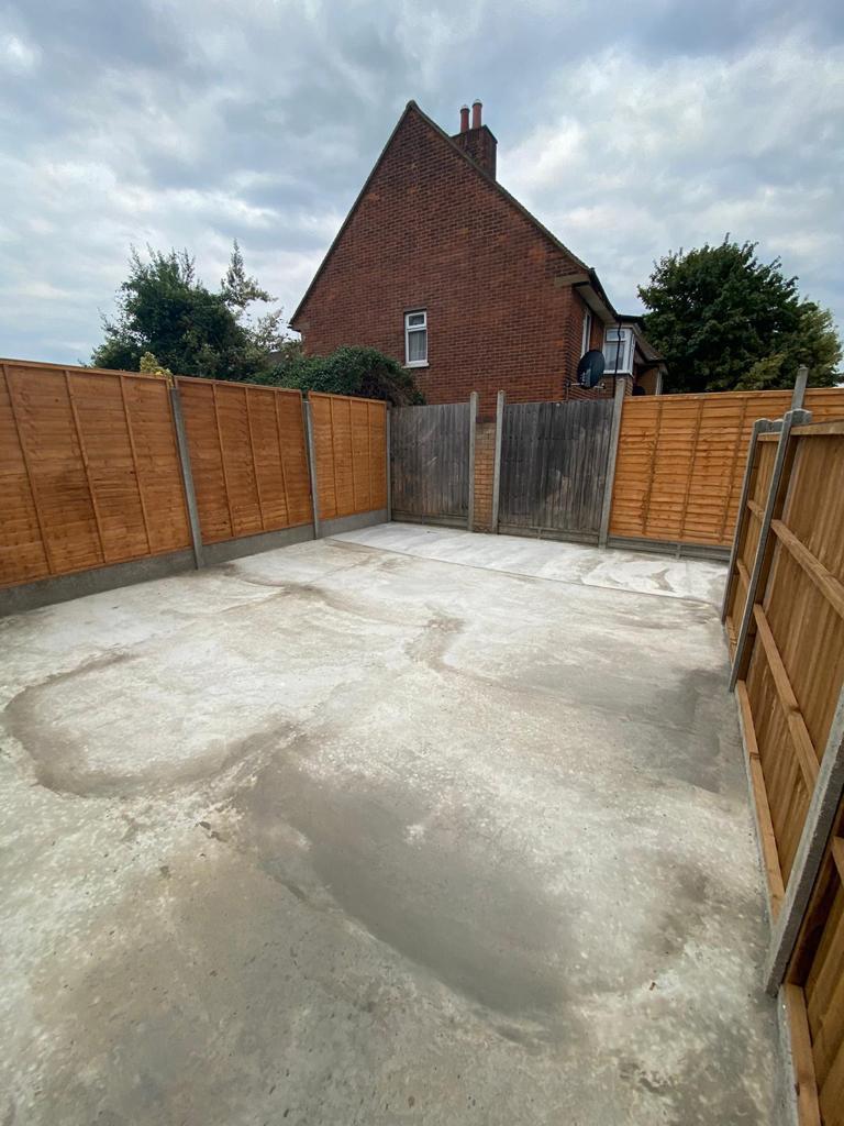
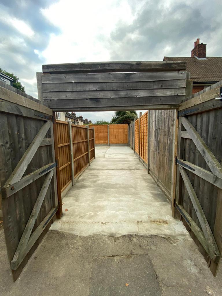
Secure Storage for Personal Use Only.
Located within 0.5 miles of Southbury Road Rail Station. This plot also has sasy access to both A10 / M25 giving great links to surrounding areas.
Enquire now to find out more information.
Listed by
Enfield Highway - Lettings
Kings Group
Reference: 131641826
EPC Rating & Upgrade Cost
Current rating: C
Potential rating: B
Inspection date: 25/07/2023
Expiry date: 24/07/2033
Est. upgrade cost to C: £19,725
Recommendations
- Increase loft insulation to 270 mm (£100 - £350)
- 50 mm internal or external wall insulation (£4,000 - £14,000)
- Floor insulation (suspended floor) (£800 - £1,200)
- Solar water heating (£4,000 - £6,000)
- Solar photovoltaic panels, 2.5 kWp (£3,500 - £5,500)
Flood risk
Zone: 1
Risk: Low
Job (default Low)
Price history
| Event | Date | Price | % change |
|---|---|---|---|
| Sold | 14/04/2014 (12 years ago) | £268,000 | — |
Source: HM Land Registry Price Paid Data. Crown copyright.
Sold Comparables
Same street and nearby sales within 0.25 miles (last 5 years). Data from Land Registry Price Paid.
| Address | Price | Date | Type |
|---|---|---|---|
| 444 LINCOLN ROAD, ENFIELD, GREATER LONDON, EN3 4AH | £66,100 | 28/01/2025 | Other |
| Same street 36 NORFOLK ROAD, ENFIELD, GREATER LONDON, EN3 4BG | £365,000 | 23/08/2024 | Terraced |
| Same street 1 NORFOLK ROAD, ENFIELD, GREATER LONDON, EN3 4BG | £520,000 | 09/08/2023 | Terraced |
| Same street 4 NORFOLK ROAD, ENFIELD, GREATER LONDON, EN3 4BG | £415,000 | 30/09/2022 | Terraced |
| WICKHAM HOUSE, 464 LINCOLN ROAD, ENFIELD, GREATER LONDON, EN3 4AH | £610,750 | 31/03/2022 | Other |
| 318 UNIT 4 LINCOLN ROAD, ENFIELD, GREATER LONDON, EN3 4AA | £1,000,000 | 11/01/2022 | Other |
| 5 CLARENCE ROAD, ENFIELD, GREATER LONDON, EN3 4BN | £312,000 | 04/10/2021 | Other |
Street average: £433,333 (3 sales)
Area average: £497,213 (4 sales)
Capital growth trend
Land Registry outcode average: last 12 months vs 5y and 10y ago (from sold prices).
House Price Index (HM Land Registry — official index, not sold-price averages): Enfield. Series: All dwelling types. As of March 2026.
Rental Range
Estimated market rent for Enfield. Low = conservative, Realistic = average, Optimistic = best case.
Based on Local Authority from postcode lookup → Enfield.
LHA (30th percentile) floor for Outer North London: Apr 2025 – Mar 2026
Location
Nearby
Nearest stations, universities and amenities (distance from property).
| Type | Name | Distance |
|---|---|---|
| Bus stop | Hail & Ride Concord Road | 0.2 miles |
| Bus stop | Hail & Ride Hill Rise | 0.2 miles |
| Shop | Belash Saree Centre | 0.2 miles |
| Shop | Ponders End Newsagents | 0.2 miles |
| Train station | Southbury | 0.4 miles |
| Train station | Ponders End | 0.7 miles |
| Hospital | North London Hospice Winchmore Hill | 2.1 miles |
| Hospital | Priory Hospital | 2.9 miles |
| University | Arden University Stratford Campus | 7.1 miles |
| University | University of Wales Trinity Saint David London | 7.7 miles |
Street-level crime
| Category | Count |
|---|---|
| Violence and sexual offences | 151 |
| Anti-social behaviour | 89 |
| Shoplifting | 55 |
| Vehicle crime | 43 |
| Other theft | 41 |
| Public order | 26 |
| Burglary | 19 |
| Criminal damage and arson | 19 |
| Drugs | 19 |
| Robbery | 15 |
| Theft from the person | 12 |
| Bicycle theft | 8 |
| Other crime | 6 |
| Possession of weapons | 5 |
| Total incidents | 508 |
Within 1 mile during Apr 2026. Source: data.police.uk (England & Wales).
Schools nearby
Nearest open schools with Ofsted ratings (England). Closed schools are not shown. Data from Get Information about Schools and Ofsted.
| Name | Type | Distance | Ofsted |
|---|---|---|---|
| Heron Hall Academy | Secondary | 0.3 miles | Good — 24 Jul 2015 |
| St Matthew's CofE Primary School | Primary | 0.4 miles | Good — 25 Sep 2023 |
| Galliard Primary School | Primary | 0.4 miles | Outstanding — 25 Sep 2023 |
| Woodpecker Hall Primary Academy | Primary | 0.5 miles | Good — 15 Jul 2024 |
| Bush Hill Park Primary School | Primary | 0.5 miles | Good — 18 Jan 2018 |
Rental Comparables
Residential lets from OpenRent and Rightmove for the area. Bedroom counts vary — use the Beds column to compare like-for-like lets. Student lets are excluded.
| Title | Rent | Beds | Distance | As seen on |
|---|---|---|---|---|
| 2 Bed Maisonette, Sandhurst Road, N9 | £550/mo | 2 | 0.37 miles | OpenRent |
| 2 Bed Maisonette, Sandhurst Road, N9 | £600/mo | 2 | 0.37 miles | OpenRent |
Average rent: £575/mo (2 listings)
Rent-driven metrics
Based on OpenRent comparables.
- Rent ratio — Monthly rent ÷ purchase price (1% rule). 1%+ = strong, 0.8–1% = okay, <0.8% = weak for cashflow.
- Max investor price — Rent ÷ 0.8%; the price at which rent would be 0.8% of price (Stoke-style target).
- Target investor price — Rent ÷ 1%; the price at which rent would be 1% of price (strong cashflow band).
- Gross yield — Annual rent as % of purchase price (no costs).
- Cashflow — Rent minus mortgage, 10% maintenance, £25/mo compliance. Assumes 75% LTV, 3.95% APR (5yr fixed), 25yr term.
- ROI — Annual profit ÷ cash in (deposit + 4% purchase costs).