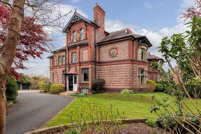
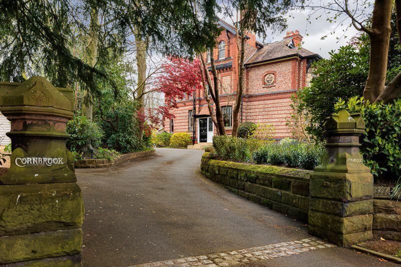
Cornbrook
LEGH ROAD, KNUTSFORD, CHESHIRE EAST WA16 8LS
£1,595,000
Property details
Tenure
FREEHOLD
Floor area
409 m²
Council tax band
G
Last sold
£1,525,000 Sep 2023
Local average
£472,550 (+237.5%)
Deprivation
Decile 10 (33,693 of 33,755)
Street crime
54 incidents within 1 mile (Apr 2026)
Key features
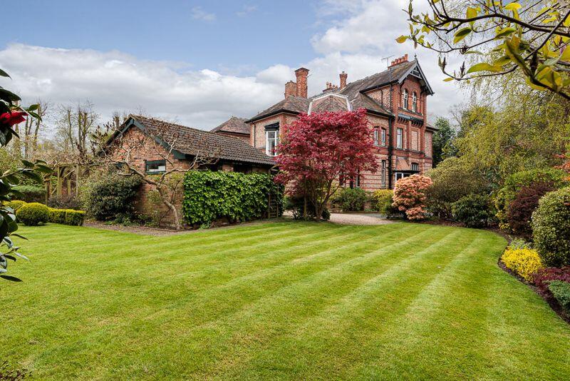
- Superb Victorian semi-detached house in an excellent central location
- Situated on the town's premier road and Conservation Area
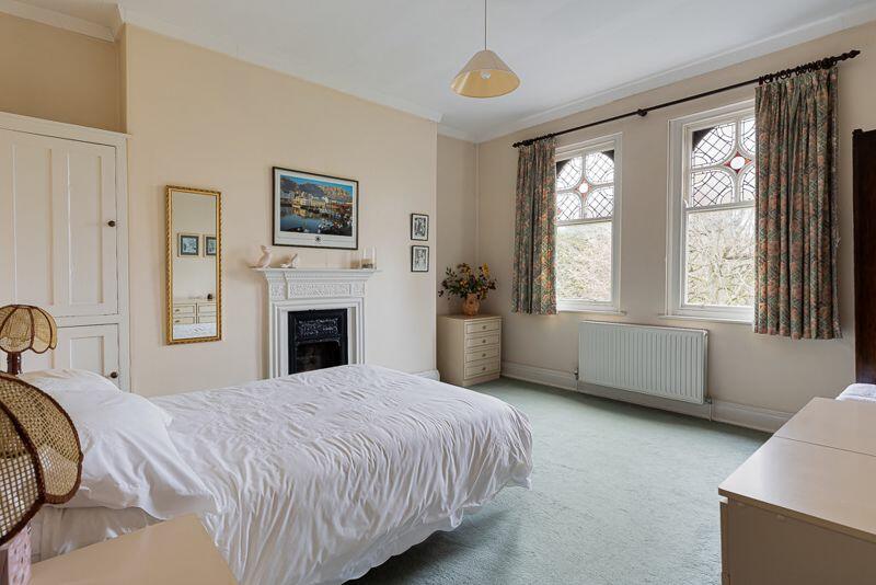
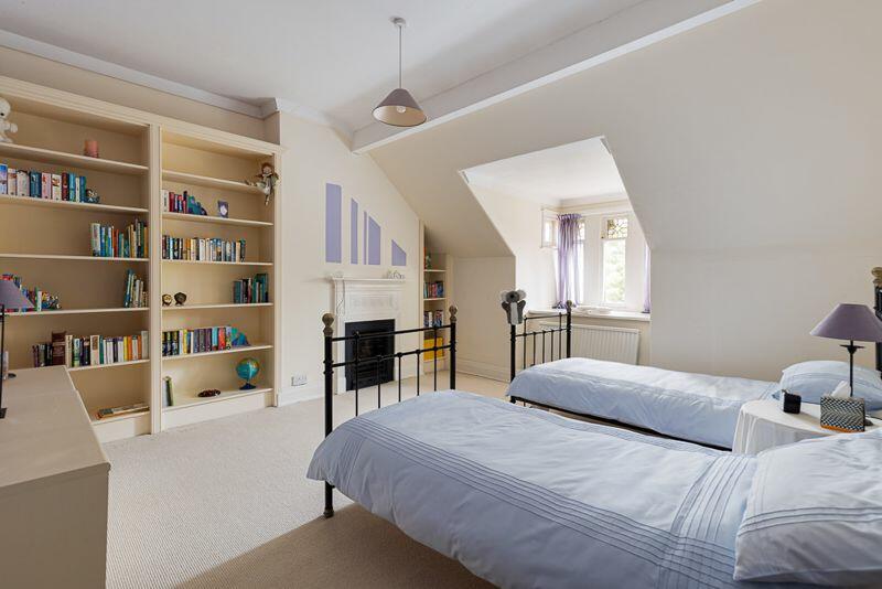
- Up to seven bedrooms (configurable), three/four reception rooms and cellars
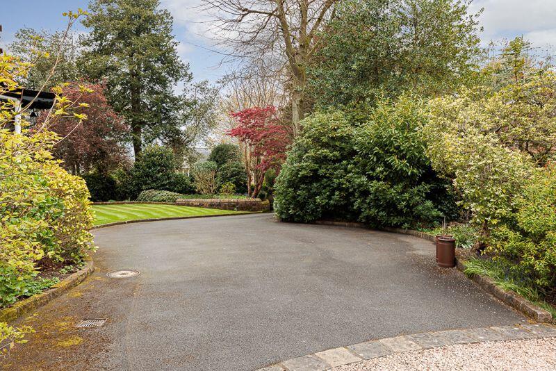
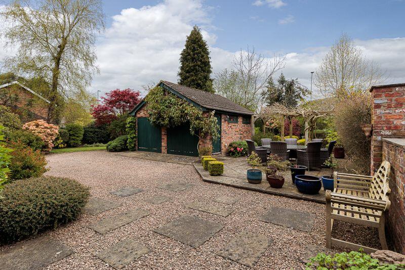
- Long driveway, attractive gardens, and double garage
Additional details
- Parking
- Yes
- Garden
- Yes
Description
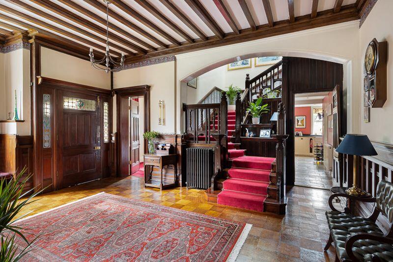
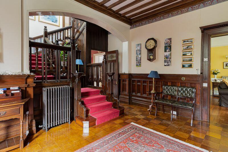
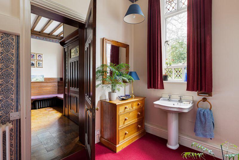
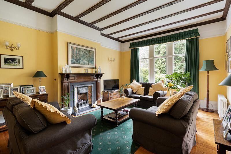
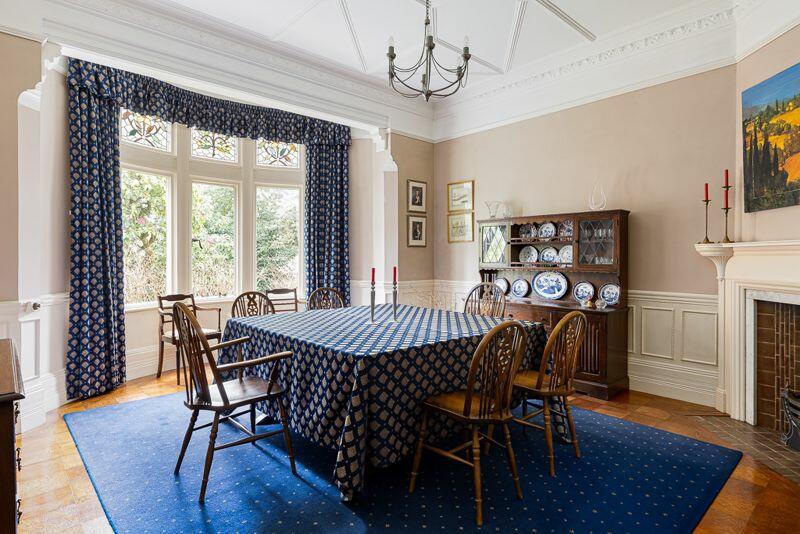
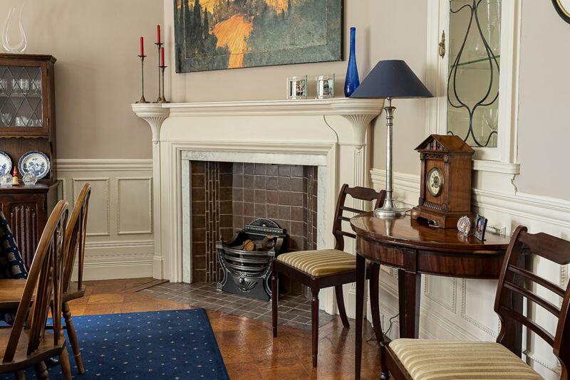
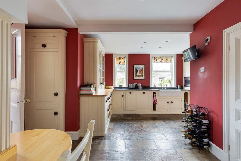
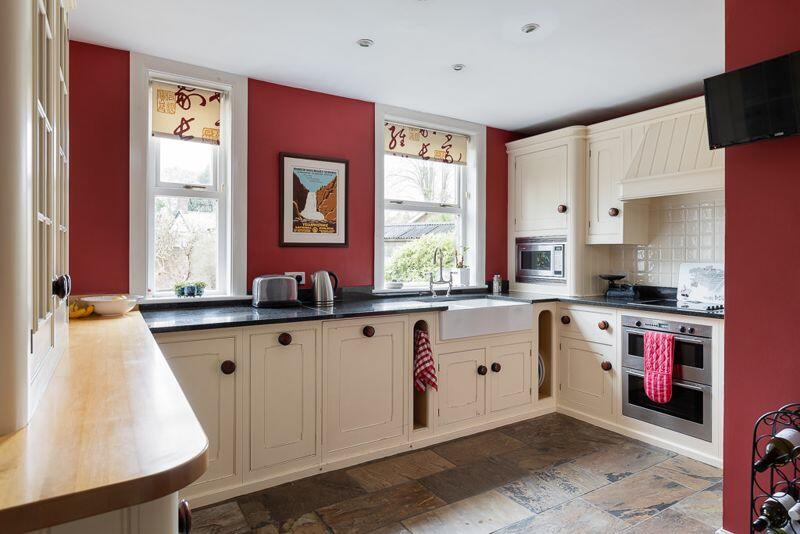
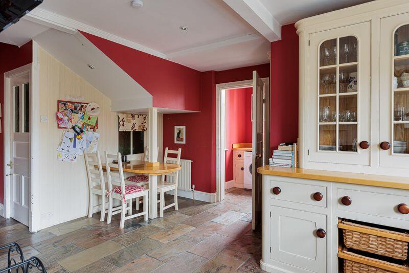
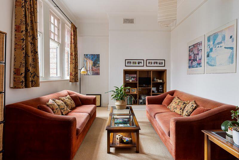
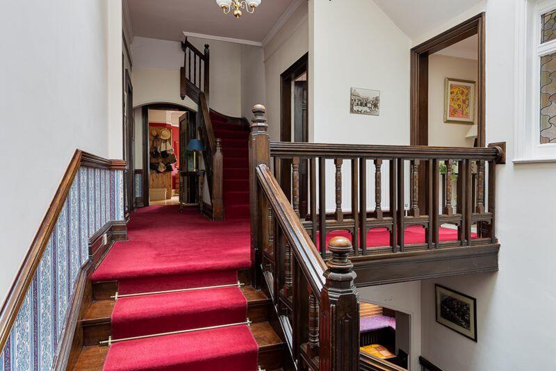
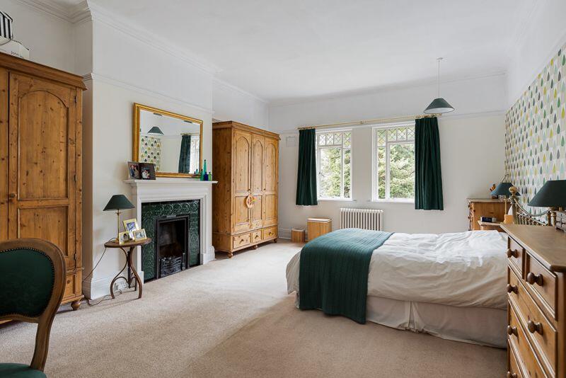
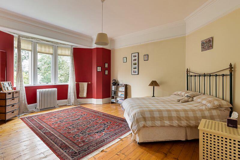
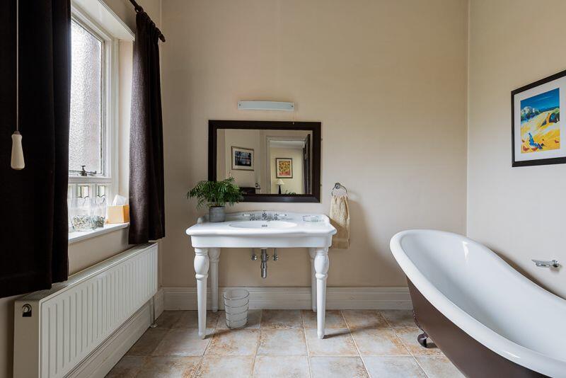
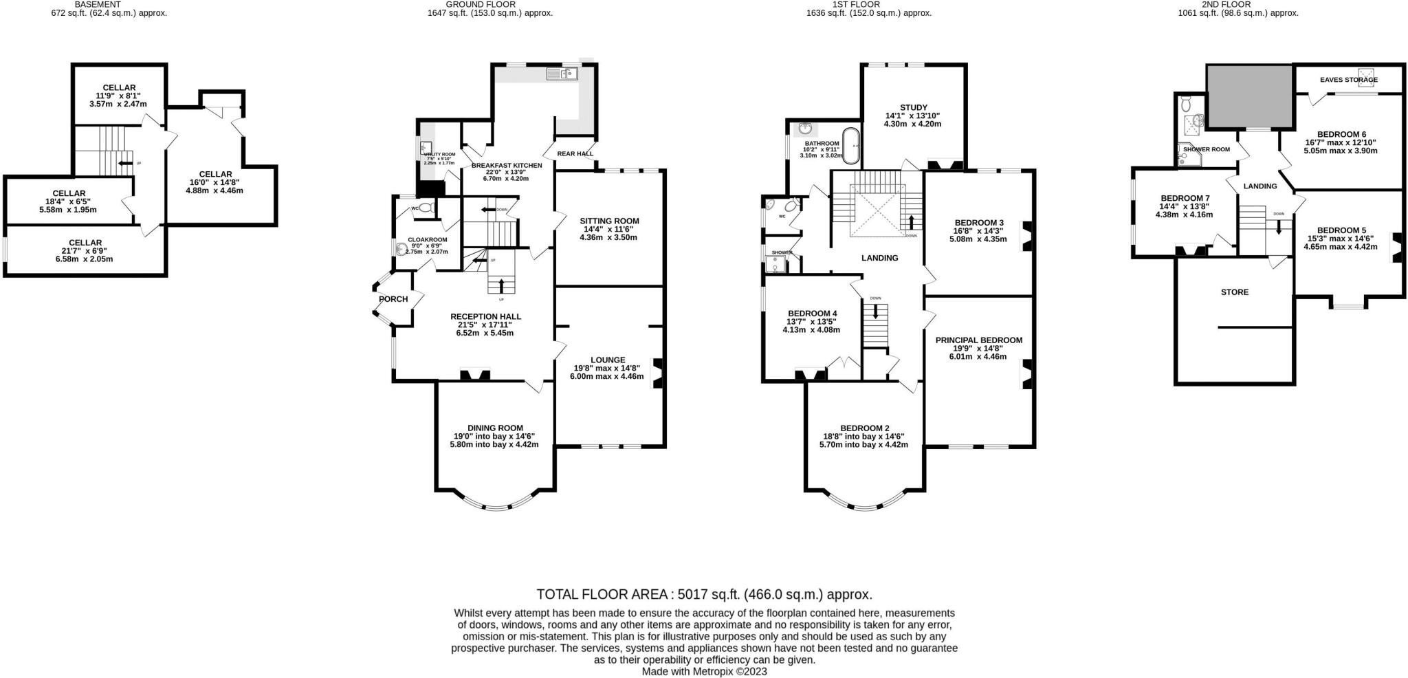
Reception hall, cloaks/wc, lounge, dining room, family room, kitchen/breakfast room and utility room, excellent large cellars. In all there are potentially seven bedrooms over two upper floors and a study, and one of them would make an excellent en-suite to the main bedroom.
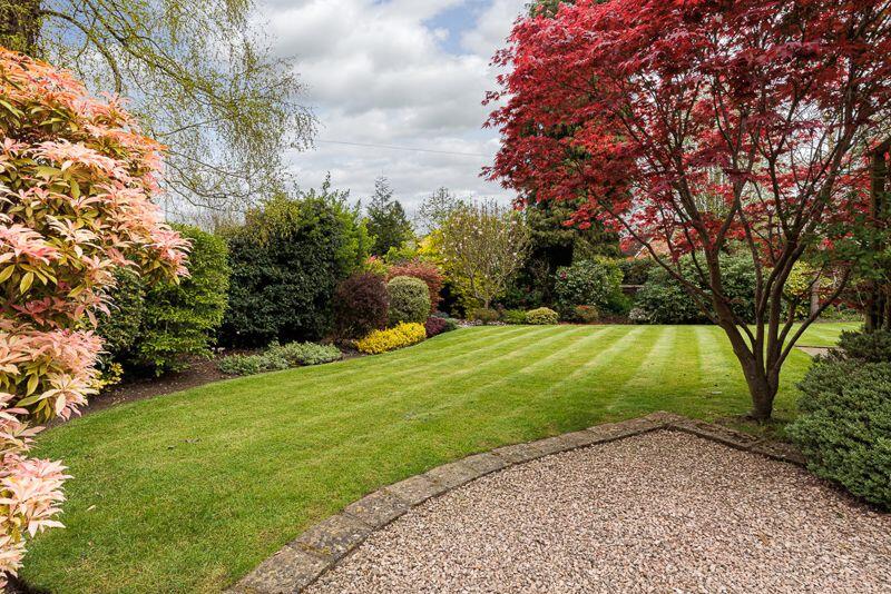
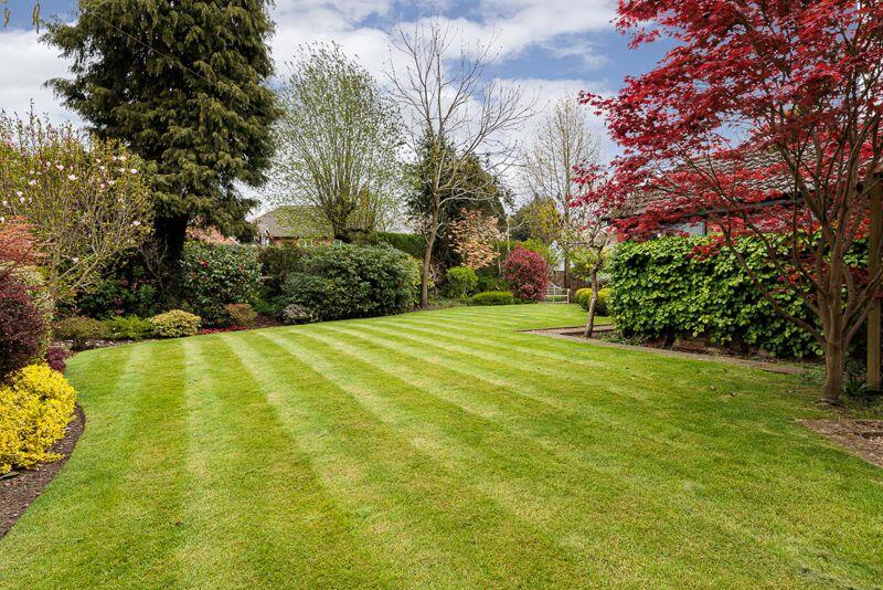
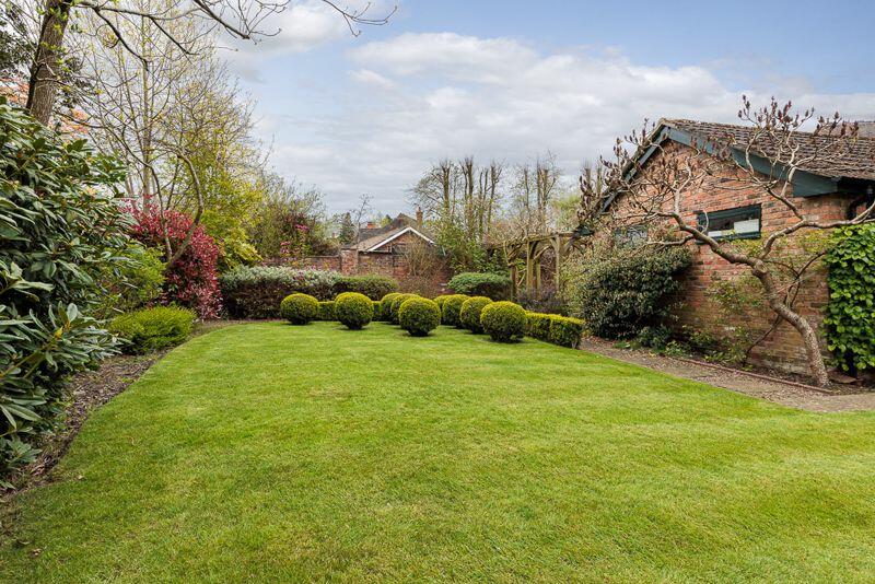
Long driveway and excellent parking with double garage. Lawned gardens to the front and the rear.
Listed by
Knutsford
Stuart Rushton & Co
Reference: 134401754
EPC ratings on this postcode
We don't have a matched EPC for this property yet. Below are efficiency scores and details for other addresses on this postcode.
| Address | Current | Potential | Floor area | Age band | Type |
|---|---|---|---|---|---|
| 2 Fairmead, Legh Road | 64 | 76 | 253 m² | England and Wales: 1967-1975 | House |
| 2 Fairmead, Legh Road, KNUTSFORD | 64 | 76 | 253 m² | England and Wales: 1967-1975 | Detached |
| 4 Fairmead, Legh Road | 58 | 70 | 226 m² | England and Wales: 1967-1975 | House |
| 4 Fairmead, Legh Road, KNUTSFORD | 58 | 70 | 226 m² | — | Detached |
| Bramley, Legh Road | 19 | 62 | 348 m² | England and Wales: before 1900 | House |
| Bramley, Legh Road, KNUTSFORD | 19 | 62 | 348 m² | England and Wales: before 1900 | Detached |
| Cornbrook, Legh Road | 36 | 74 | 398 m² | England and Wales: before 1900 | House |
| Cornbrook, Legh Road, KNUTSFORD | 65 | 77 | 409 m² | England and Wales: before 1900 | Detached |
| Cornbrook, Legh Road, KNUTSFORD | 36 | 74 | 398 m² | England and Wales: before 1900 | Detached |
| Dovengill, Legh Road | 42 | 53 | 193 m² | England and Wales: before 1900 | Flat |
| Draycote, Legh Road | 67 | 76 | 205 m² | England and Wales: 1976-1982 | House |
| Draycote, Legh Road, KNUTSFORD | 67 | 76 | 205 m² | England and Wales: 1976-1982 | Detached |
| Eskdale, Legh Road, KNUTSFORD | 58 | 71 | 376 m² | England and Wales: before 1900 | Detached |
| Hazelfield, Legh Road | 42 | 63 | 450 m² | England and Wales: 1900-1929 | House |
| Hazelfield, Legh Road, KNUTSFORD | 42 | 63 | 450 m² | — | Detached |
Flood risk
Zone: 1
Risk: Low
Job (default Low)
Floorplans
Floorplan 1
EPC Graphs

Energy Performance Cert
Price history
| Event | Date | Price | % change |
|---|---|---|---|
| Sold | 29/09/2023 (2 years ago) | £1,525,000 | — |
Source: HM Land Registry Price Paid Data. Crown copyright.
Sold Comparables
Same street and nearby sales within 0.25 miles (last 5 years). Data from Land Registry Price Paid.
| Address | Price | Date | Type |
|---|---|---|---|
| 7 BRANDEN DRIVE, KNUTSFORD, CHESHIRE EAST, WA16 8EJ | £275,000 | 26/11/2024 | Semi-detached |
| 3 HOLFORD CRESCENT, KNUTSFORD, CHESHIRE EAST, WA16 8DZ | £450,000 | 26/05/2023 | Semi-detached |
| Same street THE HOLLIES LEGH ROAD, KNUTSFORD, CHESHIRE EAST, WA16 8LS | £1,075,000 | 12/05/2023 | Detached |
| 25 CHELFORD ROAD, KNUTSFORD, CHESHIRE EAST, WA16 8LU | £675,762 | 17/02/2023 | Semi-detached |
| 4 HOLFORD CRESCENT, KNUTSFORD, CHESHIRE EAST, WA16 8DZ | £610,000 | 17/11/2022 | Semi-detached |
| 45 MOBBERLEY ROAD, KNUTSFORD, CHESHIRE EAST, WA16 8EQ | £435,000 | 07/10/2022 | Semi-detached |
| 9 CHELFORD ROAD, KNUTSFORD, CHESHIRE EAST, WA16 8LU | £240,000 | 20/09/2022 | Semi-detached |
| 4 BUCKINGHAM DRIVE, KNUTSFORD, CHESHIRE EAST, WA16 8LH | £576,000 | 23/08/2022 | Semi-detached |
| ALDWARDEN HILL LEGH ROAD, KNUTSFORD, CHESHIRE EAST, WA16 8LP | £2,500,000 | 10/06/2022 | Semi-detached |
| 3 BRANDEN DRIVE, KNUTSFORD, CHESHIRE EAST, WA16 8EJ | £135,000 | 31/03/2022 | Semi-detached |
| 41 SHARSTON CRESCENT, KNUTSFORD, CHESHIRE EAST, WA16 8AF | £350,000 | 07/01/2022 | Semi-detached |
| 6 HOLFORD CRESCENT, KNUTSFORD, CHESHIRE EAST, WA16 8DZ | £445,000 | 29/09/2021 | Semi-detached |
| 5 SHARSTON CRESCENT, KNUTSFORD, CHESHIRE EAST, WA16 8AF | £330,000 | 30/06/2021 | Semi-detached |
| 17 LILYBROOK DRIVE, KNUTSFORD, CHESHIRE EAST, WA16 8WR | £392,500 | 30/06/2021 | Semi-detached |
| Same street KANZAN LEGH ROAD, KNUTSFORD, CHESHIRE EAST, WA16 8LS | £1,500,000 | 28/06/2021 | Semi-detached |
| 21 CHELFORD ROAD, KNUTSFORD, CHESHIRE EAST, WA16 8LU | £855,000 | 28/06/2021 | Semi-detached |
Street average: £1,287,500 (2 sales)
Area average: £590,662 (14 sales)
Capital growth trend
Land Registry outcode average: last 12 months vs 5y and 10y ago (from sold prices).
House Price Index (HM Land Registry — official index, not sold-price averages): Cheshire East. Series: Semi-detached. As of March 2026.
Rental Range
Estimated market rent for Cheshire East. Low = conservative, Realistic = average, Optimistic = best case.
Based on Local Authority from postcode lookup → Cheshire East.
LHA (30th percentile) floor for East Lancs: Apr 2025 – Mar 2026
Location
Address
Legh Road
Nearby
Nearest stations, universities and amenities (distance from property).
| Type | Name | Distance |
|---|---|---|
| Bus stop | Knutsford, Brook Street / Legh Arms PH | 0.0 miles |
| Shop | Aldi | 0.3 miles |
| Shop | Station Garage | 0.3 miles |
| Train station | Knutsford | 0.3 miles |
| Hospital | Knutsford and District Community Hospital | 0.6 miles |
| Train station | Mobberley | 2.5 miles |
| Hospital | Soss Moss Hospital | 4.1 miles |
| University | University of Chester - Warrington Campus | 11.0 miles |
| University | University Academy 92 | 11.5 miles |
Street-level crime
| Category | Count |
|---|---|
| Violence and sexual offences | 31 |
| Public order | 7 |
| Shoplifting | 5 |
| Other theft | 3 |
| Anti-social behaviour | 2 |
| Burglary | 2 |
| Criminal damage and arson | 2 |
| Drugs | 1 |
| Possession of weapons | 1 |
| Total incidents | 54 |
Within 1 mile during Apr 2026. Source: data.police.uk (England & Wales).
Schools nearby
Nearest open schools with Ofsted ratings (England). Closed schools are not shown. Data from Get Information about Schools and Ofsted.
| Name | Type | Distance | Ofsted |
|---|---|---|---|
| St Vincent De Paul Catholic Primary School | Primary | 0.3 miles | Good — 6 Jun 2013 |
| Manor Park Primary School and Nursery | Primary | 0.5 miles | Good — 13 Sep 2023 |
| Egerton Primary School | Primary | 0.5 miles | Good — 13 Feb 2023 |
| Bexton Primary School | Primary | 0.6 miles | Good — 5 Mar 2018 |
| Knutsford Academy | Secondary | 0.7 miles | Good — 25 Nov 2011 |
Rental Comparables
Residential lets from OpenRent and Rightmove for the area. Bedroom counts vary — use the Beds column to compare like-for-like lets. Student lets are excluded.
| Title | Rent | Beds | Distance | As seen on |
|---|---|---|---|---|
| 4 Bed Detached House, Grove Park, WA16 | £2,000/mo | 4 | 0.17 miles | OpenRent |
| 4 Bed Detached House, Plumley Moor Road, WA16 | £8,200/mo | 4 | 0.37 miles | OpenRent |
Average rent: £5,100/mo (2 listings)
Rent-driven metrics
Based on OpenRent comparables.
- Rent ratio — Monthly rent ÷ purchase price (1% rule). 1%+ = strong, 0.8–1% = okay, <0.8% = weak for cashflow.
- Max investor price — Rent ÷ 0.8%; the price at which rent would be 0.8% of price (Stoke-style target).
- Target investor price — Rent ÷ 1%; the price at which rent would be 1% of price (strong cashflow band).
- Gross yield — Annual rent as % of purchase price (no costs).
- Cost-to-rent — Price ÷ annual rent (from OpenRent comparables). Under 14× = strong, 14–16× = acceptable, 17×+ = compressed.
- Cashflow — Rent minus mortgage, 10% maintenance, £25/mo compliance. Assumes 75% LTV, 3.95% APR (5yr fixed), 25yr term.
- ROI — Annual profit ÷ cash in (deposit + 4% purchase costs).
Enter House Number
Enter the house number to help us retrieve more accurate pricing history and property data.
Please log in to submit or correct the house number for this listing.
Log in to continue