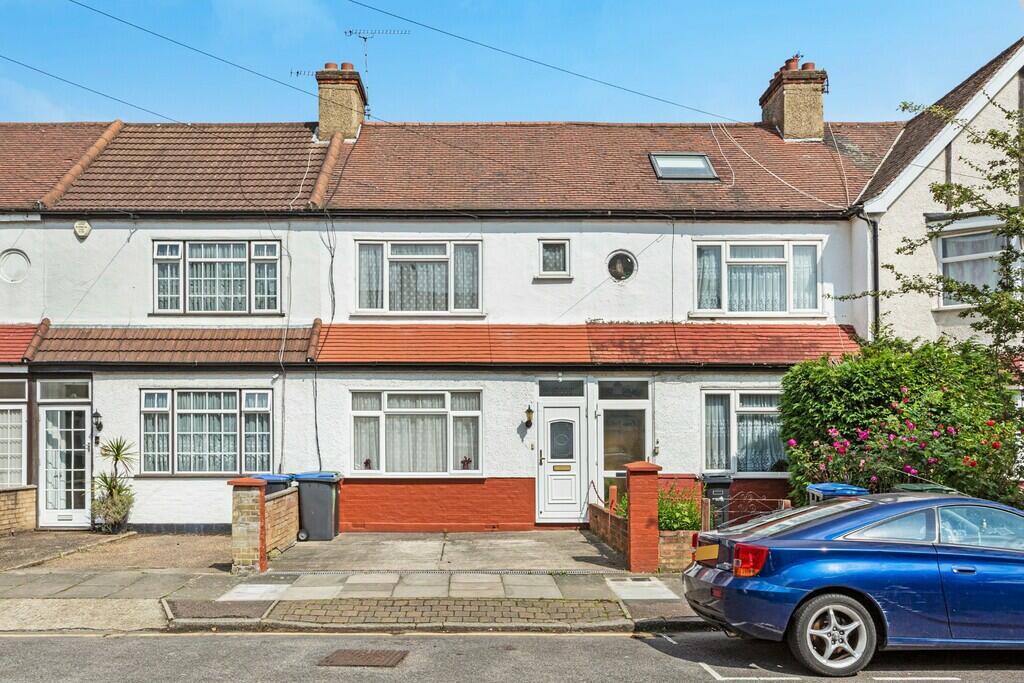
11 GIFFARD ROAD
LONDON, GREATER LONDON N18 1DR
£1,750 pcm
Property details
Floor area
73 m²
Council tax band
TBC
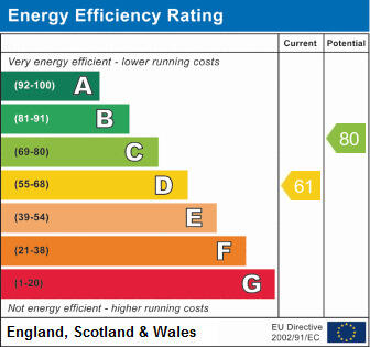
EPC rating
C
Year built
England and Wales: 1900-1929
Deprivation
Decile 2 (4,905 of 33,755)
Street crime
880 incidents within 1 mile (Apr 2026)
Key features
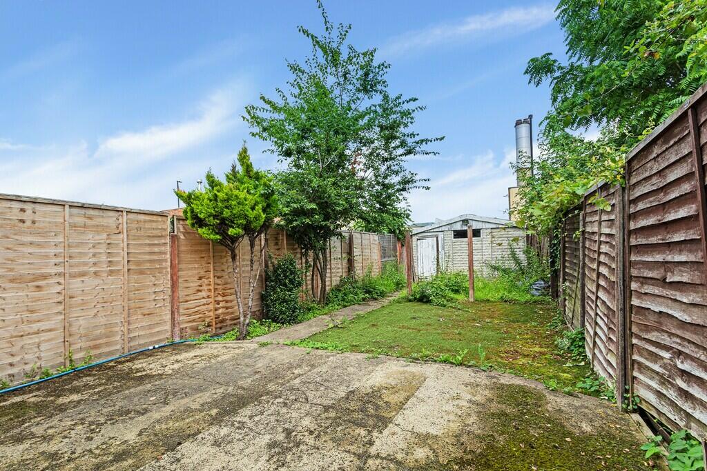
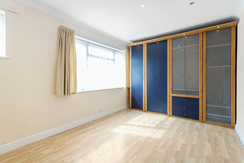
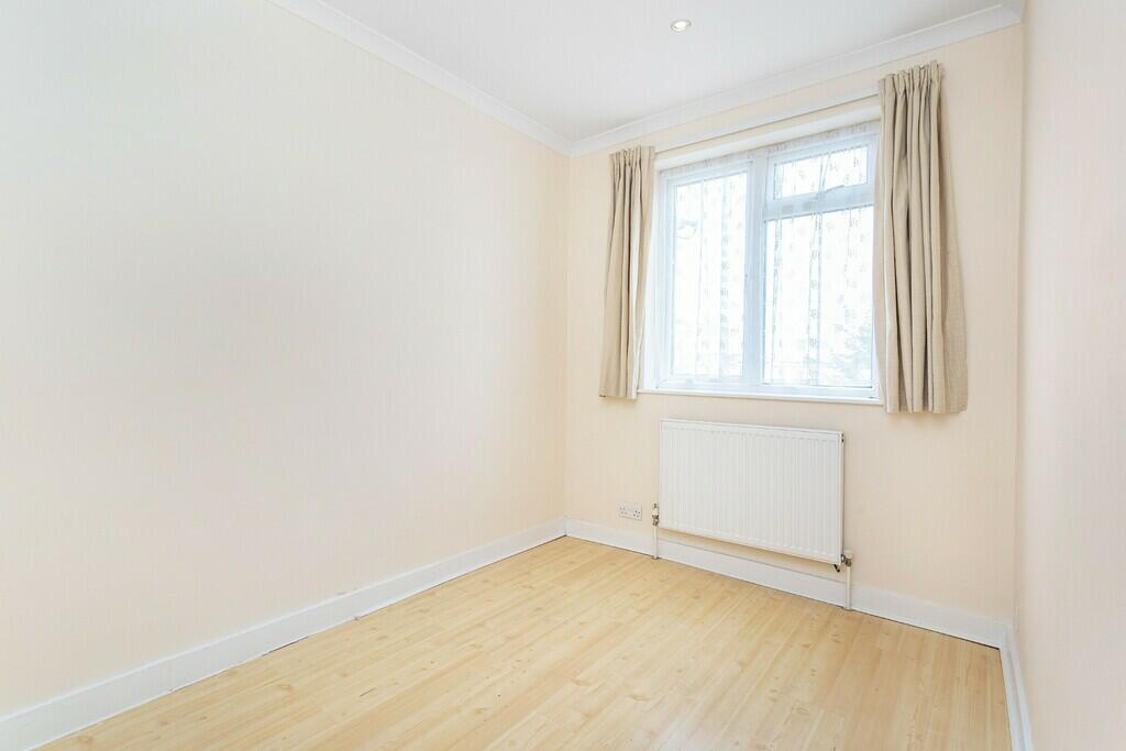
- Two Double Bedroom.
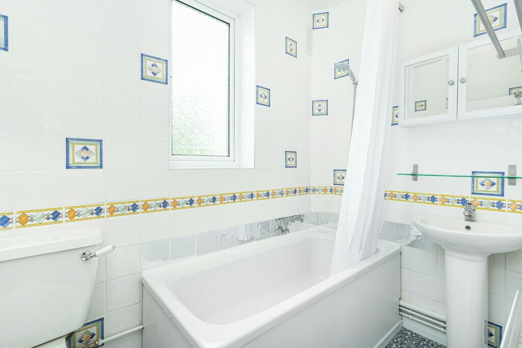
- One Bathroom.
- Terraced Family Home.
- Driveway.
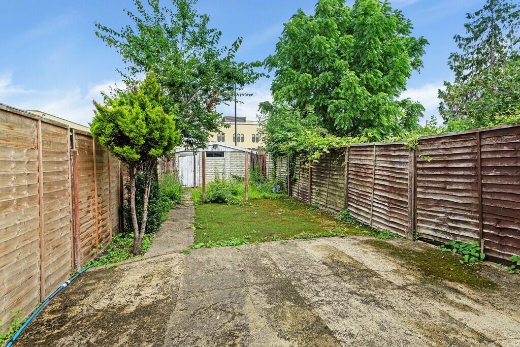
- Large Garden.
- 0.5 Mile To Silver Street Railway Station.
- Close To North Middlesex University Hospital.
- Easy Access To A406.
- Garage Not Included In Rental.
- Unfurnished
Additional details
- Parking
- Yes
- Garden
- Yes
Description
Must View
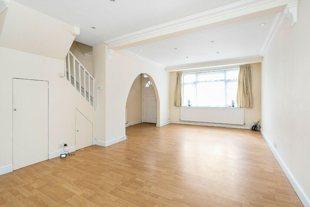
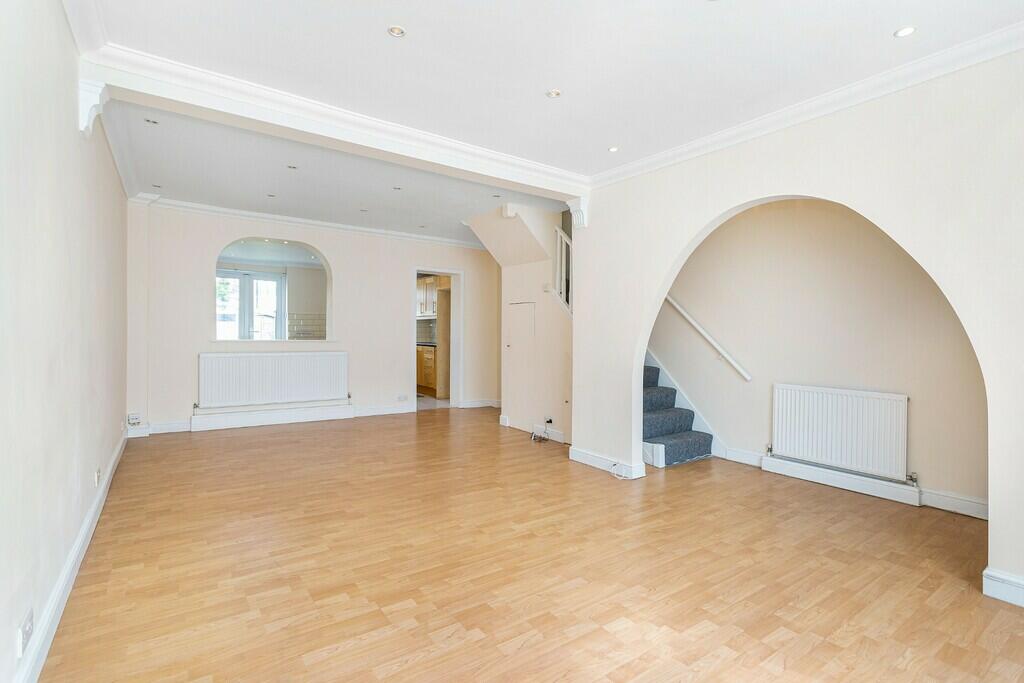
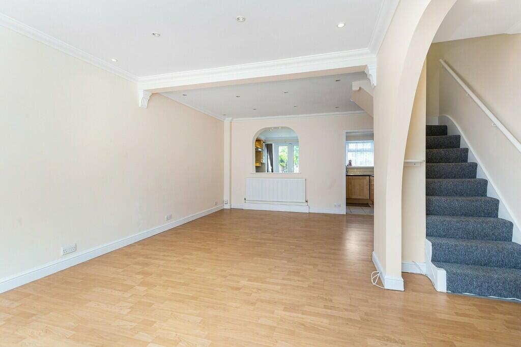
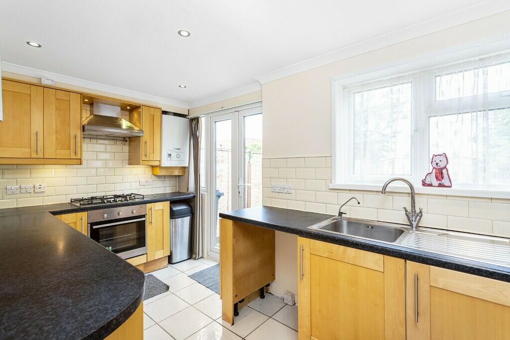
A bright and spacious two bedroom terraced family home with a driveway available to rent from the 4th August 2023 In Edmonton. The property features a spacious living area, a modern kitchen, two double bedrooms, a first floor bathroom, garden, and a driveway. Please note the garage is not included and the property is unfurnished.
Location
Located within easy reach of the A406 and North Middlesex University Hospital. You are also a short walk to Silver Street Railway Station.
Listed by
London
April Real Estates Ltd
Reference: 136081697
EPC Rating & Upgrade Cost
Current rating: C
Potential rating: B
Inspection date: 11/04/2025
Expiry date: 10/04/2035
Current heating cost: £617/year
Potential heating cost: £519/year
Est. upgrade cost to C: £18,500
Recommendations
- 50 mm internal or external wall insulation (£4,000 - £14,000)
- Solar water heating (£4,000 - £6,000)
- Solar photovoltaic panels, 2.5 kWp (£3,500 - £5,500)
Flood risk
Zone: 1
Risk: Low
Job (default Low)
Floorplans
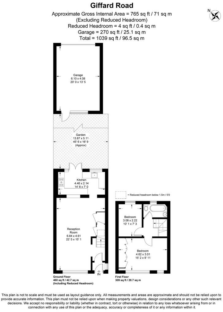
Floorplan
EPC Graphs
EPC Graph
Rental Range
Estimated market rent for Enfield. Low = conservative, Realistic = average, Optimistic = best case.
Based on Local Authority from postcode lookup → Enfield.
LHA (30th percentile) floor for Cambridge: £947/mo (Apr 2025 – Mar 2026)
Location
Nearby
Nearest stations, universities and amenities (distance from property).
| Type | Name | Distance |
|---|---|---|
| Bus stop | Wigston Close | 0.1 miles |
| Shop | Romeo Trading Ltd | 0.2 miles |
| Shop | WHSmith | 0.2 miles |
| Train station | White Hart Lane | 0.5 miles |
| Train station | Silver Street | 0.6 miles |
| Hospital | North London Hospice Winchmore Hill | 1.2 miles |
| Hospital | Priory Hospital | 2.3 miles |
| University | University of Portsmouth Walthamstow Campus | 3.2 miles |
| University | University of Wales Trinity Saint David London | 5.4 miles |
Street-level crime
| Category | Count |
|---|---|
| Violence and sexual offences | 258 |
| Anti-social behaviour | 201 |
| Vehicle crime | 74 |
| Other theft | 58 |
| Public order | 50 |
| Criminal damage and arson | 43 |
| Drugs | 42 |
| Theft from the person | 37 |
| Burglary | 36 |
| Robbery | 31 |
| Shoplifting | 23 |
| Possession of weapons | 13 |
| Other crime | 9 |
| Bicycle theft | 5 |
| Total incidents | 880 |
Within 1 mile during Apr 2026. Source: data.police.uk (England & Wales).
Schools nearby
Nearest open schools with Ofsted ratings (England). Closed schools are not shown. Data from Get Information about Schools and Ofsted.
| Name | Type | Distance | Ofsted |
|---|---|---|---|
| Wilbury Primary School | Primary | 0.2 miles | Good — 25 May 2023 |
| The Devonshire Hill Nursery & Primary School | Primary | 0.3 miles | Good — 8 Feb 2012 |
| Haringey Sixth Form College | Other | 0.4 miles | — (No rating) |
| Brook House Primary School | Primary | 0.4 miles | Outstanding — 26 Sep 2023 |
| St John and St James CofE Primary School | Primary | 0.5 miles | Good — 13 Jan 2022 |
Rental Comparables
Loading rental comparables for this postcode. Refresh in a few minutes.