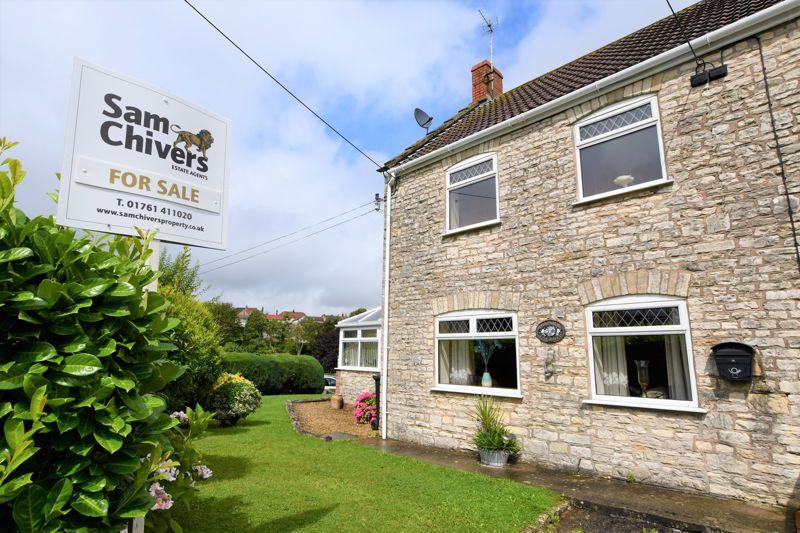
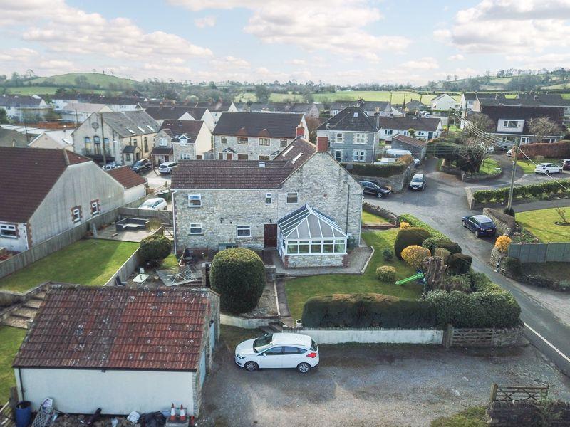
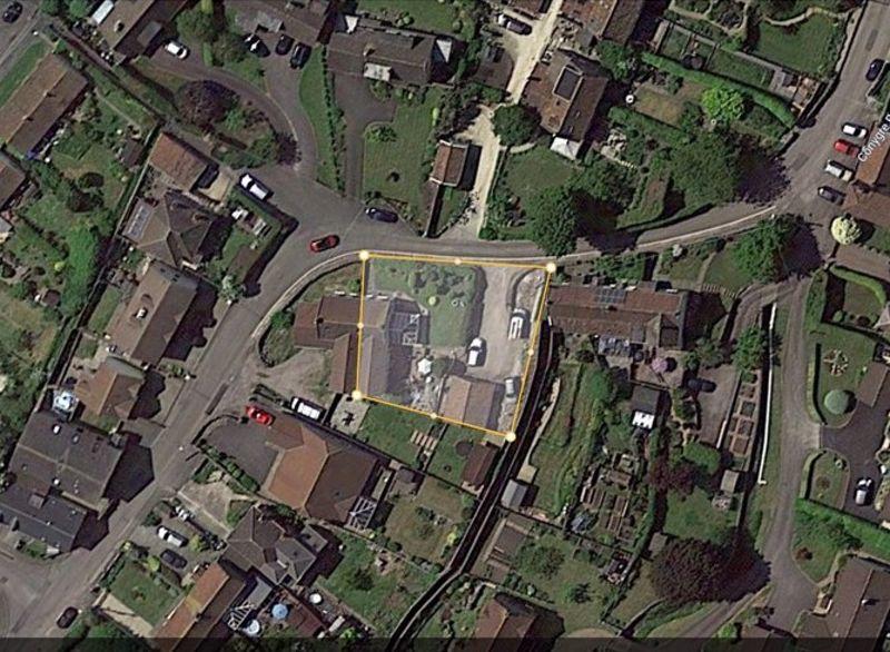
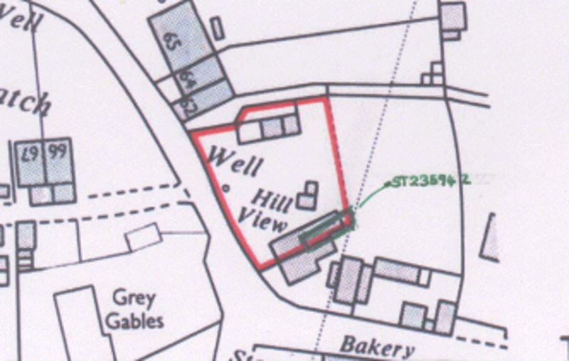
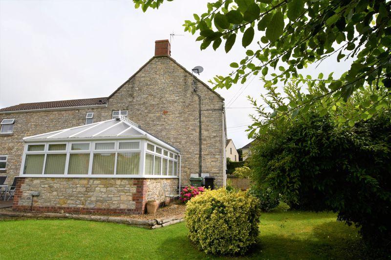
Hillview
THE BATCH, BATH, FARMBOROUGH, BATH AND NORTH EAST SOMERSET BA2 0AJ


Property details
Tenure
FREEHOLD
Floor area
144 m²
Last sold
£480,000 Jan 2022
Price per m²
£3,403/m²
Local average
£522,791 (-6.3%)
Deprivation
Decile 8 (25,588 of 33,755)
Street crime
5 incidents within 1 mile (Apr 2026)
Key features
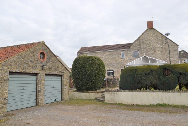
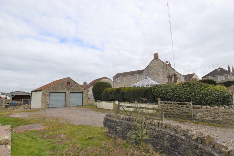
- Big double garage and ample parking
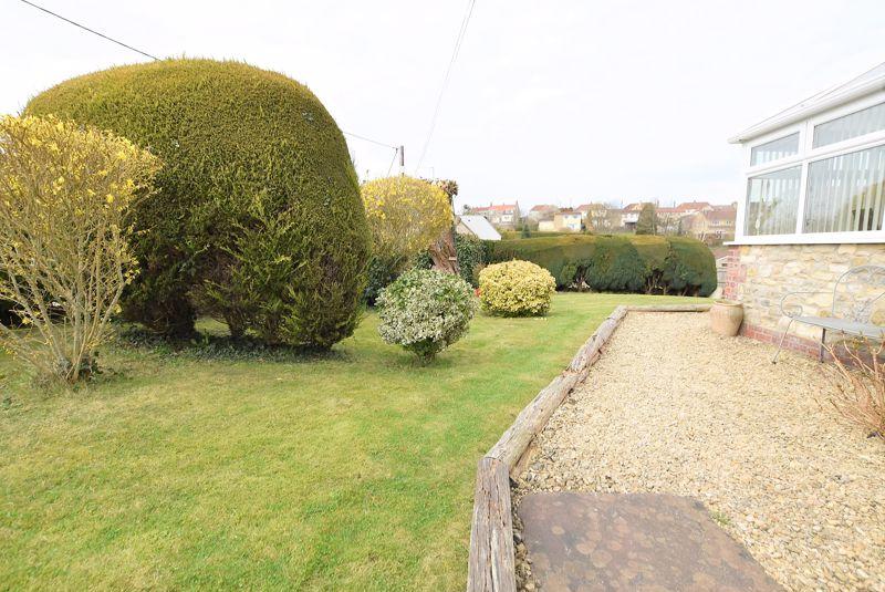
- Large plot with potential (STPP)
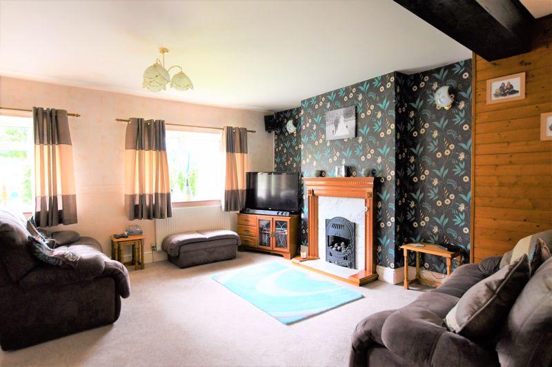
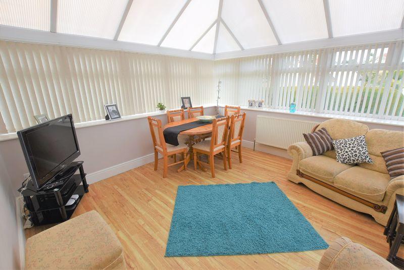
- Large lounge with separate conservatory
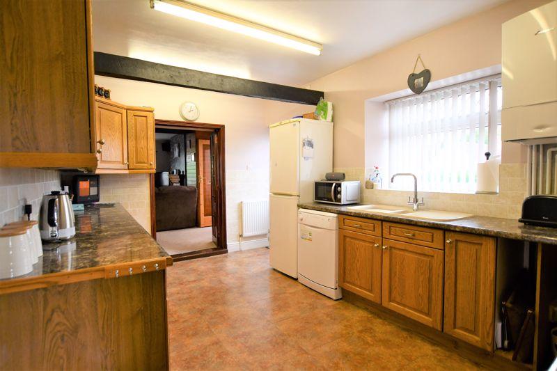
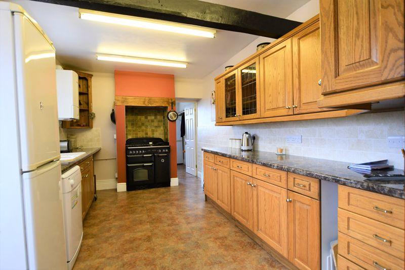
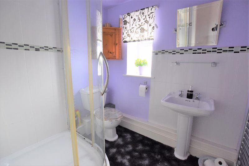
- Kitchen, utility room and cloakroom
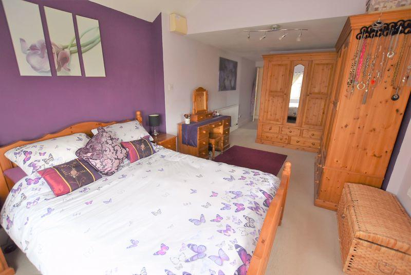
- Extended three bedroom home
- Village location close to Bath & Bristol
- Video Tour
Additional details
- Parking
- Yes
- Garden
- Yes
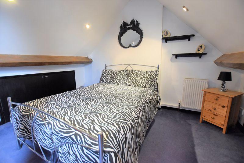
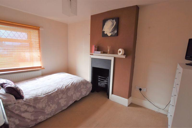
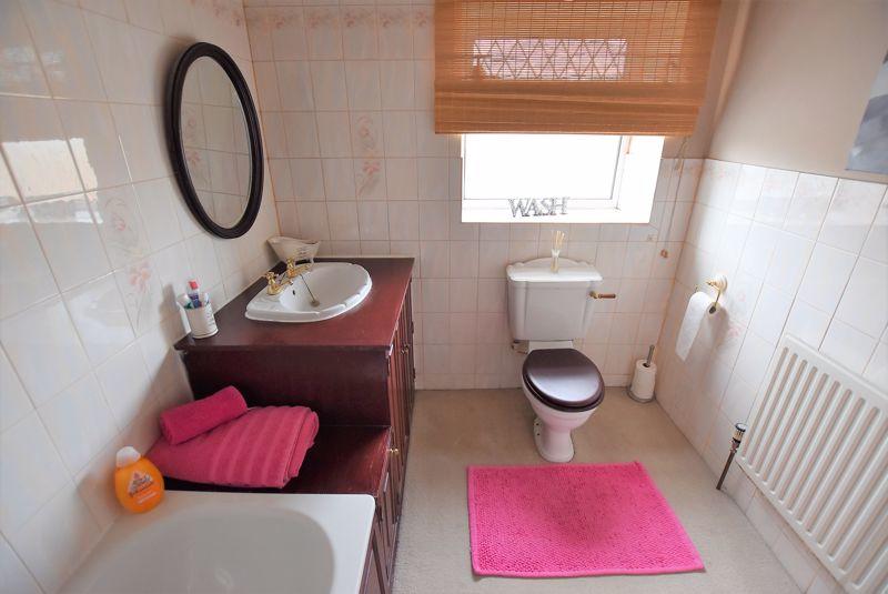
Description
Listed by
Midsomer Norton
Property Trading LTD
Reference: 79167753
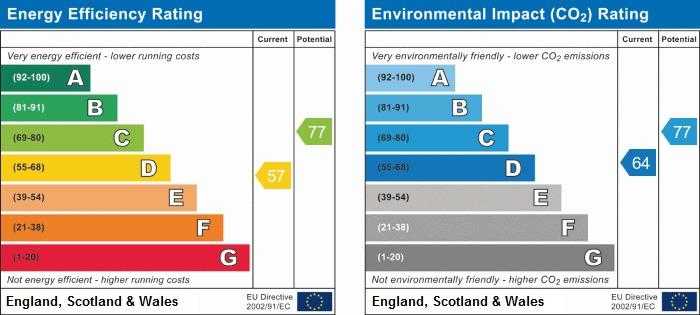
EPC ratings on this postcode
We don't have a matched EPC for this property yet. Below are efficiency scores and details for other addresses on this postcode.
| Address | Current | Potential | Floor area | Age band | Type |
|---|---|---|---|---|---|
| 63 The Batch, Farmborough, BATH | 64 | 88 | 62 m² | England and Wales: before 1900 | Terraced |
| 63, The Batch, Farmborough, BATH | 53 | 88 | 64 m² | England and Wales: before 1900 | Terraced |
| 64 The Batch, Farmborough, BATH | 72 | 76 | 95 m² | — | Detached |
| 66 The Batch, Farmborough, BATH | 30 | 75 | 95 m² | England and Wales: before 1900 | Detached |
| 68 THE BATCH, FARMBOROUGH, BATH, BATH | 38 | 75 | 114 m² | England and Wales: before 1900 | Detached |
| Belltrees, The Batch, Farmborough, BATH | 45 | 51 | 175 m² | England and Wales: 1967-1975 | Detached |
| HILLVIEW, THE BATCH, FARMBOROUGH, BATH | 57 | 77 | 144 m² | — | Detached |
| The Bramleys, The Batch, Farmborough, BATH | 77 | 82 | 266 m² | — | Detached |
Flood risk
Zone: 1
Risk: Low
Job (default Low)
Floorplans
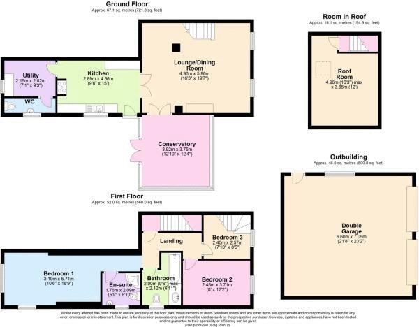
Floorplan 1
EPC Graphs
Energy Perform...

Full EPC doc
Price history
| Event | Date | Price | % change |
|---|---|---|---|
| Sold | 28/01/2022 (4 years ago) | £480,000 | — |
Source: HM Land Registry Price Paid Data. Crown copyright.
Sold Comparables
Same street and nearby sales within 0.25 miles (last 5 years). Data from Land Registry Price Paid.
| Address | Price | Date | Type |
|---|---|---|---|
| DAR-ES-SALAM TIMSBURY ROAD, FARMBOROUGH, BATH, BATH AND NORTH EAST SOMERSET, BA2 0AE | £450,000 | 31/08/2022 | Semi-detached |
| BROOKLYN COTTAGE THE STREET, FARMBOROUGH, BATH, BATH AND NORTH EAST SOMERSET, BA2 0AL | £525,000 | 02/08/2022 | Semi-detached |
| 9 TIMSBURY ROAD, FARMBOROUGH, BATH, BATH AND NORTH EAST SOMERSET, BA2 0AE | £295,000 | 29/04/2022 | Semi-detached |
| POPLAR HOUSE BATH ROAD, FARMBOROUGH, BATH, BATH AND NORTH EAST SOMERSET, BA2 0BU | £540,000 | 13/04/2022 | Semi-detached |
| Same street 63 THE BATCH, FARMBOROUGH, BATH, BATH AND NORTH EAST SOMERSET, BA2 0AJ | £310,000 | 04/02/2022 | Semi-detached |
| 2 BELLIFANTS, FARMBOROUGH, BATH, BATH AND NORTH EAST SOMERSET, BA2 0DB | £325,000 | 05/01/2022 | Semi-detached |
Street average: £310,000 (1 sale)
Area average: £427,000 (5 sales)
Capital growth trend
Land Registry outcode average: last 12 months vs 5y and 10y ago (from sold prices).
House Price Index (HM Land Registry — official index, not sold-price averages): Bath and North East Somerset. Series: Semi-detached. As of March 2026.
Rental Range
Estimated market rent for Bath and North East Somerset. Low = conservative, Realistic = average, Optimistic = best case.
Based on Local Authority from postcode lookup → Bath and North East Somerset.
LHA (30th percentile) floor for Bath: £1,197/mo (Apr 2025 – Mar 2026)
Location
Address
The Mead
Nearby
Nearest stations, universities and amenities (distance from property).
| Type | Name | Distance |
|---|---|---|
| Bus stop | Meadway | 0.1 miles |
| Shop | Rascals Hair Studio | 0.1 miles |
| Shop | Farmborough Community Shop | 0.2 miles |
| University | Bath Spa University | 2.9 miles |
| Hospital | Paulton Memorial Hospital | 3.1 miles |
| Hospital | Sulis Hospital | 3.8 miles |
| Train station | Midsomer Norton | 4.4 miles |
| University | Bath School of Art & Design | 5.1 miles |
| Train station | Avon Riverside | 5.1 miles |
Street-level crime
| Category | Count |
|---|---|
| Shoplifting | 2 |
| Anti-social behaviour | 1 |
| Burglary | 1 |
| Public order | 1 |
| Total incidents | 5 |
Within 1 mile during Apr 2026. Source: data.police.uk (England & Wales).
Schools nearby
Nearest open schools with Ofsted ratings (England). Closed schools are not shown. Data from Get Information about Schools and Ofsted.
| Name | Type | Distance | Ofsted |
|---|---|---|---|
| Farmborough Church Primary School | Primary | 0.2 miles | — (Inspected (no overall grade)) |
| St Mary's CofE Primary School | Primary | 1.2 miles | — (Inspected (no overall grade)) |
| Marksbury CofE Primary School | Primary | 1.3 miles | Good — 21 Jul 2024 |
| High Littleton CofE VC Primary School | Primary | 1.9 miles | Outstanding — 25 Feb 2014 |
| Clutton Primary School | Primary | 2.5 miles | Good — 13 Feb 2014 |
Rental Comparables
Residential lets from OpenRent and Rightmove for the area (same bedroom count). Use to validate rent estimates. Student lets are excluded.
| Title | Rent | Beds | Distance | As seen on |
|---|---|---|---|---|
| 3 Bed Bungalow, St Marys Close, BA2 | £2,000/mo | 3 | 1.26 miles | OpenRent |
Average rent: £2,000/mo (1 listing)
Rent-driven metrics
Based on OpenRent comparables.
- Rent ratio — Monthly rent ÷ purchase price (1% rule). 1%+ = strong, 0.8–1% = okay, <0.8% = weak for cashflow.
- Max investor price — Rent ÷ 0.8%; the price at which rent would be 0.8% of price (Stoke-style target).
- Target investor price — Rent ÷ 1%; the price at which rent would be 1% of price (strong cashflow band).
- Gross yield — Annual rent as % of purchase price (no costs).
- Cost-to-rent — Price ÷ annual rent (from OpenRent comparables). Under 14× = strong, 14–16× = acceptable, 17×+ = compressed.
- Cashflow — Rent minus mortgage, 10% maintenance, £25/mo compliance. Assumes 75% LTV, 3.95% APR (5yr fixed), 25yr term.
- ROI — Annual profit ÷ cash in (deposit + 4% purchase costs).
Enter House Number
Enter the house number to help us retrieve more accurate pricing history and property data.
Please log in to submit or correct the house number for this listing.
Log in to continue